Renewable energy is soaring around the globe, but one obstacle to its growth has been how to store the electricity to use it when the sun isn’t shining or the wind’s not blowing. The solution to that problem may be blowing in the wind—in the air we breathe.
Credit: Highview Power
“Liquefied air” to be exact. It’s air that has been cooled to the point it liquefies and can be stored in a tank, acting like a battery. When electricity is needed, the air is heated and expands to drive turbines that generate power. It’s super-efficient because liquifying the air generates heat. This heat can then be used to help restore the liquid to a gas.
The liquid air energy storage (LEAS) technology was first developed in the 1970s but wasn’t put into use because it’s expensive. The growth of renewables means it could now be cost effective—and a faster way to get off fossil fuels. To that point, the BBC reports, the world’s first commercial-scale liquid air energy storage facility is being built in Manchester, England. Its developer, Highview Power, expects the system to come online in 2027 and have the capacity to store enough electricity from renewables to power nearly half a million homes.
If it catches on, it could be a game changer for the storage aspect of the renewable energy paradigm. Currently, electrical grids rely on pumped hydro and lithium batteries for storage, but those have drawbacks. Pumped hydro relies on water and only works in certain locations. Lithium mining has environmental impacts, and the batteries last only around ten years. In contrast, liquid air storage facilities use above-ground tanks, which can be situated practically anywhere, and they store energy for longer. The best part, the process runs on air—an abundant natural resource.
Sea levels are rising faster than at any time in 4,000 years, and China’s sinking coastal cities are on the front lines.
Source:Rutgers University
Summary:Sea levels are rising faster than at any time in 4,000 years, scientists report, with China’s major coastal cities at particular risk. The rapid increase is driven by warming oceans and melting ice, while human activities like groundwater pumping make it worse. In some areas, the land itself is sinking faster than the ocean is rising. Still, researchers see progress as cities like Shanghai adopt new technologies to stabilize the ground and prepare for the future.Share:
FULL STORY
Scientists have found that modern sea level rise is accelerating faster than at any time in the past 4,000 years, and China’s coastal megacities are among the most at risk. Credit: Shutterstock
A team of scientists led by Rutgers University researchers has found that sea levels today are climbing more quickly than at any time in the past 4,000 years, with China’s coastal cities facing some of the most severe risks.
To uncover this trend, the researchers analyzed thousands of geological records from natural indicators such as ancient coral reefs and mangrove formations. These environments preserve long-term evidence of past sea levels. Using this data, the team reconstructed ocean changes stretching back almost 12,000 years to the start of the Holocene epoch, which began after the last major ice age.
Fastest Rate of Rise Since 1900
Published in Nature, the study reports that global sea levels have risen by an average of 1.5 millimeters (about one-sixteenth of an inch) per year since 1900. This pace is faster than any century-long period recorded in the last four millennia.
“The global mean sea level rise rate since 1900 is the fastest rate over at least the last four millennia,” said Yucheng Lin, who conducted the research as a postdoctoral associate at Rutgers and is a scientist at Australia’s national research agency, the Commonwealth Scientific and Industrial Research Organization in Hobart.
Lin worked under the guidance of Robert Kopp, a Distinguished Professor in the Department of Earth and Planetary Sciences at Rutgers. “Dr. Lin’s work illustrates how geological data can help us better understand the hazards that coastal cities face today,” said Kopp, who also authored the study.
What’s Driving the Acceleration
According to Lin, two main processes are responsible for today’s rapid sea level rise: thermal expansion and melting ice. As climate change warms the planet, oceans absorb heat, causing the water to expand. At the same time, melting glaciers and ice sheets in Greenland and Antarctica add vast amounts of water to the seas.
“Getting warmer makes your ocean take up more volume,” Lin said. “And the glaciers respond faster because they are smaller than the ice sheets, which are often the size of continents. We are seeing more and more acceleration in Greenland now.”
China’s Coastal Cities Face a Double Threat
While sea level rise is a global concern, China faces a particularly dangerous combination of natural and human factors. Many of its largest cities — including Shanghai, Shenzhen and Hong Kong — sit in delta regions made of soft, water-saturated sediment that naturally sinks over time.
Human activities have accelerated this sinking.
“We’ve been able to quantify the natural rate of sea level rise for this area,” Lin said. “But human intervention, mostly groundwater extraction, makes it happen much faster.”
Subsidence, the gradual sinking or settling of the Earth’s surface, can occur through natural geological changes or from human-driven causes such as overuse of groundwater.
Delta Regions Under Pressure
To assess the risk to China’s deltas, the researchers combined geological records, measurements of land subsidence, and data on human impacts. They focused on the Yangtze River Delta and Pearl River Delta, two areas that are home to several megacities and key industrial zones.
In Shanghai, parts of the city sank more than one meter (around three feet) during the 20th century because of extensive groundwater pumping, Lin said. That rate is vastly higher than the current global average for sea level rise.
Delta regions are naturally flat and fertile, making them ideal for farming, transport, and urban development. But those same features make them exceptionally vulnerable to flooding.
“Centimeters of sea level rise will greatly increase the risk of flooding in deltas,” Lin said. “These areas are not only important domestically, they’re also international manufacturing hubs. If coastal risks happen there, the global supply chain will be vulnerable.”
Efforts to Slow the Sinking
Despite the alarming data, Lin noted that there are reasons for optimism. Some Chinese cities have begun taking effective steps to manage the problem. Shanghai, for example, has slowed its rate of subsidence by controlling groundwater extraction and reinjecting freshwater into underground aquifers.
“Shanghai now is not sinking that fast anymore,” Lin said. “They recognized the problem and started regulating their groundwater usage.”
The research team also created vulnerability maps to help local governments and city planners identify high-risk zones and prepare for future sea level rise.
A Global Lesson
Although the study focuses on China, its implications reach far beyond. Many major coastal cities, including New York, Jakarta and Manila, are built on low-lying plains and face similar threats.
“Deltas are great places, good for farming, fishing, urban development and naturally draw civilizations to them,” Lin said. “But they are really flat yet prone to human-caused subsidence, so sustained sea level rise could submerge them really fast.”
Modeling the Past to Protect the Future
The paper is an application of PaleoSTeHM, an open-source software framework for statistically modeling paleo-environmental data that Lin developed as a postdoctoral associate.
Praveen Kumar, a postdoctoral associate in the Department of Earth and Planetary Sciences, also contributed to the study.
The National Science Foundation and NASA supported the research.
In June, the Trump administration announced that the government’s 15-year-old website, climate.gov, which was the primary source of information about climate change and science, would no longer be updated. Links to the old site redirect viewers to an address at the National Oceanic and Atmospheric Administration (NOAA). As of 2021, the old website was receiving 900,000 visits per month and was a trusted source of information about the climate, according to NPR. The jobs of those who authored stories, created photos, and designed materials were eliminated.
Climate change effects include wildfire, ocean acidification, desertification, and coastal flooding caused by storms and sea level rise. | Credit: CalFire
However, as the Guardianreports, a group of climate communications experts is rebuilding the climate.gov content at climate.us through a new nonprofit. The organization will offer services about climate to others such as local governments that are trying to adapt to global warming. The website is in development, and the organization has a presence on social media accounts like BlueSky and Facebook.
According to Rebecca Lindsey, who was the managing editor of the government’s old site, the new entity includes several of her former federal colleagues, many of whom are grieving over losing not only a job but also a vocation. Lindsey added that there is a need for content that helps people develop climate literacy. Being outside of government gives the new group new opportunities to have fun by using platforms like TikTok.
The organization has launched a crowdfunding effort and hopes to get more permanent operating support from a foundation. Lindsey said that all of the climate information released prior to July 1 is still up on a government site, but you have to know where to look for it.
Meanwhile, the National Weather Service is trying to rapidly hire 450 people, including some meteorologists to fill jobs that were cut by DOGE, or the Department of Government Efficiency. Hundreds of forecasters were cut at NOAA after Trump took office, and there were warnings that there could be dangerous consequences if weather predictions were slowed.
However, applicants for the new meteorologist positions are being asked how they would promote Trump’s agenda by identifying one or two of his executive orders that they find significant, and how they would implement them if hired. Some experts are alarmed that the ideology of a potential weather forecaster could be considered. One told the Associated Press that he questioned whether forecasts would be made better based upon someone’s ideology.
Heat waves are becoming more frequent and intense across the U.S., so perhaps this summer you took a dip in a river to cool off. However, according to new research it might not have been as refreshing as it once was.
Credit: Dillon Groves/Unsplash
A new study from Penn State found that heat waves are happening in rivers too, and they’re accelerating faster than and lasting nearly twice as long as the heat waves in the air. It’s a surprising finding, given that many rivers are fed by snowmelt and underground streams, but the team found that periods of abnormally high temperatures in rivers are becoming more common, more intense, and longer-lasting than they were 40 years ago. Lead author Li Li (李黎) wrote in The Conversation that the increased heat puts stress on aquatic ecosystems and can also raise the cost of treating drinking water.
The team collected river data at nearly 1,500 sites in the contiguous United States between 1980 and 2022. They found that temperatures rose above 59 °F (15 °C)—a threshold that can stress many species—at 82 percent of study areas for an average of 11.6 days per year. The places where the waters warmed the fastest were in the Northeast, the Rocky Mountains, and Appalachia.
The authors say climate change is driving river heat waves, as rising air temperatures affect water conditions. Changing precipitation patterns with global warming are shrinking winter snowpacks, leaving less meltwater to support river health. Low, slow-moving water warms more easily and holds less oxygen, creating dangerous conditions for aquatic life and increasing the chances of large-scale die-offs. The study adds that human activities, such as dams and agriculture, play a secondary role in shaping how and where rivers are most vulnerable to these impacts.
According to experts, water policy makers and water users in the Colorado River Basin need to get their acts together to substantially cut amounts they take from the river.
At Lees Ferry where river trips, both recreational and scientific, launch. | Credit: public domain
In a new analysis, six experts—Jack Schmidt, Anne Castle, John Fleck, Eric Kuhn, Kathryn Sorensen, and Katherine Tara—released a report saying that immediate action is needed, especially if this dry year is repeated next year. They estimate that consumptive use will exceed the flow of the river by no less than 3.6 million-acre feet, and the two main reservoirs, Lake Mead and Lake Powell, would absorb the bulk of that shortfall, causing them to be depleted and reduced to dangerous levels. Last winter’s snowpack was miserable, and the forecast for the coming season is for less precipitation and warmer temperatures.
However, leaders in the Upper Basin states of Colorado, Utah, New Mexico, and Wyoming, have been unable to agree with their lower basin neighbors of California, Arizona, and Nevada on how to cut water usage along the river. The two basins have been discussing how to allocate the shortages when the current rules expire next year. The experts who wrote the report are urging the federal government to impose cutbacks along the river, according to the Los Angeles Times.
The animosity between the Upper and Lower Basins appears to have torpedoed the Trump administration’s nomination of Ted Cooke to be the commissioner of the Bureau of Reclamation charged with managing the river. Cooke had been a water manager in Arizona for more than 20 years, which was viewed as disturbing in the Upper Basin states, and would make him biased in favor of the Lower Basin, according to KUNC.
The White House asked him to withdraw his nomination, which he told the Las Vegas Review-Journal, was based on vitriol the likes of which he had never seen. He said that officials from Colorado, Utah, Wyoming, and New Mexico had urged members of Congress to oppose his nomination.
Microscopic plankton that regulate Earth’s climate and sustain ocean ecosystems take center stage in a new awareness campaign.
Source:Ruđer Bošković Institute
Summary:Coccolithophores, tiny planktonic architects of Earth’s climate, capture carbon, produce oxygen, and leave behind geological records that chronicle our planet’s history. European scientists are uniting to honor them with International Coccolithophore Day on October 10. Their global collaboration highlights groundbreaking research into how these microscopic organisms link ocean chemistry, climate regulation, and carbon storage. The initiative aims to raise awareness that even the smallest ocean dwellers have planetary impact.Share:
FULL STORY
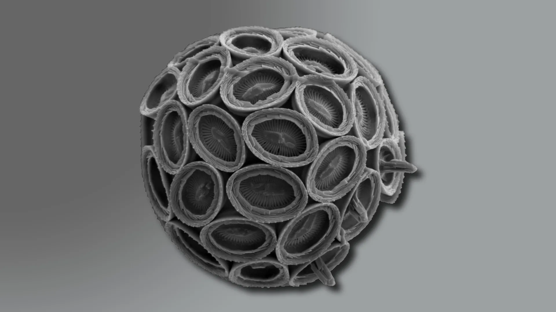
Microscopic view of a coccolithophore (Syracosphaera pulchra), a single-celled ocean alga whose intricate calcium plates (coccoliths) play a role in the global carbon cycle. Credit: Dr. Jelena Godrijan, Ruđer Bošković Institute
Smaller than a grain of dust and shaped like minute discs, coccolithophores are microscopic ocean dwellers with an outsized influence on the planet’s climate. These tiny algae remove carbon from seawater, release oxygen, and create delicate calcite plates that eventually sink to the ocean floor. Over time, these plates form chalk and limestone layers that record Earth’s climate history. Today, five European research institutions announced a new effort to establish October 10 as International Coccolithophore Day, drawing attention to the organisms’ vital contributions to carbon regulation, oxygen production, and the health of marine ecosystems that sustain life on Earth.
The initiative is being led by the Ruđer Bošković Institute (Zagreb, Croatia), the Lyell Centre at Heriot-Watt University (Edinburgh, UK), NORCE Norwegian Research Centre (Bergen, Norway), Marine and Environmental Sciences Centre (MARE) at the University of Lisbon (Portugal), and the International Nannoplankton Association (INA).
A Delicate Balance Under Threat
Few people are aware of coccolithophores, yet without them, the planet’s oceans and climate would look drastically different. These single-celled algae, which contain chlorophyll, float in the sunlit layers of the sea and are coated with calcium carbonate plates known as coccoliths.
Though incredibly small, coccolithophores are among Earth’s most effective natural carbon regulators. Every year, they generate more than 1.5 billion tonnes of calcium carbonate, capturing carbon dioxide from the atmosphere and storing it in deep-sea sediments. In addition to removing carbon, they produce oxygen, nourish marine food webs, and influence the planet’s greenhouse balance.
Coccolithophores often dominate vast stretches of the ocean, but climate change is altering the temperature, chemistry, and nutrient makeup of seawater. These shifts pose serious risks to their survival—and to the stability of the ecosystems that depend on them.
Why Coccolithophores?
What makes coccolithophores stand out from other plankton is both their role in the global carbon cycle and the unique record they leave behind. “Unlike other groups, they build intricate calcium carbonate plates that not only help draw down carbon dioxide from the atmosphere, but also transport it into deep ocean sediments, where it can be locked away for millennia. This biomineralization leaves behind an exceptional geological record, allowing us to study how they’ve responded to past climate shifts and better predict their future role. In short, their dual role as carbon pumps and climate archives makes them irreplaceable in understanding and tackling climate change,” says Professor Alex Poulton of the Lyell Centre.
“They are the ocean’s invisible architects, crafting the tiny plates that become vast archives of Earth’s climate,” says Dr. Jelena Godrijan, a leading coccolithophore researcher at the Ruđer Bošković Institute. “By studying their past and current responses to changes in the ocean, we can better understand how marine ecosystems function and explore how natural processes might help us tackle climate change.”
Cutting-Edge Science: From Plankton to Planetary Processes
The launch of International Coccolithophore Day spotlights the tiny ocean plankton that quietly help regulate atmospheric carbon dioxide.
At the Lyell Centre in Scotland, the OceanCANDY team, led by Prof. Alex Poulton, studies how these plankton pull CO2 from the air and store it in the sea, and tests how warmer, more acidic oceans could alter this process. Computer forecasts compare which species do this job best, today and tomorrow.
In Norway, scientists at NORCE Research, led by Dr. Kyle Mayers and his team, track coccolithophore life stories, how they grow, who eats them, and the viruses that infect and ultimately kill them, to show how carbon moves through the ocean. Ancient DNA in seafloor mud adds a long view of past climate shifts. “Coccolithophore interactions with viruses and grazers matter,” says Dr. Kyle Mayers of NORCE. “These links shape food webs and how the ocean stores carbon.”
In Croatia, the Cocco team at the Ruđer Bošković Institute study how they shape the ocean’s carbon cycle, from the decay of organic matter to bacterial interactions that influence seawater chemistry and CO2 uptake. “In understanding coccolithophores, we’re really uncovering the living engine of the ocean’s carbon balance,” says Dr. Jelena Godrijan “Their interactions with bacteria determine how carbon moves and transforms — processes that connect the microscopic scale of plankton to the stability of our planet’s climate.”
At MARE, University of Lisbon, Dr. Catarina V. Guerreiro leads studies to trace how aerosol-driven fertilization shapes the distribution of coccolithophores across the Atlantic into the Southern Ocean, and what that means for the ocean’s carbon pumps today and in recent times. Her approach consists of combining aerosol and seawater samples with sediment records, satellite data and lab microcosms to pin down cause and effect. “We’re connecting tiny chalky organisms to planetary carbon flows,” says Dr. Guerreiro.
At INA, scientists connect living coccolithophores to their fossil record, using their microscopic plates to date rocks and trace Earth’s climate history. By refining global biostratigraphic frameworks and calibrating species’ evolutionary timelines, INA researchers transform fossils of coccolithophores into precise tools for reconstructing ancient oceans, linking modern plankton ecology with the geological record of climate change.
Why Coccolithophore Day Matters?
Designating a day for Coccolithophores may seem like a small gesture, but its advocates argue it could have a big impact. “This could contribute to changing the way we see the ocean. “We most often talk about whales, coral reefs, and ice caps, but coccolithophores are a vital part of the planet’s climate system. They remind us that the smallest organisms can have the biggest impact, and that microscopic life plays a crucial role in shaping our planet’s future, ” says Dr. Sarah Cryer from the CHALKY project and OceanCANDY team.
The campaign to establish October 10 as International Coccolithophore Day is a call to action. By highlighting the profound, yet often overlooked, role of coccolithophores, scientists want to inspire a new wave of ocean literacy, policy focus, and public engagement.
A portion (looking south) of the 152-mile Friant-Kern Canal, an aqueduct to convey water to augment agriculture irrigation on the east side of the San Joaquin Valley, is viewed on July 8, 2021, thirty minutes east of Fresno, Calif.
The headlines suggested a comparison with the “Zero Day” announcement in Cape Town, South Africa, during a drought in 2018. That was the projected date when water would no longer be available at household taps without significant conservation. Cape Town avoided a water shutoff, barely.
While California’s announcement represents uncharted territory and is meant to promote water conservation in what is already a dry water year, there is more to the story.
California’s drought solution
California is a semi-arid state, so a dry year isn’t a surprise. But a recent state report observed that California is now in a dry pattern “interspersed with an occasional wet year.” The state suffered a three-year drought from 2007 to 2009, a five-year drought from 2012 to 2016, and now two dry years in a row; 2020 was the fifth-driest year on record, and 2021 was the second-driest.
Coming into the 2022 water year – which began Oct. 1 – the ground is dry, reservoirs are low and the prediction is for another dry year.
Over a century ago, well before climate change became evident, officials began planning ways to keep California’s growing cities and farms supplied with water. They developed a complex system of reservoirs and canals that funnel water from where it’s plentiful to where it’s needed.
Part of that system is the State Water Project.
First envisioned in 1919, the State Water Project delivers water from the relatively wetter and, at the time, less populated areas of Northern California to more populated and drier areas, mostly in Southern California. The State Water Project provides water for 27 million people and 750,000 acres of farmland, with about 70% for residential, municipal and industrial use and 30% for irrigation. There are 29 local water agencies – the state water contractors – that helped fund the State Water Project and in return receive water under a contract dating to the 1960s.
While the State Water Project is important to these local water agencies, it is usually not their only source of water. Nor is all water in California supplied through the State Water Project. Most water agencies have a portfolio of water supplies, which can include pumping groundwater.
What does 0% mean?
Originally, the State Water Project planned to deliver 4.2 million acre-feet of water each year. An acre-foot is about 326,000 gallons, or enough water to cover a football field in water 1 foot deep. An average California household uses around one-half to 1 acre-foot of water per year for both indoor and outdoor use. However, contractors that distribute water from the State Water Project have historically received only part of their allocations; the long-term average is 60%, with recent years much lower.
Based on water conditions each year, the state Department of Water Resources makes an initial allocation by Dec. 1 to help these state water contractors plan. As the year progresses, the state can adjust the allocation based on additional rain or snow and the amount of water in storage reservoirs. In 2010, for example, the allocation started at 5% and was raised to 50% by June. In 2014, the allocation started at 5%, dropped to 0% and then finished at 5%.
This year is the lowest initial allocation on record. According to the state Department of Water Resources, “unprecedented drought conditions” and “reservoirs at or near historic lows” led to this year’s headline-producing 0% allocation.
That’s 0% of each state water contractor’s allocation; however, the department committed to meet “unmet minimum health and safety needs.” In other words, if the contractors cannot find water from other sources, they could request up to 55 gallons per capita per day of water to “meet domestic supply, fire protection and sanitation needs.” That’s about two-thirds of what the average American uses.
The department is also prioritizing water for salinity control in the Sacramento Bay Delta area, water for endangered species, water to reserve in storage and water for additional supply allocations if the weather conditions improve.
Under the current plan, there will be no water from the State Water Project for roughly 10% of California’s irrigated land. As a result, both municipal and agricultural suppliers will be seeking to conserve water, looking elsewhere for water supplies, or not delivering water. None are easy solutions.
Those who can afford to dig deeper wells have done so, while others have no water as their wells have gone dry. During the 2012-2016 drought, the Public Policy Institute of California found that a majority of affected households that lost water access from their wells were in “small rural communities reliant on shallow wells – many of them communities of color.”
As someone who has worked in California and the Western U.S. on complex water issues, I am familiar with both drought and floods and the challenges they create. However, the widespread nature of this year’s drought – in California and beyond – makes the challenge even harder.
This “zero allocation” for California’s State Water Contractors is an unprecedented early warning, and likely a sign of what’s ahead.
A recent study warned that the snowpack in Western states like California may decline by up to 45% by 2050, with low- and no-snow years becoming increasingly common. Thirty-seven cities in California have already issued moratoriums on development because of water supply concerns.
If voluntary conservation does not work, enacting mandatory conservation measures like San Jose’s tough new drought rules may be needed. The state is now weighing emergency regulations on water use, and everyone is hoping for more precipitation.
Lara B. Fowler, Senior Lecturer in Law and Assistant Director for Outreach and Engagement, Penn State Institutes of Energy and the Environment, Penn State
Marine heatwaves are clogging the ocean’s carbon pump, threatening its power to fight climate change.
Source:Monterey Bay Aquarium Research Institute
Summary:Marine heatwaves can jam the ocean’s natural carbon conveyor belt, preventing carbon from reaching the deep sea. Researchers studying two major heatwaves in the Gulf of Alaska found that plankton shifts caused carbon to build up near the surface instead of sinking. This disrupted the ocean’s ability to store carbon for millennia and intensified climate feedbacks. The study highlights the urgent need for continuous, collaborative ocean observation.Share:
New research shows that marine heatwaves can reshape ocean food webs, which in turn can slow the transport of carbon to the deep sea and hamper the ocean’s ability to buffer against climate change. The study, published in the scientific journal Nature Communications on October 6, was conducted by an interdisciplinary team of researchers from MBARI, the University of Miami Rosenstiel School of Marine, Atmospheric, and Earth Science, the Hakai Institute, Xiamen University, the University of British Columbia, the University of Southern Denmark, and Fisheries and Oceans Canada.
To explore the impacts of marine heatwaves on ocean food webs and carbon flows, the research team combined multiple datasets that tracked biological conditions in the water column in the Gulf of Alaska for more than a decade. This region experienced two successive marine heatwaves during this time, one from 2013 to 2015 known as “The Blob,” and another from 2019 to 2020.
“The ocean has a biological carbon pump, which normally acts like a conveyor belt carrying carbon from the surface to the deep ocean. This process is powered by the microscopic organisms that form the base of the ocean food web, including bacteria and plankton,” said the lead author, Mariana Bif, previously a research specialist at MBARI and now an assistant professor in the Department of Ocean Sciences at the Rosenstiel School. “For this study, we wanted to track how marine heatwaves affected those microscopic organisms to see if those impacts were connected to the amount of carbon being produced and exported to the deep ocean.”
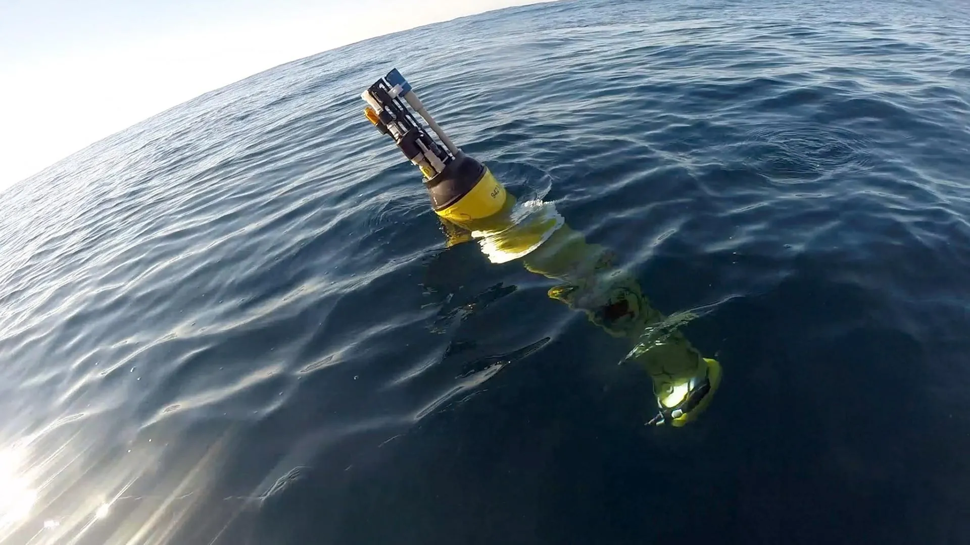
The research team used information collected by the Global Ocean Biogeochemical (GO-BGC) Array, a collaborative initiative funded by the US National Science Foundation and led by MBARI that uses robotic floats to monitor ocean health. The GO-BGC project has deployed hundreds of autonomous biogeochemical Argo (BGC-Argo) floats, which measure ocean conditions such as temperature, salinity, nitrate, oxygen, chlorophyll, and particulate organic carbon (POC) up and down the water column every five to 10 days. The team also looked at seasonal data from ship-based surveys that tracked plankton community composition, including pigment chemistry and sequencing of the environmental DNA (eDNA) from seawater samples collected during the Line P program carried out by Fisheries and Oceans Canada.
The study found that marine heatwaves did impact the base of the ocean food web, and those impacts were connected to changes in the ways that carbon was cycled in the water column. However, the changes that occurred in the food web were not consistent across the two heatwaves.
Under typical conditions, plant-like phytoplankton convert carbon dioxide to organic material. These microorganisms are the foundation of the ocean food web. When they are eaten by larger animals and excreted as waste, they transform into organic carbon particles that sink from the surface through the ocean’s mesopelagic, or twilight, zone (200 to 1,000 meters, approximately 660 to 3,300 feet) and down to the deep sea. This process locks atmospheric carbon away in the ocean for thousands of years.
During the 2013-2015 heatwave, surface carbon production by photosynthetic plankton was high in the second year, but rather than sinking rapidly to the deep sea, small carbon particles piled up approximately 200 meters (roughly 660 feet) underwater.
During the 2019-2020 heatwave, there was record-high accumulation of carbon particles at the surface in the first year that could not be attributed to carbon production by phytoplankton alone. Instead, this accumulation was likely due to the recycling of carbon by marine life and the buildup of detritus waste. This pulse of carbon then sank to the twilight zone, but lingered at depths of 200 to 400 meters (roughly 660 to 1,320 feet) instead of sinking to the deep sea.
The team attributed these differences in carbon transport between the two heatwaves to changes in phytoplankton populations. These changes cascaded through the food web, leading to a rise in small grazers who do not produce fast-sinking waste particles, so carbon was retained and recycled at the surface and in the upper twilight zone rather than sinking to deeper depths.
“Our research found that these two major marine heatwaves altered plankton communities and disrupted the ocean’s biological carbon pump. The conveyor belt carrying carbon from the surface to the deep sea jammed, increasing the risk that carbon can return to the atmosphere instead of being locked away deep in the ocean,” said Bif.
This research demonstrated that not all marine heatwaves are the same. Different plankton lineages rise and fall during these warming events, underscoring the need for long-term, coordinated monitoring of the ocean’s biological and chemical conditions to accurately model the diverse, and expansive, ecological impacts of marine heatwaves.
“This research marks an exciting new chapter in ocean monitoring. To really understand how a heatwave impacts marine ecosystems and ocean processes, we need observation data from before, during, and after the event. This research included robotic floats, pigment chemistry, and genetic sequencing, all working together to tell the entire story. It’s a great example of how collaboration can help us answer key questions about the health of the ocean,” said MBARI Senior Scientist Ken Johnson, the lead principal investigator for the GO-BGC project and a coauthor of the study.
Ocean observations and models suggest that marine heatwaves have been expanding in size and intensifying over the past few decades. The ocean absorbs a quarter of the carbon dioxide emitted each year, thanks to the steady stream of carbon particles sinking from the surface to the deep sea. A warmer ocean can mean less carbon locked away, which in turn can accelerate climate change. Beyond the changes to carbon transport, the shifts in plankton at the foundation of the ocean food web have cascading impacts on marine life and human industry too.
“Climate change is contributing to more frequent and intense marine heatwaves, which underscores the need for sustained, long-term ocean monitoring to understand and predict how future marine heatwaves will impact ecosystems, fisheries, and climate,” said Bif.
This work was funded by the US National Science Foundation’s GO-BGC project (NSF Award 1946578 with operational support from NSF Award 2110258), with additional support from the David and Lucile Packard Foundation, China National Science Foundation (grant number: 42406099), Fundamental Research Funds for the Central Universities (grant number: 20720240105), Danish Center for Hadal Research (Grant No. DNRF145), and Fisheries and Oceans Line P program.
These findings show how life adapted before photosynthesis reshaped the planet and may also guide the search for life on alien worlds.
Source:Institute of Science Tokyo
Summary:Billions of years ago, Earth’s atmosphere was hostile, with barely any oxygen and toxic conditions for life. Researchers from the Earth-Life Science Institute studied Japan’s iron-rich hot springs, which mimic the ancient oceans, to uncover how early microbes survived. They discovered communities of bacteria that thrived on iron and tiny amounts of oxygen, forming ecosystems that recycled elements like carbon, nitrogen, and sulfur.Share:
FULL STORY
Ancient microbes survived by harnessing iron and low oxygen levels in ecosystems resembling modern hot springs in Japan. These discoveries illuminate how life adapted during Earth’s Great Oxygenation Event and hint at possible life strategies on other planets. Credit: Shutterstock
Earth was not always the blue-green world we know today: the early Earth’s oxygen levels were about a million times lower than we now experience. There were no forests and no animals. For ancient organisms, oxygen was toxic. What did life look like at that time then? A recent study led by Fatima Li-Hau (graduate student at ELSI at the time of the research) along with the supervisor Associate Professor Shawn McGlynn (at the time of research) of the Earth-Life Science Institute (ELSI) at Institute of Science Tokyo, Japan, explores this question by examining iron-rich hot springs that mimic the chemistry of Earth’s ancient oceans around the time of one of Earth’s most dramatic changes: the oxygenation of the atmosphere. Their findings suggest that early microbial communities used iron along with oxygen released by photosynthetic microbes, for energy, revealing a transitional ecosystem where life turned a waste product of one organism into a new energy source before photosynthesis became dominant.
The Great Oxygenation Event (GOE) occurred around 2.3 billion years ago and marked the rise of atmospheric oxygen, likely triggered by green Cyanobacteria that used sunlight to split water, subsequently converting carbon dioxide into oxygen through photosynthesis. The result is that the current atmosphere is around 78% nitrogen and 21% oxygen, with only traces of other gases such as methane and carbon dioxide, which might have played a greater role before the rise of oxygen. The GOE fundamentally changed the course of life on Earth. This high amount of oxygen allows us animals to breathe, but it also complicates life for ancient life forms, which were almost unaware of the O2 molecule. Understanding how these ancient microbes adapted to the presence of oxygen remains a major question.
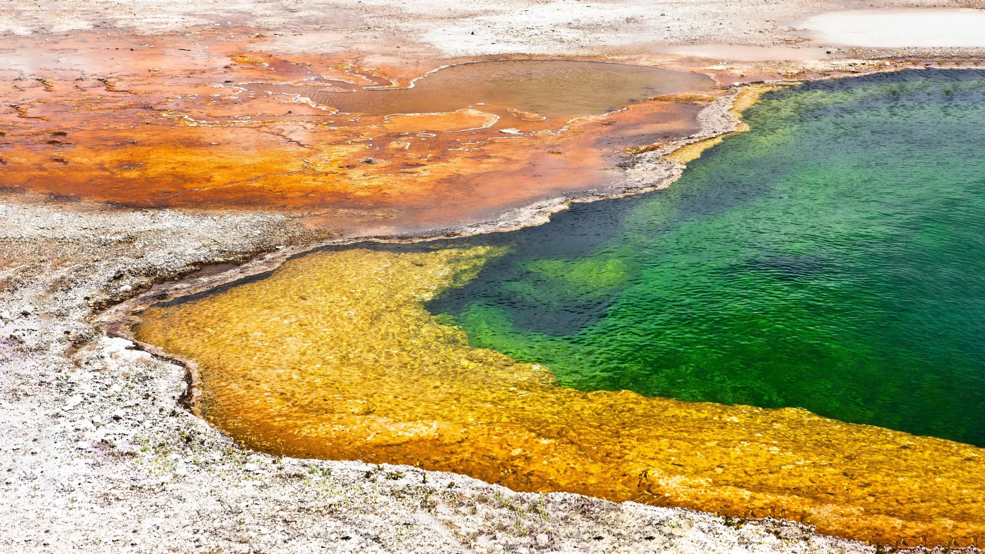
To answer this, the team studied five hot springs in Japan, which are rich in varied water chemistries. Those five springs (one in Tokyo, two each in Akita and Aomori prefectures) are naturally rich in ferrous iron (Fe2+). They are rare in today’s oxygen-rich world because ferrous iron quickly reacts with oxygen and turns into an insoluble ferric iron form (Fe3+). But in these springs, the water still contains high levels of ferrous iron, low levels of oxygen, and a near-neutral pH, conditions thought to resemble parts of the early Earth’s oceans.
“These iron-rich hot springs provide a unique natural laboratory to study microbial metabolism under early Earth-like conditions during the late Archean to early Proterozoic transition, marked by the Great Oxidation Event. They help us understand how primitive microbial ecosystems may have been structured before the rise of plants, animals, or significant atmospheric oxygen,” says Shawn McGlynn, who supervised Li-Hau during her dissertation work.
In four of the five hot springs, the team found microaerophilic iron-oxidising bacteria to be the dominant microbes. These organisms thrive in low-oxygen conditions and use ferrous iron as an energy source, converting it into ferric iron. Cyanobacteria, known for producing oxygen through photosynthesis, were also present but in relatively small numbers. The only exception was one of the Akita hot springs, where non-iron-based metabolisms were surprisingly dominant.
Using metagenomic analysis, the team assembled over 200 high-quality microbial genomes and used them to analyse in detail the functions of microbes in the community. The same microbes that coupled iron and oxygen metabolism converted a toxic compound into an energy source and helped maintain conditions that allowed oxygen-sensitive anaerobes to persist. These communities carried out essential biological processes such as carbon and nitrogen cycling, and the researchers also found evidence of a partial sulfur cycle, identifying genes involved in sulfide oxidation and sulfate assimilation. Given that hot springs contained very little sulfur compounds, this was a surprising discovery. The researchers propose that this may indicate a “cryptic” sulfur cycle, where microbes recycle sulfur in complex ways that are not yet fully understood.
“Despite differences in geochemistry and microbial composition across sites, our results show that in the presence of ferrous iron and limited oxygen, communities of microaerophilic iron oxidisers, oxygenic phototrophs, and anaerobes consistently coexist and sustain remarkably similar and complete biogeochemical cycles,” says Li-Hau.
The research suggests a shift in our understanding of early ecosystems, showing that microbes may have harnessed energy from iron oxidation and oxygen produced by early phototrophs. The study proposes that, similar to these hot springs, early Earth hosted ecosystems were composed of diverse microbes, including iron-oxidising bacteria, anaerobes, and Cyanobacteria living alongside one another and modulating oxygen concentrations.
“This paper expands our understanding of microbial ecosystem function during a crucial period in Earth’s history, the transition from an anoxic, iron-rich ocean to an oxygenated biosphere at the onset of the GOE. By understanding modern analogue environments, we provide a detailed view of metabolic potentials and community composition relevant to early Earth’s conditions,” says Li-Hau.
Together, these insights deepen our understanding of life’s early evolution on Earth and have implications for the search for life on other planets with geochemical conditions similar to those of early Earth.
More information
Earth-Life Science Institute (ELSI) is one of Japan’s ambitious World Premiere International research centers, whose aim is to achieve progress in broadly inter-disciplinary scientific areas by inspiring the world’s greatest minds to come to Japan and collaborate on the most challenging scientific problems. ELSI’s primary aim is to address the origin and co-evolution of the Earth and life.
Institute of Science Tokyo (Science Tokyo) was established on October 1, 2024, following the merger between Tokyo Medical and Dental University (TMDU) and Tokyo Institute of Technology (Tokyo Tech), with the mission of “Advancing science and human wellbeing to create value for and with society.”
World Premier International Research Center Initiative (WPI) was launched in 2007 by Japan’s Ministry of Education, Culture, Sports, Science and Technology (MEXT) to foster globally visible research centers boasting the highest standards and outstanding research environments. Numbering more than a dozen and operating at institutions throughout the country, these centers are given a high degree of autonomy, allowing them to engage in innovative modes of management and research. The program is administered by the Japan Society for the Promotion of Science (JSPS).
Earlier this year, the city scrapped plans to build a new water treatment facility because costs became too high, rising from $60 million to $83 million.
“Certainly we’re all committed to safe and healthy drinking water here in Northfield,” said Ben Martig, Northfield’s city administrator.
City officials are now advising families with infants under 1 to have them drink bottled water or to treat the water themselves, like with a reverse osmosis system.
Officials said they have been warning residents about the water quality issues for years through multiple press releases.
“We’ve talked with local providers, letting them know to notify pregnant mothers and newborn families that they should be looking at different options for their water and making sure that it is further treated,” said Justin Wagner, the city’s utilities manager.
“It’s unsafe for children under 1 and people who are pregnant, and those are important and valuable people to our community, too,” said Ward 1 City Council Member Kathleen Holmes.
She said water treatment is a city need, and costs for the project will only increase as time passes.
“This is a situation for renters who can’t put in reverse osmosis or can’t afford it,” said Holmes.
Northfield resident Levi Prinzing is the parent of an infant, but said at this point he’s more worried about the financial impacts of a new treatment facility. Prinzing also filters his water.
“I don’t think we need a new treatment plant,” said Prinzing. “The treatment plant is a lot of money and we just raised our taxes a lot.”
“We have to find a way to work together as a council and find a solution that can help bridge that gap, that we can provide safe drinking water for all residents, and hopefully reduce the financial impact or financial burden that it is on residents,” said Holmes.
The City Council may reconsider the water treatment facility in June.