Wildfires threaten water quality for up to eight years after they burn

A study of 100,000 water samples from 500 river basins found elevated levels of contaminants persist for years after a fire.

Source:University of Colorado at Boulder

Summary:Wildfires don’t just leave behind scorched earth—they leave a toxic legacy in Western rivers that can linger for nearly a decade. A sweeping new study analyzed over 100,000 water samples from more than 500 U.S. watersheds and revealed that contaminants like nitrogen, phosphorus, organic carbon, and sediment remain elevated for up to eight years after a blaze.Share:


FULL STORY


Wildfires Leave Rivers Polluted for 8 Years
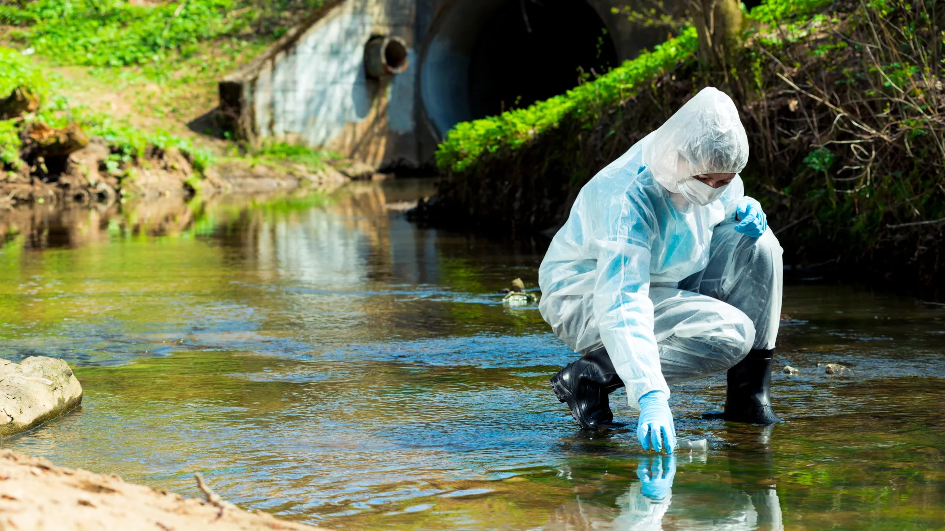
Wildfires leave a hidden trail: rivers tainted by long-lasting pollution. New research shows water contamination can linger up to eight years, with storms often triggering delayed surges of toxic runoff. Credit: Shutterstock

Years after wildfires burn forests and watersheds, the contaminants left behind continue to poison rivers and streams across the Western U.S. — much longer than scientists estimated.

A new study, published on June 23 in Nature Communications Earth & Environment, analyzed water quality in more than 500 watersheds across the Western U.S., and is the first large-scale assessment of post-wildfire quality.

The research was led by scientists from the Cooperative Institute for Research in Environmental Science (CIRES) at the University of Colorado Boulder.

“We were attempting to look at notable trends in post-wildfire water quality across the entire U.S. West, to help inform water management strategies in preparing for wildfire effects,” said Carli Brucker, lead author and former CU Boulder and Western Water Assessment PhD student.

The results showed contaminants like organic carbon, phosphorus, nitrogen, and sediment can degrade water quality for up to eight years after a fire. Water managers can use this data to help them plan for the future and respond appropriately when wildfires strike.

CIRES Fellow and Western Water Assessment Director Ben Livneh was the principal investigator and co-author of the study. Much of his research focuses on hydrology, or water supply, on a continental scale. When he realized he could use the same approach to understand large-scale trends in water quality, he was excited to test the method.

“There’s been a lot of work, for example, in the National Climate Assessment and the International Panel on Climate Change talking about changes in global water supply,” said Livneh, associate professor in the Department of Civil, Environmental and Architectural Engineering. “But those assessments point to this gap in water quality assessments in a continental scale context, whereas people like me in physical hydrology have been thinking about the continental scale challenges for a while.”

Researchers have long known that fire ash and soil destruction contribute to degraded water quality. Yet, past research has largely been limited to state and municipal studies — cities and towns test water quality in local streams and rivers following large fires.

For the new study, the team analyzed more than 100,000 water samples from 500 sites: half from burned river basins and half from unburned. They measured levels of organic carbon, nitrogen, phosphorus, and sediment as well as turbidity, or cloudiness, of each sample.

To understand wildfire-driven impacts, the team built data-driven models to measure how much contaminants changed in each basin before and after wildfires. In the final step, they compiled data to find the average across the burned basins for each pre- and post-wildfire year, and then compared those to the unburned basins.

The results showed watersheds take longer to recover after wildfires than previous studies found. Organic carbon, phosphorus, and turbidity are significantly elevated in the first one to five years post-fire. Nitrogen and sediment show significant increases up to eight years post-fire. Fire-driven impacts were worse in more forested areas.

“It can take two years, up to eight years, for the effect to be fully felt,” Livneh said. “Sometimes it can be a delayed effect, meaning, it’s not all happening right away, or sometimes you need a big enough storm that will mobilize enough of the leftover contaminants.”

Each watershed in the study felt the impacts differently. This is likely tied to where the fire struck — a fire closer to the river would be worse than an upstream fire. Different soils, vegetation, and weather also change the impact in each watershed, making it difficult to plan for the future.

“There’s a huge amount of variability in sedimentation rates,” said Brucker, who now works as a consultant. “Some streams are completely clear of sediment after wildfires, and some have 2000 times the amount of sediment.”

Despite variability across river basins, the study provides concrete numbers that give insight to water managers across the Western U.S. Researchers hope the results provide better direction on informing future planning efforts for increasing wildfire resilience.

“I’m hoping that providing concrete numbers is very impactful to water managers,” Brucker said. “You can’t fund resilience improvements on general concerns alone. Water managers need real numbers for planning, and that’s what we’re providing,” Brucker said.

CLICK HERE FOR MORE INFORMATION

https://www.sciencedaily.com/releases/2025/06/250624044332.htm#google_vignette

UNICEF and IDB report urges stronger WASH commitments in NDCs 

As Latin America and the Caribbean prepare the third generation of Nationally Determined Contributions (NDCs), a new joint report by the United Nations Children’s Fund (UNICEF) and the Inter-American Development Bank (IDB) calls for the stronger integration of water, sanitation, and hygiene (WASH) strategies into national climate commitments.  

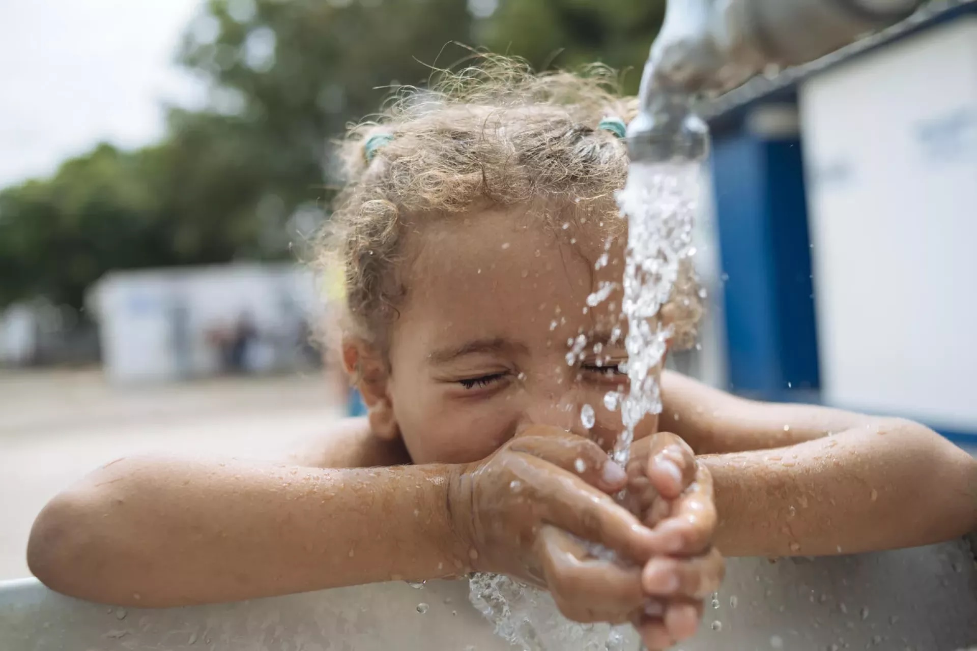
Girl drinking water from tap outdoor

The report emphasizes that aligning WASH with climate action is essential to address both environmental and development challenges, especially for vulnerable children and adolescents.

The study reviews current NDCs in the region, highlighting gaps and opportunities in water conservation, infrastructure investment, and resource governance. It also examines the extent to which climate actions reflect children’s rights and link with sustainable water management.

With climate impacts intensifying, the report urges governments to adopt more ambitious and inclusive WASH targets in the third generation of NDCs (“NDCs 3.0”) to help build climate resilience, advance equity, and limit global warming to below 1.5°C.

Explore the report in English and Spanish here

CLICK HERE FOR MORE INFORMATION

https://www.unwater.org/news/unicef-and-idb-report-urges-stronger-wash-commitments-ndcs

Drought Depletes Turkey’s Tekirdag Reservoirs, Forcing Emergency Water Curbs

By Reuters

Reuters

Reuters

A drone view shows the receding waterline and exposed lakebed in the dried basin of Turkmenli Dam, as drought conditions continue to affect water levels, in Marmara Ereglisi, in the northwestern Tekirdag province, Turkey, August 11, 2025. REUTERS/Murad Sezer

By Ali Kucukgocmen

TEKIRDAG, Turkey (Reuters) -A drought in Turkey’s northwestern province of Tekirdag has left the area’s main dams without potable water, straining infrastructure and leaving some homes without water for weeks, due to a sharp drop in precipitation in the country this year.

Authorities say drought is a critical issue, with several provinces warning of limited fresh water supply this summer.

Various areas in Izmir, Turkey’s third-most populous province, have experienced frequent water cuts this month, while the municipality in the western province of Usak was told over the weekend it would have access to water just six hours a day, with the main water reservoir depleted.

Rainfall slumped 71% in July across the country from a year ago, according to Turkey’s Meteorological Service. In the Marmara region, which includes Tekirdag and Istanbul, it shrank 95% below the monthly norm in July.

In the ten months to August, precipitation sank 32% in Marmara compared to the norm, while it fell 26% across Turkey to the lowest in 52 years.

ALTERNATIVES

The water level in Tekirdag’s Naip Dam, which has not seen any rainfall in June and July, fell to zero percent in August.

MORE: Places the U.S. Government Warns Not to Travel Right Now

That has forced authorities to find alternatives like delivering irrigation water for domestic use and building a pump system for delivery into urban areas.

The dam’s water level was 21% this time last year, according to the State Hydraulic Works.

Mehmet Ali Sismanlar, head of Tekirdag’s Water and Sewerage Administration (TESKI), said rainfall in Tekirdag has reduced dramatically over the past decade, and severe drought over the last two years has spurred frequent water cuts in some areas this summer.

“We are the area and the province that has been affected the most by the drought in Turkey,” he said, attributing it to climate change.

The water in Turkmenli dam, usually used for irrigation, was used to supply water to Tekirdag’s Marmaraereglisi district, where some neighbourhoods faced water cuts.

TESKI was working to open new wells to use ground water, not usually a preferred measure, Sismanlar said. He said ground water had sunk to twice its original depth over the years.

Mehmet, 70, a resident who lives in the Dereagzi neighbourhood with his family, said their home has had no water for two months, leaving them unable to shower or perform chores, and they were fetching water from nearby areas in large bottles.

“I have been living in filth for the past two months,” he said, standing among dirty piles of dishes in the kitchen, and adding that he last showered when he went to Istanbul, around 130 kilometres (81 miles) away.

His wife, Fatma, 65, said the family stayed up at night to fill up bottles in case water supply is resumed.

Remzi Karabas, 71, said he takes his laundry to Istanbul to be washed, but was done with living in Tekirdag. 

“We’ll leave some day soon. What can we do here? Water does not flow at all.”

(Editing by Tuvan Gumrukcu and Bernadette Baum)

CLICK HERE FOR MORE INFORMATION

https://www.usnews.com/news/world/articles/2025-08-19/drought-depletes-turkeys-tekirdag-reservoirs-forcing-emergency-water-curbs

World Water Week in Stockholm, 2025 

World Water Week 2025, taking place from 24–28 August in Stockholm, Sweden, is a long-standing global conference on water issues, first established in 1991.

Entrance to World Water Week 2023

This year, World Water Week, organized by the Stockholm International Water Institute (SIWI), celebrates its 35th edition with the theme of ‘water for climate action’.

Water is both a key pathway through which global heating affects society and a major factor in greenhouse gas emissions and carbon storage. Better water management can help policymakers meet climate goals.  

World Water Week 2025 will address these interconnected challenges, focusing on mitigation, adaptation, and resilience. The 5-day event will cover the full water cycle – from freshwater to oceans – while emphasizing ecosystem protection, equity, and climate justice to ensure vulnerable communities are included in the global climate response.

Explore the programme here

CLICK HERE FOR MORE INFORMATION

https://www.unwater.org/news/world-water-week-stockholm-2025

Global Wetland Outlook 2025: Vanishing wetlands put $39 trillion in global benefits on the line 

Wetlands, which sustain life across the planet, are disappearing faster than any other ecosystem.  

Freshwater lake in Uruguay

A new report by the Ramsar Convention on Wetlands, the Global Wetland Outlook 2025: Valuing, conserving, restoring and financing wetlands (GWO 2025), warns that without urgent action, one fifth of the world’s remaining wetlands could vanish by 2050.

According to GWO 2025, the estimated cost of this habitat loss is up to USD$39 trillion in benefits that support people, economies, and nature.  

Wetlands provide ecosystem services including clean water, food production, flood protection, and carbon storage. They also support livelihoods across sectors like agriculture, aquaculture, and tourism.  

Launched ahead of the 15th Meeting of the Conference of the Contracting Parties to the Ramsar Convention on Wetlands (COP15) in Victoria Falls, Zimbabwe, from 23 to 31 July 2025, GWO 2025 outlines four pathways to reversing wetland loss and unlocking nature-positive investment:

  1. Integrate wetland value in decision-making – treating wetlands as essential infrastructure in land-use, water, and economic planning.
  2. Recognize wetlands as key to the global water cycle – for their role in storing, filtering, and regulating water.
  3. Embed wetlands in innovative financing mechanisms – including carbon markets, resilience bonds, and blended finance.
  4. Mobilize public and private resources for wetland restoration – through partnerships that fund action on the ground and support local communities.

The Global Wetland Outlook 2025 is available in English, French, and Spanish here

CLICK HERE FOR MORE INFORMATION

https://www.unwater.org/news/global-wetland-outlook-2025-vanishing-wetlands-put-39-trillion-global-benefits-line

Protected seas help kelp forests bounce back from heatwaves

Date:August 20, 2025

Source:British Ecological Society

Summary:Kelp forests bounce back faster from marine heatwaves when shielded inside Marine Protected Areas. UCLA researchers found that fishing restrictions and predator protection strengthen ecosystem resilience, though results vary by location.Share:


FULL STORY


Protected Seas Help Kelp Forests Bounce Back
Marine Protected Areas give kelp forests a recovery edge after heatwaves, showing that local protections can buffer global climate pressures. Credit: Shutterstock

New research finds that Marine Protected Areas can boost the recovery of globally important kelp forests following marine heatwaves. The findings are published in the British Ecological Society’s Journal of Applied Ecology.

Using four decades of satellite images, University of California, Los Angeles (UCLA) researchers have looked at impacts Marine Protected Areas (MPAs) are having on kelp forests along the coast of California.

They found that although the overall effect of MPAs on kelp forest cover was modest, the benefits became clear in the aftermath of marine heatwaves in 2014-2016, when kelp forests within MPAs were able recover more quickly, particularly in southern California.

“We found that kelp forests inside MPAs showed better recovery after a major climate disturbance compared to similar unprotected areas.” Explained Emelly Ortiz-Villa, lead author of the study and a PhD researcher at UCLA Department of Geography.

“Places where fishing is restricted and important predators like lobsters and sheephead are protected saw stronger kelp regrowth. This suggests that MPAs can support ecosystem resilience to climate events like marine heatwaves.”

Professor Rick Stafford, Chair of the British Ecological Society Policy Committee, who was not involved in the study said: “It’s great to see these results and they clearly show that local action to protect biodiversity and ecosystem function can help prevent changes caused by global pressures such as climate change.

“However, it also demonstrates the need for effective MPAs. In this study, all the MPAs examined regulated fishing activity, and this is not the case for many sites which are designated as MPAs worldwide – including many in the UK.”

Kelp forests: a globally important and threatened ecosystem

Kelp forests our found around coastlines all over the world, particularly in cool, temperate waters such as the pacific coast of North America, The UK, South Africa, and Australia.

These complex ecosystems are havens for marine wildlife, including commercially important fish, and are one of the most productive habitats on Earth. They’re also efficient in capturing carbon and protect coastlines by buffering against wave energy.

However, kelp forests across the west coast of North America have declined in recent yeadue to pressures such as marine heatwaves, made more frequent and intense with climate change, and predation from increasing numbers of sea urchins, which have benefitted from population collapses of sea stars, which predate them.

Kyle Cavanaugh, a senior author of the study and professor in the UCLA Department of Geography and Institute of the Environment and Sustainability said: “Kelp forests are facing many threats, including ocean warming, overgrazing, and pollution. These forests can be remarkably resilient to individual stressors, but multi-stressor situations can overwhelm their capacity to recover. By mitigating certain stressors, MPAs can help enhance the resilience of kelp.”

Marine protected areas as a conservation tool

MPAs are designated areas of the ocean where human activity is limited to support ecosystems and the species living there. However, protections vary widely and while some areas are no-take zones, others have few restrictions or lack comprehensive management and enforcement. Many even allow destructive practices like bottom trawling.

Effective MPAs form a key part of the Kunming-Montreal Global Biodiversity Framework, agreed at COP15 in 2022, which commits nations to protecting at least 30% of oceans and land by 2030.

“Our findings can inform decisions about where to establish new MPAs or implement other spatial protection measures.” said Kyle Cavanaugh. “MPAs will be most effective when located in areas that are inherently more resilient to ocean warming, such as regions with localized upwelling or kelp populations with higher thermal tolerance.”

Emelly Villa added: “Our findings suggest that kelp forests could be a useful indicator for tracking the ecological health and climate resilience of protected areas and should be included in long-term monitoring strategies.”

Measuring the impact of marine protected areas

To understand the effects MPAs were having on kelp, the researchers used of satellite data from 1984-2022 to compare kelp forests inside and outside of 54 MPAs along the California coast.

By matching each MPA with a reference site with similar environmental conditions, they were able to test whether MPAs helped kelp forests resist loss or recover from extreme marine heatwaves which took place in the North pacific between 2014 and 2016.

The researchers warn that while their findings show that MPAs can help kelp recovery after marine heatwaves, the effect was highly variable depending on location.

“On average, kelp within MPAs showed greater recovery than in the reference sites. However, not all MPAs outperformed their corresponding reference sites, suggesting that additional factors are also play a role in determining resilience.” said Kyle Cavanaugh.

The researchers say that future work could look to identify these factors to better understand where and when MPAs are most effective at enhancing kelp resilience.

CLICK HERE FOR MORE INFORMATION

https://www.sciencedaily.com/releases/2025/08/250820000805.htm#google_vignette

Scientists reveal how just two human decisions rewired the Great Salt Lake forever

Utah geoscientist’s analysis of carbon and oxygen isotopes documents profound human-driven changes arising from agriculture and rail causeway.

Source: University of Utah

Summary:Scientists found that Great Salt Lake’s chemistry and water balance were stable for thousands of years, until human settlement. Irrigation and farming in the 1800s and a railroad causeway in 1959 created dramatic, lasting changes. The lake now behaves in ways unseen for at least 2,000 years.Share:


FULL STORY


Two Human Decisions Rewired the Great Salt Lake
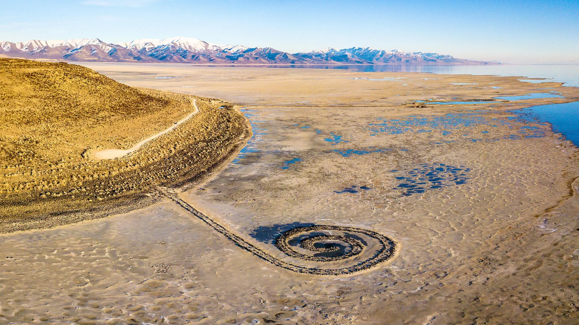
The view of Great Salt Lake’s North Arm from Gunnison Island, which has long served as a nesting ground for pelicans. Credit: Brian Maffly, University of Utah

Over the past 8,000 years, Utah’s Great Salt Lake has been sensitive to changes in climate and water inflow. Now, new sediment isotope data indicate that human activity over the past 200 years has pushed the lake into a biogeochemical state not seen for at least 2,000 years.

A University of Utah geoscientist applied isotope analysis to sediments recovered from the lake’s bed to characterize changes to the lake and its surrounding watershed back to the time the lake took its current shape from the vast freshwater Lake Bonneville that once covered much of northern Utah.

“Lakes are great integrators. They’re a point of focus for water, for sediments, and also for carbon and nutrients,” said Gabriel Bowen, a professor and chairman of the Department of Geology & Geophysics. “We can go to lakes like this and look at their sediments and they tell us a lot about the surrounding landscape.”

Sedimentary records provide context for ongoing changes in terminal saline lakes, which support fragile, yet vital ecosystems, and may help define targets for their management, according to Bowen’s new study, published last month in Geophysical Research Letters.

This research helps fill critical gaps in the lake’s geological and hydrological records, coming at a time when the drought-depleted level of the terminal body has been hovering near its historic low.

“We have all these great observations, so much monitoring, so much information and interest in what’s happening today. We also have a legacy of people looking at the huge changes in the lake that happened over tens of thousands and hundreds of thousands of years,” Bowen said. “What we’ve been missing is the scale in the middle.”

That is the time spanning the first arrival of white settlers in Utah but after Lake Bonneville receded to become Great Salt Lake.

By analyzing oxygen and carbon isotopes preserved in lake sediments, the study reconstructs the lake’s water and carbon budgets through time. Two distinct, human-driven shifts stand out:

  • Mid-19th century – Coinciding with Mormon settlement in 1847, irrigation rapidly greened the landscape around the lake, increasing the flow of organic matter into the lake and altering its carbon cycle.
  • Mid-20th century – Construction of the railroad causeway in 1959 disrupted water flow between the lake’s north and south arms, which turned Gilbert Bay from a terminal lake to an open one that partially drained into Gunnison Bay, altering the salinity and water balance to values rarely seen in thousands of years.

The new study examines two sets of sediment cores extracted from the bed of Great Salt Lake, each representing different timescales. The top 10 meters of the first core, drilled in the year 2000 south of Fremont Island, contains sediments washed into the lake up to 8,000 years ago.

The view of the Great Salt Lake from Gunnison Island, which has long served as a nesting ground for pelicans. Credit: Brian Maffly

The other samples, recovered by the U.S. Geological Survey, represent only the upper 30 centimeters of sediments, deposited in the last few hundred years.

“The first gives us a look at what was happening for the 8,000 years before the settlers showed up here,” Bowen said. “The second are these shallower cores that allow us to see how the lake changed after the arrival of the settlers.”

Bowen subjected these lakebed sediments at varying depths to an analysis that determines isotope ratios of carbon and oxygen, shedding light on the landscape surrounding the lake and the water in the lake at varying points in the past.

“The carbon tells us about the biogeochemistry, about how the carbon cycles through the lake, and that’s affected by things like weathering of rocks that bring carbon to the lake and the vegetation in the watershed, which also contributes carbon that dissolves into the water and flows to the lake,” he said.

Bowen’s analysis documented a sharp change in carbon, indicating profound changes that coincided with the arrival of Mormon pioneers in the Salt Lake Valley, where they introduced irrigated agriculture to support a rapidly growing community.

“We see a big shift in the carbon isotopes, and it shifts from values that are more indicative of rock weathering, carbon coming into the lake from dissolving limestone, toward more organic sources, more vegetation sources,” Bowen said.

The new carbon balance after settlement was unprecedented during the 8,000 years of record following the demise of Lake Bonneville.

Next, Bowen’s oxygen isotope analysis reconstructed the lake’s water balance over time.

“Essentially, it tells us about the balance of evaporation and water inflow into the lake. As the lake is expanding, the oxygen isotope ratio goes down. As the lake shrinks, it goes up, basically telling us about the rate of change of the lake volume. We see little fluctuations, but nothing major until we get to 1959.”

That’s the year Union Pacific built a 20-mile causeway to replace a historic rail trestle, dividing the lake’s North Arm, which has no tributaries, from its South Arm, also known as Gilbert Bay, which receives inflow from three rivers. Water flows through a gap in the causeway into North Arm, now rendering the South Arm an open system.

“We changed the hydrology of the lake fundamentally and gave it an outflow. We see that really clearly in the oxygen isotopes, which start behaving in a different way,” he said. Counterintuitively, the impact of this change was to make Gilbert Bay waters fresher than they would have been otherwise, buying time to deal with falling lake levels and increasing salinity due to other causes.

“If we look at the longer time scale, 8,000 years, the lake has mostly been pinned at a high evaporation state. It’s been essentially in a shrinking, consolidating state throughout that time. And that only reversed when we put in the causeway.”

The paper, “Multi-millennial context for post-colonial hydroecological change in Great Salt Lake,” was posted online July 22 in the journal Geophysical Research Letters. Gabriel Bowen is the sole author and is supported by grants from the National Science Foundation.

CLICK HERE FOR MORE INFORMATION

https://www.sciencedaily.com/releases/2025/08/250818102953.htm

Scientists just found a hidden factor behind Earth’s methane surge

Using CRISPR to dial down enzyme helps to understand the isotope signatures of methane from different environments

Source:University of California – Berkeley

Summary:Roughly two-thirds of all atmospheric methane, a potent greenhouse gas, comes from methanogens. Tracking down which methanogens in which environment produce methane with a specific isotope signature is difficult, however. UC Berkeley researchers have for the first time CRISPRed the key enzyme involved in microbial methane production to understand the unique isotopic fingerprints of different environments to better understand Earth’s methane budget.Share:

FULL STORY


Hidden Factor Behind Earth’s Methane Surge
An electron microscope image of single-celled methanogens, members of the archaea domain. They are ubiquitous in oxygen-free environments, turning simple foods into methane, a potent greenhouse gas. Credit: Alienor Baskevitch/UC Berkeley

Roughly two-thirds of all emissions of atmospheric methane — a highly potent greenhouse gas that is warming planet Earth — come from microbes that live in oxygen-free environments like wetlands, rice fields, landfills and the guts of cows.

Tracking atmospheric methane to its specific sources and quantifying their importance remains a challenge, however. Scientists are pretty good at tracing the sources of the main greenhouse gas, carbon dioxide, to focus on mitigating these emissions. But to trace methane’s origins, scientists often have to measure the isotopic composition of methane’s component atoms, carbon and hydrogen, to use as a fingerprint of various environmental sources.

A new paper by researchers at the University of California, Berkeley, reveals how the activity of one of the main microbial enzymes involved in producing methane affects this isotope composition. The finding could change how scientists calculate the contributions of different environmental sources to Earth’s total methane budget.

“When we integrate all the sources and sinks of carbon dioxide into the atmosphere, we kind of get the number that we’re expecting from direct measurement in the atmosphere. But for methane, large uncertainties in fluxes exist — within tens of percents for some of the fluxes — that challenge our ability to precisely quantify the relative importance and changes in time of the sources,” said UC Berkeley postdoctoral fellow Jonathan Gropp, who is first author of the paper. “To quantify the actual sources of methane, you need to really understand the isotopic processes that are used to constrain these fluxes.”

Gropp teamed up with a molecular biologist and a geochemist at UC Berkeley to, for the first time, employ CRISPR to manipulate the activity of this key enzyme to reveal how these methanogens interact with their food supply to produce methane.

“It is well understood that methane levels are rising, but there is a lot of disagreement on the underlying cause,” said co-author Dipti Nayak, UC Berkeley assistant professor of molecular and cell biology. “This study is the first time the disciplines of molecular biology and isotope biogeochemistry have been fused to provide better constraints on how the biology of methanogens controls the isotopic composition of methane.”

Many elements have heavier or lighter versions, called isotopes, that are found in small proportions in nature. Humans are about 99% carbon-12 and 1% carbon-13, which is slightly heavier because it has an extra neutron in its nucleus. The hydrogen in water is 99.985% hydrogen-1 and 0.015% deuterium or hydrogen-2, which is twice as heavy because it has a neutron in its nucleus.

The natural abundances of isotopes are reflected in all biologically produced molecules and variations can be used to study and fingerprint various biological metabolisms.

“Over the last 70 years, people have shown that methane produced by different organisms and other processes can have distinctive isotopic fingerprints,” said geochemist and co-author Daniel Stolper, UC Berkeley associate professor of earth and planetary science. “Natural gas from oil deposits often looks one way. Methane made by the methanogens within cow guts looks another way. Methane made in deep sea sediments by microorganisms has a different fingerprint. Methanogens can consume or ‘eat’, if you will, a variety of compounds including methanol, acetate or hydrogen; make methane; and generate energy from the process. Scientists have commonly assumed that the isotopic fingerprint depends on what the organisms are eating, which often varies from environment to environment, creating our ability to link isotopes to methane origins.”

“I think what’s unique about the paper is, we learned that the isotopic composition of microbial methane isn’t just based on what methanogens eat,” Nayak said. “What you ‘eat’ matters, of course, but the amount of these substrates and the environmental conditions matter too, and perhaps more importantly, how microbes react to those changes.”

“Microbes respond to the environment by manipulating their gene expression, and then the isotopic compositions change as well,” Gropp said. “This should cause us to think more carefully when we analyze data from the environment.”

The paper will appear Aug. 14 in the journal Science.

Vinegar- and alcohol-eating microbes

Methanogens — microorganisms that are archaea, which are on an entirely separate branch of the tree of life from bacteria — are essential to ridding the world of dead and decaying matter. They ingest simple molecules — molecular hydrogen, acetate or methanol, for example — excreted by other organisms and produce methane gas as waste. This natural methane can be observed in the pale Will-o’-the-wisps seen around swamps and marshes at night, but it’s also released invisibly in cow burps, bubbles up from rice paddies and natural wetlands and leaks out of landfills. While most of the methane in the natural gas we burn formed in association with hydrocarbon generation, some deposits were originally produced by methanogens eating buried organic matter.

The isotopic fingerprint of methane produced by methanogens growing on different “food” sources has been well established in laboratory studies, but scientists have found that in the complexity of the real world, methanogens don’t always produce methane with the same isotopic fingerprint as seen in the lab. For example, when grown in the lab, species of methanogens that eat acetate (essentially vinegar), methanol (the simplest alcohol), or molecular hydrogen (H2) produce methane, CH4, with a ratio of hydrogen and carbon isotopes different from the ratios observed in the environment.

Gropp had earlier created a computer model of the metabolic network in methanogens to understand better how the isotope composition of methane is determined. When he got a fellowship to come to UC Berkeley, Stolper and Nayak proposed that he experimentally test his model. Stolper’s laboratory specializes in measuring isotope compositions to explore Earth’s history. Nayak studies methanogens and, as a postdoctoral fellow, found a way to use CRISPR gene editing in methanogens. Her group recently altered the expression of the key enzyme in methanogens that produces the methane — methyl-coenzyme M reductase (MCR) — so that its activity can be dialed down. Enzymes are proteins that catalyze chemical reactions.

Experimenting with these CRISPR-edited microbes — in a common methanogen called Methanosarcina acetivorans growing on acetate and methanol — the researchers looked at how the isotopic composition of methane changed when the enzyme activity was reduced, mimicking what is thought to happen when the microbes are starved for their preferred food.

They found that when MCR is at low concentrations, cells respond by altering the activity of many other enzymes in the cell, causing their inputs and outputs to accumulate and the rate of methane generation to slow so much that enzymes begin running both backwards and forwards. In reverse, these other enzymes remove a hydrogen from carbon atoms; running forward, they add a hydrogen. Together with MCR, they ultimately produce methane (CH4). Each forward and reverse cycle requires one of these enzymes to pull a hydrogen off of the carbon and add a new one ultimately sourced from water. As a result, the isotopic composition of methane’s four hydrogen molecules gradually comes to reflect that of the water, and not just their food source, which starts with three hydrogens.

This is different from typical assumptions for growth on acetate and methanol that assume no exchange between hydrogen derived from water and that from the food source.

“This isotope exchange we found changes the fingerprint of methane generated by acetate and methanol consuming methanogens vs. that typically assumed. Given this, it might be that we have underestimated the contribution of the acetate-consuming microbes, and they might be even more dominant than we have thought,” Gropp said. “We’re proposing that we at least should consider the cellular response of methanogens to their environment when studying isotopic composition of methane.”

Beyond this study, the CRISPR technique for tuning production of enzymes in methanogens could be used to manipulate and study isotope effects in other enzyme networks broadly, which could help researchers answer questions about geobiology and the Earth’s environment today and in the past.

“This opens up a pathway where modern molecular biology is married with isotope-geochemistry to answer environmental problems,” Stolper said. “There are an enormous number of isotopic systems associated with biology and biochemistry that are studied in the environment; I hope we can start looking at them in the way molecular biologists now are looking at these problems in people and other organisms — by controlling gene expression and looking at how the stable isotopes respond.”

For Nayak, the experiments are also a big step in discovering how to alter methanogens to derail production of methane and redirect their energy to producing useful products instead of an environmentally destructive gas.

“By reducing the amount of this enzyme that makes methane and by putting in alternate pathways that the cell can use, we can essentially give them another release valve, if you will, to put those electrons, which they were otherwise putting in carbon to make methane, into something else that would be more useful,” she said.

Other co-authors of the paper are Markus Bill of Lawrence Berkeley National Laboratory and former UC Berkeley postdoc Rebekah Stein, and Max Lloyd, who is a professor at Penn State University. Gropp was supported by a fellowship from the European Molecular Biology Organization. Nayak and Stolper were funded, in part, by Alfred B. Sloan Research Fellowships. Nayak also is an investigator with the Chan-Zuckerberg Biohub.

CLICK HERE FOR MORE INFORMATION

https://www.sciencedaily.com/releases/2025/08/250816113528.htm

Drought Stalks Serbia, Harming Livestock

By Reuters

U.S. News & World Report

Reuters

REUTERS

A drone view shows a herd of cattle searching for water amid a severe drought that has dried up Suva Planina mountain’s main springs, near the town of Bela Palanka, Serbia August 12, 2025. REUTERS/Djordje Kojadinovic

SUVA PLANINA, Serbia (Reuters) -A prolonged drought and sweltering heat are taking their toll on villagers, livestock and crops in the mountains of southeastern Serbia, with animals starting to die.

Lack of rainfall since May has caused water shortages, wildfires and disruption to agriculture across the Western Balkans, also comprised of Montenegro, Bosnia, Albania, Kosovo and North Macedonia,

At Serbia’s Suva Planina (Dry Mountain), owners who take their cows and horses for summer grazing said the springs dried up too early this year.

“There’s not a drop of water … animals are starting to die,” said Ljubisa Petkovic, a herder from the nearby municipality of Gadzin Han.

Around 1,000 thirsty cows and horses milled round a few watering holes and springs, sipping sparse and dirty water from puddles.

Temperatures in Serbia on Tuesday stood at around 35 degrees Celsius (95 Fahrenheit) with several wildfires burning.

In late July, local authorities, alerted by cattle owners, drove water trucks up the Suva Planina pastures, filled a pond, and pledged to send more.

Nikola Manojlovic, 35, said he hoped for more state water supplies and warned that villages in the valley were also suffering from the drought.

MORE:  Places the U.S. Government Warns Not to Travel Right Now

“Corn has dried up … we’ve had no running water in the village for three months now and we have no water here,” Manojlovic said.

Meteorologists say Serbia may have a spell of rainy weather later this month, but it may not be enough to replenish the small rivers, lakes and creeks needed for the cattle to drink.

(Reporting by Branko Filipovicc; Writing by Aleksandar Vasovic; Editing by Andrew Cawthorne)

Copyright 2025 Thomson Reuters.

CLICK HERE FOR MORE INFORMATION

https://www.usnews.com/news/world/articles/2025-08-12/drought-stalks-serbia-harming-livestock

International Conference on Water, Peace and Security 2025 

UN WATER

The International Conference on Water, Peace, and Security 2025 will take place on 27-28 October in a hybrid format (Nairobi and online), gathering governments, civil society, researchers, and international organizations.  

Flooded area

The event, organized by the Water, Peace and Security (WPS) partnership, will explore water’s vital role as a catalyst for peace and cooperation, especially in regions affected by conflict and insecurity.

In recent decades, water-related conflicts have intensified globally due to climate change, population growth and unsustainable water management. At the same time, there is growing recognition that water cooperation can act as a bridge for peacebuilding, fostering dialogue, trust and collaboration across communities and nations.

Themes of the conference:

  • From water-conflicts to peace and cooperation: Case studies of successful prevention/mitigation/resolution of water-related conflicts, and pathways towards conflict sensitive and cooperative water management.
  • Innovations for water and peace: Exploring the role of data and models in promoting peaceful and cooperative water resource management.
  • Climate change and water security: Addressing the intersection of climate change impacts (floods and droughts), and associated conflict risks, and mitigation experiences.
  • Agency of marginalized groups in water, peace and security: Amplifying the role of underrepresented groups (women, youth, indigenous) in water governance and peacebuilding.

WPS is a collaboration between many organizations including IHE Delft Institute for Water Education and World Resources Institute.

Read more about participating in and attending the conference here

CLICK HERE FOR MORE INFORMATION

https://www.unwater.org/news/international-conference-water-peace-and-security-2025