Oceans could reach a dangerous tipping point by 2050

Source:University of California – Santa Barbara

Summary:UC Santa Barbara researchers project that human impacts on oceans will double by 2050, with warming seas and fisheries collapse leading the charge. The tropics and poles face the fastest changes, and coastal regions will be hardest hit, threatening food and livelihoods worldwide.Share:


FULL STORY


Oceans Near Breaking Point by 2050
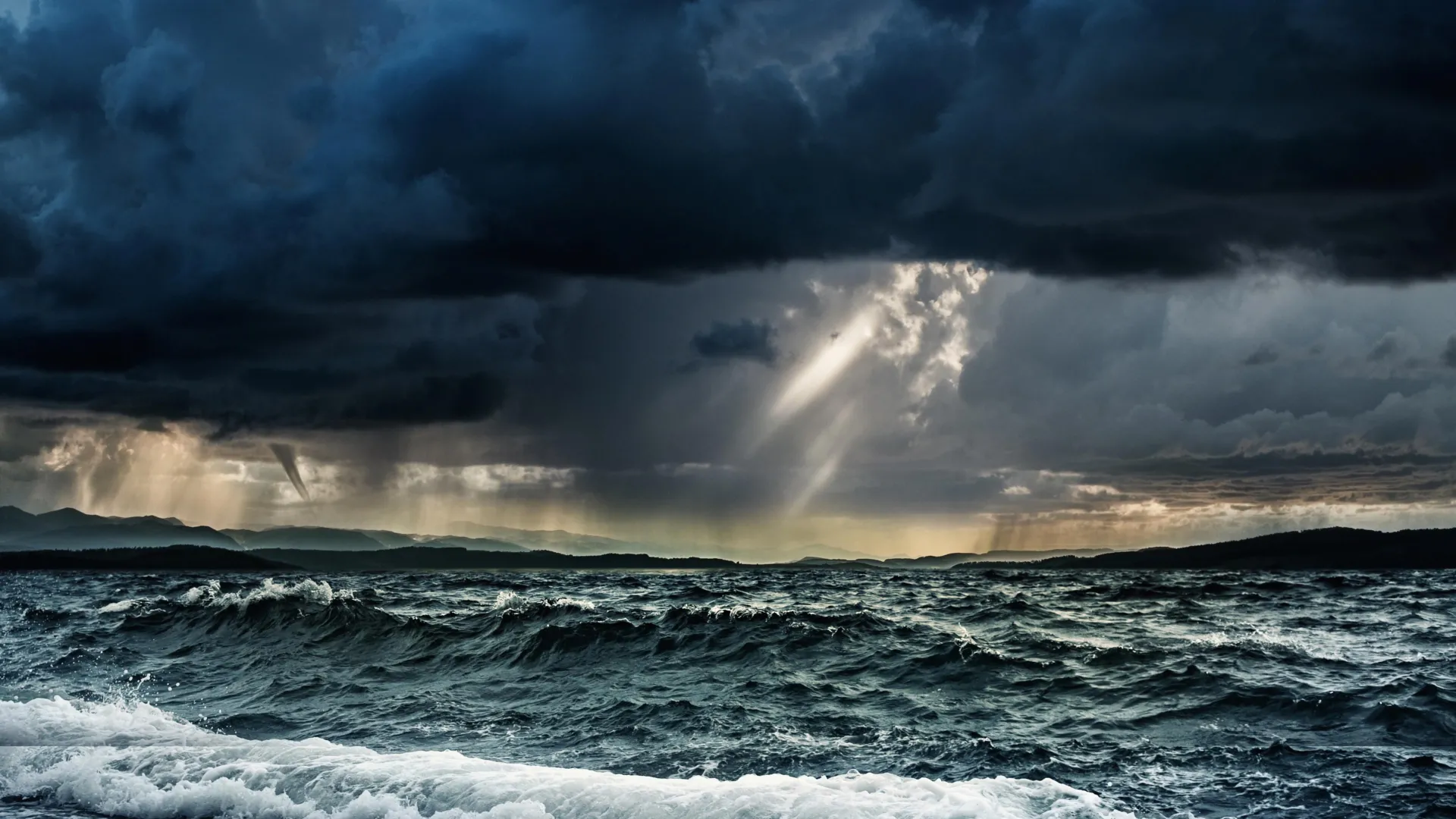
By 2050, ocean impacts from climate change and overuse could double—unless urgent action is taken. Credit: Shutterstock

The seas have long sustained human life, but a new UC Santa Barbara study shows that rising climate and human pressures are pushing the oceans toward a dangerous threshold.

Vast and powerful, the oceans can seem limitless in their abundance and impervious to disturbances. For millennia, humans have supported their lives, livelihoods and lifestyles with the ocean, relying on its diverse ecosystems for food and material, but also for recreation, business, wellness and tourism.

Yet the future of our oceans is worrying, according to researchers at UCSB’s National Center for Ecological Analysis and Synthesis (NCEAS).

“Our cumulative impact on the oceans, which is already substantial, is going to double by 2050 — in just 25 years,” said marine ecologist and NCEAS director Ben Halpern, who led the effort to forecast the future state of marine environments as they bow under the combined pressures of human activities, which include ocean warming, fisheries biomass loss, sea level rise, acidification and nutrient pollution, among other impacts. “It’s sobering. And it’s unexpected, not because impacts will be increasing — that is not surprising — but because they will be increasing so much, so fast.”

The research team, which includes collaborators from Nelson Mandela University in South Africa, also finds that the tropics and the poles will experience the fastest changes in impacts, and that coastal areas will feel the brunt of the increased impacts.

Their research, supported in large part by the National Science Foundation, is published in the journal Science.

A comprehensive global model of human impacts

As human activity on the ocean and along the coast has intensified, so have impacts on the marine environment. Halpern and a group of scientists first tackled the challenge of understanding how these pieces fit together to affect the ocean nearly 20 years ago, laying the groundwork for the current study.

“People tracked one issue at a time, but not everything together,” Halpern said. “More importantly, there was a pervasive sense that the ocean is so huge the human impacts couldn’t possibly be that bad.”

Their quest to build a comprehensive model of human impacts on the ocean led to a 2008 paper in the journal Science, a landmark study that synthesized 17 global data sets to map the intensity and extent of human activity on the world’s oceans. That initial view revealed startling results: No place was untouched, and 41% of the world’s marine environments were heavily impacted.

“The previous paper tells us where we are; the current paper tells us where we are headed,” Halpern said.

Ocean warming and biomass loss due to fisheries are expected to be the largest overall contributors to future cumulative impacts. Meanwhile, the tropics face rapidly increasing rates of impact, while the poles, which already experience a high level of impact, are expected to experience even more. According to the paper, the high level of future impacts “may exceed the capacity of ecosystems to cope with environmental change,” in turn posing challenges for human societies and institutions in a variety of ways.”

The world’s coasts are expected to bear the brunt of these increasing cumulative impacts — an unsurprising reality, the researchers say, given most human uses of the ocean are near coasts. Yet it’s also a “worrisome result nonetheless,” according to the paper, because the coasts “are where people derive most value from the ocean.” Additionally, many countries are dependent on the ocean for food, livelihood and other benefits. “Many of these countries will face substantial increases,” Halpern said.

The authors contend that enacting policies to reduce climate change and to strengthen fisheries management could be effective ways to manage and reduce human impacts, given the outsize roles that ocean warming and biomass loss play in the estimate of future human impacts on the ocean. Likewise, prioritizing management of habitats that are expected to be heavily impacted — such as salt marshes and mangroves — could help reduce the pressures on them.

In presenting these forecasts and analyses, the researchers hope that effective action can be taken sooner rather than later to minimize or mitigate the effects of increased pressures from human activity.

“Being able to look into the future is a super powerful planning tool,” Halpern said. “We can still alter that future; this paper is a warning, not a prescription.”

Research in this paper was also conducted by Melanie Frazier and Casey C. O’Hara at UCSB, and Alejandra Vargas-Fonseca and Amanda T. Lombard at Nelson Mandela University in South Africa.

CLICK HERE FOR MORE INFORMATION

https://www.sciencedaily.com/releases/2025/09/250905180728.htm

Even the toughest corals are shrinking in warming seas

Resilient coral growth predicted to decrease over next 3 decades, study finds.

Source:Ohio State University

Summary:Scientists found that Red Sea corals can endure warming seas but grow much smaller and weaken under long-term heat stress. Though recovery is possible in cooler months, rising global temperatures may outpace their resilience, endangering reefs and the people who depend on them.Share:


FULL STORY


Even the Toughest Corals Are Shrinking
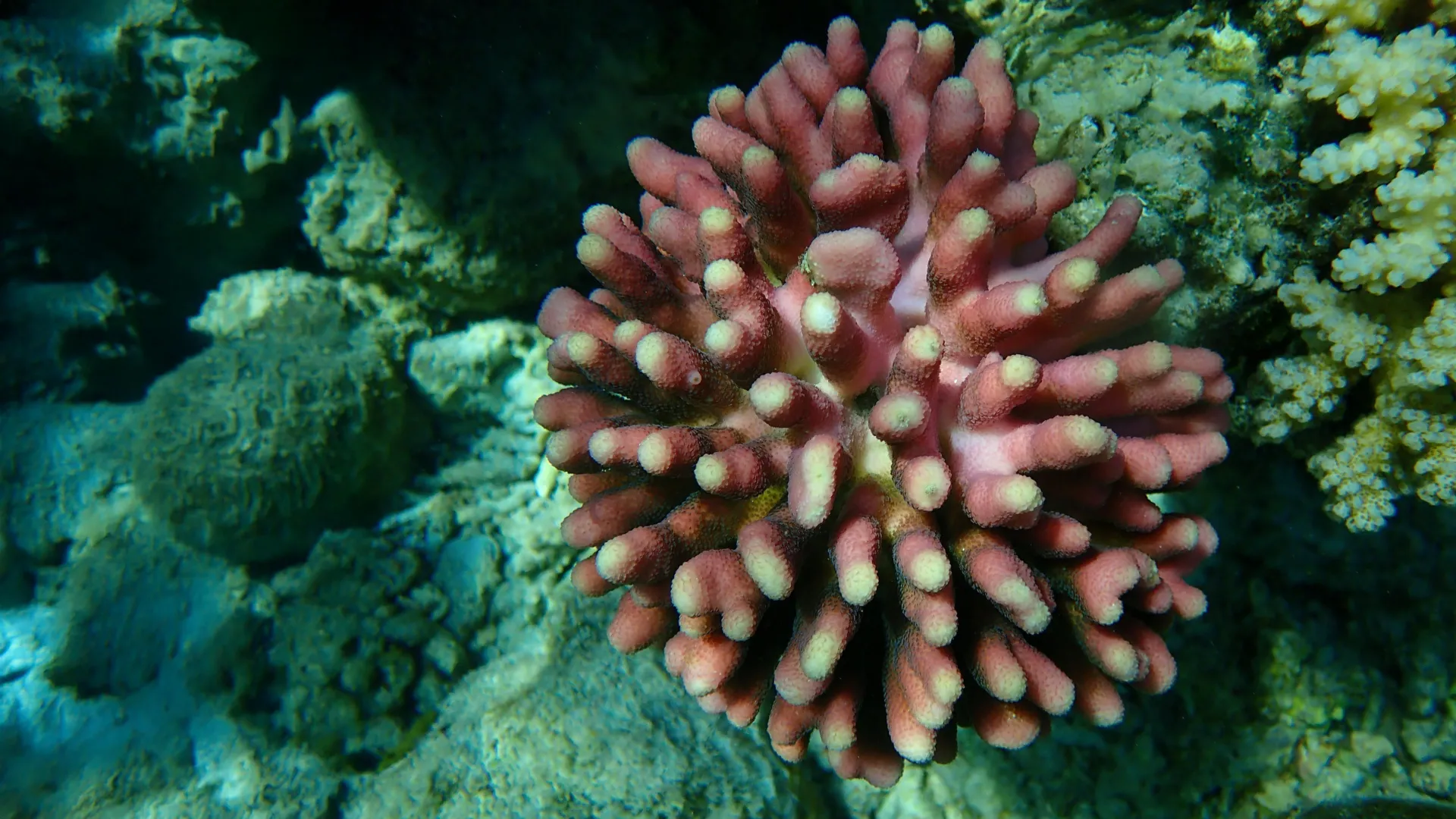
Resilient Red Sea corals survive extreme heat but shrink and weaken, raising alarms about the future of marine life and reef-dependent communities. Credit: Shutterstock

As coral reefs decline at unprecedented rates, new research has revealed that some coral species may be more resilient to warming temperatures than others.

By studying how six months of elevated ocean temperatures would affect a species of coral from the northern Red Sea called Stylophora pistillata, scientists found that although these organisms can certainly survive in conditions that mimic future warming trends, they don’t thrive.

Stylophora pistillata tend to be tolerant of high ocean temperatures, but when continuously exposed to temperatures of 27.5 and 30 degrees Celsius (81.5 and 86 degrees Fahrenheit) — baseline warming expected in tropical oceans by 2050 and 2100 — scientists saw various changes in coral growth, metabolic rates, and even energy reserves. For instance, coral in 27.5 degrees Celsius waters survived, but were 30% smaller than their control group; those placed in 30 degrees Celsius waters wound up being 70% smaller.

“In theory, if corals in the wild at these temperatures are smaller, reefs might not be as diverse and may not be able to support as much marine life,” said Ann Marie Hulver, lead author of the study and a former graduate student and postdoctoral scholar in earth sciences at The Ohio State University. “This could have adverse effects on people that depend on the reef for tourism, fishing or food.”

Overall, the team’s results suggest that even the most thermally tolerant coral species may suffer in their inability to overcome the consequences of warming seas.

The study was published on September 3 in the journal Science of the Total Environment.

While current predictions for coral reefs are dire, there is some good news. During the first 11 weeks of the experiment, researchers saw that corals were only minimally affected by elevated baseline temperatures. Instead, it was the cumulative impact of chronic high temperatures that compromised coral growth and caused them to experience a higher metabolic demand.

The coral later recovered after being exposed for a month to 25 degree Celsius waters, but had a dark pigmentation compared to corals that were never heated. This discovery implies that despite facing ever longer periods of threat from high ocean temperatures in the summer months, resilient coral like S. pistillata can bounce back when waters cool in the winter, researchers say.

Still, as ocean temperatures are expected to increase by 3 degrees Celsius by 2100, expecting coral reefs to predictably bend to projected climate models can be difficult, according to the researchers.

This team’s research does paint a more detailed picture of how coral reefs may look and function in the next 50 years, said Andrea Grottoli, co-author of the study and a professor in earth sciences at Ohio State.

“Survival is certainly the No. 1 important thing for coral, but when they’re physiologically compromised, they can’t do that forever,” said Grottoli. “So there’s a limit to how long these resilient corals can cope with an ever increasing warming ocean.”

Gaining a more complex understanding of how warming waters can alter coral growth and feeding patterns may also better inform long-term conservation efforts, said Grottoli.

“Conservation efforts could focus on areas where resilient coral are present and create protected sanctuaries so that there are some ecosystems that grow as high-probability-success reefs for the future,” she said.

For now, all coral reefs are still in desperate need of protection, researchers note. To that end, Hulver imagines future work could be aimed at investigating the resilience of similar species of coral, including replicating this experiment to determine if sustained warming might cause trade-offs in other biological processes, such as reproduction.

“For coral, six months is still a very small snapshot of their lives,” said Hulver. “We’ll have to keep on studying them.”

Other Ohio state co-authors include Shannon Dixon and Agustí Muñoz-Garcia as well as Éric Béraud and Christine Ferrier-Pagès from the Centre Scientifique de Monaco, and Aurélie Moya, Rachel Alderdice and Christian R Voolstra from the University of Konstanz. The study was supported by the National Science Foundation and the German Research Foundation.

CLICK HERE FOR MORE INFORMATION

https://www.sciencedaily.com/releases/2025/09/250905112308.htm

Scientists fear the Atlantic’s great ocean conveyor could shut down

Source:Potsdam Institute for Climate Impact Research (PIK)

Summary:A new study projects that the Atlantic Meridional Overturning Circulation (AMOC)—the system of currents that includes the Gulf Stream—could shut down after 2100 under high-emission scenarios. This shutdown would drastically reduce heat transport northward, leaving Europe vulnerable to extreme winters, summers of drying, and shifts in tropical rainfall. Climate models show the tipping point is linked to collapsing winter convection in the North Atlantic, which weakens vertical mixing and creates a feedback loop that accelerates decline.Share:


FULL STORY


Atlantic’s Great Ocean Conveyor Could Shut Down
Scientists warn the AMOC could collapse after 2100, unleashing extreme winters, shifting rainfall, and climate upheaval. Early signals show the system weakening, making emission cuts vital to slow the risk. Credit: Shutterstock

Under high-emission scenarios, the Atlantic Meridional Overturning Circulation (AMOC), a key system of ocean currents that also includes the Gulf Stream, could shut down after the year 2100. This is the conclusion of a new study, with contributions by the Potsdam Institute for Climate Impact Research (PIK). The shutdown would cut the ocean’s northward heat supply, causing summer drying and severe winter extremes in northwestern Europe and shifts in tropical rainfall belts.

“Most climate projections stop at 2100. But some of the standard models of the IPCC – the Intergovernmental Panel on Climate Change – have now run centuries into the future and show very worrying results,” says Sybren Drijfhout from the Royal Netherlands Meteorological Institute, the lead author of the study published in Environmental Research Letters. “The deep overturning in the northern Atlantic slows drastically by 2100 and completely shuts off thereafter in all high-emission scenarios, and even in some intermediate and low-emission scenarios. That shows the shutdown risk is more serious than many people realize.”

Collapse of deep convection in winter as the tipping point 

The AMOC carries sun-warmed tropical water northward near the surface and sends colder, denser water back south at depth. This ocean “conveyor belt” helps keep Europe relatively mild and influences weather patterns worldwide. In the simulations, the tipping point that triggers the AMOC shutdown is a collapse of deep convection in winter in the Labrador, Irminger and Nordic Seas. Global heating reduces winter heat loss from the ocean, because the atmosphere is not cool enough. This starts to weaken the vertical mixing of ocean waters: The sea surface stays warmer and lighter, making it less prone to sinking and mixing with deeper waters. This weakens the AMOC, resulting in less warm, salty water flowing northward.

In northern regions, then, surface waters become cooler and less saline, and this reduced salinity makes the surface water even lighter and less likely to sink. This creates a self-reinforcing feedback loop, triggered by atmospheric warming but perpetuated by weakened currents and water desalination.

“In the simulations, the tipping point in key North Atlantic seas typically occurs in the next few decades, which is very concerning,” says Stefan Rahmstorf, Head of PIK’s Earth System Analysis research department and co-author of the study. After the tipping point the shutdown of the AMOC becomes inevitable due to a self-amplifying feedback. The heat released by the far North Atlantic then drops to less than 20 percent of the present amount, in some models almost to zero, according to the study.

Lead author Drijfhout adds that “recent observations in these deep convection regions already show a downward trend over the past five to ten years. It could be variability, but it is consistent with the models’ projections.”

It is crucial to cut emissions fast

To arrive at these results, the research team analyzed CMIP6 (Coupled Model Intercomparison Project) simulations, which were used in the latest IPCC Assessment Report, with extended time horizons to years from 2300 to 2500. In all nine high-emission simulations, the models evolve into a weak, shallow circulation state with the deep overturning shutting down; this result is produced in some intermediate and low-emission simulations as well. In every case, this change follows a mid-century collapse of the deep convection in North Atlantic seas.

“A drastic weakening and shutdown of this ocean current system would have severe consequences worldwide,” PIK researcher Rahmstorf points out. “In the models, the currents fully wind down 50 to 100 years after the tipping point is breached. But this may well underestimate the risk: these standard models do not include the extra fresh water from ice loss in Greenland, which would likely push the system even further. This is why it is crucial to cut emissions fast. It would greatly reduce the risk of an AMOC shutdown, even though it is too late to eliminate it completely.”

CLICK HERE FOR MORE INFORMATION

https://www.sciencedaily.com/releases/2025/08/250830001201.htm

A monster seaweed bloom is taking over the Atlantic

Source:Florida Atlantic University

Summary:Sargassum has escaped the Sargasso Sea and exploded across the Atlantic, forming the massive Great Atlantic Sargassum Belt. Fueled by nutrient runoff, Amazon outflows, and climate events, these blooms now reshape ecosystems, economies, and coastlines on a staggering scale.Share:


FULL STORY


Monster Seaweed Bloom Taking Over the Atlantic
Sargassum on a beach in Palm Beach County in 2021. Credit: Brian Lapointe, FAU Harbor Branch

Researchers at Florida Atlantic University’s Harbor Branch Oceanographic Institute have released a landmark review tracing four decades of changes in pelagic sargassum – free-floating brown seaweed that plays a vital role in the Atlantic Ocean ecosystem.

Once thought to be primarily confined to the nutrient-poor waters of the Sargasso Sea, sargassum is now recognized as a rapidly growing and widely distributed marine organism, whose expansion across the Atlantic is closely linked to both natural processes and human-induced nutrient enrichment.

The review, published in the journal Harmful Algae, sheds new light on the origins and development of the Great Atlantic Sargassum Belt, a massive recurring bloom of sargassum that stretches across the Atlantic Ocean from the coast of West Africa to the Gulf of America.

Since its first appearance in 2011, this belt has formed nearly every year – except in 2013 – and in May, reached a new record biomass of 37.5 million tons. This does not include the baseline biomass of 7.3 million tons historically estimated in the Sargasso Sea.

By combining historical oceanographic observations, modern satellite imagery, and advanced biogeochemical analyses, this review provides a comprehensive framework for understanding the dramatic changes in sargassum distribution, productivity and nutrient dynamics. It also highlights the broader implications of anthropogenic nutrient enrichment on ocean ecology and the need for coordinated international efforts to monitor and manage the impacts of these massive seaweed blooms.

“Our review takes a deep dive into the changing story of sargassum – how it’s growing, what’s fueling that growth, and why we’re seeing such a dramatic increase in biomass across the North Atlantic,” said Brian Lapointe, Ph.D., lead author and a research professor at FAU Harbor Branch. “By examining shifts in its nutrient composition – particularly nitrogen, phosphorus and carbon – and how those elements vary over time and space, we’re beginning to understand the larger environmental forces at play.”

Early in the review, Lapointe and co-authors Deanna F. Webber, research coordinator; and Rachel Brewton, Ph.D., an assistant research professor, both with FAU Harbor Branch, explain that early oceanographers charted the Sargasso Sea based on surface sightings of sargassum, believing the seaweed thrived in its warm, clear, but nutrient-poor waters. However, this notion created a paradox when mid-20th-century oceanographers described the region as a “biological desert.”

However, recent satellite observations, ocean circulation models, and field studies have resolved this paradox by tracing the seasonal transport of sargassum from nutrient-rich coastal areas, particularly the western Gulf of America, to the open ocean via the Loop Current and Gulf Stream. These findings support early theories by explorers who proposed that Gulf-originating sargassum could feed populations in the Sargasso Sea.

Remote sensing technology played a pivotal role in these discoveries. In 2004 and 2005, satellites captured extensive sargassum windrows – long, narrow lines or bands of floating sargassum – in the western Gulf of America, a region experiencing increased nutrient loads from river systems such as the Mississippi and Atchafalaya.

“These nutrient-rich waters fueled high biomass events along the Gulf Coast, resulting in mass strandings, costly beach cleanups and even the emergency shutdown of a Florida nuclear power plant in 1991,” Lapointe said. “A major focus of our review is the elemental composition of sargassum tissue and how it has changed over time.”

Laboratory experiments and field research dating back to the 1980s confirmed that sargassum grows more quickly and is more productive in nutrient-enriched neritic waters than in the oligotrophic waters of the open ocean. Controlled studies revealed that the two primary species, sargassum natans and sargassum fluitans, can double their biomass in just 11 days under optimal conditions. These studies also established that phosphorus is often the primary limiting nutrient for growth, although nitrogen also plays a critical role.

From the 1980s to the 2020s, the nitrogen content of sargassum increased by more than 50%, while phosphorus content decreased slightly, leading to a sharp rise in the nitrogen-to-phosphorus (N:P) ratio.

“These changes reflect a shift away from natural oceanic nutrient sources like upwelling and vertical mixing, and toward land-based inputs such as agricultural runoff, wastewater discharge and atmospheric deposition,” said Lapointe. “Carbon levels in sargassum also rose, contributing to changes in overall stoichiometry and further highlighting the impact of external nutrient loading on marine primary producers.”

The review also explores how nutrient recycling within sargassum windrows, including excretion by associated marine organisms and microbial breakdown of organic matter, can sustain growth in nutrient-poor environments. This micro-scale recycling is critical in maintaining sargassum populations in parts of the ocean that would otherwise not support high levels of productivity.

Data from sargassum collected near the Amazon River mouth support the hypothesis that nutrient outflows from this major river contribute significantly to the development of the GASB. Variations in sargassum biomass have been linked to flood and drought cycles in the Amazon basin, further connecting land-based nutrient inputs to the open ocean.

The formation of the GASB appears to have been seeded by an extreme atmospheric event – the negative phase of the North Atlantic Oscillation in 2009 to 2010, which may have helped shift surface waters and sargassum from the Sargasso Sea southward into the tropical Atlantic.

However, the researchers caution that there is no direct evidence of this movement. Moreover, genetic and morphological data suggest that some sargassum populations, particularly the dominant S. natans var. wingei, were already present in the tropical Atlantic prior to 2011, indicating that this region may have had an overlooked role in the early development of the GASB.

“The expansion of sargassum isn’t just an ecological curiosity – it has real impacts on coastal communities. The massive blooms can clog beaches, affect fisheries and tourism, and pose health risks,” said Lapointe. “Understanding why sargassum is growing so much is crucial for managing these impacts. Our review helps to connect the dots between land-based nutrient pollution, ocean circulation, and the unprecedented expansion of sargassum across an entire ocean basin.”

This work was funded by the Florida Department of Emergency Management, United States Environmental Protection Agency, South Florida Program Project, and the NOAA Monitoring and Event Response for Harmful Algal Blooms program. Historical studies included within the review were funded by the NASA Ocean Biology and Biogeochemistry Program and Ecological Forecast Program, NOAA RESTORE Science Program, National Science Foundation, “Save Our Seas” Specialty License Plate and discretionary funds, granted through the Harbor Branch Oceanographic Institute Foundation, and a Red Wright Fellowship from the Bermuda Biological Station.

CLICK HERE FOR MORE INFORMATION

https://www.sciencedaily.com/releases/2025/08/250830001159.htm

Post-2025 Africa Water Vision and Policy at 3rd Pan-African Conference on Water (PANAFCON-3) 

28 August 2025

photo_georgina_smith_creative_commons_attributions

The third Pan-African Implementation and Partnership Conference on Water (PANAFCON-3), which took place in May 2025, in Lusaka, Zambia, gathered ministers, water experts, and development partners to deliberate on the draft Post-2025 Africa Water Vision and Policy, reaffirming the continent’s determination to place water at the heart of its development agenda. 

Eight bold Vision Statements, developed through subregional consultations held between March and April 2025, were presented to delegates. These statements will shape the Post-2025 Africa Water Vision and Policy, positioning water as a strategic driver for inclusive development and economic growth.

The eight draft Vision Statements are: 

  1. Universal access to safely managed water, sanitation, and hygiene services.
  2. Sustainable water availability to support transformed economies amidst climate uncertainty.
  3. Resilient people and ecosystems protected from water-related disasters.
  4. Transparent water governance rooted in subsidiarity and accountability.
  5. Water basins as assets for peace, regional integration, and shared prosperity.
  6. Skilled human capital and technology to drive resource management.
  7. Investment in integrated water information systems to support evidence-based decision-making.
  8. A thriving blue economy that harnesses Africa’s marine wealth for sustainable development. 

PANAFCON-3 was hosted by the Government of the Republic of Zambia through the Ministry of Water Development and Sanitation, convened by the African Union Commission (AUC) and the African Ministers’ Council on Water (AMCOW), and co-convened by African Development Bank/Africa Water Facility (AfDB/AWF), United Nations Economic Commission for Africa (UNECA) and the Southern African Development Community (SADC).

A summary of the main deliberations can be found here.  

CLICK HERE FOR MORE INFORMATION

https://www.unwater.org/news/post-2025-africa-water-vision-and-policy-3rd-pan-african-conference-water-panafcon-3

Geologists got it wrong: Rivers didn’t need plants to meander

Source:Stanford University

Summary:Stanford researchers reveal meandering rivers existed long before plants, overturning textbook geology. Their findings suggest carbon-rich floodplains shaped climate for billions of years.Share:


FULL STORY


Geologists Were Wrong About Meandering Rivers
A view of seasonal flow in Shoshone Creek – an unvegetated meandering stream in Nevada. Credit: M. Hasson and M. Lapôtre

A new Stanford study challenges the decades-old view that the rise of land plants half a billion years ago dramatically changed the shapes of rivers.

Rivers generally come in two styles: braided, where multiple channels flow around sandy bars, and meandering, where a single channel cuts S-curves across a landscape. Geologists have long thought that before vegetation, rivers predominantly ran in braided patterns, only forming meandering shapes after plant life took root and stabilized riverbanks.

The new study, which was published online by the journal Science on Aug. 21, 2025, suggests the theory that braided rivers dominated the first 4 billion years of Earth’s history is based on a misinterpretation of the geological record. The research demonstrates that unvegetated meandering rivers can leave sedimentary deposits that look deceptively similar to those of braided rivers. This distinction is crucial for our understanding of Earth’s early ecology and climate, as a river’s type determines how long sediment, carbon, and nutrients are stored in floodplains.

“With our study, we’re pushing back on the widely accepted story of what landscapes looked like when plant life first evolved on land,” said lead author Michael Hasson, a PhD student in Mathieu Lapôtre’s lab at the Stanford Doerr School of Sustainability. “We’re rewriting the story of the intertwined relationship between plants and rivers, which is a significant revision to our understanding of the history of the Earth.”

The muddy floodplains of meandering rivers – dynamic ecosystems created over thousands of years by river overflow – are among the planet’s most abundant non-marine carbon reservoirs. Carbon levels in the atmosphere, in the form of carbon dioxide, act as Earth’s thermostat, regulating temperature over vast timescales. Accurately budgeting for the carbon caches created by meandering rivers could help scientists build more comprehensive models of Earth’s ancient and future climate.

“Floodplains play an important role in determining how, when, and whether carbon is buried or released back into the atmosphere,” Hasson said. “Based on this work, we argue carbon storage in floodplains would have been common for much longer than the classic paradigm that assumes meandering rivers only occurred over the last several hundred million years.”

Where the river flows

To gauge vegetation’s impact on river channel patterns, the researchers examined satellite imagery of about 4,500 bends in 49 current-day meandering rivers. About half of the rivers were unvegetated and half were densely or partly vegetated.

The researchers keyed in on point bars – the sandy landforms that develop on the inside bends of meandering rivers as water flow deposits sediments. Unlike the sandy bars that form in the middle of braided rivers, point bars tend to migrate laterally away from the centers of rivers. Over time, this migration contributes to meandering rivers’ characteristically sinuous channel shapes.

Recognizing that these sandy bars form in different places based on river style, geologists for decades have measured the trajectory of bars in the rock record to reveal ancient river paths. The rocks, typically of sandstones and mudstones, provide evidence for divergent river styles because each deposits different kinds of and amounts of rock-forming sediment, giving geologists clues for reconstructing long-ago river geometries. If sandstones showed little variation in the angle of bar migration, geologists interpreted the bars as moving downstream, and thus that a braided river created the deposits.

Using this technique, geologists had noticed that rivers changed the way they behaved around the time that plants first evolved on Earth. This observation led to the conclusion that land plants made river meandering possible, for instance by trapping sediment and stabilizing riverbanks.

“In our paper, we show that this conclusion – which is taught in all geology curricula to this day – is most likely incorrect,” said Lapôtre, the paper’s senior author and an assistant professor of earth and planetary sciences at the Doerr School of Sustainability.

By looking at modern rivers with a wide range of vegetation cover, the researchers showed that plants consistently change the direction of point bar migration. Specifically, in the absence of vegetation, point bars tend to migrate downstream – like mid-channel bars do in braided rivers.

“In other words, we show that, if one were to use the same criterion geologists use in ancient rocks on modern rivers, meandering rivers would be miscategorized as braided rivers,” Lapôtre said.

Rivers over time

The findings offer a provocative new window into Earth’s past eons, upending the conventional picture of how rivers have sculpted continents. If indeed carbon-loaded floodplains were laid down far more extensively over history, scientists may need to revise models of major natural climate swings over time, with implications for our understanding of ongoing climate change.

“Understanding how our planet is going to respond to human-induced climate change hinges on having an accurate baseline for how it has responded to past perturbations,” Hasson said. “The rock record provides that baseline, but it’s only useful if we interpret it accurately.”

“We’re suggesting that an important control on carbon cycling – where carbon is stored, and for how long, due to river type and floodplain creation – hasn’t been fully understood,” he said. “Our study now points the way to better assessments.”

Additional co-authors are from the University of Padova and the University of British Columbia.

CLICK HERE FOR MORE INFORMATION

https://www.sciencedaily.com/releases/2025/08/250831010533.htm

Scientists stunned as strange islands and hidden springs appear in the Great Salt Lake

U of Utah geologists investigate reed-covered mounds that reveal spots where ancient groundwater reaches daylight.

Source:University of Utah

Summary:As the Great Salt Lake shrinks, scientists are uncovering mysterious groundwater-fed oases hidden beneath its drying lakebed. Reed-covered mounds and strange surface disturbances hint at a vast underground plumbing system that pushes fresh water up under pressure. Using advanced tools like airborne electromagnetic surveys and piezometers, researchers are mapping the hidden freshwater reserves and testing whether they could help restore fragile lakebed crusts, reduce dust pollution, and reveal long-buried secrets of the region’s hydrology.Share:


FULL STORY


Strange Islands Appear on the Great Salt Lake
Freshwater oases hidden under the Great Salt Lake are surfacing, hinting at a vast underground system that could reshape understanding of the lake’s decline. Credit: Shutterstock

 As Great Salt Lake’s levels continue to sag, yet another strange phenomenon has surfaced, offering Utah scientists more opportunities to plumb the vast saline lake’s secrets.

Phragmites-covered mounds in recent years have appeared on the drying playa off the lake’s southeast shore. After several years of scratching their heads, University of Utah geoscientists, deploying a network of piezometers and aerial electromagnetic surveys, are now finding out what’s going on under the lakebed that is creating these reed-choked oases.

Bill Johnson, a professor in the Department of Geology & Geophysics, suspects the circular mounds have formed at spots where a subsurface plumbing system delivers fresh groundwater under pressure into the lake and its surrounding wetlands.

“Water in the lake has spent a significant time underground on its way to the lake. But where that happened, we don’t know,” said Johnson during a recent visit to one of the mounds, a research site known as Round Spot 9. “Did that happen somewhere in the uplands where the water spent time in the ground and emerged in the stream before going to the lake? Or was it transmitted directly to the lake?”

On this day, Johnson and graduate student Ebenezer Adomako-Mensah were checking piezometers they had installed there last year to record underground water pressures at various depths and locations around the island.

Mapping the lakebed’ subsurface

In February 2025, Johnson hired a Canadian firm, Expert Geophysics, to conduct airborne electromagnetic surveys over Farmington Bay using a circular device hanging under a helicopter. The pilot flew a grid pattern over the bay, collecting data that will help locate freshwater deposits lurking under the lakebed.

The equipment generates current in the loop, which transmits a frequency deep into the lakebed below. A receiver suspended in a ball at the center of the hoop records the electromagnetic signals bouncing back.

“It’ll give you a spectrum, basically, of magnetic fields, and we’ll use that data to create a 3D image of what’s under the Earth,” said Jeff Sanderson, a crew leader with Expert Geophysics.

As low lake levels persist, the lakebed will increasingly serve as a source of wind-blown dust affecting Utah’s population centers. Ongoing research by U atmospheric scientists suggests that the disturbed lakebed crusts that keep sediments in place can be regenerated when they are submerged.

One goal of Johnson’s research is to determine whether the groundwater can be tapped to restore broken lakebed crusts, thereby reducing dust pollution.

“It looks like it’s a from a water resource that could be useful in the future, but we need to understand it and not overexploit it to the detriment of the wetlands,” said Johnson, who has served on the Great Salt Lake Strike Team, the university-state agency partnership exploring ways to reverse the lake’s decline.

Armed with new data, Johnson secured preliminary funding from the Utah Department of Natural Resources to investigate to characterize this underground water resource. The research team, which includes other senior geology faculty, including Kip Solomon, Mike Thorne and Michael Zhdanov, is seeking to discover the breadth and depth of the freshwater under the lake.

For example, Solomon’s lab is using isotope analysis to determine the age of the groundwater and its recharge elevation, or where it originated in the mountains. Thorne is constructing on-ground resistivity profiles. And Zhdanov and Michael Jorgensen are processing the electromagnetic data gathered in the airborne geophysical surveys to construct a 3D image of the subsurface beneath the lake.

“We hope to map out the boundary between fresh water and salt water, and find the location of freshwater springs that are discharging groundwater into the lake,” said Solomon, who is scheduled to present preliminary findings recently at the Geochemical Society’s 2025 Goldschmidt conference in the Czech Republic.

For Johnson, the groundwater mystery began several years ago when he was traveling Great Salt Lake’s North Arm by airboat and observed something strange. Water and gas were roiling the surface in a circle about twice the size of the airboat, suggesting that groundwater was rushing under pressure into the lake at that spot.

Johnson dropped a 30-foot depth gauge into the swirl, but it failed to hit the bottom of the shallow lake.

“I always wondered what the heck that was, because it seemed like groundwater was coming to the system at a huge rate,” he said. Later on, he and others noticed mounds appearing on Google Earth images of the Farmington Bay playa.

Where does the groundwater come from?

Previously, it was believed that direct groundwater discharge accounts for just 3% of the lake’s water budget, but recently gathered data using chemical mass balance methods indicate it may be as much as 12% and new insights are emerging.

For starters, Johnson’s team has found that fresh water at depth in several spots far offshore.

“We didn’t expect that. We expected that fresh water would be coming into the system at the periphery, farther away from the lake,” he said, “and yet there it is, all the way underneath the causeway in Farmington Bay.”

Johnson’s team has located freshwater almost everywhere they looked in tight sediments 30 feet below the surface. The new geophysical data indicate these sediments are up to 10,000 feet deep.

“We don’t know if it’s freshwater that deep, but it is certainly going to be fresh a long way down, and it could be fresh all the way down,” Johnson said. “The last thing I want to do is get this hyped as a water resource, but it’s very clear, and it’s under pressure. And in my mind, it could help mitigate any dust generation on the exposed playa.”

The focus of Johnson’s research homes in on one of at least 18 mounds detected off the lake’s southeast shore, most of them choked with thickets of phragmites, the water-hogging invasive reed cluttering the lakeshore.

A vast underground plumbing system

On Round Spot 9 in Farmington Bay, Johnson’s team has installed three sets of four piezometers at various distances from the edge of the 250-foot-diameter island. The four instruments are placed at varying depths, 7, 11, 30 and 60 feet, connected to the surface via white PVC pipes.

Accompanied by grad students like Adomako-Mensah, Johnson has regularly visited the site this year by mountain bike or airboat to recover data that is already telling an interesting story.

Near-surface water is the purest measured at the center of the mound and gets progressively more saline as you move closer to the edge, while deep water is fresh at all locations. In other words, the groundwater is not reaching the surface on the periphery of the island, but mostly at the center. Why?

“Those show that the fresh water in the center is pressured the deeper you go; the more hydraulic head it has. It really wants to come up,” Johnson said. “And that’s true also in the perimeter, but it’s freshwater at depth there. It’s not coming up because it’s capped.”

Johnson believes there are hundreds of these groundwater-fed oases scattered across Great Salt Lake’s exposed playa, suggesting the presence of a vast underground reservoir connected to the surface by a plumbing system that is only now getting close study, thanks in part to the lake’s decline.

With his colleagues’ help, the geologist hopes to discover where the water came from, when it fell as snow and most critically, how much is there.

“The last thing we wanted to do is for this to be characterized as a water resource we should be tapping,” he said. “It’s much more fragile than that, and we need to understand it better.”

CLICK HERE FOR MORE INFORMATION

https://www.sciencedaily.com/releases/2025/08/250831010526.htm

Harmful microplastics infiltrating drinking water

Wastewater treatment plants are still not effectively removing dangerous microplastics

Source:University of Texas at Arlington

Summary:Despite advances in wastewater treatment, tiny plastic particles called microplastics are still slipping through, posing potential health and environmental hazards, according to new research.Share:


FULL STORY


Despite advances in wastewater treatment, tiny plastic particles called microplastics are still slipping through, posing potential health and environmental hazards, according to new research from The University of Texas at Arlington.

Because plastic is inexpensive to produce yet lightweight and sturdy, manufacturers have found it ideal for use in nearly every consumer good, from food and beverage packaging to clothing and beauty products. The downside is that when a plastic item reaches the end of its useful life, it never truly disappears. Instead, it breaks down into smaller and smaller pieces called microplastics — particles five millimeters or less, about the width of a pencil eraser — that end up in our soil and water.

“What our systematic literature review found is that while most wastewater treatment facilities significantly reduce microplastics loads, complete removal remains unattainable with current technologies,” said Un-Jung Kim, assistant professor of earth and environmental sciences at UT Arlington and senior author of the study published in Science of the Total Environment.

“As a result, many microplastics are being reintroduced into the environment, likely transporting other residual harmful pollutants in wastewater, such the chemicals Bisphenols, PFAS and antibiotics,” Dr. Kim added. “These microplastics and organic pollutants would exist in trace level, but we can get exposure through simple actions like drinking water, doing laundry or watering plants, leading to potential long-term serious human health impacts such as cardiovascular disease and cancer.”

According to the study, one of the main challenges in detecting and mitigating microplastics is the lack of standardized testing methods. The researchers also call for a unified approach to define what size particle qualifies as a microplastic.

“We found that the effectiveness of treatments varies depending on the technology communities use and how microplastics are measured to calculate the removal rates,” said the study’s lead author, Jenny Kim Nguyen. “One way to better address the growing microplastics issue is to develop standardized testing methods that provide a clearer understanding of the issue.”

Nguyen began this research as an undergraduate student in Kim’s Environmental Chemistry Lab. She is now pursuing a master’s degree in earth and environmental sciences at UTA, where she is working to develop standardized experimental protocols for studying microplastics in air and water.

“This work helps us understand the current microplastics problem, so we can address its long-term health impacts and establish better mitigation efforts,” said Karthikraj Rajendiran, a co-author of the study and assistant professor of research from UTA’s Bone Muscle Research Center within the College of Nursing and Health Innovations.

The team also emphasizes the need for greater public awareness of microplastics to help consumers make more eco-friendly choices.

“While communities must take steps to improve microplastic detection and screening at the wastewater and water quality monitoring, consumers can already make a difference by choosing to buy clothing and textiles with less plastics whenever feasible, knowing that microfibers are the most common microplastic continually released through wastewater,” Kim added.

Funding for the project was provided by UTA’s Research Enhancement Program, which supports multidisciplinary researchers in launching new projects.

CLICK HERE FOR MORE INFORMATION

https://www.sciencedaily.com/releases/2025/04/250421162936.htm

The dangers of collecting drinking water

Source:University of East Anglia

Summary:Fetching drinking water in low and middle income countries can cause serious injury, particularly for women. A new study reveals dangers including falls, traffic accidents, animal attacks, and fights, which can result in broken bones, spinal injuries, lacerations, and other physical injuries. The work draws on a survey of 6,291 randomly selected households across 24 sites in 21 low- and middle-income countries in Asia, Africa, Latin America, and the Caribbean.Share:


FULL STORY


Collecting drinking water in low and middle income countries can cause serious injury, particularly for women, according to new research from the University of East Anglia.

A new international study published in BMJ Global Health reveals dangers including falls, traffic accidents, animal attacks, and fights, which can result in broken bones, spinal injuries, lacerations, and other physical injuries.

And women are most likely to sustain such injuries — highlighting the social the social and gender inequities of a hidden global health challenge.

Dr Jo-Anne Geere, from UEA’s School of Health Sciences, said: “Millions of people don’t have the luxury of clean drinking water at their home, and they face many dangers before the water even touches their lips.

“Global research on water has largely focused on scarcity and health issues related to what is in the water, but the burden and risks of how water is retrieved and carried has been overlooked until now.

“We wanted to better understand the true burden of water insecurity.”

The new study was led by Northwestern University in the US, in collaboration with UEA, the University of Miamii and the Household Water Insecurity Experiences Research Coordination Network (HWISE RCN).

The research team used a large global dataset to understand what factors might predict water-fetching injuries. The work draws on a survey of 6,291 randomly selected households across 24 sites in 21 low- and middle-income countries in Asia, Africa, Latin America, and the Caribbean.

They found that 13 per cent of the respondents reported some sort of injury while collecting water, and that women were twice as likely to be hurt as men.

Dr Sera Young, from Northwestern University, said: “Thirteen percent is a big number, but it is probably an underestimate. It’s highly likely that more people would have reported injuries if the survey had more detailed questions.

Prof Paul Hunter, from UEA’s Norwich Medical School, said: “This reinforces how the burden of water scarcity disproportionately falls on women, on rural populations, and on those who do not have water sources close to home.

“It highlights the importance of safe interventions that prioritise personal physical safety alongside traditional global indicators of water, sanitation, and hygiene.”

The researchers say that keeping track of such safety measures — in addition to the usual measures of water quality and access — could help better assess progress towards the United Nations’ Sustainable Development Goal 6.1, which sets out “to achieve universal and equitable access to safe and affordable drinking water for all” by 2030.

Dr Vidya Venkataramanan, also from Northwestern University, said: “It seems likely that water-fetching can contribute considerably to the global Water, Sanitation and Hygiene (WaSH) burden, but it usually goes unmeasured because we typically think about access and water quality. It is, therefore, a greatly underappreciated, nearly invisible public health challenge.

“It’s really important that data on water-fetching injuries are systematically collected so that we can know the true burden of water insecurity. Currently, all of the broken bones, spinal injuries, lacerations and other physical injuries are not accounted for in calculations about the burden of water insecurity.”

CLICK HERE FOR MORE INFORMATION

https://www.sciencedaily.com/releases/2020/11/201104102213.htm

The ancient oxygen flood that forever changed life in the oceans

Source:Duke University

Summary:Ancient forests may have fueled a deep-sea oxygen boost nearly 390 million years ago, unlocking evolutionary opportunities for jawed fish and larger marine animals. New isotopic evidence shows that this permanent oxygenation marked a turning point in Earth’s history — a reminder of how fragile the ocean’s oxygen balance remains today.Share:


FULL STORY


Ancient Oxygen Flood Changed Life Forever
An artist’s rendering of a prehistoric jawed fish from the Late Devonian called Dunkleosteus. These sorts of large, active vertebrates evolved shortly after the deep ocean became well-oxygenated. Credit: © 2008 N. Tamura/CC-BY-SA

Some 390 million years ago in the ancient ocean, marine animals began colonizing depths previously uninhabited. New research indicates this underwater migration occurred in response to a permanent increase in deep-ocean oxygen, driven by the aboveground spread of woody plants — precursors to Earth’s first forests. 

That rise in oxygen coincided with a period of remarkable diversification among fish with jaws — the ancestors of most vertebrates alive today. The finding suggests that oxygenation might have shaped evolutionary patterns among prehistoric species.

“It’s known that oxygen is a necessary condition for animal evolution, but the extent to which it is the sufficient condition that can explain trends in animal diversification has been difficult to pin down,” said co-lead author Michael Kipp, assistant professor of earth and climate sciences in the Duke University Nicholas School of the Environment. “This study gives a strong vote that oxygen dictated the timing of early animal evolution, at least for the appearance of jawed vertebrates in deep-ocean habitats.”

For a time, researchers thought that deep-ocean oxygenation occurred once at the beginning of the Paleozoic Era, some 540 million years ago. But more recent studies have suggested that oxygenation occurred in phases, with nearshore waters first becoming livable to breathing organisms, followed by deeper environments.

Kipp and colleagues homed in on the timing of those phases by studying sedimentary rocks that formed under deep seawater. Specifically, they analyzed the rocks for selenium, an element that can be used to determine whether oxygen existed at life-sustaining levels in ancient seas. 

In the marine environment, selenium occurs in different forms called isotopes that vary by weight. Where oxygen levels are high enough to support animal life, the ratio of heavy to light selenium isotopes varies widely. But at oxygen levels prohibitive to most animal life, that ratio is relatively consistent. By determining the ratio of selenium isotopes in marine sediments, researchers can infer whether oxygen levels were sufficient to support animals that breathe underwater.

Working with research repositories around the world, the team assembled 97 rock samples dating back 252 to 541 million years ago. The rocks had been excavated from areas across five continents that, hundreds of millions of years ago, were located along the outermost continental shelves — the edges of continents as they protrude underwater, just before giving way to steep drop-offs.

After a series of steps that entailed pulverizing the rocks, dissolving the resulting powder and purifying selenium, the team analyzed the ratio of selenium isotopes that occurred in each sample.

Their data indicated that two oxygenation events occurred in the deeper waters of the outer continental shelves: a transient episode around 540 million years ago, during a Paleozoic period known as the Cambrian, and an episode that began 393-382 million years ago, during an interval called the Middle Devonian, that has continued to this day. During the intervening millennia, oxygen dropped to levels inhospitable to most animals. The team published their findings in Proceedings of the National Academy of Sciences in August.

“The selenium data tell us that the second oxygenation event was permanent. It began in the Middle Devonian and persisted in our younger rock samples,” said co-lead author Kunmanee “Mac” Bubphamanee, a Ph.D. candidate at the University of Washington.

That event coincided with numerous changes in oceanic evolution and ecosystems — what some researchers refer to as the “mid-Paleozoic marine revolution.” As oxygen became a permanent feature in deeper settings, jawed fish, called gnathostomes, and other animals began invading and diversifying in such habitats, according to the fossil record. Animals also got bigger, perhaps because oxygen supported their growth.

The Middle Devonian oxygenation event also overlapped with the spread of plants with hard stems of wood.

“Our thinking is that, as these woody plants increased in number, they released more oxygen into the air, which led to more oxygen in deeper ocean environments,” said Kipp, who began this research as a Ph.D. student at the University of Washington.

The cause of the first, temporary oxygenation event during the Cambrian is more enigmatic.

“What seems clear is that the drop in oxygen after that initial pulse hindered the spread and diversification of marine animals into those deeper environments of the outer continental shelves,” Kipp said.

Though the team’s focus was on ancient ocean conditions, their findings are relevant now.

“Today, there’s abundant ocean oxygen in equilibrium with the atmosphere. But in some locations, ocean oxygen can drop to undetectable levels. Some of these zones occur through natural processes. But in many cases, they’re driven by nutrients draining off continents from fertilizers and industrial activity that fuel plankton blooms that suck up oxygen when they decay,” Kipp said.

“This work shows very clearly the link between oxygen and animal life in the ocean. This was a balance struck about 400 million years ago, and it would be a shame to disrupt it today in a matter of decades.”

Funding: MAK was supported by an NSF Graduate Research Fellowship and Agouron Institute Postdoctoral Fellowship. Additional support was provided by the NASA Astrobiology Institute’s Virtual Planetary Laboratory.

CLICK HERE FOR MORE INFORMATION

https://www.sciencedaily.com/releases/2025/08/250827010726.htm