Sea levels are rising faster than at any time in 4,000 years, and China’s sinking coastal cities are on the front lines.
Source:Rutgers University
Summary:Sea levels are rising faster than at any time in 4,000 years, scientists report, with China’s major coastal cities at particular risk. The rapid increase is driven by warming oceans and melting ice, while human activities like groundwater pumping make it worse. In some areas, the land itself is sinking faster than the ocean is rising. Still, researchers see progress as cities like Shanghai adopt new technologies to stabilize the ground and prepare for the future.Share:
FULL STORY

A team of scientists led by Rutgers University researchers has found that sea levels today are climbing more quickly than at any time in the past 4,000 years, with China’s coastal cities facing some of the most severe risks.
To uncover this trend, the researchers analyzed thousands of geological records from natural indicators such as ancient coral reefs and mangrove formations. These environments preserve long-term evidence of past sea levels. Using this data, the team reconstructed ocean changes stretching back almost 12,000 years to the start of the Holocene epoch, which began after the last major ice age.
Fastest Rate of Rise Since 1900
Published in Nature, the study reports that global sea levels have risen by an average of 1.5 millimeters (about one-sixteenth of an inch) per year since 1900. This pace is faster than any century-long period recorded in the last four millennia.
“The global mean sea level rise rate since 1900 is the fastest rate over at least the last four millennia,” said Yucheng Lin, who conducted the research as a postdoctoral associate at Rutgers and is a scientist at Australia’s national research agency, the Commonwealth Scientific and Industrial Research Organization in Hobart.
Lin worked under the guidance of Robert Kopp, a Distinguished Professor in the Department of Earth and Planetary Sciences at Rutgers. “Dr. Lin’s work illustrates how geological data can help us better understand the hazards that coastal cities face today,” said Kopp, who also authored the study.
What’s Driving the Acceleration
According to Lin, two main processes are responsible for today’s rapid sea level rise: thermal expansion and melting ice. As climate change warms the planet, oceans absorb heat, causing the water to expand. At the same time, melting glaciers and ice sheets in Greenland and Antarctica add vast amounts of water to the seas.
“Getting warmer makes your ocean take up more volume,” Lin said. “And the glaciers respond faster because they are smaller than the ice sheets, which are often the size of continents. We are seeing more and more acceleration in Greenland now.”
China’s Coastal Cities Face a Double Threat
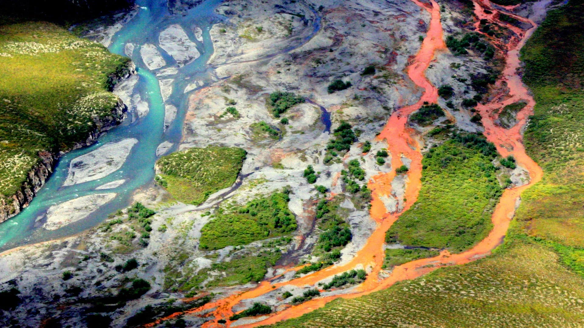
While sea level rise is a global concern, China faces a particularly dangerous combination of natural and human factors. Many of its largest cities — including Shanghai, Shenzhen and Hong Kong — sit in delta regions made of soft, water-saturated sediment that naturally sinks over time.
Human activities have accelerated this sinking.
“We’ve been able to quantify the natural rate of sea level rise for this area,” Lin said. “But human intervention, mostly groundwater extraction, makes it happen much faster.”
Subsidence, the gradual sinking or settling of the Earth’s surface, can occur through natural geological changes or from human-driven causes such as overuse of groundwater.
Delta Regions Under Pressure
To assess the risk to China’s deltas, the researchers combined geological records, measurements of land subsidence, and data on human impacts. They focused on the Yangtze River Delta and Pearl River Delta, two areas that are home to several megacities and key industrial zones.
In Shanghai, parts of the city sank more than one meter (around three feet) during the 20th century because of extensive groundwater pumping, Lin said. That rate is vastly higher than the current global average for sea level rise.
Delta regions are naturally flat and fertile, making them ideal for farming, transport, and urban development. But those same features make them exceptionally vulnerable to flooding.
“Centimeters of sea level rise will greatly increase the risk of flooding in deltas,” Lin said. “These areas are not only important domestically, they’re also international manufacturing hubs. If coastal risks happen there, the global supply chain will be vulnerable.”
Efforts to Slow the Sinking
Despite the alarming data, Lin noted that there are reasons for optimism. Some Chinese cities have begun taking effective steps to manage the problem. Shanghai, for example, has slowed its rate of subsidence by controlling groundwater extraction and reinjecting freshwater into underground aquifers.
“Shanghai now is not sinking that fast anymore,” Lin said. “They recognized the problem and started regulating their groundwater usage.”
The research team also created vulnerability maps to help local governments and city planners identify high-risk zones and prepare for future sea level rise.
A Global Lesson
Although the study focuses on China, its implications reach far beyond. Many major coastal cities, including New York, Jakarta and Manila, are built on low-lying plains and face similar threats.
“Deltas are great places, good for farming, fishing, urban development and naturally draw civilizations to them,” Lin said. “But they are really flat yet prone to human-caused subsidence, so sustained sea level rise could submerge them really fast.”
Modeling the Past to Protect the Future
The paper is an application of PaleoSTeHM, an open-source software framework for statistically modeling paleo-environmental data that Lin developed as a postdoctoral associate.
Praveen Kumar, a postdoctoral associate in the Department of Earth and Planetary Sciences, also contributed to the study.
The National Science Foundation and NASA supported the research.
CLICK HERE FOR MORE INFORMATION
https://www.sciencedaily.com/releases/2025/10/251023031627.htm