Earth is slowly peeling its continents from below, fueling ocean volcanoes

New research challenges long-held ideas about how volcanic islands form and how Earth’s interior stays dynamic.

Source:University of Southampton

Summary:Researchers discovered that continents don’t just split at the surface—they also peel from below, feeding volcanic activity in the oceans. Simulations reveal that slow mantle waves strip continental roots and push them deep into the oceanic mantle. Data from the Indian Ocean confirms this hidden recycling process, which can last tens of millions of years.Share:


FULL STORY

Hidden Forces Fuel Ocean Volcanoes
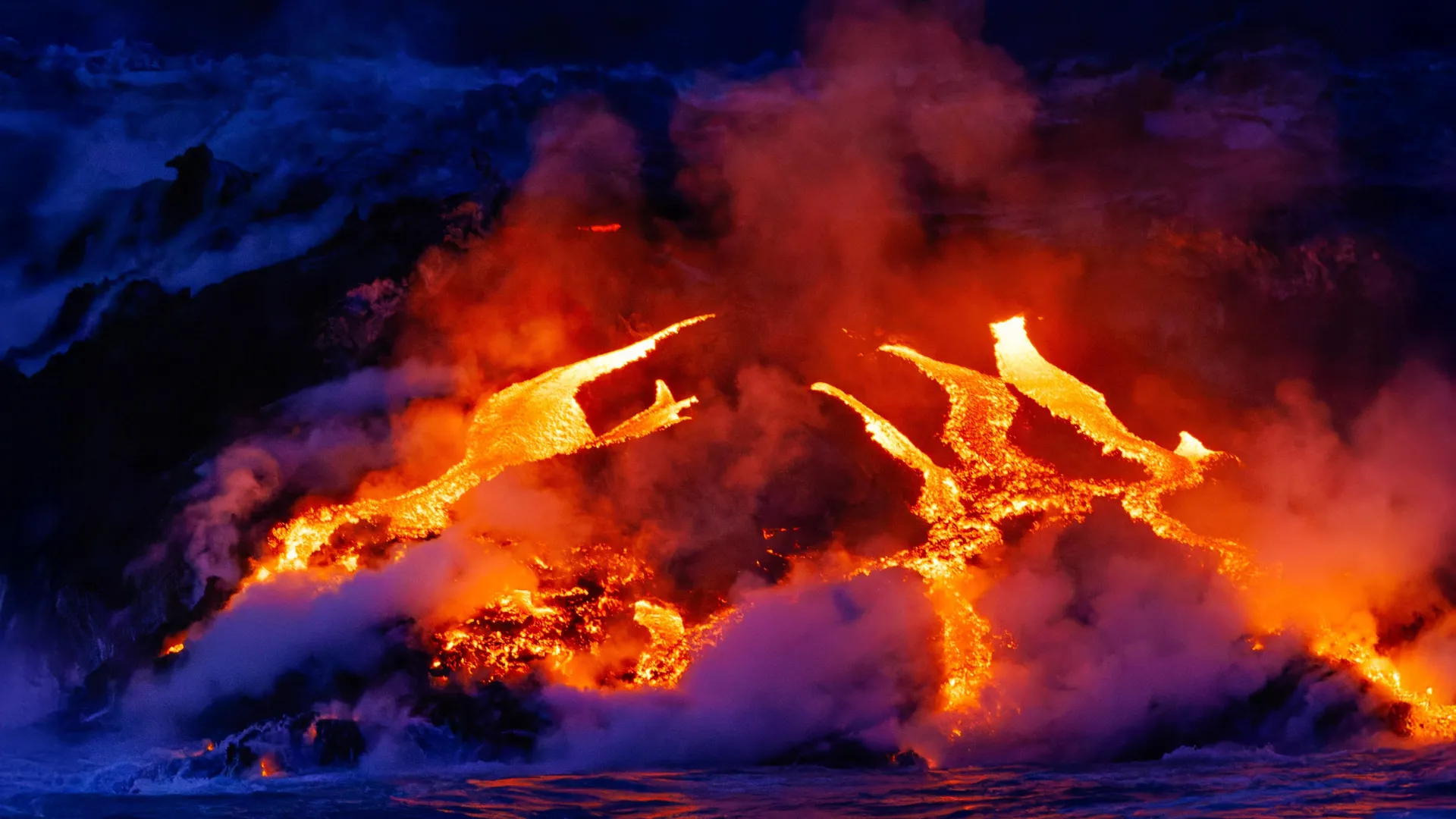
Continents slowly peel away from below, sending slivers deep into the oceanic mantle that fuel volcanic activity far from tectonic edges. This newfound process, traced through the Indian Ocean, reshapes how scientists understand Earth’s hidden geological engine. Credit: Shutterstock

Earth scientists have uncovered a slow and surprising process beneath our planet’s surface that helps fuel volcanic activity in the oceans.

Researchers from the University of Southampton found that fragments of continents are gradually stripped away from below and drawn into the oceanic mantle — the hot, mostly solid layer beneath the sea floor that slowly circulates. Once there, this continental material can power volcanic eruptions for tens of millions of years.

This discovery resolves a long-standing geological puzzle: why certain ocean islands located far from tectonic plate boundaries contain chemical signatures that look distinctly continental, even though they lie in the middle of vast oceans.

The study, published in Nature Geoscience, was conducted by an international team from the University of Southampton, GFZ Helmholtz Centre for Geosciences in Potsdam, the University of Potsdam, Queen’s University (Canada), and Swansea University.

Ancient chemical clues deep within the mantle

Ocean islands such as Christmas Island in the northeast Indian Ocean often contain unusually high concentrations of certain “enriched” elements that typically come from continents. Scientists have compared this mixing process to the motion of a cake mixer folding in older, recycled ingredients from deep within the Earth.

For years, geologists assumed these enriched elements came from ocean sediments pulled into the mantle when tectonic plates sink, or from columns of rising hot rock known as mantle plumes.

However, those explanations have limits. Some volcanic regions lack evidence of recycled crust, while others seem too shallow and cool to be driven by deep mantle plumes.

“We’ve known for decades that parts of the mantle beneath the oceans look strangely contaminated, as if pieces of ancient continents somehow ended up in there,” said Thomas Gernon, Professor of Earth Science at the University of Southampton and the study’s lead author. “But we haven’t been able to adequately explain how all that continental material got there.”

Continents are peeling from below

The researchers propose a new mechanism: continents not only split apart at the surface but also peel away from below, and across far greater distances than scientists once believed possible.

To test this, the team built computer simulations that recreated how the mantle and continental crust behave when stretched by tectonic forces.

Their results show that when continents begin to break apart, powerful stresses deep within the Earth trigger a slow-moving “mantle wave.” This rolling motion travels along the base of the continents at depths of 150 to 200 kilometers, disturbing and gradually stripping material from their deep roots.

The process happens at an incredibly slow rate — roughly a millionth the speed of a snail. Over time, these detached fragments are carried sideways for more than 1,000 kilometers into the oceanic mantle, where they feed volcanic activity for tens of millions of years.

Study co-author Professor Sascha Brune of GFZ in Potsdam explained, “We found that the mantle is still feeling the effects of continental breakup long after the continents themselves have separated. The system doesn’t switch off when a new ocean basin forms — the mantle keeps moving, reorganizing, and transporting enriched material far from where it originated.”

Clues from the Indian Ocean

To support their model, the team analyzed chemical and geological data from regions such as the Indian Ocean Seamount Province — a chain of volcanic formations that appeared after the breakup of the supercontinent Gondwana over 100 million years ago.

Their findings show that soon after Gondwana split apart, a pulse of magma unusually rich in continental material erupted to the surface. Over time, this chemical signature gradually faded as the flow of material from beneath the continents diminished. Notably, this happened without the presence of a deep mantle plume, challenging long-held assumptions about the source of such volcanism.

Professor Gernon added: “We’re not ruling out mantle plumes, but this discovery points to a completely new mechanism that also shapes the composition of the Earth’s mantle. Mantle waves can carry blobs of continental material far into the oceanic mantle, leaving behind a chemical signature that endures long after the continents have broken apart.”

The research also builds on the team’s earlier work showing that these slow, rolling mantle waves can have dramatic effects deep inside continents. Their previous studies suggest that such waves may help trigger diamond eruptions and even reshape landscapes thousands of kilometers away from tectonic boundaries.

CLICK HERE FOR MORE INFORMATION

https://www.sciencedaily.com/releases/2025/11/251112011806.htm
Deep-sea mining starves life in the ocean’s twilight zone

New research reveals that deep-sea mining waste could disrupt one of Earth’s most vital but least understood ecosystems.

Source:University of Hawaii at Manoa

Summary:Scientists have discovered that deep-sea mining plumes can strip vital nutrition from the ocean’s twilight zone, replacing natural food with nutrient-poor sediment. The resulting “junk food” effect could starve life across entire marine ecosystems.Share:


FULL STORY


Deep-Sea Mining Starves Life in the Ocean
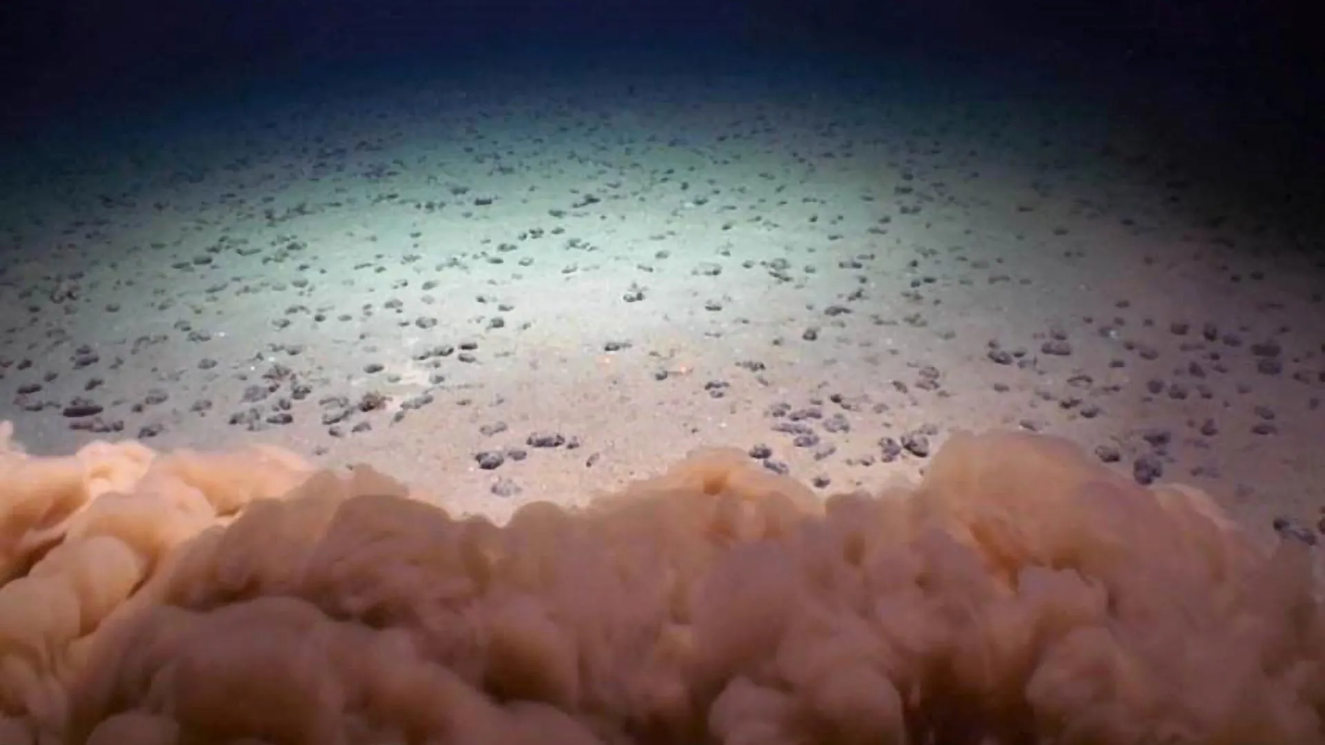
Nodules on the abyssal seafloor in the Clarion Clipperton Zone with a mud cloud from a scientific remotely-operated vehicle (ROV) touching down. Credit: UH/NOAA DeepCCZ Expedition

A new study from the University of Hawai’i (UH) at Mānoa, published on November 6 in Nature Communications, provides the first direct evidence that waste from deep-sea mining could disrupt vital ecosystems in the Pacific Ocean’s Clarion-Clipperton Zone (CCZ). This area, one of the most biologically rich regions of the deep sea, is now the focus of growing industrial interest. Researchers found that sediment discharged during mining operations could harm marine life in the midwater “twilight zone,” a key habitat between 200 and 1,500 meters below the surface that supports vast populations of tiny drifting animals called zooplankton — the foundation of the ocean’s food web.

The team determined that 53% of zooplankton and 60% of micronekton, which feed on zooplankton, would be affected by mining waste discharge. Such disturbances could ripple through the food chain, ultimately impacting larger predators such as fish, seabirds, and marine mammals.

Murky Plumes and “Junk Food” Sediment

“When the waste released by mining activity enters the ocean, it creates water as murky as the mud-filled Mississippi River. The pervasive particles dilute the nutritious, natural food particles usually consumed by tiny, drifting Zooplankton,” said Michael Dowd, lead author of the study and a graduate student in Oceanography at the UH Mānoa School of Ocean and Earth Science and Technology (SOEST).

“Micronekton, small shrimp, fish and other animals that swim, feed on zooplankton. Some migrate between the depths and near surface waters and they are consumed by fish, seabirds and marine mammals. Zooplankton’s exposure to junk food sediment has the potential to disrupt the entire food web.”

Measuring the Nutritional Impact of Deep-Sea Mining

The research, titled “Deep-sea mining discharge can disrupt midwater food webs,” examined the effects of sediment plumes released during a 2022 mining test in the CCZ. This vast region is targeted for the extraction of polymetallic nodules that contain valuable minerals such as cobalt, nickel, and copper — key components for electric vehicles and renewable technologies.

By collecting and analyzing water samples from the depths where waste was discharged, the scientists found that mining particles contained far fewer amino acids, an important measure of nutritional quality, than the natural particles that typically nourish marine organisms.

“This isn’t just about mining the seafloor; it’s about reducing the food for entire communities in the deep sea,” said co-author Erica Goetze, a SOEST oceanography professor and marine zooplankton specialist. “We found that many animals at the depth of discharge depend on naturally occurring small detrital particles — the very food that mining plume particles replace.”

At present, around 1.5 million square kilometers of the CCZ are licensed for deep-sea mining exploration, reflecting the surge in global demand for minerals used in low-carbon technologies.

Disrupting an Ecosystem Built on Scarcity

During the mining process, nodules are collected from the seafloor along with surrounding sediments and seawater, then pumped to a surface vessel where nodules are separated from the waste material. The leftover sediment and fine nodule fragments are then released back into the ocean. Some companies have proposed releasing this waste within the twilight zone, but the environmental consequences of such practices have remained largely unknown — until now.

These findings underscore a major regulatory gap, as no international rules currently govern where or how mining waste can be discharged.

The twilight zone teems with life, including krill, squid, fish, octopus, and delicate jelly-like species. Many of these organisms travel upward toward the surface each night to feed and then descend again by day, transporting carbon to the deep ocean in the process. This vertical migration helps maintain the planet’s carbon balance and supports the health of marine ecosystems worldwide.

“Our research suggests that mining plumes don’t just create cloudy water — they change the quality of what’s available to eat, especially for animals that can’t easily swim away,” said co-author Jeffrey Drazen, a deep-sea ecologist and SOEST professor of oceanography. “It’s like dumping empty calories into a system that’s been running on a finely tuned diet for hundreds of years.”

Global Implications for Marine Food Webs

The study raises concerns that large-scale mining could trigger widespread and long-lasting changes in ocean ecosystems if it proceeds without strict safeguards. Even commercial fisheries could be affected; for instance, tuna populations migrate through the CCZ, meaning the impacts of mining could extend to seafood consumed around the world.

“Deep-sea mining has not yet begun at a commercial scale, so this is our chance to make informed decisions,” said co-author Brian Popp, SOEST professor of Earth sciences and an expert in marine stable isotope biogeochemistry. “If we don’t understand what’s at stake in the midwater, we risk harming ecosystems we’re only just beginning to study.”

A Call for Responsible Regulation

The authors hope their results will guide policy discussions currently underway at the International Seabed Authority and inform environmental reviews conducted by the National Oceanic and Atmospheric Administration. They stress the importance of developing international rules to protect marine ecosystems from surface waters to the deep sea.

“Before commercial deep-sea mining begins, it is essential to carefully consider the depth at which mining waste is discharged,” added Drazen. “The fate of these mining waste plumes and their impact on ocean ecosystems varies with depth, and improper discharge could cause harm to communities from the surface to the seafloor.”

Additional contributors to the study include UH Mānoa oceanography graduate students Victoria Assad and Alexus Cazares-Nuesser, and oceanography professor Angelicque White.

CLICK HERE FOR MORE INFORMATION

https://www.sciencedaily.com/releases/2025/11/251108012850.htm

Water main break floods streets, swamps cars, damages homes in North Philadelphia near Temple University campus

By Jessica MacAulay, Scott Hezlep, Madeleine Wright

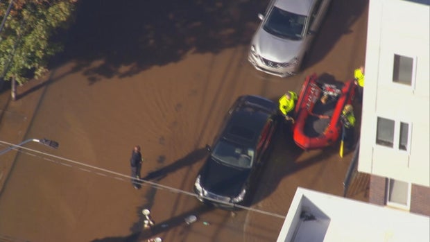
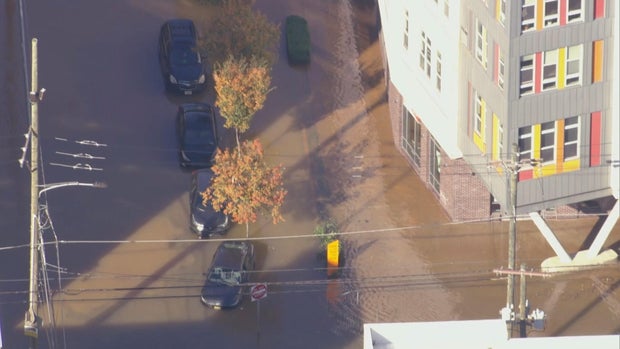
A large water main broke, gushing out 4 million gallons of water into city streets, creating a muddy mess for North Philadelphia residents near Temple University’s campus on Friday.

Chopper 3 was over the water main break at North 9th and West Berks streets shortly after 10 a.m., where crews worked to stop the flow, which took about two hours, officials said. Emergency response crews even used what appeared to be an inflatable raft to navigate the substantially flooded streets Friday morning.

lns-water-main-break-9th-and-berks-102425-frame-59074.jpg
CBS News Philadelphia

The Philadelphia Water Department said the water main is 30 inches wide, and the break was first reported at 8:45 a.m. The department said it was one of the largest breaks they’ve had in a while.

Officials said the water main is from 1879, and when it broke, gallons of water leaked out, flooding city streets. The water main break is just around the block — .2 miles away — from Temple University’s Kardon Atlantic Apartments.

lns-water-main-break-9th-and-berks-102425-frame-50895.jpg
CBS News Philadelphia

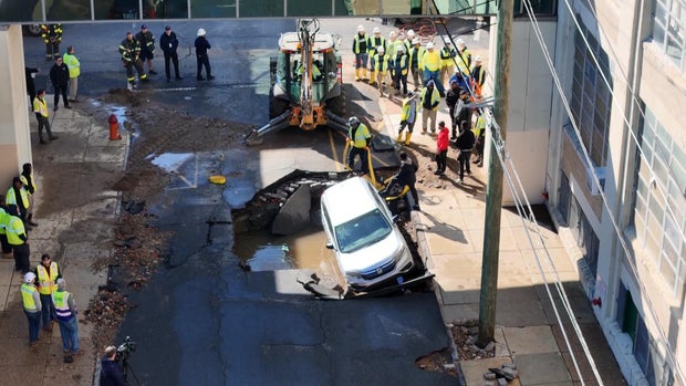
A giant hole was cracked in the ground at the intersection of North 9th Street and Montgomery Avenue. When the main broke, it caused part of the street above it to collapse, damaging a parked car owned by a Temple University chemistry student, Brian Rafferty.

Rafferty said he was getting ready for chemistry class when police called him and said his car was in a watery hole. 

“It was, you know, heartbreaking to see, ’cause you know the guys were telling me that it’s probably going to be totaled,” he said. 

While the cause of the break is still unknown, Philadelphia’s aging infrastructure has been a challenge for the system. 

“We have about 7,000 miles of water mains and sewers altogether, and that is a system that has been built over the course of 200 years, so we are continually replacing those pipes,” Brian Rademaekers, a spokesperson for PWD, said.

wright-4pm-pkg-n-philly-watermain-break-102425-frame-624.jpg
CBS News Philadelphia

No one lost water service, but landlord Boris Keisserman said the basement of his rental property flooded. 

“Oh, it’s awful. It’s green. Dark green, it’s like I said about 4 feet of the water down there,” he said. “This is a new construction house which I just finished a few months ago. No one lived there. Thank God. I was about to rent it out.”

The city said it plans to reimburse residents whose basements were flooded. 

Once crews finish repairing the main, the Streets Department will begin fixing the road, a process expected to take several days.

In:

CLICK HERE FOR MORE INFORMATION

https://www.cbsnews.com/philadelphia/news/water-main-break-north-philadelphia-temple/?intcid=CNM-00-10abd1h

Heat Waves Are Becoming More Frequent and Intense in Rivers

Heat waves are becoming more frequent and intense across the U.S., so perhaps this summer you took a dip in a river to cool off. However, according to new research it might not have been as refreshing as it once was. 

Credit: Dillon Groves/Unsplash

A new study from Penn State found that heat waves are happening in rivers too, and they’re accelerating faster than and lasting nearly twice as long as the heat waves in the air. It’s a surprising finding, given that many rivers are fed by snowmelt and underground streams, but the team found that periods of abnormally high temperatures in rivers are becoming more common, more intense, and longer-lasting than they were 40 years ago. Lead author Li Li (李黎) wrote in The Conversation that the increased heat puts stress on aquatic ecosystems and can also raise the cost of treating drinking water. 

The team collected river data at nearly 1,500 sites in the contiguous United States between 1980 and 2022. They found that temperatures rose above 59 °F (15 °C)—a threshold that can stress many species—at 82 percent of study areas for an average of 11.6 days per year. The places where the waters warmed the fastest were in the Northeast, the Rocky Mountains, and Appalachia.

The authors say climate change is driving river heat waves, as rising air temperatures affect water conditions. Changing precipitation patterns with global warming are shrinking winter snowpacks, leaving less meltwater to support river health. Low, slow-moving water warms more easily and holds less oxygen, creating dangerous conditions for aquatic life and increasing the chances of large-scale die-offs. The study adds that human activities, such as dams and agriculture, play a secondary role in shaping how and where rivers are most vulnerable to these impacts.

The study was published in the journal Proceedings of the National Academy of Sciences (PNAS).

CLICK HERE FOR MORE INFORMATION

https://h2oradio.org/this-week-in-water/your-dogs-carbon-paw-print

Alaska’s Salmon River Once Ran Pure and Clear. Now, It’s Orange Because of Climate Change.

In 1977, author John McPhee wrote his nonfiction classic “Coming into the Country.” It describes how he and a group of men canoed the Salmon River in the Brooks Range of Alaska to assess its potential for Wild and Scenic status—a designation that would provide long-term federal protection. On their trip, they found abundant Arctic grayling (Thymallus arcticus), chum salmon (Oncorhynchus keta)—and as McPhee writes, “the clearest, purest water I have ever seen flowing over rocks,” which allowed them to “see down 15 feet in pools.”

In Alaska’s Brooks Range, rivers once clear enough to drink from now run orange and hazy with toxic metals.  |  Credit: Taylor Roades

Not anymore. These days, the Salmon River runs orange—contaminated with toxic metals. Not because of acid mine drainage—although the water has the same ocher color—but because of climate change. According to new research from the University of California, Riverside, permafrost—the frozen Arctic soil that has locked away minerals for thousands of years—is beginning to thaw with a warming planet. As it thaws, water and oxygen creep into the exposed soil, triggering the breakdown of sulfide-rich rocks and creating sulfuric acid that leaches naturally occurring metals like iron, cadmium, and aluminum from rocks into the river, which poisons fish and damages ecosystems. 

According to a press release, the team’s analysis confirmed that thawing permafrost was unleashing geochemical reactions that oxidize sulfide-rich rocks like pyrite, generating acidity and mobilizing a wide suite of metals, including cadmium, which accumulates in fish organs and could affect animals like bears and birds that eat fish. The authors say that levels for several of the metals exceed EPA toxicity thresholds for aquatic life. Additionally, the cloudy water reduces the amount of light reaching the bottom of the river and smothers insect larvae that salmon and other fish eat.

According to the study, the Salmon River is not alone. A recent inventory in the same mountain range identified 75 streams that have recently turned orange and turbid. The authors say it’s likely happening across the Arctic. Wherever there’s the right kind of rock and thawing permafrost, the process can start. Unfortunately, co-author, Tim Lyons, said once it starts, it can’t be stopped, calling it “another irreversible shift driven by a warming planet.”

The study was published in the Proceedings of the National Academy of Sciences.

CLICK HERE FOR MORE INFORMATION

https://h2oradio.org/this-week-in-water/a-high-five-for-the-high-seas

Experts Say Urgent Action to Cut Water Use Is Needed in the Colorado River Basin

According to experts, water policy makers and water users in the Colorado River Basin need to get their acts together to substantially cut amounts they take from the river.

At Lees Ferry where river trips, both recreational and scientific, launch.  |  Credit: public domain

In a new analysis, six experts—Jack Schmidt, Anne Castle, John Fleck, Eric Kuhn, Kathryn Sorensen, and Katherine Tara—released a report saying that immediate action is needed, especially if this dry year is repeated next year. They estimate that consumptive use will exceed the flow of the river by no less than 3.6 million-acre feet, and the two main reservoirs, Lake Mead and Lake Powell, would absorb the bulk of that shortfall, causing them to be depleted and reduced to dangerous levels. Last winter’s snowpack was miserable, and the forecast for the coming season is for less precipitation and warmer temperatures.

However, leaders in the Upper Basin states of Colorado, Utah, New Mexico, and Wyoming, have been unable to agree with their lower basin neighbors of California, Arizona, and Nevada on how to cut water usage along the river.  The two basins have been discussing how to allocate the shortages when the current rules expire next year. The experts who wrote the report are urging the federal government to impose cutbacks along the river, according to the Los Angeles Times.

The animosity between the Upper and Lower Basins appears to have torpedoed the Trump administration’s nomination of Ted Cooke to be the commissioner of the Bureau of Reclamation charged with managing the river. Cooke had been a water manager in Arizona for more than 20 years, which was viewed as disturbing in the Upper Basin states, and would make him biased in favor of the Lower Basin, according to KUNC. 

The White House asked him to withdraw his nomination, which he told the Las Vegas Review-Journal, was based on vitriol the likes of which he had never seen. He said that officials from Colorado, Utah, Wyoming, and New Mexico had urged members of Congress to oppose his nomination.

CLICK HERE FOR MORE INFORMATION

https://h2oradio.org/this-week-in-water/a-high-five-for-the-high-seas

The Red Sea that vanished and the catastrophic flood that brought it back

KAUST researchers find the Red Sea experienced a massive disruption 6.2 million years ago completely changing its marine life.

Source:King Abdullah University of Science & Technology (KAUST)

Summary:Researchers at KAUST have confirmed that the Red Sea once vanished entirely, turning into a barren salt desert before being suddenly flooded by waters from the Indian Ocean. The flood carved deep channels and restored marine life in less than 100,000 years. This finding redefines the Red Sea’s role as a key site for studying how oceans form and evolve through extreme geological events.Share:


FULL STORY


When the Red Sea Became a Desert
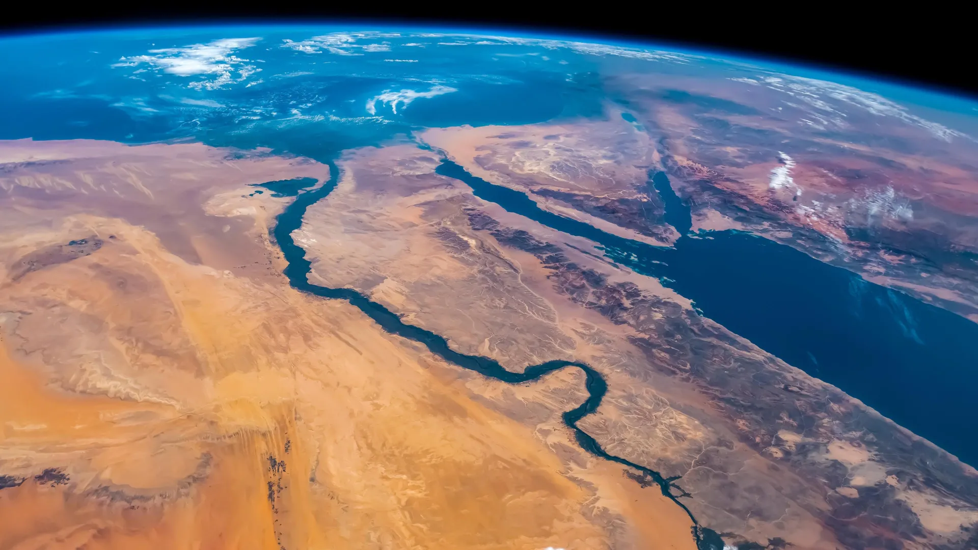
Around 6.2 million years ago, the Red Sea completely dried up before a monumental flood from the Indian Ocean refilled it in less than 100,000 years. Credit: Shutterstock

Scientists at King Abdullah University of Science and Technology (KAUST) have provided conclusive evidence that the Red Sea completely dried out about 6.2 million years ago, before being suddenly refilled by a catastrophic flood from the Indian Ocean. The findings put a definitive time on a dramatic event that changed the Red Sea.

Using seismic imaging, microfossil evidence, and geochemical dating techniques, the KAUST researchers showed that a massive change happened in about 100,000 years – a blink of an eye for a major geological event. The Red Sea went from connecting with the Mediterranean Sea to an empty, salt-filled basin. Then, a massive flood burst through volcanic barriers to open the Bab el-Mandab strait and reconnect the Red Sea with the world’s oceans.

“Our findings show that the Red Sea basin records one of the most extreme environmental events on Earth, when it dried out completely and was then suddenly reflooded about 6.2 million years ago,” said lead author Dr. Tihana Pensa of KAUST. “The flood transformed the basin, restored marine conditions, and established the Red Sea’s lasting connection to the Indian Ocean.”

How the Indian Ocean Flooded the Red Sea

The Red Sea was initially connected from the north to the Mediterranean through a shallow sill. This connection was severed, drying the Red Sea into a barren salt desert. In the south of the Red Sea, near the Hanish Islands, a volcanic ridge separated the sea from the Indian Ocean. But around 6.2 million years ago, seawater from the Indian Ocean surged across this barrier in a catastrophic flood. The torrent carved a 320-kilometer-long submarine canyon that is still visible today on the seafloor. The flood rapidly refilled the basin, drowning the salt flats and restoring normal marine conditions in less than 100,000 years. This event happened nearly a million years before the Mediterranean was refilled by the famous Zanclean flood, giving the Red Sea a unique story of rebirth.

Why the Red Sea Matters Geologically

The Red Sea formed by separation of the Arabian Plate from the African Plate beginning 30 million years ago. Initially, the sea was a narrow rift valley filled with lakes, then became a wider gulf when it was flooded from the Mediterranean 23 million years ago. Marine life thrived initially, as seen by the fossil reefs along the northern coast near Duba and Umlujj. However, evaporation and poor seawater circulation increased salinity, causing the extinction of marine life between 15 and 6 million years ago. Additionally, the basin was filled with layers of salt and gypsum. This culminated in complete desiccation of the Red Sea. The catastrophic flood from the Indian Ocean restored marine life in the Red, which persists in the coral reefs to the present.

All in all, the Red Sea is a natural laboratory for understanding how oceans are born, how salt giants accumulate, and how climate and tectonics interact over millions of years. The discovery highlights how closely the Red Sea’s history is linked with global ocean change. It also shows that the region has experienced environmental extremes before, only to return as a thriving marine ecosystem.

“This paper adds to our knowledge about the processes that form and expand oceans on Earth. It also maintains KAUST’s leading position in Red Sea research,” said co-author KAUST Professor Abdulkader Al Afifi.

CLICK HERE FOR MORE INFORMATION

https://www.sciencedaily.com/releases/2025/10/251007081831.htm

Local News

Water restored in Novi area after transmission line break, many still under boil water advisory

By Paula Wethington,

 Nick Lentz

Water service was restored by Friday morning to the communities affected by a massive water main break Thursday morning in and near Novi, Michigan, the Great Lakes Water Authority says. 

But disruptions to daily routines, including boil water advisories, school closures and the road closing along 14 Mile Road continue for thousands of people who live, work or go to school in Commerce, Walled Lake and parts of Novi. The Great Lakes Water Authority has sent water trucks into the affected neighborhoods to help provide residents and businesses with water, and in some cases, businesses arranged for water bottles and portable toilets as a temporary step.

Repairs continue 

Great Lakes Water Authority, which is the regional water system in charge of the 42-inch transmission line that broke on 14 Mile Road, said utility crews worked all day Thursday and into the night to pressurize a 24-inch line and get water service restored. 

Service was returned to all affected communities by Friday morning, GLWA said, although utility crews will remain on site until repairs are complete on the 42-inch transmission line.

The City of Novi said its residents should be noticing improved water pressure, although it may not yet be at full strength. “The system is stable, but it’s a good idea to fill your bathtub or other containers with water as a backup supply in case service is interrupted again,” the city of Novi said Friday morning. 

City officials say it will take several weeks for repairs to be finished. Crews completed isolating the broken water main on Friday afternoon and are now flushing the system before water quality testing can start. 

Once flushing is complete, Great Lakes Water Authority crews will begin collecting water samples. Per state regulations, two consecutive clean samples must be taken 24 hours apart before a boil water advisory can be lifted. Novi officials said the first sample could be collected on Sunday “if all goes as planned.” 

Officials said on Saturday that it’s hopeful the advisory can be lifted on Tuesday, but asked residents to be prepared for it to remain in place until Wednesday in case more testing is needed. 

Currently, 14 Mile Road between Welch Road and M-5 will remain closed to through traffic. 

Boil water advisories 

The Great Lakes Water Authority lifted a boil water alert that was issued as a precaution for the City of Wixom late Thursday. 

boil-water-map-0926.jpg
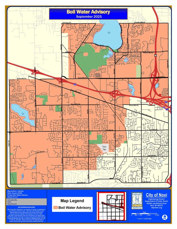
The city of Novi, Michigan, posted this map of a boil water advisory region on Sept. 26, 2025, the day after a massive water main break on 14 Mile Road.City of Novi, Michigan

But the boil water advisories for Walled Lake and the Novi neighborhoods that lost water remain in effect until further notice. The city of Novi said Friday morning that it expects the boil water advisory for its residents to remain in effect until Sunday.

Outdoor water use 

An outdoor water use restriction was posted for Novi and for nearby West Bloomfield, with residents asked to turn off irrigation systems to help ease water demand in the region.

GLWA didn’t specifically mention outdoor water use in its Friday morning report, but the water authority is asking all residents in the affected communities “to conserve water resources over the weekend to limit any additional stress on the system.”

School closures

Several schools in the affected communities were closed Thursday. The announcements for Friday include:

  • Novi Christian Academy announced it will be closed Friday. 
  • Detroit Catholic Central High School will be in session, but students are asked to bring their own water bottles.

CLICK HERE FOR MORE INFORMATION

https://www.cbsnews.com/detroit/news/water-main-break-novi-michigan-day-2/?intcid=CNM-00-10abd1h

Local News

Shedd Aquarium study on fish reproduction in Chicago River indicates continuing recovery from pollution

By Adam Harrington

A new study by the Shedd Aquarium has found that the Chicago River system continues to recover from pollution, as evidenced by the fish species that have been spawning in the river system.

A report on the study, “Larval fish community of the urbanized Chicago River,” was published Wednesday. It was authored by Dr. Austin Happel, a research biologist at the Shedd Aquarium who focuses on freshwater ecosystems.

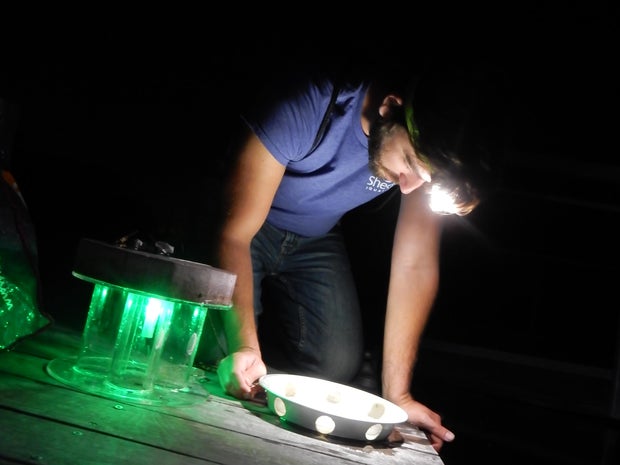
The study analyzed the species of fish that spawn in the Chicago River to sustain resilient and biodiverse fish communities, the Shedd explained in a news release. Using light traps at 10 locations in the river between 2020 and 2022, researchers collected 2,211 larval fish — and their DNA found the fish belonged to 24 different species.

light-trap-on-south-branch-of-river-1.jpg
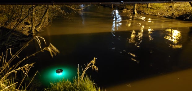
A light trap on the South Branch of the Chicago River to capture fish larvae.Shedd Aquarium

“This research represents the first documentation of larvae from fish species occurring within the Chicago River, indicating that recovery and restoration efforts allow at least 24 species to successfully spawn and reach the larval stage,” Happel said in the news release. “Our previous studies showed that improvements to water quality in the river increased biodiversity, and now we have more positive news as populations are proliferating locally within the river.”

The Chicago River: A history of pollution

The reversal of the flow of the Chicago River is a point of Chicago pride that youngsters learn in history classes at local schools. On Jan. 2, 1900, the Sanitary District of Chicago — a predecessor to the Metropolitan Water Reclamation District — completed the massive undertaking by digging the 28-mile Sanitary and Ship Canal heading southwest out of the city.

Before the reversal, human and industrial waste would flow from the river right into Lake Michigan — the source of Chicago’s drinking water, then as now. The oft-repeated story that 90,000 people died of cholera and typhoid fever after a storm in Chicago sent sewage into the lake in 1885 has been debunked, but nevertheless, the flow of disgusting material from the river into the lake was a monumental public health hazard.

However, while the reversal of the flow of the river away from Lake Michigan protected the lake itself and the city’s drinking water, the Chicago River system remained polluted, neglected, and smelly as the city grew and developed.

As explained by Friends of the Chicago River, the city went on treating the river system like an alley — dumping trash and sewage and damaging conditions for people and wildlife alike.

“After more than 100 years of this abuse, the Chicago River and the others were so polluted that when the Clean Water Act passed in 1972, officials were convinced no one would ever want to fish or swim here — and set the standards incredibly low,” Friends of the Chicago River wrote.

But for half a century now, efforts have been under way to clean up the river. The Metropolitan Water Reclamation District of Greater Chicago set up the Deep Tunnel system to reduce flooding and improve waterway quality. Meanwhile, Friends of the Chicago River — founded in 1979 — undertook habitat restoration and long-range planning efforts for river improvement, with efforts ranging from planting wetlands vegetation to encouraging river-friendly land development.

Conditions on the Chicago River have improved to the point where a Chicago River Swim is set for this coming Saturday — the first such event in 95 years. The Shedd Aquarium study documents that the diversification of fish species in the river is also evidence that things are on the right track.

brh-5931.jpg
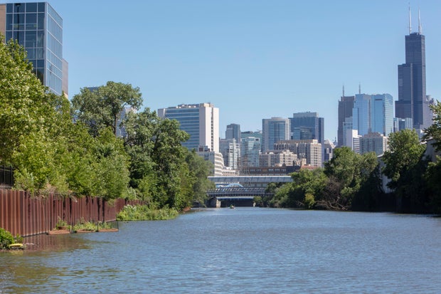
Chicago RiverBrenna Hernandez

Signs of hope in the Chicago River fish community

The fish community in the Chicago River has been rising in both numbers and species diversity since the 1970s as conditions in the river have improved, the Shedd Aquarium study said.

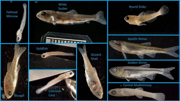
The study found species now reproducing in the Chicago River include popular sport fish like the black crappie, bluegill, and largemouth bass, and forage fish like the gizzard shad, golden shiner, and spotfin shiner. Larvae of brook silverside and mimic shiner were also found — which the Shedd found to be a pleasant surprise, as these fish were believed to be intolerant of pollution, the Shedd Aquarium said.

10-fish-species-1.jpg
Ten fish species found on the Chicago RiverShedd Aquarium

The peak abundance of fish larvae was found in July, as water temperatures reached the low 70s, the aquarium said.

The study also compared the fish larvae species found in the North Branch of the Chicago River versus the South Branch.

The North Branch of the River generally follows its historical path flowing southeast, though the North Shore Channel was dug between 1907 and 1910 to ensure further that sewage flowed into the river system and away from Lake Michigan. Before the flow reversal of 1900, the South Branch of the river flowed northeast into the Main Branch and on to Lake Michigan, but since the reversal, the South Branch has flowed southwest into the Sanitary and Ship Canal.

The Shedd Aquarium study found that species considered less tolerant of pollution were more common in the South Branch, while species more tolerant of pollution were seen more in the North Branch.

The finding indicates that “some combination of suitable substrate, submerged vegetation, and water quality and flow are most likely present in the South Branch.”

The study said these areas on the South Branch that may be favorable to the spawning of pollution-intolerant fish species could include backwater areas such as barge slips that are no longer used in Bubbly Creek. Bubbly Creek is the terminal South Fork of the river’s South Branch that was infamously once a dump site for animal remains from the Union Stockyards, but the study said the old barge slips may now be effective fish nursery habitats that offer both abundant food and protection from predators.

larval-sampling-north-side-jun-8-2020-1.jpg
Dr. Austin Happel studies fish larvae on the Chicago River.Shedd Aquarium

Happel is also researching how floating wetlands — which the Shedd Aquarium and the nonprofit Urban Rivers have been installing on the river system over the past several years — could also be affecting fish reproduction.

“As people continue to care about and conserve this critical freshwater ecosystem, we hope to see increases in the number of fish spawning in the system,” Happel said in the Shedd Aquarium news release. 

The aquarium said the study could be taken as a sign of hope for other heavily modified urban waterways, and insights on how to support fish communities to spawn and grow.

The study also demonstrates how restoration can return wildlife to a waterway, the aquarium said, emphasizing that healthy fish populations mean healthier aquatic environments overall.

The study was published in the Journal of Great Lakes Research.

CLICK HERE FOR MORE INFORMATION

https://www.cbsnews.com/chicago/news/shedd-aquarium-study-fish-reproduction-chicago-river/?intcid=CNM-00-10abd1h

Local News

Florida’s springs face pollution, climate threats as iconic waters risk losing natural beauty

Seen from the air, a Florida freshwater spring is a bit of liquid heaven, luring humans and wildlife to enjoy its aquamarine cool. With at least 1,000 of them — more than any other state — the springs serve as beaches for large swaths of central and northwestern Florida far from the ocean, with teenagers backflipping from docks and snorkelers peering into the crystalline depths.

But these treasures are under threat from agricultural pollution, rapid development and climate change.

Florida’s fragile freshwater springs under growing strain

Some places, such as fast-growing Zephyrhills in west-central Florida, have paused some construction as it struggles to stay within limits on the drinking water it can withdraw from a vast underground aquifer. Zephyrhills is home to Crystal Springs, source of the bottled water named after the town and several other brands.

“We really had to do something,” said Steven Spina, a member of the town council. “A lot of residents thought it was a good thing. People were happy to see us take a breath.”

The Floridan Aquifer: lifeline for 90% of the state’s drinking water

Covering an estimated 100,000 square miles (250,000 square kilometers), the underground Floridan Aquifer is the source of 90% of Florida’s drinking water. Because of the porous nature of the state’s bedrock, millions of gallons of water find their way to the surface in the form of clear, clean springs that, in turn, feed into rivers.

The highest concentration of springs are in central and northern Florida, including most of the 30 “first magnitude” springs — those that discharge at least 65 million gallons of water every day. All but four of them are considered polluted.

“We just have too much pollution going into the ground and too much water coming out of the ground,” said Ryan Smart, executive director of the nonprofit Florida Springs Council. “And when you get that combination, you end up with springs that are no longer blue and vibrant and full of life.”

Runoff, farming and algae blooms choke spring ecosystems

In rural Florida, runoff from fertilizers and pesticides used in farm fields is a major part of the problem. Fertilizers containing phosphates and nitrogen promote algae blooms that can suffocate a spring. Livestock waste contributes, too.

“When that algae covers everything, then you lose all of the seagrasses. The seagrasses are the forests of the water,” Smart said. “Then you begin to lose the biodiversity. And it even puts our drinking water at risk.”

Development and tourism add pressure to Florida’s springs

Elsewhere in Florida, rampant development is the threat. With over 1,000 people moving to Florida every day, more housing subdivisions are sprouting, along with the roads, strip malls, restaurants, golf courses and everything else that comes with them.

That means more paved surfaces that keep rainwater from percolating down into the aquifer and more pollutant-laden runoff from lawn fertilizers, parking lots, ever-widening roads and sometimes septic tanks. It also means more and more people, many of whom enjoy tubing, paddleboarding, kayaking and swimming in the springs.

It gets so busy in summer at some springs located in state and local parks that entry is halted by late morning. At Ichetucknee Springs State Park north of Gainesville, the daily limit of 750 tubers on the upper river is often reached within an hour after the park opens.

Kaelin Gibbs, on vacation in June with his family from Georgia, was swimming in the Blue Hole Spring along the Ichetucknee River.

“This is simply incredible; the water is cool and clear,” said Gibbs. “We’ve been to Florida’s beaches and to Orlando. There is no comparison to how beautiful this spring is.”

But that’s in peril, said Dennis Jones, a Republican former legislator deeply involved in springs issues. He said the volume of permits being issued for water use isn’t sustainable.

“You cannot keep taking water out of the aquifer because it’s not an endless supply,” Jones said.

Mining, climate change and saltwater intrusion worsen threats

Phosphate mining has also taken a toll on springs. Their operations require a great deal of water, which reduces water pressure available for springs. Some have died almost completely from mining and other factors, including White Sulphur Springs in north Florida, which was a sacred place for Native Americans and later a tourist resort that attracted famous visitors such as Henry Ford and Theodore Roosevelt.

A more subtle threat to the health of springs involves Earth’s changing climate. It is altering rainfall patterns around the globe, threatening the balance that feeds Florida’s springs.

In addition, some springs along the coasts are facing an intrusion of salt water, according to the Southwest Florida Water Management District. Four major springs are becoming increasingly brackish because of sea level rise and declining rainfall.

“As a result, freshwater vegetation has a hard time surviving in this saltier environment and unwanted vegetation moves in,” the district said in a website post.

State funding, lawsuits and grassroots activism aim to save springs

Florida spends billions every year on water quality projects, including about $800 million this year for Everglades restoration work. State funding for springs runs about $50 million a year, according to state documents.

Two state efforts at improving springs’ quality, both around a decade old, remain bottled up in court and administrative challenges. One would strengthen rules for permits to draw water from the major springs. The other would enhance rules to reduce the amount of nutrients such as nitrogen and phosphates that goes into springs that are considered impaired.

Jones, the former legislator, said lobbying by powerful agricultural interests and related political pressures have blocked progress on the nitrogen reduction plan that was expected to take about 20 years.

“We’ve burned up almost 10 years and they haven’t got on stage one. We got more nitrates now than when we started,” Jones said.

In Congress, U.S. Rep. Randy Fine recently filed a bill that would create a Florida Springs National Park across several counties, centered around the Ocala National Forest. Fine said in a statement the designation would protect the springs and increase funding. “Our Florida springs are something unique, not just to Florida but to the country,” Fine said.

It costs bottling companies just $115 for a permit allowing them to withdraw millions of gallons of water in perpetuity. But they do pay local taxes.

Blue Triton, the company that bottles Zephyrhills water, pays about $600,000 a year in taxes for things like schools, public safety and so forth, said Spina of the city council.

“They are one of our largest taxpayers,” he said.

Though they have challenges, Florida’s freshwater springs have energetic friends, too.

Michelle Jamesson loves the springs; she grew up swimming in one and is determined to help protect them for future generations. She volunteers for SpringsWatch Citizen Science Program, coordinating and working with other volunteers for monthly tests on the Wekiva River, north of Orlando.

They test water quality, take photos of underwater vegetation, count birds and more, seeking to spot any big changes that may require action. The Wekiva is fairly stable, she said, though it carries a lot of excess nutrients.

“The wildlife and the ecology, and all of it — it’s so full of life,” Jamesson said.

___

The Associated Press receives support from the Walton Family Foundation for coverage of water and environmental policy. The AP is solely responsible for all content. For all of AP’s environmental coverage, visit https://apnews.com/hub/climate-and-environment.

CLICK HERE FOR MORE INFORMATION

https://www.cbsnews.com/miami/news/florida-springs-water-pollution-climate-change-report/?intcid=CNM-00-10abd1h