Earth is slowly peeling its continents from below, fueling ocean volcanoes

New research challenges long-held ideas about how volcanic islands form and how Earth’s interior stays dynamic.

Source:University of Southampton

Summary:Researchers discovered that continents don’t just split at the surface—they also peel from below, feeding volcanic activity in the oceans. Simulations reveal that slow mantle waves strip continental roots and push them deep into the oceanic mantle. Data from the Indian Ocean confirms this hidden recycling process, which can last tens of millions of years.Share:


FULL STORY


Hidden Forces Fuel Ocean Volcanoes
Continents slowly peel away from below, sending slivers deep into the oceanic mantle that fuel volcanic activity far from tectonic edges. This newfound process, traced through the Indian Ocean, reshapes how scientists understand Earth’s hidden geological engine. Credit: Shutterstock

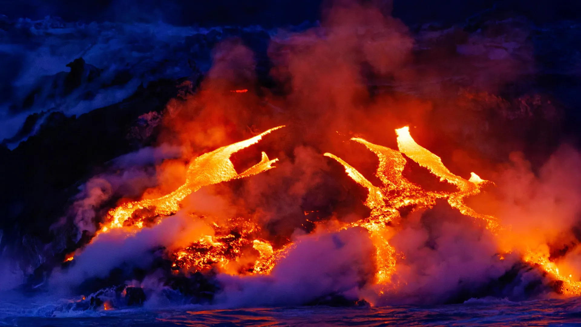
Earth scientists have uncovered a slow and surprising process beneath our planet’s surface that helps fuel volcanic activity in the oceans.

Researchers from the University of Southampton found that fragments of continents are gradually stripped away from below and drawn into the oceanic mantle — the hot, mostly solid layer beneath the sea floor that slowly circulates. Once there, this continental material can power volcanic eruptions for tens of millions of years.

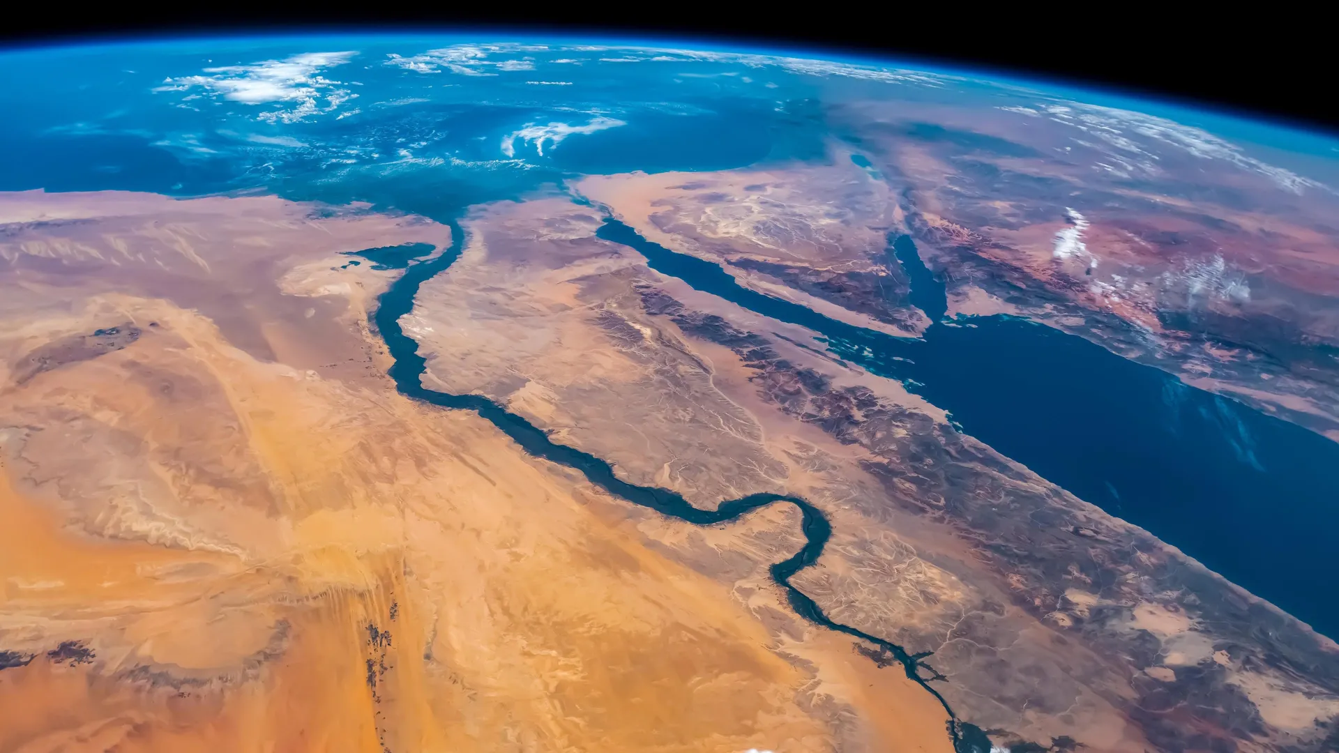
This discovery resolves a long-standing geological puzzle: why certain ocean islands located far from tectonic plate boundaries contain chemical signatures that look distinctly continental, even though they lie in the middle of vast oceans.

The study, published in Nature Geoscience, was conducted by an international team from the University of Southampton, GFZ Helmholtz Centre for Geosciences in Potsdam, the University of Potsdam, Queen’s University (Canada), and Swansea University.

Ancient chemical clues deep within the mantle

Ocean islands such as Christmas Island in the northeast Indian Ocean often contain unusually high concentrations of certain “enriched” elements that typically come from continents. Scientists have compared this mixing process to the motion of a cake mixer folding in older, recycled ingredients from deep within the Earth.

For years, geologists assumed these enriched elements came from ocean sediments pulled into the mantle when tectonic plates sink, or from columns of rising hot rock known as mantle plumes.

However, those explanations have limits. Some volcanic regions lack evidence of recycled crust, while others seem too shallow and cool to be driven by deep mantle plumes.

“We’ve known for decades that parts of the mantle beneath the oceans look strangely contaminated, as if pieces of ancient continents somehow ended up in there,” said Thomas Gernon, Professor of Earth Science at the University of Southampton and the study’s lead author. “But we haven’t been able to adequately explain how all that continental material got there.”

Continents are peeling from below

The researchers propose a new mechanism: continents not only split apart at the surface but also peel away from below, and across far greater distances than scientists once believed possible.

To test this, the team built computer simulations that recreated how the mantle and continental crust behave when stretched by tectonic forces.

Their results show that when continents begin to break apart, powerful stresses deep within the Earth trigger a slow-moving “mantle wave.” This rolling motion travels along the base of the continents at depths of 150 to 200 kilometers, disturbing and gradually stripping material from their deep roots.

The process happens at an incredibly slow rate — roughly a millionth the speed of a snail. Over time, these detached fragments are carried sideways for more than 1,000 kilometers into the oceanic mantle, where they feed volcanic activity for tens of millions of years.

Study co-author Professor Sascha Brune of GFZ in Potsdam explained, “We found that the mantle is still feeling the effects of continental breakup long after the continents themselves have separated. The system doesn’t switch off when a new ocean basin forms — the mantle keeps moving, reorganizing, and transporting enriched material far from where it originated.”

Clues from the Indian Ocean

To support their model, the team analyzed chemical and geological data from regions such as the Indian Ocean Seamount Province — a chain of volcanic formations that appeared after the breakup of the supercontinent Gondwana over 100 million years ago.

Their findings show that soon after Gondwana split apart, a pulse of magma unusually rich in continental material erupted to the surface. Over time, this chemical signature gradually faded as the flow of material from beneath the continents diminished. Notably, this happened without the presence of a deep mantle plume, challenging long-held assumptions about the source of such volcanism.

Professor Gernon added: “We’re not ruling out mantle plumes, but this discovery points to a completely new mechanism that also shapes the composition of the Earth’s mantle. Mantle waves can carry blobs of continental material far into the oceanic mantle, leaving behind a chemical signature that endures long after the continents have broken apart.”

The research also builds on the team’s earlier work showing that these slow, rolling mantle waves can have dramatic effects deep inside continents. Their previous studies suggest that such waves may help trigger diamond eruptions and even reshape landscapes thousands of kilometers away from tectonic boundaries.

CLICK HERE FOR MORE INFORMATION

https://www.sciencedaily.com/releases/2025/11/251112011806.htm

The Red Sea that vanished and the catastrophic flood that brought it back

KAUST researchers find the Red Sea experienced a massive disruption 6.2 million years ago completely changing its marine life.

Source:King Abdullah University of Science & Technology (KAUST)

Summary:Researchers at KAUST have confirmed that the Red Sea once vanished entirely, turning into a barren salt desert before being suddenly flooded by waters from the Indian Ocean. The flood carved deep channels and restored marine life in less than 100,000 years. This finding redefines the Red Sea’s role as a key site for studying how oceans form and evolve through extreme geological events.Share:


FULL STORY


When the Red Sea Became a Desert
Around 6.2 million years ago, the Red Sea completely dried up before a monumental flood from the Indian Ocean refilled it in less than 100,000 years. Credit: Shutterstock

Scientists at King Abdullah University of Science and Technology (KAUST) have provided conclusive evidence that the Red Sea completely dried out about 6.2 million years ago, before being suddenly refilled by a catastrophic flood from the Indian Ocean. The findings put a definitive time on a dramatic event that changed the Red Sea.

Using seismic imaging, microfossil evidence, and geochemical dating techniques, the KAUST researchers showed that a massive change happened in about 100,000 years – a blink of an eye for a major geological event. The Red Sea went from connecting with the Mediterranean Sea to an empty, salt-filled basin. Then, a massive flood burst through volcanic barriers to open the Bab el-Mandab strait and reconnect the Red Sea with the world’s oceans.

“Our findings show that the Red Sea basin records one of the most extreme environmental events on Earth, when it dried out completely and was then suddenly reflooded about 6.2 million years ago,” said lead author Dr. Tihana Pensa of KAUST. “The flood transformed the basin, restored marine conditions, and established the Red Sea’s lasting connection to the Indian Ocean.”

How the Indian Ocean Flooded the Red Sea

The Red Sea was initially connected from the north to the Mediterranean through a shallow sill. This connection was severed, drying the Red Sea into a barren salt desert. In the south of the Red Sea, near the Hanish Islands, a volcanic ridge separated the sea from the Indian Ocean. But around 6.2 million years ago, seawater from the Indian Ocean surged across this barrier in a catastrophic flood. The torrent carved a 320-kilometer-long submarine canyon that is still visible today on the seafloor. The flood rapidly refilled the basin, drowning the salt flats and restoring normal marine conditions in less than 100,000 years. This event happened nearly a million years before the Mediterranean was refilled by the famous Zanclean flood, giving the Red Sea a unique story of rebirth.

Why the Red Sea Matters Geologically

The Red Sea formed by separation of the Arabian Plate from the African Plate beginning 30 million years ago. Initially, the sea was a narrow rift valley filled with lakes, then became a wider gulf when it was flooded from the Mediterranean 23 million years ago. Marine life thrived initially, as seen by the fossil reefs along the northern coast near Duba and Umlujj. However, evaporation and poor seawater circulation increased salinity, causing the extinction of marine life between 15 and 6 million years ago. Additionally, the basin was filled with layers of salt and gypsum. This culminated in complete desiccation of the Red Sea. The catastrophic flood from the Indian Ocean restored marine life in the Red, which persists in the coral reefs to the present.

All in all, the Red Sea is a natural laboratory for understanding how oceans are born, how salt giants accumulate, and how climate and tectonics interact over millions of years. The discovery highlights how closely the Red Sea’s history is linked with global ocean change. It also shows that the region has experienced environmental extremes before, only to return as a thriving marine ecosystem.

“This paper adds to our knowledge about the processes that form and expand oceans on Earth. It also maintains KAUST’s leading position in Red Sea research,” said co-author KAUST Professor Abdulkader Al Afifi.

CLICK HERE FOR MORE INFORMATION

https://www.sciencedaily.com/releases/2025/10/251007081831.htm

Geologists got it wrong: Rivers didn’t need plants to meander

Source:Stanford University

Summary:Stanford researchers reveal meandering rivers existed long before plants, overturning textbook geology. Their findings suggest carbon-rich floodplains shaped climate for billions of years.Share:


FULL STORY


Geologists Were Wrong About Meandering Rivers
A view of seasonal flow in Shoshone Creek – an unvegetated meandering stream in Nevada. Credit: M. Hasson and M. Lapôtre

A new Stanford study challenges the decades-old view that the rise of land plants half a billion years ago dramatically changed the shapes of rivers.

Rivers generally come in two styles: braided, where multiple channels flow around sandy bars, and meandering, where a single channel cuts S-curves across a landscape. Geologists have long thought that before vegetation, rivers predominantly ran in braided patterns, only forming meandering shapes after plant life took root and stabilized riverbanks.

The new study, which was published online by the journal Science on Aug. 21, 2025, suggests the theory that braided rivers dominated the first 4 billion years of Earth’s history is based on a misinterpretation of the geological record. The research demonstrates that unvegetated meandering rivers can leave sedimentary deposits that look deceptively similar to those of braided rivers. This distinction is crucial for our understanding of Earth’s early ecology and climate, as a river’s type determines how long sediment, carbon, and nutrients are stored in floodplains.

“With our study, we’re pushing back on the widely accepted story of what landscapes looked like when plant life first evolved on land,” said lead author Michael Hasson, a PhD student in Mathieu Lapôtre’s lab at the Stanford Doerr School of Sustainability. “We’re rewriting the story of the intertwined relationship between plants and rivers, which is a significant revision to our understanding of the history of the Earth.”

The muddy floodplains of meandering rivers – dynamic ecosystems created over thousands of years by river overflow – are among the planet’s most abundant non-marine carbon reservoirs. Carbon levels in the atmosphere, in the form of carbon dioxide, act as Earth’s thermostat, regulating temperature over vast timescales. Accurately budgeting for the carbon caches created by meandering rivers could help scientists build more comprehensive models of Earth’s ancient and future climate.

“Floodplains play an important role in determining how, when, and whether carbon is buried or released back into the atmosphere,” Hasson said. “Based on this work, we argue carbon storage in floodplains would have been common for much longer than the classic paradigm that assumes meandering rivers only occurred over the last several hundred million years.”

Where the river flows

To gauge vegetation’s impact on river channel patterns, the researchers examined satellite imagery of about 4,500 bends in 49 current-day meandering rivers. About half of the rivers were unvegetated and half were densely or partly vegetated.

The researchers keyed in on point bars – the sandy landforms that develop on the inside bends of meandering rivers as water flow deposits sediments. Unlike the sandy bars that form in the middle of braided rivers, point bars tend to migrate laterally away from the centers of rivers. Over time, this migration contributes to meandering rivers’ characteristically sinuous channel shapes.

Recognizing that these sandy bars form in different places based on river style, geologists for decades have measured the trajectory of bars in the rock record to reveal ancient river paths. The rocks, typically of sandstones and mudstones, provide evidence for divergent river styles because each deposits different kinds of and amounts of rock-forming sediment, giving geologists clues for reconstructing long-ago river geometries. If sandstones showed little variation in the angle of bar migration, geologists interpreted the bars as moving downstream, and thus that a braided river created the deposits.

Using this technique, geologists had noticed that rivers changed the way they behaved around the time that plants first evolved on Earth. This observation led to the conclusion that land plants made river meandering possible, for instance by trapping sediment and stabilizing riverbanks.

“In our paper, we show that this conclusion – which is taught in all geology curricula to this day – is most likely incorrect,” said Lapôtre, the paper’s senior author and an assistant professor of earth and planetary sciences at the Doerr School of Sustainability.

By looking at modern rivers with a wide range of vegetation cover, the researchers showed that plants consistently change the direction of point bar migration. Specifically, in the absence of vegetation, point bars tend to migrate downstream – like mid-channel bars do in braided rivers.

“In other words, we show that, if one were to use the same criterion geologists use in ancient rocks on modern rivers, meandering rivers would be miscategorized as braided rivers,” Lapôtre said.

Rivers over time

The findings offer a provocative new window into Earth’s past eons, upending the conventional picture of how rivers have sculpted continents. If indeed carbon-loaded floodplains were laid down far more extensively over history, scientists may need to revise models of major natural climate swings over time, with implications for our understanding of ongoing climate change.

“Understanding how our planet is going to respond to human-induced climate change hinges on having an accurate baseline for how it has responded to past perturbations,” Hasson said. “The rock record provides that baseline, but it’s only useful if we interpret it accurately.”

“We’re suggesting that an important control on carbon cycling – where carbon is stored, and for how long, due to river type and floodplain creation – hasn’t been fully understood,” he said. “Our study now points the way to better assessments.”

Additional co-authors are from the University of Padova and the University of British Columbia.

CLICK HERE FOR MORE INFORMATION

https://www.sciencedaily.com/releases/2025/08/250831010533.htm

Melting glaciers are awakening Earth’s most dangerous volcanoes

Scientists have discovered that melting glaciers could unleash powerful volcanic eruptions by removing the weight that keeps magma trapped deep underground. Antarctica may hold hundreds of these explosive time bombs. Credit: Shutterstock

Melting glaciers may be silently setting the stage for more explosive and frequent volcanic eruptions in the future, according to research on six volcanoes in the Chilean Andes.

Presented today (July 8) at the Goldschmidt Conference in Prague, the study suggests that hundreds of dormant subglacial volcanoes worldwide – particularly in Antarctica – could become more active as climate change accelerates glacier retreat.

The link between retreating glaciers and increased volcanic activity has been known in Iceland since the 1970s, but this is one of the first studies to explore the phenomenon in continental volcanic systems. The findings could help scientists better understand and predict volcanic activity in glacier-covered regions.

Researchers from the University of Wisconsin-Madison, USA, used argon dating and crystal analysis across six volcanoes in southern Chile, including the now dormant Mocho-Choshuenco volcano, to investigate how the Patagonian Ice Sheet’s advance and retreat influenced past volcanic behaviour. The work is in collaboration with researchers from Lehigh University, University of California Los Angeles, and Dickinson College.

By precisely dating previous eruptions and analysing crystals in erupted rocks, the team tracked how the weight and pressure of glacial ice alter the characteristics of magma underground.

They found that during the peak of the last ice age (around 26,000-18,000 years ago), thick ice cover suppressed the volume of eruptions and allowed a large reservoir of silica-rich magma to accumulate 10-15 km below the surface.

As the ice sheet melted rapidly at the end of the last ice age, the sudden loss of weight caused the crust to relax and gasses in the magma to expand. This buildup of pressure triggered explosive volcanic eruptions from the deep reservoir, causing the volcano to form.

Pablo Moreno-Yaeger from the University of Wisconsin-Madison, USA, is presenting the research at the Goldschmidt Conference. He said: “Glaciers tend to suppress the volume of eruptions from the volcanoes beneath them. But as glaciers retreat due to climate change, our findings suggest these volcanoes go on to erupt more frequently and more explosively. The key requirement for increased explosivity is initially having a very thick glacial coverage over a magma chamber, and the trigger point is when these glaciers start to retreat, releasing pressure – which is currently happening in places like Antarctica.

“Our study suggests this phenomenon isn’t limited to Iceland, where increased volcanicity has been observed, but could also occur in Antarctica. Other continental regions, like parts of North America, New Zealand and Russia, also now warrant closer scientific attention.”

While the volcanic response to glacial melting is almost instant in geological terms, the process of changes in the magma system is gradual and occurs over centuries, giving some time for monitoring and early warning.

The researchers also note that increased volcanic activity could have global climate impacts. In the short term, eruptions release aerosol (tiny particles in gases) that can temporarily cool the planet. This was seen after the 1991 eruption of Mount Pinatubo in the Philippines, which reduced global temperatures by approximately 0.5 degrees C. But with multiple eruptions, the effects reverse.

“Over time the cumulative effect of multiple eruptions can contribute to long-term global warming because of a buildup of greenhouse gases,” said Moreno-Yaeger. “This creates a positive feedback loop, where melting glaciers trigger eruptions, and the eruptions in turn could contribute to further warming and melting.”

The research was funded by the National Science Foundation as part of a grant led by Professor Brad Singer at UW-Madison, and is due to be published in a peer-reviewed journal later this year.

The Goldschmidt Conference is the world’s foremost geochemistry conference. It is a joint congress of the European Association of Geochemistry and the Geochemical Society (US), and over 4000 delegates attend. It takes place in Prague, Czech Republic, from July 6-11 2025.

CLICK HERE FOR MORE INFORMATION

https://www.sciencedaily.com/releases/2025/07/250708045654.htm