Is it ‘Zero Day’ for California Water?

Long before talk of climate change, California planned a system of canals and reservoirs to carry water to its dry areas. It’s no longer enough.

The Conversation

By The Conversation

U.S. News & World Report

Is it ‘Zero Day’ for California Water?

More

FRESNO, CA - JULY 8: A portion (looking south) of the 152-mile Friant-Kern Canal, an aqueduct to convey water to augment agriculture irrigation on the east side of the San Joaquin Valley, is viewed on July 8, 2021, thirty minutes east of Fresno, California. Due to a lack of rain and snow in the Sierra Nevada during the past two years, California is experiencing one of the driest and hottest periods of weather in recorded history, forcing municipalities and farmers in the Central Valley to rethink their uses of water. As of this date, Governor Gavin Newsom declared a water "State of Emergency" for most state counties and has asked residents to reduce their use of water by 15%. (Photo by George Rose/Getty Images)

George Rose|Getty Images

A portion (looking south) of the 152-mile Friant-Kern Canal, an aqueduct to convey water to augment agriculture irrigation on the east side of the San Joaquin Valley, is viewed on July 8, 2021, thirty minutes east of Fresno, Calif.

By Lara B. Fowler

On Dec. 1, 2021, California triggered headlines heard around the world when officials announced how much water suppliers would be getting from the State Water Project. “California water districts to get 0% of requested supplies in an unprecedented decision,” one headline proclaimed. “No state water for California farms,” read another.

MORE: Solar Panels Over California’s Canals and Climate Payoff

The headlines suggested a comparison with the “Zero Day” announcement in Cape Town, South Africa, during a drought in 2018. That was the projected date when water would no longer be available at household taps without significant conservation. Cape Town avoided a water shutoff, barely.

While California’s announcement represents uncharted territory and is meant to promote water conservation in what is already a dry water year, there is more to the story.

California’s drought solution

California is a semi-arid state, so a dry year isn’t a surprise. But a recent state report observed that California is now in a dry pattern “interspersed with an occasional wet year.” The state suffered a three-year drought from 2007 to 2009, a five-year drought from 2012 to 2016, and now two dry years in a row; 2020 was the fifth-driest year on record, and 2021 was the second-driest.

Coming into the 2022 water year – which began Oct. 1 – the ground is dry, reservoirs are low and the prediction is for another dry year.

Over a century ago, well before climate change became evident, officials began planning ways to keep California’s growing cities and farms supplied with water. They developed a complex system of reservoirs and canals that funnel water from where it’s plentiful to where it’s needed.

Part of that system is the State Water Project.

First envisioned in 1919, the State Water Project delivers water from the relatively wetter and, at the time, less populated areas of Northern California to more populated and drier areas, mostly in Southern California. The State Water Project provides water for 27 million people and 750,000 acres of farmland, with about 70% for residential, municipal and industrial use and 30% for irrigation. There are 29 local water agencies – the state water contractors – that helped fund the State Water Project and in return receive water under a contract dating to the 1960s.

While the State Water Project is important to these local water agencies, it is usually not their only source of water. Nor is all water in California supplied through the State Water Project. Most water agencies have a portfolio of water supplies, which can include pumping groundwater.

What does 0% mean?

Originally, the State Water Project planned to deliver 4.2 million acre-feet of water each year. An acre-foot is about 326,000 gallons, or enough water to cover a football field in water 1 foot deep. An average California household uses around one-half to 1 acre-foot of water per year for both indoor and outdoor use. However, contractors that distribute water from the State Water Project have historically received only part of their allocations; the long-term average is 60%, with recent years much lower.

Based on water conditions each year, the state Department of Water Resources makes an initial allocation by Dec. 1 to help these state water contractors plan. As the year progresses, the state can adjust the allocation based on additional rain or snow and the amount of water in storage reservoirs. In 2010, for example, the allocation started at 5% and was raised to 50% by June. In 2014, the allocation started at 5%, dropped to 0% and then finished at 5%.

This year is the lowest initial allocation on record. According to the state Department of Water Resources, “unprecedented drought conditions” and “reservoirs at or near historic lows” led to this year’s headline-producing 0% allocation.

READ: California Water Supply Looks Promising in 2020, State Officials Say

That’s 0% of each state water contractor’s allocation; however, the department committed to meet “unmet minimum health and safety needs.” In other words, if the contractors cannot find water from other sources, they could request up to 55 gallons per capita per day of water to “meet domestic supply, fire protection and sanitation needs.” That’s about two-thirds of what the average American uses.

The department is also prioritizing water for salinity control in the Sacramento Bay Delta area, water for endangered species, water to reserve in storage and water for additional supply allocations if the weather conditions improve.

Under the current plan, there will be no water from the State Water Project for roughly 10% of California’s irrigated land. As a result, both municipal and agricultural suppliers will be seeking to conserve water, looking elsewhere for water supplies, or not delivering water. None are easy solutions.

The problem with pumping groundwater

To weather previous droughts, many water suppliers relied on groundwater, which led to increased costs for wells, declines in groundwater levels, land subsidence and degraded water quality. California’s Sustainable Groundwater Management Act was enacted in 2014 to help address overpumping of groundwater, but it hasn’t turned these conditions around.

Those who can afford to dig deeper wells have done so, while others have no water as their wells have gone dry. During the 2012-2016 drought, the Public Policy Institute of California found that a majority of affected households that lost water access from their wells were in “small rural communities reliant on shallow wells – many of them communities of color.”

Gov. Gavin Newsom called on residents to voluntarily conserve 15% of their water during summer 2021. Statewide reductions were only 1.8% in July but jumped to 13.2% in October. This year’s snowpack, which acts as a natural reservoir, is far below normal.

Irrigators who depend on the federal Central Valley Project are facing similar drought conditions. Imports from the Colorado River system are also limited, as this basin is also facing its first-ever shortage declaration due to drought.

MORE: Western States Maintain Best Air Quality Levels

What’s next?

As someone who has worked in California and the Western U.S. on complex water issues, I am familiar with both drought and floods and the challenges they create. However, the widespread nature of this year’s drought – in California and beyond – makes the challenge even harder.

This “zero allocation” for California’s State Water Contractors is an unprecedented early warning, and likely a sign of what’s ahead.

A recent study warned that the snowpack in Western states like California may decline by up to 45% by 2050, with low- and no-snow years becoming increasingly common. Thirty-seven cities in California have already issued moratoriums on development because of water supply concerns.

If voluntary conservation does not work, enacting mandatory conservation measures like San Jose’s tough new drought rules may be needed. The state is now weighing emergency regulations on water use, and everyone is hoping for more precipitation.

Lara B. Fowler, Senior Lecturer in Law and Assistant Director for Outreach and Engagement, Penn State Institutes of Energy and the Environment, Penn State

This article is republished from The Conversation under a Creative Commons license. Read the original article.

CLICK HERE FOR MORE INFORMATION

https://www.usnews.com/news/best-states/articles/2021-12-10/california-faces-unprecedented-water-restrictions

“Liquid Air” Could Help the World Get Off Fossil Fuels Faster

Renewable energy is soaring around the globe, but one obstacle to its growth has been how to store the electricity to use it when the sun isn’t shining or the wind’s not blowing. The solution to that problem may be blowing in the wind—in the air we breathe.

Credit: Highview Power

“Liquefied air” to be exact. It’s air that has been cooled to the point it liquefies and can be stored in a tank, acting like a battery. When electricity is needed, the air is heated and expands to drive turbines that generate power. It’s super-efficient because liquifying the air generates heat. This heat can then be used to help restore the liquid to a gas.

The liquid air energy storage (LEAS) technology was first developed in the 1970s but wasn’t put into use because it’s expensive. The growth of renewables means it could now be cost effective—and a faster way to get off fossil fuels. To that point, the BBC reports, the world’s first commercial-scale liquid air energy storage facility is being built in Manchester, England. Its developer, Highview Power, expects the system to come online in 2027 and have the capacity to store enough electricity from renewables to power nearly half a million homes.

If it catches on, it could be a game changer for the storage aspect of the renewable energy paradigm. Currently, electrical grids rely on pumped hydro and lithium batteries for storage, but those have drawbacks. Pumped hydro relies on water and only works in certain locations. Lithium mining has environmental impacts, and the batteries last only around ten years. In contrast, liquid air storage facilities use above-ground tanks, which can be situated practically anywhere, and they store energy for longer. The best part, the process runs on air—an abundant natural resource. 

CLICK HERE FOR MORE INFORMATION

https://h2oradio.org/this-week-in-water/how-liquid-air-could-help-solve-the-climate-crisis

China’s coastal cities are sinking as seas rise at record speed

Sea levels are rising faster than at any time in 4,000 years, and China’s sinking coastal cities are on the front lines.

Source:Rutgers University

Summary:Sea levels are rising faster than at any time in 4,000 years, scientists report, with China’s major coastal cities at particular risk. The rapid increase is driven by warming oceans and melting ice, while human activities like groundwater pumping make it worse. In some areas, the land itself is sinking faster than the ocean is rising. Still, researchers see progress as cities like Shanghai adopt new technologies to stabilize the ground and prepare for the future.Share:


FULL STORY


Sea Levels Are Rising Faster Than in 4,000 Years
Scientists have found that modern sea level rise is accelerating faster than at any time in the past 4,000 years, and China’s coastal megacities are among the most at risk. Credit: Shutterstock

A team of scientists led by Rutgers University researchers has found that sea levels today are climbing more quickly than at any time in the past 4,000 years, with China’s coastal cities facing some of the most severe risks.

To uncover this trend, the researchers analyzed thousands of geological records from natural indicators such as ancient coral reefs and mangrove formations. These environments preserve long-term evidence of past sea levels. Using this data, the team reconstructed ocean changes stretching back almost 12,000 years to the start of the Holocene epoch, which began after the last major ice age.

Fastest Rate of Rise Since 1900

Published in Nature, the study reports that global sea levels have risen by an average of 1.5 millimeters (about one-sixteenth of an inch) per year since 1900. This pace is faster than any century-long period recorded in the last four millennia.

“The global mean sea level rise rate since 1900 is the fastest rate over at least the last four millennia,” said Yucheng Lin, who conducted the research as a postdoctoral associate at Rutgers and is a scientist at Australia’s national research agency, the Commonwealth Scientific and Industrial Research Organization in Hobart.

Lin worked under the guidance of Robert Kopp, a Distinguished Professor in the Department of Earth and Planetary Sciences at Rutgers. “Dr. Lin’s work illustrates how geological data can help us better understand the hazards that coastal cities face today,” said Kopp, who also authored the study.

What’s Driving the Acceleration

According to Lin, two main processes are responsible for today’s rapid sea level rise: thermal expansion and melting ice. As climate change warms the planet, oceans absorb heat, causing the water to expand. At the same time, melting glaciers and ice sheets in Greenland and Antarctica add vast amounts of water to the seas.

“Getting warmer makes your ocean take up more volume,” Lin said. “And the glaciers respond faster because they are smaller than the ice sheets, which are often the size of continents. We are seeing more and more acceleration in Greenland now.”

China’s Coastal Cities Face a Double Threat

While sea level rise is a global concern, China faces a particularly dangerous combination of natural and human factors. Many of its largest cities — including Shanghai, Shenzhen and Hong Kong — sit in delta regions made of soft, water-saturated sediment that naturally sinks over time.

Human activities have accelerated this sinking.

“We’ve been able to quantify the natural rate of sea level rise for this area,” Lin said. “But human intervention, mostly groundwater extraction, makes it happen much faster.”

Subsidence, the gradual sinking or settling of the Earth’s surface, can occur through natural geological changes or from human-driven causes such as overuse of groundwater.

Delta Regions Under Pressure

To assess the risk to China’s deltas, the researchers combined geological records, measurements of land subsidence, and data on human impacts. They focused on the Yangtze River Delta and Pearl River Delta, two areas that are home to several megacities and key industrial zones.

In Shanghai, parts of the city sank more than one meter (around three feet) during the 20th century because of extensive groundwater pumping, Lin said. That rate is vastly higher than the current global average for sea level rise.

Delta regions are naturally flat and fertile, making them ideal for farming, transport, and urban development. But those same features make them exceptionally vulnerable to flooding.

“Centimeters of sea level rise will greatly increase the risk of flooding in deltas,” Lin said. “These areas are not only important domestically, they’re also international manufacturing hubs. If coastal risks happen there, the global supply chain will be vulnerable.”

Efforts to Slow the Sinking

Despite the alarming data, Lin noted that there are reasons for optimism. Some Chinese cities have begun taking effective steps to manage the problem. Shanghai, for example, has slowed its rate of subsidence by controlling groundwater extraction and reinjecting freshwater into underground aquifers.

“Shanghai now is not sinking that fast anymore,” Lin said. “They recognized the problem and started regulating their groundwater usage.”

The research team also created vulnerability maps to help local governments and city planners identify high-risk zones and prepare for future sea level rise.

A Global Lesson

Although the study focuses on China, its implications reach far beyond. Many major coastal cities, including New York, Jakarta and Manila, are built on low-lying plains and face similar threats.

“Deltas are great places, good for farming, fishing, urban development and naturally draw civilizations to them,” Lin said. “But they are really flat yet prone to human-caused subsidence, so sustained sea level rise could submerge them really fast.”

Modeling the Past to Protect the Future

The paper is an application of PaleoSTeHM, an open-source software framework for statistically modeling paleo-environmental data that Lin developed as a postdoctoral associate.

Praveen Kumar, a postdoctoral associate in the Department of Earth and Planetary Sciences, also contributed to the study.

The National Science Foundation and NASA supported the research.

CLICK HERE FOR MORE INFORMATION
https://www.sciencedaily.com/releases/2025/10/251023031627.htm

The Federal Climate Information Website Will No Longer Be Updated

In June, the Trump administration announced that the government’s 15-year-old website, climate.gov, which was the primary source of information about climate change and science, would no longer be updated. Links to the old site redirect viewers to an address at the National Oceanic and Atmospheric Administration (NOAA). As of 2021, the old website was receiving 900,000 visits per month and was a trusted source of information about the climate, according to NPR. The jobs of those who authored stories, created photos, and designed materials were eliminated.

Climate change effects include wildfire, ocean acidification, desertification, and coastal flooding caused by storms and sea level rise. |  Credit: CalFire

However, as the Guardian reports, a group of climate communications experts is rebuilding the climate.gov content at climate.us through a new nonprofit. The organization will offer services about climate to others such as local governments that are trying to adapt to global warming. The website is in development, and the organization has a presence on social media accounts like BlueSky and Facebook. 

According to Rebecca Lindsey, who was the managing editor of the government’s old site, the new entity includes several of her former federal colleagues, many of whom are grieving over losing not only a job but also a vocation. Lindsey added that there is a need for content that helps people develop climate literacy. Being outside of government gives the new group new opportunities to have fun by using platforms like TikTok.

The organization has launched a crowdfunding effort and hopes to get more permanent operating support from a foundation. Lindsey said that all of the climate information released prior to July 1 is still up on a government site, but you have to know where to look for it.

Meanwhile, the National Weather Service is trying to rapidly hire 450 people, including some meteorologists to fill jobs that were cut by DOGE, or the Department of Government Efficiency. Hundreds of forecasters were cut at NOAA after Trump took office, and there were warnings that there could be dangerous consequences if weather predictions were slowed.

However, applicants for the new meteorologist positions are being asked how they would promote Trump’s agenda by identifying one or two of his executive orders that they find significant, and how they would implement them if hired. Some experts are alarmed that the ideology of a potential weather forecaster could be considered. One told the Associated Press that he questioned whether forecasts would be made better based upon someone’s ideology.

CLICK HERE FOR MORE INFORMATION
https://h2oradio.org

The Polluted Tijuana River Is Polluting the Air in San Diego

Some people who reside in the southern portion of San Diego County, California, say it stinks to live there. Literally. For years, residents have complained that odors emanating from the polluted Tijuana River, which flows from Mexico into the U.S. toward the Pacific Ocean, are causing eye, nose and throat irritation, respiratory problems, fatigue, and headaches.

A new study shows that turbulence in polluted waters of the Tijuana River transfers contaminants to the air. In this photo, culverts at the Saturn Boulevard river crossing generate high turbulence, enhancing the transfer of toxic wastewater pollutants. The location was identified by members of the local community as a source of particularly strong odors.  |  Credit: Beatriz Klimeck / UC San Diego

Now, a new study from scientists at UC, San Diego Scripps Institution of Oceanography; UC, Riverside; San Diego State University; the National Science Foundation; and National Center for Atmospheric Research (NCAR) says the residents are not imagining things. The research found that the contaminated river is contaminating the air—releasing large quantities of the toxic gas hydrogen sulfide—commonly known as “sewer gas” because of its rotten egg smell.

In September 2024, the team had set up air quality monitors in San Diego’s Nestor community in the South Bay. One location was where water tumbles from a culvert, which as it falls, creates enough turbulence to send aerosolized particles of pollutants from the river into the air.

The scientists measured peak concentrations of hydrogen sulfide that were some 4,500 times what is typical for an urban area. In addition, they identified hundreds of other gases released into the air by the river and its ocean outflow, showing for the first time, a direct link between poor water quality and bad air quality—a connection lead investigator Kimberly Prather says had not been made before.

Untreated sewage and industrial waste have plagued the Tijuana River for decades, causing long-term closures of beaches. In July, the U.S. and Mexico signed a memorandum of understanding that requires both nations to expedite stormwater and sewage infrastructure projects on each side of the border.  

Last week, EPA announced the completion of a ten-million-gallon-per-day expansion of the South Bay International Wastewater Treatment Plant in San Diego, which could help mitigate the issue, but as inewsource reports, it’s unclear as to when it will be operating at its new capacity.

The paper was published in the journal Science.

CLICK HERE FOR MORE INFORMATION

https://h2oradio.org

Heat Waves Are Becoming More Frequent and Intense in Rivers

Heat waves are becoming more frequent and intense across the U.S., so perhaps this summer you took a dip in a river to cool off. However, according to new research it might not have been as refreshing as it once was. 

Credit: Dillon Groves/Unsplash

A new study from Penn State found that heat waves are happening in rivers too, and they’re accelerating faster than and lasting nearly twice as long as the heat waves in the air. It’s a surprising finding, given that many rivers are fed by snowmelt and underground streams, but the team found that periods of abnormally high temperatures in rivers are becoming more common, more intense, and longer-lasting than they were 40 years ago. Lead author Li Li (李黎) wrote in The Conversation that the increased heat puts stress on aquatic ecosystems and can also raise the cost of treating drinking water. 

The team collected river data at nearly 1,500 sites in the contiguous United States between 1980 and 2022. They found that temperatures rose above 59 °F (15 °C)—a threshold that can stress many species—at 82 percent of study areas for an average of 11.6 days per year. The places where the waters warmed the fastest were in the Northeast, the Rocky Mountains, and Appalachia.

The authors say climate change is driving river heat waves, as rising air temperatures affect water conditions. Changing precipitation patterns with global warming are shrinking winter snowpacks, leaving less meltwater to support river health. Low, slow-moving water warms more easily and holds less oxygen, creating dangerous conditions for aquatic life and increasing the chances of large-scale die-offs. The study adds that human activities, such as dams and agriculture, play a secondary role in shaping how and where rivers are most vulnerable to these impacts.

The study was published in the journal Proceedings of the National Academy of Sciences (PNAS).

CLICK HERE FOR MORE INFORMATION

https://h2oradio.org/this-week-in-water/your-dogs-carbon-paw-print

Alaska’s Salmon River Once Ran Pure and Clear. Now, It’s Orange Because of Climate Change.

In 1977, author John McPhee wrote his nonfiction classic “Coming into the Country.” It describes how he and a group of men canoed the Salmon River in the Brooks Range of Alaska to assess its potential for Wild and Scenic status—a designation that would provide long-term federal protection. On their trip, they found abundant Arctic grayling (Thymallus arcticus), chum salmon (Oncorhynchus keta)—and as McPhee writes, “the clearest, purest water I have ever seen flowing over rocks,” which allowed them to “see down 15 feet in pools.”

In Alaska’s Brooks Range, rivers once clear enough to drink from now run orange and hazy with toxic metals.  |  Credit: Taylor Roades

Not anymore. These days, the Salmon River runs orange—contaminated with toxic metals. Not because of acid mine drainage—although the water has the same ocher color—but because of climate change. According to new research from the University of California, Riverside, permafrost—the frozen Arctic soil that has locked away minerals for thousands of years—is beginning to thaw with a warming planet. As it thaws, water and oxygen creep into the exposed soil, triggering the breakdown of sulfide-rich rocks and creating sulfuric acid that leaches naturally occurring metals like iron, cadmium, and aluminum from rocks into the river, which poisons fish and damages ecosystems. 

According to a press release, the team’s analysis confirmed that thawing permafrost was unleashing geochemical reactions that oxidize sulfide-rich rocks like pyrite, generating acidity and mobilizing a wide suite of metals, including cadmium, which accumulates in fish organs and could affect animals like bears and birds that eat fish. The authors say that levels for several of the metals exceed EPA toxicity thresholds for aquatic life. Additionally, the cloudy water reduces the amount of light reaching the bottom of the river and smothers insect larvae that salmon and other fish eat.

According to the study, the Salmon River is not alone. A recent inventory in the same mountain range identified 75 streams that have recently turned orange and turbid. The authors say it’s likely happening across the Arctic. Wherever there’s the right kind of rock and thawing permafrost, the process can start. Unfortunately, co-author, Tim Lyons, said once it starts, it can’t be stopped, calling it “another irreversible shift driven by a warming planet.”

The study was published in the Proceedings of the National Academy of Sciences.

CLICK HERE FOR MORE INFORMATION

https://h2oradio.org/this-week-in-water/a-high-five-for-the-high-seas

The Red Sea that vanished and the catastrophic flood that brought it back

KAUST researchers find the Red Sea experienced a massive disruption 6.2 million years ago completely changing its marine life.

Source:King Abdullah University of Science & Technology (KAUST)

Summary:Researchers at KAUST have confirmed that the Red Sea once vanished entirely, turning into a barren salt desert before being suddenly flooded by waters from the Indian Ocean. The flood carved deep channels and restored marine life in less than 100,000 years. This finding redefines the Red Sea’s role as a key site for studying how oceans form and evolve through extreme geological events.Share:


FULL STORY


When the Red Sea Became a Desert
Around 6.2 million years ago, the Red Sea completely dried up before a monumental flood from the Indian Ocean refilled it in less than 100,000 years. Credit: Shutterstock

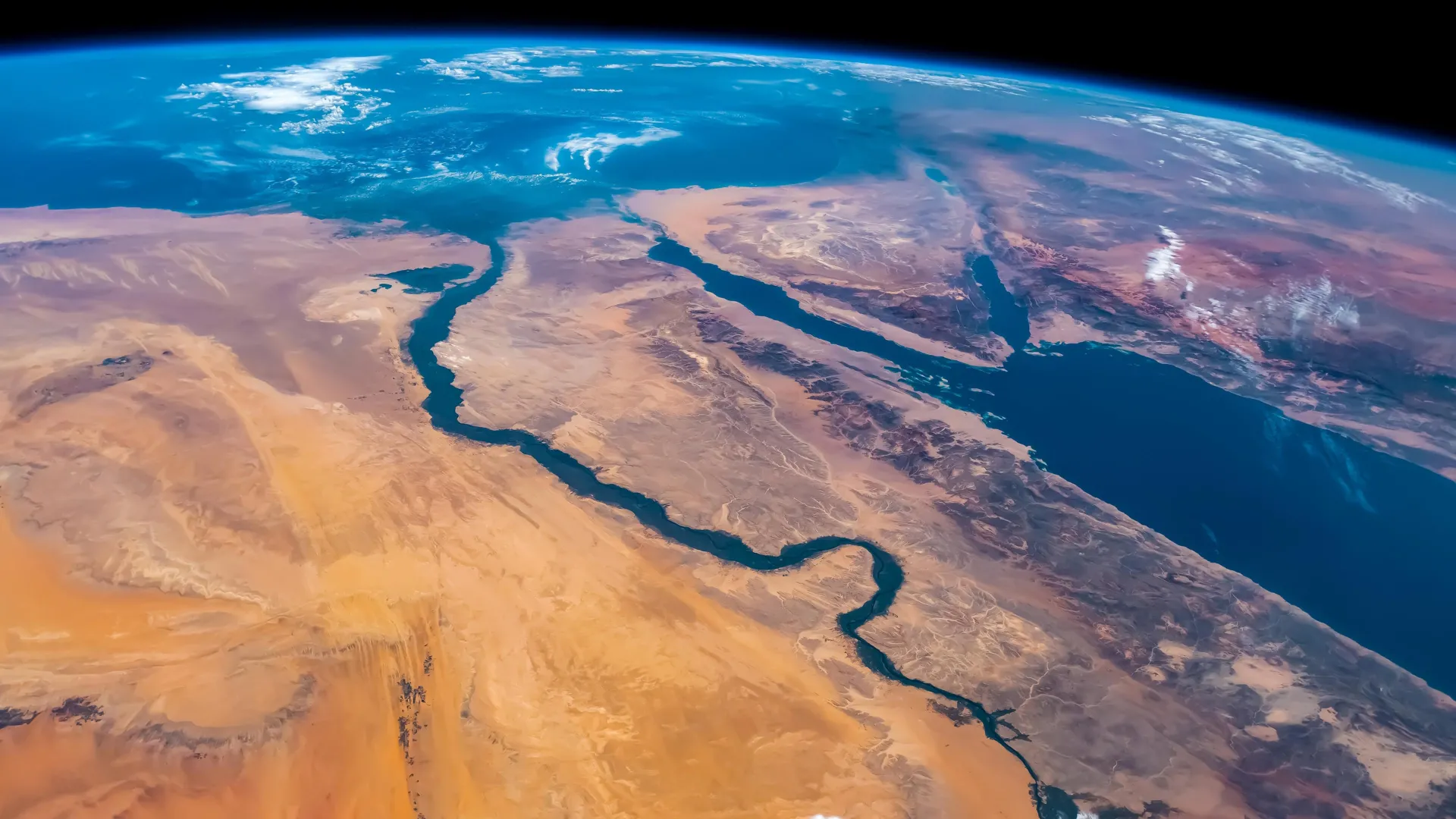
Scientists at King Abdullah University of Science and Technology (KAUST) have provided conclusive evidence that the Red Sea completely dried out about 6.2 million years ago, before being suddenly refilled by a catastrophic flood from the Indian Ocean. The findings put a definitive time on a dramatic event that changed the Red Sea.

Using seismic imaging, microfossil evidence, and geochemical dating techniques, the KAUST researchers showed that a massive change happened in about 100,000 years – a blink of an eye for a major geological event. The Red Sea went from connecting with the Mediterranean Sea to an empty, salt-filled basin. Then, a massive flood burst through volcanic barriers to open the Bab el-Mandab strait and reconnect the Red Sea with the world’s oceans.

“Our findings show that the Red Sea basin records one of the most extreme environmental events on Earth, when it dried out completely and was then suddenly reflooded about 6.2 million years ago,” said lead author Dr. Tihana Pensa of KAUST. “The flood transformed the basin, restored marine conditions, and established the Red Sea’s lasting connection to the Indian Ocean.”

How the Indian Ocean Flooded the Red Sea

The Red Sea was initially connected from the north to the Mediterranean through a shallow sill. This connection was severed, drying the Red Sea into a barren salt desert. In the south of the Red Sea, near the Hanish Islands, a volcanic ridge separated the sea from the Indian Ocean. But around 6.2 million years ago, seawater from the Indian Ocean surged across this barrier in a catastrophic flood. The torrent carved a 320-kilometer-long submarine canyon that is still visible today on the seafloor. The flood rapidly refilled the basin, drowning the salt flats and restoring normal marine conditions in less than 100,000 years. This event happened nearly a million years before the Mediterranean was refilled by the famous Zanclean flood, giving the Red Sea a unique story of rebirth.

Why the Red Sea Matters Geologically

The Red Sea formed by separation of the Arabian Plate from the African Plate beginning 30 million years ago. Initially, the sea was a narrow rift valley filled with lakes, then became a wider gulf when it was flooded from the Mediterranean 23 million years ago. Marine life thrived initially, as seen by the fossil reefs along the northern coast near Duba and Umlujj. However, evaporation and poor seawater circulation increased salinity, causing the extinction of marine life between 15 and 6 million years ago. Additionally, the basin was filled with layers of salt and gypsum. This culminated in complete desiccation of the Red Sea. The catastrophic flood from the Indian Ocean restored marine life in the Red, which persists in the coral reefs to the present.

All in all, the Red Sea is a natural laboratory for understanding how oceans are born, how salt giants accumulate, and how climate and tectonics interact over millions of years. The discovery highlights how closely the Red Sea’s history is linked with global ocean change. It also shows that the region has experienced environmental extremes before, only to return as a thriving marine ecosystem.

“This paper adds to our knowledge about the processes that form and expand oceans on Earth. It also maintains KAUST’s leading position in Red Sea research,” said co-author KAUST Professor Abdulkader Al Afifi.

CLICK HERE FOR MORE INFORMATION

https://www.sciencedaily.com/releases/2025/10/251007081831.htm

They’re smaller than dust, but crucial for Earth’s climate

Microscopic plankton that regulate Earth’s climate and sustain ocean ecosystems take center stage in a new awareness campaign.

Source:Ruđer Bošković Institute

Summary:Coccolithophores, tiny planktonic architects of Earth’s climate, capture carbon, produce oxygen, and leave behind geological records that chronicle our planet’s history. European scientists are uniting to honor them with International Coccolithophore Day on October 10. Their global collaboration highlights groundbreaking research into how these microscopic organisms link ocean chemistry, climate regulation, and carbon storage. The initiative aims to raise awareness that even the smallest ocean dwellers have planetary impact.Share:


FULL STORY


Tiny Ocean Creatures Key to Climate Stability
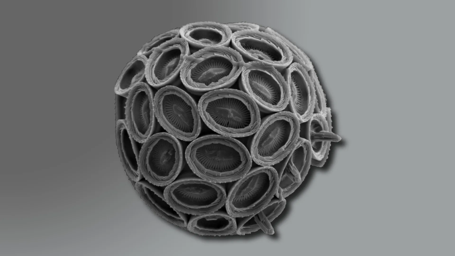
Microscopic view of a coccolithophore (Syracosphaera pulchra), a single-celled ocean alga whose intricate calcium plates (coccoliths) play a role in the global carbon cycle. Credit: Dr. Jelena Godrijan, Ruđer Bošković Institute

Smaller than a grain of dust and shaped like minute discs, coccolithophores are microscopic ocean dwellers with an outsized influence on the planet’s climate. These tiny algae remove carbon from seawater, release oxygen, and create delicate calcite plates that eventually sink to the ocean floor. Over time, these plates form chalk and limestone layers that record Earth’s climate history. Today, five European research institutions announced a new effort to establish October 10 as International Coccolithophore Day, drawing attention to the organisms’ vital contributions to carbon regulation, oxygen production, and the health of marine ecosystems that sustain life on Earth.

The initiative is being led by the Ruđer Bošković Institute (Zagreb, Croatia), the Lyell Centre at Heriot-Watt University (Edinburgh, UK), NORCE Norwegian Research Centre (Bergen, Norway), Marine and Environmental Sciences Centre (MARE) at the University of Lisbon (Portugal), and the International Nannoplankton Association (INA).

A Delicate Balance Under Threat

Few people are aware of coccolithophores, yet without them, the planet’s oceans and climate would look drastically different. These single-celled algae, which contain chlorophyll, float in the sunlit layers of the sea and are coated with calcium carbonate plates known as coccoliths.

Though incredibly small, coccolithophores are among Earth’s most effective natural carbon regulators. Every year, they generate more than 1.5 billion tonnes of calcium carbonate, capturing carbon dioxide from the atmosphere and storing it in deep-sea sediments. In addition to removing carbon, they produce oxygen, nourish marine food webs, and influence the planet’s greenhouse balance.

Coccolithophores often dominate vast stretches of the ocean, but climate change is altering the temperature, chemistry, and nutrient makeup of seawater. These shifts pose serious risks to their survival—and to the stability of the ecosystems that depend on them.

Why Coccolithophores?

What makes coccolithophores stand out from other plankton is both their role in the global carbon cycle and the unique record they leave behind. “Unlike other groups, they build intricate calcium carbonate plates that not only help draw down carbon dioxide from the atmosphere, but also transport it into deep ocean sediments, where it can be locked away for millennia. This biomineralization leaves behind an exceptional geological record, allowing us to study how they’ve responded to past climate shifts and better predict their future role. In short, their dual role as carbon pumps and climate archives makes them irreplaceable in understanding and tackling climate change,” says Professor Alex Poulton of the Lyell Centre.

“They are the ocean’s invisible architects, crafting the tiny plates that become vast archives of Earth’s climate,” says Dr. Jelena Godrijan, a leading coccolithophore researcher at the Ruđer Bošković Institute. “By studying their past and current responses to changes in the ocean, we can better understand how marine ecosystems function and explore how natural processes might help us tackle climate change.”

Cutting-Edge Science: From Plankton to Planetary Processes

The launch of International Coccolithophore Day spotlights the tiny ocean plankton that quietly help regulate atmospheric carbon dioxide.

At the Lyell Centre in Scotland, the OceanCANDY team, led by Prof. Alex Poulton, studies how these plankton pull CO2 from the air and store it in the sea, and tests how warmer, more acidic oceans could alter this process. Computer forecasts compare which species do this job best, today and tomorrow.

In Norway, scientists at NORCE Research, led by Dr. Kyle Mayers and his team, track coccolithophore life stories, how they grow, who eats them, and the viruses that infect and ultimately kill them, to show how carbon moves through the ocean. Ancient DNA in seafloor mud adds a long view of past climate shifts. “Coccolithophore interactions with viruses and grazers matter,” says Dr. Kyle Mayers of NORCE. “These links shape food webs and how the ocean stores carbon.”

In Croatia, the Cocco team at the Ruđer Bošković Institute study how they shape the ocean’s carbon cycle, from the decay of organic matter to bacterial interactions that influence seawater chemistry and CO2 uptake. “In understanding coccolithophores, we’re really uncovering the living engine of the ocean’s carbon balance,” says Dr. Jelena Godrijan “Their interactions with bacteria determine how carbon moves and transforms — processes that connect the microscopic scale of plankton to the stability of our planet’s climate.”

At MARE, University of Lisbon, Dr. Catarina V. Guerreiro leads studies to trace how aerosol-driven fertilization shapes the distribution of coccolithophores across the Atlantic into the Southern Ocean, and what that means for the ocean’s carbon pumps today and in recent times. Her approach consists of combining aerosol and seawater samples with sediment records, satellite data and lab microcosms to pin down cause and effect. “We’re connecting tiny chalky organisms to planetary carbon flows,” says Dr. Guerreiro.

At INA, scientists connect living coccolithophores to their fossil record, using their microscopic plates to date rocks and trace Earth’s climate history. By refining global biostratigraphic frameworks and calibrating species’ evolutionary timelines, INA researchers transform fossils of coccolithophores into precise tools for reconstructing ancient oceans, linking modern plankton ecology with the geological record of climate change.

Why Coccolithophore Day Matters?

Designating a day for Coccolithophores may seem like a small gesture, but its advocates argue it could have a big impact. “This could contribute to changing the way we see the ocean. “We most often talk about whales, coral reefs, and ice caps, but coccolithophores are a vital part of the planet’s climate system. They remind us that the smallest organisms can have the biggest impact, and that microscopic life plays a crucial role in shaping our planet’s future, ” says Dr. Sarah Cryer from the CHALKY project and OceanCANDY team.

The campaign to establish October 10 as International Coccolithophore Day is a call to action. By highlighting the profound, yet often overlooked, role of coccolithophores, scientists want to inspire a new wave of ocean literacy, policy focus, and public engagement.

CLICK HERE FOR MORE INFORMATION

https://www.sciencedaily.com/releases/2025/10/251010091548.htm

Investigators

Portable tests could detect “forever chemicals” in your home’s drinking water

By Tara Molina

We know how important clean water is, but tricky chemicals that get into our water can be hard to detect, posing dangers to our water systems and our health ­– until now.

Researchers with the University of Chicago have teamed up with Argonne National Labs in Lemont to detect the smallest chemicals in our water in an effort to make it safer and healthier for all.

PFAS, or per- and polyfluoroalkyl substances, are better known as “forever chemicals.” They’re man-made compounds that are found in places like fast food packaging, firefighters’ foams and other places. They’re long-lasting chemicals and do not naturally degrade, instead accumulating in the environment and our bodies over time, which is why the Environmental Protection Agency issued regulations on them last year.

Until recently, they were somewhat difficult to detect in drinking water, but labs like Argonne are making gains.

“It affects essentially all of us, and it is, in fact, dangerous,” Argonne’s Seth Darling said. “They’re really toxic to humans. They’ve been linked to cancer, they’ve been linked to reproductive issues, thyroid problems, all kinds of health issues.”

Darling is working alongside Junhong Chen, with UChicago’s Pritzker School of Molecular Engineering. They’re building a first-of-its-kind sensor that can detect PFAS in water.

“The work we are doing here is really important, because now we have a way to be able to measure this PFAS,” Chen said. “Almost the only way to measure for PFAS is to take the water sample and send it to a high-end analytical laboratory for the analysis.”

Darling says that, because the chemicals are dangerous even at low concentrations, you need a technique that can test for extremely low levels. The sensor they’re behind can detect down to what would equate to one grain of sand in an Olympic-sized swimming pool, or 250 parts per quadrillion.

Typically, this level of inspection would require intensive and expensive lab testing. Their goal is to make these tests accessible for anyone to make sure their water is safe, directly from their home.

“What’s important here is developing new ways,” Darling said, “low-cost, fast ways to determine: Is there PFAS in your water and, if so, how much?”

Other universities in the Chicago area have also delved in to research PFAS. Back in the spring, Northwestern University professor of chemistry SonBinh Nguyen and professor of engineering Tim Wei developed a graphene oxide solution that is water- and oil-resistant and could be a replacement for PFAS in items such as takeout coffee cups.

Adam Harrington contributed to this report.

CLICK HERE FOR MORE INFORMATION

https://www.cbsnews.com/chicago/news/chicago-researchers-portable-tests-forever-chemicals-drinking-water/?intcid=CNM-00-10abd1h