Scientists discover what’s linking floods and droughts across the planet

Date:January 13, 2026

Source:University of Texas at Austin

Summary:Scientists tracking Earth’s water from space discovered that El Niño and La Niña are synchronizing floods and droughts across continents. When these climate cycles intensify, far-apart regions can become unusually wet or dangerously dry at the same time. The study also found a global shift about a decade ago, with dry extremes becoming more common than wet ones. Together, the results show that water crises are part of a global pattern, not isolated events.Share:


FULL STORY


Earth’s Water Extremes Are Suddenly Linked
Across the globe, floods and droughts aren’t striking at random — they’re moving to a shared rhythm driven by El Niño and La Niña. Credit: Shutterstock

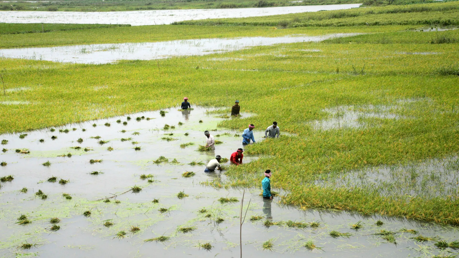
Droughts and floods can disrupt daily life, damage ecosystems, and strain local and global economies. Scientists at The University of Texas at Austin set out to better understand these water extremes by studying how they develop and spread across the planet. Their work points to a powerful climate force that links distant regions in surprising ways.

A new study published in AGU Advances shows that during the past 20 years, ENSO, a recurring climate pattern in the equatorial Pacific Ocean that includes El Niño and La Niña, has played the leading role in driving extreme changes in total water storage worldwide. The researchers also found that ENSO tends to line up these extremes so that different continents experience unusually wet or dry conditions at the same time.

Why Synchronized Extremes Matter

According to study co-author Bridget Scanlon, a research professor at the Bureau of Economic Geology at the UT Jackson School of Geosciences, understanding these global patterns has real-world consequences.

“Looking at the global scale, we can identify what areas are simultaneously wet or simultaneously dry,” Scanlon said. “And that of course affects water availability, food production, food trade — all of these global things.”

When multiple regions face water shortages or excesses at once, the impacts can ripple through agriculture, trade, and humanitarian planning.

Measuring All the Water on Earth

Total water storage is a key climate indicator because it accounts for all forms of water in a region. This includes rivers and lakes, snow and ice, moisture in the soil, and groundwater below the surface. By focusing on this full picture, researchers can better understand how water moves and changes over time.

The study is one of the first to examine total water storage extremes alongside ENSO (The El Niño-Southern Oscillation) on a global scale. This approach made it possible to see how extreme wet and dry conditions are connected across large distances, said lead author Ashraf Rateb, a research assistant professor at the bureau.

“Most studies count extreme events or measure how severe they are, but by definition extremes are rare. That gives you very few data points to study changes over time,” Rateb said. “Instead, we examined how extremes are spatially connected, which provides much more information about the patterns driving droughts and floods globally.”

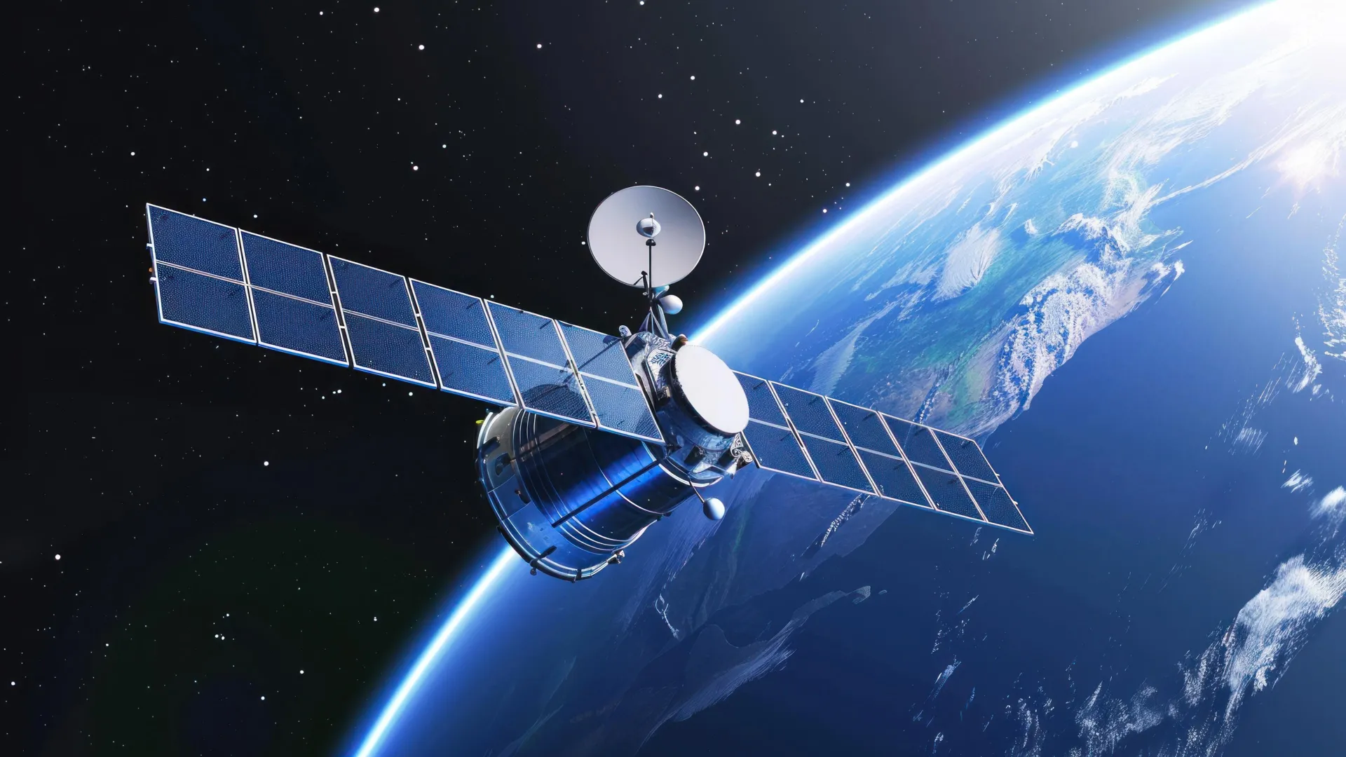
Satellites Reveal Hidden Water Changes

To estimate total water storage, the scientists relied on gravity measurements from NASA’s GRACE and GRACE Follow-On (GRACE-FO) satellites. These data allow researchers to detect changes in water mass over areas about 300 to 400 kilometers wide, roughly the size of Indiana.

The team classified wet extremes as water storage levels above the 90th percentile for a given region. Dry extremes were defined as levels below the 10th percentile.

Their analysis showed that unusual ENSO activity can push widely separated parts of the world into extreme conditions at the same time. In some regions, El Niño is linked to dry extremes, while in others the same dry conditions are associated with La Niña. Wet extremes tend to follow the opposite pattern.

Real-World Examples Across Continents

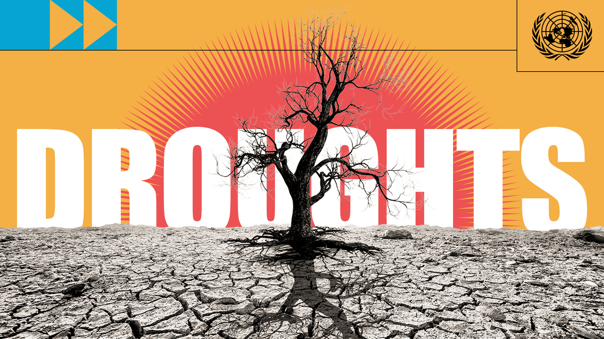
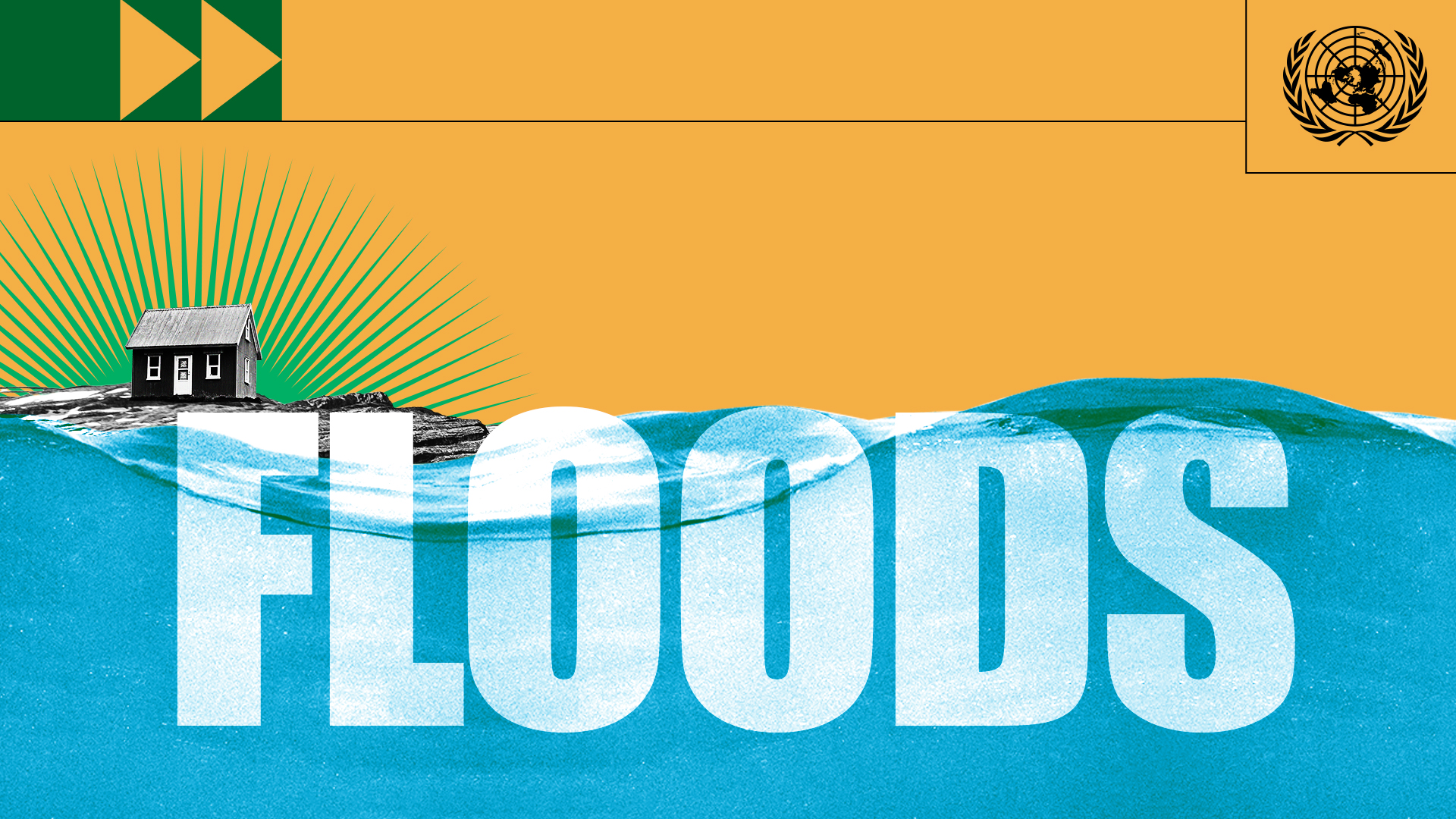
The researchers pointed to several striking cases. During the mid-2000s, El Niño coincided with severe dryness in South Africa. Another El Niño event was linked to drought in the Amazon during 2015-2016. By contrast, La Niña in 2010-2011 brought exceptionally wet conditions to Australia, southeast Brazil, and South Africa.

Beyond individual events, the study also identified a broader shift in global water behavior around 2011-2012. Before 2011, unusually wet conditions were more common worldwide. After 2012, dry extremes began to dominate. The researchers attribute this change to a long-lasting climate pattern in the Pacific Ocean that influences how ENSO affects global water.

Filling the Gaps in Satellite Records

Because GRACE and GRACE-FO data are not continuous, including an 11-month gap between missions in 2017-2018, the team used probabilistic models based on spatial patterns to reconstruct missing periods of total water storage extremes.

Although the satellite record covers only 22 years (2002-2024), it still reveals how closely climate and water systems are linked across the Earth, said JT Reager, deputy project scientist for the GRACE-FO mission at NASA’s Jet Propulsion Laboratory and JPL Discipline Program manager for the Water and Energy Cycle.

“They’re really capturing the rhythm of these big climate cycles like El Niño and La Niña and how they affect floods and droughts, which are something we all experience,” said Reager, who was not involved in the study. “It’s not just the Pacific Ocean out there doing its own thing. Everything that happens out there seems to end up affecting us all here on land.”

Preparing for Extremes, Not Just Shortages

Scanlon said the findings underscore the need to rethink how society talks about water challenges. Instead of focusing only on scarcity, she said, it is critical to plan for swings between too much and too little water.

“Oftentimes we hear the mantra that we’re running out of water, but really it’s managing extremes,” Scanlon said. “And that’s quite a different message.”

The research was funded by the UT Jackson School of Geosciences.

CLICK HERE FOR MORE INFORMATION

https://www.sciencedaily.com/releases/2026/01/260112214304.htm?

Health Impacts of Drought

What to know

Drought can impact our health in many ways. Some health effects are short-term and can be directly observed and measured. Drought can also cause long-term public health issues.

Drought health impacts

Water

Reduced stream and river flows can increase the concentration of pollutants in water and cause stagnation. Higher water temperatures in lakes and reservoirs lead to reduced oxygen levels. These levels can affect fish and other aquatic life and water quality.

Runoff from drought-related wildfires can carry extra sediment, ash, charcoal, and woody debris to surface waters, killing fish and other aquatic life by decreasing oxygen levels in the water. Many parts of the United States depend on groundwater as a primary source of water. Over time, reduced precipitation and increased surface water evaporation mean groundwater supplies are not replenished at a typical rate.

Food and Nutrition

Drought can limit the growing season and create conditions that encourage insect and disease infestation in certain crops. Low crop yields can result in rising food prices and shortages, potentially leading to malnutrition.

Drought can also affect the health of livestock raised for food. During drought, livestock can become malnourished, diseased, and die.

Air Quality

The dusty, dry conditions and wildfires that often accompany drought can harm health. Fire and dry soil and vegetation increase the number of particulates that are suspended in the air, such as pollen, smoke, and fluorocarbons. These substances can irritate the bronchial passages and lungs, making chronic respiratory illnesses like asthma worse. This can also increase the risk for acute respiratory infections like bronchitis and bacterial pneumonia.

Other drought-related factors affect air quality, including the presence of airborne toxins originating from freshwater blooms of cyanobacteria. These toxins can become airborne and have been associated with lung irritation, which can lead to adverse health effects in certain populations.

Learn more about air quality and health

Sanitation and Hygiene

Having water available for cleaning, sanitation, and hygiene reduces or controls many diseases. Drought conditions create the need to conserve water, but these conservation efforts should not get in the way of proper sanitation and hygiene.

Personal hygiene, cleaning, hand washing, and washing of fruits and vegetables can be done in a way that conserves water and also reduces health risks. Installing low-flow faucet aerators in businesses and homes is one example of how to reduce water consumption while maintaining hand washing and other healthy hygienic behaviors.

Learn more about hand washing

Recreational Risks

People who engage in water-related recreational activities during drought may be at increased risk for waterborne disease caused by bacteria, protozoa, and other contaminants such as chemicals and heavy metals. Exposure can occur through accidentally or intentionally swallowing water, direct contact of contaminants with mucous membranes, or breathing in contaminants.

Untreated surface water can be a health threat in drought conditions. In untreated surface waters, some pathogens, such as a type of amoeba (Naegleria fowleri), are more common during drought because low water levels may create warmer water temperatures that encourage their growth.

As the levels of surface waters used for boating, swimming, and fishing drop, the likelihood of injury increases. Low water levels in lakes can put people at risk for life-threatening injuries resulting from diving into shallow waters or striking objects that may not be immediately visible while boating. Low surface water levels can also expose potentially dangerous debris from the bottom of lakes, rivers, and ponds.

Learn more about healthy swimming and recreational water

Learn more about Naegleria fowleri

Infectious Disease

Increases in infectious disease can be a direct consequence of drought.

Viruses, protozoa, and bacteria can pollute both groundwater and surface water when rainfall decreases. People who get their drinking water from private wells may be at higher risk for drought-related infectious disease. Other groups also at increased risk include those who have underlying chronic conditions.

Acute respiratory and gastrointestinal illnesses are more easily spread from person to person when hand washing is compromised by a perceived or real lack of available water. During water shortages, the risk for infectious disease increases when hygiene is not maintained.

E. coli and Salmonella are examples of bacteria that can more readily contaminate food and cause infectious disease during drought. Food can serve as a vehicle for disease transmission during a drought because water shortages can cause farmers to use recycled water to irrigate their fields and process the food they grow. When used to grow crops, improperly treated water can cause a host of infectious diseases (such as those caused by toxin-producing E. coli and Salmonella), which can be life-threatening for people in high-risk groups. In addition, the likelihood of surface runoff, which can occur when rain fails to penetrate the dry and compacted soil that often accompanies drought, can cause the inadvertent contamination of crops.

Other infectious disease threats arise when drought leads to the contamination of surface waters and other types of water that are used for recreational purposes. When temperatures rise and rainfall declines, people are more likely to participate in water-related recreation. Persons exposed to contaminated recreational waters are more likely to become infected with pathogens that thrive in the shallow warm waters that exist during drought conditions.

Chronic Disease

Conditions associated with drought may negatively impact people who have certain chronic health conditions such as asthma and some immune disorders.

Drought-related changes in air quality, such as increased concentrations of air particulates and airborne toxins resulting from freshwater algal blooms, can irritate the eyes, lungs, and respiratory systems of persons with chronic respiratory conditions.

Changes in water quality, such as increased concentrations of contaminants, can threaten persons whose immune systems are compromised.

Diseases Transmitted by Insects and Animals

In periods of limited rainfall, both human and animal behavior can change in ways that increase the likelihood of other vectorborne diseases. For instance, during dry periods, wild animals are more likely to seek water in areas where humans live. These behaviors increase the likelihood of human contact with wildlife, the insects they host, and the diseases they carry.

Drought reduces the size of water bodies and causes them to become stagnant. This provides additional breeding grounds for certain types of mosquitoes (for example, Culex pipiens). Outbreaks of West Nile virus, which is transmitted to humans via mosquitoes, have occurred under such conditions. Inadequate water supply can cause people to collect rainwater. This can lead to collections of stagnant water that can become manmade mosquito breeding areas.

CLICK HERE FOR MORE INFORMATION

https://www.cdc.gov/drought-health/health-implications/index.html

Chapter 4: Water

Executive Summary 

This chapter assesses observed and projected climate-induced changes in the water cycle, their current impacts and future risks on human and natural systems and the benefits and effectiveness of water-related adaptation efforts now and in the future.

Currently, roughly half of worlds ~8 billion people are estimated to experience severe water scarcity for at least some part of the year due to climatic and non-climatic factors (medium confidence1 ). Since the 1970s, 44% of all disaster events have been flood-related. Not surprisingly, a large share of adaptation interventions (~60%) are forged in response to water-related hazards (high confidence). {4.1, Box 4.1, 4.2.1.1, 4.2.1.2, 4.2.2, 4.2.4, 4.2.5, 4.2.6, 4.3.8, 4.6, 4.7}

Intensification of the hydrological cycle due to human-induced climate change is affecting physical aspects of water security (high confidence), thereby exacerbating existing water-related vulnerabilities caused by other socioeconomic factors. {4.2, 4.2.1.1, 4.2.1.2, 4.2.1.3, 4.2.2, 4.2.4, 4.2.5, 4.2.6, 4.3}
Extreme weather events causing highly impactful floods and droughts have become more likely and (or) more severe due to anthropogenic climate change (high confidence). {4.2.4, 4.2.5, Cross-Chapter Box DISASTER in Chapter 4}
There is increasing evidence of observed changes in the hydrological cycle on people and ecosystems. A significant share of those impacts are negative and felt disproportionately by already vulnerable communities (high confidence). {4.3.1, 4.3.2, 4.3.3, 4.3.4, 4.3.5, 4.3.6, 4.3.8}
Water-related risks are projected to increase with every degree of global warming (high confidence), and more vulnerable and exposed regions and peoples are projected to face greater risks (medium confidence). {Box 4.1, 4.4.1, 4.4.1.1, 4.4.4, 4.5.4, 4.5.5, 4.5.6, Box 4.2}
Drought and flood risks and societal damages are projected to increase with every degree of global warming (medium confidence). {4.4.4, 4.4.5, 4.4.7, 4.5.1, 4.5.2}
Limiting global warming to 1.5°C would reduce water-related risks across regions and sectors (high confidence). {4.4.2, 4.4.5, 4.5.2, 4.5.3, 4.5.4, 4.5.6, 4.5.7, 4.6.1, 4.7.2}
Observed water adaptation responses have multiple benefits (high confidence), yet evidence of effectiveness of adaptation in reducing climate risks is not clear due to methodological challenges (medium confidence). {4.6, 4.7.1, 4.7.3}
Future projected adaptations are effective in reducing risks to a varying extent (medium confidence), but effectiveness falls sharply beyond 2°C, emphasizing the need for limiting warming to 1.5°C (high confidence). {4.6, 4.7.2, 4.7.3}
Water security is critical for meeting Sustainable Development Goals (SDGs) and systems transitions needed for climate resilient development, yet many mitigation measures have a high water footprint which can compromise SDGs and adaptation outcomes (high confidence). {4.1, Box 4.4, 4.6, 4.6.2, 4.6.3, 4.7, 4.7.1, 4.7.4, 4.7.5.7}
A common set of enabling principles underpinned by strong political support can help meet the triple goals of water security, sustainable and climate resilient development (high confidence). {4.8, 4.8.3, 4.8.4., 4.8.5, 4.8.6, 4.8.7}

4.1 Centrality of Water Security in Climate Change and Climate Resilient Development 

Water security is defined as ‘the capacity of a population to safeguard sustainable access to adequate quantities of acceptable quality water for sustaining livelihoods, human well-being, and socio-economic development, for ensuring protection against water-borne pollution and water-related disasters, and for preserving ecosystems in a climate of peace and political stability’ (Grey and Sadoff, 2007). Risks emanating from various aspects of water insecurity have emerged as a significant global challenge. The Global Risks Report by the World Economic Forum lists water crisis as one of the top five risks in all its reports since 2015 (WEF, 2015WEF, 2016WEF, 2017WEF, 2018WEF, 2019WEF, 2020). Water also features prominently in the SDGs (Section 4.8) and plays a central role in various systems transitions needed for climate resilient development. Most SDGs cannot be met without access to adequate and safe water (Ait-Kadi, 2016; Mugagga, 2016). In addition, without adequate adaptation, future water-related impacts of climate change on various sectors of the economy are projected to lower the global GDP by mid-century, with higher projected losses expected in low- and middle-income countries (World Bank, 2017GCA, 2019).

Read more…

CLICK HERE FOR MORE INFORMATION

https://www.ipcc.ch/report/ar6/wg2/chapter/chapter-4/

Water – at the center of the climate crisis

Photocomposition: a faceut with a drop coming out of it, with a red circle behing the drop.

Climate change is exacerbating both water scarcity and water-related hazards (such as floods and droughts), as rising temperatures disrupt precipitation patterns and the entire water cycle.

Water and climate change are inextricably linked. Climate change affects the world’s water in complex ways. From unpredictable rainfall patterns to shrinking ice sheets, rising sea levels, floods and droughts – most impacts of climate change come down to water.

Climate change is exacerbating both water scarcity and water-related hazards (such as floods and droughts), as rising temperatures disrupt precipitation patterns and the entire water cycle.

Get more facts on climate and water below.
 

Water scarcity
 

  • Over two billion people worldwide don’t have access to safe drinking water today, and roughly half of the world’s population is experiencing severe water scarcity for at least part of the year. These numbers are expected to increase, exacerbated by climate change and population growth.
  • Only 0.5 per cent of water on Earth is useable and available freshwater – and climate change is dangerously affecting that supply. Over the past twenty years, terrestrial water storage – including soil moisture, snow and ice – has dropped at a rate of 1 cm per year, with major ramifications for water security.
  • Melting glaciers, snow and permafrost are affecting humans and ecosystems in mid-to-high latitudes and the high-mountain regions. These changes are already impacting irrigation, hydropower, water supply, and populations depending on ice, snow and permafrost.
  • Climate change is one of the key drivers of the loss and degradation of freshwater ecosystems and the unprecedented decline and extinction of many freshwater-dependent populations, particularly due to land use and pollution.
  • Limiting global warming to 1.5°C compared to 2°C would approximately halve the proportion of the world population expected to suffer water scarcity, although there is considerable variability between regions.
  • Water quality is also affected by climate change, as higher water temperatures and more frequent floods and droughts are projected to exacerbate many forms of water pollution – from sediments to pathogens and pesticides.
  • Climate change, population growth and increasing water scarcity will put pressure on food supply as most of the freshwater used, about 70 per cent on average, is used for agriculture (it takes between 2000 and 5000 liters of water to produce a person’s daily food).

 Photocomposition: a dry tree in a dry soil, with the word drought written in bold big letters at the background.

Water-related hazards
 

  • Climate change has made extreme weather events such as floods and droughts more likely and more severe.
  • Rising global temperatures increase the moisture the atmosphere can hold, resulting in more storms and heavy rains, but paradoxically also more intense dry spells as more water evaporates from the land and global weather patterns change.
  • Annual mean precipitation is increasing in many regions worldwide and decreasing over a smaller area, particularly in the tropics.
  • Climate change has increased the likelihood of extreme precipitation events and the associated increase in the frequency and magnitude of river floods.
  • Climate change has also increased the likelihood or severity of drought events in many parts of the world, causing reduced agricultural yields, drinking water shortages, increased wildfire risk, loss of lives and economic damages.
  • Drought and flood risks, and associated societal damages, are projected to further increase with every degree of global warming.
  • Water-related disasters have dominated the list of disasters over the past 50 years and account for 70 per cent of all deaths related to natural disasters.
  • Since 2000, flood-related disasters have risen by 134 per cent compared with the two previous decades. Most of the flood-related deaths and economic losses were recorded in Asia. The number and duration of droughts also increased by 29 per cent over this same period. Most drought-related deaths occurred in Africa.

 Photocomposition: a house on the left, with a lot of water in the bottom of the image. The word floods is written in big bold white letters at the front of both illustrations.

Water solutions
 

  • Healthy aquatic ecosystems and improved water management can lower greenhouse gas emissions and provide protection against climate hazards.
  • Wetlands such as mangroves, seagrasses, marshes and swamps are highly effective carbon sinks that absorb and store CO2, helping to reduce greenhouse gas emissions.
  • Wetlands also serve as a buffer against extreme weather events. They provide a natural shield against storm surges and absorb excess water and precipitation. Through the plants and microorganisms that they house, wetlands also provide water storage and purification.
  • Early warning systems for floods, droughts and other water-related hazards provide a more than tenfold return on investment and can significantly reduce disaster risk: a 24-hour warning of a coming storm can cut the ensuing damage by 30 per cent.
  • Water supply and sanitation systems that can withstand climate change could save the lives of more than 360,000 infants every year.
  • Climate-smart agriculture using drip irrigation and other means of using water more efficiently can help reduce demand on freshwater supplies.

CLICK HERE FOR MORE INFORMATION

https://www.un.org/en/climatechange/science/climate-issues/water?

Extreme floods are slashing global rice yields faster than expected

Flooding is emerging as a silent but powerful destroyer of global rice supplies—and the danger is accelerating.

Source:Stanford UniversitySummary:Scientists discovered that a week of full submergence is enough to kill most rice plants, making flooding a far greater threat than previously understood. Intensifying extreme rainfall events may amplify these losses unless vulnerable regions adopt more resilient rice varieties.Share:


FULL STORY


Rising Floods Threaten the World’s Rice
Severe flooding is increasingly damaging global rice yields, slashing production by millions of tons and threatening food security for billions. Credit: Shutterstock

Intense flooding has significantly reduced rice harvests around the world in recent decades, putting at risk the food supply of billions of people who rely on the grain as a dietary staple. Between 1980 and 2015, annual losses averaged about 4.3%, or roughly 18 million tons of rice each year, according to Stanford University research published November 14 in Science Advances.

The researchers found that the damage has grown worse since 2000 as extreme floods have become more common in many of the planet’s main rice-growing regions. They report that climate change is likely to further increase the frequency and severity of these destructive floods in the coming decades.

Droughts, Floods, and a Delicate Balance for Rice

Scientists and farmers have long known that rice yields fall during droughts. The new study adds fresh detail to this picture, estimating that droughts reduced rice yields by an average of 8.1% per year during the 35-year study window. At the same time, the work draws attention to a related but less examined danger from too much water. Rice plants benefit from shallow standing water during early growth, yet prolonged or deep flooding can severely damage or kill the crop.

“While the scientific community has focused on damage to rice yield due to droughts, the impacts of floods have not received enough attention,” said Steven Gorelick, the study’s senior co-author and a professor of Earth system science in the Stanford Doerr School of Sustainability. “Our research documents not only areas where rice yields have suffered due to past flooding, but also where we can anticipate and prepare for this threat in the future.”

What Counts as a ‘Rice-Killing’ Flood

The research team clearly spells out, for the first time, the conditions that turn a flood into a lethal event for rice, said lead study author Zhi Li, who worked on the project as a postdoctoral fellow in Gorelick’s lab at Stanford and recently joined the faculty of the University of Colorado Boulder.

They found that a full week of complete submergence during the plant’s growth cycle is the critical tipping point. “When crops are fully submerged for at least seven days, most rice plants die,” Li said. “By defining ‘rice-killing floods,’ we were able to quantify for the first time how these specific floods are consistently destroying one of the most important staple foods for more than half of the global population.”

How the Researchers Measured Flood and Drought Damage

To estimate how much past droughts and floods have harmed rice production, the scientists combined several lines of evidence. They drew on information about rice growth stages, annual global rice yields, a worldwide database of droughts and floods dating back to 1950, a model of how floods behave across landscapes, and a simulation of soil moisture levels over time in major rice-growing river basins.

Their analysis indicates that, in the coming decades, the most intense week of rainfall in key rice-growing basins around the world could deliver 13% more rain than the average for those regions during the 1980 to 2015 baseline period. This projected increase suggests that rice-killing flood conditions may become more common as the climate continues to warm.

Flood-Resistant Rice Varieties and High-Risk Regions

Wider use of flood-resistant rice varieties could help reduce future losses, especially in the areas that face the highest risk. The study highlights the Sabarmati Basin in India, which experiences the longest rice-killing floods, along with North Korea, Indonesia, China, the Philippines, and Nepal, where the impact of such floods on rice yields has grown the most in recent decades. The greatest total losses have occurred in North Korea, East China, and India’s West Bengal.

The researchers also identified exceptions, such as India’s Pennar Basin, where flooding appears to boost rice yields. They suggest that in these locations, hot and dry conditions may allow standing floodwater to evaporate quickly, reducing long-term damage and sometimes even creating favorable moisture conditions for the crop.

Compounding Climate Stresses on Rice

For Gorelick and Li, the new findings reinforce the need to understand how rice responds not only to floods and droughts, but also to heat waves and cold stress, both individually and when they occur in succession. Earlier research has shown that rapid swings from drought to flood and back again can nearly double rice yield losses compared with single flood or drought events on their own. According to the authors, “How these combined effects can be mitigated remains a major challenge.”

Additional co-authors not mentioned above include Lorenzo Rosa, who is affiliated with the Department of Earth System Science in the Stanford Doerr School of Sustainability and the Department of Global Ecology at the Carnegie Institution for Science. The research was supported by a Dean’s Postdoctoral Fellowship awarded to Li by the Stanford Doerr School of Sustainability.

CLICK HERE FOR MORE INFORMATION

https://www.sciencedaily.com/releases/2025/11/251115095918.htm

Laser satellites expose a secret Antarctic carbon burst

Source:Chinese Academy of Sciences Headquarters

Summary:A new study shows that the Southern Ocean releases far more carbon dioxide in winter than once thought. By combining laser satellite data with AI analysis, scientists managed to “see” through the polar darkness for the first time. The results reveal a 40% undercount in winter emissions, changing how researchers view the ocean’s carbon balance and its impact on climate models.Share:


FULL STORY


Satellites Expose Secret Antarctic Carbon Burst
Researchers have found that the Southern Ocean emits about 40% more carbon dioxide during the Antarctic winter than previous estimates suggested. Using laser-based satellite technology, they uncovered a hidden seasonal flux that redefines the ocean’s role in the global carbon cycle. Credit: Shutterstock

A team of scientists has found that the Southern Ocean emits far more carbon dioxide (CO2) during the lightless Antarctic winter than researchers once believed. According to their new study, this wintertime release of CO2 has been underestimated by as much as 40%.

The research was led by scientists from the Second Institute of Oceanography, Ministry of Natural Resources (SIO-MNR), and the Nanjing Institute of Geography and Limnology (NIGLAS) of the Chinese Academy of Sciences. Their results were published in Science Advances on Nov. 5.

The Ocean’s Role in Earth’s Carbon Balance

The Southern Ocean is a major regulator of the global carbon cycle, absorbing a large share of the carbon released by human activity. Yet despite its importance, it remains the “largest source of uncertainty” in global CO2 flux calculations.

That uncertainty comes from a lack of winter observations. For months each year, the Southern Ocean lies in complete darkness and is lashed by extreme weather, making direct measurement nearly impossible. During this time, the region becomes an “observational black box.” Traditional satellites, which depend on reflected sunlight (passive sensors) to detect ocean properties, cannot collect data under these conditions, leaving scientists reliant on incomplete or estimated models.

Using Lasers to See in the Dark

To overcome this limitation, the researchers used an advanced approach that combined 14 years of data from a laser-based satellite instrument called LIDAR (on the CALIPSO mission) with machine learning analysis.

LIDAR, unlike passive sensors, sends out its own light signals, working similarly to radar but with lasers instead of radio waves. This technology allowed the team to observe the ocean even during the polar night and create the first continuous, observation-based record of winter CO2 exchange in the Southern Ocean.

The results revealed that earlier estimates had missed nearly 40% of the Southern Ocean’s wintertime CO2output. “Our findings suggest that the Southern Ocean’s role in the global carbon cycle is more complex and dynamic than previously known,” said Prof. Kun Shi of NIGLAS.

Rethinking the Ocean’s Carbon Dynamics

Beyond updating the numbers, the study redefines how scientists understand carbon movement in the Southern Ocean. The team introduced a new “three-loop framework” to explain how CO2 exchange varies across different regions.

In the Antarctic Loop (south of 60°S), physical factors such as sea ice and salinity are the main drivers of CO2exchange. In the Polar Front Loop (45°S-60°S), the interaction between atmospheric CO2 and biological activity (chlorophyll) becomes more influential. Meanwhile, in the Subpolar Loop (north of 45°S), sea surface temperature plays the dominant role.

Global Climate Implications

Filling this long-standing data gap could lead to more accurate global carbon budgets, which form the foundation of climate projections used by organizations such as the Intergovernmental Panel on Climate Change (IPCC).

CLICK HERE FOR MORE INFORMATION

https://www.sciencedaily.com/releases/2025/11/251108014024.htm

Antarctica’s collapse may already be unstoppable, scientists warn

Source:Australian National University

Summary:Researchers warn Antarctica is undergoing abrupt changes that could trigger global consequences. Melting ice, collapsing ice shelves, and disrupted ocean circulation threaten sea levels, ecosystems, and climate stability. Wildlife such as penguins and krill face growing extinction risks. Scientists stress that only rapid emission reductions can avert irreversible damage.Share:


FULL STORY


Antarctica’s Collapse May Already Be Unstoppable
Antarctica’s ice and ecosystems are destabilizing faster than expected, threatening coastal cities and wildlife alike. Experts say urgent emission cuts are the only way to stop a cascade of irreversible changes. Credit: Shutterstock

Antarctica faces the possibility of sudden and potentially irreversible changes to its ice, oceans, and ecosystems. Scientists warn that without a sharp global reduction in carbon emissions, these transformations could have serious effects not only for the continent but also for Australia and the rest of the planet.

The warning comes from new research published in Nature by scientists from The Australian National University (ANU) and the University of New South Wales (UNSW), together with researchers from all of Australia’s major Antarctic science institutions.

The team found that multiple large-scale changes are now unfolding at once across Antarctica and that these processes are tightly “interlinked,” intensifying global pressure on the climate system, sea levels, and ecosystems.

The West Antarctic Ice Sheet: A Collapse in Motion

Researchers identified the West Antarctic Ice Sheet (WAIS) as being at extreme risk of collapsing as atmospheric carbon dioxide levels continue to climb. A full collapse of the WAIS could raise global sea levels by more than three meters, endangering coastal populations and major cities worldwide.

Dr. Nerilie Abram, Chief Scientist at the Australian Antarctic Division (AAD) and lead author of the study, warned that such an event would have “catastrophic consequences for generations to come.”

She noted that “rapid change has already been detected across Antarctica’s ice, oceans and ecosystems, and this is set to worsen with every fraction of a degree of global warming.”

Sea Ice Decline and Worsening Feedback Loops

According to Dr. Abram, the sharp decline in Antarctic sea ice is another alarming signal. “The loss of Antarctic sea ice is another abrupt change that has a whole range of knock-on effects, including making the floating ice shelves around Antarctica more susceptible to wave-driven collapse,” she said.

The reduction in sea ice, together with the weakening of deep ocean circulation in the Southern Ocean, indicates that these systems are more vulnerable to rising temperatures than previously believed.

As sea ice disappears, more solar heat is absorbed by the ocean’s surface, amplifying regional warming. Dr. Abram added that other critical systems may soon reach a point of no return, including the ice shelves that hold back parts of the Antarctic ice sheet.

Consequences Reaching Australia and Beyond

Professor Matthew England from UNSW and the ARC Australian Centre for Excellence in Antarctic Science (ACEAS), who co-authored the study, explained that these rapid Antarctic shifts could have severe effects for Australia.

“Consequences for Australia include rising sea levels that will impact our coastal communities, a warmer and deoxygenated Southern Ocean being less able to remove carbon dioxide from the atmosphere, leading to more intense warming in Australia and beyond, and increased regional warming from Antarctic sea ice loss,” he said.

Wildlife and Ecosystems in Jeopardy

The loss of sea ice is already threatening Antarctic wildlife. Professor England warned that emperor penguin populations are facing greater extinction risks because their chicks depend on stable sea ice to mature. “The loss of entire colonies of chicks has been seen right around the Antarctic coast because of early sea ice breakout events, and some colonies have experienced multiple breeding failure events over the last decade,” he said.

Other species are also under threat. The researchers reported that krill, as well as several penguin and seal species, could experience major declines, while key phytoplankton that form the base of the food web are being affected by ocean warming and acidification.

Professor England added that a potential collapse in Antarctic overturning circulation would be disastrous for marine ecosystems, preventing vital nutrients from reaching surface waters where marine life depends on them.

Urgent Global Action Needed

Dr. Abram emphasized that while efforts through the Antarctic Treaty System remain vital, they will not be sufficient on their own. “While critically important, these measures will not help to avoid climate-related impacts that are already beginning to unfold,” she said.

She urged that “the only way to avoid further abrupt changes and their far-reaching impacts is to reduce greenhouse gas emissions fast enough to limit global warming to as close to 1.5 degrees Celsius as possible.”

Governments, industries, and communities, she added, must now include these accelerating Antarctic changes in their planning for climate adaptation, especially in regions like Australia that will be directly affected.

A Global Effort to Understand Antarctica’s Rapid Change

The research represents a collaboration among leading Antarctic experts from Australia, South Africa, Switzerland, France, Germany, and the United Kingdom. It was led by the Australian Centre for Excellence in Antarctic Science (ACEAS), working with Securing Antarctica’s Environmental Future (SAEF), the Australian Antarctic Program Partnership (AAPP), and the Australian Antarctic Division (AAD).

This study supports the objectives of the Australian Antarctic Science Decadal Strategy 2025-2035, a long-term initiative to understand and address the sweeping changes underway in Earth’s southernmost region.

CLICK HERE FOR MORE INFORMATION

https://www.sciencedaily.com/releases/2025/11/251106003941.htm#google_vignette

Earth has hit its first climate tipping point, scientists warn

Source:Goethe University FrankfurtSummary:Global scientists warn that humanity is on the verge of crossing irreversible climate thresholds, with coral reefs already at their tipping point and polar ice sheets possibly beyond recovery. The Global Tipping Points Report 2025 reveals how rising temperatures could trigger a cascade of system collapses, from the Amazon rainforest turning to savanna to the potential shutdown of the Atlantic Ocean circulation.Share:


FULL STORY


Earth Has Hit Its First Climate Tipping Point
Rising temperatures have pushed coral reefs to the brink and may have already destabilized parts of the polar ice sheets. Scientists warn of cascading climate failures but see hope in emerging positive social and technological shifts. Credit: Shutterstock

In a recently released report, a team of international climate scientists warns that saving many tropical coral reefs from destruction caused by rising ocean temperatures will now require extraordinary effort. The researchers also conclude that some regions of the polar ice sheets may have already crossed their tipping points. If this melting continues, it could cause irreversible sea level rise measured in several meters.

Scientists Warn of Cascading Climate System Failures

Among the lead authors of the Global Tipping Points Report 2025 (GTPR 2025) is Nico Wunderling, Professor of Computational Earth System Sciences at Goethe University’s Center for Critical Computational Studies | C3S and researcher at the Senckenberg Research Institute Frankfurt. Together with several co-authors, he led the chapter on “Earth System Tipping Points and Risks.”

Wunderling explains: “The devastating consequences that arise when climate tipping points are crossed pose a massive threat to our societies. There is even a risk of the tipping of one climate system potentially triggering or accelerating the tipping of others. This risk increases significantly once the 1.5°C threshold is exceeded.”

The World Nears a Cascade of Climate Tipping Points

According to the report, scientists have identified roughly two dozen parts of the global climate system that could reach tipping points. The first of these, involving tropical coral reefs, appears to have already been surpassed. The report projects that the global average temperature will rise 1.5°C above pre-industrial levels within the next few years. This would mark the start of a period in which multiple tipping points could be crossed, with profound outcomes such as rapid sea level rise from melting ice sheets or global temperature disruptions caused by a breakdown of the Atlantic Ocean circulation. The authors also recommend actions to prevent further temperature increases.

The coordinating lead author of the GTPR 2025 is Tim Lenton, Professor at the University of Exeter’s (UK) Global Systems Institute. More than 100 scientists from over 20 countries contributed to the report, which was released ahead of the 30th World Climate Conference beginning November 10, 2025, in Belém, Brazil. First published in 2023, the Global Tipping Points Report has already gained recognition as a leading reference for assessing both the risks and potential benefits of negative and positive tipping points within the Earth system and human societies.

Understanding Climate Tipping Points

Climate tipping points have become a major focus in climate research only within the past two decades. The GTPR authors describe a climate-induced tipping point as a level of warming at which key natural systems — such as coral reefs, the Amazon rainforest, or major ocean currents — undergo self-reinforcing and often irreversible change.

For example, once tropical coral reefs surpass their temperature threshold, they begin to die even if humanity later stabilizes or reduces global warming. The scientists warn that more tipping points may soon follow, as some lie near or at 1.5°C of warming. Systems already at risk include the Amazon rainforest (which could shift toward savanna), the ice sheets of Greenland and West Antarctica (which could raise sea levels by several meters), and the Atlantic Ocean circulation (whose collapse could sharply cool Europe).

CLICK HERE FOR MORE INFORMATION

https://www.sciencedaily.com/releases/2025/10/251029002920.htm

Scientists predict a wetter, greener future for the Sahara Desert

Source:University of Illinois ChicagoSummary:UIC researchers predict that the Sahara Desert could see up to 75% more rain by the end of this century due to rising global temperatures. Using 40 climate models, the team found widespread precipitation increases across Africa, though some regions may dry out. The results suggest a major rebalancing of the continent’s climate. Scientists stress that adaptation planning is essential to prepare for both wetter and drier futures.Share:


FULL STORY


A Wetter, Greener Future for the Sahara Desert
Climate models suggest that global warming could dramatically increase rainfall in the Sahara and other parts of Africa. Credit: Shutterstock

The Sahara Desert is known as one of the driest places on Earth, receiving only about 3 inches of precipitation each year — roughly one-tenth of what falls in Chicago.

However, new research from the University of Illinois Chicago (UIC) suggests that this could change dramatically within the next few decades. By the latter half of the 21st century, rising global temperatures may bring much more rain to the region. The study, published in npj Climate and Atmospheric Science, predicts that the Sahara could receive up to 75% more precipitation than its historical average. Similar increases are also projected for parts of southeastern and south-central Africa under extreme climate scenarios.

Rising Rainfall Could Reshape Africa 

“Changing rainfall patterns will affect billions of people, both in and outside Africa,” explained lead author Thierry Ndetatsin Taguela, a postdoctoral climate researcher in UIC’s College of Liberal Arts and Sciences. “We have to start planning to face these changes, from flood management to drought-resistant crops.”

Taguela emphasized that understanding how temperature increases influence rainfall is vital for developing adaptation strategies. His research used an ensemble of 40 climate models to simulate African summer rainfall during the latter half of the 21st century (2050-2099) and compared the results with data from the historical period (1965-2014). Two climate scenarios were examined: one assuming moderate greenhouse gas emissions and another assuming very high emissions.

In both scenarios, rainfall across most of Africa was projected to rise by the end of the century, although the changes vary by region. The Sahara Desert showed the largest increase at 75%, while southeastern Africa could see about 25% more rainfall and south-central Africa about 17% more. In contrast, the southwestern part of the continent is expected to become drier, with precipitation decreasing by around 5%.

Surprising Outlook for a Dry Region 

“The Sahara is projected to almost double its historical precipitation levels, which is surprising for such a climatologically dry region,” said Taguela. “But while most models agree on the overall trend of wetter conditions, there’s still considerable uncertainty in how much rainfall they project. Improving these models is critical for building confidence in regional projections.”

The increase in precipitation is largely linked to the warming atmosphere. Higher temperatures allow the air to hold more moisture, which contributes to heavier rainfall in some areas. Shifts in atmospheric circulation patterns also affect how and where rain falls, sometimes leading to both wetter and drier regions across the continent.

“Understanding the physical mechanisms driving precipitation is essential for developing adaptation strategies that can withstand both wetter and drier futures,” Taguela said.

Taguela conducts his work as part of UIC’s Climate Research Lab, led by Akintomide Afolayan Akinsanola. Their team continues to investigate how changing atmospheric conditions could reshape Africa’s environment, agriculture, and long-term sustainability.

CLICK HERE FOR MORE INFORMATION

https://www.sciencedaily.com/releases/2025/11/251102205025.htm

China’s coastal cities are sinking as seas rise at record speed

Sea levels are rising faster than at any time in 4,000 years, and China’s sinking coastal cities are on the front lines.

Source:Rutgers University

Summary:Sea levels are rising faster than at any time in 4,000 years, scientists report, with China’s major coastal cities at particular risk. The rapid increase is driven by warming oceans and melting ice, while human activities like groundwater pumping make it worse. In some areas, the land itself is sinking faster than the ocean is rising. Still, researchers see progress as cities like Shanghai adopt new technologies to stabilize the ground and prepare for the future.Share:


FULL STORY


Sea Levels Are Rising Faster Than in 4,000 Years
Scientists have found that modern sea level rise is accelerating faster than at any time in the past 4,000 years, and China’s coastal megacities are among the most at risk. Credit: Shutterstock

A team of scientists led by Rutgers University researchers has found that sea levels today are climbing more quickly than at any time in the past 4,000 years, with China’s coastal cities facing some of the most severe risks.

To uncover this trend, the researchers analyzed thousands of geological records from natural indicators such as ancient coral reefs and mangrove formations. These environments preserve long-term evidence of past sea levels. Using this data, the team reconstructed ocean changes stretching back almost 12,000 years to the start of the Holocene epoch, which began after the last major ice age.

Fastest Rate of Rise Since 1900

Published in Nature, the study reports that global sea levels have risen by an average of 1.5 millimeters (about one-sixteenth of an inch) per year since 1900. This pace is faster than any century-long period recorded in the last four millennia.

“The global mean sea level rise rate since 1900 is the fastest rate over at least the last four millennia,” said Yucheng Lin, who conducted the research as a postdoctoral associate at Rutgers and is a scientist at Australia’s national research agency, the Commonwealth Scientific and Industrial Research Organization in Hobart.

Lin worked under the guidance of Robert Kopp, a Distinguished Professor in the Department of Earth and Planetary Sciences at Rutgers. “Dr. Lin’s work illustrates how geological data can help us better understand the hazards that coastal cities face today,” said Kopp, who also authored the study.

What’s Driving the Acceleration

According to Lin, two main processes are responsible for today’s rapid sea level rise: thermal expansion and melting ice. As climate change warms the planet, oceans absorb heat, causing the water to expand. At the same time, melting glaciers and ice sheets in Greenland and Antarctica add vast amounts of water to the seas.

“Getting warmer makes your ocean take up more volume,” Lin said. “And the glaciers respond faster because they are smaller than the ice sheets, which are often the size of continents. We are seeing more and more acceleration in Greenland now.”

China’s Coastal Cities Face a Double Threat

While sea level rise is a global concern, China faces a particularly dangerous combination of natural and human factors. Many of its largest cities — including Shanghai, Shenzhen and Hong Kong — sit in delta regions made of soft, water-saturated sediment that naturally sinks over time.

Human activities have accelerated this sinking.

“We’ve been able to quantify the natural rate of sea level rise for this area,” Lin said. “But human intervention, mostly groundwater extraction, makes it happen much faster.”

Subsidence, the gradual sinking or settling of the Earth’s surface, can occur through natural geological changes or from human-driven causes such as overuse of groundwater.

Delta Regions Under Pressure

To assess the risk to China’s deltas, the researchers combined geological records, measurements of land subsidence, and data on human impacts. They focused on the Yangtze River Delta and Pearl River Delta, two areas that are home to several megacities and key industrial zones.

In Shanghai, parts of the city sank more than one meter (around three feet) during the 20th century because of extensive groundwater pumping, Lin said. That rate is vastly higher than the current global average for sea level rise.

Delta regions are naturally flat and fertile, making them ideal for farming, transport, and urban development. But those same features make them exceptionally vulnerable to flooding.

“Centimeters of sea level rise will greatly increase the risk of flooding in deltas,” Lin said. “These areas are not only important domestically, they’re also international manufacturing hubs. If coastal risks happen there, the global supply chain will be vulnerable.”

Efforts to Slow the Sinking

Despite the alarming data, Lin noted that there are reasons for optimism. Some Chinese cities have begun taking effective steps to manage the problem. Shanghai, for example, has slowed its rate of subsidence by controlling groundwater extraction and reinjecting freshwater into underground aquifers.

“Shanghai now is not sinking that fast anymore,” Lin said. “They recognized the problem and started regulating their groundwater usage.”

The research team also created vulnerability maps to help local governments and city planners identify high-risk zones and prepare for future sea level rise.

A Global Lesson

Although the study focuses on China, its implications reach far beyond. Many major coastal cities, including New York, Jakarta and Manila, are built on low-lying plains and face similar threats.

“Deltas are great places, good for farming, fishing, urban development and naturally draw civilizations to them,” Lin said. “But they are really flat yet prone to human-caused subsidence, so sustained sea level rise could submerge them really fast.”

Modeling the Past to Protect the Future

The paper is an application of PaleoSTeHM, an open-source software framework for statistically modeling paleo-environmental data that Lin developed as a postdoctoral associate.

Praveen Kumar, a postdoctoral associate in the Department of Earth and Planetary Sciences, also contributed to the study.

The National Science Foundation and NASA supported the research.

CLICK HERE FOR MORE INFORMATION

https://www.sciencedaily.com/releases/2025/10/251023031627.htm