New research shows that water is much more important in mitigating climate change than previously believed. Better management of water is critical to tackling today’s food and energy crises, both of which are exacerbated by climate change.
The report titled “The essential drop to reach Net-Zero: Unpacking Freshwater’s Role in Climate Change Mitigation,” released today, is the first-ever summary of current research on the role of water in climate mitigation. A key message is the need to better understand global water shortages and scarcity in order to plan climate targets that do not backfire in future. If not planned carefully, negative impacts of climate action on freshwater resources might threaten water security and even increase future adaptation and mitigation burdens.
“Most of the measures needed to reach net-zero carbon targets can have a big impact on already dwindling freshwater resources around the world,” said Dr. Lan Wang Erlandsson from Stockholm Resilience Centre at Stockholm University. “With better planning, such risks can be reduced or avoided.”
The report describes why, where, and how freshwater should be integrated into climate change mitigation plans to avoid unexpected consequences and costly policy mistakes. Even efforts usually associated with positive climate action—such as forest restoration or bioenergy—can have negative impacts if water supplies are not considered.
Done right, however, water-related and nature-based solutions can instead address both the climate crisis and other challenges, said Dr. Malin Lundberg Ingemarsson from Stockholm International Water Institute (SIWI).
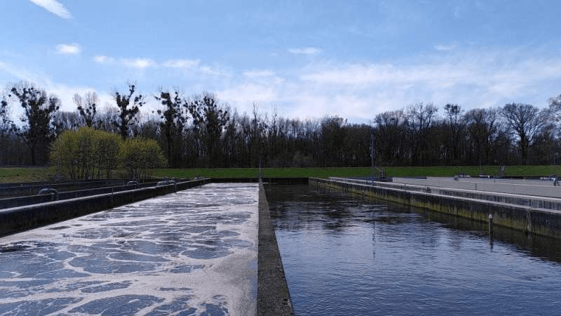
“We have identified water risks, but also win-win solutions that are currently not used to their full potential. One example is restoration of forests and wetlands which bring social, ecological, and climate benefits all at once. Another example is that better wastewater treatment can reduce greenhouse gas emissions from untreated wastewater, while improving surface water and groundwater quality, and even provide renewable energy through biogas.”
The report highlights five key messages on the interlinkage between water and mitigation:
Climate mitigation measures depend on freshwater resources. Climate mitigation planning and action need to account for current and future freshwater availability.
Freshwater impacts—both positive and negative—need to be evaluated and included in climate mitigation planning and action.
Water and sanitation management can reduce greenhouse gas emissions. More efficient drinking water and sanitation services save precious freshwater resources and reduce emissions.
Nature-based solutions to mitigate climate change can deliver multiple benefits for people and the environment. Measures safeguarding freshwater resources, protecting biodiversity, and ensuring resilient livelihoods are crucial.
Joint water and climate governance need to be coordinated and strengthened. Mainstreaming freshwater in all climate mitigation planning and action requires polycentric and inclusive governance.
“Climate change mitigation efforts will not succeed if [we are] failing to consider water needs,” says Marianne Kjellén, United Nations Development Programme (UNDP). “Water must be part of powerful solutions for enhancing ecosystem resilience, preserving biodiversity and regenerative food and energy production systems. In short, water security must be factored in to climate action,” she adds.
“To tackle the climate, food, nature, and energy crises, water availability is of the essence. It is urgent that the world focuses all attention on the double facts that water is the number one challenge for climate adaptation due to droughts and floods, and a key challenge for mitigation, as there is no safe climate future well below 2 degrees Celsius without a functioning hydrological cycle,” Professor Johan Rockström, Potsdam Institute for Climate Impact Research, concludes.
A new biodegradable packing foam developed at UBC not only potentially addresses the world’s plastic pollution crisis but also serves as an equal and true partnership example of working with First Nations.
The team came together to turn a timely research idea into reality while helping solve a critical community need at the same time. The collaboration included UBC researchers Dr. Feng Jiang and postdoctoral fellow Dr. Yeling Zhu, Reg Ogen and Joe Wong, president and CEO and vice president respectively of Wet’suwet’en First Nation’s Yinka Dene Economic Development Limited Partnership, and the office of the Chief Forester in the Ministry of Forests.
Transforming waste into pollutant-free innovation
Dr. Jiang, an assistant professor in the UBC faculty of forestry and the Canada Research Chair in Sustainable Functional Biomaterials, started developing a “biofoam” many years ago both to find new uses for wood waste and reduce pollution from packaging foam.
“Styrofoam waste fills up to 30 percent of global landfills and can take more than 500 years to break down. Our biofoam breaks down in the soil in a couple of weeks, requires little heat and few chemicals to make, and can be used as substitute for packaging foams, packing peanuts and even thermal insulation boards,” says Dr. Jiang.
He adds that the project also helps repurpose wood waste that is often left behind after trees are harvested. “Less than 50 percent of harvested trees are used in the wood industries—the rest is left behind in the forest, serving as potential fuel for devastating wildfires.”
Wet’suwet’en First Nation band and UBC form partnership
One year into the project, Dr. Jiang met Reg Ogen and Joe Wong at an event organized by the Ministry of Forests’ Innovation, Bioeconomy and Indigenous Opportunities Branch. A partnership was born.
“Our Nation was trying to create a new economy out of what was left of our forest after the wildfires and the damage caused by the mountain pine beetle epidemic in the 1990s and early 2000s. The amount of timber available for harvest in the next 20 to 60 years was significantly reduced. I have often asked why, when trees are harvested, up to 50 percent of the tree is left behind to just burn. As a Nation, we were also concerned about the losses in habitat, water quality, decline in moose and salmon populations and the acceleration in climate change,” recalls Ogen.
“When I met Dr. Jiang, I knew we wanted to work with him on this journey of creating the Wet’suwet’en forest bioeconomy, so that we could use what’s left of our forests, and maybe also be able to help other communities—including the fin species and four-legged animals.”
Two years of collaboration followed, with Yinka Dene Economic Development helping to secure provincial government funding and providing raw materials from their forests, located near Burns Lake, B.C. for the research.
Biofoam development now completed, the team is putting together a business model, with plans to open a pilot plant in B.C.
“A unique feature of this project is that the intellectual property is shared between UBC and First Nations,” says Dr. Jiang. “This project highlights the benefits of forging meaningful partnerships by first identifying the problems—reducing waste from each tree harvested, mitigating the impacts of wildfires, and ensuring participation in the forest sector by First Nations—before moving towards a solution with First Nations as a true partner.”
Ogen adds, “Status quo forestry industrial activities impact First Nations the most because we are losing our pharmacies, places of worship, areas for supporting cultural narratives and supermarkets. Climate change is accelerating our losses. This is why I felt it is important we find a partner, like Dr. Jiang’s lab at UBC, with support from the team at the Chief Forester’s office, to create a forest bioeconomy and seek solutions to mitigate climate change and reduce our reliance on fossil fuel-based products, especially in the construction and packaging sectors.”
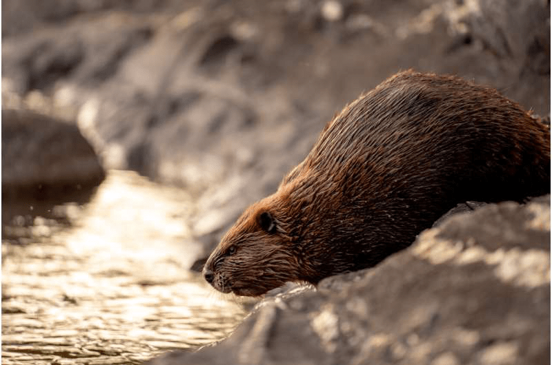
As climate change worsens water quality and threatens ecosystems, the famous dams of beavers may help lessen the damage.
That is the conclusion of a new study by Stanford University scientists and colleagues, publishing Nov. 8 in Nature Communications. The research reveals that when it comes to water quality in mountain watersheds, beaver dams can have a far greater influence than climate-driven, seasonal extremes in precipitation. The wooden barriers raise water levels upstream, diverting water into surrounding soils and secondary waterways, collectively called a riparian zone. These zones act like filters, straining out excess nutrients and contaminants before water re-enters the main channel downstream.
This beneficial influence of the big, bucktoothed, amphibious rodents looks set to grow in the years ahead. Although hotter, arid conditions wrought by climate change will lessen water quality, these same conditions have also contributed to a resurgence of the American beaver in the western United States, and consequently an explosion of dam building.
“As we’re getting drier and warmer in the mountain watersheds in the American West, that should lead to water quality degradation,” said the study’s senior author Scott Fendorf, a professor of Earth system science at Stanford University. “Yet unbeknownst to us prior to this study, the outsized influence of beaver activity on water quality is a positive counter to climate change.”
A lucky natural experiment
The discovery of the profound impact of beaver dams came about serendipitously. As a Ph.D. student in Fendorf’s lab in 2017, lead study author Christian Dewey had started doing field work along the East River, a main tributary of the Colorado River near Crested Butte in central Colorado.
Initially, Dewey had set out to track seasonal changes in hydrology, and riparian zone impacts on nutrients and contaminants in a mountainous watershed.
“Completely by luck, a beaver decided to build a dam at our study site,” said Dewey, who is now a postdoctoral scholar at Oregon State University (whose mascot, incidentally, is a beaver). “The construction of this beaver dam afforded us the opportunity to run a great natural experiment.”
Dams versus dry years and wet years
For the study, Dewey and colleagues reviewed data on water levels gathered hourly by sensors installed in the river and throughout the riparian area. The team also collected water samples, including from below the ground’s surface, to monitor nutrient and contaminant levels.
To understand how beaver dams may affect water quality in a future where global warming produces more frequent droughts and extreme swings in rainfall, the researchers compared water quality along a stretch of the East River during a historically dry year, 2018, to water quality the following year, when water levels were unusually high. They also compared these yearlong datasets to water quality during the nearly three-month period, starting in late July 2018, when the beaver dam blocked the river.
Water quality is a measure of the suitability of water for a particular purpose—ecosystem health or human consumption, for instance. During periods of drought, as less water flows through rivers and streams, the concentrations of contaminants and excess nutrients, such as nitrogen, rise. Major downpours and seasonal snowmelt are then needed to flush out contaminants and restore water quality.
Through their measurements and computer modeling of the interlinked biological, chemical, and physical processes that affect how contaminants become concentrated or flow downstream, the researchers found that the beaver dam dramatically increased removal of nitrate, a form of nitrogen, by creating a surprisingly steep drop between the water levelsabove and below the dam.
Warm, dry summers following spring snowmelt also produce big level changes, which generate a pressure gradient that pushes water into surrounding soils. The larger the gradient, the greater the flow of water and nitrate into soils, where microbes transform nitrate into an innocuous gas.
In the East River, the researchers found the increase in the gradient compared to an average day was at least 10 times greater with the dam than it was during the summer peak without the dam, for both the high-water year (2019) and the drought year (2018). Stated otherwise, the effects of the dam exceeded climatic hydrological extremes—in either direction of drought or abundant snowmelt—by an order of magnitude.
“Beavers are countering water quality degradation and improving water quality by producing simulated hydrological extremes that dwarf what the climate is doing,” said Fendorf, who is the Terry Huffington Professor in the Stanford Doerr School of Sustainability and a senior fellow at the Stanford Woods Institute for the Environment.
While in place, the beaver dam boosted removal of unwanted nitrogen from the studied East River section by 44% over the seasonal extremes. Nitrogen is an especially pernicious problem for water quality as it promotes overgrowth of algae, which when decomposed starve water of the oxygen needed to support diverse animal life and a healthy ecosystem.
The study is a reminder that as the future impacts of climate change are holistically assessed, feedback from changes in ecosystems must also be included.
“We would expect climate change to induce hydrological extremes and degradation of water quality during drought periods,” said Fendorf, “and in this study, we’re seeing that would have indeed been true if it weren’t for this other ecological change taking place, which is the beavers, their proliferating dams, and their growing populations.”
Study co-authors are affiliated with Lawrence Berkeley National Laboratory.
In recent years, large-scale natural disasters around the world have caused a series of water cutoffs, which seriously affect the quality of life of disaster victims. To address this, there has been growing interest in the viability of disaster emergency wells to mitigate water cutoffs during natural disasters.
A research group led by Professor Takahiro Endo from the Graduate School of Sustainable System Sciences at Osaka Metropolitan University conducted surveys of local well owners who supplied groundwater(91 organizations) and welfare facilities representing water users (328 facilities) that were affected by the 2016 Kumamoto Earthquake. The surveys clarified the status of groundwater use after the earthquake for suppliers and users, as well as policy issues surrounding the use of emergency wells. The findings are published in the Hydrogeology Journal.
“Groundwater has been considered an important resource for both industrial production and the natural environment, but this research has newly clarified that groundwater is also a disaster prevention resource,” explained Professor Endo.
Although there have been previous studies of groundwater use in disasters, most of these studies assessed future disasters, such as groundwater exploration techniques and estimation of groundwater availability in the event of water supply cutoffs. Groundwater is primarily provided during the chaotic period immediately after a disaster through private wells, which are scattered throughout the affected area. This makes keeping official records of groundwater usage difficult. So, up until now, emergency well usage after earthquakes was not thoroughly understood.
The surveys found that the use of emergency wells complemented the Kumamoto city government’s emergency water supply by speeding up water delivery and improving access to water. On the other hand, a reasonable number of welfare facilities did not use water from emergency wells, even when they were nearby. This indicates that publicizing emergency well locations is an important policy issue.
“This new data is very useful for city governments who have already installed or are considering installing emergency wells in the near future,” Professor Endo concluded.
South Africa’s population is urbanizing at a rapid pace. The sheer rate of change poses challenges to planning for sustainable and liveable cities.
Part of what make cities work is having green spaces, such as parks, sports fields, nature trails and street trees. These provide many social, ecological and economic benefits. Research from multiple countries such as Australia, China, Finland, India, the U.S. and South Africa has shown this.
Aside from looking good and providing recreation, urban green spaces improve air quality, physical and mental health, and regulate storm water flows. They counteract urban heat islands, store carbon and create jobs.
Some communities nevertheless oppose urban greening efforts because they fear that green spaces and street trees provide places for criminals to hide. Such fears are not unique to South Africa and have been reported from cities in both developed and developing countries.
A great deal of research has been done on urban greening and its association with crime levels. But most of these studies have been conducted in Europe and North America, which are very different socially and economically to developing countries and have markedly lower rates of crime.
We conducted research to complement the evidence from the global north. Our study is the first ever national level analysis of the relationship between various measures of urban greenness and three different classes of crime: property, violent and sexual crimes.
Our findings, based on research in South Africa, lend further credence to calls for urban greening to be adopted as a major strategy in cities—for both environmental sustainability, as well as social sustainability.
Drilling down
We used 10 years of precinct-level crime statistics in South Africa to test the hypothesis that green space is associated with reduced crime rates. South Africa has one of the highest crime rates in the world, making it an important test of the relationship between urban greening and crime.
Using the broadest greenness measure—total green space—the results of this national-scale study corroborate many previous studies from the global north indicating that greener neighborhoods have significantly lower rates of violent and property crimes. Thus, the relationship reported in other countries and contexts appears to be robust in even a relatively high crime context like South Africa.
To gauge the relationship in South Africa we used several measures of urban greenness, several different crime categories, and a national analysis.
We obtained crime statistics per police precinct (there are 1,152 police precincts) between 2010 and 2019 from the South African Police Service and aggregated them into property, violent and sexual crimes (expressed as per 100,000 citizens for each police precinct).
We then used remote sensing to calculate the total area of green space per precinct, the proportional (percentage) cover of trees, and the average distance to the closest formal or informal park.
We found that greener areas had lower rates of both violent and property crimes. But there was no relationship with the rate of sexual crimes. A more mixed picture was revealed when considering tree cover specifically, where property crime was higher with more tree cover, but violent crimes were fewer.
However, property crimes were higher in locations close to public parks and sites with more trees.
Proximity to parks showed no relationship with the rates of violent or sexual crimes.
The concentration of property crimes in neighborhoods with more trees and parks can be explained by such areas typically being where more affluent households are found.
But well-maintained public parks, and those with fencing, lighting, playing fields and some sort of security show lower crime levels in adjacent areas than poorly maintained parks or those lacking basic facilities.
What needs to be done
These findings add further impetus to arguments for urban planners and decision-makers in South Africa (and similar contexts) to be more proactive and ambitious in including and integrating urban green spaces and trees into urban developments.
Planners and authorities often downplay such calls because they are viewed as coming from an environmental lobby, and because—they say—there are more pressing economic and social development needs.
But this research shows that benefits of urban greening extend well beyond an environmental agenda. They embrace social inclusivity and sustainability too, alongside the well-established public health benefits.
Urban greening, therefore, needs to be one of the foremost considerations in urban planning and development in the country. It also requires budgets, expertise and strategies beyond the planning phase to allow for regular tree and green space maintenance that keeps them functional and attractive to local citizens.
The research also supports calls for urban greening to be integrated into any holistic crime prevention strategy.
Even as worsening drought and aridification force Los Angeles to end its overwhelming dependence on imported water, Angelenos may soon realize that weaning themselves off supplies from the rugged eastern Sierra Nevada doesn’t mean they will stop paying for the city’s long, complicated history there.
That’s because, even if the city is able to make good on a pledge by Mayor Eric Garcetti to recycle 100% of its water by 2035 and increase its ability to capture storm water, Los Angeles will still have to pay millions of dollars to control the region’s hazardous dust pollution—an environmental consequence of L.A.’s draining of Owens Lake more than a century ago, as well as recent diversions that have lowered the level of Mono Lake farther north.
Recently, the Los Angeles Department of Water and Power accused Owens Valley air pollution authorities of “regulatory overreach” when they fined the utility $21 million for ignoring an order to control dust on a 5-acre patch of dry lake bed. The order and subsequent fine imposed by the Great Basin Unified Air Pollution Control District was an attempt to “squeeze” cash from the city’s water users, the DWP said.
“Enough is enough,” read a statement from Cynthia McClain-Hill, president of the Los Angeles Board of Water and Power Commissioners. “More than 20 percent of our ratepayers live below the poverty line, and we cannot allow the people of Los Angeles to serve as a blank check for Great Basin’s illegal orders.”
The agency also angered Mono Lake officials and conservationists recently when it signaled to the Los Angeles City Council that it wanted to scrap portions of a 1994 agreement that aims to control dust emissions at Mono Lake, the hyper-saline water body east of Yosemite National Park famous for its craggy tufa formations.
Arguing that climate change and drought have fundamentally altered the state’s water supply, DWP officials suggested that it was impossible for them to ensure Mono Lake remained at certain dust-damping levels.
To be sure, DWP ratepayers will see increases due to the cost of transforming the city’s water infrastructure. However, officials say the demands by Great Basin will add even more to their water bills.
For their part, Owens Valley officials accuse Los Angeles of trying to avoid responsibility for the environmental damage its water use has caused.
“The city wants to undermine our authority to protect people’s health and safety by ordering dust control measures where needed,” said Phil Kiddoo, the air district’s enforcement officer. That enforcement authority is granted under a 2014 agreement between the DWP and the air district, he said.
The water diversions that began in 1913 dried up the 110-square-mile Owens Lake, triggering immense sheets of powder-fine, lung-damaging particles that descended on towns downwind. Over the last three decades, the DWP has spent more than $2.5 billion on projects that have reduced dust emissions by nearly 100%.
“Despite this achievement, Great Basin has refused to acknowledge the success of the program, and instead has issued a series of orders and associated fines that demonstrate a clear pattern of overreach of its regulatory role,” read a DWP statement.
For the first 90 years of its existence, the Los Angeles Aqueduct met more than 60% of the city’s demands. Today, however, half of that water must be directed onto Inyo County ranch lease operations, fisheries and dozens of court-stipulated mitigation projects to meet federal air pollution standards.
In a lawsuit filed in Sacramento County Superior Court—where the 2014 agreement was entered—air district officials allege that the DWP’s refusal to control dust emissions on the 5-acre area is a violation of the pact.
Under an earlier agreement, the DWP must fund 85% of Great Basin’s annual operating budget—about $7 million—and pay for all district legal fees whether it wins or loses in court.
The DWP has responded by filing its own lawsuit in Los Angeles County Superior Court, accusing the air district of exceeding its authority and ordering dust control measures without first conducting an environmental analysis of its impacts, as required by the California Environmental Quality Act.
“This 5-acre project may seem small—but it would result in a huge hit for our ratepayers,” said Marty Adams, general manager and chief engineer of the DWP. “It would add about $2 onto their monthly water bills. And for what? A pet project the district cooked up that doesn’t meet regulatory requirements.”
Adams said that there was “no end in sight” for such demands. “We hope it doesn’t blow up the 2014 agreement.”
Not only does the DWP accuse Great Basin of overstepping its authority, officials argue that the work would need the approval of five Indigenous tribes that have nominated 186 square miles of the lake bed for listing in the California Register of Historical Resources and in the National Register of Historic Places.
One of those tribes, the Fort Independence Indian Community of Paiute Indians, has not yet said whether it sanctions the project.
“We are shocked to see Great Basin attempting to mandate that LADWP act in opposition to the requests of our tribal partners,” read a statement from Paul Liu, manager of the utility’s Owens Lake Dust Mitigation Program.
Great Basin argues that the mitigation area is not on tribal land. The agency says it is held in trust by the State Lands Commission, which supports the implementation of air pollution controls.
The dispute underscores the acrimony that has seethed in Owens Valley since the early 1900s, when the city had agents pose as farmers and ranchers to buy land and water rights in the valley, then began building an aqueduct to collect and divert water from Inyo County to the water-craving metropolis to the south.
“The LADWP is always looking for an excuse to avoid doing the right thing for the people of Owens Valley,” said Michael Prather, a botanist and longtime Sierra Club activist in the community of Lone Pine. “In the meantime, we breathe toxic dust while people in Los Angeles build more golf courses and swimming pools with our water.”
The air pollution generated by the 5-acre area in dispute “can be severe,” according to the district’s lawsuit.
Particulate-matter air pollution can remain airborne for long periods and can lodge deep in the lungs and cause scarring, respiratory illnesses, cardiovascular disease, as well as more frequent attacks of asthma in children.
The hazardous effects of so-called PM10—particles that are less than 10 micrometers in diameter, far smaller than the width of a human hair—extend to large areas downwind of Inyo County, district officials say, including the city of Ridgecrest and the Naval Air Weapons Station China Lake.
“Based upon data from this area collected on April 16, 2018,” the district’s lawsuit says, “PM10 emissions were 160 percent of the federal standard of 150 micrograms per cubic meter.” That air pollution was transported to the community of Lone Pine, about nine miles downwind, it says.
Under the 2014 agreement, the city agreed to comply with district orders to implement controls on 48.6 square miles of the lake bed, and up to 4.8 additional square miles, if needed. It provided a cap on the total area that could be ordered for dust control by the district in return for the city’s agreement not to challenge those orders.
But the agreement did not settle the matter in the heavily litigated region where old-timers recall that each of the last four mayors of Los Angeles, in turn, proclaimed, “The bad old days are over in Inyo County.”
Then there was a DWP manager who bragged, “Litigation is cheaper than water.”
The agreement allows use of shallow flooding, managed vegetation, gravel and tillage to contain and prevent dust emissions.
The project in question was designed to minimize ground disturbance and encourage growth of existing shrubs through seasonal watering. A 1,000-foot-long water line laid on top of the ground would feed three hose spigots to allow tribal members to water the vegetation. The water would be supplied by a DWP water trailer parked nearby.
The DWP doubts the effectiveness of the plan.
“It is not a tested dust control method,” said Joseph Ramallo, the utility’s assistant general manager of water and power. “We have no evidence to prove that it will work to control dust or protect cultural resources, meaning any expenditure could be a complete waste of our customers’ money.”
However, at least one supporter said it would be the least intrusive dust control measure employed to date.
Kathy Bancroft of the Lone Pine Paiute-Shoshone Indian Reservation gazed across the vast patchwork of dust control measures blanketing the lake bed recently and shook her head. “Just look at how Los Angeles ruined this landscape,” she said.
“The dust mitigation project everyone is fighting over in court would not require excavation. It would be watered by hand without disturbing the soil or the artifacts buried in it,” she said. “All L.A. has to do is provide a little water. Is that too much to ask?”
Phosphorus is an important raw material, especially as a fertilizer for agriculture. But in water bodies, it deteriorates the water quality. Since the 1980s, phosphate precipitation has therefore been one of the core processes in municipal wastewater treatment plants. Phosphorus is bound with salts in the sewage sludge. However, because this raw material is also becoming increasingly scarce, it should be recovered there. This can be achieved, for example, if it is present in bound form as vivianite. Researchers from the Leibniz Institute of Freshwater Ecology and Inland Fisheries (IGB) have investigated which factors promote the formation of vivianite and thus increase the amount of recoverable phosphorus.
There are many good reasons to recycle phosphorus: Rock phosphates are increasingly contaminated and supply depends on a few countries. That’s why it has been on the European Union’s list of “critical raw materials” since 2014. And the German government also passed the Sewage Sludge Ordinance in 2017: According to it, by 2032, larger plant operators are to ensure that the phosphorus contained in sewage sludge is recovered.
Precipitation in sewage sludge can produce vivianite—an iron-phosphorus compound from which phosphorus can be relatively easily recycled. “But until now, it wasn’t clear what conditions in sewage treatment plants favor vivianite formation. We are also interested in this for lake restoration, where precipitation of phosphorus from water is also used to reduce nutrient loads and thus improve water quality,” explained IGB researcher Michael Hupfer, who led the study. The team analyzed the properties and compositions of sludge samples from 16 wastewater treatment plants, as well as the plants’ process parameters, to determine the factors influencing vivianite formation.
High iron content favors vivianite formation—high sulfur content reduces it
High iron content proved to be the most important factor in favoring vivianite formation. High sulfur content, in turn, decreased vivianite formation. “There are sulfur-containing and sulfur-free precipitants. We were able to show by comparison that the use of sulfur-containing precipitants can increase the sulfur content in the sludge and thus counteract vivianite formation. The choice of precipitant can therefore have a significant influence on phosphorus recycling,” said IGB doctoral student Lena Heinrich, lead author of the study.
Adjusting the conditions can make a difference: In the 16 wastewater treatment plants, the proportion of phosphorus bound in vivianite varied from around 10% to as much as 50%. This range shows the great potential to increase the yield of vivianite.
“For us as aquatic ecologists, the findings are very important because iron-containing precipitants can also be considered for restoration of lakes that are eutrophic, or polluted with nutrients. The efficiency of an iron salt addition is much greater if it results in the formation of stable vivianite in the sediment, which is then—perhaps one day—also available for the recovery of phosphorus,” said Hupfer.
Oil and gas is required for many of life’s everyday functions. Cars, trains and planes all rely on fuel in order to move people around, leaving many dependent on them. Many also rely on gas and fuel to keep their homes warm during the winter.
Although there are renewable energy sources like solar panels and windmills as well as transportation alternatives like electric vehicles, the economy is still “hooked” on oil.
There are, however, many concerns about the negative environmental impact of the oil industry and its contribution to climate change. To better understand the impact of oil and gas on the environment, and even the health of individuals, it’s important to know where oil and gas come from and what fracking is.
What is fracking?
Fracking is a method used to extract natural gas and oil from deep within the Earth’s surface, according to National Geographic. During the process of fracking, chemicals, water and sand are injected at a high pressure to open and widen cracks below the surface of the Earth.
There are many areas in the United States where fracking takes place including in the Marcellus shale formation in the northern Appalachian Basin. This includes areas in New York, Pennsylvania, Maryland, Ohio, Virginia and West Virginia, according to National Geographic.
What is hydraulic fracking?
Hydraulic fracturing is what is commonly referred to as fracking. The Barnett shale formation in northern Texas was one of the first places to use hydraulic fracturing technology, according to National Geographic.
What is crude oil?
According to Investopedia, crude oil is a fossil fuel made up of organic materials and hydrocarbon deposits. A petroleum product, crude oil is often refined to create diesel and gasoline.
What is natural gas?
Natural gas is a fossil fuel made up of many different compounds, with the largest compound being methane. Found deep under the Earth’s surface, natural gas is used as a fuel, according to the U.S. Energy Information Administration.
What are the negative effects of fracking?
There are many negative effects associated with fracking, both health-wise and environmentally.
According to the Natural Resources Defense Council, because of the toxic air pollution resulting from fracking, health effects include childhood leukemia, cardiac problems, asthma symptoms, birth defects and headaches. Some of the over 1,000 harmful chemicals used in fracking have even been linked to cancer.
There are no federal requirements for drillers to disclose what chemicals they use, meaning that people often do not know what is being pumped into their communities. State laws are also poorly enforced and there is limited testing data on air and water quality, according to the NRDC.
Because of the many unknowns, nurses and doctors often have difficulty determining what chemicals a patient has been exposed to, the Natural Resources Defense Council says.
Fracking has also been linked to a loss of plant and animal species due to greenhouse gasses, toxic air pollutants, water waste and noise, according to Yale University. Fracking is also sometimes linked problems in communities with fewer resources, worsening their burden.
The Independent Petroleum Association of America on its website contends fracking “has improved public health by dramatically improving air quality in recent years. This is not to say there are no risks, but the full body of research on this issue shows that those risks are manageable.”
The IPAA also says some states have “found that emissions during oil and natural gas development do not exceed public health thresholds.” The association also says “two dozen scientific studies have concluded that fracking does not pose a major threat to groundwater.”
Shallow lakes and ditches emit less greenhouse gases if rooted submerged plants are predominant instead of free-floating plants or algae. There are several reasons why Dutch water managers should encourage more submerged plants in Dutch waterways, researchers argue. But these plants will have a better chance of survival if fewer fertilizers are leached into Dutch waters. The researchers recently published their findings in the journal Water Research.
Lakes and ditches cause a large share of the total emissions of methane, a greenhouse gas, in the Netherlands (estimated to be around 16%). Unfortunately, climate change amplifies this problem, because emissions of methane increase rapidly as water warms up. This happens especially in nutrient-rich water, where a lot of organic matter is present on the bottom that microorganisms convert into methane via the process of decay.
Free-floating aquatic plants (such as duckweed) and algae benefit the most from climate change, because they grow near the surface and so are the first to take advantage of the higher temperatures and higher CO2 concentrations in the air. Meanwhile, the increasingly heavy rainfall is causing even more fertilizer to leach from farmland into the surface water.
More oxygen
However, in water where submerged plants predominate rather than free-floating plants, emissions increase much more slowly as the water warms up, researchers from Radboud University, the Netherlands Institute of Ecology (NIOO-KNAW), Wageningen University and IGB Berlin have revealed. They made their discovery by simulating Dutch waters in large tanks containing either mainly algae, free-floating plants or submerged plants. Half of the tanks were warmed by 4 °C, anticipating the expected degree of climate warming by the end of this century.
“We think submerged plants cause this effect because they leak oxygen into the soil, enabling the microorganisms there to consume more methane,” explains first author Ralf Aben of Radboud University. “There is a caveat though: we used the common plant watermilfoil. It is not clear whether all submerged plants have the same effect. That will require further research.”
Win-win situation
The discovery is good news for Dutch water managers, says final author Sarian Kosten of Radboud University. They are already investing in increasing the coverage of submerged plants in Dutch lakes and ditches, mainly to improve the water quality and biodiversity. “But this research shows that it is also good for reducing greenhouse gas emissions from bodies of water. So it’s a win-win,” continues Kosten.
“Unfortunately, too much fertilizer is still leaching into our surface water in everyday practice. This is due to the gigantic network of ditches we have in the Netherlands,” Kosten explains. “As a result, free-floating plants, which grow well in such waters, remain dominant. So, if we can reduce the amount of fertilizer, this will not only reduce nitrogen emissions, but it will also reduce greenhouse gas emissions from lakes and ditches.”
Certain invasive, non-native species can disrupt lakes to the point of rapid ecosystem collapse, contaminating water for drinking, aquaculture and recreation, a new study has found.
Human activity and climate change are causing invasive non-native species to spread rapidly across the globe. Researchers have found that certain invasive species can push lake ecosystems beyond a critical ‘tipping point’, causing a sudden shift from healthy to degraded conditions that is difficult to reverse.
Invasive fish such as Asian silver carp Hypophthalmichthys molitrix, and crustaceans such as American signal crayfish Pacifastacus leniusculus, were found to significantly reduce the abundance of other important organisms in lakes and degrade water quality. The findings, published today in the journal Global Change Biology, also provide guidance on the best ways to manage waterbodies.
Shallow lakes naturally exist in one of two alternative stable states: either healthy—with clear water with an abundance of vegetation, or degraded—with cloudy water dominated by algae. When a lake is in the latter state, algae use up all the nutrients in the water and block sunlight, preventing the growth of aquatic vegetation that would aid ecosystem recovery.
Deteriorated, algae-dominated freshwater ecosystems also threaten the health and water security of human populations. Blooms of cyanobacteria, known as ‘blue-green algae‘ can produce toxins that contaminate food webs and poison water supplies.
“Algal blooms represent one of the most significant threats to the security of the Earth’s surface freshwaters. Simply undoing the circumstances that triggered a tipping point will not restore the ecosystem—the road to recovery is slow and steep,” said Dr. Sam Reynolds in the University of Cambridge’s Department of Zoology, first author of the report.
However, although invasive species are recognized as a significant threat to global biodiversity, their impacts on ecosystem services may not be uniformly negative. Invasive molluscs, including the zebra mussel Dreissena polymorpha, were found to engineer the opposite biological and environmental response: they delay ecosystem collapse and potentially aid the recovery of degraded lake ecosystems.
“Managers of drinking water reservoirs, for example, may be able to avoid the cost of dealing with blooms of harmful algae, by removing invasive crayfish but allowing established non-native zebra mussels to remain and act as biological filters,” said Professor David Aldridge, senior author of the report.
He added: “Early detection and rapid response plans should always be our first line of attack. But in situations where invaders have already established and can no longer be eradicated, it may be appropriate to embrace their positive effects.”
The researchers focused on shallow lake ecosystems, but say that their framework could be applied to other critical ecosystems that experience catastrophic tipping points—such as coral reefs, kelp forests and desert shrublands.