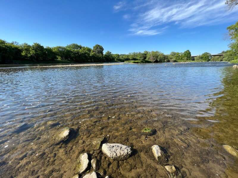
It’s hot and your local river looks enticing. But is it okay for swimming?

Swimming in rivers, creeks and lakes can be a fun way to cool off in summer. But contamination in natural waterways can pose a risk to human health.

Waterborne pathogens can cause acute gastrointestinal illnesses such as diarrhea and vomiting. Other common illnesses include skin rashes, respiratory problems, and eye and ear infections.

Unfortunately, it can be hard to find out if a waterway in Australia is safe for recreation. By contrast, a comprehensive system in Aotearoa-New Zealand, called Can I Swim Here?, provides timely water quality information for 800 beach, river and lake sites.

We have investigated the benefits and barriers associated with opening up waterways for recreation. Unsurprisingly, ensuring a local swimming site is safe is key to getting people using it. That includes giving people access to accurate information about water quality.

Can swimming really make you sick?

Contaminated water can exist in swimming pools and spas, as well as oceans, lakes, and rivers, exposing humans to a range of pathogens.

According to official advice in New South Wales, common waterborne pathogens include:

  • enteric bacteria such as Escherichia coli (E.coli) or Enterococci, that live in the intestinal tracts of all warm-blooded animals and can enter water as fecal matter (or poo). They can cause gastroenteritis, skin and ear infections and dysentery
  • viruses such as noroviruses and hepatitis. They can cause diarrhea, vomiting, hepatitis and respiratory disease
  • protozoa such as giardia which, once ingested, can live as parasites in humans and animals and cause diarrhea.

Australian research has documented a link between gastroenteritis and people swimming in public pools and freshwater sites such as rivers, lakes and dams.

Other water quality hazards for swimming include toxic blue-green algae and exposure to chemical pollutants.

Recent floods in Australia have led to an elevated risk of water contamination. As others have noted, flood waters can be highly polluted with disease-causing organisms, including from sewerage overflows.

So how do swimming locations get contaminated? Pollution can come from untreated sewage, or runoff containing animal poo or fertilizers. The source could be chemicals from nearby industrial activities, or the water users themselves.

Thankfully, most disease outbreaks from swimming are not fatal. An exception is the amoeba Naegleria fowleri. It lives in warmer waters and can cause amoebic meningitis, a potentially fatal brain disease.

How safe is your local swimming hole?

In Australia, guidance on recreational water quality tends to focus on ocean beaches. For example, NSW’s Beachwatchprogram cover more than 200 NSW coastal (and some estuary) beaches. The advice is based on likelihood of rain combined with testing swimming sites for fecal bacteria.

The Victorian government also provides coastal swimming guidance for 36 beaches in Port Phillip Bay.

But away from the coast, information on the water quality of our local rivers, creeks and lakes, is sparse.

In NSW, advice exists for swimming and boating at four sites on the Nepean River in Western Sydney. Information is provided for a recently reopened swimming site at Lake Parramatta and for swimming at some Blue Mountains sites.

In Victoria, the Yarra Watch program monitors four swimming sites in freshwater stretches of the Yarra River, upstream of Melbourne.

And authorities in Canberra provide regular water quality monitoring and swimming advice for lakes and rivers.

But in contrast to Australia, New Zealand provides far more detailed and broad guidance.

How New Zealand does it

New Zealand’s world-leading national program Can I swim here? enables people to find the best places to swim across 800 beach, river and lake sites across the country.

The advice is provided by LAWA (Land, Air, Water Aotearoa), a collaboration between regional councils, the New Zealand government, scientific experts and academics, and a philanthropist organization.

The data available includes both the latest weekly water quality test results, and results dating back five years.

The guidance also includes an interactive map (see above) where users can zoom to swimming sites in their region.

More work is needed

Everyone loves to be around, on and in the water, especially during summer. As well as providing a way to cool down, local swimming holes are great places for people to socialize, exercise and engage with nature—especially for those not near a beach.

Governments are recognizing the real opportunity to open up underused waterways for recreation across Australia. But for the sake of our communities, more work is needed on improving water quality and sharing information.

Australia has a lot to learn from New Zealand and other countries on how to manage our waterways for recreational use. And ongoing research, partnering with government and industry, is clearly needed.

FOR MORE INFORMATION: https://phys.org/news/2023-01-hot-local-river-enticing.html
Engineers examine safe drinking water management strategies

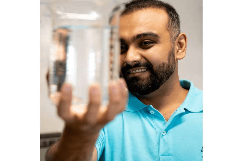
While residents in California are still dealing with damage from last month’s floods—after years of devastating droughts—UBC Okanagan engineers are looking at better ways to manage the delivery of safe drinking water to homes.

Their research was conducted in the School of Engineering’s Life Cycle Management Lab in collaboration with Universite Laval. It was published in the January edition of the Journal of Environmental Management.

Things to consider include a changing climate, costs and sustainability.

Dr. Haroon Mian, a Postdoctoral Research Associate with UBCO’s School of Engineering, says municipalities and water utilities all have drinking water management strategies to ensure the water they provide is safe and plentiful. However, a natural disaster, a breach in the supply or contamination at the treatment plant can put water supplies—and human health—at risk.

“Freshwater is essential to sustain ecosystem health and our survival,” says Dr. Mian. “But Earth’s once plentiful freshwater resources are now under increasing pressure due to population growth, urbanization and climate change.”

As water supplies become more threatened, not only is providing safe water a priority, but suppliers must also ensure that doing so will have low environmental and economic implications.

“The quality of drinking water is contingent on several important attributes such as water extraction, treatment, delivery, cost and the disposal of used water,” says Dr. Mian, who conducts research in UBC’s Life Cycle Management Lab. “Those factors can all be impacted by climate change. And they have a significant environmental influence in terms of natural resource depletion, waste generation and greenhouse gas emissions.”

Dr. Mian and his fellow researchers have developed an integrated assessment framework that combines water qualitywith lifecycle assessment techniques. Working with data from small and medium-sized communities, they provided a way to assess the long-term applicability of water systems that can provide safe drinking water to people.

According to Dr. Mian, the framework provides a different lens into a more holistic view of drinking water management and its components.

“We measure factors such as water quality, changes to the environment and potential costs to determine performance data and benchmarking, thereby providing important tools to ensure these systems experience long-term effectiveness and sustainability,” he adds.

Through assessment and management of these key factors, water can flow to a community at a reasonable cost while conserving natural resources and ensuring environmental protection.

The study evaluated the overall performance of several water distribution systems by combining the above-mentioned criteria. Water distributors can apply the framework to determine the best distribution management system that will provide safe drinking water to their consumers with minimal environmental and economic costs.

The framework continues to be tested to ensure it is flexible based on any setting, community or system.

“There are no perfect decision-making techniques. The results often vary based on the available data and assumptions,” Dr. Mian adds. “But this framework can be useful for all water distributors.”

FOR MORE INFORMATION: https://phys.org/news/2023-02-safe-strategies.html

Study finds small isolated wetlands are pollution-catching powerhouses

Small isolated wetlands that are full for only part of the year are often the first to be removed for development or agriculture, but a new study shows that they can be twice as effective in protecting downstream lake or river ecosystems than if they were connected to them.

Using a new method involving satellite imagery and computer modeling, researchers from the University of Waterloo found that since these small wetlands are disconnected, pollutants such as nitrogen and phosphorous get trapped. This is the first study to use satellite data for estimating nutrient retention.

All wetlands act like sponges, providing flood protection by absorbing the vast volume of water that can be suddenly released from rainfall or snowmelt. Improving water quality, providing habitat, increasing biodiversity, and trapping carbon are just some of the many environmental benefits wetlands provide. Their destruction increases our vulnerability to the extreme effects of climate change, including flooding, drought and the frequency of storms.

“This is especially a concern in regions like southern Ontario, which has already lost more than 70 per cent of its wetlands and is under threat to lose more from increasing population and developmental pressures. The rise in human population also increases the amount of pollution,” said Dr. Nandita Basu, a professor at Waterloo and Canada Research Chair in Global Water Sustainability and Ecohydrology. “If pollutants aren’t caught by small wetlands, then they’ll run into our lakes, beaches and eventually impact our supply of drinking water and ability to use the beaches for recreation.”

Basu, jointly appointed to the Department of Earth and Environmental Sciences and the Department of Civil and Environmental Engineering at Waterloo, worked with Dr. Frederick Cheng, who was her doctoral student on the project.

They used 30 years of satellite imagery from across the United States to determine how 3,700 wetlands were filling up and draining as a function of seasons and climate. Next, they estimated how much nitrogen would be removed by these water bodies.

“Being disconnected can actually be better because they are catching the pollutants and retaining them as opposed to leaking them back to the stream waters,” said Cheng, first author of the study and currently a postdoctoral fellow at Colorado State University.

Next, Basu and her team will apply these techniques to Canadian wetlands across the Great Lakes basin as well as the prairie region in Western Canada.

Their paper appears in Environmental Research Letters.

FOR MORE INFORMATION: https://phys.org/news/2023-02-small-isolated-wetlands-pollution-catching-powerhouses.html

If more houses had water barrels, it could help with drought, flooding and water pollution

Earlier this year, southern England experienced its driest July on record. The drought affected many parts of the UK and grew so acute that Thames Water’s hosepipe ban will remain in forceinto 2023.

But rainfall in August was heavy. The volume of rain causedoutdated drainage and sewerage systems to overflow, degrading the quality of many of the UK’s rivers. 

Extreme weather patterns such as these are set to dominate our future. The Environment Agency predicts that demand for water in southern England may outstrip supply in the next 20 years. Yet, at the same time, as many as 5.2 million UK properties are threatened by flooding.

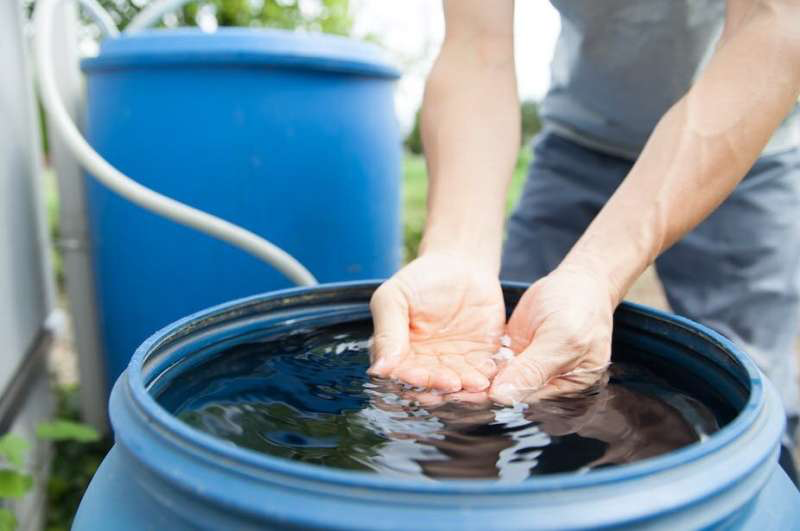
Our research suggests that collecting rainwater in water barrels may offer a solution to these problems. This cheap, small-scale intervention could help protect households against water risks while engaging those involved with water issues. Unfortunately, the government tends to ignore this scale of intervention. 

Engineered solutions to water issues

Water management in England is largely isolated to large infrastructure projects. Reservoirs are built to withstand drought and larger sewers are seen as the solution to flooding and water pollution. 

But these approaches are costly; Central London’s new sewer, the Thames Tideway Tunnel, will cost £4.9 billion. 

They can also harm the environment. The Thames Tideway tunnel will prolong the energy-intensive pumping of dirty sewage, while building reservoirs often involves the flooding of agricultural land and wildlife habitats.

These government and water industry solutions also fail to engage the public. Public awareness of the dual drought and flood crises, therefore, remains low. According to a reportpublished in 2020 and partly funded by the Environment Agency, 72% of people surveyed believe that the UK has enough water to meet the country’s needs.

Re-thinking water management

There are other ways to manage the UK’s water better.

The roof area of an average terraced house in the UK (30m²) receives 19,000–55,000 liters of rain each year. Our modeling suggests that a significant proportion of household water consumption could be met by collecting this water. 

Averaged across the UK, we found that a 210-liter rain tank—equivalent to a small bath—could supply 15% of a household’s total annual water consumption. But this will be subject to clear geographic and seasonal variation. 

The calculation accounts for the loss of rainwater through processes such as evaporation. Current regulations also restrict the use of rain tank water to non-potable demands, such as flushing toilets.

In the wetter northwest of Scotland, we found that 26% of a household’s annual water consumption could be met by collecting rainwater. In contrast, only 9% could be supplied in the southeast of England, dropping to 4% in the driest months. Although this seems a low value, it still equates to 14 liters of water per household each day.

Reducing the risk of flooding and pollution

In the future, wetter winters will also become more common. This will amplify the risk of flooding and water pollution. Our research suggests that a network of small water barrels fitted across towns or cities could substantially reduce these risks. 

In the event of a storm, a 210-liter water barrel can capture 7mm of rainfall from the roof of an average terraced house. To put this in context, in the English city of Hull, a storm that deposits 22.3 mm of rainfall is sufficient to cause flooding. This amount of rain typically falls once every ten years. 

So if we can store 7mm of that rain in a water barrel, then the amount that is required to cause a flood rises to 28.6mm. A storm that results in this amount of rainfall only occurs once every 30 years.

This approach is not without its limitations. The area that is occupied by roofs is far smaller than the total area over which rain falls. The hydrology of a flood is also complex, including the movement of water through a catchment from uplands to lower-lying areas. 

But if used in combination with sustainable drainage systemsand other natural flood management measures, water barrels could make a small but meaningful contribution to reducing the threat of flooding and water pollution. Through various processes, sustainable drainage systems provide an alternative to the direct channeling of rainwater through pipes and sewers to nearby watercourses. By providing additional storage in ponds, for example, the flow of surface water can be reduced.

Even then, large numbers of households would still need to install water barrels for this approach to have any effect. We have worked with local voluntary organizations to establish a non-profit cooperative called Susdrainable that specializes in the design and installation of rain tanks. Together, we have installed rain tanks on public buildings in Hull and are working on signage and leaflets to provide households with the information they need to participate in water management.

Water barrels are not a replacement for large-scale water management infrastructure, but they do offer a cheaper mitigation option—one that also engages the public with waterissues. There is a role for everyone as we prepare for a future dominated by drought and flood.

FOR MORE INFORMATION: https://phys.org/news/2022-11-houses-barrels-drought-pollution.html

South Africa’s biggest cities are out of water, but the dams are full: What’s gone wrong?

South Africa’s major cities in the Gauteng Province—the country’s economic heartland—are experiencing major water shortages. In Johannesburg and Tshwane taps have run dry, with numerous areas experiencing intermittent supply while some areas have no water at all.

The province has metropolitan areas—the City of Johannesburg, Tshwane and Ekurhuleni. All are affected. Rand Water, the water authority for the region, has imposed restrictions of 30%. This will be revisited when the system recovers. 

The last water shutdown was in November 2021 when Rand Water cut off water for 54 hours so that it could to do infrastructure maintenance. There were also restrictions during the drought in 2015-2017.

The province serves as a perfect example of how an area can experience water shortages and intermittent supply even though dams are full. 

The biggest problem lies with decaying infrastructure. This includes water storage, water supply and treatment. In addition water resources are poorly managed. And there’s been poor planning, a lack of financing to maintain aging infrastructure and to keep up with rapid urbanization. 

The crisis in Gauteng has been developing over many decades. The water and sanitation infrastructure in Johannesburg is old—some water pipes were installed nearly a century ago. In addition, there’s been exponential growth—of businesses and the population.

Gauteng is South Africa’s smallest province, but contributes 45% to the country’s total economic output. All economic sectors have expanded in the past decades.

The province’s population has also increased to just over 16 million—up from 12 million in 2011.

Rand Water has indicated that high water consumption is to blame for the current shortages. Estimates suggest that water consumption in Gauteng per person per day is over 300 liters, well above the global average of 173 liters. Importantly, this estimate includes non-revenue water—water that’s lost before it reaches the consumer.

The Gauteng Province is unfortunately finding itself in a perfect storm of major intermittent water supply due to continued power blackouts, high temperatures leading to above average water use as well as major continued water losses through bursting pipes and major leaks due to dilapidated infrastructure.

There’s an urgent need to put water higher on the country’s agenda. Various water problems are escalating at a rapid rate.

The decline

The quality of water infrastructure in South Africa is deemed to be below average and deteriorating in comparison to comparable countries such as Nigeria and Zambia.

A number of factors have contributed to the current state of affairs.

Firstly, the poor quality of infrastructure. This is attributed to insufficient long-term planning, poor construction techniques and materials as well as the poor maintenance of existing infrastructure. 

South Africa’s infrastructure is mostly aged (more than two decades old), in a state of decay. In its 2017 infrastructure report card the South African Institution of Civil Engineering concluded that the country’s infrastructure was at risk due to its low overall grade of D+. 

Secondly, the management of consumption has been poor. South Africa is a water scarce country. Yet the average domestic water use is estimated at 237 liters per person per day, 64 liters higher than the international benchmark of 173 liters per person per day. 

High consumption is partly attributed to high municipal non-revenue water. This stands at 41% This means that 41% of water is lost due to leakages owing to poor operation and maintenance of existing aged water infrastructure, commercial losses caused by meter manipulation or other forms of water theft and lastly, unbilled authorized consumption such as firefighting.

Global best practice is 15% .

Thirdly, a lack of institutional capacity at a local level has limited the capability of local governments to provide infrastructure. Low expenditure levels on infrastructure investment is evidence of these capacity deficits despite the national governmentcontinuously emphasizing the need for more investment.

Fourthly, there has been massive under funding for decades. This has led to decay and in some instances a collapse of infrastructure. Government spending on infrastructure reached its peak in the 1960s to late 1970s. There was then a steady decline from 1977. In 2000, the country’s per capita spending on infrastructure reached a 40-year low and warnings were issued about the condition of bulk water and sanitation infrastructure. 

By 2002 the country’s infrastructure stock was at similar levels to that of 1973. 

Other factors contributing to the current crisis include poor management (at national and local level), delays in implementation, insufficient institutional capacity and competence and a lack of political will.

Fifth, a multi-layered and complex system of managing water resources. Numerous stakeholders at different levels of government play a role in the management of water resources. 

The Department of Water and Sanitation is the custodian of the country’s water. It is ultimately responsible for ensuring that water resources are protected, used, developed, conserved, managed and controlled effectively. The development and management of national water resource infrastructure also forms part of the department’s functions. 

Other managing agents include catchment management agencies (managing water resources at a regional or catchment scale), water user institutions (providing the institutional structure) as well as water service authorities which include local government and municipalities, water utilities and private firms responsible for governing domestic water supply services. 

Johannesburg Water therefore sources water from Rand Water, which supplies potable water to the Gauteng Province and other areas. The City of Johannesburg and Johannesburg Water, for example, are responsible for dealing with growing demands and the management of the delivery and services.

What’s needed

The following steps should be considered to try and ensure continued suitable water supply within the Gauteng Province as well as other areas experiencing the same issues:

  • A suitable budget needs to be made available immediately to address priority areas. Proper planning and informed actions, not just promises, is a major requirement. Johannesburg Water estimated in 2020 that R88 billion was required for the replacement of infrastructure with a total renewal backlog of R20.4 billion.

The entity has been allocated a R3.3 billion multi-year capital budget aimed at replacing water and sewer pipes, upgrading water storage infrastructure, a wastewater treatment works program and lastly, repairing and maintaining outdated infrastructure. A further R2.3 billion has also been allocated to address burst pipes across the province.

This amount of money might be a suitable investment to address the dilapidated state of infrastructure. But it should have been assigned much sooner. 

  • Dilapidated infrastructure needs to be upgraded and properly maintained. The lack of maintenance has contributed to leaking pipes and faulty infrastructure which now needs to be fixed as a matter of urgency as it contributes to major physical water losses. This won’t solve the problem overnight given that there have been decades of neglect. But a start needs to be made.
  • Capacity constraints or lack of skills need to be identified and addressed.
  • Private sector investment in water infrastructure needs to be incentivised together with the promotion of private-public partnerships.
  • Implementation of water conservation and demand management.
  • Political will to move away from simply providing infrastructure to maintenance, rehabilitation and upgrading of existing infrastructure.

FOR MORE INFORMATION: https://phys.org/news/2022-10-south-africa-biggest-cities-full.html

‘Forever chemicals’ persist through wastewater treatment, may enter crops

PFAS (per-and polyfluoroalkyl substances), a group of more than 4,700 fully synthetic compounds that are widely used in industrial and manufacturing processes and found in many consumer products, persist through wastewater treatment at levels that may impact the long-term feasibility of “beneficial reuse of treated wastewater,” according to a study conducted by researchers at Penn State and recently published in the Journal of Environmental Quality.

PFAS, often referred to as “forever chemicals,” are used to make fluoropolymer coatings and products that resist heat, oil, stains, grease and water, and are found in a variety of products from clothing and furniture to food packaging and non-stick cooking surfaces.

“PFAS are so pervasive and persistent that they have been found in the environment all over the world, even in remote locations,” said Heather Preisendanz, associate professor of agricultural and biological engineering at Penn State. “Unfortunately, these compounds have been shown to negatively impact ecological and human health, particularly because they can bioaccumulate up the food chain and affect development in children, increase risk of cancer, contribute to elevated cholesterol levels, interfere with women’s fertility and weaken immune systems.”

Because of their wide variety of uses, PFAS enter wastewater treatment plants from both household and industrial sources, said Preisendanz.

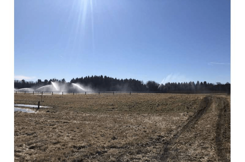
Beneficial reuse of treated wastewater is an increasingly common practice in which treated wastewater is used for irrigation and other non-potable purposes. According to Preisendanz, this practice provides an opportunity for the soil to act as an additional filter for PFAS, reducing the immediate impact of direct discharge of PFAS to surface water, as would typically happen following traditional wastewater treatment. However, given that the chemical structures of PFAS are difficult to degrade, the risks and potential tradeoffs of using treated wastewater for irrigation practices, especially in the long-term, are not well understood.

“PFAS have been shown to be taken up by crops and enter the food chain when the crops are consumed, so when treated wastewater is used for irrigation activities in agricultural fields, understanding these tradeoffs is of critical importance,” she said.

Preisendanz and her colleagues analyzed PFAS concentrations in water that passed through a water reclamation facility. They collected bi-monthly water samples from fall 2019 through winter 2021 prior to treatment and after treatment. Since the treated water from the wastewater treatment plant is used to irrigate nearby crops, the team also collected tissues from those crop plants, including corn silage and tall fescue, to assess for the presence of PFAS.

The team identified 10 types of PFAS across the site, with average total measured concentrations of 88 ng/L in the wastewater effluent and concentrations as high as 155 ng/L (nanograms per liter) in the downstream monitoring wells. The conclusions suggest that occurrence of PFAS across the site is nearly ubiquitous, and that levels increase with the direction of groundwater flow.

“The United States Environmental Protection Agency recently released updated health advisories for two of the most important PFAS—PFOA (Perfluorooctanoic acid) and PFOS (Perfluorooctanesulfonic acid)—such that ‘any detectable level is considered a risk to human health,'” said Preisendanz. “This presents potential challenges for beneficial reuse of wastewater.”

While the groundwater near the spray-irrigation site the team studied is not used for drinking, and not likely to pose a risk to human health in that regard, the team did find several PFAS compounds in crop tissue samples collected at both irrigated and non-irrigated portions of the site.

“This suggests that PFAS may enter the food chain when these crops are fed to livestock,” Preisendanz said, adding that future research is needed to determine potential risks to livestock health and the potential implications of PFAS presence in meat and dairy products, including milk. “Our study results have important implications to ensure that beneficial wastewater reuse activities achieve desired goals to reuse water and nutrients, while simultaneously ensuring PFAS levels are safe from a human health perspective.”

FOR MORE INFORMATION: https://phys.org/news/2022-10-chemicals-persist-wastewater-treatment-crops.html

Elevated levels of arsenic and other metals found in Nevada’s private wells

Outside of Nevada’s bustling cities, private wells are the primary source of drinking water, serving 182,000 people. Yet some of the tested private wells in Nevada are contaminated with levels of heavy metals that exceed federal, state or health-based guidelines, a new study published in Science of The Total Environment shows. Consuming water contaminated by metals such as arsenic can cause adverse health effects.

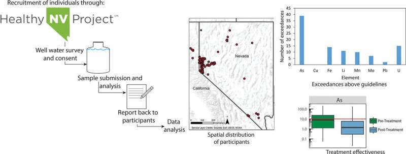
Scientists from DRI and the University of Hawaii Cancer Center recruited households with private wells through the Healthy Nevada Project. Households were sent free water testing kits, and participants were notified of their water quality results and recommended actions they could take. More than 170 households participated in the research, with the majority from Northern Nevada around Reno, Carson City and Fallon.

“The goals of the Healthy Nevada project are to understand how genetics, environment, social factors, and healthcare interact. We directly engaged our participants to better understand environmental contaminants that may cause adverse health outcomes,” said co-author Joseph Grzymski, Ph.D., research professor at DRI, principal investigator of the Healthy Nevada Project, and chief scientific officer for Renown Health.

Nearly one-quarter (22%) of the private wells sampled had arsenic that exceeded safe levels determined by the Environmental Protection Agency (EPA)—with levels 80 times higher than the limit in some cases. Elevated levels of uranium, lead, cadmium, and iron were also found.

“We know from previous research that Nevada’s arid climate and geologic landscape produce these heavy metals in our groundwater,” says Monica Arienzo, Ph.D., an associate research professor at DRI who led the study. “It was important for us to reach out to community members with private wells to see how this is impacting the safety of their drinking water.”

Fewer than half (41%) of the wells sampled used water treatment systems, and some treated water samples still contained arsenic levels over EPA guidelines. Although average levels of heavy metal contaminants were lower in treated water, many homes were unable to reduce contaminants to levels considered safe.

The state leaves private well owners responsible for monitoring their own water quality, and well water testing helps ensure water is safe to drink. This study shows that more frequent testing is needed to ensure Nevada’s rural communities have safe drinking water. This is particularly important as the effects of climate change and population growth alter the chemistry of groundwater, potentially increasing metal concentrations.

“The results emphasize the importance of regular water quality monitoring and treatment systems,” said co-author Daniel Saftner, M.S., assistant research scientist at DRI.

Although the research focused on wells in Nevada, other arid communities in Western states are facing similar risks of water contamination.

FOR MORE INFORMATION: https://phys.org/news/2022-10-elevated-arsenic-metals-nevada-private.html

Robots monitor the environmental impact of the Nord Stream gas leak

The University of Gothenburg has deployed three underwater robots in the Baltic waters around the leaks on the Nord Stream gas pipelines. This is done to be able to follow how chemistry and life in the sea changes over time due to the large release of methane gas. In addition, research vessel Skagerak is set to deploy on a new expedition to the Baltic Sea to test run the large, unmanned vessel Ran.

The expedition with R/V Skagerak was not the only measure the university’s researchers took when the Nord Stream pipelines began to leak methane gas. With the help of the Voice of the Ocean foundation, VOTO, three remote-controlled underwater robots were placed in the area. They will move around the sea and record water data continuously for the next 15 weeks. 

“They are called gliders and are provided by VOTO, who also manages their operation. The robots can give us measurements over a series of time about how the chemistry and quality of the water is affected by the natural gas leak,” says oceanographer Bastien Queste at the University of Gothenburg.

Plenty of data from the area

Since March 2021, VOTO has had two gliders in the area which functions as one of the foundation’s ocean observatories and where the water quality is measured non-stop. The robots go down to the bottom and then turn up to the surface, something that is repeated over a preset distance. Every time the glider is at the surface, the latest measurement data is sent to the researchers via satellite. Thus, plenty of data from this area already exists from before. One of the three additional robots that was dropped into the sea last week has been equipped by the manufacturer Alseamar with a special sensor to be able to measure the change in the methane content over the next 15 weeks.

“Last week’s expedition provided valuable data and a snapshot of the state of the ocean immediately after the leakage occurred. With the new robots in place, we receive continuous reports on the state of the water near the Nord stream pipeline leaks. They are deployed solely for this purpose,” says Bastien Queste.

“The point is that we get measurements from the water over a long period of time and over a larger area. We can see how long it takes for the methane to disappear and how the aquatic environment reacts over time. The response in the sea is often delayed. It may take days or weeks before we see a change,” says Bastien Queste.Even the underwater robots that are usually deployed there, can contribute important data as they measure salinity, temperature, oxygen content and the amount of chlorophyll. This completes the picture of how the water in the Baltic Sea is doing after the gas leak.

Solid scientific documentation

“Together with the new robots and the expedition’s measurements, we researchers will have solid scientific documentation of the impact of the Nord Stream leak. When we add it all up, we have a good picture of both the immediate and the delayed effects. With gliders that continuously measure, we will be able to better understand the processes that were observed then,” says Bastien Queste.

The expedition has barely had time to disembark before preparations for the next trip to the Baltic Sea with Skagerak have started. Polar researcher Anna Wåhlin had, for a long time, planned a trip with the ship precisely to the area east of Bornholm.

“I will test how the large underwater robot Ran behaves in seas with large layers of density and how well it can measure over sediment-rich bottoms. This place is perfect for that. Ran will also be able to contribute to research into gas emissionsbecause it measures the carbon dioxide and nitrate levels in the water,” says Anna Wåhlin. This is also the first time that Ran departs from Skagerak, which will be an important test of the ship’s flexibility.

FOR MORE INFORMATION: https://phys.org/news/2022-10-robots-environmental-impact-nord-stream.html

Some like it hot: The ecological benefits of oyster reefs in tropical waters

A Griffith-led study has reported that tropical oyster reefs have a far greater diversity of reef-building oyster species than those in temperate waters.

Published in Frontiers in Marine Science, the research shows there are over four times more species of reef-building oysters in the tropics compared to temperate regions and many of these tropical species often create mixed-species oyster reefs.

“We expected the diversity to be higher in the tropics, but we were surprised to find how high it was and given how little we know, we expect the number of tropical reef-building oysters will grow as research continues,” said lead author Marina Richardson, a Ph.D. candidate at the Australian Rivers Institute and the Coastal and Marine Research Center.

“We also found that tropical species grow much faster than temperate species, having the potential for multiple spawning seasons throughout the year as opposed to just one.”

Oyster reefs are formed over generations as oysters settle and die, leaving behind old shells which are then colonized by new oysters. They are found globally in coastal and estuarine environments and can form three-dimensional reef habitats that spread for kilometers.

“These reefs provide important ecosystem services including shoreline stabilization, water filtration, nutrient assimilation, and habitat for marine species including commercially important fish and crustaceans,” said Ms Richardson.

“In many parts of the world unsustainable harvesting, declining water quality, and coastal development have caused oyster reef declines and the loss of these ecosystem services.”

The widespread declines have sparked a world-wide movement for their restoration of oyster reefs, however a current scarcity of information on tropical oyster reefs has led to their exclusion from existing global assessments and restoration efforts.

In reviewing the differences between tropical and temperate oyster reefs and identifying historic tropical oyster reefs, the researchers can better inform their restoration.

“In tropical Queensland, for example, the historic presence of oyster reefs was largely unknown,” said Dr. Carmel McDougall, a co-author and research lead from the Australian Rivers Institute.

“We searched newspapers published prior to 1939 from coastal towns north of Seventeen Seventy for evidence of oyster reefs, before oyster harvests peaked in northern Queensland and conservatively identified 94 historic reefs across 58 sites, with declines were noted as early as 1902.

“Evidence that unsustainable and destructive harvesting has resulted in the decline of tropical oyster reefs shows the need to include these reefs in restoration efforts. We highlight knowledge gaps that can help guide future research and remove potential barriers to tropical oyster reef restoration.”

Since the study was published, Ms. Richardson has identified and begun researching several previously undocumented tropical oyster reefs.

“These reefs are more extensive than anything we have previously found and cover areas greater than 4 hectares,” Ms. Richardson said.

“We hope to document reef-building abilities of additional species in Queensland to identify new candidate oysters for use in restoration and quantify the invertebrate communities associated with these reefs.”

FOR MORE INFORMATION: https://phys.org/news/2022-10-hot-ecological-benefits-oyster-reefs.html

Cleaner wastewater makes for healthier rivers

Have you ever thought about where your waste goes? For people living in cities, it goes to a treatment plant. However, treated wastewater ultimately finds its way into a local waterway. This means it could end up in your nearby stream, river, or lake.

Although wastewatertreatment reduces the threat of disease, another problem remains: nutrients. Wastewater contains a lot of nutrients (nitrogen and phosphorus), including from pee and poop. All plants and animals need nutrients to grow and thrive; however, too much of a good thing is a big problem, particularly for waterways. Rivers get sick when too many nutrients impair the ecosystem. One of the worst offenders is excess ammonia.

“Ammonia is a nitrogen compound produced by the breakdown of organic matter in sewage. Discharge of ammonia into waterways can have direct toxic effects but also cause significant oxygen depletion that threatens the survival of aquatic life, including fish,” says Helen Jarvie. A professor of water science at the University of Waterloo in Canada, Jarvie studies how these nutrients affect waterways.

The study was published in the Journal of Environmental Quality.

Jarvie and her team studied what happened when two Canadian cities upgraded their wastewater treatment plants. Waterloo and Kitchener both sit along the Grand River. The Grand River is Canada’s largest river draining into Lake Erie. Over the last decade, the two cities began a program called ‘nitrification’ at their wastewater treatment plants. Nitrification turns ammonia into other types of nitrogen.

“This ultimately reduces the amount of ammonia in the wastewater that’s discharged into waterways,” says Jarvie.

Thanks to these upgrades, there was a massive drop in the amount of ammonia going into the river. Before the changes, the two wastewater plants discharged more than 90 metric tons of ammonia a month. In just one year, the Kitchener treatment plant reduced its ammonia release by 80%. A decade later, the total ammonia output had dropped to less than one metric ton a month, a 99% decrease. Nitrogen was still flowing into the river, but it was now in an amount and form that is less problematic for dissolved oxygen levels and fish.

Jarvie’s team studied how this drop in ammonia from wastewater affected the river. One of the biggest signs of waterway health was the increase in the amount of oxygen in the water. Too much ammonia depletes oxygen, killing aquatic life. So, the Grand River Conservation Authority put sensors in the river to measure how these vital dissolved oxygen levels changed.

River oxygen levels vary between daylight hours when plants produce oxygen, and the nighttime when oxygen is consumed. The scientists used the oxygen data to assess the overall metabolism of the river, which is the balance between how much organisms produce and how much they consume. When organisms consume too much, they use up a lot of oxygen.

When ammonia levels were really high, the river oxygen levels were depleted overnight. The effects were greatest during the summer when the river was most biologically active. On nearly 90% of summer days before nitrification treatment, nighttime oxygen dropped below the levels needed to support aquatic life. By the end of the study, nighttime oxygen dropped below levels needed to support the most sensitive creatures on only about 6% of summer days. 

“This represents an important improvement in the ecosystem health of the Grand River, as a result of the reductions in effluent ammonia loads,” says Jarvie.

The river’s metabolism rebalanced, and oxygen levels improved. After upgrades to the wastewater treatment plants, the reduced consumption of oxygen meant the river was in better overall health.

“This is a great success story,” says Jarvie. “We have shown how investments in wastewater management have yielded important improvement to the ecological health and water quality of the Grand River.”

Improving our waterways will mean tackling all sources of excess nutrients. Jarvie emphasizes that wastewater is only part of the equation. “Agriculture is another very important contributor of nutrients to the Grand River, ultimately to Lake Erie and to other waterways.”

FOR MORE INFORMATION: https://phys.org/news/2022-10-cleaner-wastewater-healthier-rivers.html