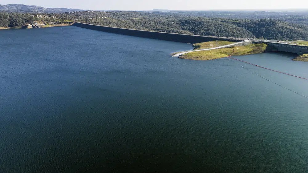
The Oroville Dam, top right, holds back water at Lake Oroville on March 25, 2023, in Butte County, Calif. Regulators say California will provide 100% of the water requested by cities and farms for the first time in years thanks to winter storms that filled reservoirs and runoff from a record snowpack
California will provide 100% of the water requested by cities and farms for the first time in years thanks to winter storms that filled reservoirs and runoff from a record snowpack, regulators announced Thursday.
The State Water Project will provide full allocations to 29 water agencies supplying about 27 million customers and 750,000 acres of farmland, the Department of Water Resources said.
As late as March, the agency was only expecting to provide 75% of requested water supplies.
The last time the state agency fully met water requests was in 2006.
Meanwhile, the federal Bureau of Reclamation announced it was increasing water allocations for the Central Valley Project to 100% for the first time since 2017.
The move was cheered by contractors who supply the federal water to the state’s agricultural heartland. It will provide much-needed water to communities, farms and families in the San Joaquin Valley, said a statement from Jose Gutierrez, interim general manager of Westlands Water District.
“Following two years of 0% allocations, this water supply will assist growers in Westlands with putting the land to work to grow the food that feeds the world,” he said.
Both the state and federal governments control networks of reservoirs and canals that supply water across California.
Three years of drought had pinched off supplies drastically in the nation’s most populous state. Late last year, nearly all of California was in drought, including at extreme and exceptional levels. Wells ran dry, farmers fallowed fields, and cities restricted watering grass.
The water picture changed dramatically starting in December, when the first of a dozen “ atmospheric rivers ” hit, causing widespread flooding and damaging homes and infrastructure, and dumping as many as 700 inches (17.8 meters) of snow in the Sierra Nevada mountains.
The statewide reservoir storage on Thursday was at 105% of the average for the date, the Department of Water Resources said.
The runoff from the melting snow will supply additional water that the state agency said it is working to capture.
As of this week, more than 65% of California no longer had drought conditions, according to the U.S. Drought Monitor.
However, the Department of Water Resources urged people to continue using water cautiously. State officials have warned that in the era of climate change, one extremely wet year could be followed by several dry years, returning the state to drought.
The state water agency noted that some northern areas of the state still have water supply issues. In addition, some areas, including the agricultural Central Valley, are still recovering after years of pumping that has depleted underground water.
“Millions of Californians rely on groundwater supplies as a sole source of water,” the agency warned.
“The Colorado River Basin, which is a critical water supply source for Southern California, is still in the midst of a 23-year drought,” the agency added. “Californians should continue to use water wisely to help the state adapt to a hotter, drier future.”
Lake Mead will rise 33 feet higher than expected this year because of snowpack levels in the Upper Colorado River Basin, according to estimates released Thursday by the U.S. Bureau of Reclamation.
Snow that will melt and feed the Colorado River is causing major adjustments in government plans to store water in Lake Powell and Lake Mead. 8NewsNow.com reported on April 12 that water flows have already increased from Lake Powell, a fact confirmed by the U.S. Bureau of Reclamation’s April 24-month study.
Historic (10 year) Release volumes from Lake Powell. (Source: USBR)
Now the government is revealing plans that include increasing the amount of water released from Lake Powell by 35% this year. The plan to release 7 million acre-feet has been adjusted to 9.5 million acre-feet — a difference of more than 800 billion gallons of water by the end of the year.
It’s the good news Las Vegas has been waiting for after two decades of watching the bathtub ring at Lake Mead. But to put one good year in perspective, the Bureau of Reclamation said Lake Powell and Lake Mead — the two biggest reservoirs in the country would go from 23% full to 26% full.
Snowpack levels at the beginning of April were around 160% of normal. Water managers regard the start of April as the peak of the snowpack, when spring temperatures begin to melt snow faster than new snow accumulates.
The high snowpack levels are translating to an expected flow in the Colorado River that’s 177% of normal levels.
The Burea of Reclamation also announced plans for a “high-flow release” later this month, when water will come out of Glen Canyon Dam at a rate of 35,900 cubic feet per second. That will move sediment stored in the river to build up beaches, “which will benefit conditions at Grand Canyon National Park and aid in management of invasive species in the Colorado River,” officials said.
This winter’s snowpack is promising and provides us the opportunity to help replenish Lakes Mead and Powell in the near-term — but the reality is that drought conditions in the Colorado River Basin have been more than two decades in the making,” Reclamation Commissioner Camille Calimlim Touton said. “Despite this year’s welcomed snow, the Colorado River system remains at risk from the ongoing impacts of the climate crisis. We will continue to pursue a collaborative, consensus-based approach to conserve water, increase the efficiency of water use, and protect the system’s reservoirs from falling to critically low elevations that would threaten water deliveries and power production.”
While Lake Mead raises by 33 feet — to an expected 1,068.05 feet this year — Lake Powell will go up by 40 feet to 3,576.50 feet, holding back an extra 2.74 million acre-feet of water from the higher runoff. Lake levels are expressed as the elevation of the lake’s surface compared to sea level.
Lake Mead is currently at 1,047.03 feet (as of noon today). The lake typically rises in spring months and begins to drop around July and continuing for the remainder of the year. The extra water from Lake Powell this year could change that pattern.
For the past few years as the megadrought has had its most severe impact on the river, water managers have adjusted releases from Glen Canyon Dam, trying to maintain hydropower production as water levels dropped to their lowest levels since the dam was built and Lake Powell was initially filled. The adjustments meant holding back water that would typically go downstream to Lake Mead.
In this Nov. 19, 2012, file photo, water is released into the Colorado River at the Glen Canyon Dam in Page, Ariz. (Rob Schumacher/The Arizona Republic via AP, File)
This year’s snowpack provides a break from “emergency” adjustments to dam operations as the reservoirs finally fill — even if it’s only to 26% capacity.
The Colorado River Compact — a century-old agreement — determines how much water each state is entitled to take as the river flows from its headwaters in the Colorado Rockies all the way to the Gulf of Mexico. Nevada takes only a small share of that water, but the drought cut allocations as the federal government formally declared a water shortage.
None of the announcements on Thursday change the situation with lower allocations for Nevada, Arizona and California.
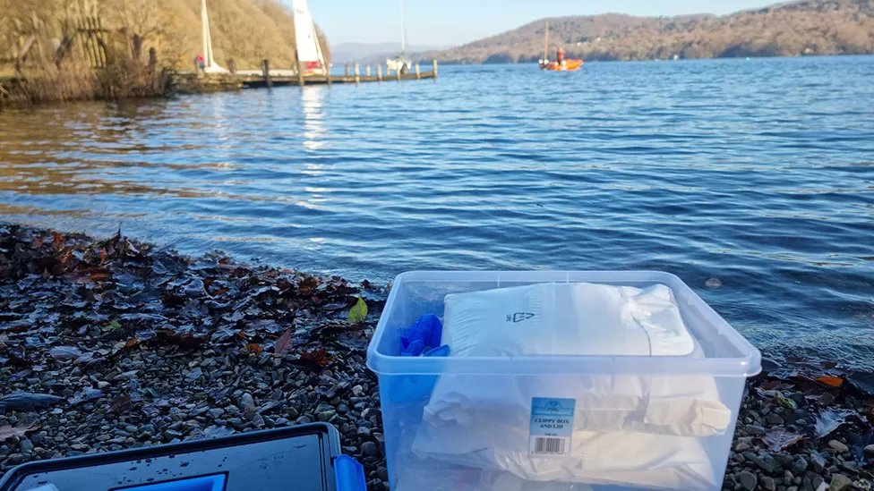
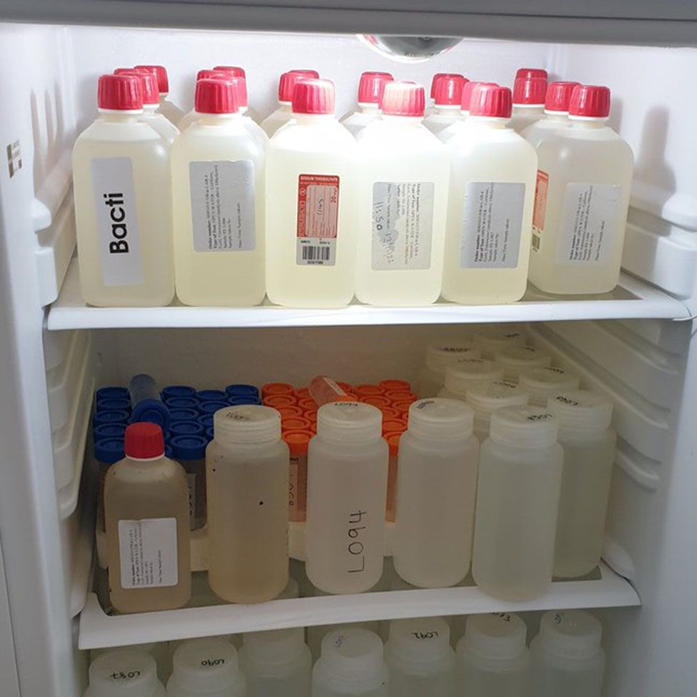
Volunteers were needed to take samples around the lake at the same time
Dozens of volunteers have been recruited for a mass sampling of water in England’s largest lake.
Concerns have been raised about the water quality in Windermere after raw sewage discharges and the presence of blue green algae.
The Freshwater Biological Association (FBA) which runs the survey said it needed help so all the samples could be taken at the same time.
Head of science Louise Lavictoire said it “couldn’t go out and sample 100 different points all at the same time in a single day”.
She said it was “fantastic” to have help in terms of logistics “but it also means that people understand a bit more about what is happening with the lake”.
Data was available from samples taken from the middle of the lake but the FBA wanted to test water at the shoreline where “most people interact” with it, she said.
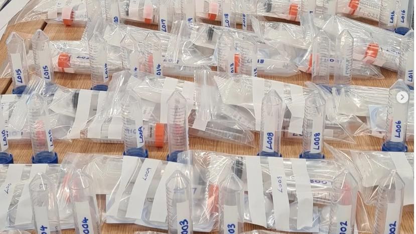
More than 100 samples needed to be taken at the same time
Windermere is ecologically important and home to rare fish species such as the Arctic charr.
Concerns have been raised about algal blooms and bacterial pollution and the potential harm to people and wildlife.
The survey collected about 100 samples on Sunday which will be analysed for nutrients and bacteria.
The FBA said there was less information available about how the lake’s water changed through the seasons, which is why it intended to run the survey four times a year.
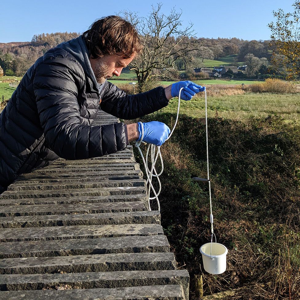
Samples are also taken from becks flowing into Windermere
The organisation said it had an “excellent response” to its call for volunteers, some of whom had helped with all four surveys carried out so far.
“We’ve got a lot of people who keep coming back because they recognise the importance,” Ms Lavictoire said.
“The water quality and the bacterial quality of these water bodies changes over time, it’s not static.
“The great thing about doing the same sites each time is that we can start the patterns and start to see where the problem points might be.”
Water sample are tested for bacteria and pollution
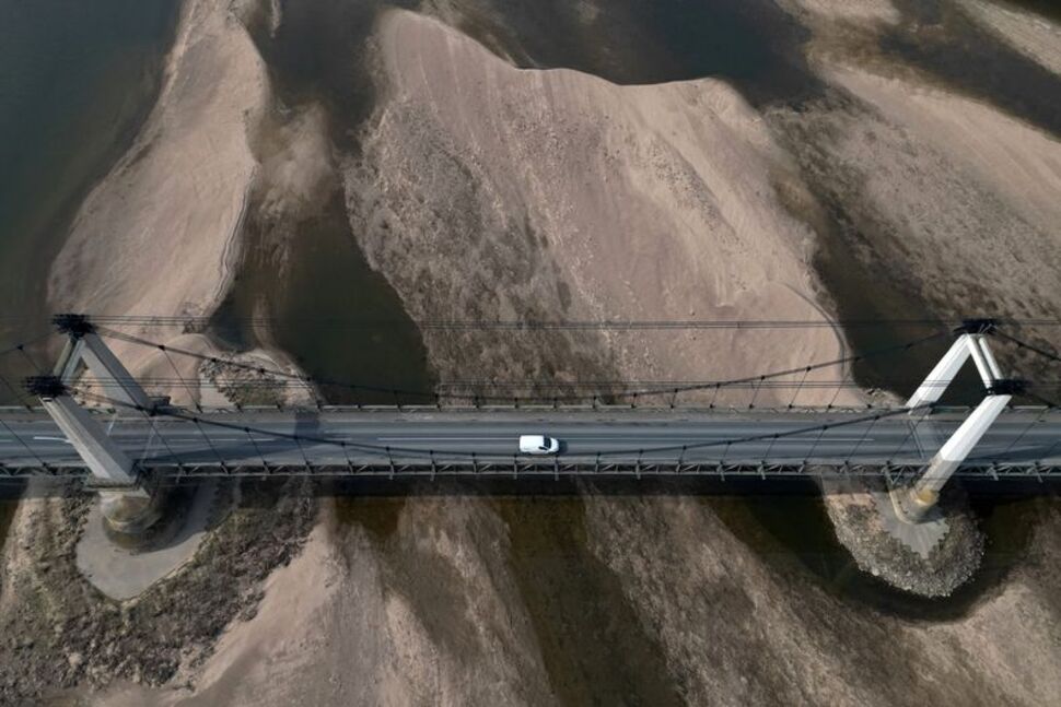
A view shows a bridge and sandbanks of the Loire River in Montjean-sur-Loire, as France faces records winter dry spell raising fears of another summer of droughts and water restrictions
Very low groundwater levels have put France on course for a worse summer drought than last year, mainly in the southern part of the country which had been ravaged by massive wildfires, French geological service BRGM said on Thursday.
France suffered its worse drought on record last summer and, like most of Europe, has faced a dry winter that has prompted concerns over water security across the continent.
“The situation is worrying because the whole of France is affected and we have had several dry years,” BRGM hydrologist Violaine Bault said.
Groundwater levels are generally below those of 2022 and recharge is insufficient in most of the country after a particularly dry winter, she said, adding that many parts of France would very likely need to introduce water restrictions in the summer, notably in central regions and around Paris.
Some groundwater levels were at their lowest on record in the wine-making Roussillon region and in the southern Var region, which hosts the tourist town of Saint-Tropez. Both suffered repeated large wildfires over the past summers.
Crops that could be affected by a lack of water in southern France mainly include fruit and vines. The region grows little grain.
Weather forecaster Meteo France said on Thursday that rainfall in March had returned soil humidity to normal levels after record lows at the start of the month.
However, the soils, which were already dry at the end of February, dried up further in southeastern part of the country and reached record low moisture values in surface soils in the southwestern Aude and Pyrenees-Orientales regions, it said.
‘Flash droughts’ have become more frequent due to human-caused climate change and this trend is predicted to accelerate in a warmer future, according to research published today [13 April 2023] involving the University of Southampton.
The research published in Science shows that flash droughts, which start and develop rapidly, are becoming ‘the new normal’ for droughts, making forecasting and preparing for their impact more difficult.
Flash droughts can develop into severe droughts within a few weeks. They are caused by low precipitation and high evapotranspiration, which quickly depletes the soil of water. While they start quickly, the droughts can last for months, damaging vegetation and ecosystems, and triggering heat waves and wildfires.
A multinational group of researchers wanted to understand if there had been a transition from conventional ‘slow’ droughts to flash droughts and how this trend will develop under different carbon emission scenarios.
“Climate change has effectively sped up the onset of droughts,” says Professor Justin Sheffield, Professor of Hydrology and Remote Sensing at the University of Southampton and co-author of the paper.
“While it varies between different regions, there has been a global shift towards more frequent flash droughts during the past 64 years.”
The transition to flash droughts is most notable over East and North Asia, Europe, the Sahara, and the west coast of South America. Some areas, such as eastern North America, Southeast Asia and North Australia, saw fewer flash and slow droughts, but the speed of drought onset had increased. In the Amazon and West Africa, there was no evidence of a transition to flash droughts; the Amazon saw an increase in slow droughts and West Africa saw an increase in the frequency and extremity of both fast and slow droughts.
Professor Justin Sheffield added: “As we head towards a warmer future, flash droughts are becoming the new normal. Our models show that higher-emission scenarios would lead to a greater risk of flash droughts with quicker onset which pose a major challenge for climate adaptation.”
The transition to flash droughts may have irreversible impacts on ecosystems as they may not have enough time to adapt to a sudden lack of water and extreme heat. Forecasting flash droughts is also difficult as current approaches to predicting droughts use longer time scales.
The researchers say new approaches are needed to provide early warnings of flash droughts, as well as a better understanding of how natural ecosystems and humans will be impacted.
Funding for the research was provided by the National Natural Science Foundation of China, the National Key R&D Program of China, the Natural Science Foundation of Jiangsu Province for Distinguished Young Scholars, and the UK-China Research & Innovation Partnership Fund through the Met Office Climate Science for Service Partnership (CSSP) China as part of the Newton Fund.
The alga Melosira arctica, which grows under Arctic sea ice, contains ten times as many microplastic particles as the surrounding seawater. This concentration at the base of the food web poses a threat to creatures that feed on the algae at the sea surface. Clumps of dead algae also transport the plastic with its pollutants particularly quickly into the deep sea — and can thus explain the high microplastic concentrations in the sediment there. Researchers led by the Alfred Wegener Institute have now reported this in the journal Environmental Science and Technology.
It is a food lift for bottom-dwelling animals in the deep sea: the alga Melosira arctica grows at a rapid pace under the sea ice during spring and summer months and forms metre-long cell chains there. When the cells die and the ice to whose underside they adhere melts, they stick together to form clumps that can sink several thousand metres to the bottom of the deep sea within a single day. There they form an important food source for bottom-dwelling animals and bacteria. In addition to food, however, these aggregates also transport a dubious cargo into the Arctic deep sea: microplastics. A research team led by biologist Dr Melanie Bergmann from the Alfred Wegener Institute, Helmholtz Centre for Polar and Marine Research (AWI) has now published this in the journal Environmental Science and Technology.
“We have finally found a plausible explanation for why we always measure the largest amounts of microplastics in the area of the ice edge, even in deep-sea sediment,” Melanie Bergmann reports. Until now, the researchers only knew from earlier measurements that microplastics concentrate in the ice during sea ice formation and are released into the surrounding water when it melts. “The speed at which the Alga descends means that it falls almost in a straight line below the edge of the ice. Marine snow, on the other hand, is slower and gets pushed sideways by currents so sinks further away. With the Melosira taking microplastics directly to the bottom, it helps explain why we measure higher microplastic numbers under the ice edge,” explains the AWI biologist.
On an expedition with the research vessel Polarstern in summer 2021, she and a research team collected samples of Melosira algae and the surrounding water from ice floes. The partners from Ocean Frontier Institute (OFI), Dalhousie University and the University of Canterbury then analysed these in the laboratory for microplastic content. The surprising result: the clumps of algae contained an average of 31,000 ± 19,000 microplastic particles per cubic metre, about ten times the concentration of the surrounding water. “The filamentous algae have a slimy, sticky texture, so it potentially collects microplastic from the atmospheric deposition on the sea, the sea water itself, from the surrounding ice and any other source that it passes. Once entrapped in the algal slime they travel as if in an elevator to the seafloor, or are eaten by marine animals,” explains Deonie Allen of the University of Canterbury and Birmingham University who is part of the research team.
Since the ice algae are an important food source for many deep-sea dwellers, the microplastic could thus enter the food web there. But it is also an important food source at the sea surface and could explain why microplastics were particularly widespread among ice-associated zooplankton organisms, as an earlier study with AWI participation shows. In this way, it can also enter the food chain here when the zooplankton is eaten by fish such as polar cod and these are eaten by seabirds and seals and these in turn by polar bears.
The detailed analysis of plastic composition showed that a variety of different plastics are found in the Arctic, including polyethylene, polyester, polypropylene, nylon, acrylic and many more. In addition to various chemicals and dyes, this creates a mix of substances whose impact on the environment and living creatures is difficult to assess. “People in the Arctic are particularly dependent on the marine food web for their protein supply, for example through hunting or fishing. This means that they are also exposed to the microplastics and chemicals contained in it. Microplastics have already been detected in human intestines, blood, veins, lungs, placenta and breast milk and can cause inflammatory reactions, but the overall consequences have hardly been researched so far,” reports Melanie Bergmann. “Micro and nano plastics have basically been detected in every place scientists have looked in the human body and within a plethora of other species. It is known to change behaviours, growth, fecundity and mortality rates in organisms and many plastic chemicals are known toxins to humans,” says Steve Allen, OFI Dalhousie University, a research team member.
Moreover, the Arctic ecosystem is already threatened by the profound environmental upheavals caused by the climate crisis. If the organisms are now additionally exposed to microplastics and the chemicals they contain, it can weaken them further. “So, we have a combination of planetary crises that we urgently need to address effectively. Scientific calculations have shown that the most effective way to reduce plastic pollution is to reduce the production of new plastic,” says the AWI biologist and adds: “This should therefore definitely be prioritised in the global plastics agreement that is currently being negotiated.” That is why Melanie Bergmann is also accompanying the next round of negotiations, which will begin in Paris at the end of May.
Water from the Colorado River fills an irrigation canal in Arizona
The federal government on Tuesday laid out options for saving the Colorado River in an effort to prevent it from falling to critically low levels and put an end to months-long negotiations between the seven western states and Indigenous nations that rely on it as a dwindling resource.
As less and less water has been flowing through the river and its reservoirs fell to historic lows, the US Bureau of Reclamation, which manages water resources, called on the basin’s seven states – California, Arizona, Nevada, New Mexico, Colorado, Utah and Wyoming – to find ways to cut as much as 30% of their river water allocation.
But despite numerous deadlines, the states have been unable to agree on how to reduce their usage to prevent deadpool – the point at which the waterline sits beneath intake pipes at the Hoover Dam and the river effectively ceases to flow. Last year, the Lake Mead reservoir sank to its lowest level since the 1930s.
On Tuesday, the Department of the Interior said it would either impose cuts to water allotments according to the water-rights priority system or evenly across the board.
The interior department did not say how states should reduce water usage, but defended its authority to make sure basic needs such as drinking water and hydropower generated from the river are met – even if it means setting aside the priority system. The more than a century old method of dividing up the water is based on a senior priority system among the states – basically, whichever one was there first – that puts California at the front of the line.
The 1,450-mile (2,334km) Colorado River serves 40 million people and generates hydroelectric power for regional markets, and irrigates nearly 6m acres (2.4m hectares) of farmland.
California receives the largest share of water from the Colorado River and would be most affected by an overall cut, particularly its agricultural regions, which help feed the country.
If allotments are changed based on the seniority of water rights, California, as the oldest user of the river’s water, would mostly be spared, but it could be disastrous for Arizona, causing the aqueduct that carries drinking water to Phoenix and Tucson to be reduced to nearly nothing and hurting the Native American tribes that rely on that water, and whose rights to it are guaranteed by treaty.
Among the main differences between the two plans is whether states should account for the vast amount of water lost along the Colorado River basin to evaporation and leaky infrastructure as it flows through the region’s behemoth dams and waterways.
Federal officials say more than 10% of river water evaporates, leaks and spills – yet Arizona, California and Nevada have never accounted for that loss.
California disagreed with that approach on grounds that the state would lose a significant amount of water if such losses were counted. The further south the river travels, more water evaporates – meaning that if evaporation losses were counted, California and Arizona would stand to lose more than states further north.
Tommy Beaudreau, the interior deputy secretary, told the New York Times he would rather see the states that rely on the Colorado River reach an agreement among themselves, so that the federal government doesn’t have to impose reductions.
The lengthy environmental analysis released by the Biden administration on Tuesday explores both options, as well as a third option that includes taking no action. States, tribes and other water users now have until 30 May to comment before federal officials announce their formal decision.
Beaudreau gave no indication of whether the department prefers one approach over the other.
A Surfers Against Sewage protest in Cornwall in 2022. The sewage scandal has become a hot topic at the local elections
More than 7,500 days’ worth of raw sewage was dumped in the constituencies of cabinet ministers last year, an analysis has found.
The Yorkshire seat of the prime minister, Rishi Sunak, was third on the leaderboard, with 3,455 dumping events, lasting 20,615 hours, Labour party analysis has found.
The Central Devon seat of Mel Stride, the secretary of state for work and pensions, topped the list with 4,054 sewage dumping events lasting 33,921 hours, while the Carmarthen West and South Pembrokeshire constituency of the chief whip, Simon Hart, was second, with 3,783 dumping events lasting 29,415 hours.
Labour analysis of Environment Agency data, ranked by constituency by website Top of the Poops, shows that in 2022 raw sewage was discharged into cabinet ministers’ constituencies for 180,759 hours. This equates to an average of 64 sewage dumps a day, or a new sewage dump taking place every 22 minutes.
The sewage scandal has become a hot topic at the local elections, and the government recently released a plan to tackle the issue of raw waste being dumped into waterways. However, the environment secretary, Thérèse Coffey, has said she believes the infrastructure needed to stop the spills is too expensive.
She also wrote this week in the online magazine ConservativeHome that she believes Labour and the Liberal Democrats have been “scamming” the public by drawing attention to the issue.
The shadow environment secretary, Jim McMahon, said: “The first duty of any member of parliament is to the people that send them to Westminster. That Tory cabinet ministers allow the areas that they represent to be sullied in tonnes of filthy raw sewage shows they have no respect for the places where their constituents live and work.
“The next Labour government will build a better Britain, ending the Tory sewage scandal by delivering mandatory monitoring on all sewage outlets, introducing automatic fines for discharges, setting ambitious targets for stopping systematic sewage dumping and ensuring that water bosses are held to account for negligence.”
McMahon recently introduced the water quality (sewage discharge) bill, which proposes four measures: setting a legal requirement for the monitoring of all sewage outlets and penalties for failures in adhering to monitoring requirements; imposing automatic fines for sewage dumping; implementing a legally binding target to reduce sewage dumping events; and a requirement for the secretary of state to publish a strategy for the reduction of sewage discharges and regular economic impact assessments.
ADepartment for Environment, Food and Rural Affairsspokesperson said: “By bringing in proper monitoring of storm overflows – up from 7% in 2010 to 91% now – this government has enabled the extent of sewage discharges to be revealed so that we are better equipped to tackle it.
“Our new Plan for Water sets out the increased investment, tougher enforcement and tighter regulation to tackle the issue. We have recently confirmed £1.1bn in new, accelerated investment to tackle storm overflows, delivering a reduction of 10,000 discharges per year.”
Record federal investment in “climate-smart” farm practices are meant to reduce environmental consequences of producing more ethanol from corn, the most heavily fertilized crop.
For decades, leading US farm leaders likened efforts to rein in harmful climate change as attacks on agriculture itself, aligning with oil and gas industry groups to block policies aimed at reducing greenhouse gas emissions.
That stance has slowly shifted in recent years, and now, fueled by $3.1 billion in federal grants, farm country is poised to shape a new era of “climate-smart” agricultural practices and take a significant role in addressing the dire consequences of a warming planet.
The actions can’t come fast enough. A panel of international scientists warned in March that the world faces a “rapidly closing window of opportunity to secure a liveable and sustainable future,” and that the actions implemented over the next few years will have consequences “now and for thousands of years.”
The Biden Administration’s focus on agriculture is just one part of a larger effort to address climate change, but it is a key element. By funding 141 experimental projects, the administration is hoping to push an industry currently responsible for generating 10% of U.S. greenhouse gases, to the front of the nation’s work to reduce carbon emissions.
The first grants from the US Department of Agriculture (U.S.D.A.) for 70 large projects, were awarded in September. A second round of funding, for 71 smaller projects, was awarded in December.
The scope of the climate-smart program is expansive. Grants range from $271,200 to teach climate-friendly practices to immigrant farmers in Iowa to $95 million to encourage grain farmers in 12 Midwest states to use cultivation methods that build soil fertility. In between are projects to expand organic and sustainable agriculture, sequester carbon on pastures where livestock graze, and develop carbon-reducing cultivation methods on farms operated by African Americans and Native Americans.
In all, more than 60,000 farms and 25 million acres of crop and rangeland are involved, with spending reaching all 50 states and Puerto Rico, according to the U.S.D.A. Considerable sums are also earmarked for development of scientific methods to effectively measure whether these climate-smart practices actually meet a program goal of sequestering 60 million metric tons of carbon.
When making the rounds at annual farm conferences across the country over the winter, Agriculture Secretary Tom Vilsack repeatedly declared that a “transformational” new era had opened for U.S. agriculture.
Grant recipients such as Marbleseed, a Wisconsin nonprofit that trains farmers in organic agriculture, say the government support is long overdue. Marbleseed is part of a partnership receiving a $4.5 million, five-year grant to train farmer in 14 Midwest and southern states on how to improve soil fertility. “We’ve been a tiny voice shouting into the storm for a very long time,” said Tom Manley, Marbleseed program director. “They finally are starting to hear us.”
Questions and controversy
But amid the optimism, fears and criticism about many elements of the program persist. While the pool of grantees include 11 historically Black universities and 36 public agricultural land grant universities, many others receiving funds are large corporate agriculture players, including companies that have played a role in creating air and water pollution and other environmental woes. They include Tyson Foods, Archer Daniels Midland, John Deere, Cargill, and Exxon Mobil. The influential American Farm Bureau Federation, which recently opposed requirements for reporting greenhouse gas emissions, helped shape the program’s design and counts several state affiliates as grantees.
Given the players involved, skeptics assert that “climate-smart” could be an empty catchphrase to divert attention away from agriculture’s documented record of extensive air and water pollution. Critics fear the projects may actually expand existing, ecologically insensitive methods of farming and say there has been a lack of transparency regarding details for some of the projects.
“The department hasn’t released much information, like a paragraph on each project,” said Ben Lilliston, director of rural strategies and climate change for the Institute for Agriculture and Trade Policy, a research group in Minneapolis. “There are 141 projects, all with different definitions, all defining climate-smart in their own way. It really opens it up to greenwashing.”
Silvia Secchi, professor in the department of geographical and sustainability sciences at the University of Iowa, said the U.S.D.A. has declined to turn over requested documents about the projects. “They said the reason was to protect confidential business information,” Secchi said. “They’re spending billions of public dollars. What about this program is so sensitive?”
The skeptics also point out that previous transformations in agriculture have come with painful and counter-productive consequences. Widespread adoption of pesticides, nitrogen fertilizers, and concentrated livestock feeding operations, for instance, led to extensive pollution of waterways, decimated soil health, killed off important pollinator species, and exposed people to toxins known to cause cancer and other diseases.
Evolution of “Climate-Smart”
The notion that modifying agricultural approaches could reduce carbon emissions took root over a decade ago. In 2010, the Food and Agriculture Organization of the United Nations introduced the concept of “climate-smart agriculture” and its carbon-reducing objectives in an influential report that was widely read in Washington and other world capitals.
The Obama administration got interested. Vilsack, who was serving his first stint as agriculture secretary, collaborated with John Kerry, then secretary of state and now President Biden’s special envoy for climate, to establish the Global Alliance for Climate-Smart Agriculture. It was introduced as an FAO project at the UN in 2014.
After four years of being ignored by the Trump administration, climate-smart farming became relevant again to the Biden Administration. A week after his inauguration, President Biden issued an executive order “to implement a Government-wide approach that reduces climate pollution in every sector of the economy.”
Recipients are thrilled to see funding coming their way. More than $300 million is directed to sustainable and organic farm projects, by far the most money the U.S.D.A has ever spent to bring environmentally sensitive farming into the mainstream.
But many millions more are earmarked for projects that support conventional farmers and related businesses. Among the large grants was $30 million awarded to Gevo, a Colorado renewable energy developer that is building a $875 million ethanol plant in South Dakota to produce fuel for airlines. The grant provides a 25 cents to 50 cents per bushel bonus to corn growers to supply 35 million bushels needed to produce 65 million gallons of what the U.S.D.A. calls “low-carbon intensity sustainable aviation fuel.” Gevo’s contracts require farmers to grow corn using “carbon-reducing practices.”
Those practices include time-honored approaches such as planting cover crops to build soil fertility, not plowing to keep carbon bound up in soil, and applying less fertilizer. They come with the extra benefits of controlling soil erosion, and in some limited cases, helping keep farm nutrients from running off into waterways.
An even larger grant of $80 million was awarded to Roeslein Alternative Energy, a Missouri company collaborating with Iowa State University, the Nature Conservancy, and 12 other groups to grow corn and soybeans, raise cattle and hogs, and produce methane from manure. The project’s innovative feature is to pay producers to plant grasses to restore prairies, and then harvest them to feed into biodigesters to produce a methane-rich biogas that can be converted to renewable natural gas. Remaining solids can be spread as fertilizer on farm fields, according to the company.
“There is so much opportunity right now in agriculture for energy,” said Roeslein spokesman Brandon Butler. “It’s figuring out how it’s sustainable. We’re at the forefront. Being able to digest biomass into clean, renewable energy coming from the Heartland.”
Following a brief but intense period of consultation and analysis, the Biden administration unveiled a pair of short-term options to sustain water levels in key Colorado River reservoirs in the next three years.
Framed by the salt-encrusted canyon walls above Lake Mead, officials from the Interior Department joined colleagues from state and tribal agencies to release a draft supplemental environmental impact statement (SEIS) that describes how operating procedures at lakes Powell and Mead might be altered to preserve water. The alterations could reduce water deliveries to the lower basin states of Arizona, California, and Nevada by as much as a quarter combined next year and even more in 2025 and 2026.
The big question: how will those cuts be distributed among the states? One option is based on historical priority. The other gives each state the same percentage of the cuts.
Managed by the federal Bureau of Reclamation, the two massive reservoirs are the largest water-storage facilities on a river that provides up to 40 million people with a portion of their drinking water and 5.5 million acres of farmland with irrigation. Yet after more than two decades of below-average precipitation they are closer to empty than full. Combined, water fills just a quarter of their storage space.
The draft SEIS is a stop-gap response. Tommy Beaudreau, the Interior deputy secretary, said that the options in the draft document allow the Bureau of Reclamation to respond to declining river flows. The hope, he said, is for ample precipitation so that drastic cuts are not immediately necessary. But the agency is willing to take action to keep the reservoirs from falling below critical levels — 950 feet at Mead, 3,500 feet at Powell — that would endanger power generation and the ability to release water downstream.
“We’re going to protect those minimum critical levels at both Powell and Mead in order to accomplish that,” Beaudreau said.
To that end, the draft SEIS provides two “bookend” options, in which the burden of supply cuts falls on different users.
One option is to apply cuts according to “priority.” This is the water rights system that privileges those who claimed water first. California, with its senior rights, is largely spared in this scenario.
The second option would distribute the cuts proportionally to all users in the three lower basin states. In this scenario if water use must be cut by 10 percent in the lower basin, each state — Arizona, California, and Nevada — would see its allocation reduced by 10 percent. California, in this case, takes a bigger share of cuts than in the first option.
A third option required of all such analyses is “no action,” meaning keeping the status quo.
The volume of cuts would be the same in the two options. For 2024, that means a maximum of just over 2 million acre-feet. About half of these cuts — 1.1 million acre-feet — are part of existing conservation agreements and would happen regardless. The draft SEIS envisions an additional 983,000 acre-feet of cuts next year if reservoirs are low. But that high-end number only applies if Mead is below 1,040 feet. Cuts are smaller at higher reservoir levels.
In the first option — the one guided by the priority system — all of the additional cuts beyond 1.1 million acre-feet are borne by Arizona and Nevada. In the second option, with shared pain, each state takes the same percent cut. How does that look in practice? In 2024 under the first option, Arizona would take 83 percent of the total shortage cuts. Under the second option, just over half.
In 2025 and 2026, cuts would get progressively more severe as reservoirs drop, topping out at a 4 million acre-foot cut if Mead is below 950 feet. Again, 1.1 million acre-feet of cuts are part of existing agreements and will happen regardless.
The seven basin states could not agree to a unified plan before the draft SEIS was published. Six states submitted a plan and California, the lone holdout, submitted its own. Farmers in California’s Imperial Irrigation District have some of the most secure rights on the river and would be protected under a plan that applies cuts according to priority.
Arizona has junior priority for its Central Arizona Project canal, which delivers Colorado River water to Phoenix and Tucson. Arizona officials have said they will not accept a solution that dries up the canal in favor of senior users. The state is “seeking an equitable outcome,” said Tom Buschatzke, director of the Arizona Department of Water Resources.
The seven states remain in negotiations, officials said. What they want is agreement, not litigation. Lawsuits could mire the basin in court while reservoirs drop.
The draft SEIS is just a precursor to longer-term changes. Current rules for operating the reservoirs expire at the end of 2026. A new set of rules is being negotiated in parallel with the interim, three-year changes proposed in the draft SEIS.
A number of other options were considered for the draft SEIS — filling Lake Mead first, decommissioning Glen Canyon Dam, accounting for evaporation and seepage, importing water — but they were deemed insufficient for detailed analysis. That’s because they either did not meet the objective of continuing to operate both dams or they lacked enough data. The draft also does not consider additional cuts for Mexico, which also uses Colorado River water.
Once the draft SEIS is published in the Federal Register on Friday, a 45-day public comment period begins. Federal officials will refine their options and then select their preferred one. They expect a final SEIS this summer and a record of decision before August so that the document can inform management decisions next year.
Turn of Fortune
The draft SEIS is being published amid a remarkable winter. The Colorado River basin — and the western states as a whole — are benefitting from a notable turn of hydrologic fortune. As SEIS consultations began last fall, the mood was grim. Reservoirs were on a downward plunge and the odds favored another subpar winter.
Federal officials were set to release 7 million acre-feet from Lake Powell this year and were prepared to throttle back releases if conditions warranted. There were fears of a “doomsday scenario” in which as little as 5 million acre-feet would be released. But then winter hit. And it snowed, and snowed, and rained, and snowed.
Today, the year’s outlook is much improved. Spring and summer runoff into Lake Powell is projected to be three times higher than last year and the highest since 2011. The reservoir could rise more than 20 feet in the next 12 months, and releases will be at least 7.8 million acre-feet, which will help Lake Mead.
Water managers view the turn of fortune with cautious appreciation. They know that one above average year does not markedly alter the basin’s path toward a drier future.
“We’ve had other good precipitation years during this 23-year drought,” Beaudreau said. “And yet the downward trajectory of the system has worsened. We cannot kick the can on finding solutions.”
The proposed changes to reservoir operations in the draft SEIS are one of many actions federal, state, and tribal officials have taken in recent years to prevent Mead and Powell from falling unacceptably low. They have released water from reservoirs higher in the watershed, redoubled conservation efforts, paid water users not to take water, and reduced releases from Powell.
Buschatzke of the Arizona Department of Water Resources said that those measures have prevented the reservoirs from crashing. But the approach was too piecemeal. The draft SEIS is an opportunity for substantial change.
“We need to have an outcome in which the cuts are big enough that we don’t have to do these emergency operations every few months,” Buschatzke said. “Because it’s an impossibility to keep that up from a staffing perspective. And I think we lose the confidence of the public, if they don’t see us taking major steps, creating an outcome in which we are stabilizing the system for a long time out into the future.”