Thunderstorms high in the Cascades recently stirred up a lot of dirt in a central Washington river, causing problems for people on its banks.
All the dirt in the Naches River was too much for the city of Yakima’s water treatment plant to handle. Cities and towns could see situations like this happen more often as the climate continues to change.
Climate change will cause more storm runoff, change when snowpack melts and lead to more severe wildfires and harmful algal blooms, said Amanda Hohner. She studies how post-wildfire runoff affects drinking water treatment plants.
“At least in the Western U.S., the effects of wildfire and also climate change are really starting to challenge drinking water treatment plants, resulting in different water quality than maybe those water treatment plants were designed for,” Hohner said.
In the Northwest, climate change is expected to alter how precipitation falls. Changes in snowpack and streamflow could mean places like the Yakima Basin in Washington and the Willamette River Basin in Oregon have bigger chances for more frequent water shortages in the summer, according to the University of Washington Climate Impacts Group and the Oregon Climate Assessments.
Climate change also could damage infrastructure and lead to service disruptions, according to the Climate Impacts Group.
Often, Hohner said, water treatment plants are used to dealing with fairly pristine water sources.
“There are new and different challenges than used to be faced because of these changes that are occurring over time,” she said.
The challenge for the City of Yakima was that this situation happened in the summertime with temperatures spiking and more water in demand.
This sort of thing normally happens in the spring or winter, when the river ices over or spring runoff kicks off too much sediment, said Mike Shane, the city’s water and irrigation manager. When the plant shuts down the city can pull water from its four wells, he said.
With the heat, the city’s backup water wells might not have held enough water. So, the city asked residents to conserve water for a few days — by washing their clothes and dishes only when machines are full, taking shorter showers, and watering gardens in the early morning or late evening.
The City of Yakima gets its water from the Naches River. Normally, the water treatment plant cleans up about 15 million gallons of water daily at this time of year, Shane said. Too much dirt can cause problems, he said.
“It clogs filters, and we’re not able to produce potable water in the same way we can when it’s not as turbid,” Shane said.
Water treatment plants are built to keep people safe and operators are used to dealing with seasonal changes – from drought in the summer to floods in the winter, said Dorothy Tibbetts, regional manager for the Washington State Department of Health’s Eastern Region Office of Drinking Water.
“Turbidity in water hides pathogens,” Tibbetts said. “It gives pathogens (a place) to grow and food and shelter. Turbidity hides those pathogens that do cause a risk to public health.”
That’s why it’s unsafe to drink directly from surface water without treatment, she said.
“The treatment system removes the turbidity for the filtration and disinfection steps to do their work to remove the pathogens from the water served to the public,” she said.
Climate change is a concern for the quality of drinking water sources, especially surface water sources, Tibbest said.
But, Hohner said, there are ways drinking water treatment plants can adapt — although some might be more expensive than others.
Water can be diverted to sedimentation basins before it gets to treatment plants. Or treatment plants can invest in better ways to manage the solid particles in the water. On the less expensive side of the scale, treatment plants can monitor more upstream to see what’s headed their way.
They also might have to rely more on backup water sources. In that area, she said, Yakima’s water users are lucky.
“Not every utility has multiple sources of water,” she said.
California’s Imperial Valley is one of the few places where a 95 degree day can be described as unseasonably cool.
In the shade of a sissoo tree, with a dry breeze rustling its leaves, JB Hamby called the weather “pretty nice” for mid-June. Over his shoulder, sprinklers ticked away over a field of onions. Every few minutes, a tractor rumbled across the broiling asphalt of a nearby road.
Hamby is a water policy bigwig, especially around these parts. He helps shape policies that define how water is used by arguably the most influential water users along the Colorado River. Hamby holds two jobs – he serves on the board of directors for the Imperial Irrigation District (IID) and was recently appointed to be California’s top water negotiator.
And he’s only 27 years old.
The Colorado River is governed by more than a century of legal agreements, most of which were hammered out by generations of older white men. The ranks of the river’s top policy negotiators have begun to diversify in recent years, including more women and people of color, but still tend to skew older. Hamby’s inclusion marks the first time a member of Generation Z will be at the negotiating table, making deals for the Southwest’s most important water source.
“I think every generation has an opportunity to do it better or worse than the prior one,” Hamby said. “My hope, at least, is being one representative of a generation about trying to make things better.”
The Imperial Valley holds a special place in the Colorado River conversation. It uses more water than any other single entity along the river – which includes dozens of farming districts and big cities like Los Angeles, Phoenix and Denver. Using that allocation, the valley produces about $3 billion in crops and livestock each year. The district has been described as brash, combative, and eager to push back on its critics.
The district is situated in California, the state with the largest allocation of the river. During negotiations in the winter of 2022-2023 the state became the lone holdout to a watershed-wide consensus deal to reduce uses along the dwindling river, much of that due to reluctant agricultural districts like IID.
As climate change shrinks the Colorado River’s water supply, the Imperial Valley is increasingly in the crosshairs. Water managers from the seven states that use the river are squeezing every last drop out of a finite supply, and looking for new ways to conserve. They’ve turned to IID, and other farm districts, and cranked up pressure to cut back on agricultural water use as states draw up new rules for water use before 2026, when the current guidelines expire.
Hamby was elected as chairman of the Colorado River Board of California in January, giving him a seat at the river’s most important negotiating tables alongside other state delegates generations his senior – representing nearly half of the river’s roughly 40 million users.
And he’s taking that seat at one of the most critical moments in the river’s management, where users are collectively trying to figure out how to get by with a lot less water by making decisions that could upend generations of policy and attitudes around the West’s water.
Agricultural roots
Hamby was raised in Brawley, California, where about 25,000 people live amidst a sea of sprawling crop fields. Hamby’s family has lived in the Imperial Valley since his great grandfather left Texas during the Great Depression. He got a job digging irrigation ditches for the same water district his descendant now helps run.
“This blasting hot, tough place with tough people that have struggled and made hardscrabble existences in time and have had dreams to be made and dashed and made a living and a life out of hardscrabble desert,” Hamby said, “I think it shapes all of us. And I don’t think I’m any different.”
Hamby’s passion for water issues goes hand in hand with his interest in history. He was a history major during his time at Stanford University, and unlike many students, long nights in the library have lingered long after graduation.
Now, he spends a lot of free evenings among stacks of leather-bound documents and rolled-up maps in the district’s archives.
During some downtime between meetings on a June afternoon, Hamby twisted a dial and swung open the antique vault door that seals off a dusty room full of papers going back more than a century. In here, he’s spent hours rifling through minutes from the district’s earliest meetings.
“There’s really nothing new under the sun in the Colorado River space,” he said. “People change, some of the words we use to describe things change, but the core themes and issues are the same ones we deal with now than as we did 100 years ago.”
Hamby plucked a stiff maroon folder from a chest-high shelf in the corner of the vault.
“Here’s a good one,” he said, leafing through the yellowed pages within.
Hamby began reading from a handout given to local farmers in the 1940s or 50s during an information campaign against the Central Arizona Project, warning them of “subversive attempts” to “mislead” California growers on Colorado River issues.
The Imperial Irrigation District and the Central Arizona Project, a canal that carries water to Phoenix through more than 300 miles of desert, have carried their tensions into the 21st century.
“Your own experience is a very painful and expensive teacher,” Hamby said. “So it’s good to learn off of other people’s expense.
A seat at the table
Even decades before the current supply-demand imbalance put Colorado River water users in a bind, meetings were heated. Hamby recalled hearing about a particularly “spirited discussion” where the district’s board members sat around a table, each stashing a gun in the drawer in front of them.
While this century’s water negotiations have perhaps included fewer firearms, contentious and well-publicized water debates played out during Hamby’s childhood in the Imperial Valley. His curiosity grew as negotiators drew up the Colorado River’s current managing guidelines in 2007, and then re-upped its rules with the drought contingency plan in 2019. When he got old enough to get involved himself, Hamby felt it was important to help prepare the Imperial Valley and the state of California for the next wave of negotiations.
“I had a real strong interest in history,” Hamby said. “Particularly of our region and the history of the Colorado River and happened to grow up in the very place that really kick started all these discussions about a century ago.”
Armed with that robust knowledge of the past, Hamby plays his youth close to the chest.
“I’m sure other people occasionally think about it,” he said. “But it’s not something I really dwell on.”
Hamby’s colleagues agree that his age isn’t a hindrance.
“I think he’s turned it into a positive and brought sort of our fresh look at things,” said Tina Shields, IID’s water department manager. “You do things for so long and you do them because you’ve always done them. And I think he can shake things up a little from that perspective.”
Shields said the group of people shaping Colorado River policy has a long way to go in terms of diversity, but already looks different than it did in the early days of her career, when she would attend meetings in Las Vegas and be treated “like a cocktail waitress.”
“Maybe the diversity isn’t where it needs to be,” she said. “But I think it’s not the old white guys you see in the pictures from the old days.”
Hamby has had to balance any fresh perspective he brings to negotiating rooms with the needs of the people he represents. Right in his backyard, legions of growers make big money on farms that have belonged to their families for generations.
John Hawk, a farmer and county-level politician, took Hamby under his wing around 2019, when he first ran for the district’s board with the campaign slogan “Water is Life.”
“Some of the growers in the valley look at the value of the water as far as dollars and cents,” Hawk said. “But many of us in the farm community look at it as the value of producing crops. And I think JB looks at it that way.”
Perhaps Hamby’s most arduous task is to dig in his heels and try to keep water in California, just like so many of the state’s water negotiators before him. California’s Colorado River allocation isn’t just the largest among the seven Colorado River basin states – it’s also the most legally untouchable.
The 1922 Colorado River Compact dictates how water is shared in the arid Western watershed. The legal system prioritizes older uses of water, like agricultural districts, meaning their shares will be the last to be shut off in times of shortage. The legal scaffolding built on top of the compact shields the Imperial Valley’s voluminous uses.
California’s biggest water users would like to see that legal priority stay in place. When pressed on their role in negotiations about the river’s future, Hamby and other California water managers point to existing laws and say they should be followed. Water policy experts say California’s protected status on the river is unlikely to change without messy court battles, which states generally agree are best avoided.
“[Hamby] looks at the letter of the law and he says ‘It’s written, this is legal, and let’s support it,” Hawk said. “And I think you can’t ask for much more than that.”
Hamby seems to be sticking to that letter-of-the-law approach so far. Both California and the Imperial Irrigation District have signed on to conservation deals in recent months, but their contributions still lag behind Arizona’s agreed-to cutbacks.
In October 2022, the district was one of four agencies which agreed to cut back on water use by a combined 400,000 acre-feet each year from 2023 to 2026, reducing California’s total water use by about 9%. Imperial is allotted 2.6 million acre-feet each year, and is set to contribute more than half of the state’s entire conservation commitment.
In January of 2023, just weeks after Hamby began his tenure as California’s top water negotiator, the state was the lone holdout on a water conservation proposal signed by all six of the other states which use water from the Colorado River.
After that proposal was released, Hamby told KUNC the process by which it was created was “horribly broken,” and not carried out in good faith.
Since then, Hamby said he’s worked to build better relationships with water leaders from other states, making things more conversational and less adversarial.
In May, California, Arizona and Nevada agreed to conserve a combined 1 million acre-feet each year until 2026. They did so once promised at least $1.2 billion in federal funds, designed to help incentivize farmers to pause some water use.
Arizona’s top negotiator, Tom Buschatzke, credited his relationship with Hamby as a factor that helped clinch the deal among the two feuding states.
“JB and I met in Yuma and kind of just had a good one on one conversation. It wasn’t really even business. It was just, let’s lay our cards on the table personally, get to know each other and build a relationship,” Buschatzke said at a recent University of Colorado river symposium. “And I think that jump started where we got among Arizona and California in the end.”
That rings true from Hamby’s perspective as well.
“The Colorado River is history,” Hamby said. “It’s science, it’s law, but it’s relationships that are perhaps equal, if not greater than any of those things.”
By Isabella O’Malley, Brittney Peterson, and Drew Costley
Schools in New Delhi were forced to close Monday after heavy monsoon rains battered the Indian capital, with landslides and flash floods killing at least 15 people over the last three days. Farther north, the overflowing Beas River swept vehicles downstream as it flooded neighborhoods.
In Japan, torrential rain pounded the southwest, causing floods and mudslides that left two people dead and at least six others missing Monday. Local TV showed damaged houses in Fukuoka prefecture and muddy water from the swollen Yamakuni River appearing to threaten a bridge in the town of Yabakei.
Although destructive flooding in India, Japan, China, Turkey and the United States might seem like distant events, atmospheric scientists say they have this in common: Storms are forming in a warmer atmosphere, making extreme rainfall a more frequent reality now. The additional warming that scientists predict is coming will only make it worse.
That’s because a warmer atmosphere holds more moisture, which results in storms dumping more precipitation that can have deadly outcomes. Pollutants, especially carbon dioxide and methane, are heating up the atmosphere. Instead of allowing heat to radiate away from Earth into space, they hold onto it.
While climate change is not the cause of storms unleashing the rainfall, these storms are forming in an atmosphere that is becoming warmer and wetter.
“Sixty-eight degrees Fahrenheit can hold twice as much water as 50 degrees Fahrenheit,” said Rodney Wynn, a meteorologist at the National Weather Service in Tampa Bay. “Warm air expands and cool air contracts. You can think of it as a balloon – when it’s heated the volume is going to get larger, so therefore it can hold more moisture.”
For every 1 degree Celsius, which equals 1.8 degrees Fahrenheit, the atmosphere warms, it holds approximately 7% more moisture. According to NASA, the average global temperature has increased by at least 1.1 degrees Celsius (1.9 degrees Fahrenheit) since 1880.
“When a thunderstorm develops, water vapor gets condensed into rain droplets and falls back down to the surface. So as these storms form in warmer environments that have more moisture in them, the rainfall increases,” explained Brian Soden, professor of atmospheric sciences at the University of Miami.
Along Turkey’s mountainous and scenic Black Sea coast, heavy rains swelled rivers and damaged cities with flooding and landslides. At least 15 people were killed by flooding in another mountainous region, in southwestern China.
“As the climate gets warmer we expect intense rain events to become more common, it’s a very robust prediction of climate models,” Soden added. “It’s not surprising to see these events happening, it’s what models have been predicting ever since day one.”
Gavin Schmidt, climatologist and director of the NASA Goddard Institute for Space Studies, said the regions being hit hardest by climate change are not the ones who emit the largest amount of planet-warming pollutants.
“The bulk of the emissions have come from the industrial Western nations and the bulk of the impacts are happening in places that don’t have good infrastructure, that are less prepared for weather extremes and have no real ways to manage this,” said Schmidt.
for water and 14% for wastewater, to end in 5 years.
A number of public commenters, who stated they are on fixed incomes such as disability or Social Security spoke at the meeting, and noted how hard the increases would hit them.
“I just want to give a reminder that you are not the only people that are contacting us and saying you want to raise our rates,” one commenter said.
Another commenter said the increase puts the district rates well above the average in the area. Other commenters noted that the water bills are already high.
Dale Warmuth said he doesn’t think the mailer sent out about the meeting and rate increase is a good enough notification, adding that he’s astounded by the increase.
Directors weigh in
Director Julie Ryan said at the meeting the rate increase is a result of decades of deferred maintenance that has fallen into their laps. She said she did not want to dump the rate increase on the next generation.
“We’re all investing in each other having clean water and not putting sewage out in the bay,” she said.
Director Joe Matteoli said that since nobody was showing up to the rate increase process, he had started reaching out to people in the last couple of weeks himself.
“It’s pretty much the same as what you all said tonight — I tallied 12 people and they all said no,” he said.
Later, Matteoli voted against the rate increase, as well as another increase that was passed 3-2 on sewer connections. He said that it’s a hardship for people and that he would like to step back and explore other options to keep the increase down.
“We already have a tremendous amount of breaks that are happening right now. It’s just getting worse,” said Hansen.
Leaky pipes in Eureka cause stormwater influx that pushes the wastewater treatment plant to its capacity, potentially causing overflows of partially treated sewage.
Hansen added the agency is chasing after emergencies, which are extremely expensive. He said it would be illegal to use revenue on anything other than water and sewer infrastructure, an accusation that came up during public comment.
The rate study stated that without capital investment in existing water and sewer systems, the future would be uncertain and service would not be sustainable at the current level of service.
“Rates were kept lower than they should be,” said Terrence Williams, general manager at the meeting. He added a lot of decisions were made in the past to support growth. He said he had been working to pull grant funding to keep rates as low as possible, adding that the district had never received any grant funding whatsoever before he started.
Williams also said the Humboldt Bay Municipal Water District is charging more for water than what they’re proposing to charge ratepayers. The rate study noted sewer treatment costs from Eureka and increases in operating and improvement costs have also caused the increase. The board voted to modify sewer and water rates, with Gardiner and Matteoli dissenting. The rate will be reanalyzed next May, considering any grant funding the district might have received by then.
New connections
The board also voted to increase costs for new connections to the district that would take effect after 60 days. Williams said this would raise over a million dollars for the sewer fund over the next 10 years, and over $600,000 for water.
Earlier, Ryan said the way she saw it, working folks were subsidizing the rates of developers because the HCSD of the past has kept the price of the connections lower than what it costs the city. Heidi Benzonelli, president of the board, said, “it will increase the cost of building a house (by about $9,568 for (a) single family residential house with a 5/8-inch to 1-inch meter and standard sewer connection),” in an email.
Gardiner said unlike water and sewer charges, this increase didn’t require a public input process.
“If we need homes for our families, where are those people going to stay?” he said, adding that he sees it hurting and stopping the potential for development.
A public commenter involved in protesting the rate increase noted that if someone wants to build a house, she doesn’t want to have to pay for the connection.
“Even subsidizing didn’t bring in the development some people want,” said Hansen, adding that he is absolutely against subsidizing development and increasing everyone’s rates to do so.
He said if someone has to make a little less money on the house they built so ratepayers don’t have to subsidize them, so be it.
“To try and say that developers don’t make money off of this is disingenuous and kind of insulting, really,” he said.
Matteoli said at a time that more housing is needed, he would like to see it being built — from single-family homes to larger apartment complexes. He said the increase was too much, which is why he voted against it.
Benzonelli said in an email she appreciated the public participation and encourages people to attend the HCSD board that attends every second and 4fourth Tuesday of the month.
“Kicking the capital improvement can down the road especially when it comes to wastewater only prolongs the problem until it becomes an expensive emergency with not only financial, environmental but also legal consequences. This is the hardest part of the job, balancing our monthly impact on our ratepayer’s pockets while providing quality service and taking care of what we have,” she said in an email.
HCSD serves a population of 20,000 people in the Eureka area, especially outside of the incorporated city. HCSO operates a wastewater collection system with treatment to Eureka. HCSD owns 32% of the city’s treatment plant capacity.
The Eureka wastewater treatment plant is facing upgrades that will cost over $100 million dollars. It has been cited by the Water Quality Control Board after a Eureka report found not all of the treated effluent leaves the bay.
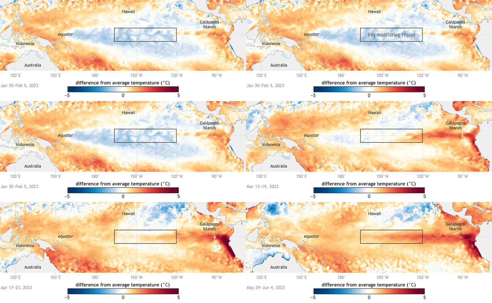
According to the National Oceanic and Atmospheric Administration (NOAA), El Niño is here. Its arrival likely augurs an increased occurrence of health threats around the world. Brought on by deviations in sea-surface temperatures, El Niño negatively impacts human, animal, and plant health—and their interconnections. According to the World Health Organization (WHO), the changing atmospheric conditions brought on by El Niño will increase the risks for droughts, fires, floods, and storms that can lead to the increased incidence of vector-borne diseases, food insecurity, and heat stress, among other health threats.
As the world enters an El Niño cycle made more extreme by climate change, effective responses must be grounded in a “One Health” approach that deals with the interconnections of humans, other animals, and plants and incorporates scientific understanding, technological advancements, and effective public policy. More resilient crops and effective vaccines and insecticides will be crucial to safeguarding global health. So will political skill, as local and national leaders around the world deal with public perception problems and political opposition to strategies that will be needed to reduce the potentially enormous health impacts of a warming world.
El Niño and public health. Each year, sea-surface temperatures, air pressure, and other atmospheric conditions naturally vary across the east-central equatorial Pacific Ocean. Every two to seven years, deviations above or below the average sea-surface temperature occur in fluctuating phases, known as the El Niño-Southern Oscillation (ENSO). Above average sea-surface temperatures are called El Niño, and below average temperatures are called La Niña. These variations can last anywhere from nine to 48 months for El Niño and 12 to 36 months for La Niña; both of these cycles have wide-ranging impacts around the world, including changes to rainfall and wind patterns.
In the continental United States, the strongest impacts of these variations are typically felt during the winter months, when the Pacific jet stream shifts south during El Niño. This southward shift results in cooler, rainier conditions in the southern parts of the country and warmer, drier conditions in the north. Alternately, during La Niña the opposite occurs as the jet stream moves north.
Globally, El Niño will increase or decrease rainfall depending on location. Asia, Australia, India, and southern Africa will experience warmer, drier conditions. Central America will have excessive rainfall along the Caribbean coasts while the Pacific coasts are dry. Parts of South America will be wetter than usual.
The impacts of shifting climatic phases can lead to a broad range of extreme weather events. During the 1982-1983 El Niño, considered one of the worst in recent history, the trade winds that normally blow east to west across the Pacific reversed, leading to weather-related disasters on almost all continents. Since ENSO involves not only ocean temperatures but also atmospheric circulation, both must be considered when talking about El Niño’s effects. The atmospheric circulation around the Maritime Continent, the region between the Indian and Pacific Oceans, is called the Walker Circulation. Normally, the Walker Circulation blows from east to west across the tropics where the ocean temperatures are warmer. El Niño shifts the Walker Circulation by moving warm waters to the east. In some cases, the loop is reversed with resulting severe weather effects.
During the 1982-83 El Niño event, shifting trade winds reduced rainfall in eastern Australia and Indonesia, which worsened historically severe droughts. Meanwhile, Peru experienced its heaviest rainfall in recorded history, resulting in at least 1300 deaths and over $10 billion in damage to livelihoods and property.
The shifting winds steered tropical storms towards Hawaii, which was ultimately hit by Hurricane Iwa. That storm, which devastated Oahu, Kauai, and other islands, was Hawaii’s worst hurricane since 1959. Meanwhile, in the continental United States, there was widespread flooding in the south and a winter without snow in the north.
Even though the damage brought on by ENSO can be significant, the disruptions have historically been generally predictable. Unfortunately, excessive greenhouse gas emissions are throwing a wrench into the planet’s natural temperature rhythms. NOAA estimates that rising global average temperatures could lead to more extreme El Niño and La Niña events that occur more frequently and have stronger impacts than they have had historically. The resulting weather events foster and exacerbate the conditions for disease outbreaks, crop failures, and heat stress.
The spread of vector-borne disease. The ancient Greek physician Hippocrates recognized that low-lying swampy areas during warm seasons led to disease outbreaks, but the specific agent of spread remained unknown. It wasn’t until several thousand years later that researchers proved the connection between mosquitoes and the warm, wet areas where they reproduce and spread diseases like yellow fever and malaria.
Today, arthropod-borne viruses, known as arboviruses, are spread by mosquitoes, ticks, and sandflies. Some of these viruses cause diseases with neurological conditions, including encephalitis, that cause brain inflammation—and vaccines are available only for some of them.
There are over 100 known arboviruses that infect humans and over 40 that infect domestic animals. These viruses cause severe diseases, including dengue, yellow fever, West Nile virus, Japanese encephalitis virus, Rift Valley fever, Nairobi sheep disease, Venezuelan equine encephalitis virus, and bluetongue. Of these, dengue is the most prevalent arbovirus worldwide and is spread by Aedes aegypti mosquitoes.
Their ubiquity and adaptability make mosquitoes the deadliest creatures on the planet, killing more than 700,000 people per year, largely through the spread of malaria parasites and arboviruses like dengue and yellow fever. Sometimes mosquitoes can kill even without spreading disease, killing livestock by sucking the blood right out of them. After a hurricane in the fall of 2020, farmers in Louisiana found hundreds of their cattle dead after massive clouds of mosquitoes had exsanguinated the animals, causing them to die from severe anemia.
ida and Cameron County, Texas. All the infected received treatment and are reportedly recovering.
Unfortunately, increasingly extreme El Niño events will likely make future vector-borne disease outbreaks worse.
El Niño-related disease outbreaks. As the world enters a new El Niño cycle, changes in temperature and precipitation will again bring changes to the range and prevalence of vector and water-borne diseases. Looking to previous cycles can help guide the response.
During the 1982-83 El Niño event, vector-borne diseases spread by arthropods increased. In the US, these conditions led to encephalitis outbreaks in humans and animals. In addition, cases of flea-spread, rodent-borne plague exploded. Nineteen cases of human plague were reported in Native Americans, seven of whom lived on a Navajo Reservation in northeastern Arizona and northwestern New Mexico. Three of the 19 plague cases were fatal. These plague cases constituted the largest number since 1975, which was, coincidentally, preceded by a strong El Niño event of 1972-73.
A study published in 2019 found that as a result of the 2015–2016 El Niño event, shifts in rainfall and temperatures led to disease activity that was 2.5 to 28 percent higher than non-El Niño periods.
In some areas, disease outbreaks were associated with increased rainfall. This was the case in Colorado and New Mexico, which saw plague outbreaks, and Tanzania, which experienced outbreaks of water-borne diseases like cholera. A large cholera outbreak also occurred in Tanzania during the 1997–1998 El Niño event. In other countries, outbreaks were associated with increased land surface temperature. For example Southeast Asia and Brazil saw outbreaks of dengue.
In El Niño sensitive regions in East Africa, cholera incidence increased three-fold. Paradoxically, some outbreaks were associated with dry conditions, others with wet conditions. While cholera is considered a water-borne, not a vector-borne disease, its occurrence is strongly linked to environmental conditions.
Food insecurity and a changing climate. During the 2015-2016 El Niño, the WHO estimated that more than 60 million people were affected worldwide, particularly those living in developing countries. Severe drought led to reduced access to food and water. The drought killed crops leading to food insecurity and malnutrition, but some regions experienced above average rainfall leading to floods. From the Amazon rainforest to Ethiopia, diverse regions experienced severe drought, crop failures, and famine.
In general, crops don’t grow well with extreme climate variability. However, some fare better than others. Maize, rice, soybeans, and wheat are the main cereal and legume crops, providing almost 60 percent of calories worldwide. El Niño’s impact varies, depending on crop types and geographical locations. For example, it might improve global mean soybean yield in the United States and Brazil but reduce maize production in the southeast United States, China, Mexico, and East and West Africa.
According to one report, the 1982-83 El Niño event was responsible for the largest synchronous global crop failure in modern history, with global financial losses in the trillions of dollars. Recovery efforts from such shocks can be costly and time-consuming as well, with economic activity slowing in the aftermath of El Niño. Globally, the 1982–83 and 1997–98 El Niño events led to economic losses of $4.1 trillion and $5.7 trillion, respectively. Most of those losses were in poor countries in the tropics. This year’s El Niño could inflict $3 trillion worth of damage on the global economy.
Reduced rainfall appeared to more strongly affect maize than wheat or soybeans. Rice yields in Asia, meanwhile, have benefitted from El Niño’s increased rainfall during the northeast monsoon season. Crops that are able to withstand droughts and floods are needed for global food security. Genetically modifying crops that can withstand current and future environmental insults are arguably the best food security strategy, despite public opposition in many countries.
Some crops tolerate heat and drought better than others. Figs, grapes, and some berries withstand dry conditions. The Green Revolution led to genetically modified crops to stave off famine, but it came with the environmental costs of intensive agriculture, among them a reliance on pesticides, water overconsumption, and air pollution.
Heat of the moment. In early July, World Meteorological Organization Secretary-General Petteri Taalas announced that the onset of El Niño would greatly increase the likelihood that temperature records would be smashed around the world. A few days later, the European Union’s Copernicus Climate Change Service confirmed that global temperatures had reached their highest level since it began recording in 1940. That record will likely be broken multiple times this summer. Specific areas of concern are in southern South America, the southern United States, the Horn of Africa, and central Asia.
Humans and other animals can tolerate heat only up to a point. Sweating helps cool the body, but it requires drinking fluids to replenish lost water and electrolytes. The maximum room temperature that a human could probably withstand is 115 degrees Fahrenheit, as long as that individual is at rest, in a room with less than 10 percent humidity, drinking fluids continuously, and wearing minimal clothing. Exercise is out of the question. (Recently, a father and his stepson died from heat stress while hiking in Big Bend National Park in Texas. The temperature was 119 degrees Fahrenheit, the second highest reading ever recorded in the region.)
It’s not just humans that need to be concerned. Dogs don’t sweat and are very sensitive to heat and pant to evaporate moisture from their lungs. Their temperatures should not exceed 100 degrees Fahrenheit. Dogs left in cars on hot days may suffer from organ failure and death.
Some livestock tolerate heat better than others but still may not be prepared for a severe El Niño. Cattle are the most sensitive type of livestock in regard to heat, and dairy cattle are more sensitive to heat than beef.
And if you thought you were safe in the water, think again. During the severe 2015–2016 El Niño event, warmer than usual ocean temperatures likely contributed to the record number of 98 shark attacks around the world, with six fatalities.
A systematic approach to preparedness and prevention. The combined effects of El Niño and climate change will require governments around the world to use a systematic approach, incorporating public education, ingenuity, and strategic thinking to reduce vector-borne diseases, food insecurity, heat stress and other health threats. Previous El Niño events can help guide response efforts, but past performance is not a guarantee of future results, especially in a changing climate on a warming planet. The best strategy is to prepare for the challenges ahead while reducing greenhouse gas emissions as soon as possible, recognizing global temperatures as a threat multiplier that will affect the entire planet.
Efforts to deal with vector-borne diseases will require new approaches. Mosquitoes are important food sources for many animals, including birds. Widespread use of pesticides is not the answer to mosquito-borne illness; insecticides like DDT were disastrous for human, wildlife, and environmental health. So health authorities need to develop better insecticides for personal use as well as safe and effective vaccines to deploy against the pathogens that mosquitoes carry.
Research is under way to develop heat-, drought-, and disease-resistant livestock and crops via genetic engineering. Unfortunately, there is widespread political opposition in many countries to anything labelled with the acronym GMO (for genetically modified organism). While some insist that small scale organic farming is the answer to the food challenges that climate change and variability pose, it’s not clear if such a strategy could possibly feed eight-plus billion humans over the course of the 21st century.
As the world enters another El Niño cycle made more extreme by climate change, the interconnections between human, animal, and plant health are increasingly apparent. The immediate risks posed by extreme weather events, disease outbreaks, food insecurity, and heat stress will require education and ingenuity to manage via a comprehensive One Health approach that combines scientific understanding, technological advancements, and effective public policy at the local, national, and global levels. Efforts to develop resilient crops and effective vaccines and insecticides are crucial to safeguarding global health. However, these endeavors must also be pursued in a complex terrain of public perception and political opposition. Surviving on an increasingly hostile planet will depend on our ability to work together in navigating through a storm of our own making.
As drought-stricken Arizona bakes in searing heat, the Scottsdale City Council unanimously agreed this week to ban natural grass in front of future single-family homes in an effort to conserve water.
The new ordinance will apply to new houses constructed or permitted after August 15.
“By adopting this ordinance, Scottsdale aims to lead the way in water conservation practices, setting an example for other communities across the region,” said Brian Biesemeyer, executive director of Scottsdale’s water department.
According to Scottsdale City Council, feedback gathered from Scottsdale Water customers in June found that 86% of those who responded supported the ordinance.
“It’s a positive step that supports responsible use of our water resources and an initiative that works in tandem with Scottsdale Water’s existing residential and commercial rebate programs that offer water saving options and maintain the beauty and functionality of Scottsdale’s neighborhoods,” the city council said in a news release.
In recent years, Arizona has implemented various methods to conserve water as the Southwest grapples with soaring temperatures, groundwater shortages and drought conditions.
Parts of Arizona have been in a long-term drought since the mid-1990s, according to the Arizona State Climate Office.
Prior to the natural grass ordinance, Scottsdale officials asked residents to use 5% less water, and city government operations reduced their water usage by 9%. Ultimately, the city saved about 657 million gallons of water, the city council said.
Across the state, Arizonans are sweltering from weeks of scorching temperatures. Temperatures in Phoenix, for example, have reached 110 degrees Fahrenheit every day this month.
And meteorologists expect the weekend heat will be record-breaking, reaching a staggering 119 degrees in some parts.
An extreme heat wave in the Southwest could pose a risk to Lake Powell’s water levels, which have been steadily increasing all summer.
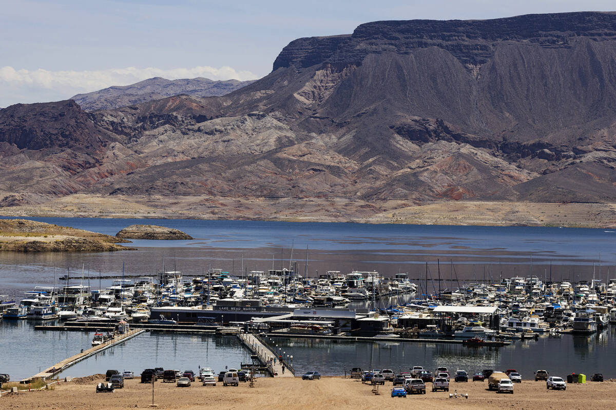
After an extended drought period, Lake Powell, which is in Utah and Arizona, reached drastically low levels last summer, but levels began rising in earnest in April after California experienced a wet winter. The above-average snowfall in the mountains led to an increased snowpack melt that has continued to supplement Lake Powell, as well as Lake Mead in Arizona and Nevada, this summer.
Lake Powell’s intake has been slowing as snowpack melt stops for the summer. The lake has seen a steep increase in recent months, with water levels rising more than 60 feet since mid-April. Levels are more than 45 feet higher than this time last year, but the increase has started to slow, and on some days the lake is losing water.
A decrease in levels is typical in the summer months as snowpack melt stops and the region enters a dry period, and a heat wave may exacerbate the lake’s tendency to lose water during summer months, according to AccuWeather senior meteorologist David Houk.
“We’re in a better position than we were last year at this time, but now we start to see the drain on the overall hydrological levels across the entire basin,” Houk told Newsweek.
He added that during the hot summer months, it is typical for water to drain out of the reservoirs and not be resupplied until the winter, when precipitation usually resumes.
However, despite the positive intake this spring and the first part of the summer, NewsNation reported that inflows are expected to plateau, and the Colorado River basin reservoirs aren’t predicted to rise again until next year, when runoff resumes.
A spokesperson from the Bureau of Reclamation said that decades of drought could not be fixed by a single season of good rainfall as Lake Powell currently stands at just 41 percent capacity.
Newsweek reached out to the U.S. Bureau of Reclamation by email for comment on Thursday.
wet and cool start to 2023 helped Southern Nevada consume 25 percent less water from the drought-stricken Colorado River through the first five months of the year.
From January through May, the region’s consumptive use from the river was just under 61,000 acre-feet of water, Warren Turkett, a natural resource analyst for the Colorado River Commission of Nevada, told commissioners Tuesday.
That’s down from nearly 82,000 acre-feet of water consumed during the same period last year, which was near the same amount the valley consumed in 2021 (84,489 acre-feet) and 2020 (80,885 acre-feet).
Turkett said that reduction is due to continued conservation efforts coupled with weather that was cooler and far wetter than usual. But whether the region can keep that pace up for the entire year remains to be seen, especially with the latest seasonal forecast showing conditions that are likely to be warmer and drier than normal through September.
“It will be telling to see what happens over the summer months because those are the biggest water use months,” Turkett told commissioners. “The next few months … hopefully will be consistent with keeping that reduction.”
Nevada normally gets 300,000 acre-feet of water from the river each year, but low water levels at Lake Mead have reduced that down to 275,000 acre-feet this year through prior drought agreements.
After cutting its consumptive water use to 224,000 acre-feet last year — a reduction of about 8 percent compared with 2021 — Nevada is on pace to use even less water this year. The latest projection from the U.S. Bureau of Reclamation released Tuesday shows the state on pace to consume about 202,000 acre-feet this year.
Consumptive use is the measurement of the total amount of water the region has used from the Colorado River minus Nevada’s return flow credits, which allow the state to pull extra water out of the river for every gallon of treated wastewater Southern Nevada sends back to Lake Mead.
That agreement, which needs to be approved by the Bureau of Reclamation, would require Nevada to keep an additional 75,000 acre-feet of water in Lake Mead in 2023 and 2024, with slightly smaller saving commitments the following two years.
The federal government is reviewing the proposal and has said it plans to release a draft environmental impact statement for the proposal this fall.
From climate change to species loss and pollution, humans have etched their impact on Earth with such strength and permanence since the middle of the 20th century that a special team of scientists says a new geologic epoch began then.
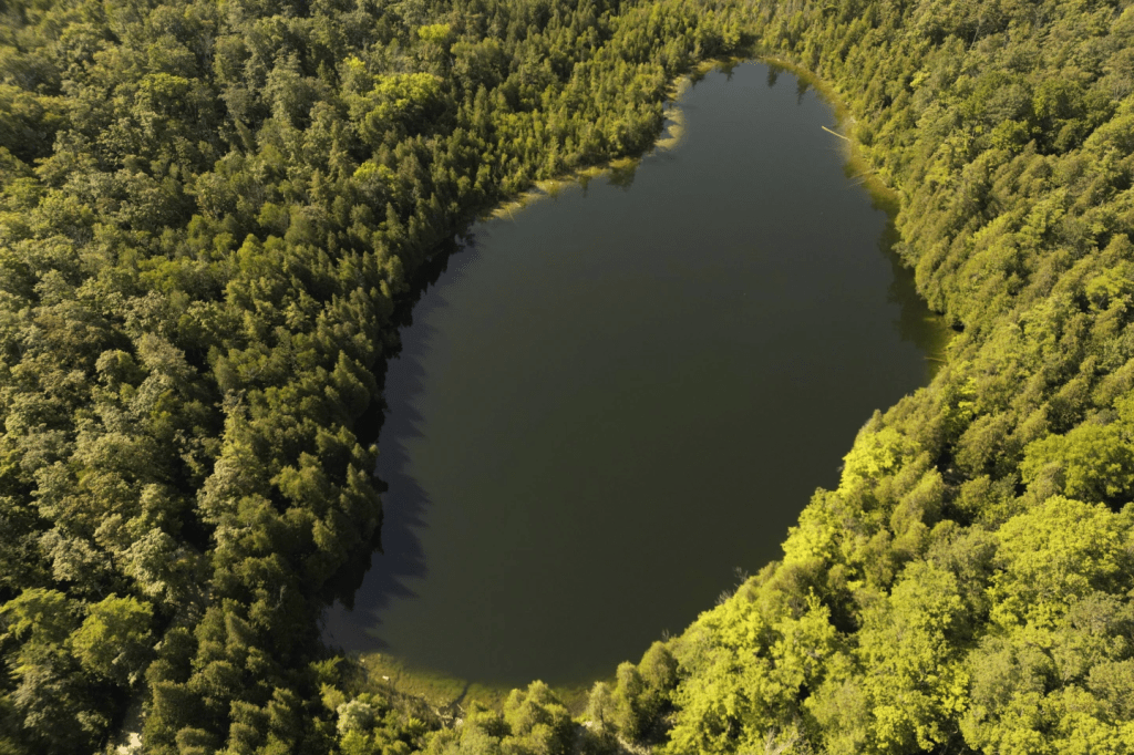
Called the Anthropocene — and derived from the Greek terms for “human” and “new” — this epoch started sometime between 1950 and 1954, according to the scientists. While there is evidence worldwide that captures the impact of burning fossil fuels, detonating nuclear weapons and dumping fertilizers and plastics on land and in waterways, the scientists are proposing a small but deep lake outside of Toronto, Canada — Crawford Lake — to place a historic marker.
“It’s quite clear that the scale of change has intensified unbelievably and that has to be human impact,” said University of Leicester geologist Colin Waters, who chaired the Anthropocene Working Group.
This puts the power of humans in a somewhat similar class with the meteorite that crashed into Earth 66 million years ago, killing off dinosaurs and starting the Cenozoic Era, or what is conversationally known as the age of mammals. But not quite. While that meteorite started a whole new era, the working group is proposing that humans only started a new epoch, which is a much smaller geologic time period.
The group aims to determine a specific start date of the Anthropocene by measuring plutonium levels at the bottom of Crawford Lake.
The idea of the Anthropocene was proposed at a science conference more than 20 years ago by the late Nobel Prize-winning chemist Paul Crutzen. Teams of scientists have debated the issue since then and finally set up the working group to study whether it was needed and, if so, when the epoch would start and where it would be commemorated.
Crawford Lake, which is 79 feet (29 meters) deep and 258,333 square feet (24,000 square meters) in area, was chosen over 11 other sites because the annual effects of human activity on the earth’s soil, atmosphere and biology are so clearly preserved in its layers of sediment. That includes everything from nuclear fallout to species-threatening pollution to steadily rising temperatures.
There are distinct and multiple signals starting around 1950 in Crawford Lake showing that “the effects of humans overwhelm the Earth system,” said Francine McCarthy, a committee member who specializes in that site as an Earth sciences professor at Brock University in Canada.
“The remarkably preserved annual record of deposition in Crawford Lake is truly amazing,” said U.S. National Academies of Sciences President Marcia McNutt, who wasn’t part of the committee.
The Anthropocene shows the power — and hubris — of humankind, several scientists said.
“The hubris is in imagining that we are in control,” said former U.S. White House science adviser John Holdren, who was not part of the working group of scientists and disagrees with its proposed start date, wanting one much earlier. “The reality is that our power to transform the environment has far exceeded our understanding of the consequences and our capacity to change course.”
Geologists measure time in eons, eras, periods, epochs and ages. The scientific working group is proposing that Anthropocene Epoch followed the Holocene Epoch, which started about 11,700 years ago at the end of an ice age.
They are also proposing that it starts a new age, called Crawfordian after the lake chosen as its starting point.
The proposal still needs to be approved by three different groups of geologists and could be signed off at a major conference next year.
The reason geologists didn’t declare the Anthropocene the start of a bigger and more important time measurement, such as a period, is because the current Quaternary Period, which began nearly 2.6 million years ago, is based on permanent ice on Earth’s poles, which still exist. But in a few hundred years, if climate change continues and those disappear, it may be time to change that, Waters said.
“If you know your Greek tragedies you know power, hubris, and tragedy go hand in hand,” said Harvard science historian Naomi Oreskes, a working group member. “If we don’t address the harmful aspects of human activities, most obviously disruptive climate change, we are headed for tragedy.”
California’s effort to secure water supplies is a struggle older than the state itself.
It played out during the Gold Rush, and it defines modern San Francisco and Los Angeles. It has created divisions between north and south as well as east and west. It consumes endless political energy and mountains of literal energy, spent by moving water from the Sacramento Bay Delta to San Jose and Southern California, from the Colorado River to the Los Angeles basin, from the Sierra Nevada to the Bay Area.
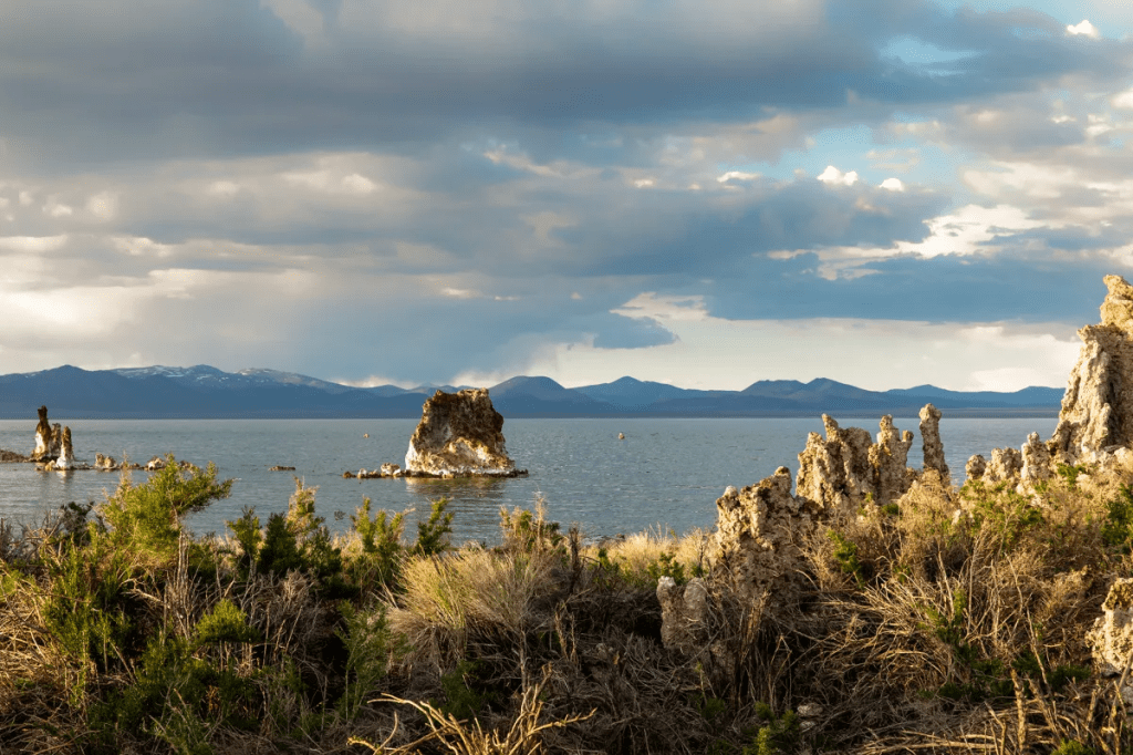
In all of that, Mono Lake is a small data point, barely a dot on the state’s vast water map. So why is Mono Lake suddenly attracting attention in water circles?
A coalition of environmentalists and Native American tribes – the Kutzadika’a Paiute have lived in the Mono basin for centuries – are fighting for that water, arguing that Los Angeles, which began diverting streams away from the lake in 1941, should give up its rights and let the lake be. That would allow Mono Lake’s surface level to rise, though it still would confront the more ancient problem of evaporation.
There’s a lot of history behind this struggle, as there is in all matters involving California water. And that early history does not reflect well on the Los Angeles Department of Water and Power’s stewardship of Mono Lake. After receiving its permits to draw water from the area in 1940, the DWP did so voraciously. The level of the lake dropped by 45 feet from 1941 to 1982.
Paradoxically, the argument for forcing Los Angeles to end its diversions from the Mono basin now rests largely on the fact that, since 1994, it hasn’t drawn that much water anyway. So, if it’s already prevented from taking more, why not stop drawing this water altogether? To advocates, that seems like common sense; to the DWP, it feels like being punished for having succeeded.
In the big scheme of things, it’s true that the amounts that DWP takes from the Mono Lake basin are tiny (no water is drawn from the lake itself, since it’s briny; the DWP gets its water from four creeks that feed the lake). Today, the DWP withdraws no more than 16,000 acre feet a year, and it often takes much less than that.
Compared to Los Angeles’ overall usage, that’s a pittance. The city consumes about 500,000 acre feet of water annually, so even in a big year, the water from the Mono watershed amounts to no more than about 3% of the total.
Still, that’s enough water to supply some 45,000 homes or as many as 200,000 people in the denser areas of Los Angeles (San Francisco, with its more tightly packed population and fewer gardens, stretches an acre foot of water to about eight households).
Then there are the birds. Mono Lake is an important way station for migratory birds and a vital shorebird habitat. If the level of the lake falls too low, it exposes land bridges that connect the lake’s major nesting island to shore, allowing coyotes to dart across the bridge and disrupt the birds. That makes keeping the lake level high enough to preserve the islands an important priority.
And yet, despite recent droughts – and even with the DWP’s diversions – the water has not fallen to the level that creates coyote bridges in decades. The level of the lake today is more than 10 feet higher than it was in 1981, according to the DWP.
“There’s nothing even remotely like a land bridge out there now,” Martin Adams, the DWP’s general manager and chief engineer, said in an interview this week.
On the issue of conservation, I asked Adams whether he would walk away from the agency’s water rights in the Mono Lake area if the DWP could find an additional 16,000 acre feet through conservation.
His answer was simple: no.
The DWP’s first priority with conservation, he said, is to cut back on importing water from expensive, environmentally inferior alternatives. If suddenly granted a windfall, “we’ll purchase less water from the Metropolitan Water District,” he said.
That makes good financial sense. Metropolitan water is expensive – about $750 per acre foot – because it has to be shipped, either from Northern California through the State Water Project or from the Colorado River, where other states and Native American tribes are fighting for their rights.
But it’s not just money. There are environmental ramifications as well, and Martin’s priorities make good environmental sense. Metropolitan water has to be shipped long distances, and as a result, it requires huge amounts of electrical power (water is heavy and very hard to move uphill). In fact, moving water from point to point is among the largest uses of electricity in California.
Since generating electricity is one of the main contributors to carbon emissions, it’s bad for the climate to move water.
By contrast, the Los Angeles Aqueduct, the genius project of William Mulholland, brings water to Los Angeles from Mono and the Owens Valley by gravity alone. In fact, it generates a bit of power as it flows south. That’s the opposite of spending energy to heave water over mountains from the Bay Delta or the Colorado.
So, financially, it does not make sense for DWP to cut off Mono Lake supplies. And the environmental costs would be mixed: It might shore up bird habitat that is not presently jeopardized, but it would do so at the expense of contributing to climate change.
I ran all of this by Jeff Kightlinger, former general manager of the Metropolitan Water District and one of California’s most highly regarded water experts. Kightlinger doesn’t have a dog in this fight. If anything, a decision by the DWP to abandon its rights to Mono Lake water would help Kightlinger’s former agency, since DWP might be forced to buy more water from Southern California’s giant importer.
Nevertheless, Kightlinger sympathized with the DWP on this one.
Yes, he said, there are issues related to birds, but those mostly seem under control – no land bridges are endangering the nesting areas. And yes, there are gains to made in conservation, but Kightlinger agreed with Adams that it’s hard to see why the DWP would give up a clean water source in the eastern Sierra, where it gets water essentially for free, in return for spending more money and using more energy to buy it from Metropolitan.
“All of these resource decisions involve trade-offs,” he said. “I’m not hearing the compelling argument in this case.”
Could that change? Of course – if the lake levels begin dropping again, putting the birds in danger. Or, if prolonged drought meant that even the DWP’s modest withdrawals from the area’s creeks cut off the supply to the lake and it falls into a downward spiral.
If history is any guide, this fight will drag on for a long time. For the moment, a very wet winter has allowed it to not feel pressing. But it hasn’t gone away.