Global workshop on ecosystems conservation and restoration in transboundary basins

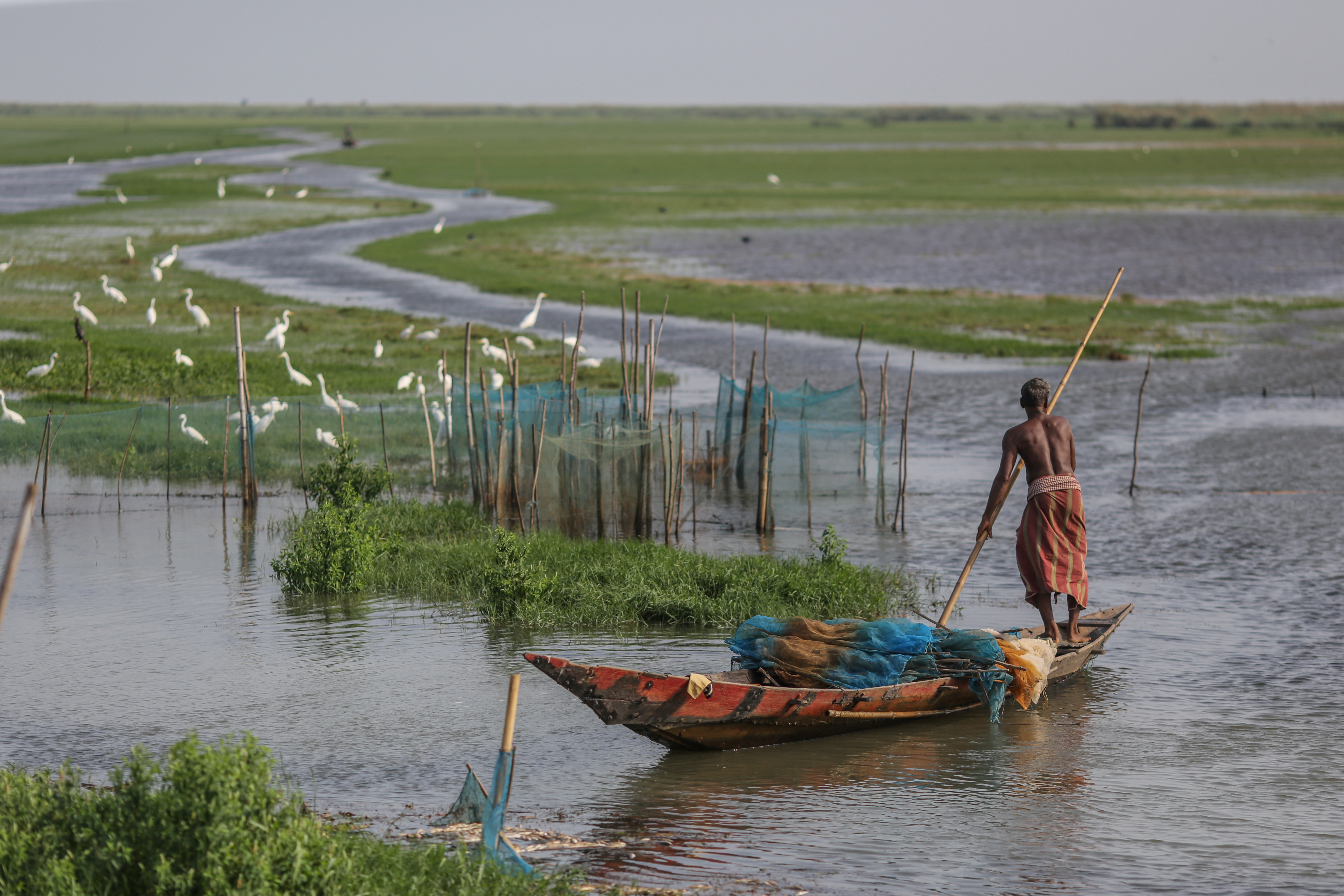
Man in boat on lake

The Global Workshop on Ecosystems Conservation and Restoration in Transboundary Basins will take place from 16–17 June 2025 at the Palais des Nations in Geneva, Switzerland.  

Organized under the UN Economic Commission for Europe (UNECE) Water Convention and co-led by France, Slovenia, and Zambia, the event will bring together governments, experts, and civil society to accelerate restoration and cooperation across shared freshwater ecosystems.

In light of the triple planetary crisis, the 10th session of the Meeting of the Parties of the Water Convention (23-25 October 2024, Ljubljana, Slovenia) decided to include in the work programme 2025-2027 of the Water Convention a dedicated sub-programme area on the conservation and restoration of transboundary freshwater ecosystems. This global workshop is an essential element of this workstream and will inform, among others, the discussion at the ninth meeting of the Task Force on Water-Food-Energy-Ecosystems Nexus (18 June 2025, Geneva).

The workshop is organized in partnership with the European Union, Global Environment Facility (GEF), and several UN-Water Members and Partners: the International Union for Conservation of Nature (IUCN), the Ramsar Convention on Wetlands, UN Environment Programme (UNEP), and the World Wildlife Fund (WWF).

Proceedings will be interpreted into Arabic, English, French, Russian and Spanish.

CLICK HERE FOR MORE INFORMATION

https://www.unwater.org/news/global-workshop-ecosystems-conservation-and-restoration-transboundary-basins

World Environment Day 2025: Global Call to #BeatPlasticPollution

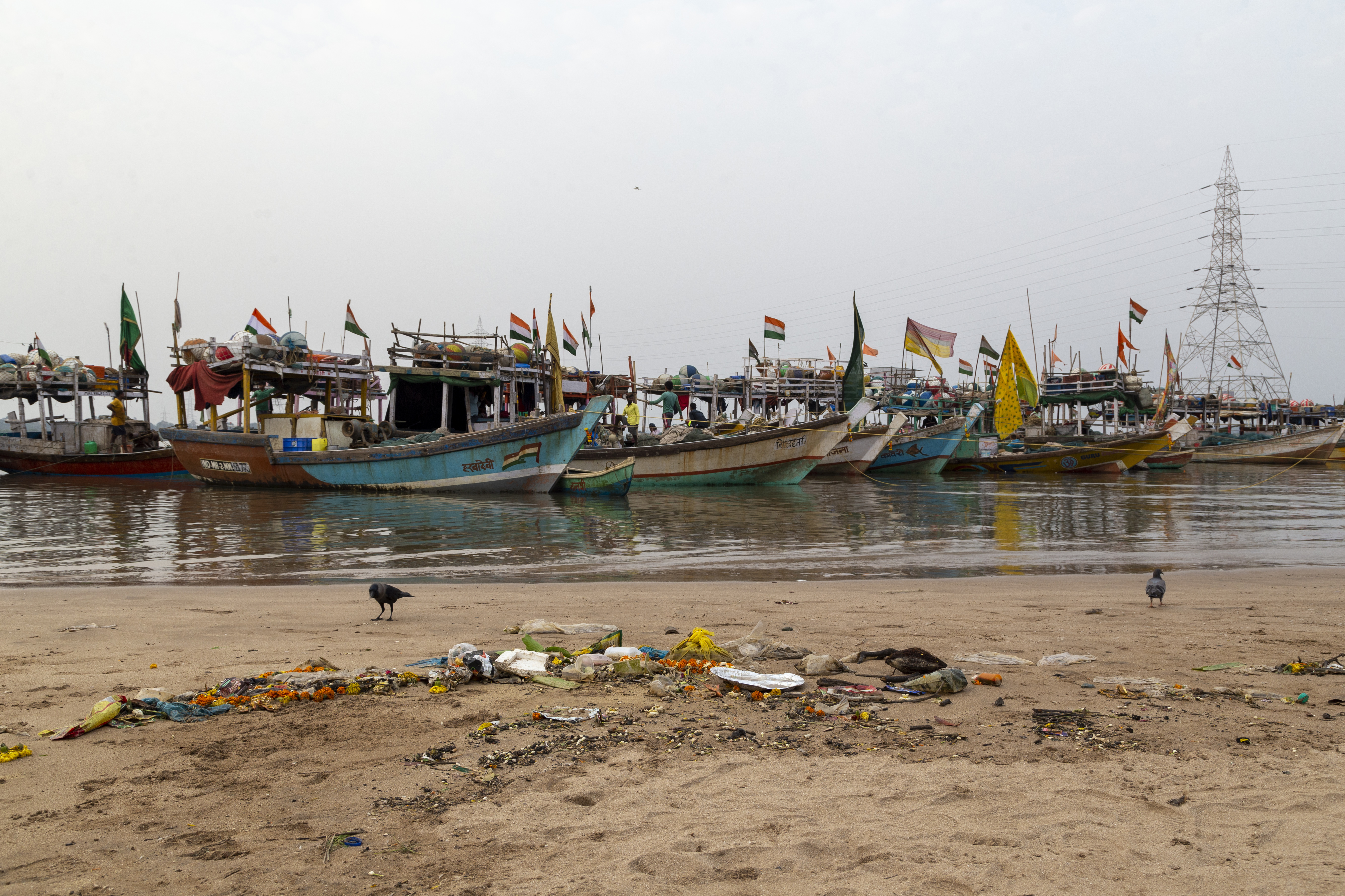
Plastic waste on beach, fishingboats in the background

World Environment Day, 5 June 2025, will focus on ending plastic pollution. The Republic of Korea will host the global celebrations. 

This year, World Environment Day joins the UN Environment Programme-led #BeatPlasticPollution initiative to mobilize communities worldwide to implement and advocate for solutions.  

Globally, an estimated 11 million tonnes of plastic waste leak into aquatic ecosystems each year, while microplastics accumulate in the soil from sewage and landfills, due to the use of plastics in agricultural products. The annual social and environmental cost of plastic pollution ranges between US$300 billion and US$600 billion.

While plastic pollution is a major concern, it is also one of the most fixable of today’s environmental challenges, with some obvious solutions at hand.

World Environment Day will spotlight the growing scientific evidence on the impacts of plastic pollution and drive momentum to refuse, reduce, reuse, recycle, and rethink plastics use. It will also reinforce the global commitment made in 2022 to end plastic pollution through a global plastic pollution treaty.

CLICK HERE FOR MORE INFORMATION

https://www.unwater.org/news/world-environment-day-2025-global-call-beatplasticpollution

Global Water Partnership Organisation opens MoU to new governments

UN Water Netherlands SDG6 Monitoring-2

For the first time in over 20 years, the Global Water Partnership Organisation (GWPO) is opening its intergovernmental Memorandum of Understanding (MoU), offering a historic opportunity for new States and Governments to join the formal body behind one of the world’s most influential water networks. 

The GWPO provides the legal framework and operational support for the Global Water Partnership (GWP) – a broad international network dedicated to sustainable water management. GWPO coordinates the network, manages finances, and represents GWP in global forums.

The MoU will open for signature on 2 June in Stockholm, Pretoria, and Geneva. The move follows strong support during a recent extraordinary meeting of GWPO’s Sponsoring Partners, where the United Call for Global Water Investment Leadership was launched.

Endorsed by Sweden, the Netherlands, Hungary, Pakistan, and the World Meteorological Organization (WMO), the initiative urges more governments to join and lead on global water investment.

CLICK HERE FOR MORE INFORMATION

https://www.unwater.org/news/global-water-partnership-organisation-opens-mou-new-governments

Scientists say microplastics are ‘silently spreading from soil to salad to humans’

A review from Murdoch University has stressed that agricultural soils now hold around 23 times more microplastics than oceans.

Amongst the revelations in the comprehensive evaluation is that plastics in soil may be exposed to up to 10,000 chemical additives, most of which are unregulated in agriculture.

“These microplastics are turning food-producing land into a plastic sink,” said PhD candidate Joseph Boctor, who led the study.

Both microplastics and nanoplastics have now been found in lettuce, wheat and carrot crops. This happens through various means, from plastic mulching, fertilisers and even through being dropped by clouds.

This is particularly concerning when combined with findings of these plastics in the human lungs, brain, heart, blood, and even placenta.

“And BPA-free does not equal risk free,” Mr Boctor said.

“Replacement chemicals like BPF and BPS show comparable or greater endocrine-disrupting activity.”

The challenge is that regulations are slower than science, and industry is faster than both.

In addition to this, assessing additive toxicity is often overlooked, Mr Boctor said, due to the lack of transparency in the plastic industry and large number of additives produced.

“This makes the plastic crisis unchecked, and human health exposed,” he said.

“This review tries to bring this creeping danger under the radar and shine a flashlight on regulators.”

Alongside endocrine disruptors, the review pinpointed other additives in soil such as Phthalates (linked to reproductive issues), and PBDEs (neurotoxic flame retardants).

These additives have been linked with neurodegenerative disease, increased risks of stroke and heart attack and early death.

“These are not distant possibilities — they are unfolding within biological systems — silently and systematically,” Mr Boctor said.

To address this crisis, Mr Boctor is working alongside his colleagues at the Bioplastics Innovation Hub to create a type of plastic that is not only safe, but also decomposes in soil, land and water, leaving behind no legacy.

One innovation currently under development is the Smart Sprays Project — which will demonstrate and test a non-toxic, bioplastic-based spray for soil which forms a water barrier to harvest rainfall and reduce evaporation that can be easily applied with existing farm equipment.

The hope is that through the Hub’s work, they will introduce a green plastic to the market that will minimise and eventually negate the need for non-sustainable plastic production worldwide.

“This review highlights the urgent need for coordinated scientific and regulatory efforts,” Joseph said.

“Regulators, scientists and industry must collaborate to close the loopholes before plastic pollution further entrenches itself in the global food chain.”

CLICK HERE FOR MORE INFORMATION

https://www.sciencedaily.com/releases/2025/05/250522125353.htm

New study reveals how competition between algae is transforming the Gulf of Maine

As the ocean warms across its temperate regions, kelp forests are collapsing and turf algae species are taking over. This shift from dense canopies of tall kelp to low-lying mats of turf algae is driving biodiversity loss and altering the flow of energy and nutrients through reef ecosystems.

It’s also fundamentally altering the chemical ecology of coastal ecosystems.

New research in Science, led by researchers at Bigelow Laboratory for Ocean Sciences, has shown for the first time how turf algae release chemicals that can kill young kelp. That creates a feedback loop where more turf algae means more harmful chemicals, which further inhibits recovery and reinforces kelp forest collapse. This chemically-mediated interaction, which scientists call allelopathy — or what the authors more bluntly call chemical warfare — reveals an indirect way that climate change is reshaping ocean ecosystems, complicating kelp forest recovery along Maine’s rapidly warming coast.

The study also includes researchers from University of Maine, University of California Riverside, University of Tübingen, Perry Institute for Marine Science, and Harvard University, working together to combine extensive field surveys, advanced chemical analysis, and novel lab experiments.

“That’s why this study is so powerful,” said Bigelow Laboratory Senior Research Scientist Doug Rasher, the study’s senior author. “It moves logically from describing a pattern in nature — the lack of recovery of kelp forests — to revealing that the chemical landscape of kelp forests and turf reefs are fundamentally different, to pinpointing that turf algae and the chemicals they exude prevent kelp recruitment.”

The impacts of kelp forest collapse and replacement by turf algae have been well documented in temperate ecosystems around the world.

“This shift from kelp to turf is analogous to a terrestrial forest transitioning into a grassland,” said the study’s lead author, Shane Farrell, a UMaine doctoral candidate based in Rasher’s research group. “With the loss of kelp forests, we see decreases in biodiversity, productivity, and the ecosystem services they provide to humans.”

Previous work has shown that once turf algae are established, they can inhibit kelp recovery by taking up space on the reef or harboring small grazers that eat baby kelp.

In tropical ecosystems, such as rainforests and coral reefs, scientists have previously shown that changes in the chemical environment also play a role in locking ecosystems into a degraded state and preventing recovery of foundational species. But no studies had considered whether that kind of chemical change could be at play in temperate kelp forests.

To answer this question, the researchers completed three years of field surveys across the Gulf of Maine, documenting a pattern of new kelp struggling to survive in the southern reaches of Maine’s coast where forests have collapsed. During those surveys, the team collected water and seaweed samples for chemical analysis.

Rather than focusing on known substances, they teamed up with Daniel Petras’s research group at the University of California, Riverside, employing non-targeted metabolomics analysis to understand the diverse chemistry in the samples. This approach involves analyzing all the small molecules within a system, which enabled the researchers to broadly identify the unique chemical features — in the water, in the seaweeds, and on the reef itself — at both kelp- and turf algae-dominated sites.

To characterize the suite of waterborne chemicals present, these methods rely on separating the molecules and breaking them into fragments, which are then matched against reference libraries, much like identifying a person from a fingerprint.

But, as Farrell pointed out, less than 2% of the chemical features the researchers found in this environment had been previously described. To fill in those gaps, the team turned to novel computational tools, which use chemical fragmentation patterns to predict compound identities, molecular formulas, and even chemical structures. These predictions allowed the researchers to classify unknown compounds into broad chemical families, highlighting just how distinct the chemical environment of a kelp forest is from a turf-dominated reef.

“It is awesome to see how our non-targeted metabolomics tools can shed new light on the fascinating chemical complexity caused by shifting environments, such as invasive algae,” Petras said. “This becomes especially powerful when we combine our chemical data with functional information, such as kelp survival.”

In a series of laboratory experiments, the researchers then tested the effects of both all the waterborne chemicals around the turf-dominated reefs, and the specific chemicals released by the five most abundant species of turf algae, on gametophytes, an early life stage of kelp. The experiments showed that gametophyte survival declined dramatically — up to 500% in some cases — when exposed to chemicals released by turf algae, confirming that the new chemical environment is directly responsible for kelp mortality.

“Our study is the first to reveal that chemical warfare can underpin the rebound potential of cold-water kelp forests. And surprisingly, some of the same types of molecules we identified on turf reefs are involved in the recovery dynamics of tropical coral reefs too,” Rasher said. “It shows we have a lot to learn about chemical warfare on temperate reefs, the organisms and molecules involved, and how this process varies globally.”

Previous work by Rasher’s research group confirmed that ocean warming is the primary driver of kelp forest decline in the Gulf of Maine. But these new findings, showing how turf algae can lock an ecosystem into a degraded state, will make it more challenging to promote kelp forest recovery.

“Once turf algae are established, just curbing global carbon emissions and reversing ocean warming is not going to bring Maine’s kelp forests back,” Farrell said. “Because of these feedback mechanisms, we need local interventions to remove the turf algae before kelp will actually recover.”

This study was supported by the NSF Established Program to Stimulate Competitive Research (Grant #OIA-1849227), the Louise H. & David S. Ingalls Foundation, the PADI Foundation, the Essex Avenue Foundation, and the German Research Foundation.

CLICK HERE FOR MORE INFORMATION

https://www.sciencedaily.com/releases/2025/05/250522162700.htm

Home water-use app improves water conservation

Study finds real-time household water data reduces consumption

A UC Riverside-led study has found that a smartphone app that tracks household water use and alerts users to leaks or excessive consumption offers a promising tool for helping California water agencies meet state-mandated conservation goals.

Led by Mehdi Nemati, an assistant professor of public policy at UCR, the study found that use of the app — called Dropcountr — reduced average household water use by 6%, with even greater savings among the highest water users.

Dropcountr works by interpreting water-use data from smart water meters, which many utilities originally installed for remote reading to streamline billing. The app turns data from these meters into real-time feedback for consumers, showing how much water they use, how their usage compares to similar households, and how it has changed over time.

This type of digital feedback gives users what behavioral economists call a “nudge” — a timely prompt to take water-saving actions, such as taking shorter showers, fixing leaks, or delaying using appliances like dishwashers and washing machines until they are full.

The app also alerts users when their consumption nears costly higher-rate tiers and notifies them of possible leaks. Utilities also can use the app to send customers tips for cutting use and notify them of rebate programs, such as those for replacing lawns with drought-tolerant landscaping.

“California water agencies are under pressure to hit individualized water-use targets and conservation goals under the ‘Making Conservation a California Way of Life’ regulation,” Nemati said. “Our study shows that this digital feedback tool can be a powerful, low-cost way to help households manage their use and reduce consumption.”

The research focused on the City of Folsom in Northern California, where Dropcountr was offered to residential customers beginning in late 2014. About 3,600 households volunteered for the program, which collected smart meter data from 2013 to 2019. This allowed researchers to analyze more than 32 million records of daily water use.

The findings, published in the journal Resource and Energy Economics, showed that participating households reduced their daily consumption by an average of 6.2% compared to a control group. The reduction was greater among high-volume users. The top 20% of users cut their water use by up to 12%.

“This is a crucial outcome when every drop counts,” Nemati said. “We found strong, statistically significant reductions, especially for high-use customers.”

Dropcountr also uses behavioral science concepts, especially the power of social norms. Users receive personalized water-use summaries that show how their consumption stacks up against more efficient nearby households, helping them set reasonable and achievable conservation goals. The app also flags possible leaks by detecting continuous usage patterns — such as when water use remains steady for 72 hours. These alerts were found to be especially effective: Water use dropped roughly 50% on the day after a leak alert was sent, followed by a 30% drop the next day, and a sustained 9% reduction even six days later. “The sharp drop suggests customers are paying attention and acting quickly,” Nemati said. “One major advantage is that they can detect leaks right away — sometimes before they cause damage or result in costly bills. That’s difficult with traditional billing systems, where usage is only seen after 30 or 60 days.” Importantly, the study also found that these behavioral changes lasted. “We looked at water use 50 months out and still found sustained reductions,” Nemati said. “People weren’t just reacting once and forgetting. They stayed engaged.”

The app works best with homes equipped with smart meters, while many homes in California still rely on older, manually read meters. Fortunately, adoption of advanced metering infrastructure continues to expand.

Still, Nemati noted, many agencies that do have smart meters continue to rely on outdated methods — like mailed letters — to notify customers of high usage or leaks.

“People get water bills, but the information may not be salient. Most bills report usage in cubic feet or units, which aren’t easy to interpret,” Nemati said. “What platforms like Dropcountr do well is make the data meaningful. People want to use water wisely. They just need timely, clear, and actionable feedback. These platforms give them that — and they work.”

With California preparing to enforce stricter drought and efficiency standards, Nemati said more utilities should consider deploying digital tools like Dropcountr.

“We have the data,” he said. “Now we just need to use it in smarter ways. This study shows how a relatively inexpensive solution can help homeowners conserve and ease pressure on our water systems.”

CLICK HERE FOR MORE INFORMATION

https://www.sciencedaily.com/releases/2025/05/250527124635.htm

Just add iron: Researchers develop a clever way to remove forever chemicals from water

PFOS, also known as “forever chemicals,” are synthetic compounds popular for several commercial applications like making products resistant to stains, fire, grease, soil and water. They have been used in non-stick cookware, carpets, rugs, upholstered furniture, food packaging and firefighting foams deployed at airports and military airfields. PFOS (perfluorooctane sulfonate or perfluorooctane sulfonic acid) are part of the larger class of forever chemicals called PFAS (per- and polyfluoroalkyl substances.) Both types have been linked to a variety of health issues, including liver disease, immune system malfunction, developmental issues and cancer.

Because of their widespread use, PFOS are found in soil, agricultural products and drinking water sources, presenting a health risk.

Xiaoguang Meng and Christos Christodoulatos, professors at the Department of Civil, Environmental and Ocean Engineering at Stevens Institute of Technology, and Ph.D. student Meng Ji working in their lab, wanted to identify the most efficient way to remove these toxins from the water.

Most water filters use activated carbon to remove forever chemicals and other contaminants.

Activated carbon removes PFOS through a process called adsorption, in which the PFOS molecules stick to the large, porous surface area of the carbon particles as the water flows through them.

However, in the wastewater industry, iron powder — in scientific terms called microscale zero-valent iron or mZVI — is also used to remove contaminants from the effluent.

“Iron powder is commonly used for water treatment and wastewater treatment, because it’s cheap — it’s cheaper than activated carbon,” says Meng.

They wanted to compare the adsorption potency of iron powder and activated carbon.

They found that iron powder was a better water purifier. “The iron powder was 26 times more effective than activated carbon per unit surface area,” says Ji. Researchers outlined their findings in the study titled Kinetic and Mechanism Study of PFOS Removal by Microscale Zero-Valent Iron from Water, published in Environmental Science & Technology, an ACS (American Chemical Society) publication, on March 19, 2025.

More interestingly, the team found that even when the iron powder rusted from being in the water, its adsorption properties weren’t affected much.

“The particles’ surface is covered by iron oxide, but it’s still very active,” says Meng — and that’s surprising.

It means that the oxidized iron still contributes to PFOS removal.

The unexpected findings made the study popular with other researchers, Meng says.

Although published recently, the paper has already been viewed over 1000 times.

Meng and Ji are planning to investigate this phenomenon further. “Now we need to do more research to find out why,” Meng says. “Because this is important for the development of large-scale removal technologies.”

CLICK HERE FOR MORE INFORMATION

https://www.sciencedaily.com/releases/2025/05/250527180920.htm

Researchers use deep learning to predict flooding this hurricane season

The 2025 hurricane season officially begins on June 1, and it’s forecast to be more active than ever, with potentially devastating storms whose heavy rainfall and powerful storm surges cause dangerous coastal flooding.

Extreme water levels — like the 15 feet of flooding Floridians saw during Hurricane Helene in 2024 — threaten lives, wash away homes, and damage ecosystems. But they can be difficult to predict without complex, data-intensive computer models that areas with limited resources can’t support.

A recent study published in Water Resources Research by civil and environmental engineering graduate student Samuel Daramola, along with faculty advisor David F. Muñoz and collaborators Siddharth Saksena, Jennifer Irish, and Paul Muñoz from Vrije Universiteit Brussel in Belgium, introduces a new deep learning framework to predict the rise and fall of water levels during storms — even in places where tide gauges fail or data is scarce — through a technique known as “transfer learning.”

The framework, called Long Short-Term Memory Station Approximated Models (LSTM-SAM), offers faster and more affordable predictions that enable smarter decisions about when to evacuate, where to place emergency resources, and how to protect infrastructure when hurricanes approach. For emergency planners, local governments, and disaster response teams, it could be a game-changer — and could save lives.

Addressing the challenge of predicting floods with transfer learning

Predicting when and where extreme water levels will strike — especially during compound floods, when multiple flooding sources, like rain and storm surge, combine to intensify flooding — is crucial for protecting vulnerable communities.

However, conventional physical-based models rely on detailed information about weather patterns, ocean conditions, and local geography. Gathering and processing this data is time consuming and expensive, limiting the models’ use to areas with long-term data records and high-powered computers.

To overcome these limitations, the research team developed LSTM-SAM, a deep-learning framework that analyzes patterns from past storms to predict water level rise during future storms. What makes this model especially useful is its ability to extrapolate from one geographic area’s data to make predictions for another locale that doesn’t have a lot of its own data. By borrowing knowledge and applying it locally, it makes accurate flood prediction more widely available.

“Our goal was to create an efficient transfer learning method that leverages pre-trained deep learning models,” said Daramola. “This is key to quickly assessing many flood-prone areas after a hurricane.”

Testing with coastal flood predictions

The researchers tested LSTM-SAM at tide gauge stations along the Atlantic coast of the United States, a region frequently impacted by hurricanes and other major storms. They found that the model was able to accurately predict the onset, peak, and decline of storm-driven water levels. The model was even able to reconstruct water levels for tide-gauge stations damaged by hurricanes, such as the station in Sandy Hook, New Jersey, which failed during Hurricane Sandy in 2012.

Researchers plan on using the LSTM-SAM framework during the upcoming hurricane season, where they can test it as storms roll in nearly in real time. They’ve also made the code available in the GitHub repository of the CoRAL Lab, where scientists, emergency planners, and government leaders can download it for free. The program runs on a laptop in a matter of minutes and could be especially helpful for smaller towns or regions in developing countries where access to high-end computing tools or detailed environmental data is limited.

“Other studies have relied on repetitive patterns in the training data,” Daramola said. “Our approach is different. We highlight extreme changes in water levels during training, which helps the model better recognize important patterns and perform more reliably in those areas.”

As the frequency of hurricane events and their socioeconomic impact is likely to increase in the future, the need for reliable flood prediction frameworks is of paramount importance. Advanced deep learning tools like LSTM-SAM could become essential in helping coastal communities prepare for the new normal, opening the door to smarter, faster, and more accessible flood predictions associated with tropical cyclones.

Original study: DOI 10.1029/2024WR039054

This research was made possible by support from the National Science Foundation, CAS-Climate Program, and the Virginia Sea Grant Fellowship.

CLICK HERE FOR MORE INFORMATION

https://www.sciencedaily.com/releases/2025/06/250602154901.htm

Nitrogen loss on sandy shores: The big impact of tiny anoxic pockets

Denitrification in tiny anoxic pockets on sand grains could account for up to one-third of total nitrogen loss in silicate shelf sands.

Some microbes living on sand grains use up all the oxygen around them.

Their neighbors, left without oxygen, make the best of it: They use nitrate in the surrounding water for denitrification — a process hardly possible when oxygen is present.

This denitrification in sandy sediments in well-oxygenated waters can substantially contribute to nitrogen loss in the oceans.

TO THE POINT:

  • Tiny environments: Microorganisms on sand grains create anoxic microenvironments.
  • Big impact: This allows their neighbours to carry out anaerobic denitrification in well-oxygenated sands.
  • Globally relevant: Overall, this reduces nitrogen in oceans, within well-oxygenated sands, worldwide for up to one third.

Human activities, such as agriculture, have dramatically increased nitrogen inputs into coastal seas.

Microorganisms remove much of this human-derived nitrogen in coastal sands through a process called denitrification.

Denitrification generally only occurs in the absence of oxygen.

However, observations indicate that it also happens in oxygenated sands, via a thus far unknown mechanism.

Scientists from the Max Planck Institute for Marine Microbiology in Bremen, Germany, now reveal how this happens: Bunches of microbes, unevenly distributed on the surface of sand grains, use up all the oxygen around them, thus creating anoxic microenvironments in which other microbes can carry out denitrification.

The results are now published in the journal Scientific Reports.

Big effects of tiny structures

The scientists used a method called microfluidic imaging, which allowed them to visualize the diverse and uneven distribution of microbes and the oxygen dynamics on extremely small scales.

“Tens of thousands of microorganisms live on a single grain of sand. We were able to distinguish oxygen-consuming and oxygen-producing microbial colonies located within micrometers of each other,” explains Farooq Moin Jalaluddin from the Max Planck Institute for Marine Microbiology.

The scientists could show that some microbes consume more oxygen than is resupplied by the surrounding pore water.

Thus, anoxic pockets develop on the surface of the sand grains.

These have so far been invisible to conventional techniques.

However, their effects are dramatic: “Our estimates based on model simulations show that anaerobic denitrification in these anoxic pockets can account for up to one third of the total denitrification in oxygenated sands,” says Jalaluddin.

Global important as a sink of anthropogenic nitrogen

Permeable sands roughly cover half of the continental shelves on our planet, making them a very important habitat in many respects. The Max-Planck-scientists thus also calculated how relevant this newly researched form of nitrogen removal in the tiny anoxic pockets on single sand grains is on a global scale. “We found that these anoxic microenvironments could account for up to one third of total nitrogen loss in silicate shelf sands,” says co-author Soeren Ahmerkamp, who is now working at the Leibniz Institute for Baltic Sea Research Warnemünde. “Consequently, this denitrification is a substantial sink for anthropogenic nitrogen entering the oceans.”

CLICK HERE FOR MORE INFORMATION https://www.sciencedaily.com/releases/2025/06/250602155328.htm

Coastal flooding more frequent than previously thought

Flooding in coastal communities is happening far more often than previously thought, according to a new study from North Carolina State University and the University of North Carolina at Chapel Hill. The study also found major flaws with the widely used approach of using marine water level data to capture instances of flooding.

“Government agencies and researchers use data from tide gauges to measure water levels in coastal areas, then use that data to estimate flood frequency in the region,” says Miyuki Hino, corresponding author of a paper on the study and assistant professor of city and regional planning at UNC. “Those estimates are used both to assess how often flooding has taken place and to predict how often flooding may take place in the future. However, our study shows that this approach does not accurately capture how often flooding takes place or how long those floods last.”

“Due to sea-level rise, we’re now seeing flooding in coastal areas outside of extreme storms like hurricanes,” says Katherine Anarde, co-author of the paper and an assistant professor of coastal engineering at NC State. “There can be flooding during everyday rain showers or at high tide on sunny days. It’s important that the methodology we use to monitor and predict flooding reflects this reality, since sea-level rise means these flooding events are going to become even more common.

“Our research shows you need land-based measures of flooding to capture the burden on coastal residents, which can inform policy and planning decisions moving forward,” Anarde says.

Anarde and Hino are part of the Sunny Day Flooding Project, a research initiative focused on improving flood monitoring, broadening our understanding of coastal flooding, and identifying the most effective flood mitigation strategies.

At present, there are two widely accepted “thresholds” used to infer flooding on land based on tide gauge data: the National Oceanic and Atmospheric Administration (NOAA) High Tide Flooding threshold (HTF) and the National Weather Service’s minor flood threshold (NWS).

For this study, the researchers made use of data from a network of land-based sensors that their team designed to identify flooded roadways and deployed across eastern North Carolina. The researchers focused on a year of data from sensors in three communities: Beaufort, Carolina Beach and Sea Level.

During the study period, the sensors detected flooding on 26 days in Beaufort, 65 days in Carolina Beach and 128 days in Sea Level.

“These numbers were very different from what the HTF and NWS thresholds tell us based on water levels at tide gauges,” Anarde says. “In general, the thresholds drastically underestimated the number of floods. For example, when you subtract floods associated with extreme storms, we recorded flooding on 122 days in Sea Level. But if you looked at the data from the closest tidal gauge, the NWS threshold inferred that there were 31 days of flooding. And the HTF threshold inferred only nine days of flooding.

“However, the NWS threshold sometimes overestimates the number of flood days,” Anarde says. “For example, Carolina Beach had 65 days of flooding, but if you applied the NWS threshold using data from the closest tidal gauge, it inferred that there were 120 days of flooding.”

“In addition to being inaccurate in terms of how often it is flooding, our findings also show that the actual duration of the floods is longer than is captured by the HTF and NWF thresholds,” Hino says. “Essentially, the thresholds don’t adequately account for how long it takes water to drain off of land.”

“More accurate information on coastal flooding can inform where and how we invest resources in building more resilient communities,” says Anarde. “It’s hard to design an efficient solution when you don’t know the scope of the problem.”

Anarde and Hino are now working with partner communities to identify and evaluate response strategies that can mitigate the impacts of chronic flooding.

“Every community is unique, so there’s no one-size-fits-all solution,” says Hino. “But with more accurate data, we can help communities assess what response strategy is best for them, now and in the future.”

The paper, “Land-based Sensors Reveal High Frequency of Coastal Flooding,” will be published June 2 in the open-access journal Nature Communications Earth & Environment. The paper was co-authored by Ryan McCune and Thomas Thelen, Ph.D. students at NC State; Elizabeth Farquhar, a research associate at NC State; Perri Woodard, an undergraduate student at NC State; Tessa Fridell, a former undergraduate student at UNC; and Anthony Whipple, a research technician at UNC.

This work was done with support from the U.S. Department of Homeland Security under grant number 2015-ST-061-ND0001-01. The views and conclusions contained herein are those of the researchers and should not be interpreted as necessarily representing the official policies, either expressed or implied, of the U.S Department of Homeland Security. The work was also done with support from North Carolina Sea Grant under institution grant NA22OAR4170109; the National Science Foundation’s Human-Environment and Geographical Systems Program under grant BCS-2215195; NOAA’s Climate Adaptation Partnerships program and the Bipartisan Infrastructure Law, under grant NA23OAR4310474; NASA, under grant 80NSSC24K0504; the North Carolina Department of Transportation, under grant RP2024-56; the Gulf Research Program Early-Career Research Fellowship, under award 2000013691-2022; and the Eunice Kennedy Shriver National Institute of Child Health and Human Development, under award 5-K01-HD112604-02. The researchers also thank their community partners in the Town of Beaufort, the Town of Carolina Beach, and the Core Sound Waterfowl Museum and Heritage Center for their support.

CLICK HERE FOR MORE INFORMATION

https://www.sciencedaily.com/releases/2025/06/250602155338.htm