World Water Week 2025, taking place from 24–28 August in Stockholm, Sweden, is a long-standing global conference on water issues, first established in 1991.
This year, World Water Week, organized by the Stockholm International Water Institute (SIWI), celebrates its 35th edition with the theme of ‘water for climate action’.
Water is both a key pathway through which global heating affects society and a major factor in greenhouse gas emissions and carbon storage. Better water management can help policymakers meet climate goals.
World Water Week 2025 will address these interconnected challenges, focusing on mitigation, adaptation, and resilience. The 5-day event will cover the full water cycle – from freshwater to oceans – while emphasizing ecosystem protection, equity, and climate justice to ensure vulnerable communities are included in the global climate response.
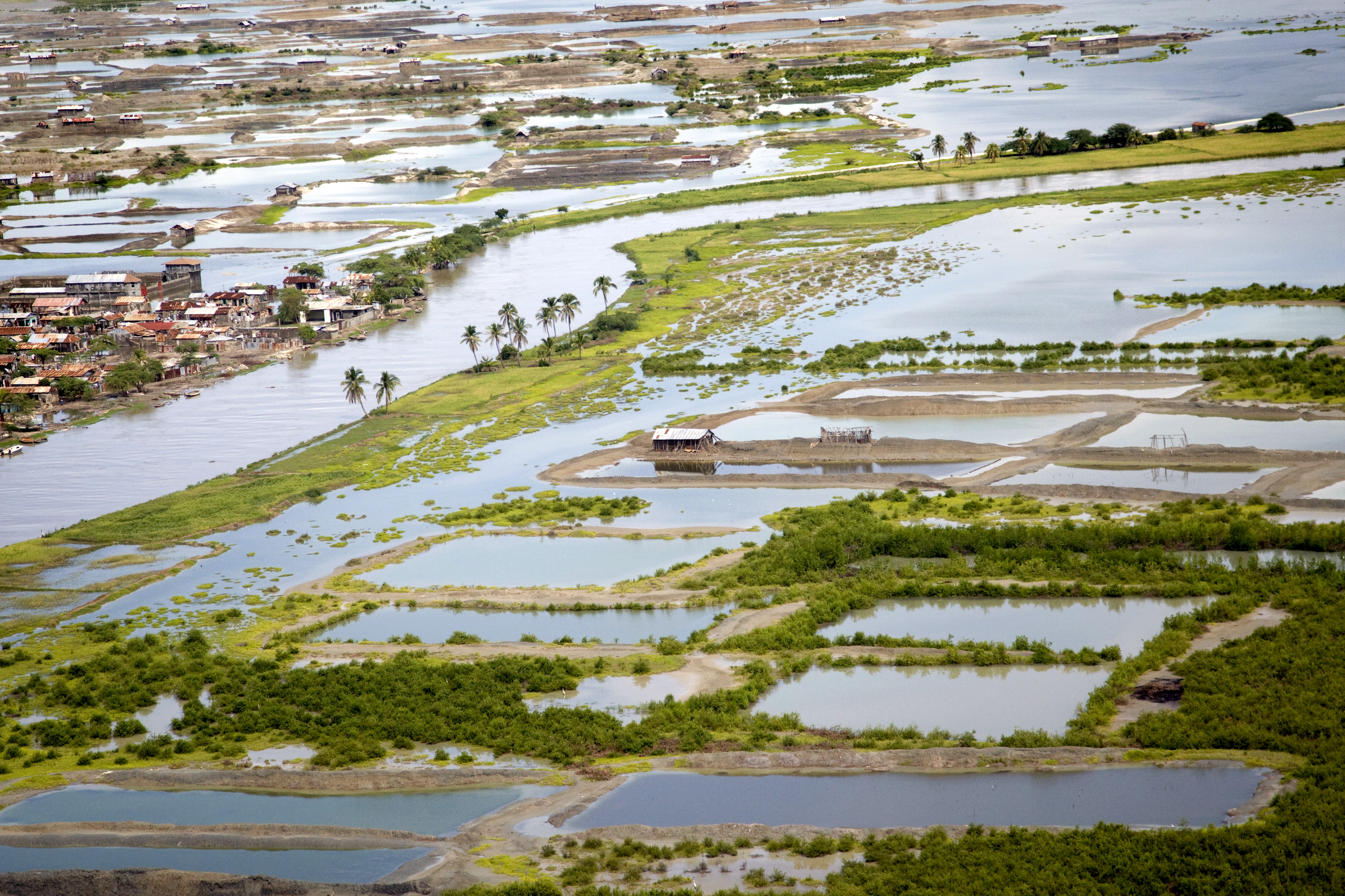
Wetlands, which sustain life across the planet, are disappearing faster than any other ecosystem.
A new report by the Ramsar Convention on Wetlands, the Global Wetland Outlook 2025: Valuing, conserving, restoring and financing wetlands (GWO 2025), warns that without urgent action, one fifth of the world’s remaining wetlands could vanish by 2050.
According to GWO 2025, the estimated cost of this habitat loss is up to USD$39 trillion in benefits that support people, economies, and nature.
Wetlands provide ecosystem services including clean water, food production, flood protection, and carbon storage. They also support livelihoods across sectors like agriculture, aquaculture, and tourism.
Launched ahead of the 15th Meeting of the Conference of the Contracting Parties to the Ramsar Convention on Wetlands (COP15) in Victoria Falls, Zimbabwe, from 23 to 31 July 2025, GWO 2025 outlines four pathways to reversing wetland loss and unlocking nature-positive investment:
Integrate wetland value in decision-making – treating wetlands as essential infrastructure in land-use, water, and economic planning.
Recognize wetlands as key to the global water cycle – for their role in storing, filtering, and regulating water.
Embed wetlands in innovative financing mechanisms – including carbon markets, resilience bonds, and blended finance.
Mobilize public and private resources for wetland restoration – through partnerships that fund action on the ground and support local communities.
The Global Wetland Outlook 2025 is available in English, French, and Spanish here.
Summary:Kelp forests bounce back faster from marine heatwaves when shielded inside Marine Protected Areas. UCLA researchers found that fishing restrictions and predator protection strengthen ecosystem resilience, though results vary by location.Share:
FULL STORY
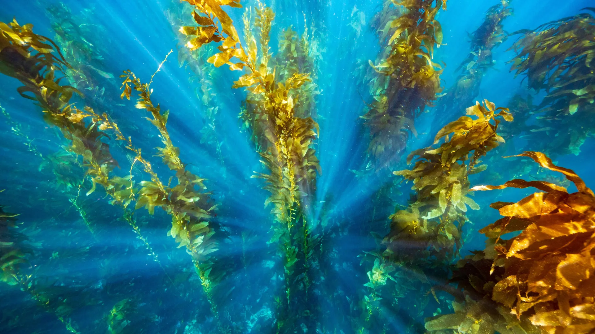
Marine Protected Areas give kelp forests a recovery edge after heatwaves, showing that local protections can buffer global climate pressures. Credit: Shutterstock
New research finds that Marine Protected Areas can boost the recovery of globally important kelp forests following marine heatwaves. The findings are published in the British Ecological Society’s Journal of Applied Ecology.
Using four decades of satellite images, University of California, Los Angeles (UCLA) researchers have looked at impacts Marine Protected Areas (MPAs) are having on kelp forests along the coast of California.
They found that although the overall effect of MPAs on kelp forest cover was modest, the benefits became clear in the aftermath of marine heatwaves in 2014-2016, when kelp forests within MPAs were able recover more quickly, particularly in southern California.
“We found that kelp forests inside MPAs showed better recovery after a major climate disturbance compared to similar unprotected areas.” Explained Emelly Ortiz-Villa, lead author of the study and a PhD researcher at UCLA Department of Geography.
“Places where fishing is restricted and important predators like lobsters and sheephead are protected saw stronger kelp regrowth. This suggests that MPAs can support ecosystem resilience to climate events like marine heatwaves.”
Professor Rick Stafford, Chair of the British Ecological Society Policy Committee, who was not involved in the study said: “It’s great to see these results and they clearly show that local action to protect biodiversity and ecosystem function can help prevent changes caused by global pressures such as climate change.
“However, it also demonstrates the need for effective MPAs. In this study, all the MPAs examined regulated fishing activity, and this is not the case for many sites which are designated as MPAs worldwide – including many in the UK.”
Kelp forests: a globally important and threatened ecosystem
Kelp forests our found around coastlines all over the world, particularly in cool, temperate waters such as the pacific coast of North America, The UK, South Africa, and Australia.
These complex ecosystems are havens for marine wildlife, including commercially important fish, and are one of the most productive habitats on Earth. They’re also efficient in capturing carbon and protect coastlines by buffering against wave energy.
However, kelp forests across the west coast of North America have declined in recent yeadue to pressures such as marine heatwaves, made more frequent and intense with climate change, and predation from increasing numbers of sea urchins, which have benefitted from population collapses of sea stars, which predate them.
Kyle Cavanaugh, a senior author of the study and professor in the UCLA Department of Geography and Institute of the Environment and Sustainability said: “Kelp forests are facing many threats, including ocean warming, overgrazing, and pollution. These forests can be remarkably resilient to individual stressors, but multi-stressor situations can overwhelm their capacity to recover. By mitigating certain stressors, MPAs can help enhance the resilience of kelp.”
Marine protected areas as a conservation tool
MPAs are designated areas of the ocean where human activity is limited to support ecosystems and the species living there. However, protections vary widely and while some areas are no-take zones, others have few restrictions or lack comprehensive management and enforcement. Many even allow destructive practices like bottom trawling.
Effective MPAs form a key part of the Kunming-Montreal Global Biodiversity Framework, agreed at COP15 in 2022, which commits nations to protecting at least 30% of oceans and land by 2030.
“Our findings can inform decisions about where to establish new MPAs or implement other spatial protection measures.” said Kyle Cavanaugh. “MPAs will be most effective when located in areas that are inherently more resilient to ocean warming, such as regions with localized upwelling or kelp populations with higher thermal tolerance.”
Emelly Villa added: “Our findings suggest that kelp forests could be a useful indicator for tracking the ecological health and climate resilience of protected areas and should be included in long-term monitoring strategies.”
Measuring the impact of marine protected areas
To understand the effects MPAs were having on kelp, the researchers used of satellite data from 1984-2022 to compare kelp forests inside and outside of 54 MPAs along the California coast.
By matching each MPA with a reference site with similar environmental conditions, they were able to test whether MPAs helped kelp forests resist loss or recover from extreme marine heatwaves which took place in the North pacific between 2014 and 2016.
The researchers warn that while their findings show that MPAs can help kelp recovery after marine heatwaves, the effect was highly variable depending on location.
“On average, kelp within MPAs showed greater recovery than in the reference sites. However, not all MPAs outperformed their corresponding reference sites, suggesting that additional factors are also play a role in determining resilience.” said Kyle Cavanaugh.
The researchers say that future work could look to identify these factors to better understand where and when MPAs are most effective at enhancing kelp resilience.
Utah geoscientist’s analysis of carbon and oxygen isotopes documents profound human-driven changes arising from agriculture and rail causeway.
Source: University of Utah
Summary:Scientists found that Great Salt Lake’s chemistry and water balance were stable for thousands of years, until human settlement. Irrigation and farming in the 1800s and a railroad causeway in 1959 created dramatic, lasting changes. The lake now behaves in ways unseen for at least 2,000 years.Share:
FULL STORY
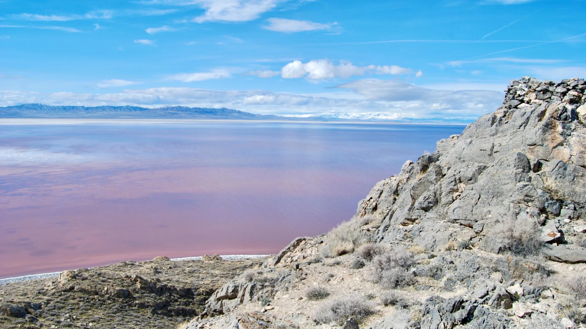
The view of Great Salt Lake’s North Arm from Gunnison Island, which has long served as a nesting ground for pelicans. Credit: Brian Maffly, University of Utah
Over the past 8,000 years, Utah’s Great Salt Lake has been sensitive to changes in climate and water inflow. Now, new sediment isotope data indicate that human activity over the past 200 years has pushed the lake into a biogeochemical state not seen for at least 2,000 years.
A University of Utah geoscientist applied isotope analysis to sediments recovered from the lake’s bed to characterize changes to the lake and its surrounding watershed back to the time the lake took its current shape from the vast freshwater Lake Bonneville that once covered much of northern Utah.
“Lakes are great integrators. They’re a point of focus for water, for sediments, and also for carbon and nutrients,” said Gabriel Bowen, a professor and chairman of the Department of Geology & Geophysics. “We can go to lakes like this and look at their sediments and they tell us a lot about the surrounding landscape.”
Sedimentary records provide context for ongoing changes in terminal saline lakes, which support fragile, yet vital ecosystems, and may help define targets for their management, according to Bowen’s new study, published last month in Geophysical Research Letters.
This research helps fill critical gaps in the lake’s geological and hydrological records, coming at a time when the drought-depleted level of the terminal body has been hovering near its historic low.
“We have all these great observations, so much monitoring, so much information and interest in what’s happening today. We also have a legacy of people looking at the huge changes in the lake that happened over tens of thousands and hundreds of thousands of years,” Bowen said. “What we’ve been missing is the scale in the middle.”
That is the time spanning the first arrival of white settlers in Utah but after Lake Bonneville receded to become Great Salt Lake.
By analyzing oxygen and carbon isotopes preserved in lake sediments, the study reconstructs the lake’s water and carbon budgets through time. Two distinct, human-driven shifts stand out:
Mid-19th century – Coinciding with Mormon settlement in 1847, irrigation rapidly greened the landscape around the lake, increasing the flow of organic matter into the lake and altering its carbon cycle.
Mid-20th century – Construction of the railroad causeway in 1959 disrupted water flow between the lake’s north and south arms, which turned Gilbert Bay from a terminal lake to an open one that partially drained into Gunnison Bay, altering the salinity and water balance to values rarely seen in thousands of years.
The new study examines two sets of sediment cores extracted from the bed of Great Salt Lake, each representing different timescales. The top 10 meters of the first core, drilled in the year 2000 south of Fremont Island, contains sediments washed into the lake up to 8,000 years ago.
The view of the Great Salt Lake from Gunnison Island, which has long served as a nesting ground for pelicans. Credit: Brian Maffly
The other samples, recovered by the U.S. Geological Survey, represent only the upper 30 centimeters of sediments, deposited in the last few hundred years.
“The first gives us a look at what was happening for the 8,000 years before the settlers showed up here,” Bowen said. “The second are these shallower cores that allow us to see how the lake changed after the arrival of the settlers.”
Bowen subjected these lakebed sediments at varying depths to an analysis that determines isotope ratios of carbon and oxygen, shedding light on the landscape surrounding the lake and the water in the lake at varying points in the past.
“The carbon tells us about the biogeochemistry, about how the carbon cycles through the lake, and that’s affected by things like weathering of rocks that bring carbon to the lake and the vegetation in the watershed, which also contributes carbon that dissolves into the water and flows to the lake,” he said.
Bowen’s analysis documented a sharp change in carbon, indicating profound changes that coincided with the arrival of Mormon pioneers in the Salt Lake Valley, where they introduced irrigated agriculture to support a rapidly growing community.
“We see a big shift in the carbon isotopes, and it shifts from values that are more indicative of rock weathering, carbon coming into the lake from dissolving limestone, toward more organic sources, more vegetation sources,” Bowen said.
The new carbon balance after settlement was unprecedented during the 8,000 years of record following the demise of Lake Bonneville.
Next, Bowen’s oxygen isotope analysis reconstructed the lake’s water balance over time.
“Essentially, it tells us about the balance of evaporation and water inflow into the lake. As the lake is expanding, the oxygen isotope ratio goes down. As the lake shrinks, it goes up, basically telling us about the rate of change of the lake volume. We see little fluctuations, but nothing major until we get to 1959.”
That’s the year Union Pacific built a 20-mile causeway to replace a historic rail trestle, dividing the lake’s North Arm, which has no tributaries, from its South Arm, also known as Gilbert Bay, which receives inflow from three rivers. Water flows through a gap in the causeway into North Arm, now rendering the South Arm an open system.
“We changed the hydrology of the lake fundamentally and gave it an outflow. We see that really clearly in the oxygen isotopes, which start behaving in a different way,” he said. Counterintuitively, the impact of this change was to make Gilbert Bay waters fresher than they would have been otherwise, buying time to deal with falling lake levels and increasing salinity due to other causes.
“If we look at the longer time scale, 8,000 years, the lake has mostly been pinned at a high evaporation state. It’s been essentially in a shrinking, consolidating state throughout that time. And that only reversed when we put in the causeway.”
The paper, “Multi-millennial context for post-colonial hydroecological change in Great Salt Lake,” was posted online July 22 in the journal Geophysical Research Letters. Gabriel Bowen is the sole author and is supported by grants from the National Science Foundation.
Using CRISPR to dial down enzyme helps to understand the isotope signatures of methane from different environments
Source:University of California – Berkeley
Summary:Roughly two-thirds of all atmospheric methane, a potent greenhouse gas, comes from methanogens. Tracking down which methanogens in which environment produce methane with a specific isotope signature is difficult, however. UC Berkeley researchers have for the first time CRISPRed the key enzyme involved in microbial methane production to understand the unique isotopic fingerprints of different environments to better understand Earth’s methane budget.Share:
FULL STORY
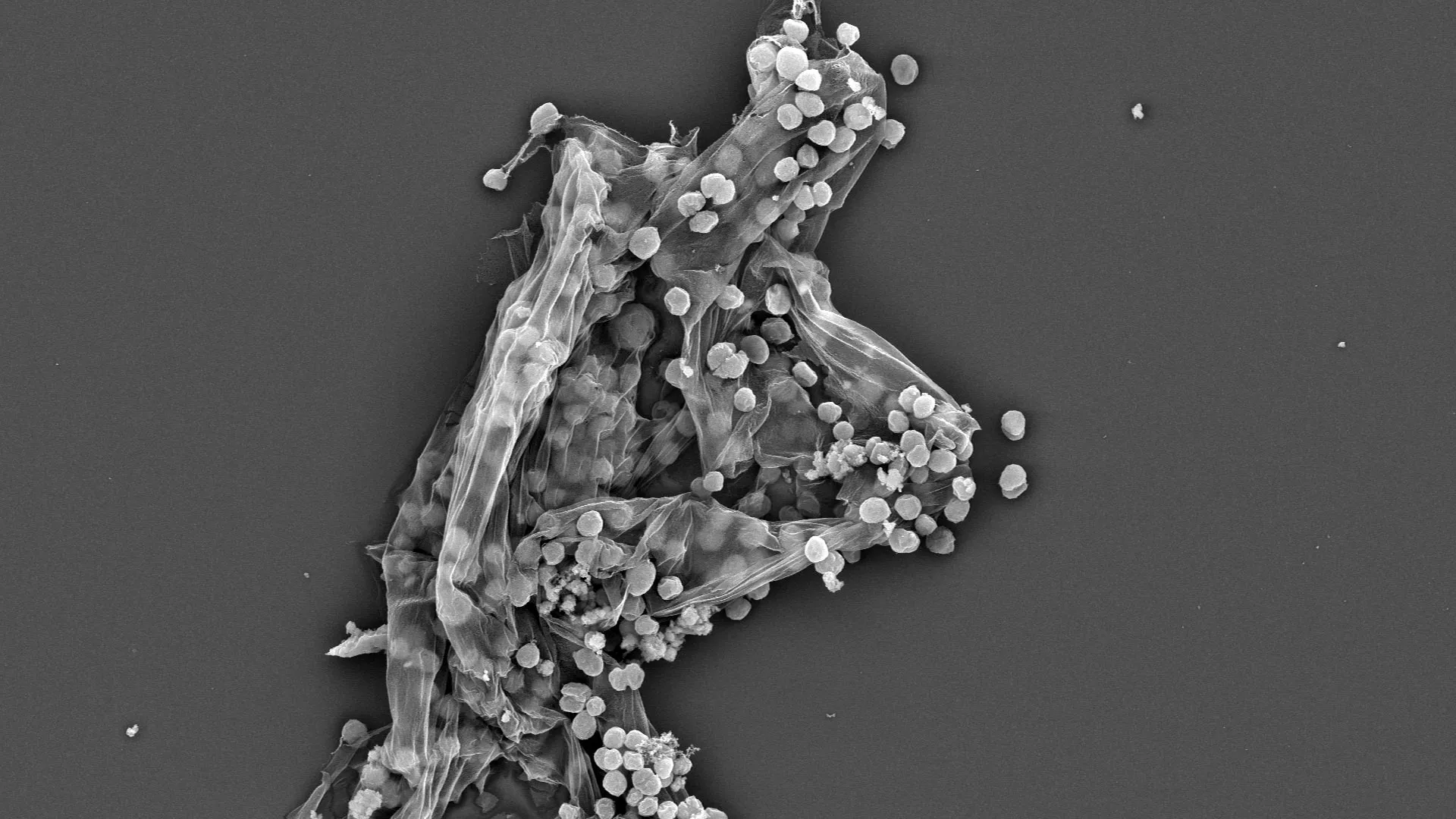
An electron microscope image of single-celled methanogens, members of the archaea domain. They are ubiquitous in oxygen-free environments, turning simple foods into methane, a potent greenhouse gas. Credit: Alienor Baskevitch/UC Berkeley
Roughly two-thirds of all emissions of atmospheric methane — a highly potent greenhouse gas that is warming planet Earth — come from microbes that live in oxygen-free environments like wetlands, rice fields, landfills and the guts of cows.
Tracking atmospheric methane to its specific sources and quantifying their importance remains a challenge, however. Scientists are pretty good at tracing the sources of the main greenhouse gas, carbon dioxide, to focus on mitigating these emissions. But to trace methane’s origins, scientists often have to measure the isotopic composition of methane’s component atoms, carbon and hydrogen, to use as a fingerprint of various environmental sources.
A new paper by researchers at the University of California, Berkeley, reveals how the activity of one of the main microbial enzymes involved in producing methane affects this isotope composition. The finding could change how scientists calculate the contributions of different environmental sources to Earth’s total methane budget.
“When we integrate all the sources and sinks of carbon dioxide into the atmosphere, we kind of get the number that we’re expecting from direct measurement in the atmosphere. But for methane, large uncertainties in fluxes exist — within tens of percents for some of the fluxes — that challenge our ability to precisely quantify the relative importance and changes in time of the sources,” said UC Berkeley postdoctoral fellow Jonathan Gropp, who is first author of the paper. “To quantify the actual sources of methane, you need to really understand the isotopic processes that are used to constrain these fluxes.”
Gropp teamed up with a molecular biologist and a geochemist at UC Berkeley to, for the first time, employ CRISPR to manipulate the activity of this key enzyme to reveal how these methanogens interact with their food supply to produce methane.
“It is well understood that methane levels are rising, but there is a lot of disagreement on the underlying cause,” said co-author Dipti Nayak, UC Berkeley assistant professor of molecular and cell biology. “This study is the first time the disciplines of molecular biology and isotope biogeochemistry have been fused to provide better constraints on how the biology of methanogens controls the isotopic composition of methane.”
Many elements have heavier or lighter versions, called isotopes, that are found in small proportions in nature. Humans are about 99% carbon-12 and 1% carbon-13, which is slightly heavier because it has an extra neutron in its nucleus. The hydrogen in water is 99.985% hydrogen-1 and 0.015% deuterium or hydrogen-2, which is twice as heavy because it has a neutron in its nucleus.
The natural abundances of isotopes are reflected in all biologically produced molecules and variations can be used to study and fingerprint various biological metabolisms.
“Over the last 70 years, people have shown that methane produced by different organisms and other processes can have distinctive isotopic fingerprints,” said geochemist and co-author Daniel Stolper, UC Berkeley associate professor of earth and planetary science. “Natural gas from oil deposits often looks one way. Methane made by the methanogens within cow guts looks another way. Methane made in deep sea sediments by microorganisms has a different fingerprint. Methanogens can consume or ‘eat’, if you will, a variety of compounds including methanol, acetate or hydrogen; make methane; and generate energy from the process. Scientists have commonly assumed that the isotopic fingerprint depends on what the organisms are eating, which often varies from environment to environment, creating our ability to link isotopes to methane origins.”
“I think what’s unique about the paper is, we learned that the isotopic composition of microbial methane isn’t just based on what methanogens eat,” Nayak said. “What you ‘eat’ matters, of course, but the amount of these substrates and the environmental conditions matter too, and perhaps more importantly, how microbes react to those changes.”
“Microbes respond to the environment by manipulating their gene expression, and then the isotopic compositions change as well,” Gropp said. “This should cause us to think more carefully when we analyze data from the environment.”
The paper will appear Aug. 14 in the journal Science.
Vinegar- and alcohol-eating microbes
Methanogens — microorganisms that are archaea, which are on an entirely separate branch of the tree of life from bacteria — are essential to ridding the world of dead and decaying matter. They ingest simple molecules — molecular hydrogen, acetate or methanol, for example — excreted by other organisms and produce methane gas as waste. This natural methane can be observed in the pale Will-o’-the-wisps seen around swamps and marshes at night, but it’s also released invisibly in cow burps, bubbles up from rice paddies and natural wetlands and leaks out of landfills. While most of the methane in the natural gas we burn formed in association with hydrocarbon generation, some deposits were originally produced by methanogens eating buried organic matter.
The isotopic fingerprint of methane produced by methanogens growing on different “food” sources has been well established in laboratory studies, but scientists have found that in the complexity of the real world, methanogens don’t always produce methane with the same isotopic fingerprint as seen in the lab. For example, when grown in the lab, species of methanogens that eat acetate (essentially vinegar), methanol (the simplest alcohol), or molecular hydrogen (H2) produce methane, CH4, with a ratio of hydrogen and carbon isotopes different from the ratios observed in the environment.
Gropp had earlier created a computer model of the metabolic network in methanogens to understand better how the isotope composition of methane is determined. When he got a fellowship to come to UC Berkeley, Stolper and Nayak proposed that he experimentally test his model. Stolper’s laboratory specializes in measuring isotope compositions to explore Earth’s history. Nayak studies methanogens and, as a postdoctoral fellow, found a way to use CRISPR gene editing in methanogens. Her group recently altered the expression of the key enzyme in methanogens that produces the methane — methyl-coenzyme M reductase (MCR) — so that its activity can be dialed down. Enzymes are proteins that catalyze chemical reactions.
Experimenting with these CRISPR-edited microbes — in a common methanogen called Methanosarcina acetivorans growing on acetate and methanol — the researchers looked at how the isotopic composition of methane changed when the enzyme activity was reduced, mimicking what is thought to happen when the microbes are starved for their preferred food.
They found that when MCR is at low concentrations, cells respond by altering the activity of many other enzymes in the cell, causing their inputs and outputs to accumulate and the rate of methane generation to slow so much that enzymes begin running both backwards and forwards. In reverse, these other enzymes remove a hydrogen from carbon atoms; running forward, they add a hydrogen. Together with MCR, they ultimately produce methane (CH4). Each forward and reverse cycle requires one of these enzymes to pull a hydrogen off of the carbon and add a new one ultimately sourced from water. As a result, the isotopic composition of methane’s four hydrogen molecules gradually comes to reflect that of the water, and not just their food source, which starts with three hydrogens.
This is different from typical assumptions for growth on acetate and methanol that assume no exchange between hydrogen derived from water and that from the food source.
“This isotope exchange we found changes the fingerprint of methane generated by acetate and methanol consuming methanogens vs. that typically assumed. Given this, it might be that we have underestimated the contribution of the acetate-consuming microbes, and they might be even more dominant than we have thought,” Gropp said. “We’re proposing that we at least should consider the cellular response of methanogens to their environment when studying isotopic composition of methane.”
Beyond this study, the CRISPR technique for tuning production of enzymes in methanogens could be used to manipulate and study isotope effects in other enzyme networks broadly, which could help researchers answer questions about geobiology and the Earth’s environment today and in the past.
“This opens up a pathway where modern molecular biology is married with isotope-geochemistry to answer environmental problems,” Stolper said. “There are an enormous number of isotopic systems associated with biology and biochemistry that are studied in the environment; I hope we can start looking at them in the way molecular biologists now are looking at these problems in people and other organisms — by controlling gene expression and looking at how the stable isotopes respond.”
For Nayak, the experiments are also a big step in discovering how to alter methanogens to derail production of methane and redirect their energy to producing useful products instead of an environmentally destructive gas.
“By reducing the amount of this enzyme that makes methane and by putting in alternate pathways that the cell can use, we can essentially give them another release valve, if you will, to put those electrons, which they were otherwise putting in carbon to make methane, into something else that would be more useful,” she said.
Other co-authors of the paper are Markus Bill of Lawrence Berkeley National Laboratory and former UC Berkeley postdoc Rebekah Stein, and Max Lloyd, who is a professor at Penn State University. Gropp was supported by a fellowship from the European Molecular Biology Organization. Nayak and Stolper were funded, in part, by Alfred B. Sloan Research Fellowships. Nayak also is an investigator with the Chan-Zuckerberg Biohub.
A drone view shows a herd of cattle searching for water amid a severe drought that has dried up Suva Planina mountain’s main springs, near the town of Bela Palanka, Serbia August 12, 2025. REUTERS/Djordje Kojadinovic
SUVA PLANINA, Serbia (Reuters) -A prolonged drought and sweltering heat are taking their toll on villagers, livestock and crops in the mountains of southeastern Serbia, with animals starting to die.
Lack of rainfall since May has caused water shortages, wildfires and disruption to agriculture across the Western Balkans, also comprised of Montenegro, Bosnia, Albania, Kosovo and North Macedonia,
At Serbia’s Suva Planina (Dry Mountain), owners who take their cows and horses for summer grazing said the springs dried up too early this year.
“There’s not a drop of water … animals are starting to die,” said Ljubisa Petkovic, a herder from the nearby municipality of Gadzin Han.
Around 1,000 thirsty cows and horses milled round a few watering holes and springs, sipping sparse and dirty water from puddles.
Temperatures in Serbia on Tuesday stood at around 35 degrees Celsius (95 Fahrenheit) with several wildfires burning.
In late July, local authorities, alerted by cattle owners, drove water trucks up the Suva Planina pastures, filled a pond, and pledged to send more.
Nikola Manojlovic, 35, said he hoped for more state water supplies and warned that villages in the valley were also suffering from the drought.
“Corn has dried up … we’ve had no running water in the village for three months now and we have no water here,” Manojlovic said.
Meteorologists say Serbia may have a spell of rainy weather later this month, but it may not be enough to replenish the small rivers, lakes and creeks needed for the cattle to drink.
(Reporting by Branko Filipovicc; Writing by Aleksandar Vasovic; Editing by Andrew Cawthorne)
The International Conference on Water, Peace, and Security 2025 will take place on 27-28 October in a hybrid format (Nairobi and online), gathering governments, civil society, researchers, and international organizations.
The event, organized by the Water, Peace and Security (WPS) partnership, will explore water’s vital role as a catalyst for peace and cooperation, especially in regions affected by conflict and insecurity.
In recent decades, water-related conflicts have intensified globally due to climate change, population growth and unsustainable water management. At the same time, there is growing recognition that water cooperation can act as a bridge for peacebuilding, fostering dialogue, trust and collaboration across communities and nations.
Themes of the conference:
From water-conflicts to peace and cooperation: Case studies of successful prevention/mitigation/resolution of water-related conflicts, and pathways towards conflict sensitive and cooperative water management.
Innovations for water and peace: Exploring the role of data and models in promoting peaceful and cooperative water resource management.
Climate change and water security: Addressing the intersection of climate change impacts (floods and droughts), and associated conflict risks, and mitigation experiences.
Agency of marginalized groups in water, peace and security: Amplifying the role of underrepresented groups (women, youth, indigenous) in water governance and peacebuilding.
WPS is a collaboration between many organizations including IHE Delft Institute for Water Education and World Resources Institute.
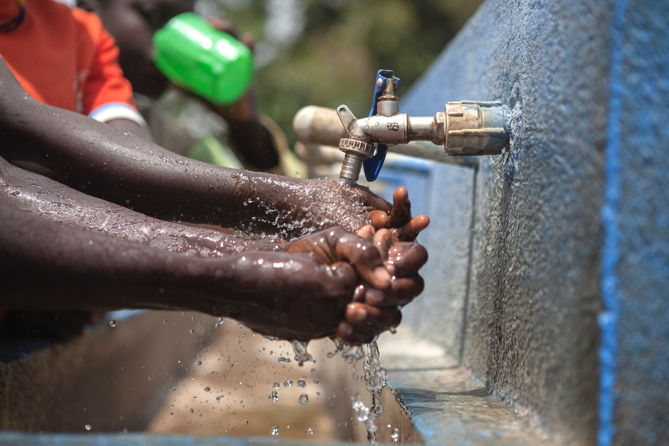
More than 40 organizations have joined forces to launch the Global Call to Action on Strengthening Water and Sanitation Regulatory Systems, a coordinated effort to improve public health, equity and climate resilience by strengthening regulatory frameworks worldwide.
The need for acceleration in strong regulation was reinforced in the most recent UN-Water Global Analysis and Assessment of Sanitation and Drinking-Water (GLAAS) report, which found that many countries still lack adequate regulatory frameworks, particularly for sanitation. Where effective regulation does exist, the report noted, countries make faster progress toward their national WASH targets.
The Call to Action outlines practical steps for governments, regulators, donors and partners to build enabling environments for strong regulation. It emphasizes the importance of legally binding standards, autonomous institutions, inclusive oversight and sustainable financing. It also highlights the role of regional regulatory associations in driving progress and sharing tools, expertise and capacity across borders.
The launch event featured remarks from global leaders including Ms. Retno Marsudi, United Nations Secretary-General’s Special Envoy on Water, and Bruce Gordon, Head of Water, Sanitation and Hygiene at WHO and Vice-Chair of UN-Water, the UN’s inter-agency coordination mechanism for water-related issues.
The Call to Action is available for download in six languages – English, French, Spanish, Portuguese, Russian and Arabic – and is accompanied by launch videos in English, French, Spanish and Portuguese. All materials are accessible here.
Heat waves and cold spells are now more common on the Great Lakes, according to U-M research, with implications for the region’s weather, economy and ecology.
Summary:Extreme heat waves and cold spells on the Great Lakes have more than doubled since the late 1990s, coinciding with a major El Niño event. Using advanced ocean-style modeling adapted for the lakes, researchers traced temperature trends back to 1940, revealing alarming potential impacts on billion-dollar fishing industries, fragile ecosystems, and drinking water quality.
Great Lakes temperature extremes have surged since the late ’90s, threatening ecosystems, fisheries, and water quality. Advanced modeling now offers a detailed history back to 1940 and could help forecast future risks. Credit: Shutterstock
Heat waves and cold spells are part of life on the Great Lakes. But new research from the University of Michigan shows that is true today in a fundamentally different way than it was even 30 years ago.
“The appearance of these extreme temperatures is increasing,” said Hazem Abdelhady, a postdoctoral research fellow in the U-M School for Environment and Sustainability, or SEAS. “For most lakes, the appearance is up more than 100% compared with before 1998.” That timing is significant because it coincides with the 1997-1998 El Niño, which is one of the strongest on record, he added.To reveal this trend, Abdelhady and his colleagues developed a state-of-the-art approach to modeling the surface temperature of the Great Lakes, which allowed them to study heat waves and cold spells dating back to 1940. The surface water temperature of the Great Lakes plays an important role in the weather, which is an obvious concern for residents, travelers and shipping companies in the region.But the uptick in extreme temperature events could also disrupt ecosystems and economies supported by the lakes in more subtle ways, Abdelhady said.
“These types of events can have huge impacts on the fishing industry, which is a billion-dollar industry, for example,” Abdelhady said. Tribal, recreational and commercial fishing in the Great Lakes account for a total value of more than $7 billion annually, according to the Great Lakes Fishery Commission.
While fish can swim to cooler or warmer waters to tolerate gradual temperature changes, the same isn’t always true for sudden jumps in either direction, Abdelhady said. Fish eggs are particularly susceptible to abnormal temperature spikes or drops.
Hot and cold streaks can also disrupt the natural mixing and stratifying cycles of the lakes, which affects the health and water quality of lakes that people rely on for recreation and drinking water.Now that the researchers have revealed these trends on each of the Great Lakes, they’re working to build on that to predict future extreme temperature events as the average temperature of the lakes — and planet — continue to warm. In studying those events and their connections with global climate phenomena, such as El Niños and La Niñas, we can better prepare to brace for their impact, Abdelhady said.
“If we can understand these events, we can start thinking about how to protect against them,” Abdelahdy said.
The study was conducted through the Cooperative Institute for Great Lakes Research, or CIGLR, and published in Communications Earth & Environment, part of the Nature journal family. The work was supported by the National Science Foundation, its Global Centers program and the National Oceanic and Atmospheric Administration, or NOAA.
Capturing the greatness of the lakes
One of the challenges of this work was the size of the problem itself. Although researchers have developed computer models that can simulate processes in most lakes around the world, the Great Lakes aren’t most lakes.
For starters, they’re an interconnected system of five lakes. They also contain more than a fifth of the world’s fresh surface water. And the length of their shoreline is comparable to that of the U.S.’s entire Atlantic coast — including the gulf states.In many regards, the Great Lakes have more in common with coastal oceans than with other lakes, said study coauthor Ayumi Fujisaki-Manome, who is an associate research scientist with SEAS and CIGLR.
“We can’t use the traditional, simpler models for the Great Lakes because they really don’t do well,” Fujisaki-Manome said.
So Abdelhady turned to modeling approaches used to study coastal oceans and tailored them for the Great Lakes. But there was also a data hurdle to overcome in addition to the modeling challenges.
Satellites have enabled routine direct observations of the Great Lakes starting about 45 years ago, Fujisaki-Manome said. But when talking about climate trends and epochs, researchers need to work with longer time periods.
“The great thing with this study is we were able to extend that historical period by almost double,” Fujisaki-Manome said.
By working with available observational data and trusted data from global climate simulations, Abdelhady could model Great Lakes temperature data and validate it with confidence back to 1940.”That’s why we use modeling a lot of the time. We want to know about the past or the future or a point in space we can’t necessarily get to,” said coauthor Drew Groneworld, an associate professor in SEAS and a leader of the Global Center for Climate Change and Transboundary Waters. “With the Great Lakes, we have all three of those.”
David Cannon, an assistant research scientist with CIGRL, and Jia Wang, a climatologist and oceanographer with NOAA’s Great Lakes Environmental Research Laboratory, also contributed to the study. The study is a perfect example of how collaborations between universities and government science agencies can create a flow of knowledge that benefits the public and the broader research community, Gronewold said.
The team’s model is now available for other research groups studying the Great Lakes to explore their questions. For the team at U-M, its next steps are using the model to explore spatial differences across smaller areas of the Great Lakes and using the model to look forward in time.
“I’m very curious if we can anticipate the next big shift or the next big tipping point,” Gronewold said. “We didn’t anticipate the last one. Nobody predicted that, in 1997, there was going to be a warm-winter El Niño that changed everything.”
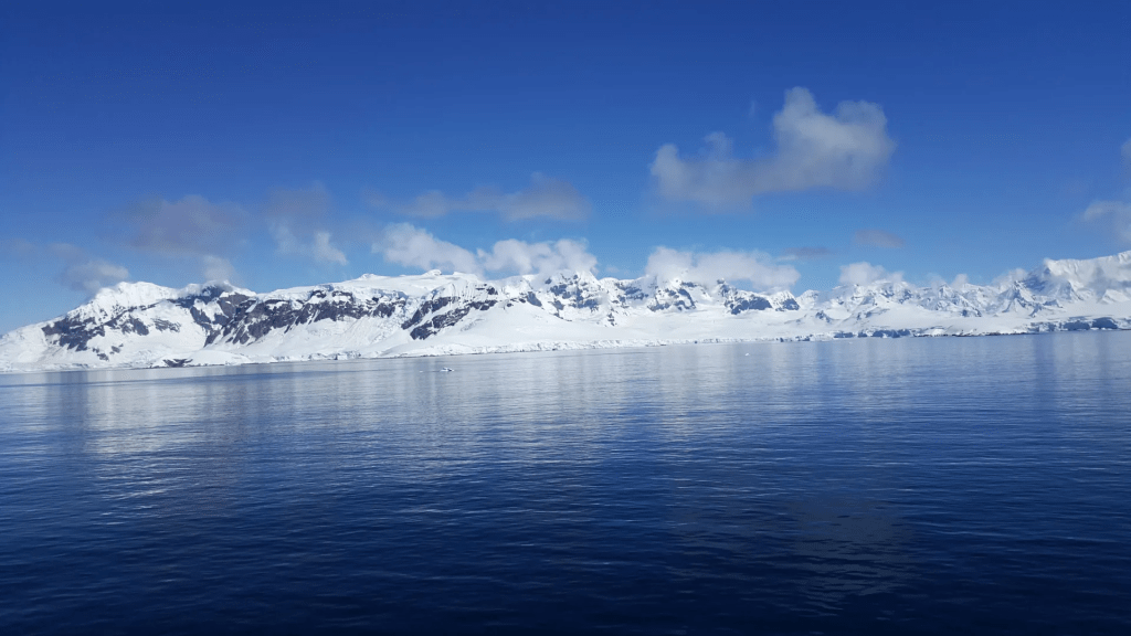
Summary:Deep beneath the Antarctic seas lies a hidden network of 332 colossal submarine canyons, some plunging over 4,000 meters, revealed in unprecedented detail by new high-resolution mapping. These underwater valleys, shaped by glacial forces and powerful sediment flows, play a vital role in transporting nutrients, driving ocean currents, and influencing global climate. Striking differences between East and West Antarctica’s canyon systems offer clues to the continent’s ancient ice history, while also exposing vulnerabilities as warm waters carve away at protective ice shelves.
Submarine canyons are among the most spectacular and fascinating geological formations to be found on our ocean floors, but at an international level scientists have yet to uncover many of their secrets, especially of those located in remote regions of the Earth like the North and South Poles. Now, an article published in the journal Marine Geologyhas brought together the most detailed catalogue to date of Antarctic submarine canyons, identifying a total of 332 canyon networks that in some cases reach depths of over 4,000 meters.
The catalogue, which identifies five times as many canyons as previous studies had, was produced by the researchers David Amblàs, of the Consolidated Research Group on Marine Geosciences at the Faculty of Earth Sciences of the University of Barcelona, and Riccardo Arosio, of the Marine Geosciences Research Group at University College Cork. Their article shows that Antarctic submarine canyons may have a more significant impact than previously thought on ocean circulation, ice-shelf thinning and global climate change, especially in vulnerable areas such as the Amundsen Sea and parts of East Antarctica.Submarine canyons: the differences between East and West Antarctica
The submarine canyons that form valleys carved into the seafloor play a decisive role in ocean dynamics: they transport sediments and nutrients from the coast to deeper areas, they connect shallow and deep waters and they create habitats rich in biodiversity. Scientists have identified some 10,000 submarine canyons worldwide, but because only 27% of the Earth’s seafloor has been mapped in high resolution the real total is likely to be higher. And despite their ecological, oceanographic, and geological value, submarine canyons remain underexplored, especially in polar regions.
“Like those in the Arctic, Antarctic submarine canyons resemble canyons in other parts of the world,” explains David Amblàs. “But they tend to be larger and deeper because of the prolonged action of polar ice and the immense volumes of sediment transported by glaciers to the continental shelf.” Moreover, the Antarctic canyons are mainly formed by turbidity currents, which carry suspended sediments downslope at high speed, eroding the valleys they flow through. In Antarctica, the steep slopes of the submarine terrain combined with the abundance of glacial sediments amplifies the effects of these currents and contributes to the formation of large canyons.The new study by Amblàs and Arosio is based on Version 2 of the International Bathymetric Chart of the Southern Ocean (IBCSO v2), the most complete and detailed map of the seafloor in this region. It uses new high-resolution bathymetric data and a semi-automated method for identifying and analysing canyons that was developed by the authors. In total, it describes 15 morphometric parameters that reveal striking differences between canyons in East and West Antarctica.
“Some of the submarine canyons we analyzed reach depths of over 4,000 meters,” explained David Amblàs. “The most spectacular of these are in East Antarctica, which is characterized by complex, branching canyon systems. The systems often begin with multiple canyon heads near the edge of the continental shelf and converge into a single main channel that descends into the deep ocean, crossing the sharp, steep gradients of the continental slope.”
Riccardo Arosio noted that “It was particularly interesting to see the differences between canyons in the two major Antarctic regions, as this hadn’t been described before. East Antarctic canyons are more complex and branched, often forming extensive canyon-channel systems with typical U-shaped cross sections. This suggests prolonged development under sustained glacial activity and a greater influence of both erosional and depositional sedimentary processes. In contrast, West Antarctic canyons are shorter and steeper, characterized by V-shaped cross sections.”According to David Amblàs, this morphological difference supports the idea that the East Antarctica Ice Sheet originated earlier and has experienced a more prolonged development. “This had been suggested by sedimentary record studies,” Amblàs said, “but it hadn’t yet been described in large-scale seafloor geomorphology.”
About the research, Riccardo Arosio also explained that “Thanks to the high resolution of the new bathymetric database — 500 meters per pixel compared to the 1-2 kilometres per pixel of previous maps — we could apply semi-automated techniques more reliably to identify, profile and analyse submarine canyons. The strength of the study lies in its combination of various techniques that were already used in previous work but that are now integrated into a robust and systematic protocol. We also developed a GIS software script that allows us to calculate a wide range of canyon-specific morphometric parameters in just a few clicks.”
Submarine canyons and climate change
As well as being spectacular geographic accidents, the Antarctic canyons also facilitate water exchange between the deep ocean and the continental shelf, allowing cold, dense water formed near ice shelves to flow into the deep ocean and form what is known as Antarctic Bottom Water, which plays a fundamental role in ocean circulation and global climate.
Additionally, these canyons channel warmer waters such as Circumpolar Deep Water from the open sea toward the coastline. This process is one of the main mechanisms that drives the basal melting and thinning of floating ice shelves, which are themselves critical for maintaining the stability of Antarctica’s interior glaciers. And as Amblàs and Arosio have explained, when the shelves weaken or collapse, continental ice flows more rapidly into the sea and directly contributes to the rise in global sea level.
Amblàs and Arosio’s study also highlights the fact that current ocean circulation models like those used by the Intergovernmental Panel on Climate Change do not accurately reproduce the physical processes that occur at local scales between water masses and complex topographies like canyons. These processes, which include current channeling, vertical mixing and deep-water ventilation, are essential for the formation and transformation of cold, dense water masses like Antarctic Bottom Water. Omitting these local mechanisms limits the ability that models have to predict changes in ocean and climate dynamics.As the two researchers conclude, “That’s why we must continue to gather high-resolution bathymetric data in unmapped areas that will surely reveal new canyons, collect observational data both in situ and via remote sensors and keep improving our climate models to better represent these processes and increase the reliability of projections on climate change impacts.”