Hungry flathead catfish are changing everything in the Susquehanna

New study suggests that smallmouth bass and channel catfish are changing what they eat to avoid having to compete with or being eaten by the invader.

Source:Penn State

Summary: Flathead catfish are rapidly reshaping the Susquehanna River’s ecosystem. Once introduced, these voracious predators climbed to the top of the food chain, forcing native fish like channel catfish and bass to shift diets and habitats. Using stable isotope analysis, researchers uncovered how the invaders disrupt food webs, broaden dietary overlaps, and destabilize energy flow across the river system. The findings show how a single invasive species can spark cascading ecological consequences. Share:


FULL STORY


Flathead Catfish Take Over the Susquehanna
Flatheads grow fast in this river system, attain large body sizes and can eat a variety of prey. Because adult flatheads have few natural predators, they can exert strong control over the ecosystem. Credit: Penn State

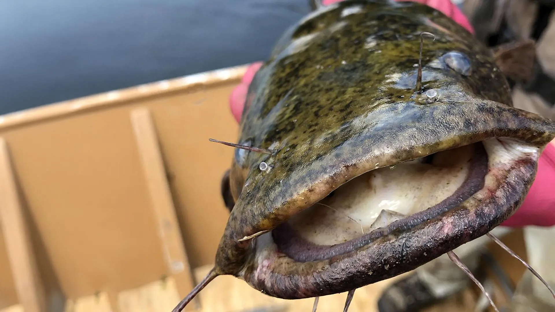
Flathead catfish, opportunistic predators native to the Mississippi River basin, have the potential to decimate native and recreational fisheries, disrupting ecosystems in rivers where they become established after their introduction or invasion from a nearby river drainage. That concern led a team of researchers from Penn State, the U.S. Geological Survey (USGS), and the Pennsylvania Fish and Boat Commission to assess how flatheads are affecting the food web and energy flow in the Susquehanna River in Pennsylvania, where they were first detected in 1991. Their population has grown rapidly in the decades since.

“Flatheads grow fast in this river system, attain large body sizes and can eat a variety of prey,” said study first author Olivia Hodgson, a master’s degree student in Penn State’s Intercollege Graduate Degree Program in Ecology. “Because adult flatheads have few natural predators, flathead catfish can exert strong control over the ecosystem.”

Hodgson is working with Tyler Wagner, a scientist with the USGS Pennsylvania Cooperative Fish and Wildlife Research Unit Program and a Penn State affiliate professor of fisheries ecology. He is senior author on the study. In findings published Sept. 4 in Ecology, the researchers reported that flathead catfish are apex predators.

Flatheads had the highest trophic position — the level an organism occupies in a food web, based on its feeding relationships — even higher than resident top predators such as smallmouth bass and channel catfish. Channel catfish had a lower trophic position in areas with flathead catfish. This means they now eat lower on the food chain, likely because they are being outcompeted by flatheads or avoiding them, the researchers explained. In areas with flathead catfish, they found, all species showed broader and overlapping diets.

“This suggests that resident species are changing what they eat to avoid competing with or being eaten by the invader,” Hodgson said. “These findings support the ‘trophic disruption hypothesis,’ that says when a new predator enters an ecosystem, it forces existing species to alter their behavior, diets and roles in the food web. This can destabilize ecosystems over time. Our study highlights how an invasive species can do more than just reduce native populations — it can reshape entire foodwebs and change how energy moves through ecosystems.”

Although the predatory effects of invasive catfishes on native fish communities have been documented — such as in a recent study on the Susquehanna River led by researchers at Penn State — the impacts of invasion on riverine food webs are poorly understood, Hodgson noted. This study quantified the effects of invasive flathead catfish on the food web in the Susquehanna by comparing uninvaded river sections to invaded sections, focusing on several key species: flathead catfish — invader, channel catfish and smallmouth bass — resident predators, and crayfish and minnows — prey.

In addition to evaluating trophic position, the researchers analyzed the isotopic niche occupied by the fish species — the range of carbon and nitrogen markers found within the tissues of an organism, reflecting its diet and habitat, providing insights into its ecological role.

To reach their conclusions, the researchers employed stable isotope analysis, a widely used tool that can explain patterns within a food web, highlighting links between trophic positions, as well as the breadth and overlap of trophic niches. Stable isotope analysis is especially useful for studying invasion ecology, such as investigating trophic reorganization and trophic overlap between introduced and resident species.

When fish eat, their bodies incorporate the isotopic signature of their food. By sampling their tissues, scientists can measure nitrogen isotopes and determine their diet, carbon isotopes to determine habitat use, and compare isotopic signatures across regions to deduce fish migration or habitat shifts. For this study, channel catfish, smallmouth bass, minnows and crayfish were selected as focal species because a previous diet analysis conducted in collaboration with Penn State, USGS, and Pennsylvania Fish and Boat Commission researchers within the Susquehanna River, showed that these species are important prey for flathead catfish.

The researchers collected a total of 279 fish and 64 crayfish for stable isotope analysis, including 79 flathead catfish, 45 smallmouth bass, 113 channel catfish and 42 minnows comprising nine species. All samples were oven dried and ground to a fine powder using a mortar and pestle. Stable isotope samples were sent to Penn State’s Core Facilities and the Michigan State University Stable Isotope Laboratories for isotope determination.

“Stable isotope analysis explained patterns within the Susquehanna food web in habitats invaded and not invaded by the flathead catfish, and it allowed us to understand links between different species in the river food web and how invasive species might lead to changes in how native species interact and compete, what they eat and how their diets overlap, and if they might be displaced from preferred habitats by the invader,” Hodgson said. “We were able to infer resource use, helping us to better understand potential competition for resources and how this changes when flathead catfish become established.”

Contributing to the research were: Sydney Stark, recent Penn State graduate with a master’s degree in wildlife and fisheries science; Megan Schall, associate professor of biology and science at Penn State Hazleton; Geoffrey Smith, Susquehanna River biologist for the Pennsylvania Fish and Boat Commission; and Kelly Smalling, research hydrologist withtheU.S. Geological Survey, New Jersey Water Science Center.

Funding for this research was provided by Pennsylvania Sea Grant and the U.S. Geological Survey.

CLICK HERE FOR MORE INFORMATION

https://www.sciencedaily.com/releases/2025/09/250909031516.htm

Scientists finally solve the mystery of ghostly halos on the ocean floor

Initially thought to contain the pesticide DDT, study reveals some barrels contained caustic alkaline waste.

Source:University of California – San Diego

Summary:Barrels dumped off Southern California decades ago have been found leaking alkaline waste, not just DDT, leaving behind eerie white halos and transforming parts of the seafloor into toxic vents. The findings reveal a persistent and little-known legacy of industrial dumping that still shapes marine life today.Share:


FULL STORY


Scientists Solve the Mystery of Ghostly Halos
A discarded barrel on the seafloor off the coast of Los Angeles. The image was taken during a survey in July 2021 by remotely operated vehicle SuBastian. Credit: Schmidt Ocean Institute

In 2020, haunting images of corroded metal barrels in the deep ocean off Los Angeles leapt into the public consciousness. Initially linked to the toxic pesticide DDT, some barrels were encircled by ghostly halos in the sediment. It was unclear whether the barrels contained DDT waste, leaving the barrels’ contents and the eerie halos unexplained.

Now, new research from UC San Diego’s Scripps Institution of Oceanography reveals that the barrels with halos contained caustic alkaline waste, which created the halos as it leaked out. Though the study’s findings can’t identify which specific chemicals were present in the barrels, DDT manufacturing did produce alkaline as well as acidic waste. Other major industries in the region such as oil refining also generated significant alkaline waste.

“One of the main waste streams from DDT production was acid and they didn’t put that into barrels,” said Johanna Gutleben, a Scripps postdoctoral scholar and the study’s first author. “It makes you wonder: What was worse than DDT acid waste to deserve being put into barrels?”

The study also found that the caustic waste from these barrels transformed portions of the seafloor into extreme environments mirroring natural hydrothermal vents — complete with specialized bacteria that thrive where most life cannot survive. The study authors said the severity and extent of this alkaline waste’s impacts on the marine environment depend on how many of these barrels are sitting on the seafloor and the specific chemicals they contained.

Despite these unknowns, Paul Jensen, emeritus marine microbiologist at Scripps and senior author of the study, said that he would have expected the alkaline waste to quickly dissipate in seawater. Instead, it has persisted for more than half a century, suggesting this alkaline waste “can now join the ranks of DDT as a persistent pollutant with long-term environmental impacts.”

The study, published on September 9 in the Proceedings of the National Academy of Sciences Nexus and supported by NOAA and the University of Southern California’s Sea Grant program, continues Scripps’ leadership role in unspooling the toxic legacy of once-legal ocean dumping off the coast of Southern California. The findings also provide a way of visually identifying barrels that formerly contained this caustic alkaline waste.

“DDT was not the only thing that was dumped in this part of the ocean and we have only a very fragmented idea of what else was dumped there,” said Gutleben. “We only find what we are looking for and up to this point we have mostly been looking for DDT. Nobody was thinking about alkaline waste before this and we may have to start looking for other things as well.”

From the 1930s until the early 1970s, 14 deep-water dump sites off the coast of Southern California received “refinery wastes, filter cakes and oil drilling wastes, chemical wastes, refuse and garbage, military explosives and radioactive wastes,” according to the EPA. A pair of Scripps-led seafloor surveys in 2021 and 2023 identified thousands of objects, including hundreds of discarded military munitions. The number of barrels on the seafloor remains unknown. Sediments in the area are heavily contaminated with the pesticide DDT, a chemical banned in 1972 now known to harm humans and wildlife. Scant records from this time period suggest DDT waste was largely pumped directly into the ocean.

Gutleben said she and her co-authors didn’t initially set out to solve the halo mystery. In 2021, aboard the Schmidt Ocean Institute’s Research Vessel Falkor, she and other researchers collected sediment samples to better understand the contamination near Catalina. Using the remotely operated vehicle (ROV) SuBastian, the team collected sediment samples at precise distances from five barrels, three of which had white halos.

The barrels featuring white halos presented an unexpected challenge: Inside the white halos the sea floor suddenly became like concrete, preventing the researchers from collecting samples with their coring devices. Using the ROV’s robotic arm, the researchers collected a piece of the hardened sediment from one of the halo barrels.

The team analyzed the sediment samples and the hardened piece of halo barrel crust for DDT concentrations, mineral content and microbial DNA. The sediment samples showed that DDT contamination did not increase closer to the barrels, deepening the mystery of what they contained.

During the analysis, Gutleben struggled to extract microbial DNA from the samples taken through the halos. After some unsuccessful troubleshooting in the lab, Gutleben tested one of these samples’ pH. She was shocked to find that the sample’s pH was extremely high — around 12. All the samples from near the barrels with halos turned out to be similarly alkaline. (An alkaline mixture is also known as a base, meaning it has a pH higher than 7 — as opposed to an acid which has a pH less than 7).

This explained the limited amount of microbial DNA she and her colleagues had been able to extract from the halo samples. The samples turned out to have low bacterial diversity compared to other surrounding sediments and the bacteria came from families adapted to alkaline environments, like deep-sea hydrothermal vents and alkaline hot springs.

Analysis of the hard crust showed that it was mostly made of a mineral called brucite. When the alkaline waste leaked from the barrels, it reacted with magnesium in the seawater to create brucite, which cemented the sediment into a concrete-like crust. The brucite is also slowly dissolving, which maintains the high pH in the sediment around the barrels, and creates a place only few extremophilic microbes can survive. Where this high pH meets the surrounding seawater, it forms calcium carbonate that deposits as a white dust, creating the halos.

“This adds to our understanding of the consequences of the dumping of these barrels,” said Jensen. “It’s shocking that 50-plus years later you’re still seeing these effects. We can’t quantify the environmental impact without knowing how many of these barrels with white halos are out there, but it’s clearly having a localized impact on microbes.”

Prior research led by Lisa Levin, study co-author and emeritus biological oceanographer at Scripps, showed that small animal biodiversity around the barrels with halos was also reduced. Jensen said that roughly a third of the barrels that have been visually observed had halos, but it’s unclear if this ratio holds true for the entire area and it remains unknown just how many barrels are sitting on the seafloor.

The researchers suggest using white halos as indicators of alkaline waste could help rapidly assess the extent of alkaline waste contamination near Catalina. Next, Gutleben and Jensen said they are experimenting with DDT contaminated sediments collected from the dump site to search for microbes capable of breaking down DDT.

The slow microbial breakdown the researchers are now studying may be the only feasible hope for eliminating the DDT dumped decades ago. Jensen said that trying to physically remove the contaminated sediments would, in addition to being a huge logistical challenge, likely do more harm than good.

“The highest concentrations of DDT are buried around 4 or 5 centimeters below the surface — so it’s kind of contained,” said Jensen. “If you tried to suction that up you would create a huge sediment plume and stir that contamination into the water column.”

In addition to Gutleben, Jensen and Levin, Sheila Podell, Douglas Sweeney and Carlos Neira of Scripps Oceanography co-authored the study, alongside Kira Mizell of the U.S. Geological Survey.

CLICK HERE FOR MORE INFORMATION

https://www.sciencedaily.com/releases/2025/09/250910000244.htm

Four billion particles of microplastics discovered in major body of water

Source:University of South Florida (USF Innovation)

Summary:While collecting water samples and plankton, researchers discovered a high concentration of microplastics, which are known to disrupt the marine food chain.Share:


FULL STORY


A new study from the University of South Florida St. Petersburg and Eckerd College estimates the waters of Tampa Bay contain four billion particles of microplastics, raising new questions about the impact of pollution on marine life in this vital ecosystem.

This is the first measurement of microplastic abundance and distribution in the region. Researchers hope the findings will provide necessary data to inform the debate around policies to reduce plastic in the marine environment.

Microplastics are tiny plastic particles less than 1/8 of an inch, barely or not at all visible to the eye. They come from the breakdown of larger plastics, such as water bottles, fishing gear and plastic bags, or from synthetic clothing and other items that contain elements of plastic. Previous studies have found these particles in every ocean on the planet and even in the Arctic.

“Very little is known about how much microplastics are out there and the full consequences of these particles on marine life,” said Kinsley McEachern, the first author of the study and a recent Environmental Science and Policy graduate student at USF St. Petersburg. “But emerging research indicates a wide range of impacts on marine ecosystems from the large accumulation of microplastics.”

Since particles are similar size as plankton, filter feeders such as oysters, clams, many fish and some birds ingest microplastics, allowing them to enter the food chain. Persistent organic pollutants, including toxic pesticides, and metals can stick to their surfaces, making ingestion potentially that much more damaging. Effects include cellular damage, reproductive disruption and even death.

The study revealed that the predominant type of these tiny particles in Tampa Bay — in both water and sediment — are thread-like fibers that are generated by fishing lines, nets and washing clothes. Synthetic fibers are released from clothes while they are being laundered, discharged to wastewater treatment plants and eventually released into the bay.

The next largest source are fragments that come from the breakdown of larger plastics.

“These plastics will remain in the bay, the gulf and ocean for more than a lifetime, while we use most plastic bags and bottles for less than an hour,” said David Hastings, Principal Investigator of the study, Courtesy Professor at USF College of Marine Science and a recently retired Professor of Marine Science and Chemistry at Eckerd College. “Although it is tempting to clean up the mess, it is not feasible to remove these particles from the water column or separate them out from sediments.”

“Only by removing the sources of plastics and microplastic particles can we successfully decrease the potential risks of plastics in the marine environment,” added McEachern.

Researchers found the largest concentrations of microplastics in water occurred after intense and long rainfall events, while in sediments the greatest amount of microplastics were located close to industrial sources.

For more than a decade, Hastings led annual research cruises in Tampa Bay with Eckerd College students to collect water samples and plankton. During these trips, he and his students were also seeing small pieces of plastic.

“We were looking at plankton, which form the base of the marine food web. But when we put the samples underneath the microscope, we were astonished to find many brightly colored pieces of microplastic. We wanted to learn more,” said Hastings.

Teaming up with McEachern, who was interested in focusing her graduate research on this issue, USFSP Associate Professor of Chemistry Henry Alegria and the Environmental Protection Commission of Hillsborough County, they set about counting microplastics in the region at 24 stations over a 14-month period. Collecting stations were located at the mouths of major rivers, near industrial facilities and in relatively pristine coastal mangroves. Particles believed to be plastic were probed with a hot dissecting needle. If the material quickly melted or disfigured, the sample was classified as a microplastic.

On average, the study found four pieces of microplastic per gallon of water at all sites, and more than 600 pieces of microplastic per pound of dry sediment. Extrapolating those findings to the entire Tampa Bay estuary, the researchers estimated there are approximately four billion particles in the water and more than 3 trillion pieces in surface sediments.

Researchers say the findings, though substantial, might also be conservative, since collection in the bay occurred several feet below the water surface, likely missing any buoyant microplastics at the surface.

“We collected only a few pieces of Styrofoam, most likely because we sampled below the surface and foam floats at the surface,” explained Hastings.

Plastic pollution in the marine environment has been a concern for decades. However, only recently have scientists started to uncover thwidespread abundance of microplastics in the environment. With mounting physical evidence of plastic pollution, there have been greater calls for action in coastal communities around the world. Recently bans on plastic bags and single-use plastics have been enacted by some local governments in Tampa Bay to reduce marine pollution and protect Florida’s largest open-water estuary.

The findings of billions of particles of microplastics in Tampa Bay waters could bring even greater calls for action and influence future decisions in the region and beyond. Researchers at USF St. Petersburg and Eckerd College are conducting further research to more fully understand microplastic pollution in the marine environment.

CLICK HERE FOR MORE INFORMATION

https://www.sciencedaily.com/releases/2019/09/190912111819.htm

Levels of one ‘forever chemical’ are increasing in groundwater

Source:American Chemical Society

Summary:Rain and water in ponds and lakes slowly seeps into the soil, moving through minute cracks to refill underground aquifers. Per- and polyfluoroalkyl substances (PFAS), often described as forever chemicals, can tag along into groundwater that’s later removed for drinking. Researchers analyzed water from over 100 wells in Denmark for one particularly persistent PFAS: trifluoroacetate. They report steadily increasing levels of the forever chemical in recent decades.Share:


FULL STORY


Rain and water in ponds and lakes slowly seeps into the soil, moving through minute cracks to refill underground aquifers. Per- and polyfluoroalkyl substances (PFAS), often described as forever chemicals, can tag along into groundwater that’s later removed for drinking. Researchers in ACS’ Environmental Science & Technology Letters analyzed water from over 100 wells in Denmark for one particularly persistent PFAS: trifluoroacetate. They report steadily increasing levels of the forever chemical in recent decades.

Trifluoroacetate forms when fluorinated gases, such as refrigerants, and fluorinated pesticides partially degrade in the environment. Water passing through air and soil picks up trifluoroacetate, transporting the persistent and mobile compound into groundwater aquifers. However, potable groundwater sources haven’t been widely tested for trifluoroacetate because there isn’t a regulatory limit for it beyond the European Environment Agency’s (EEA) limit on total PFAS in drinking water of 0.5 parts per billion (ppb). So, Christian Albers and Jürgen Sültenfuss wanted to thoroughly assess groundwater in Denmark for this contaminant, looking for potential changes in the past 60 years.

The researchers collected samples from 113 groundwater monitoring wells around Denmark. They analyzed the samples for trifluoroacetate and, using an established tritium-helium isotope method, calculated how long ago the water entered the underground aquifers. Overall, their data showed a trend of increasing trifluoroacetate concentrations since the 1960s. Specifically, groundwater from:

  • Before 1960 had unmeasurable levels.
  • 1960 to 1980 contained 0.06 ppb on average.
  • 1980 to 2000 contained 0.24 ppb on average.
  • 2000 to the 2020s contained 0.6 ppb on average, which exceeds the EEA’s total PFAS limit in drinking water.

The researchers attribute concentration differences within time periods to changing atmospheric deposition, plant uptake and local pesticide application. For example, pesticides that might be precursors for trifluoroacetate have been applied to agricultural areas within Denmark since the late 1960s. On the basis of those observations, the researchers say that trifluoroacetate concentrations could be used to categorize when groundwater entered aquifers, such as after 1985 or before 2000, rather than using more sophisticated and tedious dating methods that require isotopes. Additionally, Albers says some particularly high trifluoroacetate concentrations in groundwater less than 10 years old could suggest local sources have recently become more important, such as fluorinated pesticide applications.

CLICK HERE FOR MORE INFORMATION

https://www.sciencedaily.com/releases/2024/09/240904130857.htm

Heavy metals in water meet their match

Reusable, carbon nanotube-reinforced filters clean toxins from water, study shows

Source:Rice University

Summary:A high school student’s project removes more than 99 percent of heavy metal toxins from water. A new article demonstrates its potential for water remediation in developing nations around the world.Share:


FULL STORY


Carbon nanotubes immobilized in a tuft of quartz fiber have the power to remove toxic heavy metals from water, according to researchers at Rice University.

Prize-winning filters produced in the lab of Rice chemist Andrew Barron by then-high school student and lead author Perry Alagappan absorb more than 99 percent of metals from samples laden with cadmium, cobalt, copper, mercury, nickel and lead. Once saturated, the filters can be washed with a mild household chemical like vinegar and reused.

The researchers calculated one gram of the material could treat 83,000 liters of contaminated water to meet World Health Organization standards — enough to supply the daily needs of 11,000 people.

The lab’s analysis of the new filters appears this month in Nature’s open-access Scientific Reports.

The robust filters consist of carbon nanotubes grown in place on quartz fibers that are then chemically epoxidized. Lab tests showed that scaled-up versions of the “supported-epoxidized carbon nanotube” (SENT) filters proved able to treat 5 liters of water in less than one minute and be renewed in 90 seconds. The material retained nearly 100 percent of its capacity to filter water for up to 70 liters per 100 grams of SENT, after which the metals contained could be extracted for reuse or turned into a solid for safe disposal.

While the quartz substrate gives the filter form and the carbon nanotube sheath makes it tough, the epoxidation via an oxidizing acid appears to be most responsible for adsorbing the metal, they determined.

Alagappan, now an undergraduate student at Stanford University, was inspired to start the project during a trip to India, where he learned about contamination of groundwater from the tons of electronic waste — phones, computers and the like — that improperly end up in landfills.

“Perry contacted me wanting to gain experience in laboratory research,” Barron said. “Since we had an ongoing project started by Jessica Heimann, an undergraduate who was taking a semester at Jacobs University Bremen, this was a perfect match.”

Barron said the raw materials for the filter are inexpensive and pointed out the conversion of acetic acid to vinegar is ubiquitous around the globe, which should simplify the process of recycling the filters for reuse even in remote locations. “Every culture on the planet knows how to make vinegar,” he said.

“This would make the biggest social impact on village-scale units that could treat water in remote, developing regions,” Barron said. “However, there is also the potential to scale up metal extraction, in particular from mine wastewater.”

Alagappan’s research won a series of awards while he was still a high school student in Clear Lake, a Houston suburb, as well as a visiting student in Barron’s Rice lab. First was the top prize for environmental sciences at the Science and Engineering Fair of Houston in 2014. That qualified him to enter the Intel International Science and Engineering Fair in Los Angeles the next year, where he also took the top environmental award.

He booted that into the top prize at the 2015 Stockholm Junior Water Prize, where the crown princess of Sweden presented him with the honor.

“It’s been a tremendous honor to be recognized on an international level for this research, and I am grateful for the opportunity to work on this project alongside such a talented group of individuals,” Alagappan said. “I also especially appreciated being able to meet with other young researchers at the Intel International Science Fair and the Stockholm Junior Water Prize, who inspired me with their firm commitment to elevate society through science and technology.”

CLICK HERE FOR MORE INFORMATION

https://www.sciencedaily.com/releases/2017/07/170727083159.htm

Satellites confirm 1990s sea-level predictions were shockingly accurate

Source:Tulane University

Summary:Satellite data reveals sea-level rise has unfolded almost exactly as predicted by 1990s climate models, with one key underestimation: melting ice sheets. Researchers stress the importance of refining local projections as seas continue to rise faster than before.Share:


FULL STORY


1990s Sea-Level Predictions Shockingly Accurate
1990s climate projections nailed sea-level rise, but underestimated ice-sheet melt. Now, with accelerating seas, scientists warn of regional risks and the slim chance of catastrophic collapse. Credit: Shutterstock

Global sea-level change has now been measured by satellites for more than 30 years, and a comparison with climate projections from the mid-1990s shows that they were remarkably accurate, according to two Tulane University researchers whose findings were published in Earth’s Future, an open-access journal published by the American Geophysical Union.

“The ultimate test of climate projections is to compare them with what has played out since they were made, but this requires patience – it takes decades of observations,” said lead author Torbjörn Törnqvist, Vokes Geology Professor in the Department of Earth and Environmental Sciences.

“We were quite amazed how good those early projections were, especially when you think about how crude the models were back then, compared to what is available now,” Törnqvist said. “For anyone who questions the role of humans in changing our climate, here is some of the best proof that we have understood for decades what is really happening, and that we can make credible projections.”

Co-author Sönke Dangendorf, David and Jane Flowerree Associate Professor in the Department of River-Coastal Science and Engineering, said that while it is encouraging to see the quality of early projections, today’s challenge is to translate global information into projections tailored to the specific needs of stakeholders in places like south Louisiana.

“Sea level doesn’t rise uniformly – it varies widely. Our recent study of this regional variability and the processes behind it relies heavily on data from NASA’s satellite missions and NOAA’s ocean monitoring programs,” he said. “Continuing these efforts is more important than ever, and essential for informed decision-making to benefit the people living along the coast.”

A new era of monitoring global sea-level change took off when satellites were launched in the early 1990s to measure the height of the ocean surface. This showed that the rate of global sea-level rise since that time has averaged about one eighth of an inch per year. Only more recently, it became possible to detect that the rate of global sea-level rise is accelerating.

When NASA researchers demonstrated in October 2024 that the rate has doubled during this 30-year period, the time was right to compare this finding with projections that were made during the mid-1990s, independent of the satellite measurements.

In 1996, the Intergovernmental Panel on Climate Change published an assessment report soon after the satellite-based sea-level measurements had started. It projected that the most likely amount of global sea-level rise over the next 30 years would be almost 8 cm (three inches), remarkably close to the 9 cm that has occurred. But it also underestimated the role of melting ice sheets by more than 2 cm (about one inch).

At the time, little was known about the role of warming ocean waters and how that could destabilize marine sectors of the Antarctic Ice Sheet from below. Ice flow from the Greenland Ice Sheet into the ocean has also been faster than foreseen.

The past difficulties of predicting the behavior of ice sheets also contain a message for the future. Current projections of future sea-level rise consider the possibility, albeit uncertain and of low likelihood, of catastrophic ice-sheet collapse before the end of this century. Low-lying coastal regions in the United States would be particularly affected if such a collapse occurs in Antarctica.

CLICK HERE FOR MORE INFORMATION

https://www.sciencedaily.com/releases/2025/09/250906013453.htm

Central Asia’s last stable glaciers just started to collapse

When the Soviet Union’s collapse means no glacier data for decades in Tajikistan.

Source:Institute of Science and Technology Austria

Summary:Snowfall shortages are now destabilizing some of the world’s last resilient glaciers, as shown by a new study in Tajikistan’s Pamir Mountains. Using a monitoring station on Kyzylsu Glacier, researchers discovered that stability ended around 2018, when snowfall declined sharply and melt accelerated. The work sheds light on the Pamir-Karakoram Anomaly, where glaciers had resisted climate change longer than expected.Share:


FULL STORY


Central Asia’s Resilient Glaciers Just Collapsed
Toward the glacier, September 2023: The field team walks toward the Kyzylsu Glacier on its true left side moraine. Northwestern Pamir mountains, central Tajikistan. Credit: © Jason Klimatsas/ISTA

Too little snowfall is now also shaking the foundations of some of the world’s most resilient ‘water towers’, a new study led by the Pellicciotti group at the Institute of Science and Technology Austria (ISTA) shows. After establishing a monitoring network on a new benchmark glacier in central Tajikistan, the international team of researchers was able to model the entire catchment’s behavior from 1999 to 2023. The results, showing decreasing glacier health, were published in Communications Earth & Environment.

High-mountain Asia has been nicknamed the Third Pole due to its massive meltwater reserves, which are second only to the Arctic and Antarctic polar caps. In Central Asia, the northwestern Pamir Mountains in Tajikistan have been home to some of the last stable or growing glaciers outside the polar regions. However, between the collapse of the Soviet Union and the return of new monitoring networks, this region has also suffered from a dire lack of observational data for decades.

Researchers from Professor Francesca Pellicciotti’s group at the Institute of Science and Technology Austria (ISTA) are contributing to an international effort to address this issue. They teamed up with local researchers in Tajikistan and collaborators in Switzerland, Austria, and France to establish their own climate station on a benchmark catchment and model the glacier’s changes over more than two decades. Now, their first joint publication shows evidence that the glacier likely reached its tipping point in 2018.

“Due to the general lack of data and robust future projections in the region, we can’t tell yet whether this was truly the ‘point of no return’ for Pamir glaciers,” says the study’s first author, Achille Jouberton, a PhD student in the Pellicciotti group at ISTA. “We must keep in mind that this study only considers one specific catchment and extends from 1999 to 2023. However, it is the first study of its kind. Similar efforts will need to address these issues on a larger geographical scale.”

Understanding an anomalous state

Climate change has had a substantial impact on glaciers worldwide. While those in the Alps, Andes, and elsewhere in the world have been melting at a disconcerting rate, some glaciers in the Central Asian Pamir and Karakoram mountains were found to be surprisingly stable, possibly even growing. This unexpected and counterintuitive behavior of the glaciers has been termed the Pamir-Karakoram Anomaly. “Central Asia is a semiarid region that is highly dependent on snow and ice melt for downstream water supply,” says ISTA Professor Pellicciotti. “But we still do not fully understand the causes of this anomalous glacier state.” Are these the last resilient glaciers in the face of climate change?

The team chose to establish their monitoring site on Kyzylsu Glacier in the northwestern Pamir, in central Tajikistan. This climate station is situated at an elevation of just below 3400 meters above sea level in a country where half of the territory rises above 3000 meters. “Kyzylsu is becoming a benchmark monitoring site due to the various observational sites recently established on and around the glacier,” explains Jouberton. There, the researchers aim to start to shed light on the glaciers’ anomalous behavior in the region.

“The challenge is that there is almost no data at all.”

Since setting up their monitoring network at the Kyzylsu catchment in 2021, the team has collected extensive data about snowfall and water resources in the area. Using these observations and climate reanalysis data as inputs to their computational models, they were able to simulate the glacier’s behavior from 1999 to 2023. “We modeled the catchment’s climate, its snowpack, the glacier mass balances, and the water movements,” says Jouberton. “But whichever way we analyzed the model, we saw an important tipping point in 2018 at the latest. Since then, the decreased snowfall has changed the glacier’s behavior and affected its health.”

In fact, the glacier ice melt has increased, compensating for around a third of the lost water resources from reduced precipitation. Therefore, it seems the anomalous phase of the glacier’s relative stability in the face of climate change has reached its end.

The researchers used computational models driven by their critically important, new local observations. However, observational data alone would not have answered all questions, even if dense coverage was provided. “We need models and simulations anyway in our work, from the bottom of the valley to the top of the glacier. Even in Europe and Canada, where the monitoring networks are much more extensive, climate stations remain small, localized points on the map,” says Jouberton. “But the challenge in the Pamir region is that there is almost no data at all.” Therefore, the researchers have to densify the observational mesh. “In light of all these challenges, we are not sure how accurate the input to the model is. But since it performed well against independent observations, we are quite confident about the output. Our work is a first step in the right direction.”

Backpacks loaded with precious equipment

Since establishing the collaboration in 2021, while the Pellicciotti group was located at the Swiss Federal Institute for Forest, Snow and Landscape Research (WSL), the researchers have visited Tajikistan seven times. “We’ve planned field trips every summer with the local research institutes in Dushanbe and hiked with our backpacks loaded with precious equipment to set camp in remote mountains, cut off from the world. Having local scientists as part of the field trip not only favors close collaboration and scientific exchange but also helps us overcome the language barrier while interacting with the local inhabitants who depend on the glaciers,” says Jouberton.

2025 marks a milestone as this summer’s field trip was the last one within the project’s current funding period. Among this year’s goals were updating and automating the monitoring networks to ensure they remain functional for decades to come. By also sharing essential knowledge about the equipment’s maintenance with local inhabitants, they hope to make their work more sustainable and reduce the need for frequent field trips. Up to now, they had to travel to exchange the equipment’s internal batteries, maintain the stations’ functionality, and collect their data using USB sticks.

Considerable local impact

The team’s work relies on close cooperation with the locals. “The shepherds know us. They see us every year and often invite us for lunch. They know where we set up our stations and do their best to ensure that nothing disturbs the measurements,” says Jouberton. The team discusses the data with the locals, shares information, and works in the wilderness amid the local inhabitants, their children, and livestock. Frequently, the locals report events that have happened in the mountains. “It is impressive to hear the locals tell us about things we only saw in satellite data. This gives a real and personal impact to our work.”

The Kyzylsu catchment contributes to the drainage basin of the Amu Darya, one of the major rivers in Central Asia, whose water originates almost entirely from glaciers. The Amu Darya is also a former inflow of the now mostly dried-up Aral Sea. This inland sea has suffered from the ongoing decades-long diversion of its two main inflow rivers, the Amu Darya to the south and the Syr Darya to the northeast, to irrigate cotton fields created in the desert during Soviet times. “But the effects of the glaciers are the strongest in their immediate ecosystems,” says Jouberton. “Even though the Kyzylsu Glacier and likely other Pamir glaciers seem to be melting faster and pumping more water into the system, it is unlikely that they will refill what’s left of the Aral Sea.”

The present study was conducted by researchers from the Pellicciotti group at the Institute of Science and Technology Austria (ISTA), previously at the Swiss Federal Research Institute WSL, Switzerland, in collaboration with scientists from the Institute of Environmental Engineering, ETH Zurich, Switzerland, the University of Zurich, Department of Geography, Glaciology and Geomorphodynamics Group, Switzerland, the Department of Geosciences, University of Fribourg, Switzerland, the Institut des Géosciences de l’Environnement, Université Grenoble-Alpes, CNRS, IRD, France, the Department of Atmospheric and Cryospheric Sciences, University of Innsbruck, Austria, the Geophysical Institute, University of Alaska Fairbanks, USA, the Center for the Research of Glaciers of the Tajik Academy of Tajikistan, Dushanbe, Tajikistan, and the Mountain Societies Research Institute, University of Central Asia, Dushanbe, Tajikistan.

CLICK HERE FOR MORE INFORMATION

https://www.sciencedaily.com/releases/2025/09/250902085147.htm

Oceans could reach a dangerous tipping point by 2050

Source:University of California – Santa Barbara

Summary:UC Santa Barbara researchers project that human impacts on oceans will double by 2050, with warming seas and fisheries collapse leading the charge. The tropics and poles face the fastest changes, and coastal regions will be hardest hit, threatening food and livelihoods worldwide.Share:


FULL STORY


Oceans Near Breaking Point by 2050
By 2050, ocean impacts from climate change and overuse could double—unless urgent action is taken. Credit: Shutterstock

The seas have long sustained human life, but a new UC Santa Barbara study shows that rising climate and human pressures are pushing the oceans toward a dangerous threshold.

Vast and powerful, the oceans can seem limitless in their abundance and impervious to disturbances. For millennia, humans have supported their lives, livelihoods and lifestyles with the ocean, relying on its diverse ecosystems for food and material, but also for recreation, business, wellness and tourism.

Yet the future of our oceans is worrying, according to researchers at UCSB’s National Center for Ecological Analysis and Synthesis (NCEAS).

“Our cumulative impact on the oceans, which is already substantial, is going to double by 2050 — in just 25 years,” said marine ecologist and NCEAS director Ben Halpern, who led the effort to forecast the future state of marine environments as they bow under the combined pressures of human activities, which include ocean warming, fisheries biomass loss, sea level rise, acidification and nutrient pollution, among other impacts. “It’s sobering. And it’s unexpected, not because impacts will be increasing — that is not surprising — but because they will be increasing so much, so fast.”

The research team, which includes collaborators from Nelson Mandela University in South Africa, also finds that the tropics and the poles will experience the fastest changes in impacts, and that coastal areas will feel the brunt of the increased impacts.

Their research, supported in large part by the National Science Foundation, is published in the journal Science.

A comprehensive global model of human impacts

As human activity on the ocean and along the coast has intensified, so have impacts on the marine environment. Halpern and a group of scientists first tackled the challenge of understanding how these pieces fit together to affect the ocean nearly 20 years ago, laying the groundwork for the current study.

“People tracked one issue at a time, but not everything together,” Halpern said. “More importantly, there was a pervasive sense that the ocean is so huge the human impacts couldn’t possibly be that bad.”

Their quest to build a comprehensive model of human impacts on the ocean led to a 2008 paper in the journal Science, a landmark study that synthesized 17 global data sets to map the intensity and extent of human activity on the world’s oceans. That initial view revealed startling results: No place was untouched, and 41% of the world’s marine environments were heavily impacted.

“The previous paper tells us where we are; the current paper tells us where we are headed,” Halpern said.

Ocean warming and biomass loss due to fisheries are expected to be the largest overall contributors to future cumulative impacts. Meanwhile, the tropics face rapidly increasing rates of impact, while the poles, which already experience a high level of impact, are expected to experience even more. According to the paper, the high level of future impacts “may exceed the capacity of ecosystems to cope with environmental change,” in turn posing challenges for human societies and institutions in a variety of ways.”

The world’s coasts are expected to bear the brunt of these increasing cumulative impacts — an unsurprising reality, the researchers say, given most human uses of the ocean are near coasts. Yet it’s also a “worrisome result nonetheless,” according to the paper, because the coasts “are where people derive most value from the ocean.” Additionally, many countries are dependent on the ocean for food, livelihood and other benefits. “Many of these countries will face substantial increases,” Halpern said.

The authors contend that enacting policies to reduce climate change and to strengthen fisheries management could be effective ways to manage and reduce human impacts, given the outsize roles that ocean warming and biomass loss play in the estimate of future human impacts on the ocean. Likewise, prioritizing management of habitats that are expected to be heavily impacted — such as salt marshes and mangroves — could help reduce the pressures on them.

In presenting these forecasts and analyses, the researchers hope that effective action can be taken sooner rather than later to minimize or mitigate the effects of increased pressures from human activity.

“Being able to look into the future is a super powerful planning tool,” Halpern said. “We can still alter that future; this paper is a warning, not a prescription.”

Research in this paper was also conducted by Melanie Frazier and Casey C. O’Hara at UCSB, and Alejandra Vargas-Fonseca and Amanda T. Lombard at Nelson Mandela University in South Africa.

CLICK HERE FOR MORE INFORMATION

https://www.sciencedaily.com/releases/2025/09/250905180728.htm

Even the toughest corals are shrinking in warming seas

Resilient coral growth predicted to decrease over next 3 decades, study finds.

Source:Ohio State University

Summary:Scientists found that Red Sea corals can endure warming seas but grow much smaller and weaken under long-term heat stress. Though recovery is possible in cooler months, rising global temperatures may outpace their resilience, endangering reefs and the people who depend on them.Share:


FULL STORY


Even the Toughest Corals Are Shrinking
Resilient Red Sea corals survive extreme heat but shrink and weaken, raising alarms about the future of marine life and reef-dependent communities. Credit: Shutterstock

As coral reefs decline at unprecedented rates, new research has revealed that some coral species may be more resilient to warming temperatures than others.

By studying how six months of elevated ocean temperatures would affect a species of coral from the northern Red Sea called Stylophora pistillata, scientists found that although these organisms can certainly survive in conditions that mimic future warming trends, they don’t thrive.

Stylophora pistillata tend to be tolerant of high ocean temperatures, but when continuously exposed to temperatures of 27.5 and 30 degrees Celsius (81.5 and 86 degrees Fahrenheit) — baseline warming expected in tropical oceans by 2050 and 2100 — scientists saw various changes in coral growth, metabolic rates, and even energy reserves. For instance, coral in 27.5 degrees Celsius waters survived, but were 30% smaller than their control group; those placed in 30 degrees Celsius waters wound up being 70% smaller.

“In theory, if corals in the wild at these temperatures are smaller, reefs might not be as diverse and may not be able to support as much marine life,” said Ann Marie Hulver, lead author of the study and a former graduate student and postdoctoral scholar in earth sciences at The Ohio State University. “This could have adverse effects on people that depend on the reef for tourism, fishing or food.”

Overall, the team’s results suggest that even the most thermally tolerant coral species may suffer in their inability to overcome the consequences of warming seas.

The study was published on September 3 in the journal Science of the Total Environment.

While current predictions for coral reefs are dire, there is some good news. During the first 11 weeks of the experiment, researchers saw that corals were only minimally affected by elevated baseline temperatures. Instead, it was the cumulative impact of chronic high temperatures that compromised coral growth and caused them to experience a higher metabolic demand.

The coral later recovered after being exposed for a month to 25 degree Celsius waters, but had a dark pigmentation compared to corals that were never heated. This discovery implies that despite facing ever longer periods of threat from high ocean temperatures in the summer months, resilient coral like S. pistillata can bounce back when waters cool in the winter, researchers say.

Still, as ocean temperatures are expected to increase by 3 degrees Celsius by 2100, expecting coral reefs to predictably bend to projected climate models can be difficult, according to the researchers.

This team’s research does paint a more detailed picture of how coral reefs may look and function in the next 50 years, said Andrea Grottoli, co-author of the study and a professor in earth sciences at Ohio State.

“Survival is certainly the No. 1 important thing for coral, but when they’re physiologically compromised, they can’t do that forever,” said Grottoli. “So there’s a limit to how long these resilient corals can cope with an ever increasing warming ocean.”

Gaining a more complex understanding of how warming waters can alter coral growth and feeding patterns may also better inform long-term conservation efforts, said Grottoli.

“Conservation efforts could focus on areas where resilient coral are present and create protected sanctuaries so that there are some ecosystems that grow as high-probability-success reefs for the future,” she said.

For now, all coral reefs are still in desperate need of protection, researchers note. To that end, Hulver imagines future work could be aimed at investigating the resilience of similar species of coral, including replicating this experiment to determine if sustained warming might cause trade-offs in other biological processes, such as reproduction.

“For coral, six months is still a very small snapshot of their lives,” said Hulver. “We’ll have to keep on studying them.”

Other Ohio state co-authors include Shannon Dixon and Agustí Muñoz-Garcia as well as Éric Béraud and Christine Ferrier-Pagès from the Centre Scientifique de Monaco, and Aurélie Moya, Rachel Alderdice and Christian R Voolstra from the University of Konstanz. The study was supported by the National Science Foundation and the German Research Foundation.

CLICK HERE FOR MORE INFORMATION

https://www.sciencedaily.com/releases/2025/09/250905112308.htm

Scientists fear the Atlantic’s great ocean conveyor could shut down

Source:Potsdam Institute for Climate Impact Research (PIK)

Summary:A new study projects that the Atlantic Meridional Overturning Circulation (AMOC)—the system of currents that includes the Gulf Stream—could shut down after 2100 under high-emission scenarios. This shutdown would drastically reduce heat transport northward, leaving Europe vulnerable to extreme winters, summers of drying, and shifts in tropical rainfall. Climate models show the tipping point is linked to collapsing winter convection in the North Atlantic, which weakens vertical mixing and creates a feedback loop that accelerates decline.Share:


FULL STORY


Atlantic’s Great Ocean Conveyor Could Shut Down
Scientists warn the AMOC could collapse after 2100, unleashing extreme winters, shifting rainfall, and climate upheaval. Early signals show the system weakening, making emission cuts vital to slow the risk. Credit: Shutterstock

Under high-emission scenarios, the Atlantic Meridional Overturning Circulation (AMOC), a key system of ocean currents that also includes the Gulf Stream, could shut down after the year 2100. This is the conclusion of a new study, with contributions by the Potsdam Institute for Climate Impact Research (PIK). The shutdown would cut the ocean’s northward heat supply, causing summer drying and severe winter extremes in northwestern Europe and shifts in tropical rainfall belts.

“Most climate projections stop at 2100. But some of the standard models of the IPCC – the Intergovernmental Panel on Climate Change – have now run centuries into the future and show very worrying results,” says Sybren Drijfhout from the Royal Netherlands Meteorological Institute, the lead author of the study published in Environmental Research Letters. “The deep overturning in the northern Atlantic slows drastically by 2100 and completely shuts off thereafter in all high-emission scenarios, and even in some intermediate and low-emission scenarios. That shows the shutdown risk is more serious than many people realize.”

Collapse of deep convection in winter as the tipping point 

The AMOC carries sun-warmed tropical water northward near the surface and sends colder, denser water back south at depth. This ocean “conveyor belt” helps keep Europe relatively mild and influences weather patterns worldwide. In the simulations, the tipping point that triggers the AMOC shutdown is a collapse of deep convection in winter in the Labrador, Irminger and Nordic Seas. Global heating reduces winter heat loss from the ocean, because the atmosphere is not cool enough. This starts to weaken the vertical mixing of ocean waters: The sea surface stays warmer and lighter, making it less prone to sinking and mixing with deeper waters. This weakens the AMOC, resulting in less warm, salty water flowing northward.

In northern regions, then, surface waters become cooler and less saline, and this reduced salinity makes the surface water even lighter and less likely to sink. This creates a self-reinforcing feedback loop, triggered by atmospheric warming but perpetuated by weakened currents and water desalination.

“In the simulations, the tipping point in key North Atlantic seas typically occurs in the next few decades, which is very concerning,” says Stefan Rahmstorf, Head of PIK’s Earth System Analysis research department and co-author of the study. After the tipping point the shutdown of the AMOC becomes inevitable due to a self-amplifying feedback. The heat released by the far North Atlantic then drops to less than 20 percent of the present amount, in some models almost to zero, according to the study.

Lead author Drijfhout adds that “recent observations in these deep convection regions already show a downward trend over the past five to ten years. It could be variability, but it is consistent with the models’ projections.”

It is crucial to cut emissions fast

To arrive at these results, the research team analyzed CMIP6 (Coupled Model Intercomparison Project) simulations, which were used in the latest IPCC Assessment Report, with extended time horizons to years from 2300 to 2500. In all nine high-emission simulations, the models evolve into a weak, shallow circulation state with the deep overturning shutting down; this result is produced in some intermediate and low-emission simulations as well. In every case, this change follows a mid-century collapse of the deep convection in North Atlantic seas.

“A drastic weakening and shutdown of this ocean current system would have severe consequences worldwide,” PIK researcher Rahmstorf points out. “In the models, the currents fully wind down 50 to 100 years after the tipping point is breached. But this may well underestimate the risk: these standard models do not include the extra fresh water from ice loss in Greenland, which would likely push the system even further. This is why it is crucial to cut emissions fast. It would greatly reduce the risk of an AMOC shutdown, even though it is too late to eliminate it completely.”

CLICK HERE FOR MORE INFORMATION

https://www.sciencedaily.com/releases/2025/08/250830001201.htm