As the first heavy rains of the season poured across the Santa Cruz Mountains last month, emergency responders and residents braced for debris flows, road closures and power outages.
Others also feared for their drinking water. These included Boulder Creek resident Dan Fitzpatrick, who amid the downpours pictured the rain washing over burned-out neighborhoods and into the catchment system of his water provider.
“Every storm that has occurred since the fire has caused the water to run black for a few days, so I know runoff is making it into the water,” said Fitzpatrick, a former member of his water district‘s engineering committee.
While noting that burnt vegetation causes much of the black gunk, he added that there is “probably more than just carbon in that soot.”
Across the West, water districts are grappling with new and increasingly common challenges as fire seasons grow longer and blazes consume more suburbs and smaller communities. These fires are not only destroying people’s homes and treasured possessions, they are leaving behind an array of incinerated plastics, lead, pesticides and other toxic particles that have the potential to contaminate water supplies.
Though water managers in the Santa Cruz Mountains say their supplies are safe—before heavy rains, they start pumping groundwater instead of relying on catchment water or supplies from the San Lorenzo River—scientists say this new field of environmental concern deserves more attention.
“We’re really on the ground floor when it comes to the effects of fire on municipal water supplies in this urban wildfire nexus,” said Fernando Rosario-Ortiz, director of the environmental engineering program at the University of Colorado in Boulder. “We are learning that there’s a lot we really don’t know.”
Drinking water was polluted after the 2017 Tubbs fire in Sonoma and Napa counties and the 2018 Camp fire that devastated the town of Paradise. High levels of benzene, a recognized carcinogen, were found in drinking water in both fire zones.
Months before the rainy season, the CZU August Lightning ComplexfFire had battered water districts in the Santa Cruz Mountains, a rugged stretch of redwoods between the Pacific Ocean and Silicon Valley. The blaze, which burned for 38 days, killed one person, burned 86,509 acres, destroyed more than 1,400 structures and damaged drinking water infrastructure.
For weeks, residents in Boulder Creek, Ben Lomond and Felton were without drinking water. In some areas—particularly those close to Big Basin Redwoods State Park, and served by the smaller Big Basin Water District—residents didn’t get water back until early January.
“In the early stages, we were not even maintaining fire flow,” said Rick Rogers, general manager of the San Lorenzo Valley water district, explaining how water was unavailable for firefighting. “We just had enough for critical, potable water.”
Damien Moore, general manager for Big Basin, declined an interview, explaining that he was busy in the field, maintaining water flow to his customers.
Burnt piping and equipment, as well as potentially contaminated supplies, were largely to blame for the water shortage. In the case of San Lorenzo Valley Water, five out of the six water intakes in the upper part of the district were destroyed, as was half of its storage infrastructure.
Most of that has been since been restored, said Rogers, but not without putting strain on the system.
During a typical year, the system relies on both ground and surface water, in a roughly 50-50 split.
During the wetter winter months, surface water is preferred—it is plentiful and clean-tasting, Rogers said. Before big storms, however, those systems are temporarily shut down as the water becomes turbid and cloudy after it rains, making it difficult to treat and disinfect.
As spring moves into summer and surface water sources diminish, the district looks to its underground reserves. But relying too much on those supplies—as occurred this year—creates its “fear factor,” Rogers said.
Groundwater reserves require continuous pumping to run, which strains the small district’s engineering and maintenance crew. In addition, groundwater reserves are not limitless—a concern as the region heads into another dry winter with rain levels far below normal.
More rain is expected in the Bay Area this weekend, and though that could be good for water supplies, it adds to the risk of mudslides, blocking access for water district workers.
Three years ago, district engineers discovered one of the access roads sat atop a “considerable” ancient landslide, where the ground movement is 80 feet below the surface. That’s required an expensive $15-million repair that the district is only now beginning to address.
Continuing rains also could further spread contamination on the ground.
Although Phase I of the EPA’s fire and debris removal is complete in the region, Phase II has only just begun, leaving behind sources of toxic chemicals that could wash into catchment systems designed to collect rainwater.
Nate Gillespie, the district’s supervisor for water treatment systems, says the district checks for these pollutants. The most recent tests, which the district received Feb. 9, showed “non-detect” levels for volatile organic compounds, the pollutants of concern.
But it’s unclear how long some of the pollutants can linger, how they mobilize in surface waters or in storage, and how mild turbidity after a rain can affect the disinfection process.
“The reality is that water-quality research has really lagged,” Rosario-Ortiz said. “We’re really only just beginning to understand what is happening.”
The good news is that water districts across much of the West are talking to one another and sharing best practices.
“We’re learning from the folks in Sonoma and Paradise,” Rogers said.
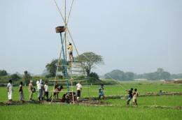
Researchers in MIT’s Department of Civil and Environmental Engineering believe they have pinpointed a pathway by which arsenic may be contaminating the drinking water in Bangladesh, a phenomenon that has puzzled scientists, world health agencies and the Bangladeshi government for nearly 30 years. The research suggests that human alteration to the landscape, the construction of villages with ponds, and the adoption of irrigated agriculture are responsible for the current pattern of arsenic concentration underground.
The pervasive incidence of arsenicpoisoning in Bangladesh and its link to drinking water were first identified in the scientific literature in the early 1980s, not long after the population began switching from surface water sources like rivers and ponds to groundwater from newly installed tube wells. That national effort to decrease the incidence of bacterial illnesses caused by contaminated drinking water led almost immediately to severe and widespread arsenic poisoning, which manifests as sores on the skin and often leads to cancers of the skin, lung, liver, bladder and pancreas.
Since then, scientists have struggled to understand how the arsenic, which is naturally occurring in the underground sediment of the Ganges Delta, is being mobilized in the groundwater.
By 2002, a research team led by Charles Harvey, the Doherty Associate Professor of Civil and Environmental Engineering at MIT, had determined that microbial metabolism of organic carbon was mobilizing the arsenic off the soils and sediments, and that crop irrigation was almost certainly playing a role in the process. But the exact sources of the contaminated water have remained elusive, until now.
In a paper appearing online in Nature Geoscience Nov. 15, Harvey, former graduate students Rebecca Neumann and Khandakar Ashfaque and co-authors explain that ponds excavated for the purpose of providing soil to build up villages for flood protection are the source of the organic carbon that presently mobilizes the arsenic in their 6-square-mile test site. The carbon settles to the bottom of the ponds, then seeps underground where microbes metabolize it. This creates the chemical conditions that cause arsenic to dissolve off the sediments and soils and into the groundwater.
The researchers also found that in their test area, which is flooded by annual monsoons, the rice fields irrigated with arsenic-laden water actually serve to filter out much of the arsenic from the water system.
“Our research shows that water from the ponds carries degradable organic carbon into the shallow aquifer. Groundwater flow, drawn by irrigation pumping, transports that pond water to the depth where dissolved arsenic concentrations are greatest and where it is then pumped up into the irrigation and drinking wells,” says Harvey. “The other interesting thing we found is that the rice fields are a sink of arsenic — more arsenic goes in with the irrigation water than comes out in the groundwater.”
In 2020 wildfires ravaged more than 10 million acres of land across California, Oregon and Washington, making it the largest fire season in modern history. Across the country, hurricanes over Atlantic waters yielded a record-breaking number of storms.
While two very different kinds of natural disasters, scientists say they were spurred by a common catalyst—climate change—and that both also threaten drinking water supplies. As the nation already wrestles with water shortages, contamination and aging infrastructure, experts warn more frequent supercharged climate-induced events will exacerbate the pressing issue of safe drinking water.
It’s no surprise then that the Biden-Harris administration has identified safe drinking water as one of the nation’s top priorities. Below, Stanford water experts Rosemary Knight, Newsha Ajami and Felicia Marcus discuss safeguarding drinking water from climate-driven disasters; emphasizing a modern approach to infrastructure investments; and focusing on watershed and water source protection. Knight is a professor of geophysics in the Stanford School of Earth, Energy & Environmental Sciences (Stanford Earth); Ajami is director of urban water policy with Stanford’s Water in the West program; and Marcus is the William C. Landreth Visiting Fellow at Water in the West.
Whether it’s floods, fires, storms, droughts or sea level rise, climate impacts have a direct influence on water supplies. What types of climate mitigation policies should the Biden team enact to protect drinking water?
Marcus: Grants and low-cost financing for community preparedness, especially for underserved communities, to adapt and plan for climate impacts would make a tremendous difference. The federal government should be doing leading-edge research, technology development and dispersion for lower-cost sensor and treatment systems for drinking water. Finally, the administration can explicitly make drinking water its highest priority for research and development, funding, and updating regulations based upon science.
Ajami: Water has to be the central part of both climate mitigation and adaptation discussions. Today we are facing many challenges that are the consequence of our approach to securing water and energy resources over the 20th century, building infrastructure networks under the assumption of abundance and overlooking inherent environmental interlinks. Source protection, demand management and public engagement strategies should be at the center of any climate policy.
News stories, such as the lead contamination of Flint, Michigan’s water in 2014, have shown failing or poorly managed infrastructure is at the heart of the potable water crisis. What types of infrastructure investments are key to ensuring access to safe water? What should the Biden team do to spur change?
Ajami: There are multiple challenges at play here: aging infrastructure, lack of infrastructure, cost of service, infrastructure operation and maintenance costs, and navigating impacts of climate change. The new administration has the opportunity to address many of these challenges through a holistic effort and having a systems-level approach by investing in water diversification strategies, multi-benefit and decentralized infrastructure (including green infrastructure, stormwater capture and reuse), and data and governance systems for innovative infrastructure solutions.
Marcus: A short list would include upper watershed protection to protect source waters; better treatment systems all along a watercourse, as communities take out and then return water through wastewater systems and natural treatment systems; basic financing for communities that can’t afford adequate drinking water systems; and support for changing out lead piping and faucets in schools and homes. Funding, better regulation and communication can make a world of difference.
Groundwater supplies drinking water to 99 percent of rural populations, but overpumping has led to aquifer depletion and water contamination. What federal and state actions can alleviate growing pressures on groundwater?
Knight: We need to change our approach to land use planning by recognizing that the most valuable use for some land is to become a site for managed recharge of the underlying groundwater system. Getting more water into regions below the ground increases the amount of stored water and can help prevent subsidence. The challenge is identifying the optimal locations for recharge zoning and requires seeing below the ground to find coarse-grained materials, such as sand and gravel, that can act as fast paths to move the water from where it is at the surface to the required depths for recharge. This is an area of work I’m currently focused on and it presents great potential to replenish and grow groundwater reserves.
Ajami: I see our groundwater supplies as our social security system; we all contribute and withdraw from it at different times. Unless we collectively contribute to it and protect it from degradation and contamination, there will be none left for future generations to draw from. I believe collaborative governance and land use management are the two most important parts of achieving groundwater sustainability, and neither can work without reliable data sources and accounting mechanisms.
Are there any technological innovations that could dramatically advance water treatment, monitoring or recharge?
Knight: We now have geophysical systems, deployed using helicopters or towed behind ATVs, that can provide fantastic underground images, mapping out fast paths for groundwater. Last month we flew along the base of the Sierra Nevada in Tulare and Fresno counties, looking for these fast paths at the mouths of rivers coming out of the mountains. The recent advancements in geophysical technology and our ability to process and interpret the acquired data position us to move forward aggressively with a new approach, where zoning for recharge becomes an integral part of land use planning. This approach could be implemented throughout California.
Ajami: I do not believe our problem currently is lack of technological advancement but our outdated and fragmented governance structure, regulatory process, rigid laws, and obsolete business models and practices skewed toward gray, once-through, centralized infrastructure systems. Any advancement that can overcome these challenges can open up opportunities for innovative 21st-century solutions to be incorporated into our existing aging centralized water systems. Investing in soft infrastructure including data systems, IT infrastructure, digital solutions, new models or decision support tools, and updated performance measures are key in this process of shepherding the paradigm shift in the water sector and providing equitable access to safe drinking water.
Every year, an explosion of microscopic life reigns over western Lake Erie, forming a green slick of algae and bacteria so massive and vibrant that it can be seen from space.
The harmful algae bloom slimes fishing boats, paints beaches in toxins and engulfs water intake cribs. In 2014, it left 400,000 people without drinking water for three days after toxins infiltrated Toledo’s water system. Then-Gov. John Kasich declared a state of emergency and called in the National Guard to distribute bottled water in an incident that served notice that drinking water from Lake Erie was in peril.
This year, the bloom was among the most severe and toxic since scientists began keeping track in the early 2000s. At its peak, it coated around 620 square miles of Lake Erie’s surface waters, an area more than twice the size of Chicago, according to satellite imagery. The sheer weight of blue-green bacteria making up the bloom—forecast to be around 46,000 metric tons—was expected to be a new record.
“If you did a Google image search for “Toledo water,” what would pop up is the Toledo skyline where the Maumee River looks like the Chicago River on (St. Patrick’s Day),” Mayor Wade Kapszukiewicz said. “The only difference is we didn’t put any dye in it.”
Climate change is jeopardizing two of the most precious resources the Midwest possesses: food and water, according to federal studies. Greater rainfall and more powerful storms are eroding some of the richest soils in the United States and, in doing so, washing bloom-inducing fertilizers from farm fields into Lake Erie. More frequent torrential downpours are also overpowering antiquated sewer systems at times, releasing a profusion of raw sewage into waterways, further polluting and degrading water quality.
Meanwhile, warmer temperatures are allowing the microbes within algae blooms—particularly the toxin-producing bacteria—to flourish in greater numbers and for more months of the year, posing elevated and prolonged risks to drinking water, wildlife and the $15.1 billion tourism industry along Ohio’s coastline.
The Great Lakes are all connected and collectively hold 20% of the world’s fresh surface water, but each lake has unique features—depth, shape, size and surroundings—making them vulnerable to different aspects of climate change.
Algae blooms occur annually across the region in shallow, sheltered waters like Saginaw Bay in Lake Huron and Green Bay in Lake Michigan. A large algae bloom even developed once in the normally pristine waters of Lake Superior near the Apostle Islands, a harbinger that no environment is immune.
The danger is most acute in Lake Erie—the shallowest, southernmost and warmest of the Great Lakes—which is a natural incubator for these colonies of microorganisms.
While countries across the globe face drought and water insecurity, it’s a bitter irony that some communities sitting on the edge of the planet’s largest system of freshwater—more than 11 million people depend on Lake Erie for drinking water—are compelled to buy bottled water.
“As population explodes, water is going to be the most valuable resource on planet Earth by the end of this century. It therefore represents the greatest advantage that this part of the country has. This region—the Great Lakes region, the Snow Belt, the Rust Belt, whatever you want to call it—has faced hard times over the last 50-60 years,” Kapszukiewicz said. “But … if we can hold on, we may be the most valuable part of the country. Frankly, with what we have, (the Midwest) could be Saudi Arabia in 100 years. We just can’t squander it.”
Billions of dollars have been spent monitoring Lake Erie’s water quality, overhauling drinking water treatment and reducing sewage outflows. But the biggest contributor to these blooms—agricultural runoff, which is responsible for up to 89% of the phosphorus flowing into Lake Erie—remains largely unregulated.
“The amount of manure from pigs, chickens and cows that goes into the western basin, that seeps untreated directly into Lake Erie, is roughly equivalent to all human waste from the cities of Chicago and Los Angeles combined,” Kapszukiewicz said. “That’s just how much animal manure is going in untreated—I’m not even talking about what they spray on crops. This is why we’re living in the world we’re living in.”
The 1,500 square miles surrounding the Maumee River was once known as the Great Black Swamp, a marshland that fostered a wealth of wildlife and naturally filtered nutrients through plant roots.
When European settlers arrived in northwest Ohio in the early 1800s, they gradually drained the swamp, converting it to farmland and introducing the livestock that would produce a concentrated source of manure. Nearby cities boomed in size, not only pumping their own sewage waste into the rivers, but also adding in phosphate laundry detergents before they were banned nationwide in 1994.
In the ’60s and ’70s, Lake Erie was so rife with nutrient pollution it was declared “dead.” Under the Clean Water Act, implemented in 1972, the U.S. cracked down on municipal wastewater treatment facilities, industrial polluters and other contributors. And, for a while, the algae blooms subsided.
In the past two decades, however, the blooms have returned as large as ever.
Scientists say Lake Erie has endured harmful algae blooms historically, but the modern-day magnitude is believed to be increasing as a result of human activities and climate change.
Each year, as melting winter snowpack and spring rains cascade over the rural landscape of northwestern Ohio, a torrent of water flushes an unfathomable amount of manure and commercial fertilizer from farm fields into the Maumee River, a 137-mile waterway carrying waste from Fort Wayne, Indiana, to Toledo, and eventually flowing into the shallowest end of Erie. Meanwhile, throughout the year, Detroit routinely pumps wastewater and sewage into its namesake river, as do other major metros.
These rivers become fuses as fecal-laden waters plunge into western Lake Erie. Nutrients—particularly phosphorus—trigger an eruption of microscopic algae, according to Chris Winslow, director of the Ohio Sea Grant, a research and education collaborative led by Ohio State University.
Just as humans need vitamins to grow, so does algae. Iron, potassium and nitrogen are essential and available in ample amounts. Human and animal excrement contain the missing ingredient: phosphorus.
“You bump up the phosphorus, and they are just waiting to capitalize off of it,” Winslow said.
An analysis of aerial photographs and state permit data identified 775 hog, cattle, dairy and poultry operations in the Maumee River watershed in Ohio, Indiana and Michigan in 2018—a 42% increase since 2005, according to a report by the Environmental Law and Policy Center and the Environmental Working Group, nonprofit advocacy groups. Of the large-scale “factory farms” in the watershed, more than a quarter had expanded since being built. Although the Maumee only contributes 5% of the water entering Lake Erie, it is so loaded with phosphorus that it is the main driver of the algae blooms.
The most potent form of phosphorus, unblended with soils, acts as a catalyst for blooms each year. The amount of this full-strength phosphorus has increased 140% since 1990. Some experts suspect this can be attributed to a change in farming practices, namely no-till farming—a technique intended to curb soil erosion, but one in which layers of manure piled on top of farmland are more easily carried away by heavy rains.
Winslow said other factors are also at play.
“We have zebra mussels in our lake filtering the water differently than 40 years ago,” he said. “We have larger farm operations. We have increased rainfall and runoff to take nutrients from the land into the water. We have warmer temperatures, and these organisms like warmer temperatures. Some of these things have more of an impact than others, but there’s a lot of moving parts.”
This fall, the Ohio countryside was a desolate mud pit marked by rampant weeds, standing water and stunted crops.
Over 880,000 acres intended for corn and nearly 600,000 acres for soybeans were left barren this year, as farmers opted to take insurance money rather than risk a meager harvest.
Ty Higgins, spokesman for the Ohio Farm Bureau, described rural Ohio this fall as the “end of the world.”
Farmers, he said, can use drought-resistant corn. They can plant strains that perform better in heat. But there’s no silver bullet for rain.
“That’s one curveball Mother Nature can throw farmers that they don’t have a workaround,” Higgins said.
Climatologists say the region has become soggier.
A spike in greenhouse gases, largely from man-made carbon emissions, has driven global temperatures upward, according to the National Oceanic and Atmospheric Administration. For every degree of warming, the atmosphere can hold 4% more moisture, which can translate into heavier and more severe downpours.
Since 1951, the Great Lakes region has seen a 2.3 degree rise in temperatures, a 14% uptick in annual precipitation and a 35% increase in the most intense storms. In the past year, the rain, snow and flooding across the Midwest was one for the record books.
Between September 2018 and August 2019, the Buckeye State endured the wettest 12 months on record since NOAA began keeping precipitation statistics in 1895.
Chris Weaver, 45, of Lyons, was one of the few who decided to plant this year—not that he had much of a choice. His family-owned dairy peddles three commodities: milk, meat and manure. With 3,000 cows on one farm in Williams County, his employees work around the clock corralling cattle into milking stalls. He depends on 5,000 acres of cropland for feed.
And each fall, Weaver draws from a manure pond the size of a football field to fertilize his land.
Manure, some might argue, is the greatest commodity for farmers with livestock. Not only does it benefit crop growth, the excess can be sold. Weaver charges about $400 to cover an acre.
“Grandpa always told me, “It smells like money to me,”” said Higgins, the farm bureau spokesman.
In the fall of 2018, because of the onslaught of rain, most farmers didn’t get a chance to put fertilizer down. Those who did witnessed that money carried downstream in this year’s spring rains.
It wasn’t until July 1, about two months later than normal, that Weaver was able to get most of his corn, soybean and alfalfa crops in the ground. Weaver had some reserves to feed his cattle but not enough to make it a whole year without a harvest.
He was still anxiously monitoring the weather throughout the fall, praying there wouldn’t be an early frost. He managed to reap his corn by mid-October while his soybeans withstood several inches of snow in November. The harvest, he said, would be enough to make it without buying reserves.
“It has to be a one-off,” Weaver said, almost as if trying to convince himself. “We’ve had a lot of wetter years. But if it happens again next year, I’m going to really be scratching my head about what I’m doing.
“It’s hard to imagine,” he said, with his voice trailing off. If July 1 became the start of planting season, “I don’t think we’d ever have corn here ever again.”
In addition to sweeping manure and commercial fertilizer into waterways, the rain turns soil into claylike mud that prevents oxygen from reaching crop roots, killing the plants. Soggy soil also makes the land harder to tend, because large farms require heavy machinery, including tractors, prone to getting stuck in the muck.
Some farmers plant cover crops, such as peas and oats, in the fall to help absorb moisture from saturated soils and hold the nutrients from fertilizer in place. The problem is, these crops don’t offer much of a return on investment. And, at the end of the day, farming is a business.
Weaver, however, sees other benefits beyond the monetary value. His in-laws live in the Toledo area and go camping each year near the lakeshore. It’s also where he goes walleye fishing.
“Overall it’s something where maybe I’m breaking even, but I’m doing something to help the environment,” Weaver said. “I think every farmer is recognizing that (cities like Toledo) are affected, that they have to do better.
“We’re only an hour from Lake Erie, so it’s our backyard too.”
But Weaver is in the minority. According to the U.S. Department of Agriculture, cover crops were used on less than 10% of cropland in Ohio in 2017.
Downstream, the Toledo area braces each year for verdant, bacteria-choked waters, no-swim advisories at beaches and noxious odors from scummy bays.
The morning of Saturday, Aug. 2, 2014, Crystal Jankowski, nearly nine months pregnant, awoke before dawn and noticed a number of missed calls from family members. Jankowski, whose father was ailing from liver and kidney failure, feared grim news about his condition.
Instead, Jankowski was jolted by ominous instructions from her mother: “Tell Josh to go find water—now! There’s something wrong with the water.”
More than 400,000 people and hundreds of businesses adjacent to the world’s 13th largest lake suddenly found themselves without potable water.
The culprit was Microcystis aeruginosa, a blue-green cyanobacteria known to create a toxin more lethal than cyanide or antifreeze. Its poison, which can cause liver failure, was so efficient at killing animals that scientists originally termed it “fast death factor.” In one of the most deadly episodes, more than 50 people died in Brazil in 1996 when hospital patients were exposed to unfiltered water containing the toxin. Scientists say no deaths attributed to these toxins have been reported in the U.S.
In Toledo, the bloom had drifted from Maumee Bay and engulfed the city’s water intake 3 miles offshore and then stalled, leaving the neon green bloom to linger for days.
At the treatment plant, a lab test showed an alarming result: The drinking water had been compromised.
Following the historic shutdown, Ohioans went on a maddening search for water, many crossing state lines.
Josh Jankowski moved through the crush of people rummaging barren grocery store aisles. Nearly three hours later, he returned with a package of baby wipes and a bottle of Pedialyte.
Not long after that, Crystal Jankowski began having contractions. The couple rushed to the hospital, where the emergency room was abnormally busy for a Saturday morning.
“Everyone thought they were sick. They had woken up, drank their coffee, took a shower. And then the morning news told people not to drink the water, and, if you did, here are the symptoms,” she said.
Lakes, rivers and some private wells are becoming saltier, largely thanks to high levels of road salt sprinkled on streets during winter. According to an article in Chemical & Engineering News (C&EN), the weekly newsmagazine of the American Chemical Society, this situation could cause harm to wildlife and humans.
Contributing editor Deirdre Lockwood notes that scientists have found greatly increased amounts of chloride in streams, lakes and rivers over the last few decades. One of the biggest culprits is salt that’s deposited onto roads before and during snowstorms. The amount used in the U.S. has grown dramatically from about 4,500 metric tons in the early 1940s to 22 million metric tons now. But salt also comes from sewage, fertilizer runoff, mining operations and deteriorating structures. Not only does all of this salt makes water taste bad, it can corrode plumbing and cause health concerns. It also can affect freshwater organisms and disrupt ecosystems.
Some scientists are calling for the U.S. Environmental Protection Agency to start regulating salts. Others are simply trying to bring more attention to this issue. And some municipalities are already implementing changes. In Madison, Wisconsin, crews apply brine, about a 20 percent salt water solution, onto roads before a snowstorm hits. With this approach, they have used about 70 percent less road salt. And the village of Lake George, New York, has reduced roadsaltapplication by about 30 percent with brine treatment and new, more effective snow plows.
Recent news about tainted water in Flint, Michigan, and other parts of the country have called into question the safety of the nation’s drinking water supply. Adding to this, a new study finds that pollutants from household wastewater—pharmaceuticals and consumer product chemicals—can make their way into people’s private wells, and that backyard septic systems are likely to blame. The findings reinforce growing concerns about the health risks posed by unregulated chemicals in drinking water.
In tests of water samples from private wells on Cape Cod, researchers at Silent Spring Institute found 27 unregulated contaminants, including a dozen different pharmaceuticals, a variety of chemicals used in non-stick coatings, flame retardants, and an artificial sweetener. The study appears online Wednesday, January 27 in the journal Science of the Total Environment.
Approximately 44 million Americans get their drinking water from private wells. Unlike public wells, private wells are not federally regulated; responsibility for ensuring the safety and quality of the water falls on individual homeowners. Because private wells tend to be shallower than public wells and are less frequently monitored, they are also more susceptible to contamination from local land use activities such as farming, residential development, and landfills. Contamination of private wells is an ongoing public health issue in many parts of the U.S., including the Midwest and California.
Homes that rely on private wells also tend to have their own septic systems. About 25 percent of all U.S. households use a septic system for processing household wastewater. In previous research on Cape Cod, scientists at Silent Spring discovered that hormone-disrupting chemicals and pharmaceuticals from septic systems can leach into groundwater and enter nearby ponds. “The next question was whether contaminants in household wastewater, once they enter the groundwater, make their way into drinking water supplies,” says Dr. Laurel Schaider, a research scientist at Silent Spring and lead author of the new study.
To answer that question, Schaider and her colleagues sampled water from 20 private wells throughout Cape Cod and tested the samples for 117 different contaminants. About 70 percent of the wells contained PFASs (perfluoroalkyl substances)—a class of fluorinated chemicals also known as PFCs. PFASs are endocrine-disrupting chemicals that have been associated with cancer and developmental disorders. They are routinely found in consumer products such as pizza boxes, non-stick pans, waterproof clothing, and stain-resistant carpets
The researchers also found pharmaceuticals in two thirds of the wells tested. Sulfamethoxazole, an antibiotic used to treat urinary tract infections, and carbamazepine, a drug used to treat seizures, nerve pain, and bipolar disorder, were among the most common pharmaceuticals detected. Twenty-five percent of the wells contained flame retardant chemicals.
Schaider and her colleagues also looked at nitrate levels in each well and found that wells with higher nitrate concentrations also had more contaminants, as well as higher concentrations of contaminants. All the wells were located in areas served by septic systems, the researchers noted, and further analysis showed that the contaminants most likely came from these backyard wastewater treatment systems. “This is the first study to show septic systems as sources of PFASs in drinking water from private wells,” says Schaider. “Given that 85 percent of residents on the Cape rely on septic systems, the risk of contaminated water is a real health concern.”
The Environmental Protection Agency (EPA) regulates nitrate in drinking water, but there are no health standards for the kinds of household pollutants found in the study. The concentrations of the pharmaceuticals the researchers detected were orders of magnitude lower than those found in a therapeutic dose. “But that doesn’t necessarily mean there’s nothing to worry about,” says Schaider. “Drugs are intended for specific uses and can have side effects,” she says. “And we don’t give certain medications to pregnant women or children because the developing body is very sensitive.”
Another concern is that people might have allergies to drugs like antibiotics, and endocrine disruptors like PFASs and flame retardants may produce effects at much lower doses than previously thought. What’s more, the health effects from exposure to mixtures of different chemicals in drinking water are unknown.
“People often don’t think about where their tap water comes from,” says Schaider. “But it’s really important that they do and that they take steps to make sure it’s safe.” Private well owners should have their water tested on an annual basis. Water quality tests typically look for nitrate and bacteria, and do not include unregulated chemicals from everyday household activities. However, the new study shows that nitrate levels may be a good indicator for these other pollutants.
“This study constitutes an important contribution to the understanding of contaminants in private drinking water wells,” says Patrick Phillips, a scientist with the U.S. Geological Survey in Troy, N.Y., who has done extensive studies of household contaminants in groundwater. “The finding that contaminants are positively correlated with nitrate is an important one that will help identify private wells that are susceptible to contamination.”
Currently, the EPA’s safe limit for nitrate in drinking water is 10 parts per million (ppm). But Schaider and her colleagues found pharmaceuticals and PFASs in drinking water with nitrate levels less than 1 ppm. In cases where nitrate levels are less than the EPA limit but greater than 1 ppm, private well owners might want to consider installing a solid carbon block filter as a precaution to remove contaminants that may be present. To stop chemicals from getting into the environment in the first place, Schaider advises people to avoid flushing unused medications down the drain, to reduce their use of products containing toxic chemicals, and to maintain their septic systems. Moving septic systems further away from private wells and limiting development near wells could also help protect drinking water from contamination.
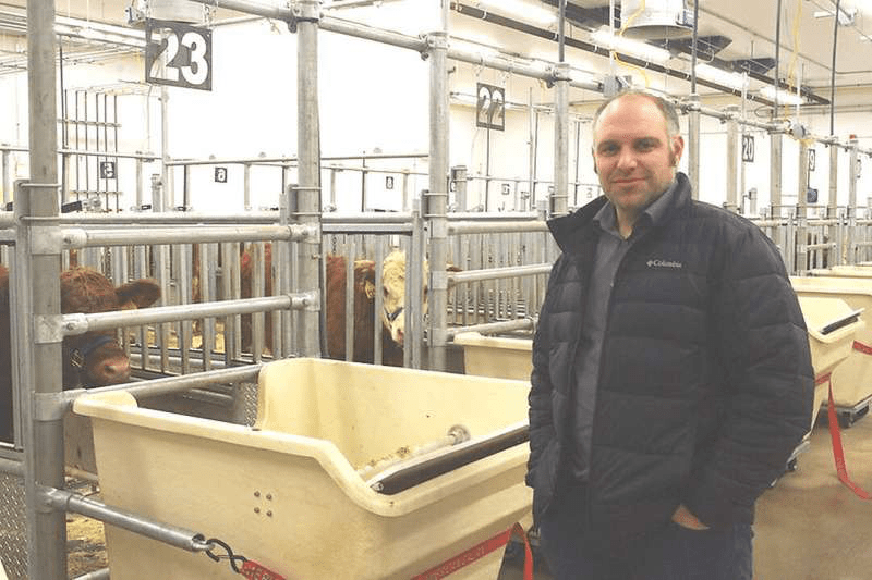
Scientists at the University of Saskatchewan (USask) have published a study that shows beef cattle can tolerate higher concentrations of sulphates in drinking water than previously believed.
“There are clear and significant implications for healthy animals from the research,” said Dr. Greg Penner (Ph.D.), associate professor in the USask Department of Animal and Poultry Science and Centennial Enhancement Chair in Ruminant Nutritional Physiology.
National and provincial recommendations for suitable or safe levels of sulphates in drinking water range from 1,000 to 2,500 milligrams (mg) of sulphates per liter of water. But these recommendations are not science-based, something Penner and his collaborators set out to change.
According to the team’s research published this month in Applied Animal Science, beef cattle can tolerate up to 3,000 mg of added sulphates per liter of water.
During the project, the cattle drank water with 1,000, 2,000 and 3,000 mg of added sulphates per liter of water to mimic real levels experienced on some Saskatchewan cattle ranches. Regardless of these levels of added sulphates, the cattle continued to drink and eat, resulting in a normal weight gain.
At first glance, the research results seem to be good news for Saskatchewan cattle producers who have wells and dugouts containing high levels of sulphates. But Penner is cautious.
The problem is that sulphates in water potentially bind with trace minerals in a cow’s rumen, one of four stomachs, making those minerals unavailable for the body to absorb and use.
So in addition to monitoring water and feed intake and weight gain, the researchers compared blood analyses at the beginning and the end of the study. The level of copper was lower at the end of the study, potentially affecting a cow’s fertility.
“There could be longer-term effects of higher sulphate exposure in terms of reproductive efficiency,” Penner said. “A producer might not see anything negative in terms of growth rate, feed intake and water intake, but those negative impacts may be hiding deeper—higher sulphate concentrations may be affecting trace mineral status, which could affect fertility.”
The research was the first to be conducted in the highly specialized metabolism barn at the university’s Livestock and Forage Centre of Excellence, located south of Clavet, Sask.
While Penner led the study, he worked closely with collaborators from Saskatchewan’s Ministry of Agriculture—Leah Clark, the province’s livestock specialist, and Colby Elford, a livestock and feed extension specialist. University student researchers Jordan Johnson and Brittney Sutherland also worked on the project.
Funding was provided by the Saskatchewan Ministry of Agriculture and the Canadian Agriculture Partnership through the Strategic Field Program. The Roy Romanow Provincial Laboratory provided water quality analysis as an in-kind contribution.
This is the first of a series of studies that Penner will conduct into safe water quality levels for cattle.
His next project, which starts in April, is a three-year study in collaboration with researchers at Texas Tech University, USask’s animal and poultry science department, the Western College of Veterinary Medicine’s large animal clinical sciences department, and the Saskatchewan Ministry of Agriculture.
Cattle will receive water with higher sulphate concentrations than were involved in today’s published research, with the expectation that, at some point, cattle will be negatively affected by the sulphates.
However, the researchers will also test various ways of interfering with the sulphates binding with trace minerals in the rumen. For instance, bismuth subsalicylate, a commonly found antacid, is known to bind with sulfides. That in turn could diminish the effect of sulphates in water consumed by cattle, minimizing the problem before it starts.
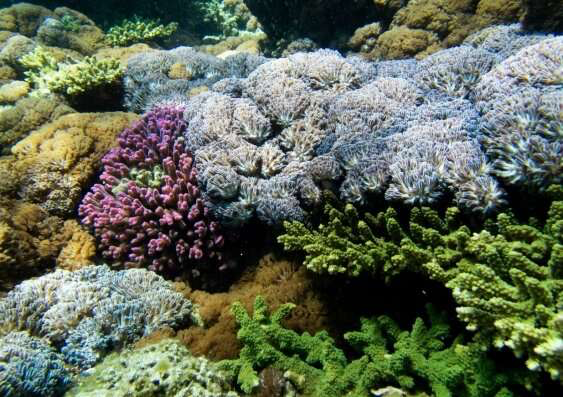
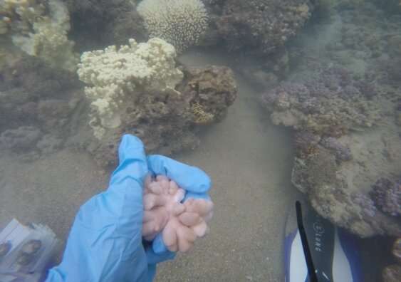
Soft corals, the penned, fanned and tentacled corals, of Lord Howe Island appear more resilient to coral bleaching than their hard coral cousins, a team of marine biologists led by UNSW Science finds.
Hard, reef-building corals appear to be less resilient to coralbleaching than soft corals according to a survey at the world’s southern-most coral reef, around Lord Howe Island, during, immediately after, and then seven months after a marine heatwave in 2019.
“Overall, soft corals at Lord Howe Island did better than hard corals during the bleaching event,” says Rosemary (Rosie) Steinberg, Ph.D. student and lead author of the paper published in Frontiers in Physiology. “This suggests that if Lord Howe Island continues to bleach, the species of soft corals that did well might become more prevalent on these reefs in comparison to their hard cousins.”
This in turn, says Steinberg, “allows us to plan for the benefits and challenges that a soft-coral dominated reef might pose.”
“Soft corals are different to hard corals—the ones we usually see in photos of reefs—because the vast majority of them don’t make a solid skeleton underneath their tissue. They are usually flexible, while hard corals are usually rigid and immovable.”
“The fact that some species not only survived bleaching but didn’t have any physical response to marine heatwaves is excellent news. It lets us know that while we may lose some species to future bleaching, there is a chance that the reef can recover, although with a different coral community.”
The resistant species were “very common soft corals [meaning they] can hopefully maintain important reef habitat and function while more sensitive species recover,” according to Steinberg.
While, overall, soft corals survived better than hard corals, some species still showed signs of bleaching.
“Some colonies of the bleached species, Cladiella sp., didn’t just bleach, but peeled off the reef during the heatwave. As far as I can tell, this is a world-first observation in the literature.” Credit: Rosie Steinberg/UNSW Science
“Each species of soft coral had a different response,” says Steinberg. “One bleached, one seemed to do better than normal, and one didn’t have any response to the increased heat.”
Coral bleaching involves the expelling of symbionts, the microscopic organisms that inhabit the coral’s cells to impart color and energy to the creature. In this survey, the researchers found one species, Xenia sp., responded to the heatwave by acquiring more (not less, which is typical for coral bleaching) of these symbionts, theoretically able to generate more, not less, energy.
“This really surprised me,” says Steinberg, “Xenia is a very charismatic and beautiful species, and I’m not entirely sure what happened. Perhaps it was a unique stress response, or perhaps they thrive during heatwaves—or, at least, warmer water than the cooler Lord Howe Island temperatures.”
The variable response of soft and hard coral species to marine heatwaves emphasizes the importance of species-specific protection of reefs.
“Knowing which groups and species of corals are likely to survive in our warming world is critical to conserving corals reefs. This information can let us predict what future reefs will look like, what species of fish and invertebrates they will support, and what services they will be able to provide to the communities that rely on them.”
“For example, many communities, including those of Lord Howe Island and the northern coasts of Australia, rely on the rocky reef structure to break waves and protect shorelines. Most studies of coral bleaching focus on hard corals, and for one very obvious reason—hard corals actually build the rock structure of the reef. Without them, the reef starts to fall apart.”
“Since we are finding that soft corals may survive better in our warming world in eastern Australia, we really need to understand what role soft corals play in keeping this hard reefstructure together.”
Next, the team is delving deeper into understanding how soft corals, their symbiotic algae, and their bacterial communities dealt with the marine heatwaves.
“We are examining which species of algae and bacteria survived the heatwaves, which were expelled from corals, and which came in to fill the empty spaces. This can help us understand if there are any interventions, like adding more heat-resistant symbionts to reefs, that might help corals at Lord Howe Island survive and recover from future marine heatwaves.”
Forests throughout the world are shrinking year after year—and Brazil is the epicenter. According to the World Wildlife Fund, more than a quarter of the Amazon rainforest will be devoid of trees by 2030 if cutting continues at the same speed.
Beyond the material and environmental consequences, this deforestation also threatens human rights, including the rights of marginalized communities to life, physical integrity, a reasonable quality of life and dignity. Brazil is one of the most worrying cases in this regard.
As a Ph.D. student in political science, my research interests include climate justice, the energy transition, the green economy and international environmental politics.
Chainsaw massacre
Article 25 of the United Nations Declaration on the Rights of Indigenous Peoples rules that these communities fully possess the “the right to maintain and strengthen their distinctive spiritual relationship with their traditionally owned or otherwise occupied and used lands, territories, waters and coastal seas and other resources.”
This article is not being respected by the Brazilian government in the Amazon.
Although the country had pledged to significantly reduce deforestation and limit clear-cutting to 3,925 square kilometers, data from Human Rights Watch shows that chainsaws have razed nearly 13,000 square kilometers of tropical forests, making communities of Indigenous peoples even more vulnerable.
This coincides with Jair Bolsonaro’s accession to power. In the month of January 2022 alone, 430 square kilometers of tropical forest was destroyed, five times more than in January 2021.
Threats and assassinations
Multiple abuses have been documented in Brazil since the beginning of colonization, including the illegal encroachment of the Brazilian state on Indigenous territories. Under Bolsonaro, the number of criminal networks contributing to the deforestation of the Amazon has multiplied. Organized crime views the large timber and agriculture industries as opportunities to move and launder money. The groups illegally exploit forest land, then hide drugs in timber shipments destined for Europe or Asia.
Experts qualify this illegal activity as “narco-deforestation.” Numerous illegal gold and mineral extraction sites are also operating in the Amazon, and the companies running them often make threats to the Munduruku that live there.
There are reminders of this in the news. Bruno Araujo Pereira, a defender of environmental and Indigenous rights, and British journalist Dom Phillips have been missing since June 5, in an area called the Javari Valley, which has a reputation of being “lawless.”
The number of deaths of people involved in environmental and territorial defense may be greatly underestimated, as data are not available and transparent for all countries.
Women and children, the main victims of deforestation
A recent United Nations report reveals a strong correlation between worsening climate change and deteriorating human rights around the world.
Deforestation disproportionately affects Indigenous communities, especially women and children. It increases the pressure already placed on women to feed their children and families, while limiting their access to essential goods, including medicine.
Indeed, the health of these communities depends on access to natural medicinal products found in biodiversity. The Amazon is a major reservoir of substances used in the manufacture of several pharmaceutical products available on the South American continent.
Nearly 80% of the population in developing countries relies on natural medicinal products for their primary health care. In the majority of communities, it is also women who are responsible for cultivating the land and providing transportation and water treatment.
Children are equally at risk. For example, a study conducted in sub-Saharan African countries shows a link between the loss of forest cover and the deterioration of health conditions of the youngest. Malnutrition, caused by reduced availability of fruits, vegetables and nuts, can affect children’s growth. The exposure to smoke from the multiple fires in the Amazon is also likely to cause respiratory problems and even more serious conditions in children.
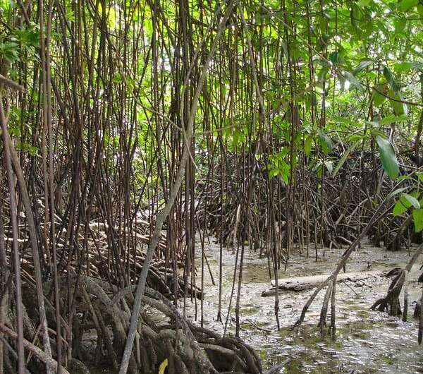
Mangroves ring the shores of many of Indonesia’s more than 17,000 islands. But in the most populated areas, the world’s largest mangrove forests have been steadily whittled away, and with them, the ability to store blue carbon.
As the world’s fourth-most populous nation has grown, pressure on the mangroves has too. More than 756,000 hectares of mangroves have been cleared and turned into brackish ponds to farm water shrimp and milkfish.
Is this another predictable bad news story about the environment? No. This is a good news story. That’s because Indonesia’s government is, rising to the challenge of conserving its mangroves—and restoring lost forests.
Government investment in mangroves is rising and the political will is in place. Indonesia’s ambitious goal is to restore almost all of what’s been lost, rehabilitating 600,000 hectares of mangroves by 2024.
Why have Indonesia’s mangroves been hard hit?
In a 2012 interview, former Indonesian forestry official Eko Warsito explained why his country’s mangroves were disappearing: “More than 50% of Indonesia’s population lives in coastal areas, and most of them are poor. An ordinary plot of mangroves is worth $84 a hectare. But if it’s cleared and planted with oil palms, it can be worth more than $20,000 a hectare.”
Credit: Ministry of Environment and Forestry, Republic of Indonesia
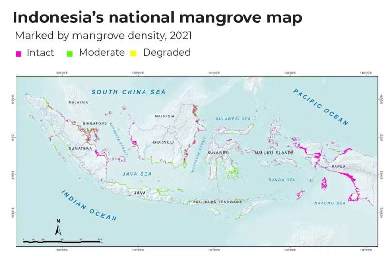
Unfortunately, this difference in perceived value has seen mangroves degraded or replaced. You can glimpse the current state of Indonesia’s 3.3 million hectares of mangrove area in the map below, which was released last year by Indonesia’s environment and forestry ministry.
Mangroves are broadly in good condition in the provinces of Papua and West Papua. But in the more populated areas—especially around the densely populated island of Java—mangroves have been largely deforested and degraded.
Recent analysis by the World Bank puts the value of mangrove ecosystems at between A$21,000 to $70,000 per hectare per year. Similarly, a 2020 cost-benefit analysis of mangrove conservation versus conversion to shrimp aquaculture in Indonesia’s Papua province estimated the direct and indirect value of mangroves at A$34,000 per hectare per year.
But these valuations are heavily influenced by the role mangroves play in providing ecosystem services. Without these services, mangroves are worth two orders of magnitude less, at around A$340 per hectare.
Their real value lies in their ability to store large amounts of carbon, averaging almost 4,000 tons of carbon dioxide equivalents per hectare. Until now, however, policy bottlenecks at the national level have stopped Indonesia from investing in better mangrove management and producing new revenue streams from stemming mangrove losses.
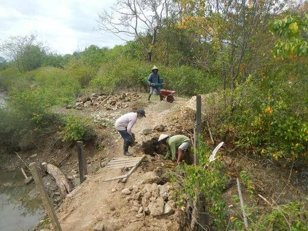
Restoring mangroves requires human labour and machinery, as in this image of villagers in Sulawesi improving water flow and drainage into disused shrimp ponds. Credit: Rio Ahmad (Director of Yayasan Hutan Biru)
Indonesia’s mangroves have suffered because of this disconnect between their real value and government policiesand institutions. Over 20 institutions have some level of responsibility for mangrove management in Indonesia. It’s no wonder their agendas often conflict.
But progress is being made. Two years ago, President Joko Widodo added mangroves to the mandate of the country’s peatland restoration agency, after its success at restoringdamaged peatlands. The goal for mangroves is to restore 600,000 hectares of mangroves by 2024.
There are alternatives to aquaculture
You might think it’s too hard to restore mangroves once they’ve been turned into shrimp farms. Previously, this has been true, with an over-reliance on simply planting more seedlings rather than tackling the harder work of social and economic reliance on former mangrove habitat. In response, Indonesia’s government has mapped around 77,000 hectares of the best restoration candidate areas across 300 villages in Sumatra and Kalimantan (Indonesian Borneo), working in full collaboration with coastal villagers.
To create alternatives to aquaculture, Indonesia’s national farmer field school program will expand to include hundreds of coastal villages. These coastal field schools help local villages improve their management of the coasts and develop alternative sources of income.
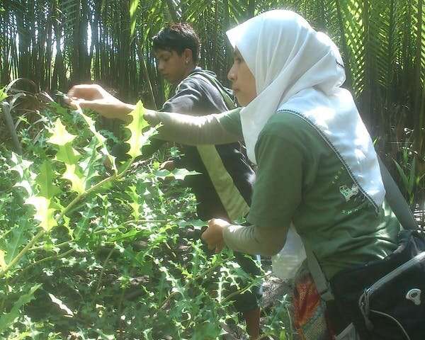
Ratna Fadillah, an expert in non-timber forest product use, harvests holly mangrove leaves to make herbal green tea. These teas offer a low-cost opportunity to create a business, which many women and youth across Indonesia are adopting. Credit: Benjamin Brown
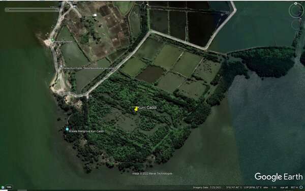
This Google Earth image shows how quickly mangroves can rebound after hydrological restoration to make water flows more natural. Credit: Google Earth
Ratna Fadillah, an expert in non-timber forest product use, harvests holly mangrove leaves to make herbal green tea. These teas offer a low-cost opportunity to create a business, which many women and youth across Indonesia are adopting. Credit: Benjamin Brown
This Google Earth image shows how quickly mangroves can rebound after hydrological restoration to make water flows more natural. Credit: Google Earth
These include learning to use Nypah palms alongside mangroves, to allow villagers to harvest the valuable sugar from the sap. This species is the only palm considered a true mangrove. They can produce 800,000 liters of sap per hectare per year, forming a sustainable commodity base for organic palm sugar production as well as bio-ethanol.
Other options include encouraging production of honey, gluten-free flour, tea, juice, jam, and cosmetics. For some villages, eco-tourism could be an option, or shifting to more sustainable aquaculture.
What’s next?
Indonesia’s government is drafting a new mangrove policy, focused on balancing mangrove protection, sustainable use and restoration. We’re already seeing welcome realignment between the nation’s ministries.
These efforts are being funded by the Indonesian government, with more financial support sought from other governments and multilateral organizations to scale up their mangrove management to a national scale.
Indonesia’s work to turn around the fate of their ailing mangroves will be shown on the world stage at the G20 summit in Bali in November. By then, there will be a public dashboard to represent progress captured by field-based and satellite monitoring.






 Ratna Fadillah, an expert in non-timber forest product use, harvests holly mangrove leaves to make herbal green tea. These teas offer a low-cost opportunity to create a business, which many women and youth across Indonesia are adopting. Credit: Benjamin Brown
 This Google Earth image shows how quickly mangroves can rebound after hydrological restoration to make water flows more natural. Credit: Google Earth
