Prehistoric fish may be poised for a comeback

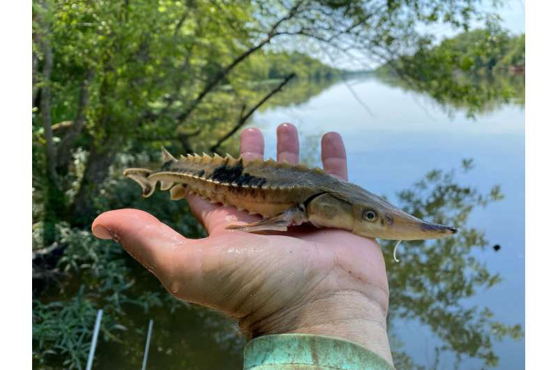
Researchers studying lake sturgeon in Northwest Georgia’s Coosa River have found evidence that the fish may be reproducing for the first time since they were wiped out in the 1970s.

The discovery was made earlier this year, as a team of researchers prepared for a project of tagging and tracking sturgeonin the river system. It’s part of an ongoing effort to assess the population of lake sturgeon since they were reintroduced by the Georgia Department of Natural Resources in 2002.

It can take 20 years for female lake sturgeon to reach sexual maturity—when they develop black eggs also coveted as caviar. Because of the timespan, fisheries experts were unsure of the long-term viability of the fish, which have been released into the river every year since their reintroduction.

“We found three females that had black eggs—mature eggs that are ready to be fertilized,” said Marty Hamel, an associate professor at the University of Georgia Warnell School of Forestry and Natural Resources. “This was the first time anybody has found a sexually mature female since the reintroduction program began, and it’s exciting because it’s confirmation that they are becoming mature and trying to spawn.”

Why did the sturgeon disappear?

Lake sturgeon are native to Georgia’s Coosa River system, and for generations it was the only place in the state home to the prehistoric fish. But due to poor water quality and over-harvesting—both of their eggs and of the fish itself—sturgeon disappeared from the Coosa in the 1970s.

Thirty years after they disappeared, Georgia DNR began an ambitious project to return lake sturgeon to the Coosa River. “The Clean Water Act really did improve the overall habitat and river quality,” said Hamel. “So, the habitat got better and with a ban on harvesting lake sturgeon, DNR considered trying to reintroduce the population.”

Working with wildlife officials in Wisconsin, which is home to a population of lake sturgeon similar to what was found in Georgia, DNR officials collected lake sturgeon eggs and brought them back to Georgia. There, they incubated and hatched the eggs, then released the fish into the Coosa River

“In 2002, the Georgia DNR began stocking young sturgeon that successfully spawned in the hatchery, and have continued to do so almost every year since,” said Hamel. “It’s a big investment because you don’t even know if the stocked fish are going to survive, let alone grow up and reproduce. A lot of things must come together to create a self-sustaining population. Because lake sturgeon take a long time to mature and then reproduce intermittently–every two to three years—we really need a robust population of varying size and age classes.”

When Hamel’s graduate students discovered the mature females, they were launching a project to help scientists understand more about the lake sturgeon population. The new discovery infused new energy into a project that began with more questions than answers.

FOR MORE INFORMATION: https://phys.org/news/2022-08-prehistoric-fish-poised-comeback.html
A snappy solution to restoring oyster reefs

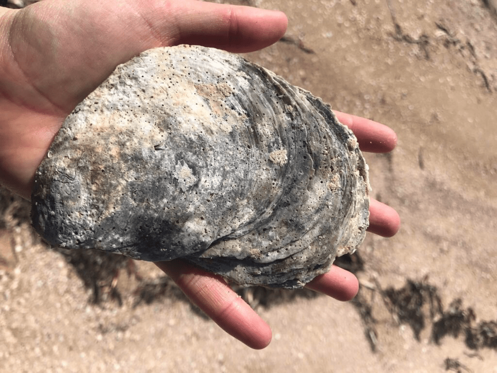
Researchers from the University of Adelaide are using underwater music to speed up the restoration of native oyster reefs.

By using underwater speaker technology, researchers are broadcasting snapping shrimp snaps in the ocean to create “highways of sound” that attract baby oysters to oyster reefs targeted for restoration.

“In the ocean, sounds orchestrated by the snaps of snapping shrimp provide navigational cues used by baby oysters to find healthy habitats to settle and grow in,” Brittany Williams, a Ph.D. candidate at the University of Adelaide.

“Marine soundscapes are silenced following large-scale habitat loss. In the lab and field, we discovered that we can re-create these lost soundscapes and entice oyster babies to swim to and settle on our new reefs,” she says.

“This is a timely and affordable solution to plug the gaps in current restoration work.”

Coastal communities around the world are scrambling to rebuild lost reefs which have been proven to play a vital role in maintaining water quality and healthy ecosystems but in many cases they have struggled to recruit sufficient babies.

Australia once had vast coastlines of native oyster reefs filled with this orchestration of snaps. But these have now been trawled and dredged to functional extinction.

This has left bare sand of muted soundscapes for more than 150 years, with no natural capacity to recover.

“Our research highlights the importance of the marine soundscape for animals, and how we can use technology to replace it in cases where it has been lost. This work has urgent practical applications,” Brittany says.

FOR MORE INFORMATION: https://phys.org/news/2022-08-snappy-solution-oyster-reefs.html

Benefits of biosolids spread across decades of research

For more than four decades, biosolids have been applied to land and studied by researchers for many useful purposes. Biosolids are a product of the wastewater treatment process. Yes, that means sewage. However, the sewage is treated carefully to ensure it has beneficial properties and is not harmful.

Biosolids are produced by separating liquids from the solids in wastewater. The solids are then treated to produce a semisolid that is nutrient rich. Jim Ippolito, a professor at Colorado State University, is an expert on the years of work on biosolids and its benefits. He and a colleague, Ken Barbarick, recently reviewed 45 years of biosolids land application research.

“All of this research occurred in Colorado, which in and of itself is amazing. Most other states don’t have the same level or depth of research history,” Ippolito says. “Regardless, we highlight early work where scientists were using basic soil science knowledge to tackle the use of this product. We also discuss current discoveries where biosolids improve soil health in various ecosystems.” 

The research was published in the Journal of Environmental Quality.

When and why did the use of biosolids begin? It can be traced back to the United States Clean Water Act of 1972. The act gave the Environmental Protection Agency a mission to govern potential water pollution. Part of this was setting standards for municipalities to meet when cleaning their wastewater prior to discharge. Cleaning wastewater generates biosolids, which also have federal regulations.

“As far as I know, there are no other biosolids review articles that span the timeframe between the creation of the Clean Water Act to present,” he says. “This overarching review article is a one-stop shop for anyone interested in the beneficial reuse of biosolids. Our research highlights the benefits of biosolids land application to raise plants to feed animals, to raise crops to feed people, and to do these things safely.”

Over the years, scientists have found many benefits of biosolids. One is that biosolids can be applied to semi-arid agricultural areas and supply crops, such as wheat and corn, with more of the mineral, zinc. This means that humans and animals can benefit from zinc consumption by eating these crops. This is particularly useful while billions of people across the world do not get enough zinc in their diet.

“Micronutrients, like copper and zinc, found in biosolids actually come from the entire municipal infrastructure, such as copper piping and zinc solder,” Ippolito explains. “They are likely also present because they are necessary nutrients for plants, animals, and humans. Furthermore, we shed these and other elements when we go to the bathroom. They concentrate in biosolids along with copper and zinc from the municipal infrastructure.”

Biosolids have been found to improve the health of the soil in semi-arid grazed rangeland settings to allow plant growth as a source of food for cattle. In the face of a rapidly changing climate, it can make the landscape more resilient. Ippolito says that findings like these are highly valuable because one third of all land in the United States is rangeland or pastureland.

Additionally, biosolids have been tested and found to be useful in other applications, such as when a landscape is recovering from a forest fire or when land has been mined. They provide energy for soil microorganisms which, in turn, improve nutrient cycling that helps plants thrive across landscapes.

“We’ve done a lot of good for the state of Colorado and other similar states in terms of beneficially reusing this product that would otherwise be landfilled,” Ippolito says. “Why throw away something that is beneficial? I’ve essentially modeled my career around ways to use biosolids and other products to improve environmental quality in a sound manner.”

FOR MORE INFORMATION: https://phys.org/news/2022-09-benefits-biosolids-decades.html

Climate change is making lakes less blue

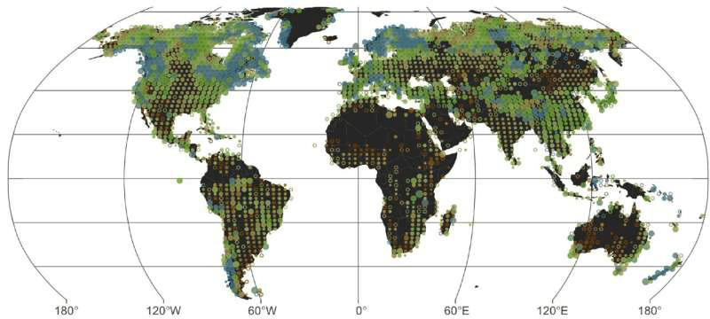
If global warming persists, blue lakes worldwide are at risk of turning green-brown, according to a new study which presents the first global inventory of lake color. Shifts in lake water color can indicate a loss of ecosystem health. The new research was published in Geophysical Research Letters.

While substances such as algae and sediments can affect the color of lakes, the new study finds that air temperature, precipitation, lake depth and elevation also play important roles in determining a lake’s most common water color.

Blue lakes, which account for less than one-third of the world’s lakes, tend to be deeper and are found in cool, high-latitude regions with high precipitation and winter ice cover. Green-brown lakes, which are 69% of all lakes, are more widespread, and are found in drier regions, continental interiors, and along coastlines, the study finds.

The researchers used 5.14 million satellite images for 85,360 lakes and reservoirs around the world from 2013 to 2020 to determine their most common water color.

“No one has ever studied the color of lakes at a global scale,” said Xiao Yang, remote sensing hydrologist at Southern Methodist University and author of the study. “There were past studies of maybe 200 lakes across the globe, but the scale we’re attempting here is much, much larger in terms of the number of lakes and also the coverage of small lakes. Even though we’re not studying every single lake on Earth, we’re trying to cover a large and representative sample of the lakes we have.”

A lake’s color can change seasonally, in part, due to changes in algal growth, so the authors characterized lake color by assessing the most frequent lake color over seven years. The results can be explored through an interactive map the authors developed.

Additionally, the new study explored how different degrees of warming could affect water color if climate change persists. The study finds climate change may decrease the percentage of blue lakes, many of which are found in the Rocky Mountains, northeastern Canada, northern Europe and New Zealand.

“Warmer water, which produces more algal blooms, will tend to shift lakes towards green colors,” said Catherine O’Reilly, an aquatic ecologist at Illinois State University and author of the new study. “There are lots of examples of where people have actually seen this happen when they studied one individual lake.”

For example, the North American Great Lakes are experiencing increased algal blooms and are also among the fastest warming lakes, O’Reilly said. Previous research has also shown remote Arctic regions have lakes with “intensifying greenness,” said Yang. 

While prior studies have used more complex and finer scale metrics to understand overall lake ecosystem health, water color is a simple yet viable metric for water quality that can be viewed from satellites at the global scale, the authors said. This approach provides a way to study how remote lakes are changing with climate.

“If you’re using lakes for fisheries or sustenance or drinking water, changes in water quality that are likely happening when lakes become greener are probably going to mean it’s going to be more expensive to treat that water,” said O’Reilly. “There might be periods where the water isn’t usable, and fish species might no longer be present, so we’re not going to get the same ecosystem services essentially from those lakes when they shift from being blue to being green.”

Additionally, changes to water color may have recreational and cultural implications in locations such as Sweden and Finland where lakes are culturally prevalent, O’Reilly said. As warming continues, lakes in northern Europe will likely lose their winter ice cover, which could affect winter and cultural activities.

“Nobody wants to go swim in a green lake,” said O’Reilly, “so aesthetically, some of the lakes that we might have always thought of as a refuge or spiritual places, those places might be disappearing as the color changes.”

FOR MORE INFORMATION: https://phys.org/news/2022-09-climate-lakes-blue.html

Changes to Florida’s climate threaten oyster reefs, researchers warn

With temperatures rising globally, cold weather extremes and freezes in Florida are diminishing—an indicator that Florida’s climate is shifting from subtropical to tropical. Tropicalization has had a cascading effect on Florida ecosystems. In Tampa Bay and along the Gulf Coast, University of South Florida researchers found evidence of homogenization of estuarine ecosystems.

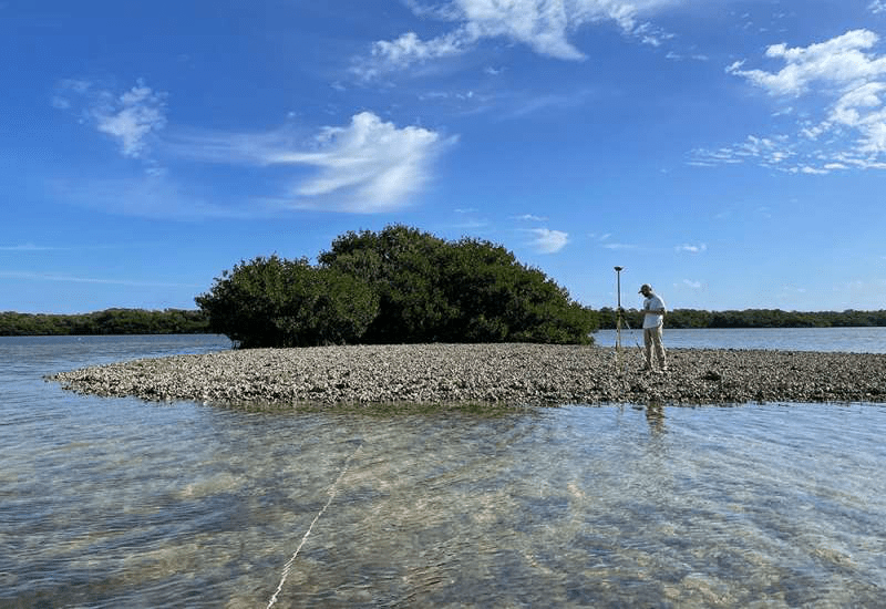
While conducting fieldwork in Tampa Bay, lead author Stephen Hesterberg, a recent graduate of USF’s integrative biology doctoral program, noticed mangroves were overtaking most oyster reefs—a change that threatens species dependent on oyster reef habitats. That includes the American oystercatcher, a bird that the Florida Fish and Wildlife Conservation Commission has already classified as “threatened.”

Working alongside doctoral student Kendal Jackson and Susan Bell, distinguished university professor of integrative biology, Hesterberg explored how many mangrove islands were previously oyster reefs and the cause of the habitat conversion. 

The interdisciplinary USF team found the decrease in freezes allowed mangrove islands to replace the previously dominant salt marsh vegetation. For centuries in Tampa Bay, remnant shorelines and shallow coastal waters supported typical subtropical marine habitats, such as salt marshes, seagrass beds, oyster reefs and mud flats. When mangroves along the shoreline replaced the salt marsh vegetation, they abruptly took over oyster reef habitats that existed for centuries.

“Rapid global change is now a constant, but the extent to which ecosystems will change and what exactly the future will look like in a warmer world is still unclear,” Hesterberg said. “Our research gives a glimpse of what our subtropical estuaries might look like as they become increasingly ‘tropical’ with climate change.” 

The study, published in the Proceedings of the National Academy of Sciences, shows how climate-driven changes in one ecosystem can lead to shifts in another.Using aerial images from 1938 to 2020, the team found 83% of tracked oyster reefs in Tampa Bay fully converted to mangrove islands and the rate of conversion accelerated throughout the 20th century. After 1986, Tampa Bay experienced a noticeable decrease in freezes—a factor that previously would kill mangroves naturally.

“As we change our climate, we see evidence of tropicalization—areas that once had temperate types of organisms and environments are becoming more tropical in nature,” Bell said. She said this study provides a unique opportunity to examine changes in adjacent coastal ecosystems and generate predictions of future oyster reef conversions.

While the transition to mangrove islands is well-advanced in the Tampa Bay estuary and estuaries to the south, Bell said Florida ecosystem managers in northern coastal settings will face tropicalization within decades. 

“The outcome from this study poses an interesting predicament for coastal managers, as both oyster reefs and mangrove habitats are considered important foundation species in estuaries,” Bell said. 

Oyster reefs improve water quality and simultaneously provide coastal protection by reducing the impact of waves. Although mangroves also provide benefits, such as habitat for birds and carbon sequestration, other ecosystem functions unique to oyster reefs will diminish or be lost altogether as reefs transition to mangrove islands. Loss of oyster reef habitats will directly threaten wild oyster fisheries and reef-dependent species.

Although tropicalization will make it increasingly difficult to maintain oyster reefs, human intervention through reef restoration or active removal of mangrove seedlings could slow or prevent homogenization of subtropical landscapes—allowing both oyster reefs and mangrove tidal wetlands to co-exist.

Hesterberg plans to continue examining the implications of such habitat transition on shellfisheries in his new role as executive director of the Gulf Shellfish Institute, a non-profit scientific research organization. He is expanding his research to investigate how to design oyster reef restoration that will prolong ecosystem lifespan or avoid mangrove conversion altogether.

FOR MORE INFORMATION: https://phys.org/news/2022-08-florida-climate-threaten-oyster-reefs.html

How does low-impact development help manage stormwater?

Cities can have many benefits when designed well, including reducing carbon imprints. Another way cities can improve their environmental impact is by using “low-impact development” with regard to water management. It is also called “green stormwater infrastructure.”

The Soil Science Society of America’s (SSSA) September 1st Soils Matter blog explores how low-impact development provides planners with a toolbox of practices and approaches to manage water during rain events and snowmelt.

According to soil scientist and blogger John McMaine, on undeveloped lands with no impervious surfaces, only a small amount of rainfall (10%) becomes runoff. The natural landscapeand soil manages the rain (or snowmelt) by storing, infiltrating, or through evapotranspiration. But in cities, where soil is covered with asphalt for roads, cement and other materials for sidewalks and parking lots, runoff becomes a problem. And buildings count, too.

Every time it rains in a city, rainfall hits pavement and runs off into streams, lakes, and ponds. There are few barriers between the source of runoff and the water body. In cities, during precipitation events, the level of water in streams and rates of flow can increase quickly. In natural and country landscapes, streams rise more slowly and over a longer period of time. Low-impact development replicates the natural water balance by reducing runoff and increasing infiltration.

A big driver for managing stormwater is to reduce local flooding. While flood reduction is an immediate and critical need, if cities just send water downstream using a curb, gutter, and storm sewer system, this just relocates the problem rather than resolving it. The approach of low-impact development is to use water management that gets as close as possible to the natural hydrology or water balance of a landscape.

Cities can manage local and downstream flooding and peak flows using low-impact development. Using detention and retention basins, cities can create ways to capture and hold water, and release it at a controlled rate. These systems can reduce downstream peak flows, but do not reduce the total flow volume. Low-impact development reduces both peak flow and total flow volume, and it improves water quality.

In general, low-impact development works by slowing water down, spreading it out, and soaking it in. Conventional development connects systems of impervious surfaces to quickly send water downstream to mitigate local flooding. An example would be storm drains on a roadway attached to an underground piping system.

Low-impact development manages stormwater by capturing, storing, and treating it on-site. Water is held and infiltrates into the ground or distributed across the landscape. Low-impact development approaches can include landscape site design or structural practices.

Considering stormwater when a building site is designed could mean disconnecting impervious surfaces, such as directing roof runoff into a lawn instead of into a driveway connected to the street. This gives runoff an opportunity to soak into the ground instead of just flowing downstream. This is an easy, low-cost way to add function to a landscape to manage stormwater runoff more effectively.

Rain gardens and rain barrels are two of the most common strategies for homeowners. Rain gardens, or bioretention cells, are shallow depressions in the landscape that runoff is routed into. The water ponds for 24-48 hours as it slowly soaks into the soil. They are planted with flowers or shrubs that can withstand extremes in water—both flooding and drought. The plants also provide pollinator habitat and aesthetic value. Rain barrels are containers, often a 50-gallon barrel, which hold captured rainwater that can be used to water landscaping.

Cities, businesses, and institutions can implement a wide range of practices to help manage runoff. Impermeable, or impervious, sidewalks, parking lots, and roads can be made permeable, or pervious. Permeable pavement can be concrete, asphalt, or pavers. They feature a large amount of empty space that allow water to soak into the pavement. If you’ve seen water rushing off a parking lot during a rainstorm, you can imagine how much runoff can be reduced with permeable or pervious pavement. Medians, boulevards, shoulder areas, and rights of way are great candidates to include pervious pavement.

Low-impact development can be implemented by homeowners, businesses, or cities. Cost does not have to be a barrier when using low-impact strategies. All landscaping costs money—why not broaden the focus from only visual, to also functional. Green stormwater infrastructure can provide attractive landscaping features that also reduce peak flows and reduce runoff volume. It can improve water quality and depending on planting types can also provide habitat for pollinators. It’s time that cities shift their paradigm to use landscapes to meet multiple objectives, not just to look good.

FOR MORE INFORMATION:https://phys.org/news/2022-09-low-impact-stormwater.html

Keeping bacteria at bay in Hawaiian water bodies

During heavy rains, Hawaii’s streams, rivers, and nearshore waters change on microscopic levels. Bacteria in these aquatic systems increase, and some of these bacteria can be harmful to human health. They can cause problems like gastroenteritis—also known as the stomach flu—as well as skin and respiratory diseases.

It is known in the science community that soils are a common source of these disease-causing—or pathogenic—bacteria. What isn’t as well-known, though, is what kinds of soils are the major suppliers of these microbial intruders.

In a new study, Tracy Wiegner, a researcher at the University of Hawaii, and her team identified urban and agricultural soils as the culprits of the bacteria. The research found that levels of pathogenic bacteria are highest in urban and agricultural soils. Stormwater runoff from these soils transports lots of bacteria into water bodies.

In contrast, pathogenic bacteria are present at low levels in soils in native forests. That makes it unlikely that these forest soils are a major source of the bacteria found in Hawaii’s inland and coastal waters.

The study was published in the Journal of Environmental Quality.

The study measured levels of three different bacteria in urban, agricultural, and native forest soils. One of the bacteria was Staphylococcus aureus. It causes staph infections. “In Hawaii, people often mention they’ve had staph infections,” says Wiegner. “This may be caused by exposure to harmful bacteria in nearshore water activities like swimming, canoeing, and surfing.”

Of particular concern to researchers and the medical community is one of the antibiotic resistant versions, methicillin-resistant S. aureus (MRSA).

The other two bacteria in the study were Enterococcus and Clostridium perfringens. Both bacteria are called fecal indicator bacteria. Levels of these bacteria can be used as indicators of pollution from sewage in most places in the United States. But in Hawaii, the situation is more complicated.

Enterococcus can thrive in the tropical soils of Hawaii. “That makes it unclear whether high levels of Enterococcus found in Hawaiian waters following storms are from sewage pollution, soils, or both,” says Wiegner. In response, Hawaii uses Clostridium bacteria as a secondary bacterial indicator for detecting sewage pollution.

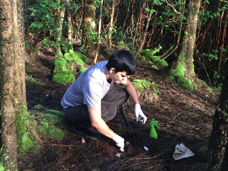
The study took place in the Hilo Bay watershed on Hawaii Island, often called the Big Island. Researchers collected soil samples from urban, agricultural, and native forest areas. Then they determined levels of the different bacteria in the samples.

The researchers could detect Staphylococcus and Enterococcus in all the soils samples. Levels of Staphylococcus and Enterococcus were highest in urban and agricultural soils and lowest in native forest soils. “This suggests that there are small natural populations of Staphylococcus and Enterococcus bacteria in Hawaiian soils,” says Wiegner. “But the presence of humans and other animals increases their levels.”

That means reducing human and animal activity can decrease levels of soil bacteria. This could be particularly useful in areas near water bodies, and could reduce how much bacteria can be transported to the water bodies during heavy rainfall.

The study also detected very low levels of Clostridium bacteria in all the soils tested. That makes it unlikely that soils are the source of Clostridium levels detected in Hawaiian waters after heavy rainfall. Instead, this bacterium comes from sewage pollution. “Clostridium may be a better indicator of sewage pollution in Hawaiian waters,” says Wiegner.

“It is important for watershed and community health managers to identify sources of pathogens entering waterbodies,” says Wiegner. “Appropriate management action can reduce the concentrations of bacteria in soils. They can also reduce their transport during storms.”

Management actions could include building green infrastructure. Examples of green infrastructure include restoring and maintaining riparian buffers, constructing wetlands for stormwater retention, and beach grooming. Building green infrastructure has improved water quality in places like the Great Lakes region in the United States and coastal waters of New Zealand. “These measures can reduce the transport of bacteria from soils to water bodies in Hawaii,” says Wiegner. “That could ultimately reduce bacterial transmission during water recreational activities.”

FOR MORE INFORMATION: https://phys.org/news/2022-09-bacteria-bay-hawaiian-bodies.html

How long does it take for seagrass to recover? What more swans could mean for estuary ecosystems

In an Australian first, scientists from Edith Cowan University (ECU) have determined how long it takes for seagrass to recover after grazing by swans.

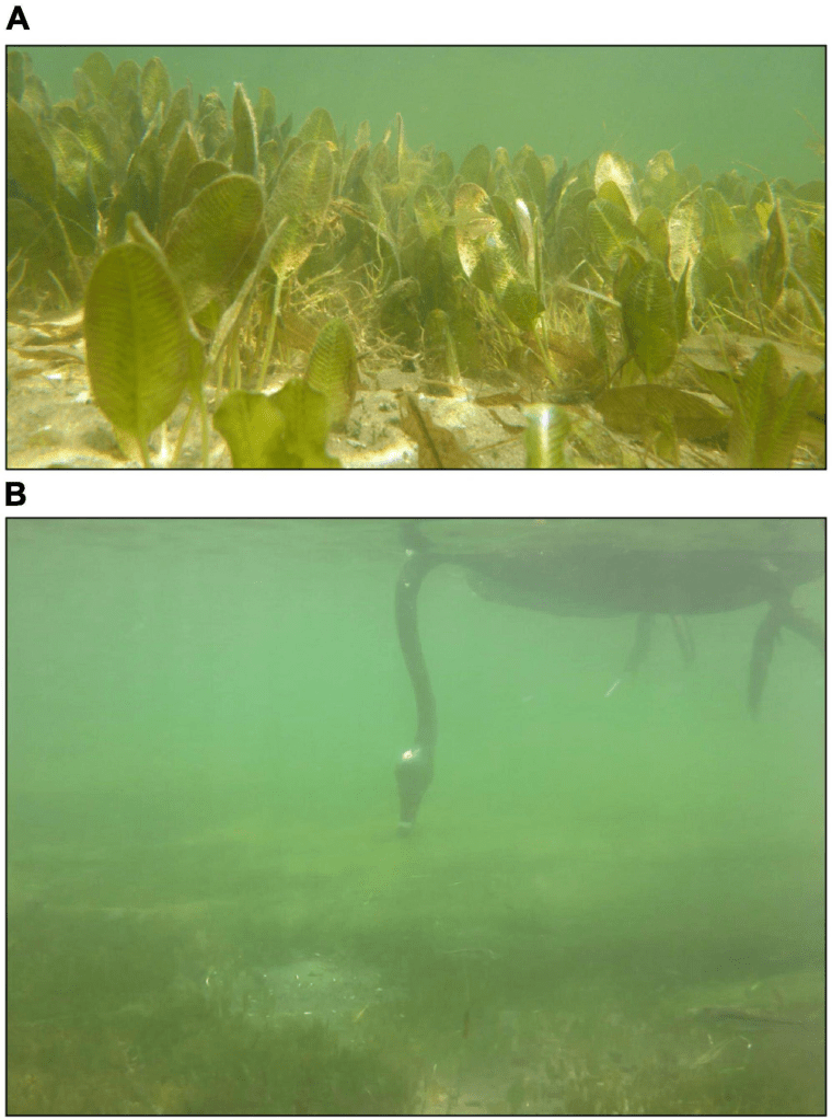
The project, led by ECU Master’s student Caitlyn O’Dea, used floating pens in Perth’s Swan River, to keep swans away from the seagrass to allow tracking of its recovery.

Seagrasses are the only flowering plants that can live underwater and are considered amongst the most productive ecosystems in the world. However, climate change, coastal developments and run-off from urban, industrial, and agricultural areas have all led to its ongoing global decline.

Grazing has also led to complete loss of seagrass in some marine ecosystems. “To simulate grazing, we removed a quarter, half, three-quarters and all the seagrass in parts of the meadow,” Ms. O’Dea said.

The experiment was set up at Mosman Park, Nedlands, Crawley, Attadale and Como.

The regrowth of seagrass was tracked weekly to fortnightly over a three-month period, leading to the first official recordings of its recovery time.

“The findings revealed that when grazing was less intense, the recovery time was four to six weeks. Under greater grazing intensity, the seagrass took seven to 19 weeks to recover,” Ms. O’Dea explained.

With a decrease in area of seasonal wetlands across in Western Australia due to the drying climate, black swans are likely to be more common in the Swan River.

“Seagrass not only provides a vital food source for birds and other animals, but it also provides habitat and shelter as well as improves water quality, so increased grazing pressure on seagrass could have implications for the ecosystem as a whole,” she explained.

Ms. O’Dea said the research also identified seagrass recovery was most commonly through vegetative measures, as opposed to sexual reproduction.

“Seagrass has rhizomes which can grow into areas like the horizontal runners of grass in your backyard. They can also flower and produce seeds, which for this species lay dormant in the sediment. We didn’t observe any recovery through reproduction, which could simply be due to the time of year, as we’d expect to see germination in spring.”

Ms. O’Dea said her research will allow for further examination of how grazing and other potentially interacting pressures could impact seagrass ecosystems even further.

FOR MORE INFORMATION: https://phys.org/news/2022-09-seagrass-recover-swans-estuary-ecosystems.html

To study impacts of longer, hotter summers, ecologists haul 5,000 pounds of sand up a mountain

As spring unfolds into summer each year on Niwot Ridge, just north of Nederland, snowdrifts give way to small shrubs and colorful lichens on this exposed tundra, resembling a coral reef at 10,000 feet above sea level. A portion of the landscape will also soon be covered in what looks like more like heaping mounds of chocolate chip ice cream.

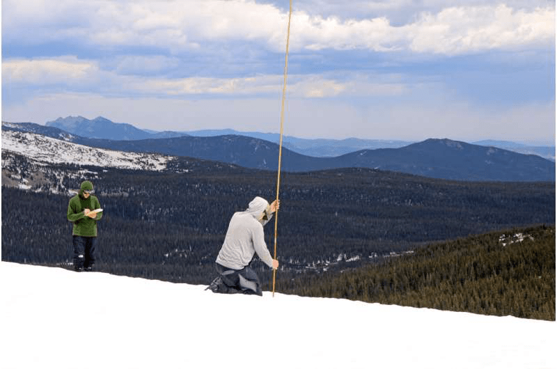
For the past five years, a small team of research assistants and volunteers have hiked up Niwot Ridge in late May to set the stage for a unique experiment in which they spread 5,000 pounds of black sand across portions of the remaining snowpack.

Their goal? To simulate the not-so-distant future effects of a warming planet on alpine ecosystems. Researchers want to know what may happen as mountain snowpack melts sooner and summer lasts longer each year due to rising temperatures from climate change.

“We’re seeing a large influence of these longer summers. When things warm up and melt out earlier, those seem to be years that really affect the system—the plants, the pikas and the water quality,” said Katharine Suding, lead investigator of the project, and professor of distinction in the Department of Ecology and Evolutionary Biology and the Institute of Arctic and Alpine Research (INSTAAR). “And the best way to figure out what might happen in the future is to test it out.”

Suding’s team uses simple, cheap and environmentally friendly sand to naturally attract more sunlight, heat up snow and melt it faster. It’s made of the same glassy silica particles used in fire pits and ash trays.Each season, the team spreads the sand on top of the snow at five test plots across the ridge, leaving some snow next to it untouched. Throughout the summer, dozens of graduate students, volunteers and faculty run soil sensors, collect vegetation and gather data about pollinators to see what kinds of changes, if any, the snow melting sooner causes on the tundra beneath.

The project is just one of dozens of research projects conducted by CU Boulder scientists and partner institutions at the century-old Mountain Research Station. The effort is also part of the Niwot Long-term Ecological Research Program.

“It’s quite an ambitious project,” said Jennifer Morse, climate technician at the Mountain Research Station, who oversees the execution of experiments like this one.

Peak snowpack typically occurs around late May or early June, although it may at first seem a misnomer. While the snow is still yards deep in some places, requiring snowshoes or skis to cross, in others it’s already long gone. The goal is to apply the sand when the snow is no longer accumulating and is instead starting to melt, so the sand they apply isn’t covered up by additional snowfall.

This timing makes for a formidable feat. Hauling 5,000 pounds of sand up the mountain in late spring requires the use of a utility task vehicle (UTV) with snow treads, as windswept and melting mounds of snow along the road from the station to the sites would prove impossible for a regular vehicle.

Once the researchers have ridden or skied up the ridge, they visit each of the five test plots over the course of a few days. They first gather snow depth measurements at set intervals on both sides of each test plot, which they’ll do every two weeks until the snow fully melts.

FOR MORE INFORMATION: https://phys.org/news/2022-09-impacts-longer-hotter-summers-ecologists.html

Overall warming of up to 5°C in this century projected for the Eastern Mediterranean and Middle East


A new report prepared by an international group of scientists and published in the authoritative journal Reviews of Geophysics, identifies the EMME* as a climate change hot spot, and concludes that the region is warming almost two times faster than the global average, and more rapidly than other inhabited parts of the world. For the remainder of the century, projections based on a business-as-usual pathway indicate an overall warming of up to 5°C or more, being strongest in the summer, and associated with unprecedented heatwaves that can be societally disruptive. Further, the region will experience rainfall shortages that compromise water and food security. Virtually all socio-economic sectors are expected to be critically affected, with potentially devastating impacts on the health and livelihoods of the 400 million people of the EMME, with worldwide implications.

The report, which was prepared under the auspices of the Max Planck Institute for Chemistry and The Cyprus Institute, in preparation to COP27, which will take place in Egypt in November 2022, provides an updated, comprehensive assessment of measurement data and recent climate analyses, covering a wide range of time scales, phenomena and possible future pathways. It identifies the region as a climate change hot spot, and also signals that the EMME is rapidly overtaking the European Union as a source of greenhouse gases, and becoming a major emitter at the global scale.

In addition to the average increase in temperatures, the researchers call attention to the emergence of extreme weather events with potentially disruptive societal impacts. These include the strongly increasing severity and duration of heatwaves, droughts and dust storms, and torrential rains which are expected to trigger flash floods. The assessment also comprises a discussion of atmospheric pollution and land-use change in the region, considering urbanization, desertification and forest fires, and includes recommendations for possible climate change mitigation and adaptation measures.

“Business-as-usual pathways for the future,” meaning projections assuming no immediate, ambitious climate action to avert the current climate trajectories, “imply a northward expansion of arid climate zones at the expense of the more temperate regions,” explains Dr George Zittis of the Cyprus Institute, first author of the study. As a result, mountainous climate zones with snow will diminish during this century. The combination of reduced rainfall and strong warming will contribute to severe droughts. The sea level in the EMME is projected to rise at a pace similar to global estimates, though many countries are unprepared for the advancing seas. “This would imply severe challenges for coastal infrastructure and agriculture, and can lead to the salinization of costal aquifers, including the densely populated and cultivated Nile Delta,” warns Zittis.

The projected changes will critically affect virtually all socio-economic sectors, particularly under a business-as-usual scenario. Jos Lelieveld, Director of the Max Planck Institute for Chemistry, Institute Professor at the Cyprus Institute and coordinator of the assessment, notes: “People living in the EMME will face major health challenges and risks of livelihood, especially underprivileged communities, the elderly, children and pregnant women.” To avoid the most extreme of severe weather events in the region, the scientists highlight that immediate and effective climate action is urgent. “The motto of COP 27 is well chosen: Together for just, ambitious implementation now,” states Jos Lelieveld. “Since many of the regional outcomes of climate change are transboundary, stronger collaboration among the countries is indispensable to cope with the expected adverse impacts. The need to meet the goals of the Paris Agreement has become more important than ever,” concludes Lelieveld. The study notes that meeting the main Paris Agreement targets could stabilize the annual temperature increase in the EMME to about 2°C by the end of the century, rather than the devastating 5°C which is projected under a business-as-usual scenario.

Possible adaptation options and policy recommendations noted in the report to contribute to meeting these targets stress the need for rapid implementation of decarbonization actions with a particular emphasis on the energy and transportation sectors, which dominate greenhouse gas emissions in the EMME. The report also stresses the importance of transformational changes toward climate resilience to adapt to increasingly challenging environmentally conditions. Priority areas include the coping with limited water resources and preparing for more frequent weather extremes such as heat waves that will be particularly challenging for the growing urban population.

The report has been published in the American Geophysical Union Open Access Journal with the highest impact factor in Earth sciences. It was motivated by the Cyprus Government Initiative for Coordinating Climate Change Actions in the EMME, launched in 2019, aiming at the development of a joint Regional Climate Action Plan to address the specific needs and challenges EMME countries are facing, and advance coordinated action towards the goals of the Paris Agreement. At the political level, an EMME Heads of State Summit will be held in autumn 2022 when the Regional Action Plan is expected.

* The 17 countries included in the analysis of the report are Bahrain, Cyprus, Egypt, Greece, Iran, Iraq, Israel, Jordan, Kuwait, Lebanon, Oman, Palestine, Qatar, Saudi Arabia, Syria, Turkey and the United Arab Emirates.

FOR MORE INFORMATION: https://www.sciencedaily.com/releases/2022/09/220906114225.htm