A woman reaches for a hose from a water tanker in Rajasthan, India
As the world’s weather flips more rapidly between the poles of too wet and too dry, the general public is taking notice.
Fifty-eight percent of people who responded to a global public opinion survey on freshwater supply and pollution said that water shortages were a “very serious” problem. A larger share – 62 percent – said the same about water pollution.
How have they been affected by water shortages? Three in 10 respondents said “greatly.”
“We’re looking at citizens who are deeply concerned with water and feel the impact of climate change,” said Perrine Bouhana, director at GlobeScan, the polling firm that conducted the survey.
The survey results indicate growing public awareness and vulnerability to the challenges of water supply and pollution. The polling data is being released a week before the United Nations hosts its first global water conference since 1977, an effort to rally support for the goal of safely managed water and sanitation for all people.
According to the survey, concern over freshwater shortages was highest in Latin American countries, with Mexico, Colombia, and Brazil at the top of the rankings. Just behind was South Africa, whose urban residents have witnessed shortages in recent years due to a combination of unfortunate weather and utility mismanagement.
Residents of Asian countries like China, Japan, Hong Kong, and South Korea were the least concerned about water shortages.
Italy and the United States registered the biggest jump in concern over water shortages since 2020. Both countries have experienced notable droughts in that time period.
“People are beginning to make those links between climate and nature and then link them with water,” said Alexis Morgan, global water stewardship lead at WWF.
The GlobeScan survey was conducted online in the summer of 2022 with the participation of about 1,000 people in each of 31 countries. In total, 29,293 people, from six continents, submitted responses.
The survey revealed divergent attitudes toward water among sexes and generations. Women were more likely than men to express concern over water shortages and pollution, just as younger people were more worried than their elders.
The GlobeScan results mirror the generational split in the United States over environmental issues. A survey conducted by Pew Research in April 2021 found that Gen Z and Millennials were more concerned about land, air, and water pollution than older generations.
Water is also more prominent in the public eye than its peer issues. A Gallup poll from 2022 found that water pollution is the biggest environmental concern among American adults. Water pollution ranked higher than air pollution, species extinction, and global warming.
The San Luis Valley, a high desert farming region in southern Colorado, is a land of daunting natural constraints, especially its scarce water reserves. Pragmatic ingenuity is being applied here to overcome them, including a new easement program that uses federal and state tax benefits to conserve groundwater.
In November, Ron Bowman, owner of the 1,900-acre Peachwood Farms, signed Colorado’s first groundwater conservation easement. The landmark legal agreement enables Bowman to gain a substantial tax credit based on the value of 2,000 acre-feet of water he used annually. In exchange Bowman is prohibited from pumping groundwater to irrigate his fields.
Easements to conserve groundwater, while new, work the same as easements that have been negotiated for decades to conserve environmentally sensitive land. A landowner’s water is valued through an appraisal. The easement restricts what can be done with the water. The easement is then purchased or donated to a land trust or government agency, which is responsible for enforcing its stipulations. The value of the donated easement can be deducted from federal taxes and some state taxes. In Colorado, the benefit to the landowner is a state income tax credit.
Though the San Luis Valley is not the first to use easements to conserve groundwater — Nebraska’s Central Platte Natural Resources District has had them for 15 years — the San Luis Valley’s experience struck a chord, becoming the water-sector equivalent of a viral hit. The lawyers, land trusts, farmers, and water districts working in the valley are at the forefront of a new form of groundwater protection in the American West.
“I think it’s a brand new tool that has a lot of promise in terms of being able to conserve groundwater in perpetuity by reducing the draw on the aquifer,” said Peter Nichols, a water lawyer in Colorado who co-drafted the model easement that Peachwood Farms used.
The San Luis Valley is an apt place to start what amounts to a last-ditch program to reduce groundwater consumption. Hemmed in by the sawtooth Sangre de Christo Mountains to the east and the San Juan Mountains to the west, the broad valley is the headwaters of the Rio Grande, a river pummeled by a warming climate. Even with rising temperatures, the growing season is just three months for the alfalfa, potatoes, barley, and hemp that are planted here. At nearly a mile and a half of elevation, a crop-killing frost can strike at any time.
Along with the formidable weather, water is a major factor limiting production. Valley farmers pump more water from the basin’s aquifers than can be sustained. After a catastrophic drought a generation ago, the state demanded that they use less, setting in motion a two-decade quest for groundwater balance. Easements are the latest step in a developing strategy to meet Colorado’s water conservation directive.
Farmers across the drying American West are taking notice because groundwater depletion is a top-line political issue in nearly every state from the High Plains to the Pacific Coast. California officials are implementing the Sustainable Groundwater Management Act to align supply and demand in its major farming valleys. Last November, voters in Arizona’s Cochise County approved new restrictions to counteract declining groundwater levels that had caused rural wells to dry up.
Groundwater conservation easements could be a solution, and the concept is starting to spread rapidly. Nichols is working with the Ogallala Land and Water Conservancy, in Clovis, New Mexico, to develop groundwater conservation easements in that state. The conservancy was founded in 2021 with the goal of using easements to protect the shrinking Ogallala Aquifer.
Attorneys, environmental groups, water groups, and land trusts in Texas also got interested in replicating the easement model following a presentation at the Texas Land Conservation Conference earlier this month by Ladona Clayton, the executive director of the Ogallala Land and Water Conservancy.
Clayton said the talk was a sensation. “Interest has suddenly exploded for me,” she said. “There’s not a quiet moment since I did that.”
Clayton is not resting while the conservancy assembles the paperwork for easements in New Mexico. In the last year she entered into three-year contracts to lease groundwater from 53 wells, saving nearly 13,000 acre-feet per year.
“Time was of the essence,” she said.
The Tools of Land Conservation But for Groundwater
The inflection point in the San Luis Valley arrived two decades ago. In 2002, amid a severe drought, groundwater levels plunged. Two years later the Legislature approved a mandate to bring the basin’s aquifers back in balance. Doing so would also ensure sufficient water would flow down the Rio Grande to New Mexico and Texas, as is required by federal compact.
About five years ago, Cleave Simpson, the general manager of the Rio Grande Water Conservation District, approached the region’s conservation groups with a challenge. Conservation easements had a long history in the valley as a tool to protect land from development. Could they be repurposed for groundwater protection?
“If all of us could eventually somehow agree to a restriction, we could improve our aquifer system,” Simpson said, recognizing one of the leading conundrums of behavioral economics and natural resource management. “But how can I incentivize folks to agree to a reduction in their groundwater withdrawals?”
Simpson put this question to Colorado Open Lands and the Rio Grande Headwaters Land Trust, two groups that work on land conservation easements. Sarah Parmar, director of conservation at Colorado Open Lands, said that farmers wanted flexibility with groundwater — to continue to grow crops but to use less water at the same time. To develop a model conservation easement, Colorado Open Lands contacted Peter Nichols and Allan Beezley, two lawyers specializing in land and water rights.
The list of groundwater protection tools is lengthy: fallowing agreements, groundwater leases, cap and trade, contracts that buy land for a one-time payment and cease farming. All the tools differ in terms of legal enforcement, funding source, length of the contract, and how they are administered. Conservation easements have two substantial benefits over their competitors, proponents say. Tax benefits mean that a funding source is already secured, one that is not subject to annual budget battles in the statehouse or Congress. And easements do not need to be renewed; they protect groundwater in perpetuity.
One of the challenges with this approach, Nichols said, is an accurate valuation. Land appraisals are common and relatively simple compared with valuing the non-use of groundwater. In the Peachwood Farms easement, the appraiser compared the value of irrigated farmland against land that is not irrigated.
The Peachwood Farms easement is no half measure either. Under the agreement, the entire 1,900-acre property will eventually forego irrigated agriculture and will be bought out by the water conservation district. Instead of rows of alfalfa or canola, the land will be returned to a natural state over a 10-year period. Some groundwater will be required in the first years, to establish native grasses and shrubs, Parmar said. And several of the fields will be leased during this transition period to produce barley for a local brewery.
An all-or-nothing groundwater approach is not the only path. Nichols said that farmers could pursue easements that would allow limited irrigation, relinquishing most of their groundwater pumping rights but keeping enough to maintain some farm production on their acreage. Parmar sees this as a viable alternative.
“Because a conservation easement can be tailored and written for a specific farm operation, our hope is that — and we’re in lots of conversations with other farmers about doing this — is to actually help them to permanently reduce their water use, but not go out of farming entirely,” Parmar said.
The easements mandate an endpoint — a reduction in groundwater pumping — but farmers determine the route. They could switch to a less water-intensive crop. They could install more efficient irrigation. Or they could fallow land. The choice is theirs.
If the benefits of groundwater conservation easements — the tax incentives, the flexibility, the ability to continue farming — are so clear, why aren’t there more?
Parmar, who has worked in land conservation for 15 years, said that organizations can be shortsighted.
“I think that there’s just been these silos that have existed between the land conservation communities and the water management communities,” Parmar said. “And I think we’re starting to work together and talk more to find more solutions, and that collaboration and engagement is, I think, what finally led to this. But it’s probably way overdue.”
Bowman, now retired, has owned Peachwood Farms for eight years as an investment property, growing alfalfa, hay, hemp, and canola on roughly 1,900 acres. He was not born in the San Luis Valley, coming to the area later in life. In his view, families that have lived in the valley longer should be the ones to continue farming. It’s one reason he was willing to sign the conservation easement.
Preservation of agriculture in the face of a tempestuous climate and unforgiving hydrology is a driving force for Cleave Simpson. Not only the general manager of the water conservation district, Simpson is a state senator and a fourth-generation farmer. He feels these changes every day.
“Agriculture is the [valley’s] biggest economic driver by far,” Simpson said. “All of our communities, our culture, our economies are all built around irrigated agriculture.”
Communities that laid their foundations more than a century ago now must adapt to an era of scarcity, Simpson said. All of the management tools today, groundwater conservation easements included, are intended to avert a disruptive transition.
“I routinely said, ‘If we’re very thoughtful about this, ag is going to change in the valley,’” Simpson said. “It can change incrementally, if we’re thoughtful about it. Or it will change fundamentally if we’re not careful.”
Officials say cleanup continues and they’re monitoring local wells
By Matt Sepic
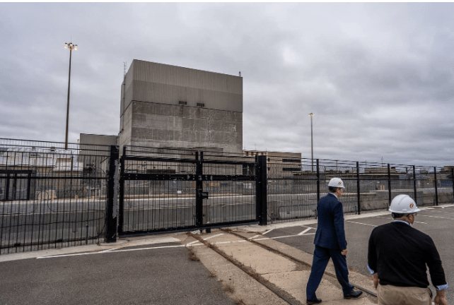
Chris Clark and Randy Fordice of Xcel Energy walk outside of the company’s nuclear generating plant in Monticello, Minn., during an October 2019 tour. Officials on Thursday acknowledged a radioactive water leak occurred at the plant last November
Water containing tritium, a radioactive form of hydrogen, leaked out of Xcel Energy’s nuclear power plant in Monticello, Minn. in November, state officials said Thursday.
Xcel reported that about 400,000 gallons of the tritiated water leaked from a water pipe between two buildings.
State officials said the tritium was found during routine checks of ground water.
“The leak has been stopped and has not reached the Mississippi River or contaminated drinking water sources. There is no evidence at this time to indicate a risk to any drinking water wells in the vicinity of the plant,” the Minnesota Pollution Control Agency said in a statement.
Water containing a radioactive form of hydrogen, tritium, leaked out of Xcel Energy’s nuclear power plant in Monticello, Minn., in November, state officials said Thursday.
How did the leak start?
Xcel reported the leak to government regulators on Nov. 22, the day it was confirmed, but Xcel Energy Regional President Chris Clark said it’s unclear when the problem began.
“As we do a full root cause analysis, we’ll have a better understanding of whether that was a few days, a few weeks, a month. But we just don’t know that at this point,” Clark said.
Clark said workers have pumped about 25 percent of the tritiated water out of the ground and are treating it on site. He said it’ll take about a year to remove the rest.
The steel pipe that leaked is about four inches in diameter and carries condensate water away from the steam turbine that drives the plant’s generators. Pat Flowers, Xcel’s manager of environmental services said the damaged pipe was in an inaccessible spot.
“The leak took place in that tiny little space and it wasn’t really visible until you drilled a hole through two feet of concrete to get to it to physically see what was leaking,” Flowers said.
Xcel will analyze the pipe to try to find out what caused it to break, Flowers said.
“In order to really understand what happened to this pipe, we’re going to have to take out several feet of concrete around the pipe so that we can get access to it,” Flowers said. “That’s not going to happen until our [routine refueling] outage that starts here in mid-April, and we’ve got plans in April to remove that pipe so we can do the metallurgy, we can repair it, and we can also understand what took place, what caused the failure.”
Though both state and federal regulators knew about the leak around the time Xcel staff discovered it, state officials did not inform the public about it for nearly four months.
The NRC’s November public notice was not in a news release, though it can be seen online at the bottom of a list of “non-emergency” event notification reports.
Both state and company officials said they did not notify the public when the incident occurred because the tritiated water was not moving toward toward drinking water wells and did not pose a danger to people near the plant.
“If at any time, we had felt that there was any threat to Minnesotans, their health or their safety, we would have notified people immediately,” said assistant Minnesota Health Commissioner Dan Huff.
The company said it is monitoring the groundwater plume at two dozen wells, and is considering options to dispose of the collected tritium. Minnesota regulators will review those options, MPCA said.
How dangerous is tritium?
Tritium occurs naturally in the atmosphere. But it’s also produced through fission in nuclear reactors. Because it’s a type of hydrogen, it reacts with oxygen to produce radioactive water.
Tritium is hazardous but only if ingested in large concentrations. The U.S. Environmental Protection Agency said tritium emits beta particles at such a low level that they are unable to penetrate human skin.
“While tritium is radioactive, it’s low energy, and so it’s not like plutonium. If you were to sit it next to you in a glass, it wouldn’t hurt you,” Huff said. “If you drank it, it would increase your radiation exposure. And we want to limit radiation exposure because radiation can cause tissue damage.”
Brian Vetter leads the Department of Radiation Safety at the University of Minnesota, where he oversees nuclear materials in the U’s research labs and medical facilities. He doesn’t work for Xcel or its government regulators.
“We’re drinking extremely small quantities of radioactive water all the time: radium, tritium,” Vetter said. “It’s just a part of our naturally radioactive world that we all live in. Very extremely small quantities, but you want to keep them extremely small.”
Both the Minnesota Pollution Control Agency and Xcel said testing indicates that the underground plume of contaminated water has not spread outside plant boundaries.
The MPCA says the closest public well is less than a mile from the plant, but is on higher ground, so the tritiated water isn’t flowing to it.
There’s also a potable water well on the Monticello plant property that employees use. Chris Clark, the Xcel executive, said there’s no evidence of tritium in that particular well, and he said he would drink from it.
“I’d be happy to drink that water. I’ve actually drank that water there at the plant,” Clark said. Our employees are there and of course we care about our employees, we care about our community. Our employees live in the community of Monticello and communities around there.”
MPCA assistant commissioner Kirk Koudelka said the agency is overseeing Xcel’s cleanup efforts.
“We are monitoring the area. Xcel is taking actions to remove contaminated groundwater from one series of wells, and in addition using other wells to control the contamination to prevent it from going offsite, whether that’s the river or outside its property boundaries,” Koudelka said.
The leak report comes as Xcel is asking federal regulators to extend Monticello’s operating license through 2050 — when the plant will be nearly 80 years old.
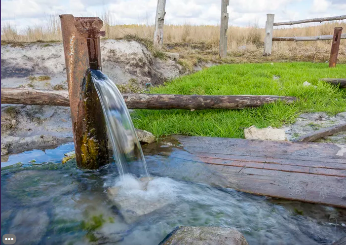
Image of water flowing from an old pipe (image from Sciencing)
A recent review study led by The University of Texas at Austin provides an overview of the planet’s freshwater supplies and strategies for sustainably managing them.
Published in Nature Reviews Earth & Environment, the study highlights the connections between surface and groundwater and calls for diversified strategies for managing them both.
“I like to emphasize a lot of solutions and how they can be optimized,” said lead author Bridget Scanlon, a senior research scientist at the UT Bureau of Economic Geology, a research unit of the Jackson School of Geosciences.
The study draws on data from satellites, climate models, monitoring networks and almost 200 scientific papers to analyze the Earth’s water supply, how it’s changing in different regions and what’s driving these changes. The study’s co-authors include almost two dozen water experts from around the world.
According to the research, humans primarily rely on surface water. Globally, it accounts for 75% of irrigation and 83% of municipal and industrial supply annually. However, what we see at the surface is tightly connected to groundwater flow. In the United States, about 50% of annual streamflow starts as groundwater. And globally, surface water that seeps into the ground accounts for about 30% of annual groundwater supplies.
Human intervention can strongly influence the exchange in water between surface and groundwater sources. About 85% of groundwater pumped by humans in the U.S. is considered “captured”from surface water, which leads to declines in streamflow. At the same time, irrigation sourced from surface water can increase groundwater recharge as irrigated water seeps through the ground back to aquifers.
The study cites numerous examples of human activity affecting this flux between surface water and groundwater supplies. For example, surface water irrigation recharged aquifers in the early to mid-1900s in the Northwestern U.S.’ Columbia Plateau and Snake River Plain, while global models show that groundwater pumping has greatly reduced the volume of water going to streams, with 15-21% of global watersheds at risk because of the reduced flows.
Despite their inherent connection, surface water and groundwater are frequently regulated and managed as separate resources. According to the researchers, future water resilience depends on recognizing that surface water and groundwater behave as a single resource — and acting on that knowledge.
The study describes different ways for managing water through both natural and engineered solutions that can help increase water supplies, reduce demand, store water and transport it. According to Scanlon, one of the best ways to adapt to increasing climate extremes is storing water during wet times and drawing on it in times of drought.
“We have droughts and we have floods,” she said. “We are trying to manage those extremes and a way to do that is to store water.”
Annually, the world stores about 7,000-8,300 cubic kilometers, or about two Lake Michigan’s worth of water, in surface reservoirs. The researchers said it was important to continue developing groundwater supplies, too, because they are more resilient than surface reservoirs during long-term droughts. Managed aquifer recharge can help cities build up their groundwater supplies by collecting surface water and diverting it underground into aquifers. Globally, about 10,000 cubic kilometers of water is stored this way each year.
“This type of integrated research, linking surface and groundwater, is exactly what is needed to develop lasting solutions to issues such as fresh water use,” said Scott Tinker, the director of the Bureau of Economic Geology. “Too often studies are done in isolation, and well-intended applications have unintended outcomes.”
Matthew Rodell, a hydrologist at NASA Goddard Space Flight Center who was not involved in the study, said that the paper offers a useful compendium of research results and potential solutions for managing water supplies while also keeping water quality — a characteristic that’s more difficult to monitor remotely than quantity — in mind.
“Water quality is one of the next targets in terms of being able to manage water resources,” he said. “I like that this was incorporated as well.”
A resident living in a flooded area refills plastic containers with drinking water on an improvised “banca” (small boat) in Artex compound, Malabon city, north of Manila
Surging global bottled water consumption reflects the failure by governments to improve public water supplies which is putting the U.N. sustainable development goal of safe drinking water by 2030 under threat, a U.N. academic think tank said on Thursday.
The bottled water market saw 73% growth from 2010 to 2020, and consumption is on track to increase from around 350 billion litres in 2021 to 460 billion litres by 2030, according to the U.N. University’s Institute for Water, Environment and Health.
“The rise in bottled water consumption reflects decades of limited progress in and many failures of public water supply systems,” the institute’s director Kaveh Madani said in statement.
The U.N. estimates that some 2.2 billion people do not have access to safe drinking water, with the number of people who had access growing by only 4% between 2016 and 2020.
Developing nations depend on bottled water to make up this shortfall. Egypt, facing water scarcity, was the fastest growing market for treated bottled water from 2018 to 2021, the UNU report said.
Singapore and Australia were the biggest per capita consumers of bottled water at 1,129 litres and 504 litres a year respectively, according to the report. Malaysia led developing countries in per capita consumption, at just under 150 litres.
More than a third of Americans said they use bottled water as their main water source, the report said.
“To a somewhat surprising extent, bottled water grew immensely over the last few decades while in the conventional and more reliable public and domestic drinking water supply, progress was slow paced,” said report co-author Vladimir Smakhtin of UNU-INWEH.
Meeting the UN sustainable development goal of providing safe drinking water by 2030 is therefore under threat, he said, noting governments were too often leaving the provision of safe drinking water to private actors.
ENVIRONMENTAL CONCERNS
In addition to concerns over poor access to clean drinking water, rising bottled water consumption also threatens the environment, ranging from concerns that corporations are depleting groundwater to plastic pollution.
The industry produced 600 billion plastic bottles in 2021, 85% of which are likely to end up in landfills.
“While there is growing awareness toward bottled water and plastic issues in the northern hemisphere … the market is not showing that,” said report co-author Zeineb Bouhlel. “It shows that campaigns run by corporations have a bigger influence on perceptions that bottled water is a better option.”
Research published last week found that plastics entering the ocean could nearly triple by 2040 if left unchecked.
“It is a human right to have access to free and clean water, but it’s also a right to live in a world free from plastic pollution,” said Marcus Eriksen, director of the 5 Gyres Institute, a plastic pollution non-profit.
A home with a swimming pool abuts the desert on the edge of the Las Vegas valley July 20, 2022, in Henderson, Nev. Nevada lawmakers on Monday, March 13, 2023, will consider another shift in water use for one of the driest major metropolitan areas in the U.S. The water agency that manages the Colorado River supply for Vegas is seeking authority to limit what comes out of residents’ taps.
CARSON CITY, Nev. (AP) — Nevada lawmakers are set to consider a remarkable shift in allowing the water agency that manages the Colorado River supply for Las Vegas to limit residential use in the desert city.
It’s another potential step in a decades-long effort to ensure one of the driest metropolitan areas in the U.S. has enough water. Already, in Las Vegas ornamental lawns are banned, new swimming pools have a size limit and the water used inside homes is recycled.
While some agencies across the U.S. West tie increased water use to increased cost, Nevada could be the first to give a water agency — the Southern Nevada Water Authority — the power to restrict what comes out of residents’ taps in state statute. The provision is one among many in a sweeping omnibus bill that goes before legislators Monday afternoon.
Nevada is one of seven states that rely on the Colorado River. Deepening drought, climate change and demand have sunk key Colorado River reservoirs that depend on melting snow to their lowest levels on record.
“It’s a worst case scenario plan,” said the bill’s sponsor, Democratic Assemblyman Howard Watts of Las Vegas. “It makes sure that we prioritize the must-haves for a home. Your drinking water, your basic health and safety needs.”
The bill would give the water authority leeway to limit water usage in single-family homes to 160,000 gallons annually, incorporate homes with septic systems into the city’s sewer system and provide funding for the effort.
The average home uses about 130,000 gallons of water per year, meaning the largest water users would feel the pinch, according to the agency.
The authority hasn’t yet decided how it would implement or enforce the proposed limits, which would not automatically go into effect, spokesperson Bronson Mack said.
Las Vegas relies on the Colorado River for 90% of its water supply. Nevada has lost about 8% of that supply already because of mandatory cuts implemented as the river dwindles further. Most residents haven’t felt the effects because Southern Nevada Water Authority recycles a majority of water used indoors and doesn’t use the full allocation.
Nevada lawmakers banned ornamental grass at office parks, in street medians and entrances to housing developments two years ago. This past summer, Clark County, which includes Las Vegas, capped the size of new swimming pools at single-family residential homes to about the size of a three-car garage.
A state edict carries greater weight than city ordinances and more force in messaging, said Kyle Roerink, executive director of the Great Basin Water Network, which monitors western water policy.
Watts said he is hopeful other municipalities that have been hesitant to clamp down on residential water use will follow suit as “good stewards of the river” with even deeper cuts to the Colorado River supply looming.
Snow that has inundated northern Nevada and parts of California serves as only a temporary reprieve from dry conditions. Some states in the Colorado River basin have gridlocked on how to cut water usage.
Water from the Colorado River largely is used for agriculture in other basin states: Arizona, California, Wyoming, Utah, New Mexico and Colorado. Municipal water is a relatively small percentage of overall use.
As populations grow and climate change leaves future supplies uncertain, policymakers are paying close attention to all available options to manage water supplies.
Santa Fe, New Mexico, uses a tiered cost structure where rates rise sharply when residents reach 10,000 gallons during the summer months.
Scottsdale, Arizona, recently told residents in a community outside city limits that it no longer could provide a water source for them. Scottsdale argued action was required under a drought management plan to guarantee enough water for its own residents.
Elsewhere in metro Phoenix, water agencies aren’t currently discussing capping residential use, Sheri Trap of the Arizona Municipal Water Users Association said in an email. But cities like Phoenix, Glendale and Tempe have said they will cut down on usage overall.
A section of the Blue River as seen Jan. 7, 2020, near the Gold Hill Trailhead in Breckenridge. Colorado Springs Utilities is fighting to keep conditional water rights tied to three small reservoirs in the headwaters of the Blue River.
COLORADO SPRINGS — A Front Range water provider is entering its eighth year of trying to keep water rights alive for three small reservoirs in the headwaters of the Blue River in Summit County to take more water from the Western Slope.
Colorado Springs Utilities has been mired in water court since 2015, fighting for its conditional water rights, which date to 1952 and are tied to three proposed reservoirs: Lower Blue Lake Reservoir, which would be built on Monte Cristo Creek with a 50-foot-tall dam and hold 1,006 acre-feet of water; Spruce Lake Reservoir, which would be built on Spruce Creek with an 80- to 90-foot-tall dam and hold 1,542 acre-feet; and Mayflower Reservoir, which would also be built on Spruce Creek with a 75- to 85-foot-tall dam and hold 618 acre-feet.
An acre-foot is the amount of water needed to cover an acre of land to a depth of 1 foot.
The water rights case has eight different opposers, including the town of Breckenridge; Summit County; the Colorado River Water Conservation District; agricultural and domestic water users in the Grand Valley; the Lower Arkansas Water Conservancy District; and a private landowner who has mining claims in the area. Most of the opposers say they own water rights in the area that may be adversely impacted if the Blue River project’s conditional rights are granted.
Representatives from the town of Breckenridge, Summit County and Colorado Springs Utilities all declined to comment on the case to Aspen Journalism.
The proposed reservoirs would feed into Colorado Springs’ Continental-Hoosier system, also known as the Blue River Project, which takes water from the headwaters of the Blue River between Breckenridge and Alma, to Colorado Springs via the Hoosier Tunnel, Montgomery Reservoir and Blue River Pipeline. It is the city’s first and oldest transmountain diversion project. The Hoosier Tunnel takes an average of about 8,000 acre-feet of water a year, according to state diversion records.
Each year, transmountain diversions take about 500,000 acre-feet from the Colorado River basin to the Front Range. Colorado Springs is a large part of this vast network of tunnels and conveyance systems that move water from the west side of the Continental Divide to the east side, where the state’s biggest cities are located.
Colorado Springs Utilities, which serves more than 600,000 customers in the Pikes Peak region, takes water from the headwaters of the Fryingpan, Roaring Fork, Eagle and Blue rivers — all tributaries of the Colorado River. Colorado Springs gets 50% of its raw water supply — about 50,000 acre-feet annually — from the Colorado River basin, according to Jennifer Jordan, public affairs specialist with Colorado Springs Utilities. The existing Blue River system represents about 9% of Colorado Springs’ total raw water supply, she said.
Colorado Springs Utilities and the city of Aurora are working on another potential transmountain diversion project: a reservoir on lower Homestake Creek in the Eagle River basin that would hold between 6,850 acre-feet and 20,000 acre-feet.
The River District, which was formed in 1937, in part, to fight transmountain diversions that take water from the Western Slope, is opposing the Blue River water rights case.
“We are open to hear what the applicants have to say about the project, what their needs are and if they can provide meaningful compensation and mitigation of the impacts,” said Peter Fleming, River District general counsel. “At the end of the day, there might be a deal where the West Slope gets a result that hopefully makes sense.”
Proposed reservoirs on the Blue River Aspen Journalism/Courtesy image
A water rights place holder
In Colorado water law, the prior appropriation doctrine reigns supreme. Those with the oldest water rights get first use of the water, making the oldest rights the most valuable, or senior. Under the prior appropriation system, a water user has to simply put water to “beneficial use” — for example, irrigating land or using water in a home — to get a water right. The user can then ask a court to make it official, securing their place in line.
Conditional water rights are an exception to this rule, letting a water user, such as Colorado Springs Utilities, save their place in line in the prior appropriation system while they work to develop big, complicated, multiyear water projects. But they must file a “diligence” application with the water court every six years, proving that they have, in fact, been working toward developing the project and that they can and will eventually put the water to beneficial use. Hoarding water rights with no real plan to put them to beneficial use amounts to speculation and is not allowed.
In its 2015 diligence filing, Colorado Springs Utilities said during the previous six years that it had hired consultants — Wilson Water Group and its subcontractors — to do a water supply assessment; an engineering and geotechnical evaluation of each reservoir site; and an investigation of potential environmental effects of development of the reservoirs. Colorado Springs Utilities said it also acquired 28 undeveloped parcels of land to protect the project’s infrastructure and also performed maintenance work on other parts of the Blue River system that contributed to more than $4.2 million in spending on the overall Blue River Project.
Assistant Pitkin County Attorney Laura Makar is not involved in the Blue River case, but she is a legal expert in conditional water rights.
“The idea is that every six years, you address what the needs are, so you don’t have someone out there parking themselves in line for 100 years,” Makar said. “They must show that the project can and will be completed with diligence in a reasonable time and applied to the beneficial uses in the amounts they have claimed.”
The Wilson Water Group study concludes there is enough water physically and legally available to fill the reservoirs.
A portion of the Blue River in Silverthorne is pictured on May 14, 2020. Colorado Springs Utilities is trying to maintain conditional water rights that would allow it to take more water from the West Slope at the headwaters of the Blue River. Liz Copan/Summit Daily News
Ancient fens and endangered species
According to the Wilson Water Group study, there are several environmental considerations. Soil samples indicate that at least a portion of the wetlands near the Lower Blue Lake Reservoir site contain fens, ancient and fragile groundwater-fed wetlands with organic peat soils.
“The presence of fen wetlands may result in permitting challenges,” the report reads.
The report also says the three reservoir sites may be home to endangered species, including Canada lynx and Greenback cutthroat trout. Construction access to the Spruce Lake Reservoir would be challenging and would require a new 2-mile-long road. A new 1.5-mile-long road would be needed for access to Mayflower Lake Reservoir.
The project would need permits from the U.S. Army Corps of Engineers, the Colorado Department of Public Health and Environment and the U.S. Forest Service, and a 1041 permit from Summit County.
Kendra Tully, executive director of the Blue River Watershed Group, said her organization’s main concern with the project is its potential impacts to the already-low flows in the Blue River.
“We do feel like there is an environmental concern already with how much water is allotted for environmental flows in the river, and if we remove anymore from the very, very top, we are just going to affect everything downstream,” she said.
Although the Blue River Watershed Group is not an opposer in the water court case, Tully said the group is encouraging Summit County to do its own environmental impact study of the project and to potentially use their 1041 powers, which allow local governments to regulate development. In 1994, Eagle County stopped Colorado Springs and Aurora from building the Homestake II reservoir project using its 1041 powers to deny permits.
“What we are asking (Summit County) to do is make sure they are really taking into consideration all the power they have with the 1041 permit, which is what (Colorado Springs Utilities) will need to actually develop any of their water right,” Tully said.
Timeline
But before permitting and construction of the reservoirs could begin, Colorado Springs Utilities first has to secure another six-year extension on its conditional storage rights. It has been eight years since Colorado Springs Utilities filed the diligence case — a lengthy but not totally unusual period of time, according to Makar. If Colorado Springs Utilities can’t work out agreements with each of the opposers with the help of a water referee, the case may go to a trial, which is not an ideal situation for any water user, Makar said.
“When you get on a trial track, then you are forced into discovery and a standard litigation posture, you’re taking depositions of everyone’s witnesses, and it tends to make people clam up,” she said. “It’s not a great model to allow for discussion and resolution of issues.”
The next status conference in the case is scheduled for April 13.
The cycling of carbon through the environment is an essential part of life on the planet.
Understanding the various sources and reservoirs of carbon is a major focus of Earth science research. Plants and animals use the element for cellular growth. It can be stored in rocks and minerals or in the ocean. Carbon in the form of carbon dioxide can move into the atmosphere, where it contributes to a warming planet.
A new study led by Florida State University researchers found that plants and small organisms in Arctic rivers could be responsible for more than half the particulate organic matter flowing to the Arctic Ocean. That’s a significantly greater proportion than previously estimated, and it has implications for how much carbon gets sequestered in the ocean and how much moves into the atmosphere.
Scientists have long measured the organic matter in rivers to understand how carbon was cycling through watersheds. But this research, published in Proceedings of the National Academy of Sciences, shows that organisms in the Arctic’s major rivers are a crucial contributor to carbon export, accounting for about 40 to 60 percent of the particulate organic matter — tiny bits of decaying organisms — flowing into the ocean.
“When people thought about these major Arctic rivers and many other rivers globally, they tended to think of them as sewers of the land, exporting the waste materials from primary production and decomposition on land” said Rob Spencer, a professor in the Department of Earth, Ocean and Atmospheric Science. “This study highlights that there’s a lot of life in these rivers themselves and that a lot of the organic material that is exported is coming from production in the rivers.”
Scientists study carbon exported via waterways to better understand how the element cycles through the environment. As organic material on land decomposes, it can move into rivers, which in turn drain into the ocean. Some of that carbon supports marine life, and some sinks to the bottom of the ocean, where it is buried in sediments.
The researchers looked at the six major rivers flowing in the Arctic Ocean: The Yukon and Mackenzie in North America, and the Ob’, Yenisey, Lena and Kolyma in Russia. Using data collected over almost a decade, they built models that used the stable and radioactive isotope signatures of carbon and the carbon-to-nitrogen ratios of the particulate organic matter to determine the contribution of possible sources to each river’s chemistry.
Not all particulate organic matter is created equal Carbon from soils that gets washed downstream is more likely to be buried in the ocean than the carbon produced within a river. That carbon is more likely to stay floating in the ocean, be eaten by organisms there and eventually breathed out as carbon dioxide.
“It’s like the difference between a french fry and a stem of broccoli,” said lead author Megan Behnke, a former FSU doctoral student who is now a researcher at the University of Alaska, Southeast. “That broccoli is going to stay in storage in your freezer, but the french fry is much more likely to get eaten.”
That means a small increase in a river’s biomass could be equivalent to a larger increase in organic material coming from the land. If the carbon in that organic matter moves to the atmosphere, it would affect the rate of carbon cycling and associated climate change in the Arctic.
“I always get excited as a scientist or a researcher when we find new things, and this study found something new in the way that these big Arctic rivers work and how they export carbon to the ocean,” Spencer said. “We have to understand the modern carbon cycle if we’re really going to begin to understand and predict how it’s going to change. This is really relevant for the Arctic at the rate that it’s warming and due to the vast carbon stores that it holds.”
The study was an international endeavor involving researchers from ten different institutions.
“That pan-Arctic view of science is more important than ever,” Behnke said. “The changes that are occurring are far bigger than one institution in one country, and we need these longstanding collaborations. That’s critically important to continue.”
Paper co-authors included Suzanne E. Tank, University of Alberta; James W. McClelland, University of Texas; Robert M. Holmes and Anya Suslova, Woodwell Climate Research Center; Negar Haghipour and Timothy I. Eglinton, ETH Zurich; Peter A. Raymond, Yale University; Alexander V. Zhulidov and Tatiana Gurtovaya, South Russia Centre for Preparation and Implementation of International Projects; Nikita Zimov and Sergey Zimov, Russian Academy of Sciences; Edda A. Mutter, Yukon River Inter-Tribal Watershed Council; and Edwin Amos, Western Arctic Research Centre.
This research was supported by the National Science Foundation through grants for the Arctic Great Rivers Observatory.
A resident surveys the massive amount of snow that has trapped residents of mountain towns near Crestline, in San Bernadino County, U.S. March 2, 2023
SACRAMENTO, Calif. (Reuters) -Record rain and snowfall in recent weeks has eased half of California out of a persistent drought and bolstered the store of mountain snow that the state relies on to provide water during the warm, dry spring and summer.
Statewide on Friday there was nearly twice as much snow in the Sierra Nevada Mountains as is typical for March 3, the California Department of Water Resources said. The snow also was dense and wet, meaning that it held nearly 170% of the typical amount of water for this time of year, the agency said.
The snowpack is considered California’s largest reservoir, and is vital to fill streams and lakes as it slowly melts.
“We could not be more fortunate to have this kind of precipitation after three very punishing years of dry and drought conditions,” said Department of Water Resources Director Karla Nemeth.
The record precipitation and accompanying powerful storms in December and February have also dramatically lessened California’s ongoing drought, a team of U.S. government agencies said this week.
The U.S. Drought Monitor map released Thursday by the National Oceanic and Atmospheric Administration and cooperating agencies showed that 17% of California was not experiencing any sort of abnormal dryness, while another third was dry but no longer officially in a state of drought.
By contrast, just three months ago the entire state was considered to be experiencing drought conditions. California has cycled through four periods of drought since 2000, making less water available to irrigate crops and sustain wildlife along with meeting the needs of the state’s 40 million residents.
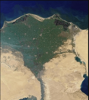
Satellite photo of the Nile Delta (From Study.com)
Large-scale heavy metal pollution, coastal erosion and seawater intrusion pose an existential threat to the Nile River Delta and endanger 60 million people (about twice the population of Texas) in Egypt who depend on its resources for every facet of life, according to new research from the USC Viterbi School of Engineering. Furthermore, the Nile River Delta is a critical stopover for migrating birds across their journey along the East African flyway.
The study, led by Essam Heggy from the USC Viterbi Innovation Fund Arid Climates and Water Research Center, published on Tuesday, March 7, in the American Geophysical Union (AGU) journal Earth’s Future.
The impact of the pollution is especially pronounced in Egypt, the most populous and arid nation downstream of the Nile, which depends entirely on the river as its only source of water for drinking and crop irrigation. The country currently faces one of the highest water budget deficits in Africa after decades of compensating for dwindling water supplies with intensive, large-scale wastewater reuse, the consequences of which have been understudied until now.
“You have roughly the combined populations of California and Florida living in a space the size of the state of New Jersey that is increasingly polluted by toxic heavy metals,” said Heggy. “Today, the civilization that thrived in a scenic waterscape for over 7,000 years must face the reality of this irreversible large-scale environmental degradation.”
For the study, researchers from the U.S. and Egypt analyzed grain size and pollution levels of eight heavy metals in samples of bottom sediment collected from two branches of the Nile River Delta. Key findings included:
Sediment at the bottom of the Nile River is highly polluted by heavy metals like cadmium, nickel, chromium, copper, lead and zinc.
Contaminants primarily come from untreated agricultural drainage and municipal and industrial wastewater. Without proper treatment of recycled water, concentrations of heavy metals increase and are permanently embedded in the riverbed unlike organic pollutants which naturally degrade over time.
Heavy metal concentrations could be exacerbated by increased damming of the Nile. Mega-dams built upstream disrupt the river’s natural flow and sediment flux and thus adversely affect its ability to flush contaminants out into the Mediterranean Sea, leaving toxins to build up in bottom sediment over time.
Much of the heavy metal contamination is irreversible, the researchers said, but science-based conservation measures suggested by the study can slow environmental degradation and hopefully recover the Nile River Delta ecosystem.
“The aggravating water stress and the rapid population growth in Egypt, reaching above 100 million, have put local authorities in a dilemma whether to provide sufficient fresh water for the thirsty agricultural sector to secure the food supply through reusing untreated agricultural drainage water or to preserve the health of the Nile River,” said Abotalib Z. Abotalib, a postdoctoral researcher at USC Viterbi and co-author of the study. “The balance is challenging, and the consequences of both choices are measurable.”
“Our study underscores the need for more research on the environmental impacts of untreated water recycling and the change in river turbidity under increased upstream damming of the Nile,” Heggy said.
“Continued research with more sampling campaigns in this area could inform future conversations and collaborations among nations of the Nile River Basin, who have a shared interest toward maintaining a healthy Nile River system.”