New scoring scale tracks the harmful effects of salt pollution in freshwater streams and rivers

The road salt that makes your drive to work easier on snowy days may be damaging the water quality in local rivers and streams long after winter is over.

A new study led by University of Maryland scientists sheds light on how salinization from winter road saltcombined with other pollutants creates “chemical cocktails” that can jeopardize the ecological balance of waterways, including those in the Washington, D.C. area. The researchers developed a new five-stage scale to track the progression of this damage, a tool that could inform public policy in the future. The study was published online March 14, 2022 in the journal Limnology and Oceanography Letters.

“We realize this is a really diverse problem that’s caused by road salt, but also other sources of salt pollution in our environment—the fertilizers we put on crops, the sewage we put out, the roads that break down,” explained the study’s lead author Sujay Kaushal, a professor in UMD’s Department of Geology and Earth System Science Interdisciplinary Center. “And it’s not just sodium chloride that’s increasing, it’s all these salt ions that are dissolved in water that contribute to salt pollution.”

Over time, many streams and rivers around the world have become saltier and more alkaline. Salt in this case refers to a wide variety of different compounds in water, which can affect drinking water supplies as well as aquatic organisms and biodiversity. It can also enhance the mobilization of pollutants including nitrates, phosphates, radionuclides and metals.

Kaushal has been studying this problem—which he and his team named Freshwater Salinization Syndrome—for nearly two decades. In this new study, they found that road salts combined with other human-made pollutants are creating conditions that periodically exceed certain regional Environmental Protection Agency (EPA) limits for aquatic life and other limits around the world for good drinking water and agriculture.

After analyzing and reviewing data from around the world, the study’s authors identified five major risk factors for Freshwater Salinization Syndrome. The research team defined stages of its progression, developing a five-tier scoring system for the salt pollution that’s making our rivers sick.

“We’ve developed this five-stage system to identify and track unhealthy progression of salinization in our rivers in much the same way we would track an illness or disease like cancer,” Kaushal said. “We have to look at this unhealthy Salinization Syndrome from a systems-level perspective if we’re going to develop guidelines for diagnosing harmful levels and treat the problem.”

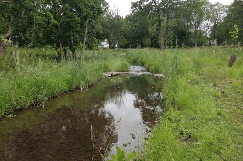
Using a combination of data spanning decades in some of the world’s major rivers and sensors that monitor electrical conductivity in streams and rivers around Washington D.C., Kaushal and his team identified major risk factors that make some waterways more susceptible to salt pollution than others.

These fundamental risk factors included climate, geology, flow paths, human activities and time. The research team then developed a five-level scorecard to track the damaging impact of Freshwater Salinization Syndrome and its water quality symptoms based on risk factors:

Stage 0: Highest water quality, minimally disturbed

Stage I: Abnormally elevated concentrations of one or more salt ions across one season

Stage II: Chronically elevated concentrations of salt ions across multiple seasons

Stage III: Formulation of harmful chemical cocktails exceeding water quality thresholds

Stage IV: Systems-level failures in infrastructure and ecosystem functions and services (drinking water and biodiversity)

Kaushal’s research team found D.C.-area waterways have salt levels exceeding water quality thresholds, scoring higher than Stage II at various times during the year.

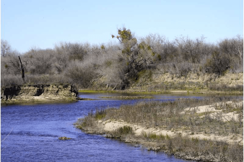
“If you look at the Potomac River, it can exceed the EPA regional aquatic life criteria for salt, and the Anacostia River can exceed the United Nations salt limit for crop growth,” Kaushal said. “Parts of the Potomac, the Anacostia and Rock Creek waterways are in Stage III on the scale for at least part of the time, depending on weather, road salt and other factors.”

Gene E. Likens, noted ecosystem ecologist from the Cary Institute of Ecosystem Studies and the University of Connecticut, indicated that this new study is an important step forward in understanding the impact on road salts on waterway ecology.

“The identification and analysis of critical state factors is a major advance in our understanding and management of Freshwater Salinization Syndrome,” he said.

The new salinization scorecard could be a useful tool in diagnosing and treating Freshwater Salinization Syndrome in waterways locally and worldwide. Armed with this type of data on salts accumulating in our waterways and new knowledge of environmental symptoms across stages, policymakers could address the issue with regulations to manage winter salt application as well as other forms of salt pollution that contribute to the freshwater salinization problem and its growing impacts on water quality.

The research paper, “Five State Factors Control Progressive Stages of Freshwater Salinization Syndrome,” Sujay S. Kaushal et. al., was published in Limnology and Oceanography Letterson March 14, 2022.


FOR MORE INFORMATION: https://phys.org/news/2022-03-scoring-scale-tracks-effects-salt.html

Starving manatees will face another rough winter next season

When manatees on Florida’s east coast gather next winter, they’re likely to face another season of starvation.

Despite efforts to reduce pollution in the Indian River Lagoon, where record numbers of manatees died in the past two years, the sea cows are unlikely to find enough seagrass to get through next winter without help. Proposals to improve water quality and protect seagrass died in the Republican-dominated state Legislature, although lawmakers did budget more money for manatee habitat restoration and rescues.

Such rescues appear likely to be needed next winter, as wildlife officials say they expect to mount another emergency feeding operation, in which they supplement the manatees’ natural diet with handouts of lettuce.

“We’re not going to solve the seagrass issue in the Indian River Lagoon over the summer,” said Tom Reinert, south regional director for the Florida Fish and Wildlife Conservation Commission. “So we’ll have to see, but it feels likely we may have to do this again.”

More than 55 tons of romaine and butter leaf lettuce were distributed to manatees near the Florida Power & Light plant in Brevard County, where manatees congregate during the cold months of winter. Unable to tolerate water temperatures below 68 degrees, manatees have learned to come to power plant discharge zones for warmth.

But when manatees concentrate in such numbers, they quickly strip the surrounding area of food, a problem worsened by the loss of vast fields of seagrass in the Indian River Lagoon, a 156-mile-long body of water enclosed by barrier islands that runs from northern Palm Beach County to Volusia County. When fertilizer chemicals such as nitrogen or phosphorus reach the lagoon, they stimulate the growth of algae that blocks sunlight, killing seagrass.

At least 420 manatees have died so far this year from all causes, although malnutrition is thought to be the biggest cause. While this number is lower than the 456 that died during the same period last year, it’s still far higher than the death rate in a normal year.

Mark Perry, executive director of the Florida Oceanographic Society, a conservation group that focuses on the state’s east coast, said water quality may be improving in parts of the lagoon.

For about a year, the lagoon has been spared discharges from Lake Okeechobee, a major source of algae-laden water. In communities around the lagoon, septic tanks are being replaced by sewer systems, reducing another source of pollution. And wetlands have been constructed that extract nutrients from water washing off farms and lawns.

But even if the lagoon’s water quality improves and it gets through the summer without another horrific episode of toxic algae, Perry said seagrass takes time to grow.

“Even if we could correct the water quality problems, get the water right for seagrass to grow,” he said. “It’s going to be a long time, a couple of years. It’s going to be slow, so we’ll still see some elevated mortality.”

Since 2009 the seagrass acreage in the lagoon has decreased by 58%. And the remaining seagrass beds have fallen sharply in productivity, with seagrass cover thinning by 89%, according to the St. Johns River Water Management District.

Water quality showed improvement this year, however, said Ashley Evitt, spokeswoman for the water management district. But while many projects are in the works to reduce incoming pollution and cleanse the lagoon, it will take years for seagrass to recover, she said.

“The district anticipates the need for several years of good water quality to see a substantial response in seagrass restoration; and unfortunately, it isn’t possible to predict water quality for next year or beyond,” she said in an email. “… It would be a fair assumption that until the amount of seagrass in the [Indian River Lagoon] increases, manatees may continue to struggle next winter.”

Three environmental groups have filed formal notice of intent to sue the Environmental Protection Agency for allowing Florida to impose what they considered to be weak water-quality standards with lax enforcement that allowed pollution to build up in the lagoon.

Jaclyn Lopez, Florida director for the Center for Biological Diversity, said Florida does little to enforce standards intended to reduce the amount of fertilizers and other pollutants washing off farms, ranches and lawns.

“We have a bunch of laws and regulations through the Clean Water Act and through Florida’s version of that that are intended to address land use in a way that there isn’t really bad runoff that just pushes all these nutrients into the water,” she said. “Those laws are not being followed and they’re not being enforced. So we have a compliance issue and we also have an enforcement issue.”

The Florida Department of Environmental Protection did not respond to a request for comment.

State Sen. Linda Stewart, D-Orlando, introduced a bill intended to improve water quality by implementing recommendations of the state’s Blue-Green Algae Task Force. These included standards for septic tanks, including inspections every five years and pump-outs of failing systems, as well as other measures to reduce pollution washing off land.

But the bill never made it through the process, with Stewart blaming a difficult legislative session in which the process was slowed by COVID and dominated by social issues that were Republican priorities.

“That would have been a big help if we could have gotten it passed,” Stewart said. “So many things that were important to people of Florida did not get through the process. We had some crazy social issues that seemed to have a higher priority.”

The budget approved by the state Legislature, which is still awaiting the signature of Gov. Ron DeSantis, includes more than $30 million for manatees, paying for expansion of rehabilitation centers, restoration of habitat and additional rescues workers.

Although a repeat of this year’s unprecedented feeding operation, which distributed more than 55 tons of lettuce to hungry manatees, appears likely, it’s not certain. Reinert, of the state wildlife commission, said experts need to analyze the current operation to see whether it was effective before deciding to set up a similar operation next winter.

Pat Rose, executive director of Save the Manatee Club, said the feeding operation needs to be improved, with lettuce offered nearer to where the majority of manatees congregate by the warm-water discharges of the power plant. He said officials need to monitor manatees’ conditions over the summer and should consider beginning the feeding program earlier, in areas where they congregate before temperatures hit bottom.

He said there’s a chance there may be more seagrass available to them next year, even if the improvement is modest.

“None of this is going to change dramatically in a year,” he said. “But we’re seeing some signs of seagrass availability. There are indications that water quality in some of the river systems is getting a little better. That may or may not stay that way.”

FOR MORE INFORMATION: https://phys.org/news/2022-03-starving-manatees-rough-winter-season.html

Team studies greenhouse gas emissions from Appalachian streams

Freshwater ecosystems can be substantial sources of greenhouse gases to the atmosphere, but it can be difficult to figure out how unique aquatic habitat arrangements and connections influence carbon cycling at different scales.

In mountain streams, carbon cycling is affected by many interwoven factors, such as precipitation and the productivity of the surrounding forest. A team of researchers from Virginia Tech studied freshwater greenhouse gas emissions in the mountains of North Carolina to try to better understand how carbon moves through connected streams and wetland networks. 

Kristen Bretz, a Ph.D. candidate, and Erin Hotchkiss, an assistant professor of biological sciences in the Virginia Tech College of Science, recently worked with three undergraduate researchers who have since graduated, on a two-year study at the U.S. Forest Service Coweeta Hydrologic Laboratory.

They found that greenhouse gas emissions from streams and wetlands at Coweeta could be highly variable, but that the presence of a vernal pool, or a small freshwater temporary wetland, in a stream corridor could increase overall emissions.

“This project was an awesome opportunity to envelop several wonderful undergraduate research efforts into the long tradition of Virginia Tech stream research at Coweeta Hydrologic Laboratory,” said Bretz.

Bretz and Hotchkiss, who are both members of the Global Change Center, an arm of the Fralin Life Sciences Institute, published their findings in the Journal of Geophysical Research: Biogeosciences.

“The coolest thing about this paper is that it shows how complex carbon emissions are at small scales—even within a single basin like Coweeta. Zooming in on a landscape can complicate the picture, but we were able to find an interesting linkage between temporary pools and stream emissions of two greenhouse gases: carbon dioxide and methane,” said Bretz.

As parcels of water move through a watershed, they pick up terrestrial materials and flow along pathways in the landscape created by erosion. The biological processes that occur in water moving into and through streams are affected by both soil properties and the arrangements of landscape features, or patches, in and near the channel.

The patches in this study included temporary (vernal) pools, hillside slopes along the streams, stream surface waters, and dry stream beds where the water flows underground.

The exciting results of this research project would not have been feasible without the help of three dedicated undergraduate researchers: Alexis Jackson, Jonathon Monroe, and Sumaiya Rahman. The three recent graduates from the Department of Biological Sciences received numerous accolades for research excellence during their time at Virginia Tech.

In 2019 and 2020, Monroe and Jackson received Undergraduate Research Grant Awards from Virginia Tech’s Global Change Center. Jackson and Rahman conducted their research that contributed to this paper while working as National Science Foundation Research Experience for Undergraduates fellows.

“Their contributions allowed us to move beyond the single-ecosystem approach typical of most research in our field,” said Hotchkiss.

Inspired by her work in the Hotchkiss lab, Jackson recently entered the University of Florida’s environmental engineering Ph.D program as a National Science Foundation Graduate Research fellow.

“The Hotchkiss lab was the foundation to my love for field workand interest in wetland biogeochemistry. Being mentored and surrounded by such skilled, supportive, and innovative women and men has made all the difference in my life and directly impacted my career choice in becoming a wetland ecologist,” said Jackson.

Monroe, now a research assistant at the Mayo Clinic Vaccine Research Group, reflects on his time in the lab. “My time in the Hotchkiss lab was incredibly important in my decision to pursue a career in research,” said Monroe. 

At Virginia Tech, Bretz and Hotchkiss will continue to address knowledge gaps about the water quality and biology of streams in creative ways that will have both local and global implications in the face of climate change.

“Our work provides a unique perspective on how the presence and arrangement of different ecosystems within a landscape control the sources and emissions of carbon gases from mountain stream corridors,” said Hotchkiss.

The study in Coweeta sets the stage for ongoing research, led by Bretz, on how carbon cycling changes as streams dry and rewet and what that means for downstream water quality and food webs.

As climate change is expected to cause longer periods of drought coupled with more intense storms, “work characterizing the variability in freshwater ecosystems will provide critical information about the consequences of those changes on freshwater carbon cycling and water quality,” said Hotchkiss.

FOR MORE INFORMATION: https://phys.org/news/2022-03-team-greenhouse-gas-emissions-appalachian.html

Critical threshold of dissolved oxygen for survival of blue mussel determined

The blue mussel Mytilus edulis, which is a common species of the family Mytilidae, is widely distributed and cultured in coastal waters. It plays an important role in the food web and carbon cycle.

However, as coastal eutrophication rapidly worsens in many regions, both the intensity and duration of hypoxic events increase tremendously, posing a great threat to blue mussels. But how hypoxic stress influences mussel survival as well as their population densitiesremains unknown. 

Recently, a research team led by Prof. Sun Song from the Institute of Oceanology of the Chinese Academy of Sciences (IOCAS) has determined the critical threshold of dissolved oxygen (DO) concentration for the survival of blue mussel through an experiment covering the DO range of 0.5–2.0 mg L-1during 16-day exposure.

They further assessed the impact of DO fluctuations and poor water quality, and analyzed the responses of metabolic rate and several key enzymes to identify possible physiological stresses. 

The study was published in Marine Environmental Research on Mar. 15.

According to the results, the critical threshold of DO for experimental mussels exposed to 16 days of hypoxia was 0.7–0.8 mg L-1, below which survival dropped drastically from nearly 80% to less than 38%. When hypoxia was combined with DO fluctuations or with poor water quality, the threshold could further rise as the mussels under combined threats suffered higher mortality than those under the single stress of hypoxia. 

In the following physiological and biochemical analysis, the researchers found that the blue mussel was an oxygen conformer that depressed its respiration rate as well as the individual’s total energy requirement when the DO concentration fell below 5–6 mg L-1.

Among all the enzymes analyzed, acid phosphatase and alkaline phosphatase were the most sensitive ones, suggesting that a compromised immune response was another important factor challenging the survival of blue mussel in addition to energy deficiency.

In general, the blue mussel has a strong tolerance against hypoxia, and a moderate hypoxia event is less likely to cause mass mortality. “However, it is worth noting that the survival rate was significantly lower when the DO was at a moderate level of 1.0 mg L-1, but the experimental conditions included a doubled population density, no water change, no water purifier, and no Ultraviolet lamp illumination,” said Li Qiao, first author of the study. “Thus, we strongly recommend that both the DO concentration and the spread of pathogens should be closely monitored in blue mussel mariculture, and that the stocking density should be relatively low under a risk of hypoxic conditions.”

“The findings will help to predict the fate of blue mussels under increased hypoxic events and provide scientific advice for mariculture management,” said Prof. Sun.

FOR MORE INFORMATION: https://phys.org/news/2022-03-critical-threshold-dissolved-oxygen-survival.html

Testing how seaweed biofilters could improve Great Barrier Reef water quality

An innovative new solution using seaweed to help improve water quality on the Great Barrier Reef is progressing to the next exciting phase of research, with on-water trials beginning next month.

Researchers will test whether native seaweed species placed in strategic locations are effective at soaking up damaging pollutants from the water.

The Australian Seaweed Institute developed the nature-based solution, which has already been recognized by the World Economic Forum as one of the top global innovations for protecting oceans.

What affects Reef water quality?

Every year thousands of metric tons of excess nutrients, such as nitrogen and phosphorous from fertilizers, run off the land and out onto the Reef. This can cause harmful algae blooms, reducing light and smothering corals.

The impacts of rising greenhouse gas emissions are also causing the water to become more acidic as the ocean absorbs higher levels of carbon dioxide—threatening the survival of coral reefs and their marine life.

How can seaweed help?

Seaweed has shown promising potential to act as an effective biofilter, controlling pollution by capturing and breaking down these harmful pollutants. Seaweed is ideal because it absorbs carbon, nitrogen and phosphorous from the water to help it grow and provides habitat for marine life.

Both functions could significantly improve the quality of water and marine biodiversity, improving conditions for the entire Reef ecosystem.

What’s been achieved so far?

In 2020 the first stage of work on seaweed biofilters, the concept design phase, identified three native seaweed species that absorb high levels of nutrients—Asparagopsis taxiformis, Sargassum spp and Gracilaria edulis. Researchers also explored the optimal methods for growing these species and carried out in-tank trials.

This work was a collaboration between the Australian Seaweed Institute and Central Queensland University. They found seaweed biofilters have the potential to remove thousands of metric tons of dissolved inorganic nitrogen—a key Reef pollutant—from the water every year.

What’s next?

Under the second stage of research, the proof of concept phase, small seaweed “bio-pods” containing the target seaweed species will be installed in a river estuarine location. These plants will be monitored to see how well they grow and how much nitrogen they absorb. Researchers will then model how the biofilters are likely to perform in various locations across the Reef.

FOR MORE INFORMATION: https://phys.org/news/2022-03-seaweed-biofilters-great-barrier-reef.html

Aquatic drone measures water quality throughout river networks with precision and speed

Measuring water quality throughout river networks with precision, speed and at lower cost than traditional methods is now possible with AquaBOT, an aquatic drone developed by Oak Ridge National Laboratory.

The maneuverable AquaBOT measures water quality indicatorssuch as nitrate, temperature and dissolved oxygen along the entire length of mid-sized streams where water quality can be variable.

“Compared to manual measurements taken in just a few locations, the drone gives a much more detailed picture of what’s happening along streams and rivers,” said ORNL’s Natalie Griffiths. “AquaBOT helps us identify hot spots where pollutants, such as excess fertilizer, are flowing into waterways. Pinpointing these areas is the first step to understanding water quality changes and developing solutions.”

Griffiths and colleagues at Drake University are using AquaBOT to study streams in Iowa croplands, evaluating potential sustainability practices with bioenergy crops. Her team is also adapting the technology to measure climate-warming methane emissions from reservoirs.

FOR MORE INFORMATION: https://phys.org/news/2022-04-aquatic-drone-quality-river-networks.html

Study links fracking, drinking water pollution, and infant health

New research documents for the first time the pollution of public water supplies caused by shale gas development, commonly known as fracking, and its negative impact of infant health. These findings call for closer environmental regulation of the industry, as levels of chemicals found in drinking water often fall below regulatory thresholds.

“In this study, we provide evidence that public drinking water quality has been compromised by shale gas development,” said Elaine Hill, Ph.D., an associate professor with the University of Rochester Departments of Public Health Sciences, Economics and Obstetrics & Gynecology. “Our findings indicate that drilling near an infant’s public water source yields poorer birth outcomes and more fracking-related contaminants in public drinking water.”

The new paper, which appears in the Journal of Health Economics, is co-authored by Hill and Lala Ma, Ph.D., with the University of Kentucky. Hill’s previous research was the first to link shale gas development to drinking water quality and has examined the association between shale gas development and reproductive health, and the subsequent impact on later educational attainment, higher risk of childhood asthma exacerbation, higher risk of heart attacks, and opioid deaths. Her research brings an important perspective to the policy discussion about fracking which has often emphasized the immediate job creation and economic benefits, without fully understanding the long-term environmental and health consequences for communities in which drilling occurs.

This new study is a complex examination of the geographic expansion of shale gas drilling in Pennsylvania from 2006 to 2015, during which more than 19,000 wells were established in the state. Hill and Ma mapped the location of each new well in relation to groundwater sources that supply public drinking water, and linked this information maternal residences served by those water systems on birth records, and U.S. Geological Service groundwater contamination measures. This data set allowed the two to pinpoint infant health outcomes—specifically preterm birth and low birth weight—before, during, and after drilling activity. Preterm birth and low birth weight are associated with a range of negative outcomes, including higher risk for developing behavioral and social-emotional problems, and learning difficulties.

Other studies have shown elevated levels of chemicals associated with fracking in surface water, however, these levels often tend to be below federal guidelines, are not monitored closely, and even if detected do not rise to levels that trigger remediation. The new study indicates that fracking-related chemicals—including dangerous volatile organic compounds—are making their way into groundwater that feeds municipal water systems, and that the potential for contamination is greatest during the pre-production period when a new well is established. With only 29 out of more than 1,100 shale gas contaminants regulated in drinking water, the results suggest that the true contamination level is higher. The study specifically finds that every new well drilled within one kilometer of a public drinking water source was associated with an 11-13 percent increase in the incidence of preterm births and low birth weight in infants exposed during gestation. 

“These findings indicate large social costs of water pollution generated by an emerging industry with little environmental regulation,” said Hill. “Our research reveals that fracking increases regulated contaminants found in drinking water, but not enough to trigger regulatory violations. This adds to a growing body of research that supports the re-evaluation of existing drinking water policies and possibly the regulation of the shale gas industry.”

FOR MORE INFORMATION:https://phys.org/news/2022-04-links-fracking-pollution-infant-health.html

California leads effort to let rivers roam, lower flood risk

Between vast almond orchards and dairy pastures in the heart of California’s farm country sits a property being redesigned to look like it did 150 years ago, before levees restricted the flow of rivers that weave across the landscape.

The 2,100 acres (1,100 hectares) at the confluence of the Tuolumne and San Joaquin rivers in the state’s Central Valley are being reverted to a floodplain. That means when heavy rains cause the rivers to go over their banks, water will run onto the land, allowing traditional ecosystems to flourish and lowering flood risk downstream.

The Dos Rios Ranch Preserve is California’s largest single floodplain restoration project, part of the nation’s broadest effort to rethink how rivers flow as climate change alters the environment. The land it covers used to be a farm, but the owners sold it to the nonprofit River Partners to use for restoring wildlife habitat.

The state wants to fund and prioritize similar projects that lower risks to homes and property while providing other benefits, like boosting habitats, improving water quality and potentially recharging depleted groundwater supplies. By notching or removing levees, swelling rivers can flow onto land that no longer needs to be kept dry.

“It’s giving new life ecologically but in a way that’s consistent with, complementary to, the human systems that have developed over the 150 years since the Gold Rush,” said Julie Rentner, president of Rivers Partners.

The Central Valley covers about 20,000 square miles (51,800 square kilometers) and is an agricultural powerhouse—more than 250 crops are grown there. The region constitutes about 1% of U.S. farmland but produces 25% of the nation’s food while accounting for one-fifth of all groundwater pumping in the U.S.

A flood in the 1860s demonstrates the potential for disaster; up to 6,000 square miles (15,500 square kilometers) of the valley were submerged. As the state’s population rapidly expanded and farming boomed through the 20th century, the government engineered vast systems to move water around to supply people and farms, and erected levees to protect cities and crops.

Some of those levees cut off rivers from their natural floodplains. As climate change causes temperatures to warm, mountain snow that typically trickles into the state’s watershed may fill rivers much faster, increasing the flows beyond what levees can take.

FOR MORE INFORMATION: https://phys.org/news/2022-04-california-rivers-room-stem.html

Nigeria’s pristine freshwater ecosystems need protection before they are lost

As human populations grow, pure freshwater systems are becoming rare around the world. Urbanization and infrastructure development have had an impact on the natural environment in African countries, as elsewhere. Many species have become extinct.

In Nigeria, various environmental pressures have jeopardized freshwater biodiversity in recent years. Undisturbed freshwater systems have become scarce, as human activity has destroyed many rivers, lakes and streams. 

Cutting down trees, using water for domestic and industrial purposes, farming on river banks, dumping garbage and washing are some of the activities that contribute to reducing freshwater biodiversity. 

Studies have found that the animals in Nigeria’s freshwater ecosystems are mostly species that indicate low or moderate water quality. In the waters studied, there are fewer species that indicate excellent water quality. Larvae of non-biting midges, soldier flies and hover flies are examples of species that indicate poor water quality. But biological indicators of excellent water quality, such as mayflies, stoneflies and caddisflies, are frequently underrepresented

My research group recently conducted an ecological study of the freshwater systems of three waterfalls in Nigeria’s remote regions. They are all far from human settlement and are situated in Nigeria’s different vegetation and geographical zones. Our findings revealed that the streams had exceptional biological water quality, which is unusual in Nigeria.

It’s important to protect these places because pristine freshwater ecosystems are becoming rarer globally.

FOR MORE INFORMATION: https://phys.org/news/2022-04-nigeria-pristine-freshwater-ecosystems-lost.html

Stream restoration trade-offs: Higher environmental benefits to be had where homeowners are less willing to pay

Although stream restoration filters pollutants out of local waterways and improves the health of the Chesapeake Bay, Baltimore area neighborhoods where it would do the most for water quality are far less willing to pay for such projects, according to a new study by a University of Maryland environmental economist and an interdisciplinary team of colleagues.

The team found that homeowners in the least densely populated, and generally wealthier areas of their study region, were less willing to pay to restore streams, while those in the most densely populated areas, which tended to have lower incomes, were more willing to pay for restoration projects.

The study, which appeared in the journal Environmental Research Letters, should help inform decision makers charged with improving water quality, who often must balance community support with environmental impacts.

“We see this strong urban-to-rural gradient where in urban areas there’s a higher economic potential as far as community support to pay for stream restoration, but less ecological potential to reduce nutrient pollution, and vice versa,” said David Newburn, an associate professor in the Department of Agricultural and Resource Economics at UMD and co-author of the study. “The overall trend is that there’s often a trade-off for environmental and economic benefits from stream restoration projects, and it’s hard to find the win-win locations.”

Stream restoration projects vary greatly with the local environment, but they are all designed to improve the ability of a stream to absorb and process nutrient pollutants and prevent them from flowing downstream. Such projects are central to improving water quality in the Chesapeake Bay and other watersheds around the world. But stream restoration can change the local landscape, sometimes removing trees or adding grassy meadows along streambanks.

Newburn and his colleagues wanted to understand the complex relationship between the environmental benefits of stream restoration and the perceived value to homeowners who frequently pay for them through taxes and fees. The team combined their analysis of one of the most comprehensive data sets on urban stream water quality in the world with a homeowner survey to estimate willingness to pay for various types of restoration projects.

The researchers leveraged long-term sampling data from the Baltimore Ecosystem Study, which has been measuring streamflow and nutrient load (a measure of ecological health of a waterway) since 1998 across fully forested, agricultural and highly developed watersheds. Using modern ecosystem modeling techniques, they estimated how much of the nitrogen would be removed by different stream restoration designs in a variety of settings.

They focused on small, headwater streams within the Baltimore region spanning urban, suburban and exurban neighborhoods, meaning neighborhoods outside of city septic systems that are dominated by single family homes on one to five acre lots. Newburn and his colleagues developed hydrologic models that showed stream restoration had the most nitrogen reduction in the less densely populated exurban areas, where small streams predominantly have low flows. Streams lined by grassy buffers had the highest nutrient reduction compared to tree-lined streams.

The researchers suggest that low water flow in these areas allowed the streams to process nutrients in the water, and grassy buffers allowed more sunlight to reach the water than did tree covered stream banks. Sunlight is important because it helps the algae in streams to remove nitrogen from the water more effectively.

The projects that had the least nitrogen pollution reduction were in the most densely populated, urban areas of Baltimore city. In these neighborhoods, urban runoff from impervious surfaces like rooftops and parking lots leads to local flooding during rainstorms, and the torrents of swift-moving water do not allow streams time to remove a substantial portion of the nutrient pollution.

Next, the researchers used homeowner survey data to analyze willingness to pay for different stream restoration designs and mapped their results throughout the study region.

“In rural areas you get this high environmental benefit, that has high potential to remove nitrogen pollution from waterways, particularly when you remove trees and have grassy streambanks to open up the streams to sunlight,” Newburn said. “But that’s where you get the lowest willingness to pay and sometimes even resistance to tree removal from nearby homeowners compared to doing restoration somewhere else.”

Trees often represent an amenity that has value because homeowners enjoy their aesthetic benefits, and removing them equates to removing this value from the neighborhood. But in densely populated urban areas, where streams were more likely to be surrounded by man-made infrastructure, the addition of grassy meadows or trees during restoration provides green-space amenities that are often lacking, particularly in lower-income urban neighborhoods.

Newburn noted that the added green space in urban areas has social benefits beyond water quality improvement that may be factored into the environmental and socio-economic analysis for decision makers. He also suggested that in the future, research on additional benefits of restoration projects such as reducing urban heat islands, restoring habitats, and quality of life benefits may reveal a greater balance that favors some projects more clearly than others.

FOR MORE INFORMATION:https://phys.org/news/2022-04-stream-trade-offs-higher-environmental-benefits.html