

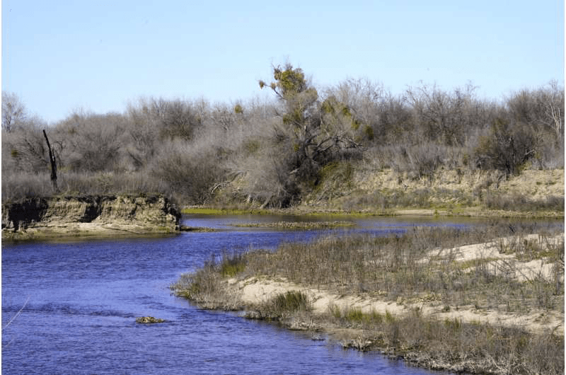
Between vast almond orchards and dairy pastures in the heart of California’s farm country sits a property being redesigned to look like it did 150 years ago, before levees restricted the flow of rivers that weave across the landscape.
The 2,100 acres (1,100 hectares) at the confluence of the Tuolumne and San Joaquin rivers in the state’s Central Valley are being reverted to a floodplain. That means when heavy rains cause the rivers to go over their banks, water will run onto the land, allowing traditional ecosystems to flourish and lowering flood risk downstream.
The Dos Rios Ranch Preserve is California’s largest single floodplain restoration project, part of the nation’s broadest effort to rethink how rivers flow as climate change alters the environment. The land it covers used to be a farm, but the owners sold it to the nonprofit River Partners to use for restoring wildlife habitat.
The state wants to fund and prioritize similar projects that lower risks to homes and property while providing other benefits, like boosting habitats, improving water quality and potentially recharging depleted groundwater supplies. By notching or removing levees, swelling rivers can flow onto land that no longer needs to be kept dry.
“It’s giving new life ecologically but in a way that’s consistent with, complementary to, the human systems that have developed over the 150 years since the Gold Rush,” said Julie Rentner, president of Rivers Partners.
The Central Valley covers about 20,000 square miles (51,800 square kilometers) and is an agricultural powerhouse—more than 250 crops are grown there. The region constitutes about 1% of U.S. farmland but produces 25% of the nation’s food while accounting for one-fifth of all groundwater pumping in the U.S.
A flood in the 1860s demonstrates the potential for disaster; up to 6,000 square miles (15,500 square kilometers) of the valley were submerged. As the state’s population rapidly expanded and farming boomed through the 20th century, the government engineered vast systems to move water around to supply people and farms, and erected levees to protect cities and crops.
Some of those levees cut off rivers from their natural floodplains. As climate change causes temperatures to warm, mountain snow that typically trickles into the state’s watershed may fill rivers much faster, increasing the flows beyond what levees can take.
FOR MORE INFORMATION: https://phys.org/news/2022-04-california-rivers-room-stem.html
