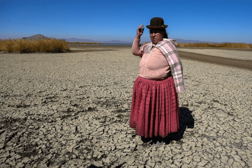
LIMA (Reuters) – The water level at Lake Titicaca on the Peru-Bolivia border is edging towards a record low, exacerbated by the weather phenomenon known as El Nino that is expected to get still more intense in coming months.
The waters of the sprawling freshwater lake nestled in the Andes mountains have fallen an average 4 inches (10 cm) per month since April, said Milagros Quispe, an engineer with Peru’s national meteorology and hydrology service Senamhi.
Severe drought conditions and unusually high temperatures have caused the shoreline to shrivel at Titicaca, South America’s largest lake and the world’s highest navigable body of water. The water level is now around 13 inches (33 cm) above its record low recorded in 1943.
The double whammy of extreme dryness and heat has led to higher-than-normal water evaporation, said Quispe. Over the past seven months, the lake’s water level has fallen 29 inches (74 cm), according to Senamhi data.
Limited rainfall in the mountainous area had not been enough to stabilize the lake’s shoreline, Quispe added.
El Nino causes major rainfall along Peru’s Pacific coast but drought conditions in its highlands.
Last month, Peru’s climate study office raised the probability that the intensity of this El Nino will be strong from December, up from a previous forecast that saw only moderate intensity.
Climate change is doubling down on the impacts from the natural El Nino phenomenon — layering heat on top of heat, or excess rainfall on top of excess rainfall.
That includes Titicaca. “The lake’s basin and ecosystem have been modified as a result of global warming,” said Quispe.
The water for a community along Louisiana’s Gulf coast has seen a significant increase in the levels of contaminants known as disinfection byproducts, according to recent state water tests reviewed by the Guardian. According to the Environmental Protection Agency (EPA), long-term exposure to such substances poses an increased risk of cancer.
The findings have emerged as many residents along Louisiana’s southern coast have faced saltwater intrusion from the Gulf of Mexico.
Since early summer, the combination of drought and rising sea levels has helped drag salty water from the ocean up the Mississippi River. The high levels of saltwater have made much of the region’s water undrinkable. But public health experts have also voiced worries that the saltwater intrusion could, over time, corrode the region’s ageing water infrastructure, leach heavy metals into the drinking water and create other knock-on problems.
Recent state testing in the lower Plaquemines parish has shown a spike in two groups of compounds that result from the water disinfection process.The EPA has stated that long-term exposure to these groups of chemicals carries an increased risk of cancer.
Experts who spoke to the Guardian called the jump startling.
“Good Lord,” said Dr Susan Richardson, a chemistry professor at the University of South Carolina who reviewed the findings. “These levels are crazy.”
In most ofthe country, household tap water has been treated with solutions that kill off bacteria and viruses. This treatment process creates disinfection byproducts, which in small quantities are harmless. However, when seawater enters a water treatment plant, it requires much more disinfecting. And the byproducts formed by disinfecting seawater are especially toxic.
The Port Sulphur water district has had high levels oftwo groups ofdisinfection byproducts – trihalomethanes (THMs) and haloacetic acids (HAA5s) – since 2021. Both groups ofsubstances have been linked to cancer by the EPA.
In August, the water district released a public notice acknowledging that total THM levels were above the EPA standard of 80 parts per billion (ppb); testing from earlier this year detected total THM levels at 135ppb and 128ppb, according to the notice.
However, the release states that neither the Louisiana state health department nor the EPA “consider this violation to have any serious adverse health effects on human health as a result of short-term exposure”. “This is not an emergency,” the notice reads. “If it had been, you would have been notified immediately.”But a test by the state health department on 5 September found that the total THMs within the Port Sulphur water district, which serves 9,000 people, had jumped far more – to 761ppb, or almost 10 times the maximum amount allowed by EPA regulations. Richardson said they were the highest readings she had seen in her career.
That same day, testing at a second sampling site in the Port Sulphur water district detected 676ppb of total THMs. Two weeks later, on 18 September, moretesting showed similarly high levels at both sampling sites. In one test, HAA5 levels had climbedto 149ppb.
All tests showed particularly high levels of one toxigenic THM, bromoform, which is created by disinfecting bromide, a compound which naturally occurs in seawater. Richardson said the bromoform levels were more than 100 times what is typical for drinking water, and described this as “super disturbing”. The EPA classifies bromoform as a probable human carcinogen.
In response to a request for comment, Jeff DiMarco, director of public service in Plaquemines parish, saidthat the parish’s water was safe for drinking and bathing. Asked about elevated levels of THMs, DiMarco said he was not concerned. However, the state department of health confirmed it had initiated increased monitoring of disinfection byproducts.
In an interview with the Guardian earlier this month over the risks of saltwater intrusion, the Plaquemines parish president, Keith Hinkley, insisted the water was safe to drink.
Experts agreed that the most recent spike in disinfection byproducts was probably triggered by the saltwater intrusion.
“What’s really most likely driving this is the bromide concentration in the seawater,” said Treavor Boyer, a water systems engineer at Arizona State University who has conducted experiments simulating seawater intrusion from the Gulf of Mexico. Bromide levels are low in freshwater, but naturally abundant in both seawater and seaweed.
Richardson, whose research focuses on disinfection byproducts in drinking water, was so taken aback by the test results that she double-checked to ensure the numbers were not missing a decimal place.
Boyer said water test results in Port Sulphur are just what he’d expect from seawater entering a water system. And according to Boyer, the parish’s temporary solution – blending in fresh river water to mix with the seawater – “is creating some very ideal conditions” for increased levels of disinfection byproducts.
‘I would not be drinking that water’
Disinfection byproducts in drinking water are regulated by the EPA to ensure levels stay low. Long-term exposure has been linked to cancer and reproductive effects in lab animals.skip past newsletter promotion
THMs as a group “have been most consistently linked to increased risk of bladder cancer”, said Dr Rena Jones of the National Cancer Institute.One study attributed 5% of all bladder cancers in the European Union to THMs. There is also limited evidence to suggest THMs and HAA5s increase risk for colorectal, breast and uterine cancers, said Jones.
There are also some indications that high THM levels can be harmful in the short term. Jones noted that “research studies in laboratory animals have shown some associations between high-level, short-term exposure to some [disinfection byproducts] and damage to the liver, kidneys and nervous system.”
While such research is limited, Richardson said simply: “I would not be drinking that water right now.”
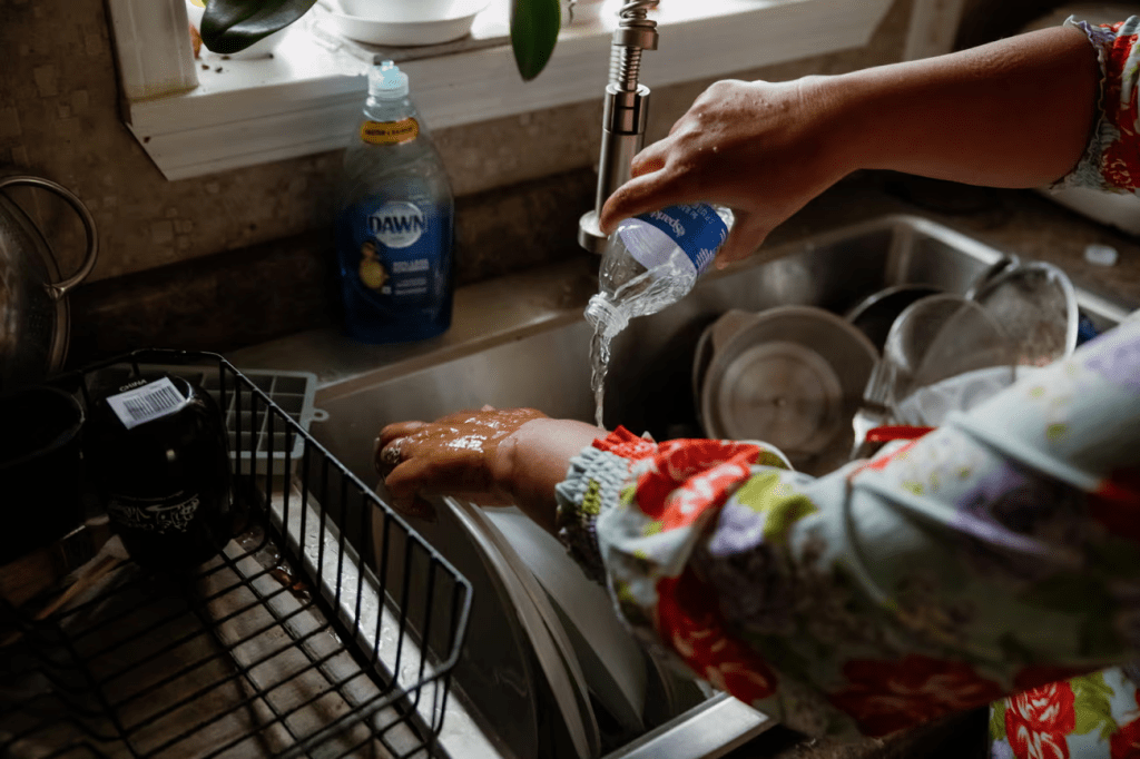
Many residents of the Port Sulphur district have indeed not been drinking the tap water since June due to its saltiness – but THMs are also readily absorbed through skin, and inhaled as steam during warm showers. By some estimates,exposure from just a 10-minute shower is roughly equivalent to drinking 2.5 liters (0.66 gallons) of water.
Erik Olson, an advocate with the Natural Resources Defense Council, called the state test results “very concerning”.
A chemical smell
Disinfection byproducts can be lowered by reducing the amount of organic matter in the water – such as by installing a carbon filter or reverse osmosis machine. The Port Sulphur water treatment plant recently received reverse osmosis and microfiltration machinery. Lab results for the Port Sulphur water cleaned by reverse osmosis are not yet available.
In the meantime, several residents reported a lack of information about the water issues.
“I haven’t ever heard about that,” said resident Katie Mazarac, when asked about the continuously elevated levels of disinfection byproducts.
Residents here have voiced concerns about their water for months. Mazarac has been so concerned about the water since spring that she has conducted at-home water tests and brought her child to a pediatrician to be checked for heavy metals.
All through the summer, residents were alarmed by the water’s condition. “At times, our water would smell like sewage,” said Catherine Vodopija, who was born and raised in lower Plaquemines. “It would bleach our clothes. It would come out foggy and have fumes coming out of the glass … It smelt chemical, like gas and diesel. It was petrifying.”
Public notices of elevated THMs have appeared in Plaquemines’ only local newspaper each quarter, as required by the state. Notices were also mailed to residents’ homes.
But the notice was in English, and lower Plaquemines parish has a large population of Vietnamese immigrants who work on shrimp boats. Sandy Nguyen of Coastal Communities Consulting, which works on language access for coastal fishers, estimates that about 15% of adults in lower Plaquemines do not speak fluent English. Plaquemines is also home to Indigenous members of the United Houma Nation and the Grand Bayou Indian Village.
The region comprises one of the country’s largest seafood ports, and thousands of boats moor here, bringing in shrimp, redfish and oysters.
Long Ly is a Vietnamese immigrant whose English is limited. Since 1997, she has run the shrimp dock on Tiger Pass Road – one of the testing locations where a jump in total THM levels was detected last month.
When asked about her water, Ly said she wasn’t worried. She then swiftly cupped her hands and drank from a tap by the dock’s edge.
“It’s OK,” she said, shaking her hands dry. “A little salt.”
The Environment Agency has slashed its water-use inspections by almost a half over the past five years, it can be revealed.
Environment Agency (EA) officers visited people and businesses with licences to abstract, or take, water from rivers and aquifers 4,539 times in 2018-19, but this dropped to 2,303 inspections in 2022-23, according to data obtained by the Guardian and Watershed Investigations.
The fall in inspections comes despite England facing a possible water deficit of 4bn litres a day by 2050 unless action is taken, and predictions that the summer flows of some rivers could dwindle by 80% in that time.
“Obviously, this is highly beneficial to water companies and agriculture, and incredibly detrimental to water resources and therefore the environment,” an EA insider told the Guardian and Watershed on condition of anonymity. Last year, the Guardian reported that the EA did not have a strong grasp on the total volumes taken from rivers and groundwater.
The agency has also introduced desk-based inspections, which the insider described as meaningless. “They are a substitute for field inspections, and given an officer needs to check meters or records, or on-site behaviours, they are useless except for ticking a key performance indicator box.” The EA says it only uses desk inspections to assess compliance of low-risk abstraction and impounding licences.
“By reducing inspections you reduce the ability to detect illegal activity and gather evidence against,” the insider said. “Desk-based inspections are solely reliant on the word of the operator, so, for example, if an operator tells an Environment Agency officer he hasn’t abstracted any water, then the officer records that as fact. If it is an illegal operator, they are unlikely to hand themselves in. These methods provide a smokescreen of numbers that suggest correct regulation is being carried out should anyone try to audit it, when in reality the regulation is meaningless.”
Figures obtained by the Guardian and Watershed Investigations show that the biggest drop in inspections was in the Kent, south London and East Sussex area, where inspections fell 67% – from 450 to 148 between 2018-19 and 2022-23. This was followed by Greater Manchester, Merseyside and Cheshire, where the number of inspections dropped from 139 to 47. In East Anglia, 824 abstraction inspections fell to 318, and in the Lincolnshire and Northamptonshire area they dropped from 173 to just 67.
However, an EA spokesperson said the insider’s interpretation of the drop in numbers was misleading because “inspection figures alone are not the only way of assessing whether those who take water from the environment are complying with their licences – satellite data, irrigation patrols, river gauges, groundwater level and ecological monitoring systems are increasingly used. This allows us to target activity to where and when the risks are highest and the environment is most vulnerable.”
Despite the total funding for the agency’s water, land and biodiversity area business group having risen by £73m, from £221m in 2015-16 to £294m in 2021-22, staff costs for roles in land and water management, groundwater, contaminated land and environmental monitoring fell by £2.6m (9%) over the past three years.
“The Environment Agency leadership have received vast increases in money to tackle the issue, but this has been deliberately moved away from the frontline,” said the insider. “This means they must not view protecting water supplies as a priority and that the money could be better spent elsewhere.”
The EA spokesperson said the regulator was “recruiting and training more staff to carry out water resources compliance work and … also strengthening the way we regulate to drive better performance from the water industry, with additional specialist officers and new data tools to provide better intelligence”.
Public water supply and rivers are at risk from intensifying droughts driven by the climate crisis. The chair of the EA, Alan Lovell, said about 4bn extra litres of water would be needed every day by 2050 if significant action were not prioritised, and the Centre for Ecology and Hydrology has predicted that some rivers could lose up to 80% of their flows in summer by 2050.
Meanwhile, water sector leaks remain high, with the Environment Agency putting the volumes of water lost at 2.3bn litres a day last year.
A spokesperson for Water UK said water companies were “acutely aware of the environmental impact of abstraction and are proposing to stop half a billion litres’ worth of abstractions from rivers by 2030. Companies also have ambitious plans to cut leakage, which has come down every year since 2020, by a quarter by the end of the decade. To ensure the security of our water supply in the future, water companies are planning to build up to 10 new reservoirs as well as looking at alternative supplies of water including water recycling and desalination.”
Richard Benwell, the CEO of Wildlife and Countryside Link, said: “A long-term funding drought for the Environment Agency has left it under-resourced for the water challenges ahead. Recent funding rises don’t offset the years of underinvestment in the agency.
“This drop-off in post-Covid inspections is highly worrying and runs the risk of failures going under the radar. Desk-based and industry self-assessments simply aren’t up to the task, as we’ve seen with the sewage pollution crisis.”
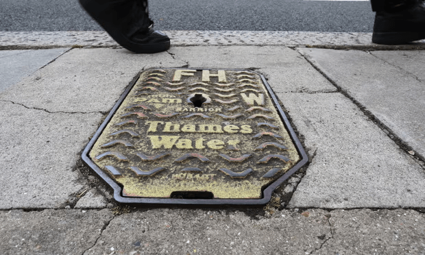
Thousands of people have been left without water after Storm Ciarán caused problems at a treatment works in Surrey, Thames Water has said.
A major incident was declared as at least 13,500 homes in Guildford, Godalming and the surrounding areas were left without water or with low pressure by 2.50pm on Sunday, while a further 6,500 were expected to lose supply later in the day.
Thames Water said in a statement: “We’re really sorry about the continuing water supply problems in GU1, GU2, GU3, GU5, GU6, GU7 and GU8. This follows issues caused by Storm Ciarán at Shalford water treatment works.”
The company added: “Our engineers remain on site, working hard to get things back to normal. We’re also using tankers to pump water into our supply network. We know how worrying and inconvenient this is and thank you for your patience.”
Jeremy Hunt, the chancellor and MP for South West Surrey, said in a social media post that he was “very concerned” about the situation and would talk to a Thames Water executive.
Surrey county council (SCC) told those affected to head to water stations set up by Thames Water at the crown court in Godalming but they were reportedly faced with long queues, the PA news agency reported. Bottled water stations were also set up at Artington park and ride in Guildford.
After speaking to Alastair Cochran, Thames Water’s interim co-chief executive and chief financial officer, Hunt posted a message on X, formerly Twitter, which said the company was “resetting and reprogramming” the control system.
He added: “If successful they will be able to restore supply to affected customers. Artington now open for water supply so that should relieve congestion.“Good that SCC have now declared this a major incident. Next question is what the impact will be on schools tomorrow if it is not resolved. Also getting messages from pubs that have lost trade from closing on a busy day – big, big impact on many people.”
He later tweeted that Thames Water was “tankering water to ensure that they can support hospitals and bottled water stations remain open”.
Hunt tweeted later on Sunday that Thames Water was hoping to bring Shalford treatment works back online, as they had identified the cause of the problem, adding: “They have significantly reduced water turbidity and are hopeful that the alarms will not trip once it has gone through.”
Tanya Plibersek has written to the Tasmanian government to flag she may reconsider the future of decade-old salmon farms in Macquarie Harbour due to concern about their impact on a critically endangered species.
It follows scientific warnings the salmon industry is having a “catastrophic” impact on the Maugean skate, an ancient fish thought to be found only in the vast harbour on the state’s west coast.
The federal threatened species scientific committee reported in September that “substantial recent evidence indicates a high risk of extinction for the species in the near future”, and recommended urgent action including reducing the amount of salmon to improve dissolved oxygen levels before summer.
In the letter to the Tasmanian premier, Jeremy Rockliff, on Monday, the environment minister said evidence considered by a skate recovery team had found better regulation and monitoring of “lower salmon farming industry loads” would be an important step in protecting the species.
“This last remaining population is under enormous pressure due to the low oxygen levels and poor water quality in the harbour,” the environment minister said in the letter, seen by Guardian Australia. “Urgent action must be taken to change this. Failure to do so will have implications for the long-term viability of important regional industries and jobs, especially in tourism and aquaculture
Plibersek said environment officials were examining three requests – from the Australia Institute, the Bob Brown Foundation and the Environmental Defenders’ Office – for a “reconsideration” of whether the salmon industry had the approvals it needed to operate in Macquarie Harbour. If the requests were found to have legal validity it would trigger “a broad consultation” with the state government, the salmon industry, its workers, their union and the community.
“If the reconsideration finds that the salmon industry in Macquarie Harbour does not have the necessary environmental approvals, [national environment law] would require operations to pause while approvals are sought,” Plibersek said.
“But I will look at any action I can take, consistent with my legal obligations… to support the Tasmanian government regulator, and the salmon farming industry, to put their operations on a truly sustainable footing.”
A decision to reconsider the approval of farms owned by Tassal, Petuna and Huon Aquaculture would likely spark a fierce response from the industry, and be opposed by it supporters in the Liberal state government and Labor opposition.
Writing in the Mercury last month, Luke Martin, the chief executive of the lobby group Salmon Tasmania, said: “Let’s be clear, this industry will not concede one single fish or one single job, and we caution environment minister Tanya Plibersek from being captive to loud green groups as she considers the future of the skate.”
Martin said salmon farming was one of several industries that operated in the harbour, and the scale of the industry had been reduced in 2017 without dissolved oxygen levels improving.
Studies have found the skate’s numbers have fallen due to the impact of salmon farms, hydro power stations altering upstream river flows, gillnet fishing and rising harbour temperatures due to the climate crisis.
The number of surviving Maugean skate is not clear, but an interim monitoring report estimated the population had slumped by 47% between 2014 and 2021. Scientists from the University of Tasmania said the species could be one extreme weather event from extinction.
Eloise Carr, Tasmanian director of the Australia Institute, said Plibersek’s letter showed the federal government was “taking the impacts of salmon farming on water quality seriously”. She said the industry and state government were trying to pressure the minister “to ignore the evidence”.
The federal and state governments each recently announced $2.1m funding to set up a captive breeding program to create a skate “insurance population”. The state government did not respond to a request for comment.
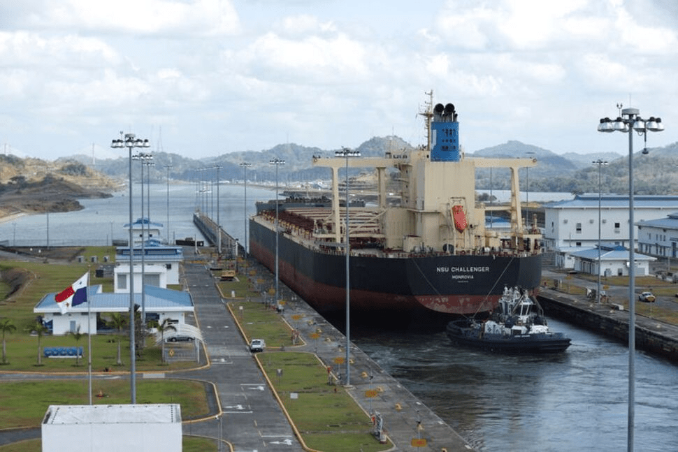
PANAMA CITY (Reuters) -The Panama Canal, one of the world’s main maritime trade routes, will further reduce daily ship crossings in the coming months due to a severe drought, the authorities managing the canal said late on Monday, increasing shipping costs.
Booking slots will be cut to 25 per day starting Nov. 3 from an already reduced 31 per day, the Panama Canal Authority (ACP) said in a client advisory, and will be gradually reduced further over the next three months to 18 slots from Feb. 1.
In recent months, the ACP has imposed various passage restrictions to conserve scarce water, including cutting vessel draft and daily passage authorizations.
Water levels in Gatun Lake, the rainfall-fed principal reservoir that floats ships through the Panama Canal’s lock system, have “continued to decline to unprecedented levels for this time of year,” the ACP said.
“The recorded precipitation for October has been the lowest on record since 1950 (41% below), and so far, 2023 ranks as the second driest year for the same period,” the authority said.
A naturally occurring El Nino climate pattern associated with warmer-than-usual water in the central and eastern tropical Pacific Ocean is contributing to Panama’s drought.
The late arrival of this year’s rains and the lack of precipitation in the Canal watershed had forced the canal authority to reduce average daily transit capacity slightly to 32 vessels per day since July 30.
The existing restrictions have resulted in long delays, with tens of vessels waiting to transit the canal.
An analyst note from the U.S. Energy Information Administration stressed that delays at the canal “have pushed shipping rates higher elsewhere by decreasing the globally available number of vessels.”
It also said delays for some gas transporters were at record highs in Panama, pushing up the cost of shipping liquefied gas from the U.S.
By Helmholtz Centre for Ocean Research Kiel (GEOMAR)
The explosion of the underwater volcano Kolumbo in the Aegean Sea in 1650 triggered a destructive tsunami that was described by historical eye witnesses. A group of researchers led by Dr Jens Karstens from the GEOMAR Helmholtz Centre for Ocean Research Kiel has now surveyed Kolumbo’s underwater crater with modern imaging technology and reconstructed the historical events. They found that the eyewitness accounts of the natural disaster can only be described by a combination of a landslide followed by an explosive eruption. Their findings are published today in the journal Nature Communications.
From the Greek island of Santorini, the eruption had been visible for several weeks. In the late summer of 1650, people reported that the colour of the water had changed and the water was boiling. About seven kilometres north-east of Santorini, an underwater volcano had risen from the sea and began ejecting glowing rocks. Fire and lightning could be seen, and plumes of smoke darkened the sky. Then the water suddenly receded, only to surge towards the coastline moments later, battering it with waves up to 20 metres high. A huge bang was heard more than 100 kilometres away, pumice and ash fell on the surrounding islands, and a deadly cloud of poisonous gas claimed several lives.
“We know these details of the historic eruption of Kolumbo because there are contemporary reports that were compiled and published by a French volcanologist in the 19th century,” says Dr Jens Karstens, marine geophysicist at GEOMAR Helmholtz Centre for Ocean Research Kiel. But how did these devastating events come about? To find out, he and his German and Greek colleagues went to the Greek Aegean Sea in 2019 to study the volcanic crater with special technology. Karstens: “We wanted to understand how the tsunami came about at that time and why the volcano exploded so violently.”
On board the now decommissioned research vessel POSEIDON, the team used 3D seismic methods to create a three-dimensional image of the crater, which is now 18 metres below the water’s surface. Dr Gareth Crutchley, co-author of the study: “This allows us to look inside the volcano.” Not only did the 3D imaging show that the crater was 2.5 kilometres in diameter and 500 metres deep, suggesting a truly massive explosion, the seismic profiles also revealed that one flank of the cone had been severely deformed. Crutchley: “This part of the volcano has certainly slipped.” The researchers then took a detective’s approach, comparing the various mechanisms that could have caused the tsunami with the historical eyewitness accounts. They concluded that only a combination of a landslide followed by a volcanic explosion could explain the tsunami. Their findings are published today in the journal Nature Communications.
By combining 3D seismics with computer simulations, the researchers were able to reconstruct how high the waves would have been if they had been generated by the explosion alone. Karstens: “According to this, waves of six metres would have been expected at one particular location, but we know from the reports of eyewitnesses that they were 20 metres high there.” Furthermore, the sea is said to have first receded at another point, but in the computer simulation a wave crest reaches the coast first. Thus, the explosion alone cannot explain the tsunami event. However, when the landslide was included in the simulations, the data agreed with historical observations.
Jens Karstens explains: “Kolumbo consists partly of pumice with very steep slopes. It is not very stable. During the eruption, which had been going on for several weeks, lava was continuously ejected. Underneath, in the magma chamber, which contained a lot of gas, there was enormous pressure. When one of the volcano’s flanks slipped, the effect was like uncorking a bottle of champagne: the sudden release of pressure allowed the gas in the magma system to expand, resulting in a huge explosion.” Something similar could have happened during the 2022 eruption of the Hunga Tonga undersea volcano, whose volcanic crater has a similar shape to Kolumbo’s.
The study thus provides valuable information for the development of monitoring programmes for active submarine volcanic activity, such as SANTORY, which is led by co-author Prof. Dr Paraskevi Nomikou of the National and Kapodistrian University of Athens (NKUA). “We hope to be able to use our results to develop new approaches to monitor volcanic unrest,” says Jens Karstens, “maybe even an early warning system, collecting data in real time. That would be my dream.”
About 3D Marine Reflection Seismics
3D seismics is a geophysical technique that exploits the fact that sound waves are partially reflected at the boundaries of layers. This makes it possible to create cross-sectional profiles of geological structures beneath the seabed. Unlike 2D reflection seismics, marine 3D reflection seismics uses multiple measuring cables (housing receivers) towed in parallel behind the research vessel. The result is a three-dimensional image, known as a seismic volume, which allows us to look beneath the seafloor and analyse the geology in detail.
Researchers have discovered a protein that seals plant roots to regulate the uptake of nutrients and water from the soil, the discovery could help develop climate proof crops that require less water and chemical fertilizers.
Researchers from the University of Nottingham identified new components of the lignin barrier in plant roots and the specific function of dirigent proteins (DPs), located in the root endodermis that control water and nutrient uptake. Their findings have been published today in Science Direct.
Plant roots function by absorbing mineral nutrients and water from the soil and also controlling their proper balance in the plant. This control is exerted by a specialised layer of root tissue called the endodermis.
The endodermis contains a barrier to the movement of solutes and water that is made of lignin, the same material present in wood. This impermeable barrier blocks the uncontrolled movement of material into the root, by forming a tight seal between cells. This seal ensures the only pathway for nutrients and water to be taken up by roots is through the cells of the endodermis. This allows full cellular control over what enters and leaves the plant via the roots.
This research has identified new components of the lignin deposition machinery that focus on the function of dirigent proteins (DPs), located in the root endodermis. These proteins act in coordination with other described root regulatory components to direct and organize the correct deposition of lignin in the endodermis allowing the plant to ensure it receives the optimum balance of nutrients from the soil.
Dr Gabriel Castrillo from the University of Nottingham’s School of Biosciences one of the leaders of the research, said: “With record temperatures being reached in parts of the world this year and erratic rainfall it is ever more important to understand the mechanisms of plants so we can future proof them to secure future food supplies. This research shows how plant roots regulate their uptake of water and nutrients through the deposition of lignin, which is regulated by DPs. Without these proteins, proper root sealing is not completed and the nutrient balance in the plant is compromised. We can use this knowledge to engineer plants to be able to grow with less water and chemical fertilizers.”
PFAS, a family of highly fluorinated substances, represent a danger for humans and the environment. Particularly problematic members of this family, such as perfluorooctane sulfonate (PFOS) and perfluorooctanoic acid (PFOA) appear to cause organ damage and cancer, as well as disrupting the endocrine system. In the journal Angewandte Chemie, researchers have now introduced a new method for an economical, easy-to-use fluorescence sensor for sensitive on-site testing for PFAS in water samples.
The term per- and polyfluoroalkyl substances (PFAS) refers to a group of organic compounds in which most or all the hydrogen atoms bound to the carbon atoms have been replaced with fluorine atoms. They are used to provide water-, oil-, and dirt-resistance to a variety of products, such as nonstick pans, outdoor clothing, and packaging. They may also be found in fire-suppressing foam, paint, and car polish. These compounds are highly useful — and highly dangerous when they find their way into the environment: they do not break down and thus become concentrated in plants, animals, and people.
Limits of 100 ng/l for individual specific PFAS substances and 500 ng/l for the total of all PFAS were set for drinking water in the EU. In Germany, water providers must begin testing drinking water for PFAS in 2026. The US Environmental Protection Agency has set stricter limits: for the most widespread PFAS (PFOS and PFOA), the upper limit is set at 4nm/l for each substance.
The usual method used to detect such trace amounts involves chromatography and mass spectrometry, is time-consuming and expensive, and requires complex equipment and experienced personnel. Timothy M. Swager and Alberto Concellón at the Massachusetts Institute of Technology (MIT) in Cambridge, USA, have now introduced a technique for making a portable, inexpensive test that uses fluorescence measurements to easily and selectively detect PFAS in water samples.
The test is based on a polymer — in the form of a thin film or nanoparticles — with fluorinated sidechains that have fluorinated dye molecules (squaraine derivatives) embedded in them. The special polymer backbone (poly-phenylene ethynylene) absorbs violet light and transfers the light energy to the dye by an electron exchange (Dexter mechanism). The dye then fluoresces red. If PFAS are present in the sample, they enter the polymer and displace the dye molecules by a fraction of a nanometer. This is enough to stop the electron exchange and thus the energy transfer. The dye’s red fluorescence is “switched off,” while the blue fluorescence of the polymer is “switched on.” The degree of fluorescence change is proportional to the concentration of PFAS.
This new technique, which has a detection limit in the µg/l range for PFOA and PFOS is suitable for on-site detection in highly contaminated regions. Detection of trace amounts of these contaminants in drinking water can be achieved with sufficient precision after pre-concentration of the samples by solid-phase extraction.
What is the value of a river? Or a healthy wetland that purifies water, impedes floods, and traps carbon?
High Cost of Cheap Water, a provocative report commissioned by the conservation heavyweight WWF, attempts to answer that question in dollars. The conclusion: freshwater ecosystems have an economic use value of $58 trillion, or roughly 60 percent of global GDP.
The staggering figure accounts for direct uses (the water used by households, farms, and industries) and services provided indirectly (flood protection, water storage, animal habitat), which are seven times more valuable than direct uses.
Stuart Orr, freshwater practice leader for WWF, spoke with Circle of Blue about the implications of putting water in economic terms.
“When we have those valuations it allows you to have a conversation about the values and benefits that people derive from these systems,” Orr said. “I hope that leads us to better outcomes. It’s sometimes unfortunate that we have to put everything in dollar terms, but that’s where we are in trying to convince people this is the right thing to do.”
The global economic system as it is currently structured does a poor job of valuing water, Orr said. The report calls this error a form of “water blindness.”
Water blindness is “pervasive,” Orr said, even among organizations working on intimately connected topics like climate and food. “It is the biome and the resource that is forgotten. That’s why we came out with a big number. It’s also the resource that has no economic signals to send to anybody that we’re doing the wrong things and we may need to reconsider how we are using water.”
After nearly three decades in water conservation, Orr lamented the lack of progress. “I’m not seeing the kind of action and movement I would have hoped or would have thought by now.”
Will a more complete evaluation of the value of water, one couched in business-friendly GDP terms, drive home the message?
“We have to do whatever it takes to shake people out of this lethargy around water,” he said.