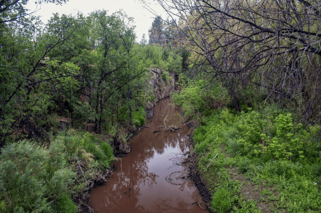
As Brazil’s drought continues, the Amazon River has fallen to its lowest level since records began in 1902.
UNESCO has approved a $5 billion dam downstream from Victoria Falls for both Zambia and Zimbabwe.
Along Kenya’s Lake Victoria shores, flooding attributed to climate change has contributed to water-related disease and destroyed villages.
Melting glaciers have been a boon for Peruvian farming communities in need of water now — but insecurities in the long-term are a major concern.
In Gaza, an ongoing shortage of water supplies, cut off by Israeli forces, have reached a breaking point.
“We need to truck fuel into Gaza now. Fuel is the only way for people to have safe drinking water. If not, people will start dying of severe dehydration … Water is now the last remaining lifeline.” — United Nations statement.
Prior to the latest escalation of violence between Israel and Palestine, daily water consumption in Gaza was less than the World Health Organization’s recommendation, Reuters reports. It was just 83.1 liters per capita, compared to WHO’s recommended 100 liters.
Today, severe water shortages have become “a matter of life and death,” and in a majority of schools, “clean water has actually run out,” according to the UN.
Gaza has few options for receiving potable water. Their only natural source is the Coastal Aquifer Basin, which is polluted and unreplenished. More than 96 percent “of household water from the aquifer is undrinkable,” according to Reuters.
Gaza’s three major desalination plants have had their power cut off by Israeli authorities, leaving residents to drink saltwater or dig wells where groundwater is polluted with sewage. Over the weekend, a deal brokered between U.S. President Joe Biden and Israeli Prime Minister Benjamin Netanyahu was said to have renewed a supply of water from Israel to Palestine’s Gaza Strip. But according to Hamas, this has not taken place.
Gaza still needs fuel, currently withheld by Israel, to restart and re-power desalination plants.
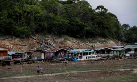
The Negro and Amazon rivers meet in Brazil’s port of Manaus, a city of 2 million people located in the country’s northwest region. At this spot the Amazon’s water level is now the lowest ever recorded, Reuters reports.
“We have gone three months without rain here in our community,” Pedro Mendonca, a rainforest villager, told Reuters. “It is much hotter than past droughts.” In some areas of the Amazon, communities are experiencing their worst drought in more than 40 years.
The state of Amazonas’ civil defense agency has said that 481,000 people — those who rely on the river for transportation, resources, fishing, and “access to food and medicine” — have been affected so far by the drought, attributed in the region to the El Niño climate pattern. The effects of such weather are expected to last until at least December, according to state scientists.
Water shortages have additionally strained water quality. Two weeks ago, the deaths of more than 100 river dolphins in the Amazon were attributed to drought and hot water. As the lack of precipitation persists, children are falling ill with diarrhea, fevers, and vomiting.
This Week’s Top Water Stories, Told In Numbers
12
The number of villages in Kenya near the shores of Lake Victoria that were submerged after an unexpected surge of water flooded the lake’s banks, destroying communities and leaving many children orphaned, in 2019, Mongabay reports. Experts have attributed the flooding to climate change, unpredictable amounts of rainfall, and a “lack of vegetation to control runoff.” In the years since the flooding, makeshift communities have become a breeding ground for diseases related to poor water and sanitation. Many children have been forced to become the heads of their families. Meanwhile, experts warn that unprecedented flooding will persist as a climate-related crisis into the future.
51
Percent of Peru’s glaciers lost to climate change over the past 50 years, the country’s National Water Authority reports. This high-altitude melting, however, has created immediate opportunities for valley farming communities. They have been using the melt to grow water-intensive crops including strawberries and sugar-snap peas, The Guardian reports. Hotter temperatures and drought across Peru’s Cordillera Blanca region had put agricultural livelihoods at risk — if not for glacial melt and the freshwater reservoirs the phenomenon created, agribusiness would have been unsustainable. But when the communities look up into the Andes peaks, they see little snow. And by the year 2111, Peru’s Ministry of Agriculture and Irrigation predicts, the last snow could disappear. When that happens, residents are unsure where their water will come from.
On the Radar
UNESCO has granted permission for a $5 billion hydroelectric dam to be built downstream from Victoria Falls, a UNESCO World Heritage Site and where Zambia and Zimbabwe are separated by the Zambezi River, Business Insider reports.
The countries had been pushing for the dam’s approval as a way to make money and limit domestic power outages, though they remain apart on issues such as construction cost.
Environmental activists have been pushing back on the project, saying that the complex will harm the waterfall and river health, but UNESCO was satisfied with the proposed dam’s design. According to Business Insider, “the project is built as a run-of-river project, which means there would be little water storage behind the turbines, limiting the impact on Victoria Falls.”
More Water News
Marimo: The population of marimo, “popular pet water plants” and filamentous algae found only in the world’s coldest lakes, is decreasing on a global scale, researchers at Kobe University have found, Science Daily reports.
Massacre River: The river, which forms the natural border between the Dominican Republic and Haiti and is an important channel for trade and commerce, has been shut down since September as the two countries continue to spar politically over usage, construction, and treaty rights, U.S. News and World Report reports.
LAS VEGAS, New Mexico — The largest fire in New Mexico history began with a disastrous government agency blunder. Its consequences for land and a small northern New Mexico city’s water were magnified by man-made climate change.
In the first week of April 2022, the U.S. Forest Service was setting a controlled burn in Santa Fe National Forest near the rocky promontory of Hermit’s Peak. A tool to thin overgrown forests, prescribed fires are intended to reduce the risk of hundred-thousand-acre megafires that have recently incinerated the American West.
Fanned by shifting winds blowing across dry timber, the deliberately ignited flames jumped containment lines. Then a dormant fire in nearby Calf Canyon reignited and merged with the blaze beneath Hermit’s Peak. Combined, the fire grew into an uncontrolled juggernaut that burned 341,735 acres of public and private land over four months.
But the collision between government error and climate change that produced a colossal fire disaster in the forests of northern New Mexico didn’t end once the flames were extinguished. The fire was a prelude to a water supply emergency that the city of Las Vegas still reckons with.
The fire burned the upper reaches of the Gallinas River watershed, the drinking water source for more than 17,000 people in and around Las Vegas. The fire had plenty of fuel — the watershed hadn’t had a major burn in more than a century. Ash and sediment flushed into the river from the bald slopes of the burn scar are undeniable threats to the city’s water treatment system.
By the end of August 2022, amid heavy monsoon rains, Las Vegas had a full-blown menace: a deteriorating river and just 21 days of water remaining in storage.
The trials of Las Vegas in the last year and a half are a sharp illustration of climate vulnerability in the American West, the domino effect of climate disasters, and the cost to taxpayers of repairing the damage. Similar cautionary tales dot the region’s map. Fires in recent years have destroyed water systems in Superior, Colorado; Detroit, Oregon; Malden, Washington; and in the California locales of Paradise, Santa Rosa, and the San Lorenzo Valley.
The risk of high-severity fire is growing due to decades of fire suppression combined with a warming planet. A fuels buildup is being conditioned to burn. As the number of burned acres trends upwards, the U.S. Forest Service expects one-third of western U.S. watersheds to experience a doubling of post-fire sediment flows in rivers by mid-century. Towns downstream of flammable terrain are a lightning strike or undoused campfire away from being unable to provide reliable water service.
The seat of San Miguel County, Las Vegas is one of the poorest municipalities in one of the country’s poorest states. The city’s poverty rate is more than 30 percent. The Hermit’s Peak/Calf Canyon fire so damaged the Gallinas watershed – charring the soil and increasing the sediment load in streams – that the drinking water treatment system cannot keep up. It must be replaced.
Unable to afford such a large expense on its own, Las Vegas turned to Congress. Lawmakers were willing to open the public purse due to the federal government’s role in causing the disaster. The Hermit’s Peak/Calf Canyon Fire Assistance Act was included in a short-term budget extension that President Biden signed on September 30, 2022. It offered $2.5 billion to compensate property owners for fire damage. The final 2023 budget bill added $1.45 billion to the pot, bringing the total federal assistance for injuries and property losses to $3.95 billion. That includes $140 million to replace water treatment facilities damaged by the fire.
Las Vegas intends a complete overhaul: a new water treatment plant, equipment to remove sediment from river water before it enters the treatment facility, and a system to purify wastewater to reuse as drinking water. Full build-out might take seven years, but when all the pieces are in place it will be the largest capital project in the city’s history.
“It’s huge,” Mayor Louie Trujillo told Circle of Blue about the federal assistance. “We could have never done it. We don’t have the budget.”
A Chaotic Period
As soon as the fire started, Maria Gilvarry knew that her city’s water supply was in jeopardy.
“The watershed is our water system,” Gilvarry, the Las Vegas Utilities Department director, told Circle of Blue. “So the more of the watershed that burns, the more that impacts our ability to treat and provide water.”
Even as the forests above Las Vegas smoldered, monsoon rains pummeled the burn scar last summer, delivering huge slugs of soil and debris into the Gallinas River. “It was just day after day of brown and black water,” Gilvarry recalled. The sediment load was too thick for the 1970s-era treatment facility. Two of the city’s three reservoirs were incapacitated by the muck.
Forests are on the frontlines of climate disasters. Hotter temperatures are a hair dryer pointed at mountain slopes that bristle with dense stands of trees and understory growth.
Because forests provide a disproportionately large share of the nation’s drinking water, what happens in the woods doesn’t stay in the woods. Though forests are water sources in eastern ranges like the Appalachians and Catskills, the water-forest-fire relationship is especially acute in the drying American West.
According to U.S. Forest Service research, national forests in the western states account for just 19 percent of the land area. But they contribute 46 percent of the surface water supply.
Amanda Hohner, an assistant professor at Montana State University, has spent a decade studying the effect of wildfire on municipal water systems. She says the places most vulnerable to wildfire contamination of drinking water sources share several characteristics. They are small systems with a single, surface water source — usually a river or lake. Who fits that description? The city of Las Vegas, for one.
Las Vegas has a backup groundwater well for emergencies. But Gilvarry said that mechanical problems kept it offline last summer. When the fire started, the Gallinas River was the only option.
It was a chaotic, high-stress period. Evacuated from her property, Gilvarry was running the utility department while staying in a trailer on a co-worker’s property. Her husband volunteered to fight the fire.
The utility crew shifted to round-the-clock operations at the water treatment plant, watching nervously as the fire approached — but never overran — the facility.
“Young staff members could look out and see flames,” Gilvarry said. “And, you know, they wanted to go home with their families at night. So part of my job was to counsel them and keep them safe, while also keeping water flowing for the community. And they did it — those employees were awesome.”
After the fire threat subsided, the task did not get easier. The Army Corps of Engineers installed 10-foot-tall steel Geobrugg netting across side canyons to catch large trees and boulders. The U.S. Geological Survey ramped up its stream monitoring. Straw-filled wattles, rock-filled gabions, berms, and barricades were deployed to prevent ash and sediment from entering the Gallinas. And yet it was not enough. Monsoon rains were severe, and sediment spiked.
Trujillo and Gilvarry said that Las Vegas made it through the emergency period by focusing on conservation until a temporary state-funded sediment removal system could be installed at Storrie Lake, one of the storage reservoirs. Water department staff talked with restaurants and laundries. They asked car washes to voluntarily shut down. They identified pipe leaks and sealed them. Water was brought in via truck and bottle. Trujillo made frequent appearances on radio, in town hall meetings, at the senior center, at the community college.
“The citizens were ready to help us and they did,” Trujillo said.
‘A Marathon, Not a Sprint’
High-intensity fires do more than scorch trees and destroy homes. They upend the ecological function of entire watersheds. Burned forests become riddled with impairments. Shorn of trees, the land sheds more water than before. Though more water flows downstream, the costs of megafire outweigh this benefit. Without the forest buffer, floods are more destructive and more common. The land erodes easily. More nutrients are flushed downstream.
For these reasons, the conservation groups American Rivers named the Gallinas one of the country’s most endangered rivers for 2023.
“The recovery of wildfire can be a little bit different from other natural disasters, in that the impacts can be cascading,” explained Madelene McDonald, a water scientist with Denver’s drinking water utility, which has also contended with the ripple effects of wildfires. “They’re not necessarily all at once, but it’s those repetitive storm events that can cause the greatest impact.”
It happens again and again in the western states. Nitrogen levels in Colorado streams spiked immediately after the 2002 Hayman fire and remained elevated for more than a decade. Nitrogen is a plant vitamin that feeds lake-befouling algal blooms. And that’s not the only contaminant. Carbon, organic matter, heavy metals, and sediment — all accumulate in post-fire streams.
These chemical and physical changes to land and water are impairments that Gilvarry and her staff will face for years. More organic matter in the river can interfere with drinking water treatment. Disinfection chemicals like chlorine can produce toxic byproducts when too much carbon is in the source water. Sediment also clogs reservoirs and reduces water storage capacity.
The risks for Las Vegas were not unknown. The 1994 Gallinas River Watershed Plan, a joint effort with the city, U.S. Forest Service, and Tierra y Montes Soil and Water Conservation District, noted the need to reduce the fuel load in the watershed. The Viveash fire, in year 2000, burned mostly in the adjacent Cow Creek drainage. But some 820 acres of high-intensity fire did creep into the Gallinas watershed.
“A fire of Viveash’s magnitude occurring completely in the Gallinas Watershed would be disastrous for those who depend on Las Vegas’ water quality,” according to a March 2006 environmental assessment of prescribed fire that was prepared by the Santa Fe National Forest. That is exactly what happened with Hermit’s Peak/Calf Canyon.
Though the summer of 2022 was a nightmare, the summer of 2023, in terms of water quality, was much better. Monsoon rains were a trickle, not a flood. Sediment levels have been manageable. All three reservoirs are functioning again.
A bright spot for Gilvarry is that Las Vegas itself did not burn. That means there are no contaminants to flush from drinking water pipes. Cities in California, Colorado, and Oregon had to deal with benzene and other volatile chemicals in their water distribution systems after fires burned within city limits.
Denver’s experience with wildfire is a template for Las Vegas’s future. Both the Hayman fire and the 1996 Buffalo Creek fire burned the watersheds above Strontia Springs reservoir, a storage facility through which 80 percent of Denver’s drinking water passes. Denver Water is still planting trees in the burn scar. Even today, more than two decades after the fires, McDonald sees sediment levels in the reservoir climb after heavy rain.
“Recovery really is a marathon and not a sprint,” McDonald said.
How can communities like Las Vegas better prepare for the race? McDonald is part of the Wildland Fire Mitigation and Management Commission, a group of more than 50 national and regional fire experts tasked by Congress to recommend policy solutions to the wildfire crisis.
In September the commission submitted its report. Among its many recommendations are five specific to drinking water. In essence, they focus on prevention and response. Before a fire, utilities need to map their vulnerabilities and reduce fire risk in their watersheds by thinning and incorporating low-intensity burns. Risk assessments could identify utilities in need of water infrastructure upgrades – those like Las Vegas that have a sole surface water source or do not have the equipment to handle higher sediment levels. Portland, Oregon, for instance, is building a $1.48 billion water filtration plant, scheduled for completion in 2027, that will filter sediment from post-wildfire erosion in its forested Bull Run watershed.
Congress also has a role, the commission argues. Lawmakers could authorize grant funding for these assessments and amend existing forest restoration programs so that they explicitly target funds to areas with critical sources of drinking water, even though those areas may be far from where people live. Lawmakers could expand the timeline for disaster-relief funding, acknowledging that fire can harm water quality for years.
Gilvarry points to funding as a major obstacle to protecting water for smaller, low-income areas. Even if they are aware of the risks, can they bear the adaptation costs? “For the community to have built a top-of-the-line system ten, twenty, thirty, forty years ago to plan for this would have been multi-million dollars, but it would have come from the residents here,” Gilvarry said. “And I don’t think the residents could have afforded that.”
There are targeted research approaches, too. The Wildfire and Water Security project is investigating how drinking water systems can become more resilient to wildfire. Led by the U.S. Forest Service’s Pacific Northwest Research Station along with academic partners at Montana State, Oregon State, and Washington State, the initiative is considering water treatment options, water quality after fires, and the economic implications of fire damage and risk-reduction costs.
At the state level, the Colorado Water Conservation Board assessed the vulnerability of drinking water infrastructure in the state to wildfire damage. Called Wildfire Ready Watersheds, the program is intended to enable community-level preparation before a fire.
Critical to the effort is the U.S. Forest Service. Armed with $3.5 billion from the two-year-old Infrastructure Investment and Jobs Act to prepare communities for wildfire, the land management agency has adopted a “fireshed” approach in responding to the wildfire crisis. Firesheds are forest and rangeland units of roughly 250,000 acres that, if wildfire erupted, could damage homes, watersheds, water supplies, utility lines, and other critical infrastructure.
The U.S. Forest Service did not make any staff available for an interview. “The agency collaborates in the development and implementation of source water protection plans,” the press office wrote to Circle of Blue in an email. “In many places, we have agreements with local municipalities on how activities in the municipal watershed will be carried out to ensure the drinking water supply is protected; some of these agreements go back decades.”
A year after being pushed to the brink, Las Vegas residents celebrated the return of the People’s Faire, a community arts festival held on August 26 that had been absent for three years due to Covid and the fire.
Food and crafts vendors lined the sun-dappled lawn in front of the Monticello-inspired Carnegie Library, while children plotted their moves on a giant chess board.
Trujillo, in sunglasses and a stylish floral shirt, acted as unofficial host, greeting nearly everyone who passed by. For a moment, on a warm late-summer day, the water emergency was a memory and all was right in Las Vegas.
“It’s nice that we have all this,” an older woman told him.
Her friend, who was shopping for Christmas presents, agreed. “When I lived in Oregon, we didn’t have the parades,” she said. “We didn’t have all this stuff that we have here. So it is nice. This little town does a lot.”
CHICAGO (Reuters) – Low water levels on the lower Mississippi River are likely to persist through at least January despite expected above-normal precipitation across the southern United States this winter, forecasters with the National Oceanic Atmospheric Administration (NOAA) said on Thursday.
The severe to exceptional drought choking the lower Mississippi River valley is expected to improve this winter as the El Nino weather pattern brings better rains to the region, NOAA said in its U.S. winter weather outlook.
But lingering drought in the upper Midwest and forecasts for normal to below-normal precipitation across basins that supply tributaries like the Illinois and Ohio rivers could slow the Mississippi River’s recovery.
Low water has slowed export-bound barge shipments of grain from the Midwest farm belt for a second straight year during the busy fall harvest season, making U.S. exports of corn and soybeans less competitive in the world market.
“We are expecting improving drought conditions for the lower to middle Mississippi Valley during the next few months. But for the hydrological impacts such as low river levels and low ground water levels, that will be a little slower to recover,” said Brad Pugh, operational drought lead with NOAA’s Climate Prediction Center.
“The hydrological impacts could linger beyond the end of January,” he said.
The Mississippi River fell to an all-time low on Monday at the Memphis, Tennessee, river gauge, eclipsing the previous low water record set nearly a year ago, according to National Weather Service data.
Shallow river conditions prompted barge shippers to restrict the amount of grain they haul to avoid getting stuck in the drought-parched waterway.
Still, areas of the lower Mississippi River have been closed to navigation at times over the past several weeks following vessel groundings or as U.S. Army Corps of Engineers crews dredged low spots to deepen the channel.
The port in Manaus, the region’s most populous city located where the Negro river meets the Amazon river, recorded a water level of 13.59 meters (44.6ft) on Monday, according to its website. That is the lowest level since records began in 1902, passing a previous all-time low set in 2010.
After months without rain, Pedro Mendonça, an Amazon rainforest villager, was relieved when a Brazilian NGO delivered supplies to his riverside community near Manaus late last week.
“We have gone three months without rain here in our community,” said Mendonça, who lives in Santa Helena do Inglês, west of Manaus, the capital of Amazonas state. “It is much hotter than past droughts.”
Some areas of the Amazon have seen the lowest rain levels from July to September since 1980, according to the Brazilian government disaster alert center Cemaden.
Brazil’s science ministry blames the drought on this year’s onset of the climate phenomenon El Niño, which is driving extreme weather patterns globally. In a statement earlier this month, the ministry said it expected the drought will last until at least December, when El Niño’s effects are forecast to peak.
The drought has affected 481,000 people as of Monday, according to the civil defense agency in the state of Amazonas, where Manaus is located.
Late last week, workers from the Brazilian NGO Fundação Amazônia Sustentáve (FAS) fanned out across the parched region near Manaus to deliver food and other supplies to vulnerable village communities. The drought has threatened their access to food, drinking water and medicines, which are usually transported by river.
Nelson Mendonça, a leader in Santa Helena do Inglês, said although some areas were still reachable by canoe, many boats had not been able to travel on the river to bring supplies, and goods were being transported by tractors or on foot.
“It’s not very good for us, because we’re practically isolated,” he said.
Luciana Valentin, who also lives in Santa Helena do Inglês, said she was concerned about the cleanliness of the local water supply after the drought reduced water levels.
“Our children are getting diarrhea, vomiting, and often having fever because of the water,” she said.
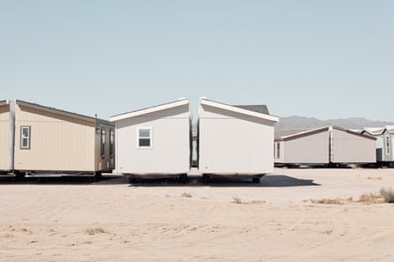
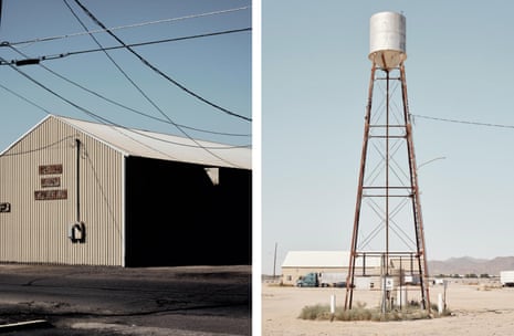
Arizona, stressed by years of drought, has declared its house-building boom will have to be curbed due to a lack of water, but one of its fastest-growing cities is refusing to give up its relentless march into the desert – even if it requires constructing a pipeline that would bring water across the border from Mexico.
The population of Buckeye, located 35 miles west of Phoenix, has doubled over the past decade to just under 120,000 and it is now priming itself to become one of the largest cities in the US west. The city’s boundaries are vast – covering an area stretching out into the Sonoran desert that would encompass two New York Cities – and so are its ambitions.
Buckeye expects to one day contain as many as 1.5 million people, rivaling or even surpassing Phoenix – the sixth largest city in the US, which uses roughly 2bn gallons of water a day – by furthering the tendrils of suburbia, with its neat lawns, snaking roads and large homes, into the baking desert.
Arizona’s challenging water situation appears to be a major barrier to such hopes, however. In June, the state announced that new uses of its groundwater have essentially hit a limit, placing restrictions on house building, just a few months after the state lost a fifth of its water allocation from the ailing Colorado River.
There isn’t enough water beneath Buckeye to support homes not already being built, Arizona’s water department has said. But the city is embarking upon an extraordinary scramble to find water from other sources – by recycling it, purchasing it or importing it – to maintain the sort of hurtling growth that continues to propel the US west even in an era of climate crisis.
“Personally, my view is that we are still full steam ahead,” said Eric Orsborn, Buckeye’s ebullient mayor. Orsborn said he understands the state has to be “really careful” with water resources but that the city is exploring “options to keep us going and allow us to continue to grow at the rate that we want to grow”.
Some of the grander options are ambitious to the point of appearing outlandish, such as a plan to bring desalinated seawater from Mexico to Arizona via a lengthy, uphill pipeline. Arizona may, instead, pipe in water from the west, in California, or from 1,000 miles east, from the Missouri River. Buckeye has already shown it is prepared to spend big to achieve its dreams – in January the city council agreed to spend $80m for a single acre of nearby land, an area smaller than a football pitch, just to secure its attached water rights.
Buckeye’s mayor, Eric Orsborn: ‘What we need to figure out is what’s that next crazy idea that’s out there.’ Photograph: Adam Riding/The Guardian
“We’ll be as big or larger than Phoenix, ultimately – we don’t have to have all that water solved today,” Orsborn said in city hall, which itself may have to be upsized to deal with Buckeye’s growth. On his office wall is a map of the vast expanse of untouched desert that sits within the city’s voluminous territory.
“What we need to figure out is what’s that next crazy idea that’s out there,” said the mayor, who also owns a construction company. “We’re just hustling to get to that point, to keep things moving along.”
Perhaps the most “crazy” of the ideas is the one that would involve building a desalination plant in the Mexican town of Puerto Peñasco, perched on the edge of the Gulf of California, to suck up seawater and then send the treated water in a pipeline several hundred miles north to Arizona. Much of the pipeline’s proposed route is uphill and will traverse an international border, a federally protected area famed for its cactus and several small towns.
A new housing development in northern Buckeye. Photograph: Adam Riding/The Guardian
Environmentalists have already criticized the plan for its potential ecological impact upon both land and sea – the salty brine left over would be dumped back into the Gulf of California, altering its composition and potentially harming its marine life. The odds may be against the pipeline, given the cost and opposition. But IDE, the Israeli company that proposed the $5bn plan, has said the pipeline would be “transformative” for Arizona, provide enough water for the entire state and “secure Arizona’s future growth”.
Arizona’sWater Infrastructure Finance Authority (or Wifa), the agency tasked with implementing a new inflow of water to the state, is assessing the Mexico idea, as well as other options. Chuck Podolak, the director of the agency, has his own office map that helps him envision other possible stupendous infrastructure undertakings, such as a pipeline running from another desalination plant, in California, or a pipeline that could bring water from the distant Missouri River to the thirsty desert.
“Those are big, audacious ideas, but I don’t think any are off the table,” said Podolak. “We’re going to seek the wild ideas and fund the good ones.”
Podolak acknowledged that any pipeline from Mexico will face numerous hurdles – Wifa has been in touch with lawmakers in Mexico, some of whom are unfavorable to the idea – but insisted Arizona will continue to push for a new, leviathan project to make up its water shortfall.
“I just want to see multiple projects and figure out the best one for us. If we want to have that long-term security, we do need a new bucket, so to speak, a new source of supply outside of the state. This is a fantastic place to live,” he said.
Podolak points out such big ideas are in keeping with previous monumental, and seemingly impossible, projects. “We dammed up the Colorado River and built the Hoover Dam, we have an artificial river that runs from Lake Havasu to Tucson uphill 300 miles – it’s called the Central Arizona Project,” he said.
“All these things seemed audacious, but now they’re part of the landscape. We’ve been doing it for 100 years.”
Such grandiose plans are being mulled because Arizona faces pressures like never before. The state has been in the teeth of a drought, spurred by global heating, that is the worst the US south-west has seen in approximately 1,200 years. About a third of the state’s water supply comes from the Colorado River, which has shrunk as temperatures have risen. Last year, under a mechanism where Arizona shares water with other states, its allotment of Colorado River water was cut by 21%.
Arizona’s other major water source – from underground aquifers, sucked up by wells – has become depleted in some parts of the state and, in the rapidly growing areas on the fringes of Phoenix, has been entirely laid claim to by developers who have to show under law that there is a reliable 100-year supply of water before erecting new homes on the cheap desert land.
In June, in a sobering dose of reality, the state declared there was not enough water for all current planned construction in the Phoenix region – amounting to a 4% shortfall over the next century – and that all future housing developments will have to find some other source of water. Already approved projects, and new housing within Phoenix itself, could still continue, the state stressed. “We are not out of water and we will not be running out of water,” said Katie Hobbs, Arizona’s governor.
While the decision won’t halt Arizona’s growth – which has been fueled by relatively cheap housing, fine weather and fresh jobs brought by firms such as Intel and newcomer battery manufacturers – some see the end of an era in which sprawling homes, swimming pools, lawns and water-intensive crops could endlessly unfurl into the desert.
“It’s a clear sign that this sprawl was never sustainable and that there is just no more groundwater left to do that,” said Christopher Kuzdas, the senior water program manager at Environmental Defense Fund who argues Arizona should better conserve its own groundwater before turning to new pipelines.
“We are at a real crossroads as to how Arizona grows,” he said. “There just aren’t many easy options left when it comes to water.”
A downtown Buckeye restaurant. Photograph: Adam Riding/The Guardian
For Buckeye, the conversion of farmland to new housing will subsume existing irrigation rights – agriculture takes up more than 70% of Arizona’s water, after all, with Hobbs recently removing state land from being used to grow alfalfa, a particularly thirsty, and controversial, crop in order to protect what she called the state’s “water future”.
Beyond that, as the city expands into untouched desert, there is water recycling, where wastewater is treated and reused, or perhaps a raising of the dam on the nearby Verde River to collect more water. Any new water pipeline from further away will take many years, and billions of dollars, if it happens at all. Orsborn insists the city will find a way.
“I’m not saying it’s not going to be a challenge, but it’s not going to break that growth,” said the mayor. “For thousands of years, water’s been moved from one point to another point. We just have to continue to do that.”
Driving around Buckeye – there isn’t really any other option to get around – can feel rather disjointed. The city’s downtown is somewhat threadbare but then at the periphery there is a frenzy of building activity, with rows of new beige and cream-colored houses with piles of roof slates being put in place, swarms of machinery preparing dusty tracts of ground, flags fluttering with legends such as “new homes” and “now selling”.
A new housing development at Copper Falls by New Home Co. Photograph: Adam Riding/The Guardian
Drive a further 30 minutes north into the desert, a mix of scrubland dotted with saguaro cacti and two starkly beautiful mountain outcrops, you’re somehow still in Buckeye and work is underway to conjure up a massive new development called Teravalis – meaning “land of the valley” – that calls itself a “city of the future” that will eventually house 300,000 people and various businesses.
“We are effectively building a small city,” said Heath Melton, the president of the Phoenix region for the developer, the Howard Hughes Corporation. Teravalis will reclaim water and be cautious with its use of turf and irrigation, according to Melton. “We want to enrich people’s lives and be good stewards of the environment,” he said. “Buckeye is very bullish on its growth and it’s good for them to be bullish.”
For the optimists, Arizona’s past is instructive. The state has found spectacular fixes to secure the water that has catapulted its growth and is getting better at saving it – somehow Arizona uses less water than it did in the 1950s despite now having 500% more people.
Downtown Buckeye. Photograph: Adam Riding/The Guardian
But past conditions bear a dwindling resemblance to Arizona’s future. This summer was, globally, probably the hottest that humans have ever experienced. In Phoenix, there were a record 31 consecutive days above 100F (37C) and the seasonal monsoon season was the driest since 1895. It will only get hotter and drier. Arizona may be able to move the sea from Mexico, but somehow out-engineering the climate crisis in the longer term will be an even more grueling feat.
“I think Buckeye has some real challenges and the degree of their success will depend on the degree to which people are willing to pay for those more expensive solutions,” said Kathryn Sorensen, an expert in water policy at Arizona State University.
“But it’s absolutely feasible,” she adds. “We pave over rivers, we build sea walls, we drain swamps, we destroy wetlands, we import water supplies where they never would have otherwise gone. Humans always do outlandish things, it’s what we do.”
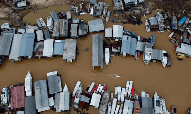
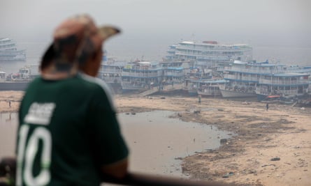
A withering drought has turned the Amazonian capital of Manaus into a climate dystopia with the second worst air quality in the world and rivers at the lowest levels in 121 years.
The city of 1 million people, which is surrounded by a forest of trees, normally basks under blue skies. Tourists take pleasure boats to the nearby meeting of the Negro and Amazon (known locally as the Solimões) rivers, where dolphins can often be seen enjoying what are usually the most abundant freshwater resources in the world.
But an unusually dry season, worsened by an El Niño and human-driven global heating, has threatened the city’s self-image, the wellbeing of its residents and the survival prospects for the entire Amazon basin.
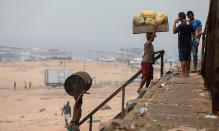
The forest capital has been enveloped in a murky brown haze reminiscent of China during its most polluted phase. The usually vibrant port has been pushed far out across the dried-up, rubbish-strewn mud flats.
Last week air-quality monitors registered 387 micrograms of pollution a cubic metre, as a result of smoke haze from fires in the Amazon rainforest. Photograph: Michael Dantas/AFP/Getty Images
So many fires are burning in the surrounding tinder-dry forest that air-quality monitors last week registered 387 micrograms of pollution a cubic metre, compared with 122 in Brazil’s economic capital of São Paulo. The only city in the world that measured worse was an industrial centre of Thailand.
A recent front page of the A Crítica newspaper showed a photograph of the drought-stricken port under the headline “Health in peril” and a story about the challenges of securing medicines and essential resources at a time when goods ships could not navigate the river. “Boiling Amazon” read the lead story of Cenarium magazine, which noted the unusually high heat and low humidity that have created dangerously dry conditions in the forest.
The drought has affected swathes of Brazil. The state of Amazonas has recorded 2,770 fires during the current dry season, which local media said was the highest recorded.
Although more droughts and fires than usual were to be expected in El Niño years such as this, local firefighting services were ill-prepared and ill-equipped.
The secretary of Borba town, said: “If municipalities had even the minimum structure in place, we could have avoided many problems.”
Jane Crespo, the environmental secretary of Maués, a community 155 miles (250km) from Manaus, said: “Some municipalities don’t have enough water to put out the fires.”
Floating houses and boats stranded at the Marina do Davi, a docking area of the Negro river, in Manaus. Photograph: Michael Dantas/AFP/Getty Images
Rivers are the only means of access in many parts of the Amazon. As their levels have fallen, some communities have been cut off, raising concerns of a humanitarian disaster. Elsewhere, navigation is only possible by small boats, which make transport more expensive. At Tabatinga, Benjamin Constant and Atalaia do Norte, people complain that goods are becoming more expensive.
Factory production has also been hit by the lack of supplies, threatening the economy of Manaus and its reputation as a free-trade zone. Amazonas state authorities have called an emergency meeting to discuss the regional climate crisis and appealed to the federal government for assistance.
Road industry lobbyists are using the crisis to push demands for a new paved road – the controversial BR 319 – that would link Manaus to Porto Velho. Amazon conservationists warn this would be a disaster for one of the last remaining areas of globally important and intact forest.
The impact on other species is likely to be devastating. As well as the mass deaths of endangered river dolphins, countless other species are likely to be experiencing mortalities. The Manaus-based mycologist Noemia Ishikawa said she had noticed an almost total absence of mushrooms in the fields.
Rio Negro port is blanketed in smoke haze from fires in the Amazon rainforest. Photograph: Michael Dantas/AFP/Getty Images
Philip Fearnside, a senior researcher at the National Institute for Amazonian Research, warned the rainforest was moving closer to a point of irreversible decline as dry seasons lengthen, along with more days of extreme heat and no rain.
Adding to the risks is a growing human population that is converting more forest into pasture, which is regularly burned. Fearnside said: “All of the tree deaths from these processes can contribute to initiating a vicious cycle, where the dead wood left in the forest serves as fuels for forest fires, which are both more likely to start and spread and are more intense and damaging if they occur.
“Repeated fires can destroy the forest entirely. In addition to tipping points in terms of temperature and dry-season length, there is also a tipping point from the loss of forest beyond a certain limit, which is also believed to be near at hand.”
Brief periods of upriver rain in recent days have raised hopes the dry season may be drawing to an end, but meteorologists say it is too soon to predict that with any confidence. However, climate trends make it almost certain that this drought will not be a record for long.
Welsh Water has admitted to spilling untreated sewage near a rare dolphin habitat for at least a decade.
A BBC investigation found the water company had been illegally discharging untreated wastewater at dozens of sewage plants, often for years at a time.
The organisation has promised to tackle the problems after viewing the analysis, which it did not dispute.
Water companies across England and Wales frequently discharge sewage into rivers and seas. In England, sewage was spilled via storm overflows more than 300,000 times last year.
Peter Hammond, a former UCL professor who campaigns for Windrush Against Sewage, collated the data, which shows Welsh Water was discharging sewage before it reached its stipulated overflow level, which means it should have been treating it, but was not. He asked the Welsh Rivers Trust, as well as local anglers, for suggestions for outflows to look at.
Sewage systems overflow during periods of heavy rain, and companies are allowed to discharge when they reach a certain level to prevent waste backing up into homes, but not before.
The data, from 11 Welsh sewage plants, found that 10 released untreated waste before their stipulated overflow level had been reached. The worst-performing plant was Cardigan, which spilled for more than 200 days a year from 2019-22, and it almost never treated the sewage it was supposed to. The treatment plant spills into the Teifi estuary, where there is one of Europe’s largest populations of bottlenose dolphins. Welsh Water said in response that the nearby Poppit Sands beach had water rated “excellent”.
Hammond told the Guardian the dumping of sewage in the rare dolphin habitat “really upset me”. He added: “There are dolphins only in two places regularly in Wales and Scotland. And they’re dumping on one of them.”
This pattern is repeated in England. Earlier this year the high court heard that in 2022 52% of the raw sewage discharges from the 14,000 storm overflows that were monitored spilled more than 10 times. Eleven per cent discharged raw sewage more than 60 times. As such they had been in breach of the law – the urban wastewater (England and Wales) regulations 1994. The environmental watchdog in England recently declared that ministers might have broken the law over sewage dumping.
Welsh Water told the BBC it has between 40 and 50 wastewater treatment plants currently operating in breach of their permits, and that decisions on improvements were taken with customer bills in mind.
A spokesperson added: “Regarding Cardigan works specifically, we had already identified the issue there being linked to saltwater entering the works, which impacts the treatment process. We reported this to Natural Resources Wales (NRW) and agreed to undertake investment to improve the situation.” They are now investing a further £20m to ensure compliance with their discharge permit, and have disclosed the issues to NRW.
Hammond responded: “In the case of Cardigan, it’s been known for 10 years. And obviously, Welsh Water have not got to grips with it. You know, they say they’ve tried various solutions, but nothing’s worked.”
He said he believes they installed their current system in 2004 and have known about the problems for at least 10 years. “So you would have thought that by now, they would have put the money in.”
Huwel Manley, NRW’s head of operations for south-west Wales, told the BBC: “We have prosecuted Welsh Water on a number of instances for pollution events, just not for low flow spills as is the case here.
“But we are working with trying to set national guidance along with England so that we have a more standardised approach as to how and when we take that prosecution route.”
A Welsh Water spokesperson said: “We have over 5,000 environmental permits as Wales has some of the largest numbers of treatment works, pumping stations and storm overflows in the UK. We are continually monitoring and when we find issues, we share this data with regulators, investigate and deliver improvements. We are investing around £1m a day in improving our services.
“We always aim to resolve any issues as quickly as possible, to limit any impact for both the environment and our customers.”
Experts have cast doubt on groundwater studies that underpin the Northern Territory government’s decision to permit fracking in the Beetaloo basin, after methane bubbles were observed at hot springs in an area targeted for gas production.
In a new report, commissioned by the Environment Centre NT (ECNT), the scientists warn of “critical knowledge gaps” in baseline groundwater assessments conducted by the government in response to the Pepper inquiry into fracking.
Ninety percent of the territory’s water supply comes from groundwater while the territory’s hot springs support ecosystems and Indigenous cultural values.
“Our analysis shows that there are significant and critical gaps in the knowledge base underpinning fracking approvals in the Northern Territory,” said Matt Currell, a professor of environmental engineering at Griffith University and lead author of the report commissioned by the ECNT.
“This means that, at present, it is not possible to properly assess the risk of contamination and over-extraction of Northern Territory water due to fracking.
“Further studies are required to fill these knowledge gaps. To proceed on the current evidence base would be unwise, and may risk valuable aquifers, rivers and springs.”
Of particular concern, the authors found the government had failed to properly determine where the groundwater that flows to important springs comes from. They said the baseline studies lacked clear data on potential connectivity between shallow and deeper aquifers.
The authors said the government had also failed to develop a thorough profile of water quality throughout the groundwater systems. This would help establish whether there was a risk that saline water found at deeper levels, for example, could contaminate freshwater at shallow levels.
Currell also pointed to studies at hot springs on Tanumbirini station – an area targeted by gas companies.
“The discovery of methane bubbling to the surface at hot springs is particularly concerning, as it suggests connections between the shale gas layer to be targeted for fracking and surface water,” he said.
“This could become a pathway for contamination of water relied upon by communities in the Northern Territory.”
A spokesperson for the NT environment, parks and water security department defended the studies which, combined with the fracking inquiry, had made the Beetaloo region “the most extensively studied in the Territory across land, water and biodiversity, with a comprehensive focus on water”.
In a letter to the NT environment minister, Lauren Moss, six environment groups urged the government to put further fracking approvals and finalisation of a water allocation plan for the Beetaloo region on hold until it addressed “16 critical knowledge gaps” identified in Currell’s report and had its baseline studies peer-reviewed.
“We have repeatedly been assured by the NT government that the science underpinning its decision to greenlight fracking is sound,” the executive director of the ECNT, Kirsty Howey, said.
“Now we learn that baseline water studies are slipshod and seriously flawed, with holes so big you could drive a truck through them.“All fracking approvals and water allocations for fracking must be put on hold until the federal government ensures that the water trigger is in place, and baseline studies are completed and peer reviewed.”
The water trigger requires the environment minister to consider the impact of large coal and coal seam gas proposals on local water resources.
Djingili elder and director of Nurrdalinji Aboriginal Corporation, Elaine Sandy, said “we have a responsibility to protect water, for our communities and everyone living here”.
Djingili elder and director of the Nurrdalinji Aboriginal Corporation, Elaine Sandy. Photograph: Mike Bowers/Guardian Australia
“If fracking damages our water it can never be put right,” she said.
The letter calls for activities to be put on hold until the NT government established water advisory committees for the Beetaloo region and the federal government expanded the water trigger under national environmental laws.
The Albanese government has promised to expand the water trigger to include the shale gas in the Beetaloo basin as part of environmental reforms that have been delayed until next year. The Greens and independent MP Sophie Scamps have introduced their own bills to pressure the government to act before the end of the year.
The NT government’s spokesperson said investigations, led by CSIRO, would continue on the Hot Springs Valley located on Tanumbirini Station.
The spokesperson said a summary that synthesised the findings of the baseline assessments had been externally reviewed by two experts who sat on the panel of the inquiry into fracking.
They said the dataset for the Beetaloo region would continue to grow as a result of monitoring through government programs and by petroleum companies operating in the region.
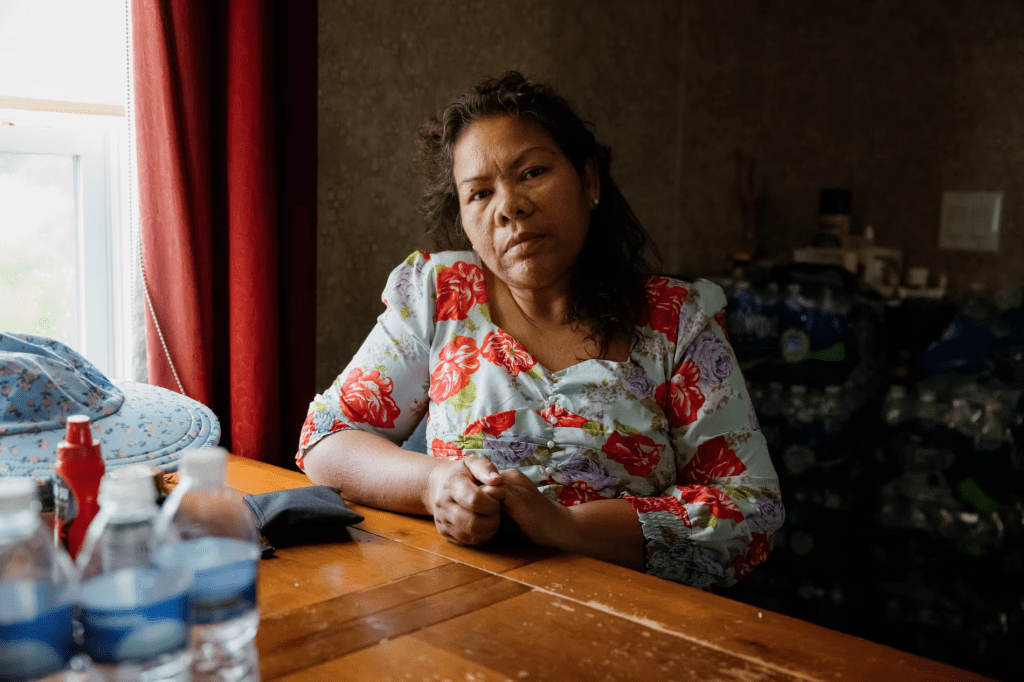
The first time Leah Chan’s hair fell out, her heart pounded and she wept with fear.
It was June this year, and the 55-year-old worried that the thick clumps left in her hands were a sign of cancer. But her doctor suspected another cause: the water running through her pipes.
Chan lives in a small trailer home in the community of Buras, Louisiana, a sliver of land that embraces the edge of the Mississippi River on one side and the increasingly eroded Gulf coastline on the other.
Earlier this summer, she noticed a funny smell from the tap water. It left her morning coffee tasting salty, like a warm broth. Soon her skin broke out in rashes and officials told residents here that their water was not safe to drink.
Out on the southernmost frontiers of Plaquemines parish, residents have endured the brunt of extreme weather events for decades; Hurricane Katrina still lives in people’s memories and the scars of Hurricane Ida in 2021 remain visible on damaged buildings. But, for many, living with the indignities of a summer-long water crisis has been an unbearable burden.
“I feel like we’re living in a lost world,” Chan said. “Like nobody can reach us. Like nobody knows.”
A few weeks ago the water crisis in Plaquemines parish stirred national headlines as a so-called “wedge” of saltwater surged upriver, traveling up the Mississippi, threatening the drinking water for nearly a million people in the city of New Orleans and the suburbs that surround it.
Buras, the neighborhood that Leah Chan lives in, sits directly next to the Mississippi River.
During a year of extreme weather, which has seen record heat and wildfires in Louisiana, it is drought in America’s midwest that has caused the latest climate-related disaster here. As freshwater flowing down the Mississippi River falls to dangerous lows, saltwater from the Gulf of Mexico has pushed up into the channel, winding its way into public intake facilities and people’s homes – making their drinking water unusable, damaging appliances and threatening to corrode ageing infrastructure.
As officials say the threat to New Orleans has begun to subside, many residents of Plaquemines parish fear their situation will fade from public view, even as the prospect of frequent recurrence is exacerbated by the climate crisis and long-term solutions remain costly and unclear.
Chan often runs out of bottled water, and is forced to make long, expensive drives to a Dollar General store further up the river. Sometimes, there is none left and she is forced to use the salty water to prepare meals.
“I am tired of losing every time,” she said. “Fighting battles that we just can’t seem to win.”
Leah Chan noticed large amounts of her hair falling out during the timeframe that the tap water became full of salt and officials telling residents the water was unsafe to drink or cook with.The simple task of washing a sink full of dishes a cooking a pot of rice took nearly six bottles of water.
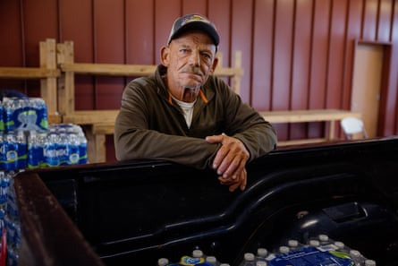
At a bottled water distribution center last week, on the grounds of a volunteer fire department station in Buras, a steady stream of residents arrived to pick up their daily allowance. The station goes through about 1,300 cases a day, said officials, with supplies running dry by the afternoon. Only two cases are allowed per household.
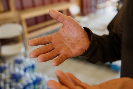
Patrick Hue, a 62 year-old lifelong resident, arrived in a small pickup truck between shifts out in the Gulf catching shrimp. He pointed to the rashes on the palms of his hands, his elbows and feet.
“Everything you get out the faucet is salt,” he said. “I bathe in it, then use the bottled water to rinse off.”
He had lived through saltwater intrusions before, including last year, but never for a period this long. Like many, he expressed frustration with local authorities over perceived indifference to the plight of the few thousand residents down the river.
“They don’t spend money in this part of the parish,” Hue said. “It’s been years since anyone paid any mind to the deterioration here.”
To illustrate the point, one of the parish’s five water treatment facilities in the nearby town of Port Sulphur had been out of operation since Hurricane Ida over two years ago.
It was only recently brought back online with temporary repairs, said the Plaquemines parish president, Keith Hinkley, who sat in his Port Sulphur office last week. He described the burdensome mitigation efforts put in place after last month’s state of emergency declaration: fresh water from upstream is being brought in by barges, then used to dilute salinity and pumped further downriver to treatment plants in affected communities.
A resident picks up cases of water at the Venice-Boothville fire department, one of several water and ice distribution locations in Plaquemines Parish.
Hinkley, elected less than a year ago, lives in the parish’s largest population center of Belle Chasse where the treatment plant is not yet inundated with saltwater. He argued forcefully that mitigation efforts had now made water safe to drink in the lower regions of his parish. “I’m drinking this water every day,” he said.
But further downriver, as the president was speaking, a drinking water advisory still remained in place. Official notices said residents should continue to rely on bottled water until reverse osmosis filtering machines at treatment plants had been fully installed. (The parish finally lifted its advisory this Wednesday, but just hours later issued another boil water advisory for parts of the region.)
Hinkley acknowledged that the parish could endure similar extremes next year too, but denied the effects of the climate crisis in causing drought, despite the overwhelming scientific evidence.
“I can’t agree with 100% of climate change,” Hinkley said. “But things change and shift.”
For now, most of New Orleans appears to have avoided harm – but the threat of prolonged drought and higher sea level rise combining to form another saltwater wedge looms over the region’s future.
In September, officials warned that the seawater could wind its way upriver to New Orleans by late October, potentially forcing the city of nearly 400,000 people to find alternate sources of water to drink.
However, these early estimates of the seawater’s upstream movement didn’t fully account for how the seawater would move across the river’s undulating floor. Because saltwater is heavier than freshwater, it moves slowly along the river’s bottom. “The river bottom looks like the surface of the moon,” said Ricky Boyett, chief of public affairs for the army corps, New Orleans district. “It’s ups and downs and craggy. Modeling of it looks like a mountain range.”
Any significant holes in the riverbed slows down the saltwater’s progress.
Patrick Hue at one of several water and ice distribution locations in Plaquemines parish.Hue has noticed his skin getting dry and cracking.
“At one point it was traveling about a mile and a half a day, then it reached this extremely deep part of the river. Before it can move on, it has to fill the hole up until it equalizes,” said Boyett.
Before the saltwater wedge made its way to Belle Chasse, a town of about 10,000 people, it fell into a 120ft hole in the river bottom. The town is still expected to experience saltwater in their drinking water by mid-November.
Another, deeper hole just downriver from New Orleans’ Westbank water intake is expected to further slow the progression of the saltwater, should it get that far.
Rain in the midwest also helped delay the saltwater’s upriver movement, said Julie Lesko, a senior service hydrologist with the National Weather Service New Orleans/Baton Rouge office. “It’s a small rise. It’s not projected to stay elevated,” she said.
The close call for New Orleans highlighted the difficulty of replacing an entire metropolitan area’s water source, a dilemma more cities across the US could face in a warming world. In the end, the area will have spent millions for temporary relief.
In late-September the army corps of engineers began to raise the height of an underwater levee it built in July, while leaving a 625ft-wide gap for ship traffic to resume. But the underwater levee, like other solutions put forward during the height of the threat, was a short-term fix. It’s expected to erode when the Mississippi River rises again.
The army corps would not provide details for the cost of this temporary fix.
In early-October, the army corps began to barge in water from upstream to help smaller communities near the mouth of the river dilute the saltwater. But that was never a realistic solution for New Orleans. The amount of water needed to quench the city’s thirst – about 165m gallons of water a day – could not be barged in or even produced via reverse osmosis, a costly option that would be difficult to scale.
As a result, New Orleans and its suburban neighbor, Jefferson parish, developed separate plans to build temporary pipelines to siphon water from upriver.
The 10-mile pipeline proposed by New Orleans was expected to cost up to $200m and take between two weeks and two months to build, according to an initial summary and bid of the project obtained by the Guardian through a public records request. Rental fees and maintenance could cost another $3m to $4m a month, plus the cost of fuel needed to run pumps to push water through the pipeline.
A similar project for Jefferson parish would cost $6.9m a month to run, plus nearly $1m to build and later take down, according to a proposal obtained through a public records request.
Jefferson parish began construction on their pipeline in early October. New Orleans is unlikely to move forward with its freshwater pipeline given the updated timeline of the saltwater intrusion. According to the latest estimates, salinity levels are not projected to rise significantly for most of the city, although the water board announced last week it is preparing for “higher-than-typical” levels of saltwater in the city’s west bank.
Jefferson Parish, in anticipation of the saltwater intrusion in the Mississippi River making it upstream, has started installing temporary, flexible piping to bring fresher water further upriver into their water system.
Nonetheless, said the New Orleans sewage and water board executive director, Ghassan Korban, the city will still review contract bids for a range of temporary mitigation solutions.
The disaster has brought into sharp focus the city’s ailing water infrastructure, which consists of about 1,600 miles of water distribution mains, a third of which are over a century old.
“Our system is beyond aged,” said Korban.
Officials do not know how many of the city’s water pipes are made of lead, which, as occurred in Flint, Michigan, can corrode when exposed to poorly treated water, and lead to dangerous toxins entering the system.
The city is in the midst of attempting to map its lead piping to reach a federal deadline by October of next year, and has contracted a non-profit group, BlueConduit, to carry out the work by digitizing thousands of old paper records to make data-driven estimations.
In an interview, BlueConduit co-founder Eric Schwartz, said the scale of the challenge in New Orleans was larger than many other jurisdictions due to disarray in the city’s record keeping.
Volunteer firefighter Mike Croft helps load ice into a resident’s car at the Venice-Boothville fire department.
“The thing that makes New Orleans one of the more challenging places in terms of data is not just a lack of information about older construction, but we also have a lack of information about newer construction due to rebuilding in the aftermath of recent natural disasters,” Schwartz said.
The army corps of engineers now projects that during the intrusion salinity levels in New Orleans will not go above the 250 parts per million (ppm), listed by the EPA as the point when most people will no longer want to drink the water because of the salty taste.
Nonetheless, Korban acknowledged that while 250ppm remained the working safe threshold, with so many unknowns in the system that number may need to be lowered, as the city monitors the situation closely with water testing for lead and other toxins that could leach due to corrosion.
“This is not a very known, definitive space where somebody can say: ‘if you have a certain material and the level is 100 [ppm] you will have this [outcome].’ Nobody can definitely give you any answers.”
He added: “I can’t give you the exact number, whether its going to be 100 or 150 [ppm]. But we’re not taking this issue lightly. We don’t want to take any chances.”
A spokeswoman for the sewage and water board later added that the city’s longstanding “corrosion control methods” were not believed to be affected by elevated salinity.
Venture Global LNG is building a giant liquid natural gas plant in Plaquemines parish which is currently employing 4-5,000 new people in the parish, which is putting additional strain on the water system.
In the long term, Korban acknowledged the effects of the climate crisis could well mean New Orleans will face even greater saltwater challenges in the years ahead, meaning “much, much greater” cost implications than the temporary solutions the city has examined.
“It’s our responsibility to be more adaptable to these circumstances and be ready for them,” he said.
Hinkley, the Plaquemines parish president, estimated that permanent solutions to future saltwater crises would cost about $200m to implement, including the repair and replacement of old parish infrastructure. While that figure may seem high, Hinkley argues that such an investment would be offset by a multibillion-dollar gargantuan liquified natural gas export facility being built by Venture Global in the parish, which could bring jobs, taxes and increase local business.
“That cost-to-benefit ratio is well worth it right there,” he said.
Not everyone in Plaquemines parish agrees with Hinkley’s analysis. It’s the biggest construction project in the parish’s history and the most expensive liquified gas export terminal in the US.
But the construction workers and water needs of the project put extra pressure on the parish during the current water crisis, said Byron Marinovich, a former Plaquemines parish council member and owner of Black Velvet Oyster Bar and Grill, in Buras. “Our parish population is only about 23,000 and they have four or five thousand additional people on top of that,” he said. “And we’re happy for the progress, or whatever you want to call it, but that really kind of hurt us. And even worse than that was we had trucks coming in pulling water out of the fire hydrants, municipal potable water, to make concrete.”
Byron Marinovich at his restaurant, Black Velvet.
Burning the gas exported from the facility is expected to emit roughly the same amount of greenhouse gases as 42 coal plants or 35.8m cars, according to the Sierra Club. Scientists have warned that climate change could increase the frequency of droughts in the midwest.
“What we’re seeing now with more frequent periods with reduced rainfall is what scientists predicted,” said Jason Knouft, a professor of biology at Saint Louis University and research scientist at the National Great Rivers Research and Education Center. “If I were to bet on it I’d say we’re going to see these low water events happening again and probably becoming more common.”
Not only does global warming increase air temperatures, it also causes more variability in precipitation. “That makes it difficult for water managers to prepare,” Knouft said. But water management will be a particularly important issue, as Mississippi River water levels not only impact drinking water in south Louisiana, but global food prices, as grain from the midwest is shipped downstream and around the world. “Water touches every part of our lives,” he said.
I hope you appreciated this article. Before you move on, I was hoping you would consider taking the step of supporting the Guardian’s journalism.
From Elon Musk to Rupert Murdoch, a small number of billionaire owners have a powerful hold on so much of the information that reaches the public about what’s happening in the world. The Guardian is different. We have no billionaire owner or shareholders to consider. Our journalism is produced to serve the public interest – not profit motives.
And we avoid the trap that befalls much US media – the tendency, born of a desire to please all sides, to engage in false equivalence in the name of neutrality. While fairness guides everything we do, we know there is a right and a wrong position in the fight against racism and for reproductive justice. When we report on issues like the climate crisis, we’re not afraid to name who is responsible. And as a global news organization, we’re able to provide a fresh, outsider perspective on US politics – one so often missing from the insular American media bubble.
Around the world, readers can access the Guardian’s paywall-free journalism because of our unique reader-supported model. That’s because of people like you. Our readers keep us independent, beholden to no outside influence and accessible to everyone – whether they can afford to pay for news, or not.
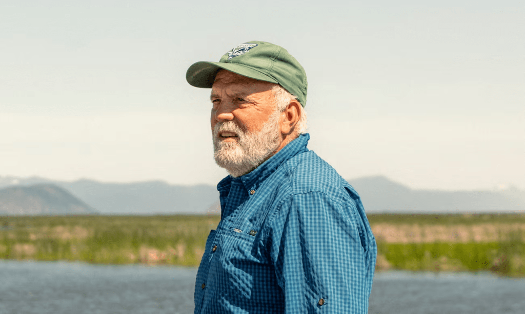
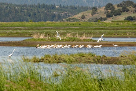
Birdsong hums over the rumble of Karl Wenner’s truck as it bounces along the dusty trails that weave through his property. For almost 100 years, this farm in southern Oregon grew barley, but now, amid the sprawling fields, there lies a wetland teeming with life.
Wenner installed the wetland on 70 of the farm’s 400 acres to help deal with phosphorus pollution that leaked into the adjacent Upper Klamath Lake after his land flooded each winter. With support from a team of scientists and advocates, the project has become a welcome sanctuary for migrating and native birds that are disappearing from the area.
Today, this corner ofLakeside Farms looks far different from a typical American farm. Waterfowl nest among the vegetation, joining pond turtles and even endangered native fish near rows of sprouting barley.
Looking out at the swaying cattails and wocus plants peeking through the water on an afternoon in June, Wenner beams: “This place wanted to be a wetland.”
Lakeside Farms features a wetland that has drawn harmful pollutants out of the soil and now serves as a sanctuary for migratory and native birds. Photograph: Gabrielle Canon/The Guardian
It’s a remarkable transformation and a promising example of a symbiotic solution to one of the world’s most pressing environmental problems.
Wenner, a co-owner of the land, hopes the farm won’t be unique for long. With an unprecedented amount of federal funding available through the Biden administration’s Inflation Reduction Act and other government programs, Wenner and his partners are encouraging more farmers and ranchers to follow in their footsteps.
“We are demonstrating it is possible,” Wenner said. “We just have to do it on a gigantic scale.”
‘It’s a magical thing to see’
The Lakeside Farms wetland broke ground in 2021, flattening the barley fields and carving dikes and channels for water flows that would leave small artificial nesting islands. The water, produced from a natural spring on the property, quickly germinated seeds for marsh plants that had been dropped by birds and long left dormant. By the summer of 2022, the vegetation began to do its work, feeding fowl and cleaning the farm’s runoff, pumped within its banks rather than into the lake.
The plan, designed with both conservation and capitalization of the land in mind, took 70 acres of the farm out of production. But Wenner says his costs have largely been covered with government funds, and there’s a lot more to go around.
The benefits, Wenner says, have been almost immediate.
Wetlands serve as a natural sponge, soaking up harmful minerals and pollution before they seep into the watershed. Tucked between Upper Klamath Lake and an interstate highway, Lakeside Farms’ cropland leached high amounts of phosphorus – roughly five times above the amount allowed by regulations last February. It took mere months for the wetland to filter the sediment back to safe levels.
“You set the stage and Mother Nature takes over,” Wenner said. “It’s just a magical thing to see.”
Wenner is convinced the move has been a boon to business. The farm is no longer running afoul of regulations, while a plan to add a rotating wetland on other parts of its land will enable it to go organic, yielding “a much higher price for the crop”.
The Klamath River basin was once called the ‘Everglades of the west’. Today, extreme drought is putting strain on agricultural communities and wildlife alike. Photograph: Nathan Howard/AP
The project comes at a critical time for the region, where one the largest watersheds in the western US coexists with hundreds of farms and ranches. The area is home to rich biodiversity but has struggled as marshes and lakebeds were replaced by cattle ranges and crops.
The climate crisis is making the Klamath basin hotter and drier, creating stress for farmers and wildlife alike. Populations of migrating birds have plummeted, falling from roughly 5.8 million observed in 1958 to a peak of just 93,000 counted last year.
Many are finding hope in plans to demolish four dams along the Klamath River – the largest dam removal project in US history – bringing the ecosystem one step closer to recovery. But more solutions will be needed.
“We have the dams coming out and one of the biggest ecosystems in the county has the potential to be a functioning ecosystem again,” Wenner said. “It is a disrupted, screwed-up system – but this is fixable.”
The work is not without obstacles. “Our biggest challenge is where water is available to manage wetlands,” said Ed Contreras, a coordinator of the Intermountain West Joint Venture, an organization dedicated to building public-private partnerships to support bird habitats. He added that the Lakeside Farms project was an important case study.
“The way I see this program right now is it is a pilot,” he said. There was excitement across the region about the potential to expand, he said, “but it is going to take a lot of people coming together and thinking big picture to scale that up.”
Thousands of miles away, Paul Botts is confronting the same challenges. As the executive director of the Wetlands Initiative, a non-profit conservation organization in Chicago, he is determined to expand the use of what he calls “smart wetlands” across productive farm belts and hopes one day they will be as common as any other farming strategy.
“The ultimate goal here is that one day my children or grandchildren are driving around the midwest and every other farm field has one of these wetlands,” he said. He believes more widespread reliance on wetlands will be essential to meet conservation goals, and will also help stabilize food producers in an uncertain future.
“Our climate is changing and farmers are living it,” he said. “One of the best things we can do to adapt ourselves to that changing climate is to put small scattered wetlands back in our landscape.”
These natural systems help blunt climate catastrophes, holding water for dry times and slowing the speed of floods. “We view smart wetlands as an excellent example of a big-picture climate adaptation solution,” Botts added.
Wenner examines the pollen collected from bees at Lakeside Farms. Photograph: Gabrielle Canon/The Guardian
Back in Klamath, Wenner is checking on his bees. He pulls out a small tray from one of his boxed hives, marveling at the collected pollen as the insects casually come and go. Soon he will send it off to a lab in Belgium that analyzes what the bees have retrieved to give him information about what’s taking seed at Lakeside Farms.
“There are a huge number of plants growing out there and the bees are going to tell us what they are,” he said. Already the results have been exciting. After decades, the once monoculture land is bursting with biodiversity, both plants and animals alike.
Wenner gets emotional when he talks about the change. A strategy to fall in line with regulations sprouted an opportunity. “I read the news and it is one environmental disaster after another,” he said. “But I always hoped that maybe we can be smart enough to fix this stuff.
“Now I am learning that you can,” he added. Wenner hopes the natural systems will be given a chance. “We just have to figure out how to do it.”
I hope you appreciated this article. Before you move on, I was hoping you would consider taking the step of supporting the Guardian’s journalism.
From Elon Musk to Rupert Murdoch, a small number of billionaire owners have a powerful hold on so much of the information that reaches the public about what’s happening in the world. The Guardian is different. We have no billionaire owner or shareholders to consider. Our journalism is produced to serve the public interest – not profit motives.
And we avoid the trap that befalls much US media – the tendency, born of a desire to please all sides, to engage in false equivalence in the name of neutrality. While fairness guides everything we do, we know there is a right and a wrong position in the fight against racism and for reproductive justice. When we report on issues like the climate crisis, we’re not afraid to name who is responsible. And as a global news organization, we’re able to provide a fresh, outsider perspective on US politics – one so often missing from the insular American media bubble.
Around the world, readers can access the Guardian’s paywall-free journalism because of our unique reader-supported model. That’s because of people like you. Our readers keep us independent, beholden to no outside influence and accessible to everyone – whether they can afford to pay for news, or not.